Preview

This is your website preview.

Currently it only shows your basic business info. Start adding relevant business details such as description, images and products or services to gain your customers attention by using Boost 360 android app / iOS App / web portal.

SBENTERPRISESTRADINGPUNE 5abfbf1e7c88bb04a4d0fcc7 Products https://www.surveyequipment.in
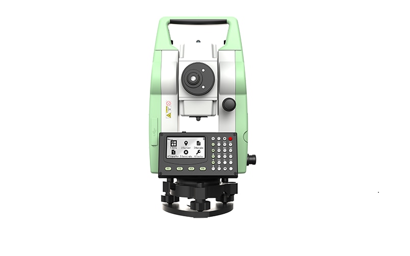
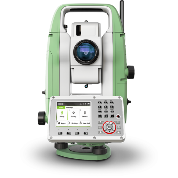
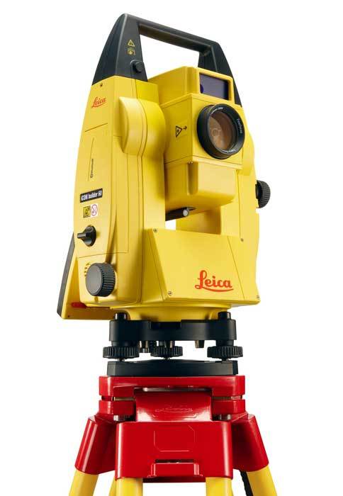
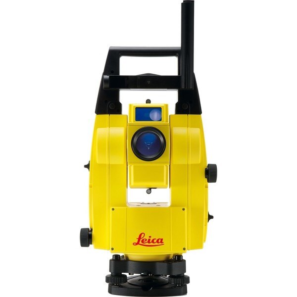
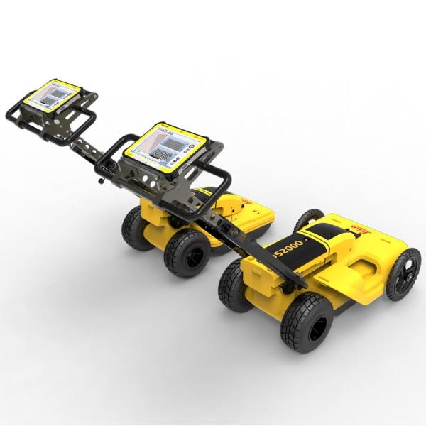
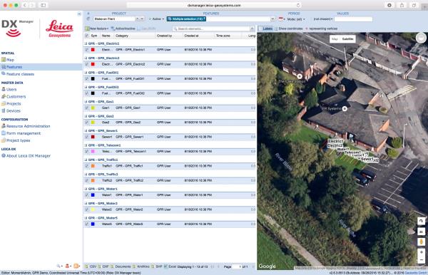
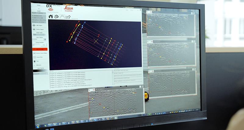
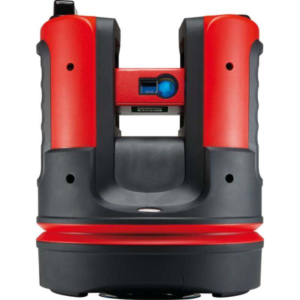
{ "products": [ { "_id": "65c5dc636523861ec4890fc9", "fptag": "SBENTERPRISESTRADINGPUNE", "merchantname": null, "customwidgets": null, "externalsourceid": null, "name": "GIM 120 PROFESSIONALDIGITAL INCLINOMETER", "description": "GIM 120 PROFESSIONALDIGITAL INCLINOMETER\nLonger for maximum precisionMeasures precise tilts in degrees, percent or millimetres/metresDirection arrows and audible signals at 0° and 90° for easy alignmentMeasured values automatically turn on the display when working overhead\n��️ Bosch GIM 120 PROFESSIONAL - Elevate Precision to Perfection! ��\nUpgrade your toolkit with the Bosch GIM 120 PROFESSIONAL, your go-to solution for unparalleled precision in measurements. ��\n✨ Key Features:\nPinpoint Accuracy: Achieve flawless results with the GIM 120's advanced measurement technology.Compact Design: Take precision on the go - the sleek, portable design ensures convenience on any job site.Durability: Built to withstand the rigors of professional use, the GIM 120 is your reliable companion for the long haul.�� Why Choose Bosch?Trusted by professionals worldwide, Bosch is synonymous with quality and innovation. The GIM 120 PROFESSIONAL continues this legacy, offering cutting-edge technology in a compact, durable package.\n�� Take Your Craft to New Heights!Whether you're a carpenter, electrician, or DIY enthusiast, the Bosch GIM 120 PROFESSIONAL is a game-changer. Elevate your precision game and achieve unparalleled results in every project.", "price": 0.0, "discountamount": 0.0, "currencycode": "INR", "priority": 1000000, "isfreeshipmentavailable": false, "shipmentduration": 7, "_keywords": [ "✨", "0°", "go", "job", "site", "Craft", "legacy", "quality", "degrees", "project", "percent", "display", "toolkit", "solution", "carpenter", "long haul", "innovation", "Durability", "Perfection", "convenience", "electrician", "New Heights", "millimetres", "measurements", "game-changer", "Key Features", "precise tilts", "professionals", "precision game", "DIY enthusiast", "Compact Design", "audible signals", "flawless results", "professional use", "Elevate Precision", "Pinpoint Accuracy", "reliable companion", "unparalleled results", "metresDirection arrows", "sleek, portable design", "unparalleled precision", "cutting-edge technology", "The GIM 120 PROFESSIONAL", "compact, durable package", "maximum precisionMeasures", "Bosch GIM 120 PROFESSIONAL", "easy alignmentMeasured values", "advanced measurement technology", "GIM 120 PROFESSIONALDIGITAL INCLINOMETER" ], "isarchived": false, "isavailable": true, "applicationid": null, "productindex": 234, "imageuri": "https://productimages.withfloats.com/actual/65c5dc65f71fb2d544cd4eaf.jpg", "tileimageuri": "https://productimages.withfloats.com/tile/65c5dc65f71fb2d544cd4eaf.jpg", "images": null, "totalqueries": 0, "gpid": null, "groupproductid": null, "createdon": "2024-02-09T08:03:47.25Z", "updatedon": "2024-02-09T08:03:47.25Z", "buyonlinelink": null, "producturl": "http://WWW.SURVEYEQUIPMENT.IN/products/gim-120-professionaldigital-inclinometer/234", "availableunits": -1.0, "iscodavailable": false, "isprepaidonlineavailable": false, "maxcodorders": 0, "maxprepaidonlineorders": 0, "uniquepaymenturl": null, "brandname": "BOSCH ", "category": "CROSSLINELESER", "tags": null, "variants": false, "keyspecification": null, "otherspecifications": null, "pickupaddressreferenceid": "", "paymenttype": "None", "producttype": "products", "hsncode": null, "gstslab": 0.0, "isnotforsale": false }, { "_id": "60e1a313e49d1200012fbdc3", "fptag": "SBENTERPRISESTRADINGPUNE", "merchantname": null, "customwidgets": null, "externalsourceid": null, "name": "Leica TS01 Manual Total Stations ", "description": "Leica TS01: The entry to Leica Geosystems' Total Stations\nLeica TS01 empowers you to carry out measurement tasks with ease and simplicity.\n\nThe Leica TS01 total station empowers you to carry out measurement tasks with ease and simplicity. The TS01 is an entry-level manual total station, created to help you master surveying, layout and mapping projects. It will prove itself in the field and immediately become a valuable member of your team.\n\nBuying a Leica TS01 is a smart decision as it represents a business-smart entry into Leica Geosystems world. You and your surveying crew members will be ready for new projects in no time.\n\nEnjoy the benefits of a 500 m non-prism range and 3,000 m prism range, always combined with accuracy and measurement speed, which increases your productivity. With built-in sensors like an electronic dual axis compensator, a laser plummet, onboard field software and short keys for quick menu access you'll have a fast instrument setup and fast measurements.\n\nWith the Leica TS01 total station you get your all-in-on package as it comes with Leica Geosystems accessories, such as a long-operating battery, a charger and a tribrach tested to reliably fulfil the requirements – when every detail counts.\n\n\nFirst class after sales service and support\n\nLeica Geosystems's highly qualified after-sales service and support network will help you managing any issue to continue work quickly.\nBe it maintenance work, in any of our local service workshops, or getting a question answered from local support, both are part of Leica Geosystems's active customer care.\n\n\nStart-up into business easily\n\n\n\nLeica Geosystems' TS01 will get your trusted partner in managing survey, layout and mapping projects with ease and simplicity.\nPowerful built-in sensors, as well as intuitive field software, empower you to complete tasks without any delay.\n", "price": 0.0, "discountamount": 0.0, "currencycode": "INR", "priority": 1000000, "isfreeshipmentavailable": false, "shipmentduration": 7, "_keywords": null, "isarchived": false, "isavailable": true, "applicationid": null, "productindex": 200, "imageuri": "https://productimages.withfloats.com/actual/60e1a315eef7850001dd7f3e.png", "tileimageuri": "https://productimages.withfloats.com/tile/60e1a315eef7850001dd7f3e.png", "images": null, "totalqueries": 0, "gpid": null, "groupproductid": null, "createdon": "2021-07-04T12:01:23.298Z", "updatedon": "2021-07-04T12:01:23.298Z", "buyonlinelink": null, "producturl": "http://WWW.SURVEYEQUIPMENT.IN/products/leica-ts01-manual-total-stations-/200", "availableunits": -1.0, "iscodavailable": false, "isprepaidonlineavailable": false, "maxcodorders": 0, "maxprepaidonlineorders": 0, "uniquepaymenturl": null, "brandname": "Leica Geosystems", "category": "Leica Total Station in India ", "tags": [ "Leica Total Station in India", "TOTALSTATIONS", "Robotic Total Station", "leicatotalstationsindia", "robotictotalstationpune", "robotictotalstations", "leicatotalstationsindia", "leicatotalstationoune", "leicageosystems", "Geographical Survey", "GNSS/GPS Survey Equipment - Surveying Equipment fr" ], "variants": false, "keyspecification": null, "otherspecifications": null, "pickupaddressreferenceid": "", "paymenttype": "None", "producttype": "products", "hsncode": null, "gstslab": 0.0, "isnotforsale": false }, { "_id": "5daaf779f9dc390001952ef9", "fptag": "SBENTERPRISESTRADINGPUNE", "merchantname": null, "customwidgets": null, "externalsourceid": null, "name": "Leica FlexLine TS07 Manual Total Station", "description": "Leica FlexLine TS07 Manual Total Station\nThe Leica FlexLine TS07 high-quality, manual total station is based on a proven product concept that has been revolutionising the world of measurement and survey for nearly 200 years. The Leica TS07 is equipped with a comprehensive application-based software package - Leica FlexField software - that enables most survey and stakeout tasks to be carried out easily and efficiently. The new FlexLine TS07 works reliably and delivers accurate results even in the harshest environments.\n\nWork faster: measure more points per day due to faster measurement and stakeout procedures (endless drives, trigger key, drives on both sides, pinpoint EDM and more), supported by our comprehensive and user-friendly Leica FlexField software.\nUse it trouble-free: increase productivity and minimise downtime by relying on instruments that simply work and come with a global service and support network.\nChoose products that are built to last: FlexLine operates with the same high level of quality even after years of use under harsh conditions (like mud, dust, blowing rain, extreme heat and cold).\nControl your investment: reliability, speed and accuracy ensure a lower investment over the product lifetime and a higher resell value.\nSave time with AutoHeight: measure, read and set the instrument height automatically with this revolutionary feature in the FlexLine TS07 (optional). Errors are minimised and the setup process onsite is faster.", "price": 0.0, "discountamount": 0.0, "currencycode": "INR", "priority": 1000000, "isfreeshipmentavailable": false, "shipmentduration": 7, "_keywords": null, "isarchived": false, "isavailable": true, "applicationid": null, "productindex": 156, "imageuri": "https://productimages.withfloats.com/actual/5daaf77b836b6b0001c86cb4.png", "tileimageuri": "https://productimages.withfloats.com/tile/5daaf77b836b6b0001c86cb4.png", "images": null, "totalqueries": 0, "gpid": null, "groupproductid": null, "createdon": "2019-10-19T11:46:01.098Z", "updatedon": "2019-10-19T11:46:01.098Z", "buyonlinelink": null, "producturl": "http://WWW.SURVEYEQUIPMENT.IN/products/leica-flexline-ts07-manual-total-station/156", "availableunits": -1.0, "iscodavailable": false, "isprepaidonlineavailable": false, "maxcodorders": 0, "maxprepaidonlineorders": 0, "uniquepaymenturl": null, "brandname": "Leica Geosystems ", "category": "", "tags": null, "variants": false, "keyspecification": null, "otherspecifications": null, "pickupaddressreferenceid": "", "paymenttype": "None", "producttype": "products", "hsncode": null, "gstslab": 0.0, "isnotforsale": false }, { "_id": "5b6b3a9ed682be0552aefded", "fptag": "SBENTERPRISESTRADINGPUNE", "merchantname": null, "customwidgets": null, "externalsourceid": null, "name": " Leica iCON Builder 62", "description": "Leica iCON Builder 62 – The perfect total station for construction layout\n\nConstruction layout has never been more professional than with Leica iCON builder 60 manual total station. The intuitive user interface paired with the highest quality manual total station perfects any job on site. You perform construction layout tasks fast and easy thanks to the simple, straightforward application software. \n\nThe iCON builder 60 total station is built especially with construction workers in mind, providing an entry into the world of Leica Geosystems’ intelligent CONstruction (iCON) solution. \n\niCON builder 60 delivers with: \n\nLeica iCON build - Industry leading layout software \nBest-in-class measurement technology \nHigh return on investment - take a look for yourself, click here \n\nAll the functionality you need \niCON builder 60 can be used for many different tasks in many different ways, for example as a one-person station for checks such as tie distances clearance or verticality. Easily connect a tablet computer via the internal Bluetooth and you instantly benefit from a larger screen. \n\nIntuitive software \nThe user interface is easy to understand and offers you graphical map view for quick navigation and point/line selection. iCON builder 60 saves you time by short and straightforward operating procedures. Get quick results and save time, speeding up your layout measurements on site. \n\nPackage includes: \n\n● iCON builder 62 2\" Manual Total Station & iCONstruct Build software on-board, \n● 500m/1300ft reflectorless range, \n● tribrach, \n● 2x Li-Ion battery, \n● charger, \n● TrueZero prism, \n● mini prism pole, \n● USB to Mini-USB transfer cable, \n● USB memory stick, \n● quick guide \n● carry case.\n\n", "price": 0.0, "discountamount": 0.0, "currencycode": "INR", "priority": 1000000, "isfreeshipmentavailable": false, "shipmentduration": 7, "_keywords": [ "builder 60 delivers", "iCON builder 60 saves", "Leica iCON Builder 62", "perfect total station", "tie distances clearance", "intuitive user interface", "intelligent CONstruction", "iCONstruct Build software", "iCON builder 60 total station", "straightforward application software", "straightforward operating procedures", "quality manual total station perfects", "perform construction layout tasks fast", "Leica iCON builder 60 manual total station" ], "isarchived": false, "isavailable": true, "applicationid": null, "productindex": 100, "imageuri": "https://productimages.withfloats.com/actual/5b5029a5b33e28053e42fa30.jpg", "tileimageuri": "https://productimages.withfloats.com/tile/5b5029a5b33e28053e42fa30.jpg", "images": null, "totalqueries": 0, "gpid": null, "groupproductid": null, "createdon": "2018-07-19T06:03:17.733Z", "updatedon": "2018-08-08T18:46:54.368Z", "buyonlinelink": null, "producturl": "http://WWW.SURVEYEQUIPMENT.IN/products/-leica-icon-builder-62/100", "availableunits": -1.0, "iscodavailable": true, "isprepaidonlineavailable": false, "maxcodorders": 0, "maxprepaidonlineorders": 0, "uniquepaymenturl": null, "brandname": null, "category": "leicatotalstationspune", "tags": [ "leicatotalstationspune", "leicaicon", "leicatotalstationsindia", "machinecontroltotalstations" ], "variants": false, "keyspecification": null, "otherspecifications": null, "pickupaddressreferenceid": "5d08ebb3edf0e25c3b8da5d0", "paymenttype": "AssuredPurchase", "producttype": "products", "hsncode": null, "gstslab": 0.0, "isnotforsale": false }, { "_id": "5b6b3a9ed682be0552aefde4", "fptag": "SBENTERPRISESTRADINGPUNE", "merchantname": null, "customwidgets": null, "externalsourceid": null, "name": "Leica iCON Robot 50", "description": "Leica iCON Robot 50\nThe Leica iCON Robot 50 total station is operable using the field controller (iCON CC50) at the point of positioning using the prism pole, therefore there is no need for an operator at the instrument itself. This technology is extremely efficient and a highly accurate way of working.\n\nThe iCON robot 50 achieves the most precise reflector less measurements in its class. It features a simple one-button keyboard and patented PowerSearch option in order to find the prism quickly. Take advantage of applications through the custom-built software – iCONstruct. It also communicates using Bluetooth (up to 350m), WLAN (150m) and RS232 for different requirements, simply change the instrument handle to upgrade.\n\nWith very tight tolerances the Leica iCON Robot 50 is able to precisely control Graders, Dozers and Pavers automatically as well as set out or survey conventionally with one person. With the use of the most precise and accurate laser pointers the Leica Robot 50 is also able to layout points on ceilings or walls.\n\nFeatures\nExtremely precise reflectorless measurements\nSimple keyboard for easy use\nExcellent tracking\nRobust data communication\nGuide light\nand-over control from the rover\nWide range of apps with bespoke iCONstruct software\nIntegrates with all Leica iCON sensors\n\nLeica iCON robot 50 is designed specifically for ease of use within the construction industry, simply level the instrument and go.\n\nSave time and increase your productivity by doing layout work and as-built checks yourself. With iCON robot 50 you don’t need an operator at the instrument. The robotic total station can be operated from the field controller at the prism pole, at the point you need positioning.\n\nThe iCON robot 50 also delivers with:\n\nMost accurate reflectorless measurements in its class\nOne-button keyboard for simple operation\nFaster prism search by PowerSearch (patented technology)\nSuperior tracking performance ensures minimum machine downtime in machine control operation\nFlexible data communication: WLAN (150m range) or Long-range Bluetooth® (350m). Simply upgrade your communication by swapping the instrument handle\nEasy hand-over control from rover to machine control and vice versa\n \nOne-person robotic \nWith industry leading tracking performance and the patented PowerSearch technology, iCON robot 50 allows you to finish jobs faster maintaining highest accuracy.\n\nInterior overhead with laser pointer \nUsing one of the world’s most accurate laser pointers, remotely lay-out points on walls for drill patterns or on ceilings for air conditioning or other such projects.\n\nMachine control \nWork to the tightest tolerances under any site conditions. Carry out fine grading and paving with highest precision, speeding up your work with construction machinery.\n\nLimitless applications \nWith the iCONstruct software, you can use iCON robot 50 for a wide range of measuring and positioning tasks on site, such as:\n\nLayout\nStake-out\nGrade checking\nVolumes\nAs-built checks\nMachine control\n\n", "price": 0.0, "discountamount": 0.0, "currencycode": "INR", "priority": 1000000, "isfreeshipmentavailable": false, "shipmentduration": 7, "_keywords": [ "Leica Robot 50", "use iCON robot 50", "iCONstruct software", "iCON robot 50 allows", "precise reflectorless", "robotic total station", "construction industry", "iCON robot 50 achieves", "PowerSearch technology", "accurate laser pointers", "Leica iCON Robot 50 total station", "accurate reflectorless measurements", "performance ensures minimum machine downtime" ], "isarchived": false, "isavailable": true, "applicationid": null, "productindex": 99, "imageuri": "https://productimages.withfloats.com/actual/5b486c5af599f80511fd9ca6.jpg", "tileimageuri": "https://productimages.withfloats.com/tile/5b486c5af599f80511fd9ca6.jpg", "images": null, "totalqueries": 0, "gpid": null, "groupproductid": null, "createdon": "2018-07-13T09:09:46.162Z", "updatedon": "2018-08-08T18:46:54.36Z", "buyonlinelink": null, "producturl": "http://WWW.SURVEYEQUIPMENT.IN/products/leica-icon-robot-50/99", "availableunits": -1.0, "iscodavailable": true, "isprepaidonlineavailable": false, "maxcodorders": 0, "maxprepaidonlineorders": 0, "uniquepaymenturl": null, "brandname": null, "category": "leicatotalstations", "tags": [ "leicatotalstations", "leicatotalstationsindia", "robotictotalstations", "leicatotalstationpune", "leicaicon" ], "variants": false, "keyspecification": null, "otherspecifications": null, "pickupaddressreferenceid": "5d08ebb3edf0e25c3b8da5d0", "paymenttype": "AssuredPurchase", "producttype": "products", "hsncode": null, "gstslab": 0.0, "isnotforsale": false }, { "_id": "5b6b3a9ed682be0552aefd47", "fptag": "SBENTERPRISESTRADINGPUNE", "merchantname": null, "customwidgets": null, "externalsourceid": null, "name": "Leica DS2000 Utility Detection Radar", "description": "Leica DS2000 Utility Detection Radar\nUncovering safer, faster, more\n\nThere’s a lot going on underground that you need to know about before you ever start to dig. The Leica DS2000 Utility Detection Radar finds all potential threats, including non-conductive pipes and fibre optics, increasing safety by lowering the risk of accidently hitting underground assets.\n\nIncrease safety, speed up work and lower asset management costs with the ability to prevent hazardous outages and collect more information. The DS2000 betters your business by making it safer, faster and more efficient.\n\nKey benefits\nIncrease safety when the DS2000 identifies all potential threats\nGet to assets and recover quicker from outages when you know exactly where underground utility assets are located\nDual-frequency antenna to detect deep and shallow targets simultaneously\nEasily collect and understand data with the DS2000’s simple and intuitive software and data storage\nSimple data storage and export to continue working on the post-processing at the office\nEffortlessly maneuver around the most challenging sites with the DS2000’s advanced ergonomics\nExpert knowledge of Leica Geosystems with more than 270 service centres worldwide\nPROTECT by Leica Geosystems - the strongest warranty in the market\n\nDetection and underground mapping solution\nCombined with the powerful and rugged Leica CT2000 field tablet, the GG04 or the GPS60 smart antenna, and the DIGICAT intelligent cable locators and DIGITEX transmitters, the DS2000 is part of the complete Leica Geosystems detection and underground mapping solution that will enhance your business by making it faster and more efficient. With DX Office Vision post processing software, convert radar data to CAD file in an uncomplicated way.\n\nStart today\nContact your Leica Geosystems distribution partner for more information on the Leica DS2000 and other detection solutions.", "price": 0.0, "discountamount": 0.0, "currencycode": "INR", "priority": 1000000, "isfreeshipmentavailable": false, "shipmentduration": 7, "_keywords": [ "DS2000 betters", "convert radar data", "intuitive software", "GPS60 smart antenna", "detection solutions", "DIGITEX transmitters", "asset management costs", "Leica CT2000 field tablet", "underground utility assets", "DIGICAT intelligent cable locators", "complete Leica Geosystems detection", "Leica DS2000 Utility Detection Radar", "Leica Geosystems distribution partner", "DX Office Vision post processing software" ], "isarchived": false, "isavailable": true, "applicationid": null, "productindex": 94, "imageuri": "https://productimages.withfloats.com/actual/5b45a66fd4575c0f14706fc4.jpg", "tileimageuri": "https://productimages.withfloats.com/tile/5b45a66fd4575c0f14706fc4.jpg", "images": null, "totalqueries": 0, "gpid": null, "groupproductid": null, "createdon": "2018-07-11T06:40:39.103Z", "updatedon": "2018-08-08T18:46:54.113Z", "buyonlinelink": null, "producturl": "http://WWW.SURVEYEQUIPMENT.IN/products/leica-ds2000-utility-detection-radar/94", "availableunits": -1.0, "iscodavailable": true, "isprepaidonlineavailable": false, "maxcodorders": 0, "maxprepaidonlineorders": 0, "uniquepaymenturl": null, "brandname": null, "category": "GPR Ground Penetrating Radar", "tags": [ "GPR Ground Penetrating Radar", "| GPR Ground Penetrating Radar Survey Equipment Di" ], "variants": false, "keyspecification": null, "otherspecifications": null, "pickupaddressreferenceid": "5d08ebb3edf0e25c3b8da5d0", "paymenttype": "AssuredPurchase", "producttype": "products", "hsncode": null, "gstslab": 0.0, "isnotforsale": false }, { "_id": "5b6b3a9dd682be0552aefcbd", "fptag": "SBENTERPRISESTRADINGPUNE", "merchantname": null, "customwidgets": null, "externalsourceid": null, "name": "Leica DX Manager Mapping", "description": "Leica DX Manager Mapping\nOne central dashboard for all the Leica Geosystems Detection solutions\n\nLeica DX Manager is the only enterprise grade utility mapping solution on the market. A unique cloud-powered solution that delivers unparalleled performance. Manage projects, tasks and spatial data from one central dashboard for all the Leica Geosystems Detection solutions.\n\nUpdate drawings, raw data, location pictures, data layers and mobile forms remotely and in a period of real time operate at an enterprise level rather than having to manually update individual users one at a time. With the Leica DX Manager, you have all dashboards, status updates and project management tools in one platform. Now, project managers can track field operations in real time and make critical decisions with a broader understanding of the current situation.\n\nKey benefits\n\nSimplified processes\nImprovement of data quality and accuracy\nConsistent data collection methods\nIntegration of DS2000, cable locators and asset mapping data\nWorkflows to maintain data integrity\nManage the whole workflow\n\nShare data to all devices and users within your organisation.\n\nAnalyse maps result\nVisualise on online maps\nFilter on users, within date ranges or any attributes\nExport to standard GIS and CAD formats\nShare data to your clients\nAn easy-to-use online portal allows management of all aspects of documenting utility location tasks. The user can switch between street view, satellite imagery and cartographic street maps. Field acquired survey data becomes instantly available and can be accessed by users anytime and anywhere.\n\nUtility detection integration\n\nLeica DX Manager integrates the entire Leica Geosystems Detection portfolio into a simple survey workflow, empowering the user to apply locator depth measurements to GNSS measurements. The result is a seamless fusion of both worlds – with all locator related data reviewable either in Leica DX Manager or any export format.\n\nLocate the utility\nMeasure the depth\nAll location data is sent directly to the Leica DX Field application on the GNSS device\nIt triggers the GNSS measurement on the mapping device\nAll data is integrated into the features metadata\nMaximum user experience and productivity\n\nLeica DX Field mobile app is designed for productivity and maximum user experience and built for enforcing data quality and accuracy. \n\nEasy mapping / surveying of assets\nSmart mobile forms\nImmediate visualisation on map\nMetadata collection\nAutomatic sync with Cloud\nFull offline capabilities\nMake sure your measured data always matches your quality expectations (up to centimetres with RTK) as Leica DX Manager notifications steadily monitor the system parameters. All quality parameters are stored as metadata. Next to the utility mapping aspect, it delivers work orders, time tracking and document management.", "price": 0.0, "discountamount": 0.0, "currencycode": "INR", "priority": 1000000, "isfreeshipmentavailable": false, "shipmentduration": 7, "_keywords": [ "data quality", "location data", "data collection", "data reviewable", "survey data becomes", "DX Field mobile app", "Leica DX Manager Mapping", "cartographic street maps", "Leica DX Field application", "update individual users one", "Leica DX Manager notifications", "apply locator depth measurements", "enterprise grade utility mapping solution", "entire Leica Geosystems Detection portfolio" ], "isarchived": false, "isavailable": true, "applicationid": null, "productindex": 89, "imageuri": "https://productimages.withfloats.com/actual/5b459fa2f3579911b41e9cda.jpg", "tileimageuri": "https://productimages.withfloats.com/tile/5b459fa2f3579911b41e9cda.jpg", "images": null, "totalqueries": 0, "gpid": null, "groupproductid": null, "createdon": "2018-07-11T06:11:47.283Z", "updatedon": "2018-08-08T18:46:53.959Z", "buyonlinelink": null, "producturl": "http://WWW.SURVEYEQUIPMENT.IN//leica-dx-manager-mapping/89", "availableunits": -1.0, "iscodavailable": true, "isprepaidonlineavailable": false, "maxcodorders": 0, "maxprepaidonlineorders": 0, "uniquepaymenturl": null, "brandname": null, "category": "GPR", "tags": [ "GPR", "Detection and underground mapping solution", "Leica DX Manager Mapping" ], "variants": false, "keyspecification": null, "otherspecifications": null, "pickupaddressreferenceid": "5d08ebb3edf0e25c3b8da5d0", "paymenttype": "AssuredPurchase", "producttype": "products", "hsncode": null, "gstslab": 0.0, "isnotforsale": false }, { "_id": "5b6b3a9ed682be0552aefd91", "fptag": "SBENTERPRISESTRADINGPUNE", "merchantname": null, "customwidgets": null, "externalsourceid": null, "name": "DX Office Vision", "description": "DX Office Vision\nUtility post processing software\n\n\nDX Office Vision is Leica Geosystems’ Utility Post Processing Software that allows DS2000 users to map digitally the detected underground utilities in a simple way by converting GPR data into CAD drawings.\n\nKey benefits:\nCreate CAD drawings of the detected utilities in an uncomplicated way in minimum time and with less training.\nView collected data of the detected utilities in a simple way - compare data files side by side or from top to bottom to locate consistent features.\nObtain CAD drawings in 3D with object attributes in different layers – filter, select, identify and make annotations of consistent targets and anomalies.\nReduce processing time with no intermediate converting, third party software or patch required.\nVisualise radar data from your DS2000 with an intuitive interface.\nMerge your DX Office Vision Data with other Leica detection products like DS2000, Digicat and Ultra.\n \n\nTake over data processing into CAD drawings with confidence and simplicity\nFor utility surveyors looking to map digitally the detected underground utilities, DX Office Vision is the post processing software with the fastest conversion speed and most intuitive interface to convert GPR data into CAD drawings for every user. DX Office Vision was developed by utility mapping contractors who are every day on the field, and understand the need of delivering 3D CAD drawings in an efficient way.\n\nDX Office Vision features:\nAutomatic data import\nAutomatic pre-set filtering\nReal-world depth calibration\n3D CAD export\nTarget addition, Target connectivity, Depth filtering\nDX Office Vision X-Section:\nAdditional to DX Office Vision,\n\nVelocity Depth Calibration\n3D CAD view (fully navigable)\nTime Slice Function\n\n", "price": 0.0, "discountamount": 0.0, "currencycode": "INR", "priority": 1000000, "isfreeshipmentavailable": false, "shipmentduration": 7, "_keywords": [ "3D CAD drawings", "data processing", "convert GPR data", "intuitive interface", "third party software", "DX Office Vision Data", "underground utilities", "Office Vision features", "compare data files side", "Leica detection products", "utility mapping contractors", "Utility Post Processing Software" ], "isarchived": false, "isavailable": true, "applicationid": null, "productindex": 96, "imageuri": "https://productimages.withfloats.com/actual/5b459f01d4575c0f14705198.jpg", "tileimageuri": "https://productimages.withfloats.com/tile/5b459f01d4575c0f14705198.jpg", "images": null, "totalqueries": 0, "gpid": null, "groupproductid": null, "createdon": "2018-07-11T06:08:57.374Z", "updatedon": "2018-08-08T18:46:54.222Z", "buyonlinelink": null, "producturl": "http://WWW.SURVEYEQUIPMENT.IN/products/dx-office-vision/96", "availableunits": -1.0, "iscodavailable": true, "isprepaidonlineavailable": false, "maxcodorders": 0, "maxprepaidonlineorders": 0, "uniquepaymenturl": null, "brandname": null, "category": "Utility post processing software", "tags": [ "Utility post processing software", "Detection and underground mapping solution", "GPR" ], "variants": false, "keyspecification": null, "otherspecifications": null, "pickupaddressreferenceid": "5d08ebb3edf0e25c3b8da5d0", "paymenttype": "AssuredPurchase", "producttype": "products", "hsncode": null, "gstslab": 0.0, "isnotforsale": false }, { "_id": "5b6b3a9dd682be0552aefc3f", "fptag": "SBENTERPRISESTRADINGPUNE", "merchantname": null, "customwidgets": null, "externalsourceid": null, "name": "Leica Disto 3D Laser Distance Meter ", "description": "Leica Disto 3D Laser Distance Meter \n\nThe high-precision Leica 3D Disto is used whenever the use of conventional measuring tools is only possible with a great deal of time and effort. With the various measurement functions you can record all spatial situations precisely and use the data afterwards in your customary software environment. With the realistic data you can produce the final parts directly. The time-consuming template and modification work during installation is no longer necessary. The fully digitalized workflow saves valuable time.\n\nLine and surface scans\nDigital measurement with immediate results\nCable-free operation\nDigital pointfinder\nGraphic 2D or 3D display\nMarking heights, plumb points and parallel lines\nImport of own data for simple staking out\nChanging the position with photo backup\nExport formats: DXF (2D, 3D and overview plan), JPG, CSV and TXT\nComes supplied with\nLeica 3D Disto\nLicense for 3D Disto Software for Windows®\nRemote control RM100\nPower supply for 3D Disto\n4 country specific powercords for worldwide use\nPower supply for control unit\n4 country specific adapter plugs for worldwide use\nUSB memory stick\nSelf-adhesive target points\nRuler (for measuring hidden points)\nLeica GZM3 target plate\n2x USB cable\nQuickstart", "price": 0.0, "discountamount": 0.0, "currencycode": "INR", "priority": 1000000, "isfreeshipmentavailable": false, "shipmentduration": 7, "_keywords": [ "plumb points", "Leica 3D Disto", "realistic data", "data afterwards", "3D Disto Software", "modification work", "spatial situations", "measuring hidden points", "workflow saves valuable", "country specific powercords", "conventional measuring tools", "various measurement functions", "country specific adapter plugs", "customary software environment", "Leica Disto 3D Laser Distance Meter" ], "isarchived": false, "isavailable": true, "applicationid": null, "productindex": 84, "imageuri": "https://productimages.withfloats.com/actual/5b3f2d14f3579908c0a05310.jpg", "tileimageuri": "https://productimages.withfloats.com/tile/5b3f2d14f3579908c0a05310.jpg", "images": null, "totalqueries": 0, "gpid": null, "groupproductid": null, "createdon": "2018-07-06T08:49:25.454Z", "updatedon": "2018-08-08T18:46:53.666Z", "buyonlinelink": null, "producturl": "http://WWW.SURVEYEQUIPMENT.IN//leica-disto-3d-laser-distance-meter-/84", "availableunits": -1.0, "iscodavailable": true, "isprepaidonlineavailable": false, "maxcodorders": 0, "maxprepaidonlineorders": 0, "uniquepaymenturl": null, "brandname": null, "category": "leicatotalstations", "tags": [ "leicatotalstations", "leicadisto3dlaserdistancemeter", "leicadisto" ], "variants": false, "keyspecification": null, "otherspecifications": null, "pickupaddressreferenceid": "5d08ebb3edf0e25c3b8da5d0", "paymenttype": "AssuredPurchase", "producttype": "products", "hsncode": null, "gstslab": 0.0, "isnotforsale": false } ], "hasmoreitems": false, "isapirequest": false, "totalresults": 27, "query": null, "floatingpoint": null }

Still searching for
world?

Still searching for
world?

Chat with us