Currently it only shows your basic business info. Start adding relevant business details such as description, images and products or services to gain your customers attention by using Boost 360
android app
/
iOS App/ web portal.
{
"products": [
{
"_id": "65c5dc636523861ec4890fc9",
"fptag": "SBENTERPRISESTRADINGPUNE",
"merchantname": null,
"customwidgets": null,
"externalsourceid": null,
"name": "GIM 120 PROFESSIONALDIGITAL INCLINOMETER",
"description": "GIM 120 PROFESSIONALDIGITAL INCLINOMETER\nLonger for maximum precisionMeasures precise tilts in degrees, percent or millimetres/metresDirection arrows and audible signals at 0° and 90° for easy alignmentMeasured values automatically turn on the display when working overhead\n��️ Bosch GIM 120 PROFESSIONAL - Elevate Precision to Perfection! ��\nUpgrade your toolkit with the Bosch GIM 120 PROFESSIONAL, your go-to solution for unparalleled precision in measurements. ��\n✨ Key Features:\nPinpoint Accuracy: Achieve flawless results with the GIM 120's advanced measurement technology.Compact Design: Take precision on the go - the sleek, portable design ensures convenience on any job site.Durability: Built to withstand the rigors of professional use, the GIM 120 is your reliable companion for the long haul.�� Why Choose Bosch?Trusted by professionals worldwide, Bosch is synonymous with quality and innovation. The GIM 120 PROFESSIONAL continues this legacy, offering cutting-edge technology in a compact, durable package.\n�� Take Your Craft to New Heights!Whether you're a carpenter, electrician, or DIY enthusiast, the Bosch GIM 120 PROFESSIONAL is a game-changer. Elevate your precision game and achieve unparalleled results in every project.",
"price": 0.0,
"discountamount": 0.0,
"currencycode": "INR",
"priority": 1000000,
"isfreeshipmentavailable": false,
"shipmentduration": 7,
"_keywords": [
"✨",
"0°",
"go",
"job",
"site",
"Craft",
"legacy",
"quality",
"degrees",
"project",
"percent",
"display",
"toolkit",
"solution",
"carpenter",
"long haul",
"innovation",
"Durability",
"Perfection",
"convenience",
"electrician",
"New Heights",
"millimetres",
"measurements",
"game-changer",
"Key Features",
"precise tilts",
"professionals",
"precision game",
"DIY enthusiast",
"Compact Design",
"audible signals",
"flawless results",
"professional use",
"Elevate Precision",
"Pinpoint Accuracy",
"reliable companion",
"unparalleled results",
"metresDirection arrows",
"sleek, portable design",
"unparalleled precision",
"cutting-edge technology",
"The GIM 120 PROFESSIONAL",
"compact, durable package",
"maximum precisionMeasures",
"Bosch GIM 120 PROFESSIONAL",
"easy alignmentMeasured values",
"advanced measurement technology",
"GIM 120 PROFESSIONALDIGITAL INCLINOMETER"
],
"isarchived": false,
"isavailable": true,
"applicationid": null,
"productindex": 234,
"imageuri": "https://productimages.withfloats.com/actual/65c5dc65f71fb2d544cd4eaf.jpg",
"tileimageuri": "https://productimages.withfloats.com/tile/65c5dc65f71fb2d544cd4eaf.jpg",
"images": null,
"totalqueries": 0,
"gpid": null,
"groupproductid": null,
"createdon": "2024-02-09T08:03:47.25Z",
"updatedon": "2024-02-09T08:03:47.25Z",
"buyonlinelink": null,
"producturl": "http://WWW.SURVEYEQUIPMENT.IN/products/gim-120-professionaldigital-inclinometer/234",
"availableunits": -1.0,
"iscodavailable": false,
"isprepaidonlineavailable": false,
"maxcodorders": 0,
"maxprepaidonlineorders": 0,
"uniquepaymenturl": null,
"brandname": "BOSCH ",
"category": "CROSSLINELESER",
"tags": null,
"variants": false,
"keyspecification": null,
"otherspecifications": null,
"pickupaddressreferenceid": "",
"paymenttype": "None",
"producttype": "products",
"hsncode": null,
"gstslab": 0.0,
"isnotforsale": false
},
{
"_id": "5e96c40249c9ab000155998b",
"fptag": "SBENTERPRISESTRADINGPUNE",
"merchantname": null,
"customwidgets": null,
"externalsourceid": null,
"name": "Leica DD220 Smart Cable & Pipe Locator",
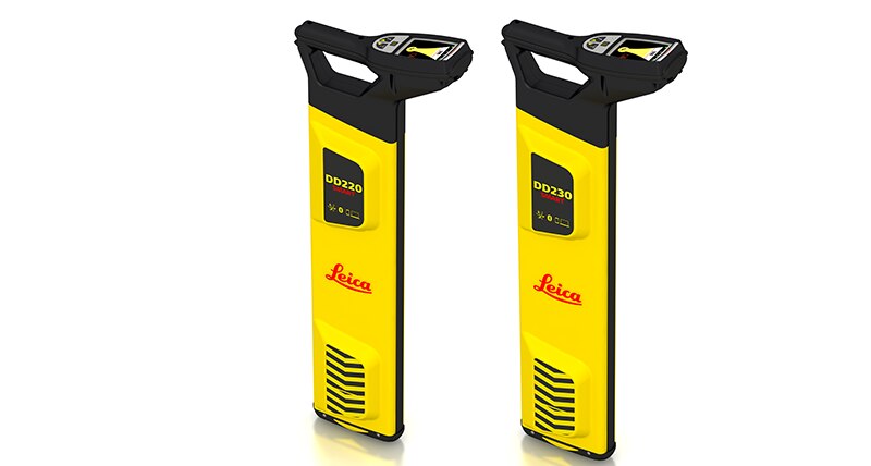
"description": "Leica DD220 Smart Utility LocatorProtect your assets and your workersThe new Leica DD220 is an easy to use, intuitive locator simplifying the detection of buried utilities and increasing user confidence .\n\n\nWith automated pinpointing technology and a clear visible display, the DD220 discovers buried utilities with confidence, even in densely packed areas. On-board video support, usage alerts and diagnostics, combine to improve product use and, protect operators and utilities.\n\n\n\nSMART Technology; GPS, Bluetooth®, 8GB internal memory\nPower, Radio, Auto modes\nTransmitter modes, 131kHz, 33kHz, 8kHz or Auto (automatic detection of the transmitter signal)\nDepth detection up to 7 meters (23 feet)\nGood-to-Go™ Health Check and Start up test\nOn-board video user guides\nIP66 rating - protection from dust and water\nWeb Calibration Verification\n3 year Warranty\nLeica DD SMART utility locator solution\n\n\nFor professionals looking to streamline utility locating operations, the Leica DD SMART utility locators create a single source solution. DX Shield software provides a space for utility analysis and a convenient connection between SMART locators to increase productivity and save time.\n\nDX Shield software allows you to gain a better understanding of task performance and site complexities with easy-to-use reports that provide a fast and convenient overview of product use, reducing utility strikes and saving direct repair costs and project downtime.",
"price": 0.0,
"discountamount": 0.0,
"currencycode": "INR",
"priority": 1000000,
"isfreeshipmentavailable": false,
"shipmentduration": 7,
"_keywords": null,
"isarchived": false,
"isavailable": true,
"applicationid": null,
"productindex": 169,
"imageuri": "https://productimages.withfloats.com/actual/5e96c4065379a400011ee9f4.png",
"tileimageuri": "https://productimages.withfloats.com/tile/5e96c4065379a400011ee9f4.png",
"images": null,
"totalqueries": 0,
"gpid": null,
"groupproductid": null,
"createdon": "2020-04-15T08:21:22.911Z",
"updatedon": "2020-04-15T08:21:22.911Z",
"buyonlinelink": null,
"producturl": "http://WWW.SURVEYEQUIPMENT.IN/products/leica-dd220-smart-cable-pipe-locator/169",
"availableunits": -1.0,
"iscodavailable": false,
"isprepaidonlineavailable": false,
"maxcodorders": 0,
"maxprepaidonlineorders": 0,
"uniquepaymenturl": null,
"brandname": "Leica",
"category": "",
"tags": null,
"variants": false,
"keyspecification": null,
"otherspecifications": null,
"pickupaddressreferenceid": "",
"paymenttype": "None",
"producttype": "products",
"hsncode": null,
"gstslab": 0.0,
"isnotforsale": false
},
{
"_id": "5c540483e5988200018b673a",
"fptag": "SBENTERPRISESTRADINGPUNE",
"merchantname": null,
"customwidgets": null,
"externalsourceid": null,
"name": "ASM 14-2 PC (without battery)",
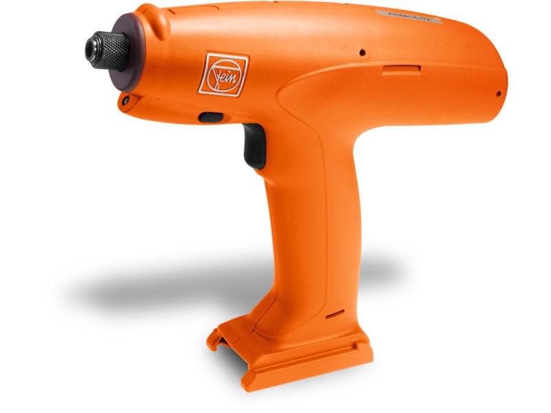
"description": "ASM 14-2 PC (without\nbattery)\nPrecision Electric Screwdriver\nPrecision cordless Screwdriver\nCordless Power Precision Screwdriver\n\nPrecision cordless screwdriver, mid-mounted\nhandle, up to 2 Nm\n\nCertified screwdriver according to ISO 5393, VDI/VDE 2647, achieves CMK value > 1,67 at ± 10% (referred to 6 Sigma).\n\nBrushless, maintenance-free motor.\nFreely programmable parameters: speed, direction of rotation, angle of rotation, torque, threshold, time.\nCan be adapted to the individual application in up to five program steps to suit your process.\nAdjustable error criteria prevent manipulation.\nFEIN Li-ion technology for more screw connections per battery charge.\nMaintenance module records all screw connections and calibration data.\nEasy data input on the computer.\nProgram with confidence using the integrated interface.\nStore data for later reuse.\nFor soft and hard screwed connections.\nSensor-based control means no loss of speed when screwdriving.\nProtection of the tool through a factory-installed password.\n\n",
"price": 0.0,
"discountamount": 0.0,
"currencycode": "INR",
"priority": 1000000,
"isfreeshipmentavailable": false,
"shipmentduration": 0,
"_keywords": null,
"isarchived": false,
"isavailable": false,
"applicationid": null,
"productindex": 140,
"imageuri": "https://productimages.withfloats.com/actual/5c5408a58e7f2d000101f1ce.jpg",
"tileimageuri": "https://productimages.withfloats.com/tile/5c5408a58e7f2d000101f1ce.jpg",
"images": null,
"totalqueries": 0,
"gpid": null,
"groupproductid": null,
"createdon": "2019-02-01T08:34:11.916Z",
"updatedon": "2019-02-01T08:51:48.923Z",
"buyonlinelink": null,
"producturl": "http://WWW.SURVEYEQUIPMENT.IN/products/asm-14-2-pc-without-battery-/140",
"availableunits": -1.0,
"iscodavailable": true,
"isprepaidonlineavailable": false,
"maxcodorders": 0,
"maxprepaidonlineorders": 0,
"uniquepaymenturl": null,
"brandname": null,
"category": "Precision cordless screwdriver",
"tags": [
"Precision cordless screwdriver",
"Precision Electric Screwdriver",
"Cordless Power Precision Screwdriver"
],
"variants": false,
"keyspecification": null,
"otherspecifications": null,
"pickupaddressreferenceid": "5d08ebb3edf0e25c3b8da5d0",
"paymenttype": "AssuredPurchase",
"producttype": "products",
"hsncode": null,
"gstslab": 0.0,
"isnotforsale": false
},
{
"_id": "5b6b3a9ed682be0552aefdb1",
"fptag": "SBENTERPRISESTRADINGPUNE",
"merchantname": null,
"customwidgets": null,
"externalsourceid": null,
"name": "Leica Digicat 750i SMARTREADY Cable Locators",
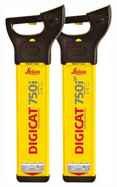
"description": "Leica Digicat 750i SMARTREADY Cable Locators\nWorld’s First SMARTREADY Locator\n\nLeica Digicat 750i SMARTREADY locators delivers a true digital platform with GPS technology, data logging and Bluetooth® connectivity that will document the where, when and how it has been used.\n\nLocating and recording the position of buried utilities before excavation work can help prevent operator injury, asset damage risks or any subsequent costs. The pioneering Leica Digicat 750i SMARTREADY cable locators deliver extra visibility of cable locating activities and provides users with evidence of compliance to industry best practice.\n\nSMARTREADY Improved mobile flexibility\nThe Digicat 750i SMARTREADY is the first locator to communicate seamlessly through Bluetooth® with Apple and Android mobile devices. \nImproved mobile flexibility allows the Digicat SMARTREADY locator to working with 94% of mobile devices, reducing restriction of use and strengthened fleet utilisation.\n\nUnmatched ease-of-use\nWith Automatic Pinpointing there is no need for you to manually adjust the sensitivity of your Digicat cable locator, ensuring you’re using the optimum sensitivity for the environment you are detecting underground utilities in. Reducing the likelihood of human error and ultimately saving you time and money.\n\nIncreased confidence and extra visibility of locating results\nThe Leica Digicat 750i SMARTREADY cable locators record and store how, when and where your cable locator has been used. The data collected can be easily transferred via Bluetooth® to your PC, Apple and Android mobile devices, using Leica’s LOGiCAT VU software. Once transferred the GPS data can be conveniently analysed in Google Maps. It provides extra visibility of activities, making it easier for you to identify training needs and providing traceability of activities following a near miss or utility strike. Building increased confidence in cable locating activities.\n\nImproved accuracy and application scope\nTo achieve improved accuracy and applications scope use the Digicat cable locators in conjunction with a Digitex 100t or 300t signal transmitter and/or the Digisystem accessories. \nEstimating the depth of the underground infrastructure improves utility locating accuracy and data range. To get a depth estimation you can use a Digicat 750i cable locator and a Digitex 100t or 300t signal transmitter.\n\nDigicat 750i SMARTREADY cable locator – with depth - GPS technology, data logging, Bluetooth®, mobile software, hazard zone alert, signal service indicator, built-in self-test and service due indicator.",
"price": 135478.0,
"discountamount": 18856.0,
"currencycode": "INR",
"priority": 1000000,
"isfreeshipmentavailable": true,
"shipmentduration": 0,
"_keywords": [
"First SMARTREADY",
"mobile flexibility",
"Digicat cable locators",
"Android mobile devices",
"300t signal transmitter",
"signal service indicator",
"Digicat 750i cable locator",
"Digicat SMARTREADY locator",
"underground infrastructure",
"Digicat 750i SMARTREADY locators delivers",
"Leica Digicat 750i SMARTREADY cable locators record"
],
"isarchived": false,
"isavailable": false,
"applicationid": null,
"productindex": 97,
"imageuri": "https://productimages.withfloats.com/actual/5b45f055d4575c0f14711280.jpg",
"tileimageuri": "https://productimages.withfloats.com/tile/5b45f055d4575c0f14711280.jpg",
"images": null,
"totalqueries": 0,
"gpid": null,
"groupproductid": null,
"createdon": "2018-07-11T11:54:28.687Z",
"updatedon": "2018-08-08T18:46:54.281Z",
"buyonlinelink": null,
"producturl": "http://WWW.SURVEYEQUIPMENT.IN//leica-digicat-750i-smartready-cable-locators/97",
"availableunits": -1.0,
"iscodavailable": true,
"isprepaidonlineavailable": false,
"maxcodorders": 0,
"maxprepaidonlineorders": 0,
"uniquepaymenturl": null,
"brandname": null,
"category": "Avoidance & Locating of buried pipe & cable utilit",
"tags": [
"Avoidance & Locating of buried pipe & cable utilit",
"Underground Pipe and Cable Locator in India",
"underground cable & pipe locating equipments",
"Pipe and Cable locators",
"Cable Avoidance Tools"
],
"variants": false,
"keyspecification": null,
"otherspecifications": null,
"pickupaddressreferenceid": "5d08ebb3edf0e25c3b8da5d0",
"paymenttype": "AssuredPurchase",
"producttype": "products",
"hsncode": null,
"gstslab": 0.0,
"isnotforsale": false
},
{
"_id": "5b6b3a9dd682be0552aefccb",
"fptag": "SBENTERPRISESTRADINGPUNE",
"merchantname": null,
"customwidgets": null,
"externalsourceid": null,
"name": "Leica ULTRA Utility Tracing System",
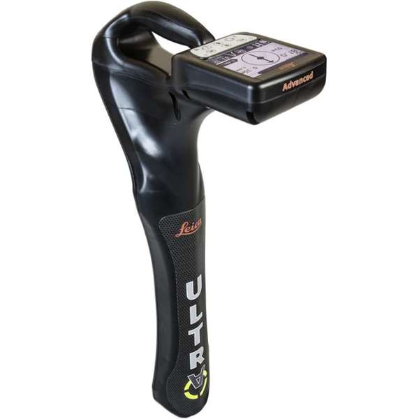
"description": "Leica ULTRA Utility Tracing System\nBest precision locating in faster, more confident work\n\nSave time and increase confidence in your results with the Leica ULTRA, our most advanced precision utility tracing instrument.\n\nThe complexity of underground utility networks is continually increasing, and obtaining precise information on the location of buried utilities has never been more important. The protection of buried assets during excavation work demands accurate mapping and surveying of existing utilities. \n\nIntegrating intelligent signal processing with unique flexible operating modes, Leica ULTRA traces buried utility lines accurately for safe underground excavations and utility surveys. Outstanding performance with operational ease and flexibility.\n\nLARGE CLEAR DISPLAY\nLarge backlit high visibility LCD screen\nClear display provides clear, improved and confident location and utility tracing\nCUSTOM FREQUENCIES\nConfigure for site specific applications\nUser configurable modes from 50 Hz to 200 kHz\nChoose from 100 pre-selected frequencies or customise your own frequencies\nCOMPASS\nShows the user the direction of the utility they are locating / tracing\nBLUETOOTH®\nEnable wireless communications with software running on a laptop, survey field PC or other GPS enabled device\nINCREASED TRANSMITTER POWER OUTPUT\nChoose between 5W and 12W transmitter power outputs for superior tracing performance\nBUILT FOR THE MOST DEMANDING ENVIRONMENTS\nIP65 protection\nFulfils toughest standards - shock resistant, protected against water and dust ingress\nSELECTABLE ANTENNA CONFIGURATION\nConfigure antenna to best optimise for your job site\nSelect between more range, sharper response, noise cancelling or easier sweeping\nDIRECTION ENABLED\nIdentifying your target utility amongst multiple parallel utilities\nApply a special direction enabled signal from the transmitter, the receiver will display an arrow on the compass heading to guide you along the designated utility path\nUnlock the power\nConfigure the Leica ULTRA for site specific applications. Custom build your receiver and transmitter.\n\nChoose from over 100 preselected frequencies, or customise your own frequency for highly specialised applications.\n\nAutomatically capture the instruments location data to ensure adherence to best practice. The data logging feature allows the user to record external GPS coordinates and download with the datafile as a KML or CSV format. Upload into GIS systems or Google Maps to confirm where, when and how the work was performed.\n",
"price": 0.0,
"discountamount": 0.0,
"currencycode": "INR",
"priority": 1000000,
"isfreeshipmentavailable": false,
"shipmentduration": 7,
"_keywords": [
"target utility",
"utility surveys",
"precision utility",
"Leica ULTRA traces",
"designated utility",
"12W transmitter power",
"wireless communications",
"instruments location data",
"site specific applications",
"100 preselected frequencies",
"underground utility networks",
"safe underground excavations",
"intelligent signal processing",
"unique flexible operating modes",
"Leica ULTRA Utility Tracing System"
],
"isarchived": false,
"isavailable": true,
"applicationid": null,
"productindex": 90,
"imageuri": "https://productimages.withfloats.com/actual/5b45ea4dd3d93d01c4f1c9f9.jpg",
"tileimageuri": "https://productimages.withfloats.com/tile/5b45ea4dd3d93d01c4f1c9f9.jpg",
"images": null,
"totalqueries": 0,
"gpid": null,
"groupproductid": null,
"createdon": "2018-07-11T11:30:28.043Z",
"updatedon": "2018-08-08T18:46:53.973Z",
"buyonlinelink": null,
"producturl": "http://WWW.SURVEYEQUIPMENT.IN/products/leica-ultra-utility-tracing-system/90",
"availableunits": -1.0,
"iscodavailable": true,
"isprepaidonlineavailable": false,
"maxcodorders": 0,
"maxprepaidonlineorders": 0,
"uniquepaymenturl": null,
"brandname": null,
"category": null,
"tags": null,
"variants": false,
"keyspecification": null,
"otherspecifications": null,
"pickupaddressreferenceid": "5d08ebb3edf0e25c3b8da5d0",
"paymenttype": "AssuredPurchase",
"producttype": "products",
"hsncode": null,
"gstslab": 0.0,
"isnotforsale": false
},
{
"_id": "5b6b3a9ed682be0552aefd6c",
"fptag": "SBENTERPRISESTRADINGPUNE",
"merchantname": null,
"customwidgets": null,
"externalsourceid": null,
"name": "Leica ULTRA Locator – Standard",
"description": "Leica ULTRA Locator – Standard\nThe ULTRA System has unique flexible operating modes to help you easily decide the right mode for your locating application and site conditions.\n\nMultimode operation – 50-200Khz\nDaylight visible LCD screen\nPrecision locating, for utility tracing\nThe complexity of underground utility networks are continually increasing. So obtaining precise information on the location of buried utilities has never been more important. The protection of buried assets during excavation work demands accurate mapping and surveying of existing utilities.\n\nThe Leica ULTRA provides our most advanced precision utility tracing system. Intelligent signal processing has been integrated with unique flexible operating modes, to help save you time and increased confidence in your results. Selectable antenna and customised frequencies optimises your instrument for site specific applications, supported by our AIM system which monitors signal interference levels, recommending which mode to use for the best results.\n\nAmbient Interference Measurement (AIM) \nWhen working in congested environments, external interferences can affect the effectiveness of utility tracing. To guard against interference, the Leica ULTRA incorporates advanced Ambient Interference Measurement (AIM), which analyses the surrounding area for noise and recommends the best frequencies for accurate utility tracing.\n\nOffset measuring \nThere will always be an occasion when the utility runs close to, or underneath an obstruction. With Offset Measuring, the Leica ULTRA can locate the target line if not directly accessible from above. The function uses the available data to estimate the horizontal and vertical (depth) distance.\n\nTransmitter to receiver link \nAdvanced communication link between the Leica ULTRA receiver and transmitter, enables you to control the transmitter directly from the receiver. Work smarter and at greater distances to help achieve best practice whilst reducing time spent walking to the transmitter.",
"price": 0.0,
"discountamount": 0.0,
"currencycode": "INR",
"priority": 1000000,
"isfreeshipmentavailable": false,
"shipmentduration": 7,
"_keywords": [
"communication link",
"Leica ULTRA Locator",
"precise information",
"Leica ULTRA receiver",
"congested environments",
"external interferences",
"advanced precision utility",
"site specific applications",
"underground utility networks",
"Intelligent signal processing",
"unique flexible operating modes",
"monitors signal interference levels",
"advanced Ambient Interference Measurement"
],
"isarchived": false,
"isavailable": true,
"applicationid": null,
"productindex": 95,
"imageuri": "https://productimages.withfloats.com/actual/5b45e9a9d3d93d01c4f1c26c.jpg",
"tileimageuri": "https://productimages.withfloats.com/tile/5b45e9a9d3d93d01c4f1c26c.jpg",
"images": null,
"totalqueries": 0,
"gpid": null,
"groupproductid": null,
"createdon": "2018-07-11T11:27:45.603Z",
"updatedon": "2018-08-08T18:46:54.165Z",
"buyonlinelink": null,
"producturl": "http://WWW.SURVEYEQUIPMENT.IN/products/leica-ultra-locator-standard/95",
"availableunits": -1.0,
"iscodavailable": true,
"isprepaidonlineavailable": false,
"maxcodorders": 0,
"maxprepaidonlineorders": 0,
"uniquepaymenturl": null,
"brandname": null,
"category": "cable pipe detector equipments",
"tags": [
"cable pipe detector equipments",
"Cable Avoidance Tools",
"cable",
"cable route tracing to Datalogging locators",
"ndustry standard for cable locating equipments.",
"Pipe and Cable locators",
"underground cable & pipe locating equipments"
],
"variants": false,
"keyspecification": null,
"otherspecifications": null,
"pickupaddressreferenceid": "5d08ebb3edf0e25c3b8da5d0",
"paymenttype": "AssuredPurchase",
"producttype": "products",
"hsncode": null,
"gstslab": 0.0,
"isnotforsale": false
},
{
"_id": "5b6b3a9dd682be0552aefcbd",
"fptag": "SBENTERPRISESTRADINGPUNE",
"merchantname": null,
"customwidgets": null,
"externalsourceid": null,
"name": "Leica DX Manager Mapping",
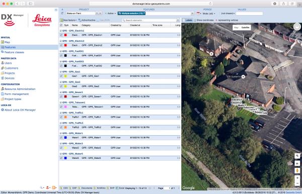
"description": "Leica DX Manager Mapping\nOne central dashboard for all the Leica Geosystems Detection solutions\n\nLeica DX Manager is the only enterprise grade utility mapping solution on the market. A unique cloud-powered solution that delivers unparalleled performance. Manage projects, tasks and spatial data from one central dashboard for all the Leica Geosystems Detection solutions.\n\nUpdate drawings, raw data, location pictures, data layers and mobile forms remotely and in a period of real time operate at an enterprise level rather than having to manually update individual users one at a time. With the Leica DX Manager, you have all dashboards, status updates and project management tools in one platform. Now, project managers can track field operations in real time and make critical decisions with a broader understanding of the current situation.\n\nKey benefits\n\nSimplified processes\nImprovement of data quality and accuracy\nConsistent data collection methods\nIntegration of DS2000, cable locators and asset mapping data\nWorkflows to maintain data integrity\nManage the whole workflow\n\nShare data to all devices and users within your organisation.\n\nAnalyse maps result\nVisualise on online maps\nFilter on users, within date ranges or any attributes\nExport to standard GIS and CAD formats\nShare data to your clients\nAn easy-to-use online portal allows management of all aspects of documenting utility location tasks. The user can switch between street view, satellite imagery and cartographic street maps. Field acquired survey data becomes instantly available and can be accessed by users anytime and anywhere.\n\nUtility detection integration\n\nLeica DX Manager integrates the entire Leica Geosystems Detection portfolio into a simple survey workflow, empowering the user to apply locator depth measurements to GNSS measurements. The result is a seamless fusion of both worlds – with all locator related data reviewable either in Leica DX Manager or any export format.\n\nLocate the utility\nMeasure the depth\nAll location data is sent directly to the Leica DX Field application on the GNSS device\nIt triggers the GNSS measurement on the mapping device\nAll data is integrated into the features metadata\nMaximum user experience and productivity\n\nLeica DX Field mobile app is designed for productivity and maximum user experience and built for enforcing data quality and accuracy. \n\nEasy mapping / surveying of assets\nSmart mobile forms\nImmediate visualisation on map\nMetadata collection\nAutomatic sync with Cloud\nFull offline capabilities\nMake sure your measured data always matches your quality expectations (up to centimetres with RTK) as Leica DX Manager notifications steadily monitor the system parameters. All quality parameters are stored as metadata. Next to the utility mapping aspect, it delivers work orders, time tracking and document management.",
"price": 0.0,
"discountamount": 0.0,
"currencycode": "INR",
"priority": 1000000,
"isfreeshipmentavailable": false,
"shipmentduration": 7,
"_keywords": [
"data quality",
"location data",
"data collection",
"data reviewable",
"survey data becomes",
"DX Field mobile app",
"Leica DX Manager Mapping",
"cartographic street maps",
"Leica DX Field application",
"update individual users one",
"Leica DX Manager notifications",
"apply locator depth measurements",
"enterprise grade utility mapping solution",
"entire Leica Geosystems Detection portfolio"
],
"isarchived": false,
"isavailable": true,
"applicationid": null,
"productindex": 89,
"imageuri": "https://productimages.withfloats.com/actual/5b459fa2f3579911b41e9cda.jpg",
"tileimageuri": "https://productimages.withfloats.com/tile/5b459fa2f3579911b41e9cda.jpg",
"images": null,
"totalqueries": 0,
"gpid": null,
"groupproductid": null,
"createdon": "2018-07-11T06:11:47.283Z",
"updatedon": "2018-08-08T18:46:53.959Z",
"buyonlinelink": null,
"producturl": "http://WWW.SURVEYEQUIPMENT.IN/products/leica-dx-manager-mapping/89",
"availableunits": -1.0,
"iscodavailable": true,
"isprepaidonlineavailable": false,
"maxcodorders": 0,
"maxprepaidonlineorders": 0,
"uniquepaymenturl": null,
"brandname": null,
"category": "GPR",
"tags": [
"GPR",
"Detection and underground mapping solution",
"Leica DX Manager Mapping"
],
"variants": false,
"keyspecification": null,
"otherspecifications": null,
"pickupaddressreferenceid": "5d08ebb3edf0e25c3b8da5d0",
"paymenttype": "AssuredPurchase",
"producttype": "products",
"hsncode": null,
"gstslab": 0.0,
"isnotforsale": false
},
{
"_id": "5b6b3a9ed682be0552aefd91",
"fptag": "SBENTERPRISESTRADINGPUNE",
"merchantname": null,
"customwidgets": null,
"externalsourceid": null,
"name": "DX Office Vision",
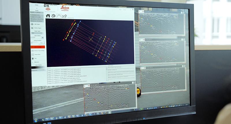
"description": "DX Office Vision\nUtility post processing software\n\n\nDX Office Vision is Leica Geosystems’ Utility Post Processing Software that allows DS2000 users to map digitally the detected underground utilities in a simple way by converting GPR data into CAD drawings.\n\nKey benefits:\nCreate CAD drawings of the detected utilities in an uncomplicated way in minimum time and with less training.\nView collected data of the detected utilities in a simple way - compare data files side by side or from top to bottom to locate consistent features.\nObtain CAD drawings in 3D with object attributes in different layers – filter, select, identify and make annotations of consistent targets and anomalies.\nReduce processing time with no intermediate converting, third party software or patch required.\nVisualise radar data from your DS2000 with an intuitive interface.\nMerge your DX Office Vision Data with other Leica detection products like DS2000, Digicat and Ultra.\n \n\nTake over data processing into CAD drawings with confidence and simplicity\nFor utility surveyors looking to map digitally the detected underground utilities, DX Office Vision is the post processing software with the fastest conversion speed and most intuitive interface to convert GPR data into CAD drawings for every user. DX Office Vision was developed by utility mapping contractors who are every day on the field, and understand the need of delivering 3D CAD drawings in an efficient way.\n\nDX Office Vision features:\nAutomatic data import\nAutomatic pre-set filtering\nReal-world depth calibration\n3D CAD export\nTarget addition, Target connectivity, Depth filtering\nDX Office Vision X-Section:\nAdditional to DX Office Vision,\n\nVelocity Depth Calibration\n3D CAD view (fully navigable)\nTime Slice Function\n\n",
"price": 0.0,
"discountamount": 0.0,
"currencycode": "INR",
"priority": 1000000,
"isfreeshipmentavailable": false,
"shipmentduration": 7,
"_keywords": [
"3D CAD drawings",
"data processing",
"convert GPR data",
"intuitive interface",
"third party software",
"DX Office Vision Data",
"underground utilities",
"Office Vision features",
"compare data files side",
"Leica detection products",
"utility mapping contractors",
"Utility Post Processing Software"
],
"isarchived": false,
"isavailable": true,
"applicationid": null,
"productindex": 96,
"imageuri": "https://productimages.withfloats.com/actual/5b459f01d4575c0f14705198.jpg",
"tileimageuri": "https://productimages.withfloats.com/tile/5b459f01d4575c0f14705198.jpg",
"images": null,
"totalqueries": 0,
"gpid": null,
"groupproductid": null,
"createdon": "2018-07-11T06:08:57.374Z",
"updatedon": "2018-08-08T18:46:54.222Z",
"buyonlinelink": null,
"producturl": "http://WWW.SURVEYEQUIPMENT.IN/products/dx-office-vision/96",
"availableunits": -1.0,
"iscodavailable": true,
"isprepaidonlineavailable": false,
"maxcodorders": 0,
"maxprepaidonlineorders": 0,
"uniquepaymenturl": null,
"brandname": null,
"category": "Utility post processing software",
"tags": [
"Utility post processing software",
"Detection and underground mapping solution",
"GPR"
],
"variants": false,
"keyspecification": null,
"otherspecifications": null,
"pickupaddressreferenceid": "5d08ebb3edf0e25c3b8da5d0",
"paymenttype": "AssuredPurchase",
"producttype": "products",
"hsncode": null,
"gstslab": 0.0,
"isnotforsale": false
},
{
"_id": "5b6b3a9cd682be0552aefb16",
"fptag": "SBENTERPRISESTRADINGPUNE",
"merchantname": null,
"customwidgets": null,
"externalsourceid": null,
"name": "Leica NAK2 Automatic Level",
"description": "Leica NAK2 Automatic Level\nThe NAK2 automatic level is the flagship optical level product from Leica Geosystems. Designed by leading surveyors and developed by highly skilled engineers with a great deal of experience in knowing what an instrument must achieve in the field. Created for all types of surveying task. the NAK2 is economical and productive for routine levelling task on building sites, for geodetic control at all levels of accuracy, and in engineering projects.\n\nFeatures of the NAK2\n\nSuited for levelling of all orders and types of accuracy\nAccurate settlement and levelling determinations\nRoutine heighting for road, railway, pipeline, and tunnel construction\nControl measurements and setting-out work on site\nHigh accuracy area levelling\nK-version on flat terrain provides Tacheometric levelling by bringing together stadia and angular measurements with height readings\nBridge monitoring and deformation measurement\n \n\nThe NAK2 provides added angle measurement.\n\nThe model NAK2 has an internal glass circle which is read via a scale microscope and which can be set to any value by turning the rim around the base of the instrument. Tacheometric levelling is also available with the K-version on fl at terrain by combining stadia and angular measurements with height readings.\n\nGenerally, the NAK2 is able to set up on any Leica tripod. In most cases we recommend the heavy-duty Leica GST20 Wooden Tripod. For precise levelling the GST40 Wooden Tripod is suitable due to its extreme rigidity.\n\nThe durable and tough NAK2 can be used in varying weather conditions and very reliable when used in harsh working conditions such as the building site. The pendulum compensator is protected against shocks and the vibration damping mechanism is highly effective.\n\nSet up is quick and easy with the circular level only needing to be centred approximately and bring the compensator into its working range. The Pentaprism provides a positive bubble which is monitored down the eyepiece.\n\nThe high quality optics within the telescope provides bright, high contrast images which can be focussed on quickly.\n\nFor ease of use and the press of one button, the instantaneous check facility give complete confidence. Controls are well designed and arranged for added convenience and the endless horizontal drive enables rapid fine pointing.\n\nAccessories including the parallel-plate, laser eyepiece, increase the potential use of this impressive levelling instrument.",
"price": 0.0,
"discountamount": 0.0,
"currencycode": "INR",
"priority": 1000000,
"isfreeshipmentavailable": false,
"shipmentduration": 7,
"_keywords": [
"Leica Geosystems",
"GST40 Wooden Tripod",
"angular measurements",
"high contrast images",
"pendulum compensator",
"internal glass circle",
"routine levelling task",
"Tacheometric levelling",
"harsh working conditions",
"Leica GST20 Wooden Tripod",
"Leica NAK2 Automatic Level",
"instantaneous check facility",
"flagship optical level product",
"impressive levelling instrument",
"endless horizontal drive enables rapid fine"
],
"isarchived": false,
"isavailable": true,
"applicationid": null,
"productindex": 68,
"imageuri": "https://productimages.withfloats.com/actual/5b1a4e873b9b610fc8e459d0.jpg",
"tileimageuri": "https://productimages.withfloats.com/tile/5b1a4e873b9b610fc8e459d0.jpg",
"images": null,
"totalqueries": 0,
"gpid": null,
"groupproductid": null,
"createdon": "2018-06-08T09:38:15.903Z",
"updatedon": "2018-08-08T18:46:52.529Z",
"buyonlinelink": null,
"producturl": "http://WWW.SURVEYEQUIPMENT.IN/products/leica-nak2-automatic-level/68",
"availableunits": -1.0,
"iscodavailable": true,
"isprepaidonlineavailable": false,
"maxcodorders": 0,
"maxprepaidonlineorders": 0,
"uniquepaymenturl": null,
"brandname": null,
"category": null,
"tags": null,
"variants": false,
"keyspecification": null,
"otherspecifications": null,
"pickupaddressreferenceid": "5d08ebb3edf0e25c3b8da5d0",
"paymenttype": "AssuredPurchase",
"producttype": "products",
"hsncode": null,
"gstslab": 0.0,
"isnotforsale": false
}
],
"hasmoreitems": false,
"isapirequest": false,
"totalresults": 27,
"query": null,
"floatingpoint": null
}