Preview

This is your website preview.

Currently it only shows your basic business info. Start adding relevant business details such as description, images and products or services to gain your customers attention by using Boost 360 android app / iOS App / web portal.

SBENTERPRISESTRADINGPUNE 5abfbf1e7c88bb04a4d0fcc7 Products https://www.surveyequipment.in
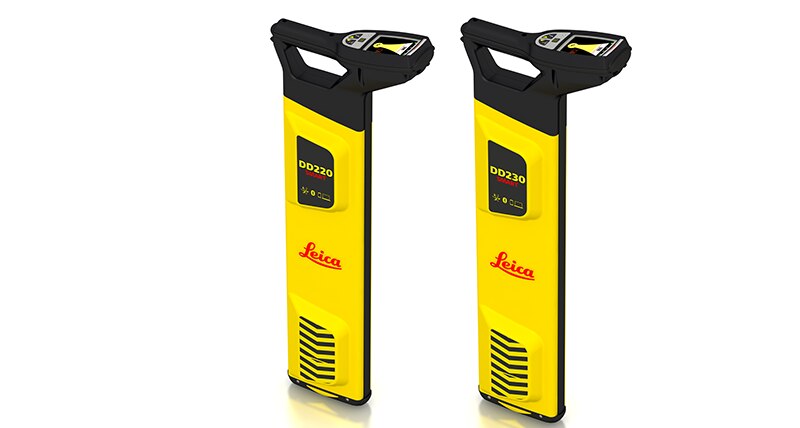
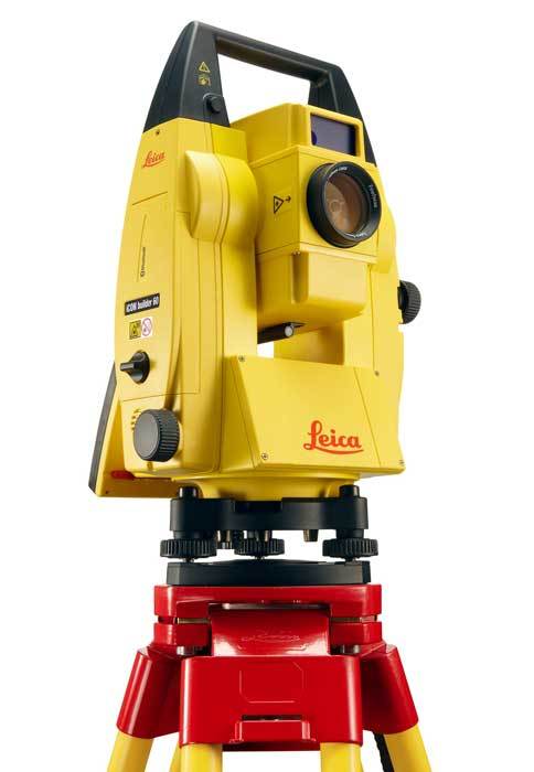
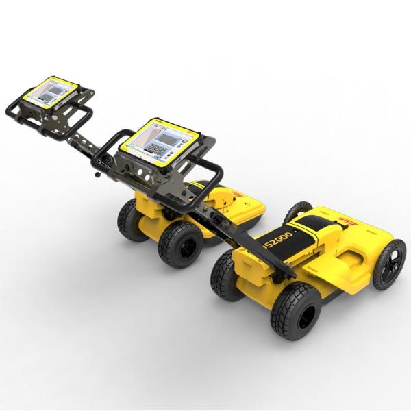
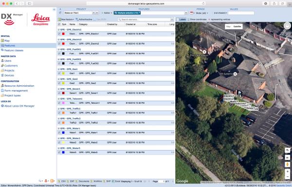
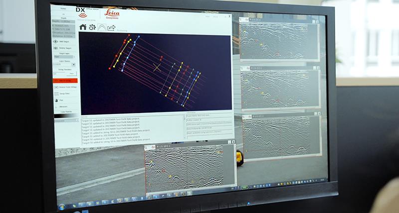
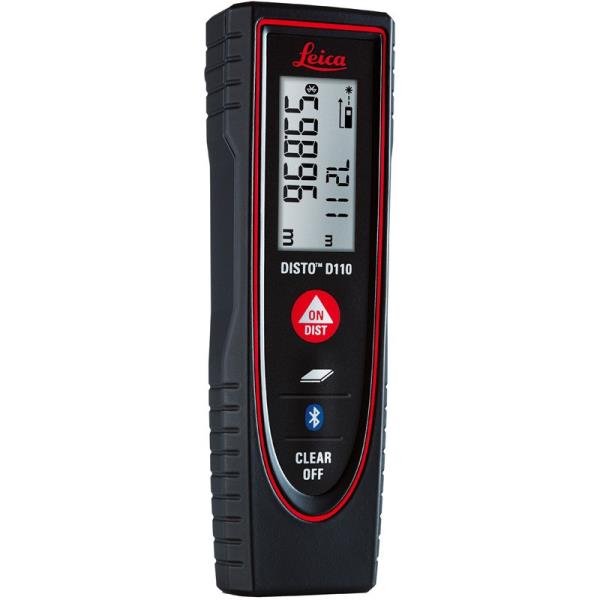
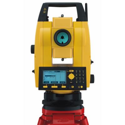
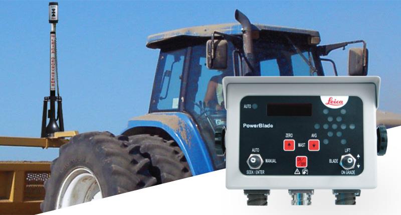
{ "products": [ { "_id": "5b6b3a99d682be0552aef687", "fptag": "SBENTERPRISESTRADINGPUNE", "merchantname": null, "customwidgets": null, "externalsourceid": null, "name": "Leica FlexLine TS02plus Manual Total Station", "description": "Leica FlexLine TS02plus Manual Total Station\nBest-in-class precision\n\nThe Leica FlexLine TS02plus is the perfect manual total station for standard measuring tasks where moderate accuracy is necessary.\n\nQuality, precision & reliability \nFlexLine plus total stations are built to the highest Swiss Technology quality standards. Users benefit from high precision and reliable instruments in order to fulfil their tasks with the requested accuracy. \n\nBest-in-class EDM technology \nWith PinPoint Electronic Distance Measurement (EDM), TS02plus delivers the optimal balance in:\n\nRange\nAccuracy\nReliability\nBeam visibility\nLaser dot size\nMeasurement time\nWith a wide variety of EDM options, the TS02plus is able to measure to both prisms and direct objects without the need for a reflector.\n\nIntuitive onboard software \nThe TS02plus is delivered with the intuitive onboard software, Leica FlexField plus. Guided workflows and easy to understand graphics and icons ensure a low learning curve when working in the field. Graphics and icons make the interpretation of measurement values or text no longer necessary, guaranteeing faster and simple operation when you need it. \n\nBest-in-class service & support \nFlexLine plus manual total stations are supported by superior after sales service and support. With the Active Customer Care program and myWorld customer portal, users have access to latest software updates, service and support as well as the mySecurity theft protection system. With mySecurity activitated, the locking mechanism ensures the device is disabled and can no longer be used.\n\n\nLeica Flexline TS02plus R500 Electronic Total Station Scope of delivery\nLeica Flexline TS02plus R500\nBattery GEB 212\nBattery charger GKL 311\nData Downloding Cable GEV267\nFlexoffice Standard Software\nCarrying Case\nPrism with Holder & Target Plate\nTelescopic Prism Pole\nHeavy Duty Wooden Tripod", "price": 310987.0, "discountamount": 0.0, "currencycode": "INR", "priority": 1000000, "isfreeshipmentavailable": true, "shipmentduration": 7, "_keywords": [ "TS02plus delivers", "moderate accuracy", "measurement values", "understand graphics", "reliable instruments", "manual total stations", "myWorld customer portal", "intuitive onboard software", "Active Customer Care program", "mySecurity theft protection system", "Swiss Technology quality standards", "PinPoint Electronic Distance Measurement", "Leica FlexLine TS02plus Manual Total Station", "Flexline TS02plus R500 Electronic Total Station Scope" ], "isarchived": false, "isavailable": true, "applicationid": null, "productindex": 6, "imageuri": "https://productimages.withfloats.com/actual/5ae69ac8994f4d0754b86b04.jpg", "tileimageuri": "https://productimages.withfloats.com/tile/5ae69ac8994f4d0754b86b04.jpg", "images": null, "totalqueries": 0, "gpid": null, "groupproductid": null, "createdon": "2018-04-30T04:25:39.125Z", "updatedon": "2018-08-08T18:46:49.577Z", "buyonlinelink": null, "producturl": "http://WWW.SURVEYEQUIPMENT.IN/products/leica-flexline-ts02plus-manual-total-station/6", "availableunits": -1.0, "iscodavailable": true, "isprepaidonlineavailable": false, "maxcodorders": 0, "maxprepaidonlineorders": 0, "uniquepaymenturl": null, "brandname": null, "category": "Leica Total Station in India ", "tags": [ "Leica Total Station in India ", "Leica FlexLine TS02plus", "Leica Total Station pune ", "Leica Total Station ", "Leica Total Station In Mumbai " ], "variants": false, "keyspecification": null, "otherspecifications": null, "pickupaddressreferenceid": "5d08ebb3edf0e25c3b8da5d0", "paymenttype": "AssuredPurchase", "producttype": "products", "hsncode": null, "gstslab": 0.0, "isnotforsale": false }, { "_id": "5e96c40249c9ab000155998b", "fptag": "SBENTERPRISESTRADINGPUNE", "merchantname": null, "customwidgets": null, "externalsourceid": null, "name": "Leica DD220 Smart Cable & Pipe Locator", "description": "Leica DD220 Smart Utility LocatorProtect your assets and your workersThe new Leica DD220 is an easy to use, intuitive locator simplifying the detection of buried utilities and increasing user confidence .\n\n\nWith automated pinpointing technology and a clear visible display, the DD220 discovers buried utilities with confidence, even in densely packed areas. On-board video support, usage alerts and diagnostics, combine to improve product use and, protect operators and utilities.\n\n\n\nSMART Technology; GPS, Bluetooth®, 8GB internal memory\nPower, Radio, Auto modes\nTransmitter modes, 131kHz, 33kHz, 8kHz or Auto (automatic detection of the transmitter signal)\nDepth detection up to 7 meters (23 feet)\nGood-to-Go™ Health Check and Start up test\nOn-board video user guides\nIP66 rating - protection from dust and water\nWeb Calibration Verification\n3 year Warranty\nLeica DD SMART utility locator solution\n\n\nFor professionals looking to streamline utility locating operations, the Leica DD SMART utility locators create a single source solution. DX Shield software provides a space for utility analysis and a convenient connection between SMART locators to increase productivity and save time.\n\nDX Shield software allows you to gain a better understanding of task performance and site complexities with easy-to-use reports that provide a fast and convenient overview of product use, reducing utility strikes and saving direct repair costs and project downtime.", "price": 0.0, "discountamount": 0.0, "currencycode": "INR", "priority": 1000000, "isfreeshipmentavailable": false, "shipmentduration": 7, "_keywords": null, "isarchived": false, "isavailable": true, "applicationid": null, "productindex": 169, "imageuri": "https://productimages.withfloats.com/actual/5e96c4065379a400011ee9f4.png", "tileimageuri": "https://productimages.withfloats.com/tile/5e96c4065379a400011ee9f4.png", "images": null, "totalqueries": 0, "gpid": null, "groupproductid": null, "createdon": "2020-04-15T08:21:22.911Z", "updatedon": "2020-04-15T08:21:22.911Z", "buyonlinelink": null, "producturl": "http://WWW.SURVEYEQUIPMENT.IN/products/leica-dd220-smart-cable-pipe-locator/169", "availableunits": -1.0, "iscodavailable": false, "isprepaidonlineavailable": false, "maxcodorders": 0, "maxprepaidonlineorders": 0, "uniquepaymenturl": null, "brandname": "Leica", "category": "", "tags": null, "variants": false, "keyspecification": null, "otherspecifications": null, "pickupaddressreferenceid": "", "paymenttype": "None", "producttype": "products", "hsncode": null, "gstslab": 0.0, "isnotforsale": false }, { "_id": "5b6b3a9ed682be0552aefded", "fptag": "SBENTERPRISESTRADINGPUNE", "merchantname": null, "customwidgets": null, "externalsourceid": null, "name": " Leica iCON Builder 62", "description": "Leica iCON Builder 62 – The perfect total station for construction layout\n\nConstruction layout has never been more professional than with Leica iCON builder 60 manual total station. The intuitive user interface paired with the highest quality manual total station perfects any job on site. You perform construction layout tasks fast and easy thanks to the simple, straightforward application software. \n\nThe iCON builder 60 total station is built especially with construction workers in mind, providing an entry into the world of Leica Geosystems’ intelligent CONstruction (iCON) solution. \n\niCON builder 60 delivers with: \n\nLeica iCON build - Industry leading layout software \nBest-in-class measurement technology \nHigh return on investment - take a look for yourself, click here \n\nAll the functionality you need \niCON builder 60 can be used for many different tasks in many different ways, for example as a one-person station for checks such as tie distances clearance or verticality. Easily connect a tablet computer via the internal Bluetooth and you instantly benefit from a larger screen. \n\nIntuitive software \nThe user interface is easy to understand and offers you graphical map view for quick navigation and point/line selection. iCON builder 60 saves you time by short and straightforward operating procedures. Get quick results and save time, speeding up your layout measurements on site. \n\nPackage includes: \n\n● iCON builder 62 2\" Manual Total Station & iCONstruct Build software on-board, \n● 500m/1300ft reflectorless range, \n● tribrach, \n● 2x Li-Ion battery, \n● charger, \n● TrueZero prism, \n● mini prism pole, \n● USB to Mini-USB transfer cable, \n● USB memory stick, \n● quick guide \n● carry case.\n\n", "price": 0.0, "discountamount": 0.0, "currencycode": "INR", "priority": 1000000, "isfreeshipmentavailable": false, "shipmentduration": 7, "_keywords": [ "builder 60 delivers", "iCON builder 60 saves", "Leica iCON Builder 62", "perfect total station", "tie distances clearance", "intuitive user interface", "intelligent CONstruction", "iCONstruct Build software", "iCON builder 60 total station", "straightforward application software", "straightforward operating procedures", "quality manual total station perfects", "perform construction layout tasks fast", "Leica iCON builder 60 manual total station" ], "isarchived": false, "isavailable": true, "applicationid": null, "productindex": 100, "imageuri": "https://productimages.withfloats.com/actual/5b5029a5b33e28053e42fa30.jpg", "tileimageuri": "https://productimages.withfloats.com/tile/5b5029a5b33e28053e42fa30.jpg", "images": null, "totalqueries": 0, "gpid": null, "groupproductid": null, "createdon": "2018-07-19T06:03:17.733Z", "updatedon": "2018-08-08T18:46:54.368Z", "buyonlinelink": null, "producturl": "http://WWW.SURVEYEQUIPMENT.IN/products/-leica-icon-builder-62/100", "availableunits": -1.0, "iscodavailable": true, "isprepaidonlineavailable": false, "maxcodorders": 0, "maxprepaidonlineorders": 0, "uniquepaymenturl": null, "brandname": null, "category": "leicatotalstationspune", "tags": [ "leicatotalstationspune", "leicaicon", "leicatotalstationsindia", "machinecontroltotalstations" ], "variants": false, "keyspecification": null, "otherspecifications": null, "pickupaddressreferenceid": "5d08ebb3edf0e25c3b8da5d0", "paymenttype": "AssuredPurchase", "producttype": "products", "hsncode": null, "gstslab": 0.0, "isnotforsale": false }, { "_id": "5b6b3a9ed682be0552aefd47", "fptag": "SBENTERPRISESTRADINGPUNE", "merchantname": null, "customwidgets": null, "externalsourceid": null, "name": "Leica DS2000 Utility Detection Radar", "description": "Leica DS2000 Utility Detection Radar\nUncovering safer, faster, more\n\nThere’s a lot going on underground that you need to know about before you ever start to dig. The Leica DS2000 Utility Detection Radar finds all potential threats, including non-conductive pipes and fibre optics, increasing safety by lowering the risk of accidently hitting underground assets.\n\nIncrease safety, speed up work and lower asset management costs with the ability to prevent hazardous outages and collect more information. The DS2000 betters your business by making it safer, faster and more efficient.\n\nKey benefits\nIncrease safety when the DS2000 identifies all potential threats\nGet to assets and recover quicker from outages when you know exactly where underground utility assets are located\nDual-frequency antenna to detect deep and shallow targets simultaneously\nEasily collect and understand data with the DS2000’s simple and intuitive software and data storage\nSimple data storage and export to continue working on the post-processing at the office\nEffortlessly maneuver around the most challenging sites with the DS2000’s advanced ergonomics\nExpert knowledge of Leica Geosystems with more than 270 service centres worldwide\nPROTECT by Leica Geosystems - the strongest warranty in the market\n\nDetection and underground mapping solution\nCombined with the powerful and rugged Leica CT2000 field tablet, the GG04 or the GPS60 smart antenna, and the DIGICAT intelligent cable locators and DIGITEX transmitters, the DS2000 is part of the complete Leica Geosystems detection and underground mapping solution that will enhance your business by making it faster and more efficient. With DX Office Vision post processing software, convert radar data to CAD file in an uncomplicated way.\n\nStart today\nContact your Leica Geosystems distribution partner for more information on the Leica DS2000 and other detection solutions.", "price": 0.0, "discountamount": 0.0, "currencycode": "INR", "priority": 1000000, "isfreeshipmentavailable": false, "shipmentduration": 7, "_keywords": [ "DS2000 betters", "convert radar data", "intuitive software", "GPS60 smart antenna", "detection solutions", "DIGITEX transmitters", "asset management costs", "Leica CT2000 field tablet", "underground utility assets", "DIGICAT intelligent cable locators", "complete Leica Geosystems detection", "Leica DS2000 Utility Detection Radar", "Leica Geosystems distribution partner", "DX Office Vision post processing software" ], "isarchived": false, "isavailable": true, "applicationid": null, "productindex": 94, "imageuri": "https://productimages.withfloats.com/actual/5b45a66fd4575c0f14706fc4.jpg", "tileimageuri": "https://productimages.withfloats.com/tile/5b45a66fd4575c0f14706fc4.jpg", "images": null, "totalqueries": 0, "gpid": null, "groupproductid": null, "createdon": "2018-07-11T06:40:39.103Z", "updatedon": "2018-08-08T18:46:54.113Z", "buyonlinelink": null, "producturl": "http://WWW.SURVEYEQUIPMENT.IN/products/leica-ds2000-utility-detection-radar/94", "availableunits": -1.0, "iscodavailable": true, "isprepaidonlineavailable": false, "maxcodorders": 0, "maxprepaidonlineorders": 0, "uniquepaymenturl": null, "brandname": null, "category": "GPR Ground Penetrating Radar", "tags": [ "GPR Ground Penetrating Radar", "| GPR Ground Penetrating Radar Survey Equipment Di" ], "variants": false, "keyspecification": null, "otherspecifications": null, "pickupaddressreferenceid": "5d08ebb3edf0e25c3b8da5d0", "paymenttype": "AssuredPurchase", "producttype": "products", "hsncode": null, "gstslab": 0.0, "isnotforsale": false }, { "_id": "5b6b3a9dd682be0552aefcbd", "fptag": "SBENTERPRISESTRADINGPUNE", "merchantname": null, "customwidgets": null, "externalsourceid": null, "name": "Leica DX Manager Mapping", "description": "Leica DX Manager Mapping\nOne central dashboard for all the Leica Geosystems Detection solutions\n\nLeica DX Manager is the only enterprise grade utility mapping solution on the market. A unique cloud-powered solution that delivers unparalleled performance. Manage projects, tasks and spatial data from one central dashboard for all the Leica Geosystems Detection solutions.\n\nUpdate drawings, raw data, location pictures, data layers and mobile forms remotely and in a period of real time operate at an enterprise level rather than having to manually update individual users one at a time. With the Leica DX Manager, you have all dashboards, status updates and project management tools in one platform. Now, project managers can track field operations in real time and make critical decisions with a broader understanding of the current situation.\n\nKey benefits\n\nSimplified processes\nImprovement of data quality and accuracy\nConsistent data collection methods\nIntegration of DS2000, cable locators and asset mapping data\nWorkflows to maintain data integrity\nManage the whole workflow\n\nShare data to all devices and users within your organisation.\n\nAnalyse maps result\nVisualise on online maps\nFilter on users, within date ranges or any attributes\nExport to standard GIS and CAD formats\nShare data to your clients\nAn easy-to-use online portal allows management of all aspects of documenting utility location tasks. The user can switch between street view, satellite imagery and cartographic street maps. Field acquired survey data becomes instantly available and can be accessed by users anytime and anywhere.\n\nUtility detection integration\n\nLeica DX Manager integrates the entire Leica Geosystems Detection portfolio into a simple survey workflow, empowering the user to apply locator depth measurements to GNSS measurements. The result is a seamless fusion of both worlds – with all locator related data reviewable either in Leica DX Manager or any export format.\n\nLocate the utility\nMeasure the depth\nAll location data is sent directly to the Leica DX Field application on the GNSS device\nIt triggers the GNSS measurement on the mapping device\nAll data is integrated into the features metadata\nMaximum user experience and productivity\n\nLeica DX Field mobile app is designed for productivity and maximum user experience and built for enforcing data quality and accuracy. \n\nEasy mapping / surveying of assets\nSmart mobile forms\nImmediate visualisation on map\nMetadata collection\nAutomatic sync with Cloud\nFull offline capabilities\nMake sure your measured data always matches your quality expectations (up to centimetres with RTK) as Leica DX Manager notifications steadily monitor the system parameters. All quality parameters are stored as metadata. Next to the utility mapping aspect, it delivers work orders, time tracking and document management.", "price": 0.0, "discountamount": 0.0, "currencycode": "INR", "priority": 1000000, "isfreeshipmentavailable": false, "shipmentduration": 7, "_keywords": [ "data quality", "location data", "data collection", "data reviewable", "survey data becomes", "DX Field mobile app", "Leica DX Manager Mapping", "cartographic street maps", "Leica DX Field application", "update individual users one", "Leica DX Manager notifications", "apply locator depth measurements", "enterprise grade utility mapping solution", "entire Leica Geosystems Detection portfolio" ], "isarchived": false, "isavailable": true, "applicationid": null, "productindex": 89, "imageuri": "https://productimages.withfloats.com/actual/5b459fa2f3579911b41e9cda.jpg", "tileimageuri": "https://productimages.withfloats.com/tile/5b459fa2f3579911b41e9cda.jpg", "images": null, "totalqueries": 0, "gpid": null, "groupproductid": null, "createdon": "2018-07-11T06:11:47.283Z", "updatedon": "2018-08-08T18:46:53.959Z", "buyonlinelink": null, "producturl": "http://WWW.SURVEYEQUIPMENT.IN//leica-dx-manager-mapping/89", "availableunits": -1.0, "iscodavailable": true, "isprepaidonlineavailable": false, "maxcodorders": 0, "maxprepaidonlineorders": 0, "uniquepaymenturl": null, "brandname": null, "category": "GPR", "tags": [ "GPR", "Detection and underground mapping solution", "Leica DX Manager Mapping" ], "variants": false, "keyspecification": null, "otherspecifications": null, "pickupaddressreferenceid": "5d08ebb3edf0e25c3b8da5d0", "paymenttype": "AssuredPurchase", "producttype": "products", "hsncode": null, "gstslab": 0.0, "isnotforsale": false }, { "_id": "5b6b3a9ed682be0552aefd91", "fptag": "SBENTERPRISESTRADINGPUNE", "merchantname": null, "customwidgets": null, "externalsourceid": null, "name": "DX Office Vision", "description": "DX Office Vision\nUtility post processing software\n\n\nDX Office Vision is Leica Geosystems’ Utility Post Processing Software that allows DS2000 users to map digitally the detected underground utilities in a simple way by converting GPR data into CAD drawings.\n\nKey benefits:\nCreate CAD drawings of the detected utilities in an uncomplicated way in minimum time and with less training.\nView collected data of the detected utilities in a simple way - compare data files side by side or from top to bottom to locate consistent features.\nObtain CAD drawings in 3D with object attributes in different layers – filter, select, identify and make annotations of consistent targets and anomalies.\nReduce processing time with no intermediate converting, third party software or patch required.\nVisualise radar data from your DS2000 with an intuitive interface.\nMerge your DX Office Vision Data with other Leica detection products like DS2000, Digicat and Ultra.\n \n\nTake over data processing into CAD drawings with confidence and simplicity\nFor utility surveyors looking to map digitally the detected underground utilities, DX Office Vision is the post processing software with the fastest conversion speed and most intuitive interface to convert GPR data into CAD drawings for every user. DX Office Vision was developed by utility mapping contractors who are every day on the field, and understand the need of delivering 3D CAD drawings in an efficient way.\n\nDX Office Vision features:\nAutomatic data import\nAutomatic pre-set filtering\nReal-world depth calibration\n3D CAD export\nTarget addition, Target connectivity, Depth filtering\nDX Office Vision X-Section:\nAdditional to DX Office Vision,\n\nVelocity Depth Calibration\n3D CAD view (fully navigable)\nTime Slice Function\n\n", "price": 0.0, "discountamount": 0.0, "currencycode": "INR", "priority": 1000000, "isfreeshipmentavailable": false, "shipmentduration": 7, "_keywords": [ "3D CAD drawings", "data processing", "convert GPR data", "intuitive interface", "third party software", "DX Office Vision Data", "underground utilities", "Office Vision features", "compare data files side", "Leica detection products", "utility mapping contractors", "Utility Post Processing Software" ], "isarchived": false, "isavailable": true, "applicationid": null, "productindex": 96, "imageuri": "https://productimages.withfloats.com/actual/5b459f01d4575c0f14705198.jpg", "tileimageuri": "https://productimages.withfloats.com/tile/5b459f01d4575c0f14705198.jpg", "images": null, "totalqueries": 0, "gpid": null, "groupproductid": null, "createdon": "2018-07-11T06:08:57.374Z", "updatedon": "2018-08-08T18:46:54.222Z", "buyonlinelink": null, "producturl": "http://WWW.SURVEYEQUIPMENT.IN/products/dx-office-vision/96", "availableunits": -1.0, "iscodavailable": true, "isprepaidonlineavailable": false, "maxcodorders": 0, "maxprepaidonlineorders": 0, "uniquepaymenturl": null, "brandname": null, "category": "Utility post processing software", "tags": [ "Utility post processing software", "Detection and underground mapping solution", "GPR" ], "variants": false, "keyspecification": null, "otherspecifications": null, "pickupaddressreferenceid": "5d08ebb3edf0e25c3b8da5d0", "paymenttype": "AssuredPurchase", "producttype": "products", "hsncode": null, "gstslab": 0.0, "isnotforsale": false }, { "_id": "5b6b3a9dd682be0552aefc69", "fptag": "SBENTERPRISESTRADINGPUNE", "merchantname": null, "customwidgets": null, "externalsourceid": null, "name": "Leica Disto D110 Laser Distance Meter", "description": "Leica Disto D110 Laser Distance Meter\nThe New Leica Disto D110 is the smallest Disto with Bluetooth Smart on the market. Create floor plans and sketches very easily by connecting the new Leica D110 with the DISTO Sketch app on a Smartphone or tablet device.\n\nBenefits of the Leica Disto D110:\nNew ergonomic design for easy use\nIncreased functionality with integrated Bluetooth Smart technology and Leica Disto Sketch app\nPerfect for fast indoor distance and area measurements\nPocket clip to help with carrying\nProven Leica quality and precision\nThis is the first laser Disto with Bluetooth technology that’s small and fits in a pocket.\n\nEffortless measurements can be taken whether it’s for a quick material estimation or a home improvement project, the Disto Sketch App provides potential to create floor plans, sketches and document measurements with pictures using a tablet or smartphone.\n\nMeasure precise distances with ±1.5mm accuracy\nMeasure up to 60m distances without moving\nIdeal for the jobsite – Protected against splash water and dust\nDocument results with the Disto Sketch App for faster, easier and safer work. The App is available for free download from Google Play and the App Store for Android and iOS devices.\n\nThe lightest and smallest Disto in the range, its ergonomic design means that it fits in your hand perfectly and is very comfortable to use. The simple to understand button allow intuitive and quick operation. Measuring has never been easier. The removable pocket clip is a valued accessory, simply clip the device to the pocket of your shirt or trousers for convenient use.\n\nTechnical Data\nMeasuring Accuracy: ±1.5mm\nRange: 60m\nMeasuring units: m, ft, in\nIncludes: Power Range Technology, Illuminated Display, Free App\nBatteries: 2x AAA\nProtection Class: IP54 (splash water and dust)\nDimensions: 120x37x23mm\nWeight: 92g\nIncludes:\nLeica DISTO D110 Laser Distance Meter\nPocket Clip\nHolster\n2x AAA Batteries.\n", "price": 0.0, "discountamount": 0.0, "currencycode": "INR", "priority": 1000000, "isfreeshipmentavailable": false, "shipmentduration": 7, "_keywords": [ "new Leica D110", "Disto Sketch App", "first laser Disto", "Leica Disto Sketch", "create floor plans", "New Leica Disto D110", "Bluetooth technology", "fast indoor distance", "removable pocket clip", "document measurements", "Power Range Technology", "home improvement project", "quick material estimation", "Bluetooth Smart technology", "Leica Disto D110 Laser Distance Meter" ], "isarchived": false, "isavailable": true, "applicationid": null, "productindex": 86, "imageuri": "https://productimages.withfloats.com/actual/5b3f41a0d3d93d03a4b91a60.jpg", "tileimageuri": "https://productimages.withfloats.com/tile/5b3f41a0d3d93d03a4b91a60.jpg", "images": null, "totalqueries": 0, "gpid": null, "groupproductid": null, "createdon": "2018-07-06T10:17:10.03Z", "updatedon": "2018-08-08T18:46:53.841Z", "buyonlinelink": null, "producturl": "http://WWW.SURVEYEQUIPMENT.IN//leica-disto-d110-laser-distance-meter/86", "availableunits": -1.0, "iscodavailable": true, "isprepaidonlineavailable": false, "maxcodorders": 0, "maxprepaidonlineorders": 0, "uniquepaymenturl": null, "brandname": null, "category": "leicadisto", "tags": [ "leicadisto", "laserdistancemeter", "leicageosystems" ], "variants": false, "keyspecification": null, "otherspecifications": null, "pickupaddressreferenceid": "5d08ebb3edf0e25c3b8da5d0", "paymenttype": "AssuredPurchase", "producttype": "products", "hsncode": null, "gstslab": 0.0, "isnotforsale": false }, { "_id": "5b6b3a9dd682be0552aefc15", "fptag": "SBENTERPRISESTRADINGPUNE", "merchantname": null, "customwidgets": null, "externalsourceid": null, "name": "Leica Builder 502", "description": "Leica Builder 502 – when a construction plan goes digital\n\nThe Leica Builder 502 total station is designed to meet the requirements of construction. High performance and ease to use built in Leica Powersite software makes it the ideal solution for every layout task. The user additionally benefits from the most advanced electronic distance measurement and pinpoint accuracy.Builder Programmes include - Setup, Height transfer, Layout as built, Angle & Distance,Tie & Distance, Area & Volumes, Measure & Descriptor, Parallel Lines, Hidden Point, COGO, Layout Line/ Arc/ Spiral, Stockpile Volumes.New features of the Leica PowerSite Software extend the users’ possibilities such as calculate volumes, layout of curved structures, measuring to hidden points and layout using intersection points or grid points. Graphical elements guide the user through the software and make all tasks visually understandable, starting from the first levelling of the instrument, to a computed block volume.\n\nLeica Builder 502 Total Station – turning construction sites digital. The Leica Builder 502 total station is an all-round instrument. Whether you require a total station that performs routine surveying tasks or a professional highly accurate instrument, the Leica Builder 502 has all the features to meet your demands.\n\nBenefits of The Builder 502 are:\nCall up plan data and record points eliminate read and write errors.\nData exchange via industrial grade USB stick simplifies data handling.\nA direct DXF download function.\nTracking mode.\nSetup anywhere function.\nOptional volumes calculation.\nLaser distance measurement up to 250m.\nLeica Builder 500 Options:\nThe Leica Builder 500 Series is available in three accuracy:\n\nBuilder 502 – 2″ Angle Measurement\nBuilder 503 – 3″ Angle Measurement\nBuilder 505 – 5″ Angle Measurement\nUnique Features of Leica Builder 502 Series Total Station\nMultilingual Function\nIf you have a crew that speak different languages then the Leica Builder 502 is the ideal total station for you. The Leica Builder is the only instrument in its class that comes with multiple languages on-board. Switching between languages is fast and easy with only one keystroke, improving convenience and efficiency. The Leica Builder 502 total station allows 3 languages to be displayed at the same time.\n\nDirect.dxf\nWith “Direct.dxf” functionality, data can be read directly from the instrument in dxf-format and read into AutoCAD® on a PC without any intermediate steps. Coordinates and point numbers can be stored in different layers.\n\nTheft protection\n\nA PIN-code system features on the Leica Builder 500 to prevent unauthorised persons from using the instrument. This increases your data security. Without correct code, the equipment cannot be operated, data erased and makes it less appealing to steal, which protects you from having damages, increases your safety and possibly lowers your insurance rates.\n\nLeica Builder 500 Delivery Package:\nCTB101 Black Tribrach (01 No.)\nGEB211 Battery (02 Nos.)\nGKL221 Charger (complete with car adapter cable) (01 No.)\nCPR111 Builder Prism (01 No.)\nGLS115 Mini Reflector Pole set with point (01 No.)\nGEV223 Data Cable TS to USB (01 No.)\nMS1, 1Gb USB Stick (01 No.)\nUser Manual (01 No.)\nCarry Case (01 No.)\n\n", "price": 0.0, "discountamount": 0.0, "currencycode": "INR", "priority": 1000000, "isfreeshipmentavailable": false, "shipmentduration": 0, "_keywords": [ "Builder Prism", "construction plan", "multiple languages", "ideal total station", "accurate instrument", "intersection points", "Leica Builder 500 Series", "Leica Powersite software", "speak different languages", "Builder 500 Delivery Package", "prevent unauthorised persons", "Leica Builder 502 Series Total", "Leica Builder 502 total station", "electronic distance measurement", "industrial grade USB stick simplifies data" ], "isarchived": false, "isavailable": false, "applicationid": null, "productindex": 82, "imageuri": "https://productimages.withfloats.com/actual/5b237d830c1c510f40d95d51.jpg", "tileimageuri": "https://productimages.withfloats.com/tile/5b237d830c1c510f40d95d51.jpg", "images": null, "totalqueries": 0, "gpid": null, "groupproductid": null, "createdon": "2018-06-15T08:42:40.75Z", "updatedon": "2018-08-08T18:46:53.464Z", "buyonlinelink": null, "producturl": "http://WWW.SURVEYEQUIPMENT.IN//leica-builder-502/82", "availableunits": -1.0, "iscodavailable": true, "isprepaidonlineavailable": false, "maxcodorders": 0, "maxprepaidonlineorders": 0, "uniquepaymenturl": null, "brandname": null, "category": null, "tags": null, "variants": false, "keyspecification": null, "otherspecifications": null, "pickupaddressreferenceid": "5d08ebb3edf0e25c3b8da5d0", "paymenttype": "AssuredPurchase", "producttype": "products", "hsncode": null, "gstslab": 0.0, "isnotforsale": false }, { "_id": "5b6b3a9bd682be0552aef946", "fptag": "SBENTERPRISESTRADINGPUNE", "merchantname": null, "customwidgets": null, "externalsourceid": null, "name": "Leica PowerBlade Scraper System", "description": "Leica PowerBlade Scraper System\nAutomated grading system for construction and agricultural tractors\n\nThe Leica PowerBlade system is a complete solution steered by the MCP700 control box – easy-to-use and full of features. A choice of laser receivers allows you to tailor the system to your application. An extremely rugged electric mast and a variety of hydraulic options complete the system. All components have been developed to meet the extra strain experienced on dozers and agricultural tractors.\n\nThe PowerBlade system features a very rugged and durable design and is up to any challenge:\n\nDesigned for advanced agricultural land levelling, providing survey capability, automatic averaging and lift functionality\nVariety of hydraulic valves can be operated and tuned (black/white, proportional, Danfoss)\nChoice of manual or automatic level control of the machine\nQuick learning curve due to simple user interface\nBright LED display that can be read even in strong direct sunlight\n360° capture range in 190 mm (8”) window with MLS720 receiver\nProportional detection gives you the accuracy exactly where you need it\n2,5 mm (1/10”) accuracy independent of laser beam width\nWorks with all types of lasers\nThe system can be mounted on a broad range of machinery such as scrapers, dozers and agricultural tractors, automatically controlling and adjusting the work.\n\nControl box MCP700 \nThe PowerBlade system offers five different indications of grade position, including directional out-of-beam indicators. This information is shown where you need it - on the control box. Selectable accuracies provide job tolerances from rough grading to final finishing. The control box is water-resistant (IP65) and uses a LED display that can be easily read, even in strong sunlight. Two easy to operate switches let you choose between auto/manual mode and blade raise/lower. The well-laid out design makes the control box both easy-to-use and understand. The system features a lift function allowing the operator to temporarily lift the blade without leaving automatic mode. This feature is especially helpful for coarse grading when great amounts of dirt are moved. The survey function provides height information of a defined area even including an average height function.\n\nThis feature makes land levelling a simple task. The small size of the control box makes it easy to integrate into any machine.\n\nElectric mast MPM700 \nThe electric mast MPM700 was specifically developed for use in tough and demanding environments. The rugged design and the anti-vibration system of the platform are the ultimate combination against damage in harsh construction environments.\n\nLaser receiver MLS720 \nThe laser receiver is waterproof (IP68) and uses an LED display that can be easily read, even in strong direct sunlight. The receiver has a 360° capture range, with a measurement window of 190 mm. It features five different indications of grade position. The receiver communicates and is powered via CAN bus from the MCP700.", "price": 0.0, "discountamount": 0.0, "currencycode": "INR", "priority": 1000000, "isfreeshipmentavailable": false, "shipmentduration": 7, "_keywords": [ "MCP700 control box", "electric mast MPM700", "agricultural tractors", "strong direct sunlight", "demanding environments", "Leica PowerBlade system", "automatic level control", "PowerBlade system features", "advanced agricultural land", "hydraulic options complete", "Leica PowerBlade Scraper System", "features five different indications" ], "isarchived": false, "isavailable": true, "applicationid": null, "productindex": 42, "imageuri": "https://productimages.withfloats.com/actual/5af2c04685c6af0a10709320.jpg", "tileimageuri": "https://productimages.withfloats.com/tile/5af2c04685c6af0a10709320.jpg", "images": null, "totalqueries": 0, "gpid": null, "groupproductid": null, "createdon": "2018-05-09T09:32:53.616Z", "updatedon": "2018-08-08T18:46:51.361Z", "buyonlinelink": null, "producturl": "http://WWW.SURVEYEQUIPMENT.IN//leica-powerblade-scraper-system/42", "availableunits": -1.0, "iscodavailable": true, "isprepaidonlineavailable": false, "maxcodorders": 0, "maxprepaidonlineorders": 0, "uniquepaymenturl": null, "brandname": null, "category": null, "tags": null, "variants": false, "keyspecification": null, "otherspecifications": null, "pickupaddressreferenceid": "5d08ebb3edf0e25c3b8da5d0", "paymenttype": "AssuredPurchase", "producttype": "products", "hsncode": null, "gstslab": 0.0, "isnotforsale": false } ], "hasmoreitems": false, "isapirequest": false, "totalresults": 27, "query": null, "floatingpoint": null }

Still searching for
understand graphics?

Still searching for
understand graphics?

Chat with us