Preview

This is your website preview.

Currently it only shows your basic business info. Start adding relevant business details such as description, images and products or services to gain your customers attention by using Boost 360 android app / iOS App / web portal.

SBENTERPRISESTRADINGPUNE 5abfbf1e7c88bb04a4d0fcc7 Products https://www.surveyequipment.in
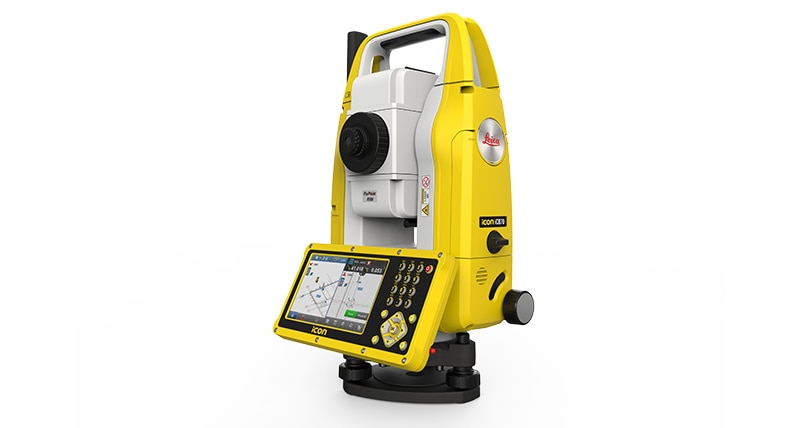
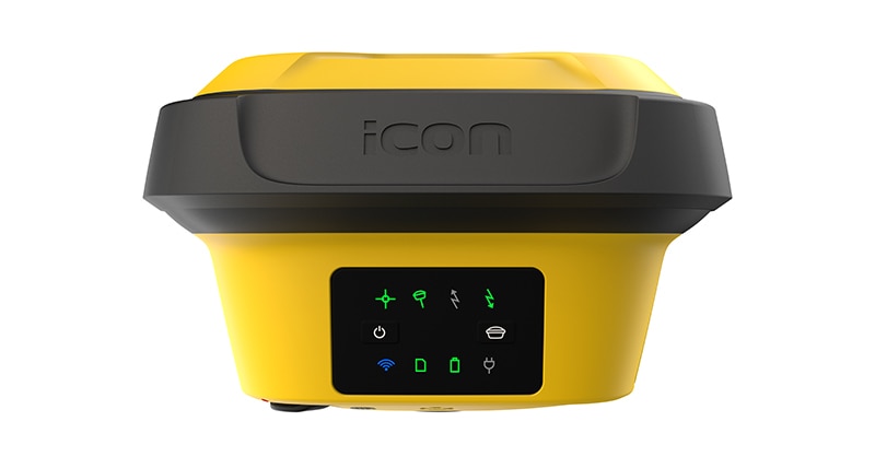
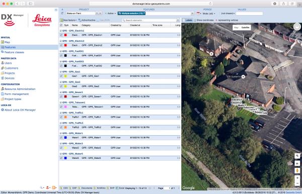
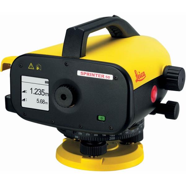
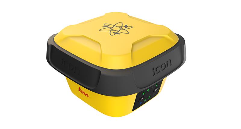
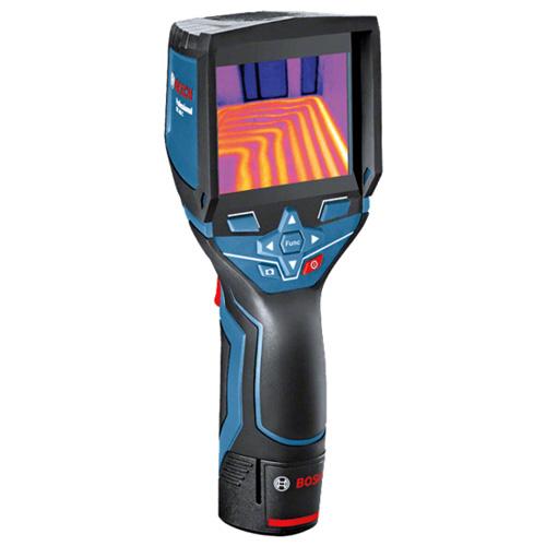
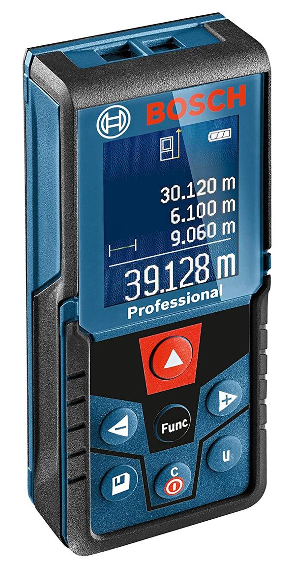
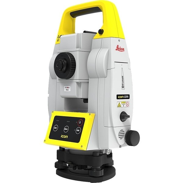
{ "products": [ { "_id": "5b6b3a9ed682be0552aefe5c", "fptag": "SBENTERPRISESTRADINGPUNE", "merchantname": null, "customwidgets": null, "externalsourceid": null, "name": "Leica iCON iCR70 Robotic Total Station", "description": "The Leica iCON iCR70 facilitates the move from traditional analogue measurement methods to modern digital layout techniques.\n\nThe Leica iCON iCR70 facilitates the move from traditional analogue measurement methods to modern digital layout techniques. Which are a necessity within modern BIM processes and achieves high productivity and accuracies demanded by the building construction industry. \nThe iCR70 can be used by the existing construction workforce with minimal training and does not disrupt existing construction processes.\n\nLayout lines for footings or chalk line for formwork on foundations\nLayout points on binding layer such as pipe insert of cut-outs before pouring concrete\nMEP layout of hanger locations for HVAC and duct work, inserts and slits for sheet metal work\nFully automatic layout routines of points on floor or ceiling lines for pipe wall penetrations\nPrepare and execute construction tasks faster, simpler and more accurately. This robot, tailored to your construction needs, is designed for one-person operation, giving you approximately an eighty per cent increase of productivity over other conventional layout practices. The iCON iCR70 is your best partner for construction layout, helping you to simplify your work on site, be on time and under budget. With a bullet-proof set-up routine, you can be confident that you have the right set up. It guarantees layout efficiency with flexible handling of fully rendered 3D design models in the field.\n\n4-button keypad for simple operation\nFast prism search by patented technology SpeedSearch\nStable data communication with long-range Bluetooth (up tp 400m)\nAligned to modern BIM processes, fully-rendered 3D design models can be easily shared via COnx from the design office to the field crews\nGo Digital \nSwap the traditional measuring methods for new modern technology that is easy-to-use. The iCON iCR70 allows you to move from traditional analogue layout methods, such as tapes, plumb bobs and strings to modern digital layout methods. Using the new construction total station from Leica you can now turn complex designs into reality with ease.\n\nAutonomy\nRich intelligent design data can be handed over form the office to field crews as fully rendered 3D models. The layout objects App. allows you to lay out straight from 3D models be selecting an object, like a column or pipe, simply by tapping on it in the controller. This gives field crews full flexibility selecting their work packages by objects with simple yet powerful filter mechanisms making this ideal for MEP/HVAC construction layout.\n\nAutomated Set Up\nThe Setup Pilot app allows you to remain confident with the most reliable, simple and automated setup routine which requires no user interaction. With it a successful set-up completion is visually communicated, indicating layout can immediately begin at the push of a button.", "price": 0.0, "discountamount": 0.0, "currencycode": "INR", "priority": 1000000, "isfreeshipmentavailable": false, "shipmentduration": 7, "_keywords": [ "construction layout", "new modern technology", "construction workforce", "automatic layout routines", "execute construction tasks", "guarantees layout efficiency", "field crews full flexibility", "modern digital layout methods", "conventional layout practices", "new construction total station", "building construction industry", "modern digital layout techniques", "traditional analogue layout methods", "Leica iCON iCR70 Robotic Total Station", "traditional analogue measurement methods" ], "isarchived": false, "isavailable": true, "applicationid": null, "productindex": 108, "imageuri": "https://productimages.withfloats.com/actual/5b6550f8ca14c4050adf1f4e.jpg", "tileimageuri": "https://productimages.withfloats.com/tile/5b6550f8ca14c4050adf1f4e.jpg", "images": null, "totalqueries": 0, "gpid": null, "groupproductid": null, "createdon": "2018-08-04T07:08:40.837Z", "updatedon": "2018-08-08T18:46:54.54Z", "buyonlinelink": null, "producturl": "http://WWW.SURVEYEQUIPMENT.IN/products/leica-icon-icr70-robotic-total-station/108", "availableunits": -1.0, "iscodavailable": true, "isprepaidonlineavailable": false, "maxcodorders": 0, "maxprepaidonlineorders": 0, "uniquepaymenturl": null, "brandname": null, "category": "robotictotalstationpune", "tags": [ "robotictotalstationpune", "robotictotalstations" ], "variants": false, "keyspecification": null, "otherspecifications": null, "pickupaddressreferenceid": "5d08ebb3edf0e25c3b8da5d0", "paymenttype": "AssuredPurchase", "producttype": "products", "hsncode": null, "gstslab": 0.0, "isnotforsale": false }, { "_id": "5e204a5d390cad0001e6d72b", "fptag": "SBENTERPRISESTRADINGPUNE", "merchantname": null, "customwidgets": null, "externalsourceid": null, "name": " iCON iCB70 Reflectorless Total Station", "description": "Leica iCON iCB70 Manual Construction Total Station\nThe Leica iCON iCB70 manual construction total station makes you layout more points per day on your construction project with either prism or reflectorless measurements. Featuring mobile data capability, the iCB70 lets you transfer construction data between the office and the instrument directly, keeping your project progress and plans constantly up to date, assuring that you do not miss any changes in design. Facilitating the move from conventional analogue layout methods to modern digital workflows, the iCB70 helps you to achieve the productivity and accuracies demanded by the building construction industry.\n\nThe iCON iCB70 allows users to:\n\nKeep tight project tolerances by measuring to a prism\nLayout points and lines quickly and accurately, even on complex structures\nPerform verticality checks on formwork and structures\nComplete fast and accurate as-built measurements\nReport volume calculations directly on site\nWork with digital design data including fully rendered models in IFC format\nTransfer construction data directly to and from the instrument\n\n\nEquipped with the construction-tailored and easy-to-use software platform iCON build, the Leica iCON iCB70 manual construction total station guarantees efficient layout and as-built tasks. Forget about paper plans, tapes, plumb-bobs and chalk-line that cause error-prone layout jobs on your construction site. Leica Geosystems’ new manual construction total stations support you in your no-tapes and no-strings approach to construction layout.\n\nThe iCON iCB70 features:\n\niCON build with ‘build plus’ on-board software\n5 inch colour touch screen and full numeric keyboard\nFineFocus telescope to simply aim to a defined target\n1’’, 2’’ and 5’’ angular accuracy\nPrism and reflectorless measurements\nBluetooth and WLAN\nMobile data (GSM / GPRS / UMTS / LTE) as an option\nIP66 rating", "price": 0.0, "discountamount": 0.0, "currencycode": "INR", "priority": 1000000, "isfreeshipmentavailable": false, "shipmentduration": 7, "_keywords": null, "isarchived": false, "isavailable": true, "applicationid": null, "productindex": 162, "imageuri": "https://productimages.withfloats.com/actual/5e204a5f61b40d000185be1d.jpg", "tileimageuri": "https://productimages.withfloats.com/tile/5e204a5f61b40d000185be1d.jpg", "images": null, "totalqueries": 0, "gpid": null, "groupproductid": null, "createdon": "2020-01-16T11:34:53.026Z", "updatedon": "2020-01-16T11:34:53.026Z", "buyonlinelink": null, "producturl": "http://WWW.SURVEYEQUIPMENT.IN/products/-icon-icb70-reflectorless-total-station/162", "availableunits": -1.0, "iscodavailable": false, "isprepaidonlineavailable": false, "maxcodorders": 0, "maxprepaidonlineorders": 0, "uniquepaymenturl": null, "brandname": "Leica", "category": "", "tags": [ "Leica Total Station in India", "TOTALSTATIONS", "robotictotalstationpune", "Robotic Total Station" ], "variants": false, "keyspecification": null, "otherspecifications": null, "pickupaddressreferenceid": "", "paymenttype": "None", "producttype": "products", "hsncode": null, "gstslab": 0.0, "isnotforsale": false }, { "_id": "5c839daa0eac470001975d08", "fptag": "SBENTERPRISESTRADINGPUNE", "merchantname": null, "customwidgets": null, "externalsourceid": null, "name": "Leica iCON gps 70 Series", "description": "Leica iCON gps 70 Series\nPermanent tilt compensation and resistance to magnetic interferences – Leica iCON gps 70 T\n\n\nLeica iCON gps 70 Series – Ultimate performance for your construction site\nUltimate GNSS Rover and field solution for maximum efficiency. Speed up – anytime, anywhere. Leica Geosystems introduces the most efficient construction GNSS rovers, the Leica iCON gps 70 Series. Combining the latest GNSS technology and inertial measurement unit (IMU), the Leica iCON gps 70 T is equipped with permanent tilt compensation and as well resistant to any magnetic interferences. Being calibration-free, the iCON gps 70 T is ready when you are – anytime, anywhere. The iCON gps 70 T releases the limitations of working with the pole in vertical positions and increases the productivity compared to conventional methods. Furthermore, the efficiency on a construction site is enhanced by collecting as-built field data and staking out designs faster, while increasing accuracy and reducing errors. Without time-consuming procedures, users measure where it was not possible before with improved quality control. The seamless integration of the Leica iCON gps 70 Series into the Leica iCON field software leads to simple workflows which require less training and avoid costly downtime.\n\n\nDGPS Surveying Instruments\nDGPS Surveying Instruments - Positioning System Retailer from Mumbai\n\nDGPS Surveying Instruments - Positioning System Retailer from Pune\n\nDGPS Surveying Instruments - Positioning System Retailer from India\n\nDGPS Surveying Instruments - Positioning System Retailer from Maharashtra\n\nGPS Survey Equipment\n\nDifferential GPS India\n\nDifferential Global Positioning System (DGPS) from Mumbai\n\nDifferential Global Positioning System (DGPS) from Pune\n\nDifferential Global Positioning System (DGPS) from India\n\nDifferential Global Positioning System (DGPS) from Maharashtra\n\nGNSS/GPS Survey Equipment - Surveying Equipment from Mumbai\n\nGNSS/GPS Survey Equipment - Surveying Equipment from Pune\n\nGNSS/GPS Survey Equipment - Surveying Equipment from India\n\nGNSS/GPS Survey Equipment - Surveying Equipment from Maharashtra\n\nConstruction Surveying Equipment, Surveying Instruments in India‎\n\n \n\n", "price": 0.0, "discountamount": 0.0, "currencycode": "INR", "priority": 1000000, "isfreeshipmentavailable": false, "shipmentduration": 7, "_keywords": [ "Survey Equipment", "Leica iCON gps 70 T", "Surveying Equipment", "Surveying Instruments", "iCON gps 70 T releases", "Leica iCON gps 70 Series", "Global Positioning System", "Leica iCON field software", "inertial measurement unit", "Positioning System Retailer", "permanent tilt compensation", "efficient construction GNSS rovers" ], "isarchived": false, "isavailable": true, "applicationid": null, "productindex": 141, "imageuri": "https://productimages.withfloats.com/actual/5c839dabdc44740001742988.jpg", "tileimageuri": "https://productimages.withfloats.com/tile/5c839dabdc44740001742988.jpg", "images": null, "totalqueries": 0, "gpid": null, "groupproductid": null, "createdon": "2019-03-09T11:04:10.316Z", "updatedon": "2019-03-09T11:04:10.316Z", "buyonlinelink": null, "producturl": "http://WWW.SURVEYEQUIPMENT.IN/products/leica-icon-gps-70-series/141", "availableunits": -1.0, "iscodavailable": true, "isprepaidonlineavailable": false, "maxcodorders": 0, "maxprepaidonlineorders": 0, "uniquepaymenturl": null, "brandname": null, "category": "DGPS Surveying Instruments", "tags": [ "DGPS Surveying Instruments", "Differential GPS India", "DGPS Surveying Instruments - Positioning System Re", "GNSS/GPS Survey Equipment - Surveying Equipment fr" ], "variants": false, "keyspecification": null, "otherspecifications": null, "pickupaddressreferenceid": "5d08ebb3edf0e25c3b8da5d0", "paymenttype": "AssuredPurchase", "producttype": "products", "hsncode": null, "gstslab": 0.0, "isnotforsale": false }, { "_id": "5b6b3a9dd682be0552aefcbd", "fptag": "SBENTERPRISESTRADINGPUNE", "merchantname": null, "customwidgets": null, "externalsourceid": null, "name": "Leica DX Manager Mapping", "description": "Leica DX Manager Mapping\nOne central dashboard for all the Leica Geosystems Detection solutions\n\nLeica DX Manager is the only enterprise grade utility mapping solution on the market. A unique cloud-powered solution that delivers unparalleled performance. Manage projects, tasks and spatial data from one central dashboard for all the Leica Geosystems Detection solutions.\n\nUpdate drawings, raw data, location pictures, data layers and mobile forms remotely and in a period of real time operate at an enterprise level rather than having to manually update individual users one at a time. With the Leica DX Manager, you have all dashboards, status updates and project management tools in one platform. Now, project managers can track field operations in real time and make critical decisions with a broader understanding of the current situation.\n\nKey benefits\n\nSimplified processes\nImprovement of data quality and accuracy\nConsistent data collection methods\nIntegration of DS2000, cable locators and asset mapping data\nWorkflows to maintain data integrity\nManage the whole workflow\n\nShare data to all devices and users within your organisation.\n\nAnalyse maps result\nVisualise on online maps\nFilter on users, within date ranges or any attributes\nExport to standard GIS and CAD formats\nShare data to your clients\nAn easy-to-use online portal allows management of all aspects of documenting utility location tasks. The user can switch between street view, satellite imagery and cartographic street maps. Field acquired survey data becomes instantly available and can be accessed by users anytime and anywhere.\n\nUtility detection integration\n\nLeica DX Manager integrates the entire Leica Geosystems Detection portfolio into a simple survey workflow, empowering the user to apply locator depth measurements to GNSS measurements. The result is a seamless fusion of both worlds – with all locator related data reviewable either in Leica DX Manager or any export format.\n\nLocate the utility\nMeasure the depth\nAll location data is sent directly to the Leica DX Field application on the GNSS device\nIt triggers the GNSS measurement on the mapping device\nAll data is integrated into the features metadata\nMaximum user experience and productivity\n\nLeica DX Field mobile app is designed for productivity and maximum user experience and built for enforcing data quality and accuracy. \n\nEasy mapping / surveying of assets\nSmart mobile forms\nImmediate visualisation on map\nMetadata collection\nAutomatic sync with Cloud\nFull offline capabilities\nMake sure your measured data always matches your quality expectations (up to centimetres with RTK) as Leica DX Manager notifications steadily monitor the system parameters. All quality parameters are stored as metadata. Next to the utility mapping aspect, it delivers work orders, time tracking and document management.", "price": 0.0, "discountamount": 0.0, "currencycode": "INR", "priority": 1000000, "isfreeshipmentavailable": false, "shipmentduration": 7, "_keywords": [ "data quality", "location data", "data collection", "data reviewable", "survey data becomes", "DX Field mobile app", "Leica DX Manager Mapping", "cartographic street maps", "Leica DX Field application", "update individual users one", "Leica DX Manager notifications", "apply locator depth measurements", "enterprise grade utility mapping solution", "entire Leica Geosystems Detection portfolio" ], "isarchived": false, "isavailable": true, "applicationid": null, "productindex": 89, "imageuri": "https://productimages.withfloats.com/actual/5b459fa2f3579911b41e9cda.jpg", "tileimageuri": "https://productimages.withfloats.com/tile/5b459fa2f3579911b41e9cda.jpg", "images": null, "totalqueries": 0, "gpid": null, "groupproductid": null, "createdon": "2018-07-11T06:11:47.283Z", "updatedon": "2018-08-08T18:46:53.959Z", "buyonlinelink": null, "producturl": "http://WWW.SURVEYEQUIPMENT.IN//leica-dx-manager-mapping/89", "availableunits": -1.0, "iscodavailable": true, "isprepaidonlineavailable": false, "maxcodorders": 0, "maxprepaidonlineorders": 0, "uniquepaymenturl": null, "brandname": null, "category": "GPR", "tags": [ "GPR", "Detection and underground mapping solution", "Leica DX Manager Mapping" ], "variants": false, "keyspecification": null, "otherspecifications": null, "pickupaddressreferenceid": "5d08ebb3edf0e25c3b8da5d0", "paymenttype": "AssuredPurchase", "producttype": "products", "hsncode": null, "gstslab": 0.0, "isnotforsale": false }, { "_id": "5b6b3a9cd682be0552aefab1", "fptag": "SBENTERPRISESTRADINGPUNE", "merchantname": null, "customwidgets": null, "externalsourceid": null, "name": "Leica Sprinter 50 Digital Level", "description": "Leica Sprinter 50 Digital Level\nLeica Sprinter 50 essential primary construction work\nThe Leica Sprinter 50 digital level is the perfect instrument for standard daily levelling work. Simply target and focus then click one button to measure. Results are calculated quickly and with functions that reduce errors, including the tilt sensor which prevents measurements being taken if the operator is outside the compensator range. Read the results with confidence knowing that they are all error free!\n\nAccurate Optics\nMake use of the highly accurate optical elements and use as a standard level by focusing on the staff in the traditional manor.\n\nOne Click Action\nSimple and easy to use one press button, the Sprinter 50 doesn’t require any comprehensive training. Point and shoot, that’s it!\n\nRead\nWith the use of a bar coded staff there is no need for optical readings. The staff itself ascertains both the height and distance which is then shown on the very clear LCD display. This avoids confusion when reading the results.\n\nIncludes:\nLeica Sprinter 50 Digital Level\n4x AA Batteries\nCarry Case\nUser Manual\n", "price": 0.0, "discountamount": 0.0, "currencycode": "INR", "priority": 1000000, "isfreeshipmentavailable": false, "shipmentduration": 7, "_keywords": [ "tilt sensor", "standard level", "standard daily", "click one button", "optical readings", "avoids confusion", "compensator range", "clear LCD display", "perfect instrument", "use one press button", "prevents measurements", "comprehensive training", "accurate optical elements", "Leica Sprinter 50 digital level", "Sprinter 50 essential primary construction" ], "isarchived": false, "isavailable": true, "applicationid": null, "productindex": 63, "imageuri": "https://productimages.withfloats.com/actual/5affeb7e6061cb0720599ded.jpg", "tileimageuri": "https://productimages.withfloats.com/tile/5affeb7e6061cb0720599ded.jpg", "images": null, "totalqueries": 0, "gpid": null, "groupproductid": null, "createdon": "2018-05-19T09:16:44.829Z", "updatedon": "2018-08-08T18:46:52.218Z", "buyonlinelink": null, "producturl": "http://WWW.SURVEYEQUIPMENT.IN//leica-sprinter-50-digital-level/63", "availableunits": -1.0, "iscodavailable": true, "isprepaidonlineavailable": false, "maxcodorders": 0, "maxprepaidonlineorders": 0, "uniquepaymenturl": null, "brandname": null, "category": null, "tags": null, "variants": false, "keyspecification": null, "otherspecifications": null, "pickupaddressreferenceid": "5d08ebb3edf0e25c3b8da5d0", "paymenttype": "AssuredPurchase", "producttype": "products", "hsncode": null, "gstslab": 0.0, "isnotforsale": false }, { "_id": "5b6b3a9bd682be0552aef96c", "fptag": "SBENTERPRISESTRADINGPUNE", "merchantname": null, "customwidgets": null, "externalsourceid": null, "name": "Leica iCON gps 70", "description": "Leica iCON gps 70 Series\nPermanent tilt compensation and resistance to magnetic interferences – Leica iCON gps 70 T\n\nLeica iCON gps 70 Series – Ultimate performance for your construction site\nUltimate GNSS Rover and field solution for maximum efficiency. Speed up – anytime, anywhere. Leica Geosystems introduces the most efficient construction GNSS rovers, the Leica iCON gps 70 Series. Combining the latest GNSS technology and inertial measurement unit (IMU), the Leica iCON gps 70 T is equipped with permanent tilt compensation and as well resistant to any magnetic interferences. Being calibration-free, the iCON gps 70 T is ready when you are – anytime, anywhere. The iCON gps 70 T releases the limitations of working with the pole in vertical positions and increases the productivity compared to conventional methods. Furthermore, the efficiency on a construction site is enhanced by collecting as-built field data and staking out designs faster, while increasing accuracy and reducing errors. Without time-consuming procedures, users measure where it was not possible before with improved quality control. The seamless integration of the Leica iCON gps 70 Series into the Leica iCON field software leads to simple workflows which require less training and avoid costly downtime.\n\nTilt – Traceability – Trust\n\nWith the Leica iCON gps 70 T there is no need to hold the pole vertical and level the bubble when measuring. Reliable traceability by storing tilt values with each measurement improves the quality control of any measured point. The permanent tilt compensation extends the measurement possibilities on any construction site and improves quality and accuracy of the collected data.\n\niCON field solution – unmatched simplicity\n\nLeica iCON field offers a smart and customised positioning solution for all construction sites. Construction-tailored, intelligent software applications, workflows and an innovative software design result in improved performance. Seamlessly integrating into all iCON sensors and Leica ConX, Leica Geosystems provides all the tools to increase the efficiency of your field operations. The iCON gps 70 Series follows this concept and perfectly complements the existing iCON field solution.", "price": 0.0, "discountamount": 0.0, "currencycode": "INR", "priority": 1000000, "isfreeshipmentavailable": false, "shipmentduration": 7, "_keywords": [ "Leica Geosystems", "iCON field offers", "Leica iCON gps 70 T", "iCON field solution", "iCON gps 70 T releases", "Leica iCON gps 70 Series", "Leica iCON field software", "inertial measurement unit", "measurement possibilities", "permanent tilt compensation", "innovative software design result", "intelligent software applications", "efficient construction GNSS rovers" ], "isarchived": false, "isavailable": true, "applicationid": null, "productindex": 44, "imageuri": "https://productimages.withfloats.com/actual/5af4387e85c6af0e4085d331.jpg", "tileimageuri": "https://productimages.withfloats.com/tile/5af4387e85c6af0e4085d331.jpg", "images": null, "totalqueries": 0, "gpid": null, "groupproductid": null, "createdon": "2018-05-10T12:18:12.482Z", "updatedon": "2018-08-08T18:46:51.438Z", "buyonlinelink": null, "producturl": "http://WWW.SURVEYEQUIPMENT.IN/products/leica-icon-gps-70/44", "availableunits": -1.0, "iscodavailable": true, "isprepaidonlineavailable": false, "maxcodorders": 0, "maxprepaidonlineorders": 0, "uniquepaymenturl": null, "brandname": null, "category": null, "tags": null, "variants": false, "keyspecification": null, "otherspecifications": null, "pickupaddressreferenceid": "5d08ebb3edf0e25c3b8da5d0", "paymenttype": "AssuredPurchase", "producttype": "products", "hsncode": null, "gstslab": 0.0, "isnotforsale": false }, { "_id": "65cf1a9a6f500018087d604e", "fptag": "SBENTERPRISESTRADINGPUNE", "merchantname": null, "customwidgets": null, "externalsourceid": null, "name": "Bosch GTC 400 C Professional thermal camera", "description": "The Bosch GTC 400 C Professional thermal camera is designed to provide high-quality thermal imaging for various applications. Here are some key features and benefits:\nHigh-Quality Thermal Images: The thermal camera boasts a 160 x 120 pixel sensor, resulting in 19,200 measuring points. This high resolution allows for detailed and accurate thermal imaging, making it easier to visualize temperature differences in the working environment.\nTemperature Range and Accuracy: The GTC 400 C has a broad temperature range, allowing it to measure temperatures between -10°C and +400°C. The device provides an accuracy of ±3°C, ensuring reliable and precise temperature readings in various conditions.\nData Storage and Reference: With the ability to save up to 500 visual and thermal images, the device enables users to document measurements for later reference. This feature is valuable for creating records, analyzing trends, and maintaining a history of thermal conditions.\nEasy Data Transfer and Analysis: The Measuring Master app facilitates quick data exchange and documentation of measurements. Additionally, the PC software allows users to edit thermal images and create detailed reports. This feature enhances the overall usability of the thermal camera in professional settings.\nUser-Friendly Interface: The thermal camera is designed with ease of use in mind. The interface is user-friendly, and important functions can be accessed with just one click. The picture-in-picture function is a useful feature that aids in locating measurements efficiently.\nVersatility: The wide working temperature range and high image quality make the GTC 400 C suitable for a variety of applications, from industrial and construction settings to maintenance and troubleshooting tasks.\nApplication Support: The device is supported by the Measuring Master app, providing additional functionality and connectivity options for seamless integration into various workflows.\nOverall, the Bosch GTC 400 C Professional thermal camera appears to be a versatile and reliable tool for professionals who require accurate thermal imaging in their work.\n\nThe Bosch GTC 400 C Professional thermal camera is well-suited for a wide range of applications, including but not limited to:\nElectrical Applications:\nQuickly and effectively check cable connections for anomalies or overheating.Inspect cabinets and electrical components to identify potential issues.Detect abnormal temperature patterns that may indicate electrical problems.HVAC (Heating, Ventilation, and Air Conditioning):\nCheck underfloor heating systems to ensure even heat distribution.Locate leaks in HVAC systems by identifying temperature variations.Inspect radiators for proper functioning and identify any blockages or malfunctions.Window Installation:\nSearch for faulty insulation in windows and doors.Identify thermal bridges that can contribute to energy inefficiency.Detect leaks and water penetration around windows and doors.Automotive:\nScan heating and cooling systems to identify temperature irregularities.Inspect fuse boxes for overheating or electrical issues.Check coolant pipes and radiators for leaks or blockages.Inspect catalytic converters for proper functioning.In each of these applications, the thermal camera's ability to visualize temperature differences provides a valuable tool for preventive maintenance, troubleshooting, and quality control. It allows professionals to identify potential problems before they lead to more significant issues, improving overall efficiency and safety in various industries. The device's wide temperature range, high image quality, and user-friendly interface make it a versatile tool for professionals in electrical, HVAC, construction, automotive, and related fields.", "price": 72000.0, "discountamount": 0.0, "currencycode": "INR", "priority": 1000000, "isfreeshipmentavailable": false, "shipmentduration": 7, "_keywords": [ "ease", "mind", "10°C", "±3°C", "Scan", "users", "doors", "leaks", "safety", "device", "trends", "+400°C", "Search", "variety", "records", "history", "windows", "cabinets", "Analysis", "benefits", "Accuracy", "anomalies", "blockages", "one click", "500 visual", "wide range", "industrial", "fuse boxes", "Automotive", "Versatility", "overheating", "Ventilation", "PC software", "temperatures", "key features", "malfunctions", "measurements", "Data Storage", "HVAC systems", "reliable tool", "coolant pipes", "valuable tool", "The GTC 400 C", "professionals", "documentation", "versatile tool", "related fields", "useful feature", "later reference", "thermal bridges", "high resolution", "quality control", "cooling systems", "potential issues", "Air Conditioning", "picture function", "detailed reports", "Inspect radiators", "water penetration", "electrical issues", "overall usability", "heat distribution", "various workflows", "faulty insulation", "cable connections", "various industries", "overall efficiency", "proper functioning", "thermal conditions", "significant issues", "various conditions", "potential problems", "Easy Data Transfer", "high image quality", "quick data exchange", "working environment", "Application Support", "important functions", "energy inefficiency", "Window Installation", "electrical problems", "various applications", "seamless integration", "connectivity options", "catalytic converters", "construction settings", "troubleshooting tasks", "professional settings", "electrical components", "preventive maintenance", "wide temperature range", "temperature variations", "160 x 120 pixel sensor", "temperature differences", "19,200 measuring points", "Electrical Applications", "broad temperature range", "User-Friendly Interface", "The Measuring Master app", "additional functionality", "accurate thermal imaging", "temperature irregularities", "underfloor heating systems", "High-Quality Thermal Images", "precise temperature readings", "high-quality thermal imaging", "abnormal temperature patterns", "wide working temperature range", "The Bosch GTC 400 C Professional thermal camera" ], "isarchived": false, "isavailable": true, "applicationid": null, "productindex": 235, "imageuri": "https://productimages.withfloats.com/actual/65cf1a9e1f63cf9c49f7de00.jpg", "tileimageuri": "https://productimages.withfloats.com/tile/65cf1a9e1f63cf9c49f7de00.jpg", "images": null, "totalqueries": 0, "gpid": null, "groupproductid": null, "createdon": "2024-02-16T08:19:38.327Z", "updatedon": "2024-02-16T08:19:38.327Z", "buyonlinelink": null, "producturl": "http://WWW.SURVEYEQUIPMENT.IN/products/bosch-gtc-400-c-professional-thermal-camera/235", "availableunits": -1.0, "iscodavailable": false, "isprepaidonlineavailable": false, "maxcodorders": 0, "maxprepaidonlineorders": 0, "uniquepaymenturl": null, "brandname": "BOSCH ", "category": "ThermalCamera", "tags": null, "variants": false, "keyspecification": null, "otherspecifications": null, "pickupaddressreferenceid": "", "paymenttype": "None", "producttype": "products", "hsncode": null, "gstslab": 0.0, "isnotforsale": false }, { "_id": "65c5dc636523861ec4890fc9", "fptag": "SBENTERPRISESTRADINGPUNE", "merchantname": null, "customwidgets": null, "externalsourceid": null, "name": "GIM 120 PROFESSIONALDIGITAL INCLINOMETER", "description": "GIM 120 PROFESSIONALDIGITAL INCLINOMETER\nLonger for maximum precisionMeasures precise tilts in degrees, percent or millimetres/metresDirection arrows and audible signals at 0° and 90° for easy alignmentMeasured values automatically turn on the display when working overhead\n��️ Bosch GIM 120 PROFESSIONAL - Elevate Precision to Perfection! ��\nUpgrade your toolkit with the Bosch GIM 120 PROFESSIONAL, your go-to solution for unparalleled precision in measurements. ��\n✨ Key Features:\nPinpoint Accuracy: Achieve flawless results with the GIM 120's advanced measurement technology.Compact Design: Take precision on the go - the sleek, portable design ensures convenience on any job site.Durability: Built to withstand the rigors of professional use, the GIM 120 is your reliable companion for the long haul.�� Why Choose Bosch?Trusted by professionals worldwide, Bosch is synonymous with quality and innovation. The GIM 120 PROFESSIONAL continues this legacy, offering cutting-edge technology in a compact, durable package.\n�� Take Your Craft to New Heights!Whether you're a carpenter, electrician, or DIY enthusiast, the Bosch GIM 120 PROFESSIONAL is a game-changer. Elevate your precision game and achieve unparalleled results in every project.", "price": 0.0, "discountamount": 0.0, "currencycode": "INR", "priority": 1000000, "isfreeshipmentavailable": false, "shipmentduration": 7, "_keywords": [ "✨", "0°", "go", "job", "site", "Craft", "legacy", "quality", "degrees", "project", "percent", "display", "toolkit", "solution", "carpenter", "long haul", "innovation", "Durability", "Perfection", "convenience", "electrician", "New Heights", "millimetres", "measurements", "game-changer", "Key Features", "precise tilts", "professionals", "precision game", "DIY enthusiast", "Compact Design", "audible signals", "flawless results", "professional use", "Elevate Precision", "Pinpoint Accuracy", "reliable companion", "unparalleled results", "metresDirection arrows", "sleek, portable design", "unparalleled precision", "cutting-edge technology", "The GIM 120 PROFESSIONAL", "compact, durable package", "maximum precisionMeasures", "Bosch GIM 120 PROFESSIONAL", "easy alignmentMeasured values", "advanced measurement technology", "GIM 120 PROFESSIONALDIGITAL INCLINOMETER" ], "isarchived": false, "isavailable": true, "applicationid": null, "productindex": 234, "imageuri": "https://productimages.withfloats.com/actual/65c5dc65f71fb2d544cd4eaf.jpg", "tileimageuri": "https://productimages.withfloats.com/tile/65c5dc65f71fb2d544cd4eaf.jpg", "images": null, "totalqueries": 0, "gpid": null, "groupproductid": null, "createdon": "2024-02-09T08:03:47.25Z", "updatedon": "2024-02-09T08:03:47.25Z", "buyonlinelink": null, "producturl": "http://WWW.SURVEYEQUIPMENT.IN//gim-120-professionaldigital-inclinometer/234", "availableunits": -1.0, "iscodavailable": false, "isprepaidonlineavailable": false, "maxcodorders": 0, "maxprepaidonlineorders": 0, "uniquepaymenturl": null, "brandname": "BOSCH ", "category": "CROSSLINELESER", "tags": null, "variants": false, "keyspecification": null, "otherspecifications": null, "pickupaddressreferenceid": "", "paymenttype": "None", "producttype": "products", "hsncode": null, "gstslab": 0.0, "isnotforsale": false }, { "_id": "637e462719b75d0001675857", "fptag": "SBENTERPRISESTRADINGPUNE", "merchantname": null, "customwidgets": null, "externalsourceid": null, "name": "Bosch GLM 400 Laser Distance Measurer (40M Range)", "description": "Bosch GLM 400 Professional Digital Laser Measure\nMeasurement range 0.05 – 40.00 mLaser diode 635 nm, < 1 mWUnits of measurement m/cm/ft/inch/ft-inchWeight, approx. 0.1 kg\nSKU 0 601 072 RK0 | EAN 3165140997119\n- Dedicated conversion button for immediate unit change at one press- User-friendly human machine interface (HMI) for quick selection of measuring functions- Colour display technology for easy interpretation of essential information and measurements\nGLM 400 PROFESSIONALLASER MEASURE\nConversion at one pressDedicated conversion button for immediate unit change at one pressUser-friendly human machine interface (HMI) for quick selection of measuring functionsColour display technology for easy interpretation of essential information and measurements", "price": 0.0, "discountamount": 0.0, "currencycode": "INR", "priority": 1000000, "isfreeshipmentavailable": false, "shipmentduration": 7, "_keywords": [ "measurements", "0 601 072 RK0", "quick selection", "conversion button", "easy interpretation", "mLaser diode 635 nm", "immediate unit change", "400 PROFESSIONALLASER", "essential information", "human machine interface", "functionsColour display technology", "Bosch GLM 400 Laser Distance Measurer", "Bosch GLM 400 Professional Digital Laser" ], "isarchived": false, "isavailable": true, "applicationid": null, "productindex": 223, "imageuri": "https://productimages.withfloats.com/actual/637e462843afb00001e44a62.jpg", "tileimageuri": "https://productimages.withfloats.com/tile/637e462843afb00001e44a62.jpg", "images": null, "totalqueries": 0, "gpid": null, "groupproductid": null, "createdon": "2022-11-23T16:11:19.852Z", "updatedon": "2022-11-23T16:11:19.852Z", "buyonlinelink": null, "producturl": "http://WWW.SURVEYEQUIPMENT.IN/products/bosch-glm-400-laser-distance-measurer-40m-range-/223", "availableunits": -1.0, "iscodavailable": false, "isprepaidonlineavailable": false, "maxcodorders": 0, "maxprepaidonlineorders": 0, "uniquepaymenturl": null, "brandname": "Leica", "category": "laserdistancemeter", "tags": null, "variants": false, "keyspecification": null, "otherspecifications": null, "pickupaddressreferenceid": "", "paymenttype": "None", "producttype": "products", "hsncode": null, "gstslab": 0.0, "isnotforsale": false } ], "hasmoreitems": false, "isapirequest": false, "totalresults": 27, "query": null, "floatingpoint": null }

Still searching for
traditional analogue measurement methods?

Still searching for
traditional analogue measurement methods?

Chat with us