Preview

This is your website preview.

Currently it only shows your basic business info. Start adding relevant business details such as description, images and products or services to gain your customers attention by using Boost 360 android app / iOS App / web portal.

SBENTERPRISESTRADINGPUNE 5abfbf1e7c88bb04a4d0fcc7 Products https://www.surveyequipment.in
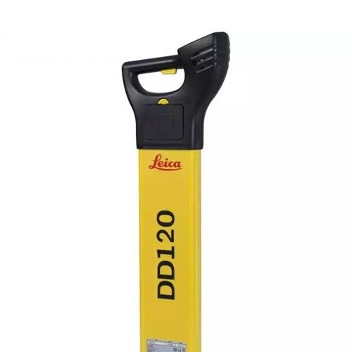
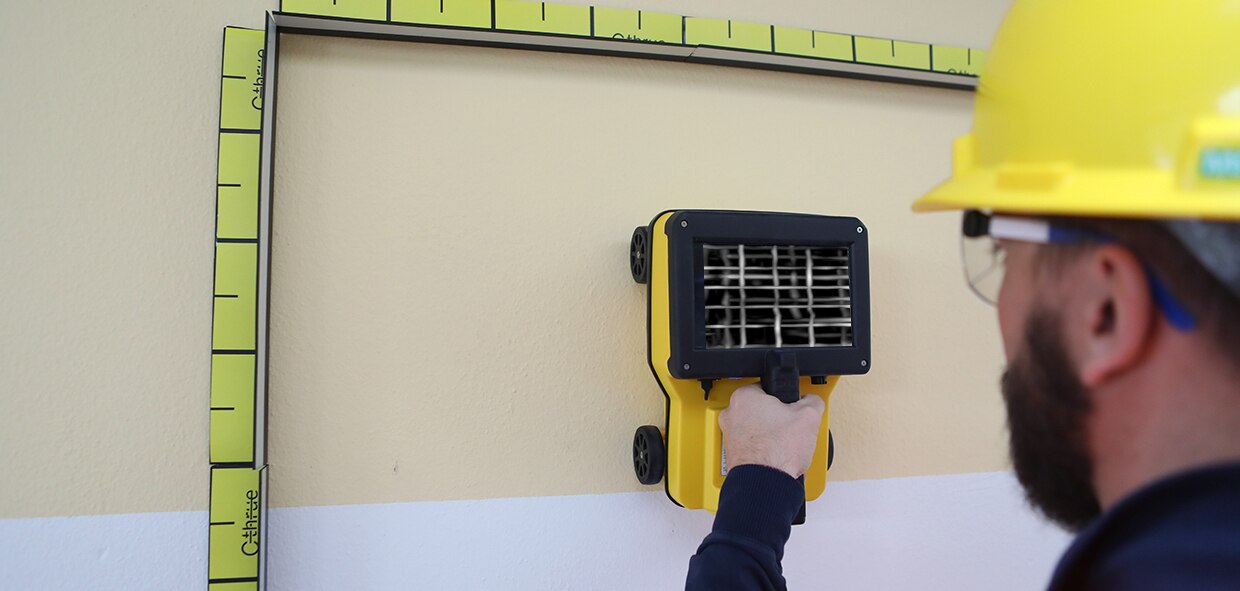
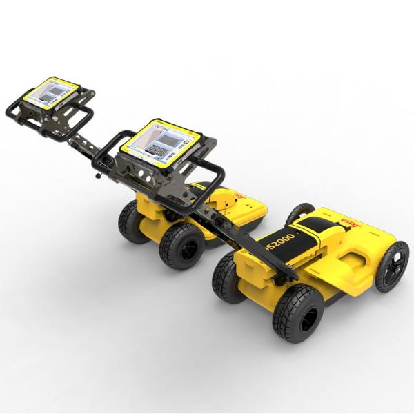
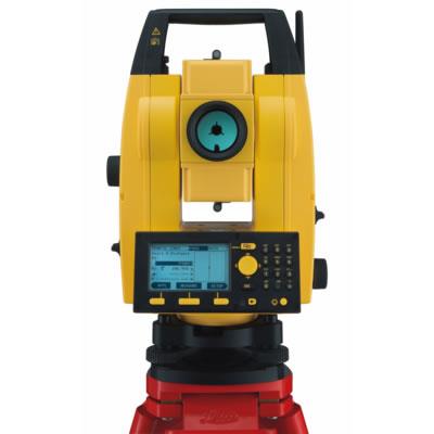
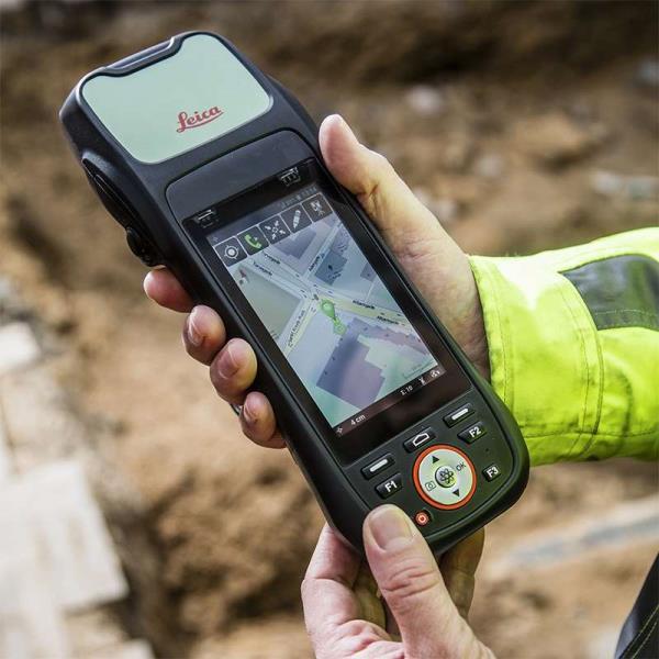
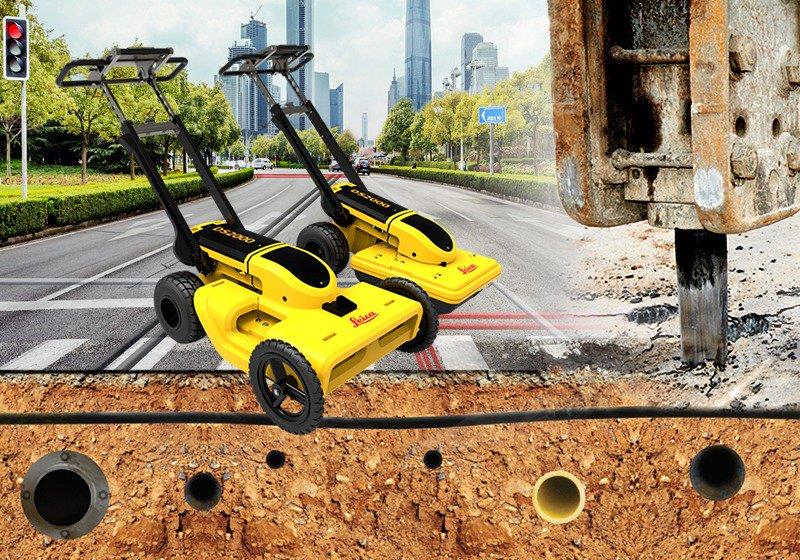
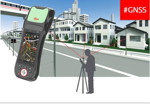
{ "products": [ { "_id": "5b6b3a9dd682be0552aefc94", "fptag": "SBENTERPRISESTRADINGPUNE", "merchantname": null, "customwidgets": null, "externalsourceid": null, "name": "Leica LOGiCAT VU Management & Monitoring System", "description": "Leica LOGiCAT VU Management & Monitoring System\nAnalyse data to reduce utility strikes\n\nBy deploying Leica Digicat cable locators, utility strike rates have reduced dramatically. Now, with the introduction of Leica LOGiCAT VU software, cable locators can be managed and monitored centrally.\nData analysis helps fleet managers to improve cable locator usage and effectiveness during the excavation, increases attention to site safety initiative and enhances product familiarisation training and operator behaviour.\n\nWhat is Leica LOGiCAT VU?\nLeica LOGiCAT VU is a management and monitoring system for analysing data from cable locators.\nCable locators are used to identifying the location of buried utilities; the data enables instruments to record GPS coordinates alongside logged instrument data.\nLeica LOGiCAT VU helps plant, fleet and site managers to evaluate and analyse the data from one or more cable locators.\nThe system gives fleet managers a “view” of how the survey was conducted and if it has been undertaken to best practice. The locator positions can be mapped and presented through Google maps, highlighting the path of the survey.\n\nKey benefits\n\nGreater insight if best practice has been followed\nUsing just the cable locator on its own you could miss 45 up to 50% of dormant utilities which hold the potential of fatal injury. The Fleet Manager can evaluate the Leica LOGiCAT VU data and see how and if the Operator has thoroughly undertaken a site investigate, in all modes and with correct accessories, ensuring adherence to best practice.\n\nData visualisation on satellite images to support interpretation\nGPS enables cable locator to record their coordinates alongside usage data. Leica LOGiCAT VU displays field data overlaid on digital map and images, showing where the operator has undertaken the survey to support post-survey evaluation.Clarity for post utility strike evaluation. \n\nClarity for post utility strike evaluation\nIn the event of a utility strike, the incident report can be produced simply and provide a comprehensive and clear view of instruments usage leading up to the incident. Within the report, colours indicate the survey quality, Red/Poor and Green/Good.\n\nData export to GIS and BIM System\nThe instruments data can be exported to a third party GIS and BIM software enhancing knowledge about subsurface utilities for future excavation activities. ", "price": 0.0, "discountamount": 0.0, "currencycode": "INR", "priority": 1000000, "isfreeshipmentavailable": false, "shipmentduration": 7, "_keywords": [ "instruments data", "cable locator usage", "alongside usage data", "utility strike rates", "subsurface utilities", "Leica LOGiCAT VU data", "enables cable locator", "site safety initiative", "data enables instruments", "Leica LOGiCAT VU software", "Leica LOGiCAT VU Management", "post utility strike evaluation", "deploying Leica Digicat cable locators", "enhances product familiarisation training" ], "isarchived": false, "isavailable": true, "applicationid": null, "productindex": 88, "imageuri": "https://productimages.withfloats.com/actual/5b45a062d3d93d01c4f0ed4e.jpg", "tileimageuri": "https://productimages.withfloats.com/tile/5b45a062d3d93d01c4f0ed4e.jpg", "images": null, "totalqueries": 0, "gpid": null, "groupproductid": null, "createdon": "2018-07-11T06:15:05.058Z", "updatedon": "2018-08-08T18:46:53.924Z", "buyonlinelink": null, "producturl": "http://WWW.SURVEYEQUIPMENT.IN/products/leica-logicat-vu-management-monitoring-system/88", "availableunits": -1.0, "iscodavailable": true, "isprepaidonlineavailable": false, "maxcodorders": 0, "maxprepaidonlineorders": 0, "uniquepaymenturl": null, "brandname": null, "category": null, "tags": null, "variants": false, "keyspecification": null, "otherspecifications": null, "pickupaddressreferenceid": "5d08ebb3edf0e25c3b8da5d0", "paymenttype": "AssuredPurchase", "producttype": "products", "hsncode": null, "gstslab": 0.0, "isnotforsale": false }, { "_id": "6538b3519c14ab0f94083db9", "fptag": "SBENTERPRISESTRADINGPUNE", "merchantname": null, "customwidgets": null, "externalsourceid": null, "name": "Leica DD120 Cable Loctoer ", "description": "Easy to use, intuitive avoidance tool\nThe new Leica DD120 locator reduces the complexity normally associated with scanning for buried utilities. For construction professionals who need to know what is beneath their sites, the DD120 cable locator is a simple, intuitive locator designed to detect and avoid buried utilities. The DD120’s automated pinpointing process improves the detection of utilities, reduces utility damage and increases workforce safety.\nAutomatic pinpointing\nPower, Radio, Auto modes\nTransmitter, 33kHz, 8kHz\nDepth detection up to 3 meters (10 feet)\nGood-to-Go™ Health Check and Start up test\nIP54 rating - protection from dust and water\n1 year Warranty\n\nHandheld multi-frequency underground service locatorThe Leica DD100 Series cable locators feature advanced automatic controls making the DD100 Series easy-to-use, requiring minimal user experience. Avoiding underground cables and pipes is a major concern on construction sites. Therefore, detecting the position of buried cables and pipes before excavation work can help prevent operator injury, asset damage and any subsequent costs. Use the DD120 or DD130 cable locators in conjunction with a DA220 or DA230 signal transmitter or range of accessories to achieve improved accuracy and application scope.\nUnmatched ease of useWith Automatic Pinpointing there is no need for you to manually adjust the sensitivity of your Digicat cable locator ensuring you’re using the optimum sensitivity for the environment you are detecting the underground utilities in. Reducing the likelihood of human error and enabling easier and more efficient cable and pipe locating. Ultimately saving you time and money.\n\nUnderground Exploration with Leica DD120User-Centric Design: Effortless operation with an in-built self-test for accuracy assurance.Dynamic Alert System: Hazard Zone alert for shallow services within 30cm ensures enhanced safety.Versatile Modes: Detect in Auto, Power, Radio, and Transmitter modes for comprehensive utility detection.\n\n", "price": 0.0, "discountamount": 0.0, "currencycode": "INR", "priority": 1000000, "isfreeshipmentavailable": false, "shipmentduration": 7, "_keywords": null, "isarchived": false, "isavailable": true, "applicationid": null, "productindex": 232, "imageuri": "https://productimages.withfloats.com/actual/6538b35d9144637b5496fab1.jpg", "tileimageuri": "https://productimages.withfloats.com/tile/6538b35d9144637b5496fab1.jpg", "images": null, "totalqueries": 0, "gpid": null, "groupproductid": null, "createdon": "2023-10-25T06:18:57.85Z", "updatedon": "2023-10-25T06:18:57.85Z", "buyonlinelink": null, "producturl": "http://WWW.SURVEYEQUIPMENT.IN/products/leica-dd120-cable-loctoer-/232", "availableunits": -1.0, "iscodavailable": false, "isprepaidonlineavailable": false, "maxcodorders": 0, "maxprepaidonlineorders": 0, "uniquepaymenturl": null, "brandname": "Leica", "category": "Pipe and Cable locators", "tags": null, "variants": false, "keyspecification": null, "otherspecifications": null, "pickupaddressreferenceid": "", "paymenttype": "None", "producttype": "products", "hsncode": null, "gstslab": 0.0, "isnotforsale": false }, { "_id": "5bcee6f6ed9a300001691ccc", "fptag": "SBENTERPRISESTRADINGPUNE", "merchantname": null, "customwidgets": null, "externalsourceid": null, "name": "CRC Hand Cleaner", "description": "Product Description\n1. GENERAL DESCRIPTION\nWaterless hand Cleaner containing lanolin.\n\nCRC Hand cleaner is formulated to meet the tough needs of the industrial professional, with hand care as the primary objective. It is based on mild hydrocarbon solvents and biodegradable surfactants. CRC Handcleaner can be used without water and is ideal when working inside or outside where there is no easy access to wash facilities.\n\n2. FEATURES\nRemoves the most stubborn dirt and grime\nSuper effective on grease, common paints, ink, glue cements, bitumen, carbon and many other chemical compounds\nCan be used with or without water.\nQuick cleaning capacity\nContains lanolin to condition the skin\nPleasant perfume odour\nContains no abrasives\nLeaves the hands with a smooth soft feel\nNo disposal problems\n\n3. APPLICATIONS\nTo clean hands soiled with:\noils and greases\nstains and grime\ncement and adhesives\nbitumen and tar\ncommon paints and inks\n\nOut-cleans soaps:\nin industrial plants\nin mines\nat farms\nat construction sites\nat home\n\n4. DIRECTIONS\nBefore use, do not wet hands.\nApply sufficient cleaner (about a teaspoonful) onto dry, soiled hands.\nRub well until completely liquefied and all soiling is loosened.\nJust wipe off with paper towel or cloth, or rinse off with water.\nDry hands properly.Avoid eye contact. Keep out of reach of children.\nA safety data sheet according EU directive 93/112 is available for all CRC products.\n\n5. TYPICAL(*) PRODUCT DATA\nAppearance : semi solid cream\n\nColour : white\n\nOdour : characteristic perfume odour\n\nClarity : opaque\n\nSpecific gravity (@ 20C) : 1 0,1\n\npH (5% in water) : 6,25 6,75\n\nViscosity : 8.000 9.000 cp\n\nSolids content (6 hrs. @ 100C) : 12,0 %\n\nThermal stability\n\n48 hrs. @ 45C : pass\n\n48 hrs. @ 0C : pass\n\nProperties of the hydrocarbon solvent\n\nDistillation range : 195 245 C\n\nFlash point (closed cup) : 73 C\n\nAromatics content : < 0,1% wt\n\nCRC AEROSOL, ELECTRICAL MAINTENANCE Spray, CRC 2-26, CRC CO CONTACT CLEANER, CRC LECTRA CLEAN, CRC N F Precision, ONLINE CONTACT CLEANER, CRC URETHANE ISOLATION RED, CRC PLASTIC 70, CRC BATTERY TERMINAL COATING, CRC 3-36, CRC 5-56, CRC GASKET REMOVER, CRC FAST DRY DEGREASER, GALVABRITE, CRC RUST REMOVER, CRC COPPER PASTE, CRC METAL FREE PASTE, CRC HAND CLEANER, CRC ANTI FRICTIONAL TEFLON COATING, CRC FREEZE 75, CRC SP-400, CRC SP - 350 ", "price": 0.0, "discountamount": 0.0, "currencycode": "INR", "priority": 1000000, "isfreeshipmentavailable": false, "shipmentduration": 7, "_keywords": null, "isarchived": false, "isavailable": true, "applicationid": null, "productindex": 121, "imageuri": "https://productimages.withfloats.com/actual/5bcee6f717cd230001d29a5d.jpg", "tileimageuri": "https://productimages.withfloats.com/tile/5bcee6f717cd230001d29a5d.jpg", "images": null, "totalqueries": 0, "gpid": null, "groupproductid": null, "createdon": "2018-10-23T09:16:38.011Z", "updatedon": "2018-10-23T09:16:38.011Z", "buyonlinelink": null, "producturl": "http://WWW.SURVEYEQUIPMENT.IN//crc-hand-cleaner/121", "availableunits": -1.0, "iscodavailable": true, "isprepaidonlineavailable": false, "maxcodorders": 0, "maxprepaidonlineorders": 0, "uniquepaymenturl": null, "brandname": null, "category": "handcleaner", "tags": [ "handcleaner", "oilandgas" ], "variants": false, "keyspecification": null, "otherspecifications": null, "pickupaddressreferenceid": "5d08ebb3edf0e25c3b8da5d0", "paymenttype": "AssuredPurchase", "producttype": "products", "hsncode": null, "gstslab": 0.0, "isnotforsale": false }, { "_id": "5bcda7bf2757570001e2fc40", "fptag": "SBENTERPRISESTRADINGPUNE", "merchantname": null, "customwidgets": null, "externalsourceid": null, "name": "C-thrue", "description": "C-thrue\nSee thru concrete structures and reveal true data that lead to optimal decision-making\n\nCONCRETE SCANNING\nPinpoint hidden objects in cured concrete—without expensive specialists.\n\nScanning, analyzing, and interpreting what's beneath concrete has never been faster or easier. The C-thrue, now equipped with an additional sensor are the industry's easiest-to-use tools for self-performing concrete inspections.\n\nC-thrue is an all-in-one Ground Penetrating Radar (GPR) for accurate scanning and real time analysis of concrete structures. Construction and service companies as well as civil and structural engineers can now improve the way they locate rebars, voids, post-tension cables, cavities, conduits, and any other objects buried in the structure before cutting or drilling into the concrete.\n\nC-thrue is an easy-to-use and robust solution to see through concrete structures and reveal true data that lead to optimal decision-making. The solution is suited for all construction sites and operations including building renovation, overpasses, monuments, bridges and tunnels surveys, as well as for detailed analysis of the original engineering project and comparison with the as-built structure.\n\nToday, C-thrue offers more flexibility with no limitations for your analysis requirements, thanks to a compact and light telescopic pole and an external controller that can be easily transported on site in challenging locations or conditions (e.g. under a deck, along vertical walls, etc...). \nThe C-thrue external controller allows easier and faster data interpretation thanks to real-time data processing and representation of results in Augmented Reality for more efficient decision-making.\n\nFeatures and Benefits:\n\nClearer and faster surveys \nDetection of both first and second levels of rebars thanks to the system’s double polarisation.\nSafe drill in the surveyed structure\nRebar/void automatic insight capabilities that improve safety before cutting or drilling into the concrete.\n\nFully-visible, multi-touch display \nData displayed on the screen are never obscured by the handle or the user’s hand.\n\nSimplified data interpretation\nOptimal decision-making supported by visualisation of acquired data in 3D models.\n\nIncreased data accuracy\nEliminate manual, error-prone paper grids with an automatic positioning and navigation system.\n\nAdvanced data visualisation\nAugmented reality for 3D data visualisation and sharing across operators – in real time or intervals after acquisition.\n\nAutomated data acquisition and analysis\nAutomatic detection of the first layer of rebars and result exportation.\n\nFlexibility everywhere\nLightweight, compact, drop resistant and transportable system for every user operations and construction sites.", "price": 0.0, "discountamount": 0.0, "currencycode": "INR", "priority": 1000000, "isfreeshipmentavailable": false, "shipmentduration": 7, "_keywords": null, "isarchived": false, "isavailable": true, "applicationid": null, "productindex": 117, "imageuri": "https://productimages.withfloats.com/actual/5bcda7c0e34dfa000137913c.jpg", "tileimageuri": "https://productimages.withfloats.com/tile/5bcda7c0e34dfa000137913c.jpg", "images": null, "totalqueries": 0, "gpid": null, "groupproductid": null, "createdon": "2018-10-22T10:34:39.836Z", "updatedon": "2018-11-22T05:55:37.191Z", "buyonlinelink": null, "producturl": "http://WWW.SURVEYEQUIPMENT.IN/products/c-thrue/117", "availableunits": -1.0, "iscodavailable": true, "isprepaidonlineavailable": false, "maxcodorders": 0, "maxprepaidonlineorders": 0, "uniquepaymenturl": null, "brandname": null, "category": "gpr", "tags": [ "gpr", "ground peantritng radar", "concretescanner" ], "variants": false, "keyspecification": null, "otherspecifications": null, "pickupaddressreferenceid": "5d08ebb3edf0e25c3b8da5d0", "paymenttype": "AssuredPurchase", "producttype": "products", "hsncode": null, "gstslab": 0.0, "isnotforsale": false }, { "_id": "5b6b3a9ed682be0552aefd47", "fptag": "SBENTERPRISESTRADINGPUNE", "merchantname": null, "customwidgets": null, "externalsourceid": null, "name": "Leica DS2000 Utility Detection Radar", "description": "Leica DS2000 Utility Detection Radar\nUncovering safer, faster, more\n\nThere’s a lot going on underground that you need to know about before you ever start to dig. The Leica DS2000 Utility Detection Radar finds all potential threats, including non-conductive pipes and fibre optics, increasing safety by lowering the risk of accidently hitting underground assets.\n\nIncrease safety, speed up work and lower asset management costs with the ability to prevent hazardous outages and collect more information. The DS2000 betters your business by making it safer, faster and more efficient.\n\nKey benefits\nIncrease safety when the DS2000 identifies all potential threats\nGet to assets and recover quicker from outages when you know exactly where underground utility assets are located\nDual-frequency antenna to detect deep and shallow targets simultaneously\nEasily collect and understand data with the DS2000’s simple and intuitive software and data storage\nSimple data storage and export to continue working on the post-processing at the office\nEffortlessly maneuver around the most challenging sites with the DS2000’s advanced ergonomics\nExpert knowledge of Leica Geosystems with more than 270 service centres worldwide\nPROTECT by Leica Geosystems - the strongest warranty in the market\n\nDetection and underground mapping solution\nCombined with the powerful and rugged Leica CT2000 field tablet, the GG04 or the GPS60 smart antenna, and the DIGICAT intelligent cable locators and DIGITEX transmitters, the DS2000 is part of the complete Leica Geosystems detection and underground mapping solution that will enhance your business by making it faster and more efficient. With DX Office Vision post processing software, convert radar data to CAD file in an uncomplicated way.\n\nStart today\nContact your Leica Geosystems distribution partner for more information on the Leica DS2000 and other detection solutions.", "price": 0.0, "discountamount": 0.0, "currencycode": "INR", "priority": 1000000, "isfreeshipmentavailable": false, "shipmentduration": 7, "_keywords": [ "DS2000 betters", "convert radar data", "intuitive software", "GPS60 smart antenna", "detection solutions", "DIGITEX transmitters", "asset management costs", "Leica CT2000 field tablet", "underground utility assets", "DIGICAT intelligent cable locators", "complete Leica Geosystems detection", "Leica DS2000 Utility Detection Radar", "Leica Geosystems distribution partner", "DX Office Vision post processing software" ], "isarchived": false, "isavailable": true, "applicationid": null, "productindex": 94, "imageuri": "https://productimages.withfloats.com/actual/5b45a66fd4575c0f14706fc4.jpg", "tileimageuri": "https://productimages.withfloats.com/tile/5b45a66fd4575c0f14706fc4.jpg", "images": null, "totalqueries": 0, "gpid": null, "groupproductid": null, "createdon": "2018-07-11T06:40:39.103Z", "updatedon": "2018-08-08T18:46:54.113Z", "buyonlinelink": null, "producturl": "http://WWW.SURVEYEQUIPMENT.IN/products/leica-ds2000-utility-detection-radar/94", "availableunits": -1.0, "iscodavailable": true, "isprepaidonlineavailable": false, "maxcodorders": 0, "maxprepaidonlineorders": 0, "uniquepaymenturl": null, "brandname": null, "category": "GPR Ground Penetrating Radar", "tags": [ "GPR Ground Penetrating Radar", "| GPR Ground Penetrating Radar Survey Equipment Di" ], "variants": false, "keyspecification": null, "otherspecifications": null, "pickupaddressreferenceid": "5d08ebb3edf0e25c3b8da5d0", "paymenttype": "AssuredPurchase", "producttype": "products", "hsncode": null, "gstslab": 0.0, "isnotforsale": false }, { "_id": "5b6b3a9dd682be0552aefc15", "fptag": "SBENTERPRISESTRADINGPUNE", "merchantname": null, "customwidgets": null, "externalsourceid": null, "name": "Leica Builder 502", "description": "Leica Builder 502 – when a construction plan goes digital\n\nThe Leica Builder 502 total station is designed to meet the requirements of construction. High performance and ease to use built in Leica Powersite software makes it the ideal solution for every layout task. The user additionally benefits from the most advanced electronic distance measurement and pinpoint accuracy.Builder Programmes include - Setup, Height transfer, Layout as built, Angle & Distance,Tie & Distance, Area & Volumes, Measure & Descriptor, Parallel Lines, Hidden Point, COGO, Layout Line/ Arc/ Spiral, Stockpile Volumes.New features of the Leica PowerSite Software extend the users’ possibilities such as calculate volumes, layout of curved structures, measuring to hidden points and layout using intersection points or grid points. Graphical elements guide the user through the software and make all tasks visually understandable, starting from the first levelling of the instrument, to a computed block volume.\n\nLeica Builder 502 Total Station – turning construction sites digital. The Leica Builder 502 total station is an all-round instrument. Whether you require a total station that performs routine surveying tasks or a professional highly accurate instrument, the Leica Builder 502 has all the features to meet your demands.\n\nBenefits of The Builder 502 are:\nCall up plan data and record points eliminate read and write errors.\nData exchange via industrial grade USB stick simplifies data handling.\nA direct DXF download function.\nTracking mode.\nSetup anywhere function.\nOptional volumes calculation.\nLaser distance measurement up to 250m.\nLeica Builder 500 Options:\nThe Leica Builder 500 Series is available in three accuracy:\n\nBuilder 502 – 2″ Angle Measurement\nBuilder 503 – 3″ Angle Measurement\nBuilder 505 – 5″ Angle Measurement\nUnique Features of Leica Builder 502 Series Total Station\nMultilingual Function\nIf you have a crew that speak different languages then the Leica Builder 502 is the ideal total station for you. The Leica Builder is the only instrument in its class that comes with multiple languages on-board. Switching between languages is fast and easy with only one keystroke, improving convenience and efficiency. The Leica Builder 502 total station allows 3 languages to be displayed at the same time.\n\nDirect.dxf\nWith “Direct.dxf” functionality, data can be read directly from the instrument in dxf-format and read into AutoCAD® on a PC without any intermediate steps. Coordinates and point numbers can be stored in different layers.\n\nTheft protection\n\nA PIN-code system features on the Leica Builder 500 to prevent unauthorised persons from using the instrument. This increases your data security. Without correct code, the equipment cannot be operated, data erased and makes it less appealing to steal, which protects you from having damages, increases your safety and possibly lowers your insurance rates.\n\nLeica Builder 500 Delivery Package:\nCTB101 Black Tribrach (01 No.)\nGEB211 Battery (02 Nos.)\nGKL221 Charger (complete with car adapter cable) (01 No.)\nCPR111 Builder Prism (01 No.)\nGLS115 Mini Reflector Pole set with point (01 No.)\nGEV223 Data Cable TS to USB (01 No.)\nMS1, 1Gb USB Stick (01 No.)\nUser Manual (01 No.)\nCarry Case (01 No.)\n\n", "price": 0.0, "discountamount": 0.0, "currencycode": "INR", "priority": 1000000, "isfreeshipmentavailable": false, "shipmentduration": 0, "_keywords": [ "Builder Prism", "construction plan", "multiple languages", "ideal total station", "accurate instrument", "intersection points", "Leica Builder 500 Series", "Leica Powersite software", "speak different languages", "Builder 500 Delivery Package", "prevent unauthorised persons", "Leica Builder 502 Series Total", "Leica Builder 502 total station", "electronic distance measurement", "industrial grade USB stick simplifies data" ], "isarchived": false, "isavailable": false, "applicationid": null, "productindex": 82, "imageuri": "https://productimages.withfloats.com/actual/5b237d830c1c510f40d95d51.jpg", "tileimageuri": "https://productimages.withfloats.com/tile/5b237d830c1c510f40d95d51.jpg", "images": null, "totalqueries": 0, "gpid": null, "groupproductid": null, "createdon": "2018-06-15T08:42:40.75Z", "updatedon": "2018-08-08T18:46:53.464Z", "buyonlinelink": null, "producturl": "http://WWW.SURVEYEQUIPMENT.IN/products/leica-builder-502/82", "availableunits": -1.0, "iscodavailable": true, "isprepaidonlineavailable": false, "maxcodorders": 0, "maxprepaidonlineorders": 0, "uniquepaymenturl": null, "brandname": null, "category": null, "tags": null, "variants": false, "keyspecification": null, "otherspecifications": null, "pickupaddressreferenceid": "5d08ebb3edf0e25c3b8da5d0", "paymenttype": "AssuredPurchase", "producttype": "products", "hsncode": null, "gstslab": 0.0, "isnotforsale": false }, { "_id": "5b6b3a9cd682be0552aefb49", "fptag": "SBENTERPRISESTRADINGPUNE", "merchantname": null, "customwidgets": null, "externalsourceid": null, "name": "Leica Z-Rover Package", "description": "Leica ZRover – Faster, more accurate asset management\nSwitch from manual tools to digital processes to improve the accuracy and efficiency of collecting asset management information.\n\nThe construction industry is transforming to adopt digital ways of working. Traditional ways are often manual, time consuming and subject to human error.\n\nSwitching to digital asset management, by using the Leica ZRover solution, enables users to digitally locate, record and measure assets on a construction site with the highest accuracy, saving time and reducing errors.\n\nThe complete Z-Rover package includes\n\nLeica Zeno 20 Android UMTS Professional\nZeno Mobile (Android) 'Prof' on Zeno 20\n1 yr Zeno 20 / Zeno Mobile Basic CCP\nLeica AS10, Triple Frequency GNSS Antenna\nLeica GLS30, GNSS telescopic pole,carbon-fibre\nLeica AZ204 Zeno 20 Pole Mount\nLeica GEV238, 1.2m external antenna cable\nLeica AZ212 Hard Container for Zeno 20\nLeica GHT63 Pole clamp for attaching GHT\nAdopt digital working practices to improve efficiency, reporting, communication, record keeping and health and safety.", "price": 0.0, "discountamount": 0.0, "currencycode": "INR", "priority": 1000000, "isfreeshipmentavailable": false, "shipmentduration": 0, "_keywords": [ "yr Zeno 20", "GHT63 Pole clamp", "Zeno Mobile Basic", "digital processes", "construction site", "AZ204 Zeno 20 Pole", "adopt digital ways", "Zeno 20 Android UMTS", "GNSS telescopic pole", "AZ212 Hard Container", "Leica ZRover solution", "Triple Frequency GNSS", "construction industry", "digital asset management", "digital working practices" ], "isarchived": false, "isavailable": false, "applicationid": null, "productindex": 71, "imageuri": "https://productimages.withfloats.com/actual/5b1ba01d3b9b61043c76e8f2.jpg", "tileimageuri": "https://productimages.withfloats.com/tile/5b1ba01d3b9b61043c76e8f2.jpg", "images": null, "totalqueries": 0, "gpid": null, "groupproductid": null, "createdon": "2018-06-09T09:33:44.339Z", "updatedon": "2018-08-08T18:46:52.725Z", "buyonlinelink": null, "producturl": "http://WWW.SURVEYEQUIPMENT.IN/products/leica-z-rover-package/71", "availableunits": -1.0, "iscodavailable": true, "isprepaidonlineavailable": false, "maxcodorders": 0, "maxprepaidonlineorders": 0, "uniquepaymenturl": null, "brandname": null, "category": "gnssservicepune", "tags": [ "gnssservicepune", "DGPSssuplier GNSS Leica Geosystems", "gnss receiver", "GNSS", "leicageosystemspune", "GPS", "totalstions" ], "variants": false, "keyspecification": null, "otherspecifications": null, "pickupaddressreferenceid": "5d08ebb3edf0e25c3b8da5d0", "paymenttype": "AssuredPurchase", "producttype": "products", "hsncode": null, "gstslab": 0.0, "isnotforsale": false }, { "_id": "5b6b3a99d682be0552aef6d9", "fptag": "SBENTERPRISESTRADINGPUNE", "merchantname": null, "customwidgets": null, "externalsourceid": null, "name": "Leica DS2000 Utility Detection Radar", "description": "Leica DS2000 Utility Detection Radar\nUncovering safer, faster, more\n\nThere’s a lot going on underground that you need to know about before you ever start to dig. The Leica DS2000 Utility Detection Radar finds all potential threats, including non-conductive pipes and fibre optics, increasing safety by lowering the risk of accidently hitting underground assets.\n\nIncrease safety, speed up work and lower asset management costs with the ability to prevent hazardous outages and collect more information. The DS2000 betters your business by making it safer, faster and more efficient.\n\nKey benefits\nIncrease safety when the DS2000 identifies all potential threats\nGet to assets and recover quicker from outages when you know exactly where underground utility assets are located\nDual-frequency antenna to detect deep and shallow targets simultaneously\nEasily collect and understand data with the DS2000’s simple and intuitive software and data storage\nSimple data storage and export to continue working on the post-processing at the office\nEffortlessly maneuver around the most challenging sites with the DS2000’s advanced ergonomics\nExpert knowledge of Leica Geosystems with more than 270 service centres worldwide\nPROTECT by Leica Geosystems - the strongest warranty in the market\n\nDetection and underground mapping solution\nCombined with the powerful and rugged Leica CT2000 field tablet, the GG04 or the GPS60 smart antenna, and the DIGICAT intelligent cable locators and DIGITEX transmitters, the DS2000 is part of the complete Leica Geosystems detection and underground mapping solution that will enhance your business by making it faster and more efficient. With DX Office Vision post processing software, convert radar data to CAD file in an uncomplicated way.\n\n", "price": 0.0, "discountamount": 0.0, "currencycode": "INR", "priority": 1000000, "isfreeshipmentavailable": false, "shipmentduration": 7, "_keywords": [ "DS2000 betters", "potential threats", "convert radar data", "intuitive software", "GPS60 smart antenna", "270 service centres", "DIGITEX transmitters", "asset management costs", "Leica CT2000 field tablet", "underground utility assets", "DIGICAT intelligent cable locators", "complete Leica Geosystems detection", "Leica DS2000 Utility Detection Radar", "DX Office Vision post processing software" ], "isarchived": false, "isavailable": true, "applicationid": null, "productindex": 10, "imageuri": "https://productimages.withfloats.com/actual/5ae6f0c89c08ba0c2c2afa3e.jpg", "tileimageuri": "https://productimages.withfloats.com/tile/5ae6f0c89c08ba0c2c2afa3e.jpg", "images": null, "totalqueries": 0, "gpid": null, "groupproductid": null, "createdon": "2018-04-30T10:32:43.449Z", "updatedon": "2018-08-08T18:46:49.746Z", "buyonlinelink": null, "producturl": "http://WWW.SURVEYEQUIPMENT.IN/products/leica-ds2000-utility-detection-radar/10", "availableunits": -1.0, "iscodavailable": true, "isprepaidonlineavailable": false, "maxcodorders": 0, "maxprepaidonlineorders": 0, "uniquepaymenturl": null, "brandname": null, "category": null, "tags": null, "variants": false, "keyspecification": null, "otherspecifications": null, "pickupaddressreferenceid": "5d08ebb3edf0e25c3b8da5d0", "paymenttype": "AssuredPurchase", "producttype": "products", "hsncode": null, "gstslab": 0.0, "isnotforsale": false }, { "_id": "5b6b3a99d682be0552aef672", "fptag": "SBENTERPRISESTRADINGPUNE", "merchantname": null, "customwidgets": null, "externalsourceid": null, "name": "Leica Zeno 20 GIS Collector", "description": "Leica Zeno 20 GIS Collector\nSimple, accurate and rugged asset management\n\n\nThe Leica Zeno 20 simplifies daily data capture for GIS field personnel. Leverage the strength of cutting-edge technology in one remarkably compact device.\n\nSo simplistic it will become your indispensable tool.\nSo accurate you will always be sure.\nSo productive it will change your workday.\nMade rugged to withstand the elements of any work site, the Leica Zeno comes with a durable IP67 dust and waterproof rating. Work from anywhere when you download the Android app that streams RTK-corrected GNSS positons.\n\nSolve daily GIS challenges with new technologies\nThe No. 1 challenge facing GIS field personnel is GNSS-denied environments. Collecting reliable and accurate positioning data is near impossible in these areas. This struggle is eliminated with new innovative technologies by Leica Geosystems inside the Leica Zeno 20 GIS collector:\n\nApogeetec\nEven in closed or covered areas, such as dense forests, an internal antenna enables collecting accurate position data. With maximum performance, collect more, collect simpler.\nGamtec\nBe more productive, increase safety and save time when the Leica Zeno 20 GIS collector is combined with the Leica DISTO S910 laser distance metre. End the struggle to access hard-to-reach and dangerous points when you simply aim and instantly collect from anywhere, anytime.\nMore accuracy, greater time savings, increased productivity – achieve all this with the Leica Zeno 20 GIS collector’s better satellite acquisition with stronger signals and contactless offset measuring . This GIS solution is truly comprehensive and second to none.\n\nLeica Geosystems, Esri improve GIS with ZenoCollector\nThe leader in measurement technology has joined with the leader in GIS technology to bring you an all-new integrated solution in mobile data capturing. The rugged Leica Zeno 20 combines with the powerful Collector for ArcGISto create the ZenoCollector. With Collector for ArcGIS as its main user interface and bundled with an ArcGIS Online organisational subscription for one year, the ZenoCollector:\n\nSaves time automatically synching field changes to enterprise information\nIncreases productivity opening access to all for the latest data from the field\nImproves accuracy with professional-grade GNSS coordination\n ", "price": 0.0, "discountamount": 0.0, "currencycode": "INR", "priority": 1000000, "isfreeshipmentavailable": false, "shipmentduration": 7, "_keywords": [ "GIS solution", "GIS technology", "Leica Geosystems", "GIS field personnel", "Leica Zeno 20 combines", "accurate position data", "measurement technology", "one remarkably compact", "internal antenna enables", "accurate positioning data", "Leica Zeno 20 GIS Collector", "new innovative technologies", "Leica DISTO S910 laser distance metre", "ArcGIS Online organisational subscription", "Leica Zeno 20 simplifies daily data capture" ], "isarchived": false, "isavailable": true, "applicationid": null, "productindex": 5, "imageuri": "https://productimages.withfloats.com/actual/5ae6ee849c08ba0c2c2af762.jpg", "tileimageuri": "https://productimages.withfloats.com/tile/5ae6ee849c08ba0c2c2af762.jpg", "images": null, "totalqueries": 0, "gpid": null, "groupproductid": null, "createdon": "2018-04-30T10:22:58.832Z", "updatedon": "2018-08-08T18:46:49.527Z", "buyonlinelink": null, "producturl": "http://WWW.SURVEYEQUIPMENT.IN/products/leica-zeno-20-gis-collector/5", "availableunits": -1.0, "iscodavailable": true, "isprepaidonlineavailable": false, "maxcodorders": 0, "maxprepaidonlineorders": 0, "uniquepaymenturl": null, "brandname": null, "category": null, "tags": null, "variants": false, "keyspecification": null, "otherspecifications": null, "pickupaddressreferenceid": "5d08ebb3edf0e25c3b8da5d0", "paymenttype": "AssuredPurchase", "producttype": "products", "hsncode": null, "gstslab": 0.0, "isnotforsale": false } ], "hasmoreitems": false, "isapirequest": false, "totalresults": 27, "query": null, "floatingpoint": null }

Still searching for
site safety initiative?

Still searching for
site safety initiative?

Chat with us