Preview

This is your website preview.

Currently it only shows your basic business info. Start adding relevant business details such as description, images and products or services to gain your customers attention by using Boost 360 android app / iOS App / web portal.

SBENTERPRISESTRADINGPUNE 5abfbf1e7c88bb04a4d0fcc7 Products https://www.surveyequipment.in
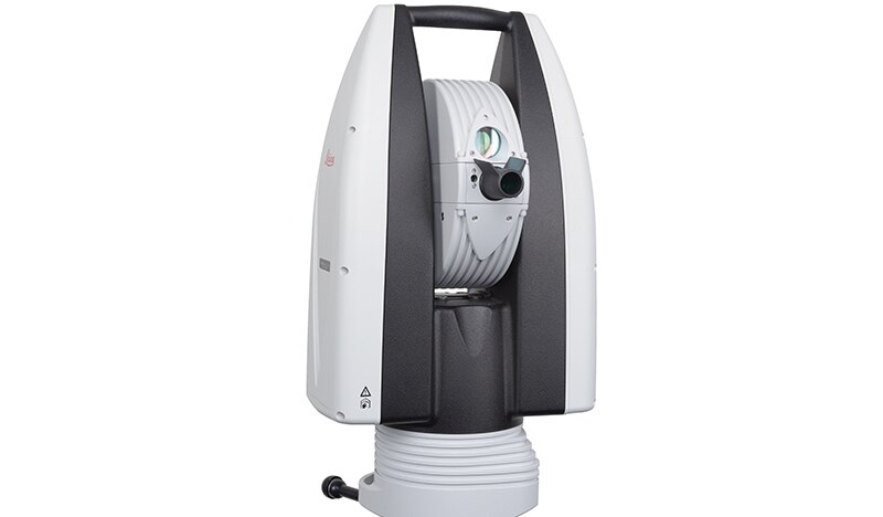
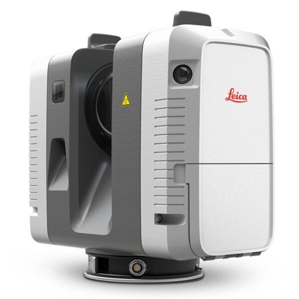
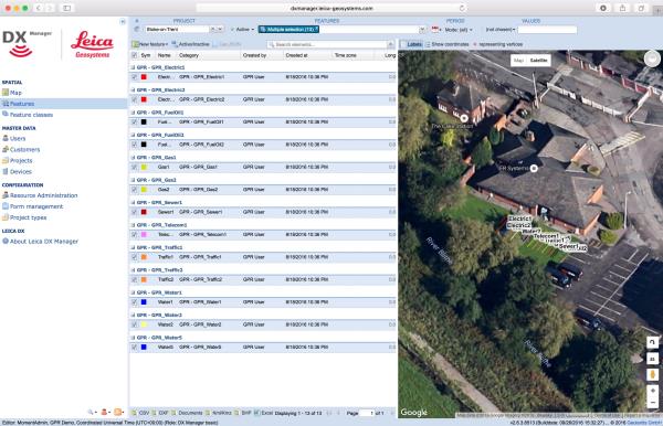
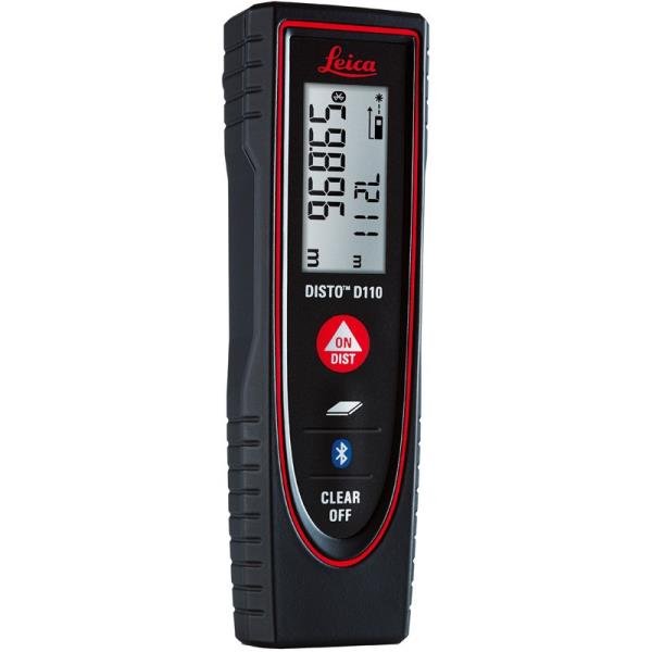
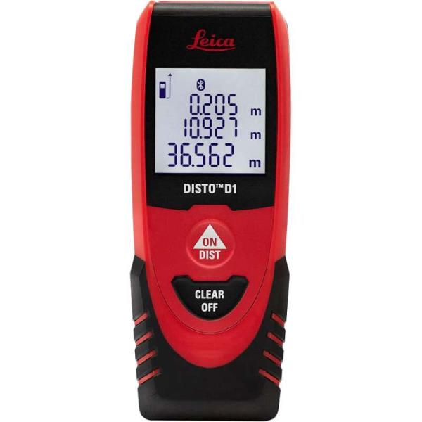
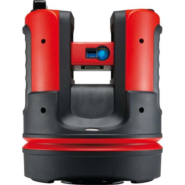
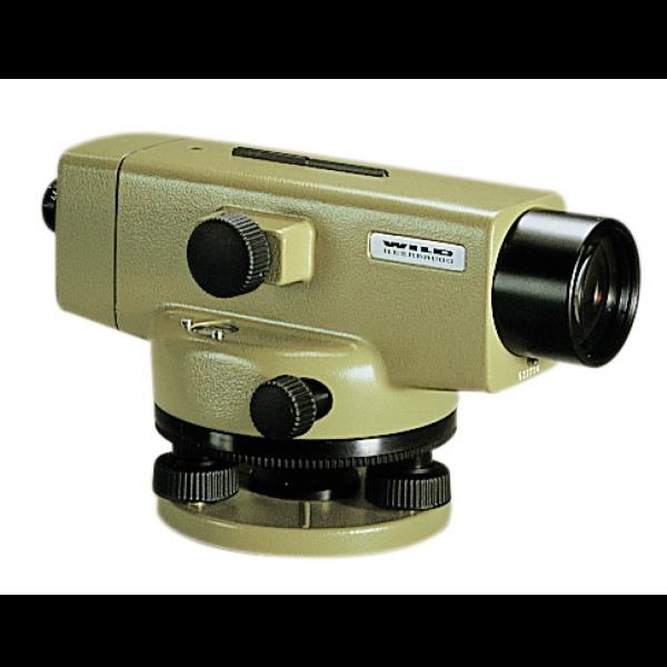
{ "products": [ { "_id": "5b6b3a99d682be0552aef687", "fptag": "SBENTERPRISESTRADINGPUNE", "merchantname": null, "customwidgets": null, "externalsourceid": null, "name": "Leica FlexLine TS02plus Manual Total Station", "description": "Leica FlexLine TS02plus Manual Total Station\nBest-in-class precision\n\nThe Leica FlexLine TS02plus is the perfect manual total station for standard measuring tasks where moderate accuracy is necessary.\n\nQuality, precision & reliability \nFlexLine plus total stations are built to the highest Swiss Technology quality standards. Users benefit from high precision and reliable instruments in order to fulfil their tasks with the requested accuracy. \n\nBest-in-class EDM technology \nWith PinPoint Electronic Distance Measurement (EDM), TS02plus delivers the optimal balance in:\n\nRange\nAccuracy\nReliability\nBeam visibility\nLaser dot size\nMeasurement time\nWith a wide variety of EDM options, the TS02plus is able to measure to both prisms and direct objects without the need for a reflector.\n\nIntuitive onboard software \nThe TS02plus is delivered with the intuitive onboard software, Leica FlexField plus. Guided workflows and easy to understand graphics and icons ensure a low learning curve when working in the field. Graphics and icons make the interpretation of measurement values or text no longer necessary, guaranteeing faster and simple operation when you need it. \n\nBest-in-class service & support \nFlexLine plus manual total stations are supported by superior after sales service and support. With the Active Customer Care program and myWorld customer portal, users have access to latest software updates, service and support as well as the mySecurity theft protection system. With mySecurity activitated, the locking mechanism ensures the device is disabled and can no longer be used.\n\n\nLeica Flexline TS02plus R500 Electronic Total Station Scope of delivery\nLeica Flexline TS02plus R500\nBattery GEB 212\nBattery charger GKL 311\nData Downloding Cable GEV267\nFlexoffice Standard Software\nCarrying Case\nPrism with Holder & Target Plate\nTelescopic Prism Pole\nHeavy Duty Wooden Tripod", "price": 310987.0, "discountamount": 0.0, "currencycode": "INR", "priority": 1000000, "isfreeshipmentavailable": true, "shipmentduration": 7, "_keywords": [ "TS02plus delivers", "moderate accuracy", "measurement values", "understand graphics", "reliable instruments", "manual total stations", "myWorld customer portal", "intuitive onboard software", "Active Customer Care program", "mySecurity theft protection system", "Swiss Technology quality standards", "PinPoint Electronic Distance Measurement", "Leica FlexLine TS02plus Manual Total Station", "Flexline TS02plus R500 Electronic Total Station Scope" ], "isarchived": false, "isavailable": true, "applicationid": null, "productindex": 6, "imageuri": "https://productimages.withfloats.com/actual/5ae69ac8994f4d0754b86b04.jpg", "tileimageuri": "https://productimages.withfloats.com/tile/5ae69ac8994f4d0754b86b04.jpg", "images": null, "totalqueries": 0, "gpid": null, "groupproductid": null, "createdon": "2018-04-30T04:25:39.125Z", "updatedon": "2018-08-08T18:46:49.577Z", "buyonlinelink": null, "producturl": "http://WWW.SURVEYEQUIPMENT.IN/products/leica-flexline-ts02plus-manual-total-station/6", "availableunits": -1.0, "iscodavailable": true, "isprepaidonlineavailable": false, "maxcodorders": 0, "maxprepaidonlineorders": 0, "uniquepaymenturl": null, "brandname": null, "category": "Leica Total Station in India ", "tags": [ "Leica Total Station in India ", "Leica FlexLine TS02plus", "Leica Total Station pune ", "Leica Total Station ", "Leica Total Station In Mumbai " ], "variants": false, "keyspecification": null, "otherspecifications": null, "pickupaddressreferenceid": "5d08ebb3edf0e25c3b8da5d0", "paymenttype": "AssuredPurchase", "producttype": "products", "hsncode": null, "gstslab": 0.0, "isnotforsale": false }, { "_id": "5d4e66ac5c6ebf0001143d5b", "fptag": "SBENTERPRISESTRADINGPUNE", "merchantname": null, "customwidgets": null, "externalsourceid": null, "name": "Leica Absolute Tracker AT960", "description": "Leica Absolute Tracker AT960\nLaser Tracker Systems\nHigh-accuracy probing, scanning and reflector measurement for large-volume industrial applications\n\n\n\nHigh-performance 6DoF laser tracker technology in an ultra-portable and easy-to-use form factor.\n\n\n\nThe Leica Absolute Tracker AT960 is a robust, all-in-one laser tracker that fits in a single flight case. Offering high-speed dynamic measurement as standard, it is a complete solution for six degrees of freedom (6DoF) probing, scanning and automated inspection as well as reflector measurement.\n\n\nA new generation of portable CMM system based on proven technology, the AT960 brings together the 6DoF functionality introduced with the Leica Absolute Tracker AT901 and the portability and usability delivered by the compact Leica Absolute Tracker AT403. The result is a highly-sophisticated yet easy-to-use large-volume measurement solution weighing less than 14 kilograms.\n\nThe AT960 laser tracker can be transported easily, unpacked quickly and powered up in minutes to deliver high-performance measurement almost anywhere. Dynamic features and flexible functionality give users absolute speed, accuracy and portability.\n\nFeaturing wireless communication and a battery operation option, the integrated-technology design of the AT960 makes lengthy setup a thing of the past. The Leica Absolute Interferometer (AIFM) enables accurate high-speed measurement to a moving target while the innovative PowerLock function ensures an interrupted beam is instantly re-established without user intervention, reducing operator workload and training requirements. Intuitive touch-screen controls minimise the potential for user error, saving time, effort and money. Check and compensation architecture means basic adjustments can be made in the field, while robust design guarantees on-specification operations with minimal calibration and servicing\n\nWhen combined with the Real-Time Feature Pack and Leica T-Mac, the AT960 evolves into a laser tracker solution that meets the deterministic measurement data-delivery requirements of high-end automated installations. Built on the industry-proven EtherCAT protocol, it enables the delivery of 6DoF measurement data with accurate timestamps at an output rate of up to 1000 Hertz. Known as 7DoF measurement data, this enables real-time machine control within even highly-dynamic robotic setups.\n\nWith a measurement volume of up to 160 metres in diameter, the AT960 is compatible with Leica T-Probe, Leica T-Mac, Leica T-Scan 5 and Leica Absolute Scanner technology. This flexibility allows it to cater to a wide variety of inspection applications – from quality lab to in-line; from in the factory to in the field – ensuring users have the right tool for any measurement challenge.\n\n", "price": 0.0, "discountamount": 0.0, "currencycode": "INR", "priority": 1000000, "isfreeshipmentavailable": false, "shipmentduration": 7, "_keywords": null, "isarchived": false, "isavailable": true, "applicationid": null, "productindex": 150, "imageuri": "https://productimages.withfloats.com/actual/5d4e66adb409c900010d17d6.jpg", "tileimageuri": "https://productimages.withfloats.com/tile/5d4e66adb409c900010d17d6.jpg", "images": null, "totalqueries": 0, "gpid": null, "groupproductid": null, "createdon": "2019-08-10T06:39:40.851Z", "updatedon": "2019-08-10T06:39:40.851Z", "buyonlinelink": null, "producturl": "http://WWW.SURVEYEQUIPMENT.IN/products/leica-absolute-tracker-at960/150", "availableunits": -1.0, "iscodavailable": false, "isprepaidonlineavailable": false, "maxcodorders": 0, "maxprepaidonlineorders": 0, "uniquepaymenturl": null, "brandname": "Leica ", "category": "", "tags": [ "laser tracker" ], "variants": false, "keyspecification": null, "otherspecifications": null, "pickupaddressreferenceid": "", "paymenttype": "None", "producttype": "products", "hsncode": null, "gstslab": 0.0, "isnotforsale": false }, { "_id": "5c18b8e4ead682000197c724", "fptag": "SBENTERPRISESTRADINGPUNE", "merchantname": null, "customwidgets": null, "externalsourceid": null, "name": "Leica RTC360 Laser Scanner", "description": "Leica RTC360 Laser Scanner\nFast, agile and precise 3D reality capture solution\nFast\nFAST\nThe Leica RTC360 laser scanner makes 3D reality capture faster than ever before. With a measuring rate of up to 2 million points per second and advanced HDR imaging system, the creation of colored 3D point clouds can be completed in under 2 minutes. Plus, automated targetless field registration (based on VIS technology) and the seamless, automated transfer of data from site to office reduce time spent in the field and further maximize productivity.\n\nAgile\nAgile\nSmall and lightweight, the Leica RTC360 scanner’s portable design and collapsible tripod mean it’s compact enough to fit into most backpacks, ready to be taken anywhere. Once on-site, easy-to-use one-button operation makes for fast, hassle-free scanning.\n\nPrecise\nPrecise\nLow noise data allows for better images, resulting in crisp, high-quality scans that are rich in detail and ready for use in a range of applications. Combined with Cyclone FIELD 360 software for automated registration in the field, the Leica RTC360 scanner offers outstanding precision that can be checked on-site.\n\nLeica RTC360 Product Specifications\n3D Laser Scanner\tHigh-speed 3D laser scanner with integrated HDR spherical imaging system and Visual Inertial System (VIS) for real time registration\nData acquisition\t< 2 min for complete full dome scan and spherical HDR image at 6mm @ 10m resolution\nReal time registration\tAutomatic point cloud alignment based on real time tracking of scanner movement between setups based on Visual Inertial System (VIS) by video-enhanced inertial measurement unit\nDouble scan\tAutomatic removal of moving objects\nDistance measurement\tHigh-speed, high dynamic time of flight enhanced by Waveform Digitizing (WFD) technology\nLaser Class\t1 (in accordance with IEC 60825-1:2014), 1550nm (invisible)\nField of view\t360° (horizontal) / 300° (vertical)\nRange\tMin. 0.5 - up to 130 m\nSpeed\tUp to 2‘000‘000 pts / sec\nResolution\t3 user selectable settings (3/6/12mm @ 10m)\nAccuracy\tAngular accuracy 18”\nRange accuracy 1.0 mm + 10 ppm \n3D point accuracy \n1.9 mm @ 10 m \n2.9 mm @ 20 m \n5.3 mm @ 40 m\nRange noise\t0.4 mm @ 10 m, 0.5 mm @ 20 m\nCamera\t36 MP 3-camera system captures \n432 MPx raw data for calibrated \n360° x 300° spherical image\nSpeed\t1 minute for full spherical HDR image at any light condition\nHDR\tAutomatic, 5 brackets\nVisual Inertial System\tVideo enhanced inertial measuring system to track movement of the scanner position relative to the previous setup in real time\nTilt\tIMU based, Accuracy: 3‘ for any tilt\nAdditional sensors\tAltimeter, Compass, GNSS\nOn scanner\tTouch-screen control with finger touch, full color WVGA graphic display 480 x 800 pixels\nMobile devices\tLeica Cyclone FIELD 360 app for iPad or Android tablets including:\n- Remote control of scan functions\n- 2D & 3D data viewing\n- Tagging\n- Automatic alignment of scans\nWireless\tIntegrated wireless LAN (802.11 b/g/n)\nData storage\tLeica MS256, 256GB exchangeable USB 3.0 flash drive\nHousing\tAluminium frame and sidecovers\nDimensions\t120mm x 240mm x 230mm / 4.7‘‘ x 9.4‘‘ x 9.1\nWeight\t5.35 kg / 11.7 lbs, nominal (w/o batteries)\nMounting mechanism\tQuick mounting on 5/8“ stub on lightweight tripod / optional tribrach adapter / survey tribrach adapter available\nInternal battery\t2 x Leica GEB361 internal, rechargeable Li-Ion batteries.\nDuration: Typically up to 4 hours\nWeight: 340 g per battery\nExternal\tLeica GEV282 AC adapter\nOperating temperature\t5° to +40° C\nStorage temperature\t40° to +70° C\nDust/Humidity\tSolid particle/liquid ingress protection IP54", "price": 0.0, "discountamount": 0.0, "currencycode": "INR", "priority": 1000000, "isfreeshipmentavailable": false, "shipmentduration": 7, "_keywords": null, "isarchived": false, "isavailable": true, "applicationid": null, "productindex": 132, "imageuri": "https://productimages.withfloats.com/actual/5c18b8e5c4c56a0001280ffa.jpg", "tileimageuri": "https://productimages.withfloats.com/tile/5c18b8e5c4c56a0001280ffa.jpg", "images": null, "totalqueries": 0, "gpid": null, "groupproductid": null, "createdon": "2018-12-18T09:07:48.277Z", "updatedon": "2019-02-16T09:46:13.795Z", "buyonlinelink": null, "producturl": "http://WWW.SURVEYEQUIPMENT.IN/products/leica-rtc360-laser-scanner/132", "availableunits": -1.0, "iscodavailable": true, "isprepaidonlineavailable": false, "maxcodorders": 0, "maxprepaidonlineorders": 0, "uniquepaymenturl": null, "brandname": null, "category": "blk360laserscanner", "tags": [ "blk360laserscanner", "3dlaserscanner", "laserscanner", "rtc36laserscanner" ], "variants": false, "keyspecification": null, "otherspecifications": null, "pickupaddressreferenceid": "5d08ebb3edf0e25c3b8da5d0", "paymenttype": "AssuredPurchase", "producttype": "products", "hsncode": null, "gstslab": 0.0, "isnotforsale": false }, { "_id": "5b6b3a9dd682be0552aefccb", "fptag": "SBENTERPRISESTRADINGPUNE", "merchantname": null, "customwidgets": null, "externalsourceid": null, "name": "Leica ULTRA Utility Tracing System", "description": "Leica ULTRA Utility Tracing System\nBest precision locating in faster, more confident work\n\nSave time and increase confidence in your results with the Leica ULTRA, our most advanced precision utility tracing instrument.\n\nThe complexity of underground utility networks is continually increasing, and obtaining precise information on the location of buried utilities has never been more important. The protection of buried assets during excavation work demands accurate mapping and surveying of existing utilities. \n\nIntegrating intelligent signal processing with unique flexible operating modes, Leica ULTRA traces buried utility lines accurately for safe underground excavations and utility surveys. Outstanding performance with operational ease and flexibility.\n\nLARGE CLEAR DISPLAY\nLarge backlit high visibility LCD screen\nClear display provides clear, improved and confident location and utility tracing\nCUSTOM FREQUENCIES\nConfigure for site specific applications\nUser configurable modes from 50 Hz to 200 kHz\nChoose from 100 pre-selected frequencies or customise your own frequencies\nCOMPASS\nShows the user the direction of the utility they are locating / tracing\nBLUETOOTH®\nEnable wireless communications with software running on a laptop, survey field PC or other GPS enabled device\nINCREASED TRANSMITTER POWER OUTPUT\nChoose between 5W and 12W transmitter power outputs for superior tracing performance\nBUILT FOR THE MOST DEMANDING ENVIRONMENTS\nIP65 protection\nFulfils toughest standards - shock resistant, protected against water and dust ingress\nSELECTABLE ANTENNA CONFIGURATION\nConfigure antenna to best optimise for your job site\nSelect between more range, sharper response, noise cancelling or easier sweeping\nDIRECTION ENABLED\nIdentifying your target utility amongst multiple parallel utilities\nApply a special direction enabled signal from the transmitter, the receiver will display an arrow on the compass heading to guide you along the designated utility path\nUnlock the power\nConfigure the Leica ULTRA for site specific applications. Custom build your receiver and transmitter.\n\nChoose from over 100 preselected frequencies, or customise your own frequency for highly specialised applications.\n\nAutomatically capture the instruments location data to ensure adherence to best practice. The data logging feature allows the user to record external GPS coordinates and download with the datafile as a KML or CSV format. Upload into GIS systems or Google Maps to confirm where, when and how the work was performed.\n", "price": 0.0, "discountamount": 0.0, "currencycode": "INR", "priority": 1000000, "isfreeshipmentavailable": false, "shipmentduration": 7, "_keywords": [ "target utility", "utility surveys", "precision utility", "Leica ULTRA traces", "designated utility", "12W transmitter power", "wireless communications", "instruments location data", "site specific applications", "100 preselected frequencies", "underground utility networks", "safe underground excavations", "intelligent signal processing", "unique flexible operating modes", "Leica ULTRA Utility Tracing System" ], "isarchived": false, "isavailable": true, "applicationid": null, "productindex": 90, "imageuri": "https://productimages.withfloats.com/actual/5b45ea4dd3d93d01c4f1c9f9.jpg", "tileimageuri": "https://productimages.withfloats.com/tile/5b45ea4dd3d93d01c4f1c9f9.jpg", "images": null, "totalqueries": 0, "gpid": null, "groupproductid": null, "createdon": "2018-07-11T11:30:28.043Z", "updatedon": "2018-08-08T18:46:53.973Z", "buyonlinelink": null, "producturl": "http://WWW.SURVEYEQUIPMENT.IN/products/leica-ultra-utility-tracing-system/90", "availableunits": -1.0, "iscodavailable": true, "isprepaidonlineavailable": false, "maxcodorders": 0, "maxprepaidonlineorders": 0, "uniquepaymenturl": null, "brandname": null, "category": null, "tags": null, "variants": false, "keyspecification": null, "otherspecifications": null, "pickupaddressreferenceid": "5d08ebb3edf0e25c3b8da5d0", "paymenttype": "AssuredPurchase", "producttype": "products", "hsncode": null, "gstslab": 0.0, "isnotforsale": false }, { "_id": "5b6b3a9dd682be0552aefcbd", "fptag": "SBENTERPRISESTRADINGPUNE", "merchantname": null, "customwidgets": null, "externalsourceid": null, "name": "Leica DX Manager Mapping", "description": "Leica DX Manager Mapping\nOne central dashboard for all the Leica Geosystems Detection solutions\n\nLeica DX Manager is the only enterprise grade utility mapping solution on the market. A unique cloud-powered solution that delivers unparalleled performance. Manage projects, tasks and spatial data from one central dashboard for all the Leica Geosystems Detection solutions.\n\nUpdate drawings, raw data, location pictures, data layers and mobile forms remotely and in a period of real time operate at an enterprise level rather than having to manually update individual users one at a time. With the Leica DX Manager, you have all dashboards, status updates and project management tools in one platform. Now, project managers can track field operations in real time and make critical decisions with a broader understanding of the current situation.\n\nKey benefits\n\nSimplified processes\nImprovement of data quality and accuracy\nConsistent data collection methods\nIntegration of DS2000, cable locators and asset mapping data\nWorkflows to maintain data integrity\nManage the whole workflow\n\nShare data to all devices and users within your organisation.\n\nAnalyse maps result\nVisualise on online maps\nFilter on users, within date ranges or any attributes\nExport to standard GIS and CAD formats\nShare data to your clients\nAn easy-to-use online portal allows management of all aspects of documenting utility location tasks. The user can switch between street view, satellite imagery and cartographic street maps. Field acquired survey data becomes instantly available and can be accessed by users anytime and anywhere.\n\nUtility detection integration\n\nLeica DX Manager integrates the entire Leica Geosystems Detection portfolio into a simple survey workflow, empowering the user to apply locator depth measurements to GNSS measurements. The result is a seamless fusion of both worlds – with all locator related data reviewable either in Leica DX Manager or any export format.\n\nLocate the utility\nMeasure the depth\nAll location data is sent directly to the Leica DX Field application on the GNSS device\nIt triggers the GNSS measurement on the mapping device\nAll data is integrated into the features metadata\nMaximum user experience and productivity\n\nLeica DX Field mobile app is designed for productivity and maximum user experience and built for enforcing data quality and accuracy. \n\nEasy mapping / surveying of assets\nSmart mobile forms\nImmediate visualisation on map\nMetadata collection\nAutomatic sync with Cloud\nFull offline capabilities\nMake sure your measured data always matches your quality expectations (up to centimetres with RTK) as Leica DX Manager notifications steadily monitor the system parameters. All quality parameters are stored as metadata. Next to the utility mapping aspect, it delivers work orders, time tracking and document management.", "price": 0.0, "discountamount": 0.0, "currencycode": "INR", "priority": 1000000, "isfreeshipmentavailable": false, "shipmentduration": 7, "_keywords": [ "data quality", "location data", "data collection", "data reviewable", "survey data becomes", "DX Field mobile app", "Leica DX Manager Mapping", "cartographic street maps", "Leica DX Field application", "update individual users one", "Leica DX Manager notifications", "apply locator depth measurements", "enterprise grade utility mapping solution", "entire Leica Geosystems Detection portfolio" ], "isarchived": false, "isavailable": true, "applicationid": null, "productindex": 89, "imageuri": "https://productimages.withfloats.com/actual/5b459fa2f3579911b41e9cda.jpg", "tileimageuri": "https://productimages.withfloats.com/tile/5b459fa2f3579911b41e9cda.jpg", "images": null, "totalqueries": 0, "gpid": null, "groupproductid": null, "createdon": "2018-07-11T06:11:47.283Z", "updatedon": "2018-08-08T18:46:53.959Z", "buyonlinelink": null, "producturl": "http://WWW.SURVEYEQUIPMENT.IN/products/leica-dx-manager-mapping/89", "availableunits": -1.0, "iscodavailable": true, "isprepaidonlineavailable": false, "maxcodorders": 0, "maxprepaidonlineorders": 0, "uniquepaymenturl": null, "brandname": null, "category": "GPR", "tags": [ "GPR", "Detection and underground mapping solution", "Leica DX Manager Mapping" ], "variants": false, "keyspecification": null, "otherspecifications": null, "pickupaddressreferenceid": "5d08ebb3edf0e25c3b8da5d0", "paymenttype": "AssuredPurchase", "producttype": "products", "hsncode": null, "gstslab": 0.0, "isnotforsale": false }, { "_id": "5b6b3a9dd682be0552aefc69", "fptag": "SBENTERPRISESTRADINGPUNE", "merchantname": null, "customwidgets": null, "externalsourceid": null, "name": "Leica Disto D110 Laser Distance Meter", "description": "Leica Disto D110 Laser Distance Meter\nThe New Leica Disto D110 is the smallest Disto with Bluetooth Smart on the market. Create floor plans and sketches very easily by connecting the new Leica D110 with the DISTO Sketch app on a Smartphone or tablet device.\n\nBenefits of the Leica Disto D110:\nNew ergonomic design for easy use\nIncreased functionality with integrated Bluetooth Smart technology and Leica Disto Sketch app\nPerfect for fast indoor distance and area measurements\nPocket clip to help with carrying\nProven Leica quality and precision\nThis is the first laser Disto with Bluetooth technology that’s small and fits in a pocket.\n\nEffortless measurements can be taken whether it’s for a quick material estimation or a home improvement project, the Disto Sketch App provides potential to create floor plans, sketches and document measurements with pictures using a tablet or smartphone.\n\nMeasure precise distances with ±1.5mm accuracy\nMeasure up to 60m distances without moving\nIdeal for the jobsite – Protected against splash water and dust\nDocument results with the Disto Sketch App for faster, easier and safer work. The App is available for free download from Google Play and the App Store for Android and iOS devices.\n\nThe lightest and smallest Disto in the range, its ergonomic design means that it fits in your hand perfectly and is very comfortable to use. The simple to understand button allow intuitive and quick operation. Measuring has never been easier. The removable pocket clip is a valued accessory, simply clip the device to the pocket of your shirt or trousers for convenient use.\n\nTechnical Data\nMeasuring Accuracy: ±1.5mm\nRange: 60m\nMeasuring units: m, ft, in\nIncludes: Power Range Technology, Illuminated Display, Free App\nBatteries: 2x AAA\nProtection Class: IP54 (splash water and dust)\nDimensions: 120x37x23mm\nWeight: 92g\nIncludes:\nLeica DISTO D110 Laser Distance Meter\nPocket Clip\nHolster\n2x AAA Batteries.\n", "price": 0.0, "discountamount": 0.0, "currencycode": "INR", "priority": 1000000, "isfreeshipmentavailable": false, "shipmentduration": 7, "_keywords": [ "new Leica D110", "Disto Sketch App", "first laser Disto", "Leica Disto Sketch", "create floor plans", "New Leica Disto D110", "Bluetooth technology", "fast indoor distance", "removable pocket clip", "document measurements", "Power Range Technology", "home improvement project", "quick material estimation", "Bluetooth Smart technology", "Leica Disto D110 Laser Distance Meter" ], "isarchived": false, "isavailable": true, "applicationid": null, "productindex": 86, "imageuri": "https://productimages.withfloats.com/actual/5b3f41a0d3d93d03a4b91a60.jpg", "tileimageuri": "https://productimages.withfloats.com/tile/5b3f41a0d3d93d03a4b91a60.jpg", "images": null, "totalqueries": 0, "gpid": null, "groupproductid": null, "createdon": "2018-07-06T10:17:10.03Z", "updatedon": "2018-08-08T18:46:53.841Z", "buyonlinelink": null, "producturl": "http://WWW.SURVEYEQUIPMENT.IN//leica-disto-d110-laser-distance-meter/86", "availableunits": -1.0, "iscodavailable": true, "isprepaidonlineavailable": false, "maxcodorders": 0, "maxprepaidonlineorders": 0, "uniquepaymenturl": null, "brandname": null, "category": "leicadisto", "tags": [ "leicadisto", "laserdistancemeter", "leicageosystems" ], "variants": false, "keyspecification": null, "otherspecifications": null, "pickupaddressreferenceid": "5d08ebb3edf0e25c3b8da5d0", "paymenttype": "AssuredPurchase", "producttype": "products", "hsncode": null, "gstslab": 0.0, "isnotforsale": false }, { "_id": "5b6b3a9ed682be0552aefcef", "fptag": "SBENTERPRISESTRADINGPUNE", "merchantname": null, "customwidgets": null, "externalsourceid": null, "name": "Leica Disto D1 Laser Distance Meter", "description": "Leica Disto D1 Laser Distance Meter\nOld fashioned measuring tape versus laser precision? There’s no comparison.\n\nLeica Disto D1\nThe Leica Disto D1 measures distances and heights of up to 40m like a pro and there’s no need of a ladder, a slack steel tape or a tired companion. You’ll get 2 mm accuracy with just one press of a button. It’ll save you time and reduce errors. Difficult or unsafe measuring situations are now in the past. The Leica Disto D1 provides professionals as well as DIY users with a fast, reliable and easy-to-use laser measuring tool. One measurement is enough and the result can be effortlessly read off the clear display.\n\nJust turn on the Bluetooth™ Smart enabled Leica D1 and it can connect with the Disto Sketch app. Create photos or sketches and dimension them with the results, which are transmitted directly to your tablet or smart phone. Plans are automatically completed with circumferences and areas. Disto Sketch integrates measurements into job-site sketches or project images to speed up workflows and finished jobs faster. Error-free information of projects is sent instantly back to the site or office.\n\nEnjoy the convenience of modern simplicity with renowned Leica precision and quality. Compact and lightweight, the D1 is never out of reach.\n\nFeatured with\nBluetooth® Smart for data transfer to smart phones and tablets\nFree App Leica DISTO™ sketch\n40meter range\nXRange Power Technology\nClear, illuminated display\nIP54 splash water and dust protected", "price": 5607.0, "discountamount": 0.0, "currencycode": "INR", "priority": 1000000, "isfreeshipmentavailable": false, "shipmentduration": 7, "_keywords": [ "Leica D1", "App Leica", "2 mm accuracy", "Create photos", "circumferences", "project images", "Leica precision", "laser precision", "One measurement", "tired companion", "Disto Sketch app", "slack steel tape", "modern simplicity", "Leica Disto D1 Laser Distance Meter" ], "isarchived": false, "isavailable": true, "applicationid": null, "productindex": 91, "imageuri": "https://productimages.withfloats.com/actual/5b3f3770d4575c0f401f7cf2.jpg", "tileimageuri": "https://productimages.withfloats.com/tile/5b3f3770d4575c0f401f7cf2.jpg", "images": null, "totalqueries": 0, "gpid": null, "groupproductid": null, "createdon": "2018-07-06T09:33:30.021Z", "updatedon": "2018-08-08T18:46:54.01Z", "buyonlinelink": null, "producturl": "http://WWW.SURVEYEQUIPMENT.IN/products/leica-disto-d1-laser-distance-meter/91", "availableunits": -1.0, "iscodavailable": true, "isprepaidonlineavailable": false, "maxcodorders": 0, "maxprepaidonlineorders": 0, "uniquepaymenturl": null, "brandname": null, "category": "leasedistancemeter", "tags": [ "leasedistancemeter", "leicadistopune", "leicadisto", "Leica Disto D1 Laser Distance Meter" ], "variants": false, "keyspecification": null, "otherspecifications": null, "pickupaddressreferenceid": "5d08ebb3edf0e25c3b8da5d0", "paymenttype": "AssuredPurchase", "producttype": "products", "hsncode": null, "gstslab": 0.0, "isnotforsale": false }, { "_id": "5b6b3a9dd682be0552aefc3f", "fptag": "SBENTERPRISESTRADINGPUNE", "merchantname": null, "customwidgets": null, "externalsourceid": null, "name": "Leica Disto 3D Laser Distance Meter ", "description": "Leica Disto 3D Laser Distance Meter \n\nThe high-precision Leica 3D Disto is used whenever the use of conventional measuring tools is only possible with a great deal of time and effort. With the various measurement functions you can record all spatial situations precisely and use the data afterwards in your customary software environment. With the realistic data you can produce the final parts directly. The time-consuming template and modification work during installation is no longer necessary. The fully digitalized workflow saves valuable time.\n\nLine and surface scans\nDigital measurement with immediate results\nCable-free operation\nDigital pointfinder\nGraphic 2D or 3D display\nMarking heights, plumb points and parallel lines\nImport of own data for simple staking out\nChanging the position with photo backup\nExport formats: DXF (2D, 3D and overview plan), JPG, CSV and TXT\nComes supplied with\nLeica 3D Disto\nLicense for 3D Disto Software for Windows®\nRemote control RM100\nPower supply for 3D Disto\n4 country specific powercords for worldwide use\nPower supply for control unit\n4 country specific adapter plugs for worldwide use\nUSB memory stick\nSelf-adhesive target points\nRuler (for measuring hidden points)\nLeica GZM3 target plate\n2x USB cable\nQuickstart", "price": 0.0, "discountamount": 0.0, "currencycode": "INR", "priority": 1000000, "isfreeshipmentavailable": false, "shipmentduration": 7, "_keywords": [ "plumb points", "Leica 3D Disto", "realistic data", "data afterwards", "3D Disto Software", "modification work", "spatial situations", "measuring hidden points", "workflow saves valuable", "country specific powercords", "conventional measuring tools", "various measurement functions", "country specific adapter plugs", "customary software environment", "Leica Disto 3D Laser Distance Meter" ], "isarchived": false, "isavailable": true, "applicationid": null, "productindex": 84, "imageuri": "https://productimages.withfloats.com/actual/5b3f2d14f3579908c0a05310.jpg", "tileimageuri": "https://productimages.withfloats.com/tile/5b3f2d14f3579908c0a05310.jpg", "images": null, "totalqueries": 0, "gpid": null, "groupproductid": null, "createdon": "2018-07-06T08:49:25.454Z", "updatedon": "2018-08-08T18:46:53.666Z", "buyonlinelink": null, "producturl": "http://WWW.SURVEYEQUIPMENT.IN/products/leica-disto-3d-laser-distance-meter-/84", "availableunits": -1.0, "iscodavailable": true, "isprepaidonlineavailable": false, "maxcodorders": 0, "maxprepaidonlineorders": 0, "uniquepaymenturl": null, "brandname": null, "category": "leicatotalstations", "tags": [ "leicatotalstations", "leicadisto3dlaserdistancemeter", "leicadisto" ], "variants": false, "keyspecification": null, "otherspecifications": null, "pickupaddressreferenceid": "5d08ebb3edf0e25c3b8da5d0", "paymenttype": "AssuredPurchase", "producttype": "products", "hsncode": null, "gstslab": 0.0, "isnotforsale": false }, { "_id": "5b6b3a9cd682be0552aefb01", "fptag": "SBENTERPRISESTRADINGPUNE", "merchantname": null, "customwidgets": null, "externalsourceid": null, "name": "Leica NA2 Automatic Level", "description": "The NA2 automatic level is the flagship optical level product from Leica Geosystems. Designed by leading surveyors and developed by highly skilled engineers with a great deal of experience in knowing what an instrument must achieve in the field. Created for all types of surveying task, the NA2 is highly precise and efficient when doing routine levelling task on building sites, for geodetic control at all levels of accuracy, and in engineering projects. For additional precision it can be coupled with the optional GPM3 Parallel Plate Micrometer.\n\nFeatures of the NA2\n\nSuited for levelling of all orders and types of accuracy\nAccurate settlement and levelling determinations\nRoutine heighting for road, railway, pipeline, and tunnel construction\nControl measurements and setting-out work on site\nHigh accuracy area levelling\nK-version on flat terrain provides Tacheometric levelling by bringing together stadia and angular measurements with height readings\nBridge monitoring and deformation measurement\n \n\nGenerally, the NA2 is able to set up on any Leica tripod. In most cases we recommend the heavy-duty Leica GST20 Wooden Tripod. For precise levelling the GST40 Wooden Tripod is suitable due to its extreme rigidity.\nSet up is quick and easy with the circular level only needing to be centred approximately and bring the compensator into its working range. The Pentaprism provides a positive bubble which is monitored down the eyepiece.\n\nThe durable and tough NA2 can be used in varying weather conditions and very reliable when used in harsh working conditions such as the building site. The pendulum compensator is protected against shocks and the vibration damping mechanism is highly effective.\n\nFor ease of use and the press of one button, the instantaneous compensator check facility gives complete confidence. Controls are well designed and arranged for added convenience and the endless horizontal drive enables rapid fine pointing.\nThe high quality optics within the telescope provides bright, high contrast images which can be focussed on quickly. \nAccessories including the parallel-plate, laser eyepiece, increase the potential use of this impressive levelling instrument.\n\n\n", "price": 0.0, "discountamount": 0.0, "currencycode": "INR", "priority": 1000000, "isfreeshipmentavailable": false, "shipmentduration": 7, "_keywords": [ "GST40 Wooden Tripod", "pendulum compensator", "angular measurements", "high contrast images", "engineering projects", "additional precision", "routine levelling task", "Tacheometric levelling", "harsh working conditions", "Leica NA2 Automatic Level", "Leica GST20 Wooden Tripod", "optional GPM3 Parallel Plate", "flagship optical level product", "instantaneous compensator check facility", "endless horizontal drive enables rapid fine" ], "isarchived": false, "isavailable": true, "applicationid": null, "productindex": 67, "imageuri": "https://productimages.withfloats.com/actual/5b1a4e2c3b9b610fc8e459ad.jpg", "tileimageuri": "https://productimages.withfloats.com/tile/5b1a4e2c3b9b610fc8e459ad.jpg", "images": null, "totalqueries": 0, "gpid": null, "groupproductid": null, "createdon": "2018-06-08T09:36:45.562Z", "updatedon": "2018-08-08T18:46:52.424Z", "buyonlinelink": null, "producturl": "http://WWW.SURVEYEQUIPMENT.IN/products/leica-na2-automatic-level/67", "availableunits": -1.0, "iscodavailable": true, "isprepaidonlineavailable": false, "maxcodorders": 0, "maxprepaidonlineorders": 0, "uniquepaymenturl": null, "brandname": null, "category": null, "tags": null, "variants": false, "keyspecification": null, "otherspecifications": null, "pickupaddressreferenceid": "5d08ebb3edf0e25c3b8da5d0", "paymenttype": "AssuredPurchase", "producttype": "products", "hsncode": null, "gstslab": 0.0, "isnotforsale": false } ], "hasmoreitems": false, "isapirequest": false, "totalresults": 27, "query": null, "floatingpoint": null }

Still searching for
s b enterprises precision measurement tools quality surveying instruments?

Still searching for
s b enterprises precision measurement tools quality surveying instruments?

Chat with us