Currently it only shows your basic business info. Start adding relevant business details such as description, images and products or services to gain your customers attention by using Boost 360
android app
/
iOS App/ web portal.
{
"products": [
{
"_id": "5c528f7519bf0400016c2058",
"fptag": "SBENTERPRISESTRADINGPUNE",
"merchantname": null,
"customwidgets": null,
"externalsourceid": null,
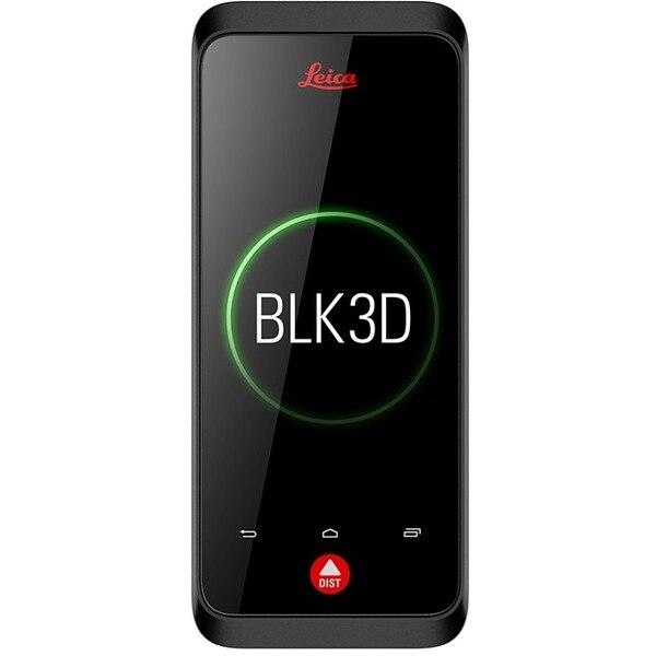
"name": "Leica BLK3D",
"description": "Leica BLK3D\nReal-time, professional grade, in-picture 3D measurement\nThe Leica BLK3D is a real-time, in-picture 3D measurement solution. By combining measurement sensors, software, and on-device edge data processing capabilities, the Leica BLK3D makes in-picture measurements with professional-grade accuracy in real-time possible. Every image captured is a complete and precise 3D measurement record.\n\nIts edge computing capabilities eliminate the need for network connections and cloud services, ensuring professionals can make faster decisions within their daily workflows – whether measuring inaccessible locations, creating floor plans, estimating building installations, documenting construction site progress or creating measurable, as-built documentation.\n\nTake a picture. Measure anything.\nThe BLK3D captures images and places precise measurements at your fingertips. Share images and measurements in multiple formats.\n\nThe art of photogrammetry. Simplified.\nUn-matched combination of a calibrated stereo-camera, advanced algorithms and real-time edge computing fused with leading Electronic Distance Measurement (EDM) technology.\n\nAccess projects. Anywhere, anytime.\nMeasure in your image – on the handheld imager, on the desktop, on-site or in the office.\n\nWorking with digital floorplans.\nCreate floorplans and import existing ones. Add measurable images. Document construction progress with multiple images over time.\n\nNew dimensions for 2D pictures.\nThe BLK3D creates images that contain precise three-dimensional measurements.\n\nProgressive project documentation for AEC.\nCapture critical moments throughout the life of a building.\n\nObject detection and snapping.\nAuto-Snapping uses computer vision technologies to select the right points for your measurements.\n\nStore. Organize. Share.\nStore your measurable images on the device and on desktop. Organize your projects by tagging measurable images with searchable keywords for easy recall and share them in multiple formats.\n\n",
"price": 0.0,
"discountamount": 0.0,
"currencycode": "INR",
"priority": 1000000,
"isfreeshipmentavailable": false,
"shipmentduration": 0,
"_keywords": null,
"isarchived": false,
"isavailable": false,
"applicationid": null,
"productindex": 139,
"imageuri": "https://productimages.withfloats.com/actual/5c5293511e8d150001c19faa.jpg",
"tileimageuri": "https://productimages.withfloats.com/tile/5c5293511e8d150001c19faa.jpg",
"images": null,
"totalqueries": 0,
"gpid": null,
"groupproductid": null,
"createdon": "2019-01-31T06:02:29.05Z",
"updatedon": "2019-01-31T06:18:55.492Z",
"buyonlinelink": null,
"producturl": "http://WWW.SURVEYEQUIPMENT.IN/products/leica-blk3d/139",
"availableunits": -1.0,
"iscodavailable": true,
"isprepaidonlineavailable": false,
"maxcodorders": 0,
"maxprepaidonlineorders": 0,
"uniquepaymenturl": null,
"brandname": null,
"category": "leicageosystems",
"tags": [
"leicageosystems",
"BLK3D",
"leicadisto",
"BLK360",
"laserdistancemeter",
"leicascanner"
],
"variants": false,
"keyspecification": null,
"otherspecifications": null,
"pickupaddressreferenceid": "5d08ebb3edf0e25c3b8da5d0",
"paymenttype": "AssuredPurchase",
"producttype": "products",
"hsncode": null,
"gstslab": 0.0,
"isnotforsale": false
},
{
"_id": "5b6b3a9cd682be0552aefb7c",
"fptag": "SBENTERPRISESTRADINGPUNE",
"merchantname": null,
"customwidgets": null,
"externalsourceid": null,
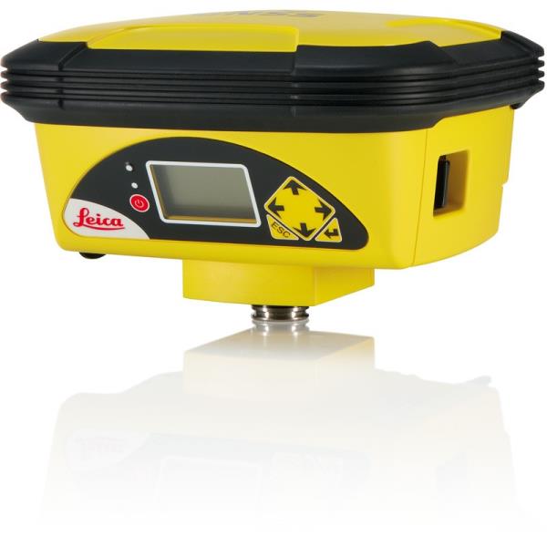
"name": "Leica iCON GPS 60 GNSS Smart Antenna",
"description": "Leica iCON GPS 60 GNSS Smart Antenna\nThe Leica iCON GPS 60 GNSS Smart Antenna is an impressive and versatile SmartAntenna for on-site positioning projects. Meeting all the requirements and producing precise and reliable measurements using its excellent GNSS (GPS+GLONASS) technology as well as other communication functions. The Leica iCON 60 display gives all the instruments information making configuration and operation very easy. It also features superior network capabilities, providing RTK network services and improving GPS position with more reliable data.\n\nFeatures at a glance:\nExcellent GNSS technology for precision and reliability, featuring both Leica SmartTrack+ and Smart-Check+.\nSatellite tracking supporting an increased range of satellite signals\nUse as site GNSS Base, Net Rover or Rover, or in a vehicle\nGNSS Base can be used\nFlexible options for machine control\nIntegrated radio, Bluetooth and radio for increased communications\nFast modem providing network performance\nBase station set-up requires no controller\nFlexible software licensing and upgrades\nQuickly and easily position tasks on your own, cut & fill or check grade, stake out lines and points as built checks. No need for a controller when setting up, making the Leica iCON GPS 60 GNSS Smart Antenna a superb mobile base station. Communicate data using the internet without the use of a radio. It can also be used for machine control. \nPackage Includes:\niCG60, iCON gps 60 SmartAnt. Base\nLeica USB-Card-Folder A5 iCON\nLeica iCON GPS60 QG,multil.",
"price": 0.0,
"discountamount": 0.0,
"currencycode": "INR",
"priority": 1000000,
"isfreeshipmentavailable": false,
"shipmentduration": 7,
"_keywords": [
"GPS position",
"site GNSS Base",
"excellent GNSS",
"GNSS technology",
"mobile base station",
"iCON gps 60 SmartAnt",
"RTK network services",
"Leica iCON 60 display",
"reliable measurements",
"versatile SmartAntenna",
"instruments information",
"communication functions",
"superior network capabilities",
"Leica iCON GPS 60 GNSS Smart Antenna"
],
"isarchived": false,
"isavailable": true,
"applicationid": null,
"productindex": 74,
"imageuri": "https://productimages.withfloats.com/actual/5b1ba233ab52d60c9c317b04.jpg",
"tileimageuri": "https://productimages.withfloats.com/tile/5b1ba233ab52d60c9c317b04.jpg",
"images": null,
"totalqueries": 0,
"gpid": null,
"groupproductid": null,
"createdon": "2018-06-09T09:47:30.969Z",
"updatedon": "2018-08-08T18:46:52.899Z",
"buyonlinelink": null,
"producturl": "http://WWW.SURVEYEQUIPMENT.IN//leica-icon-gps-60-gnss-smart-antenna/74",
"availableunits": -1.0,
"iscodavailable": true,
"isprepaidonlineavailable": false,
"maxcodorders": 0,
"maxprepaidonlineorders": 0,
"uniquepaymenturl": null,
"brandname": null,
"category": null,
"tags": null,
"variants": false,
"keyspecification": null,
"otherspecifications": null,
"pickupaddressreferenceid": "5d08ebb3edf0e25c3b8da5d0",
"paymenttype": "AssuredPurchase",
"producttype": "products",
"hsncode": null,
"gstslab": 0.0,
"isnotforsale": false
},
{
"_id": "6538b3519c14ab0f94083db9",
"fptag": "SBENTERPRISESTRADINGPUNE",
"merchantname": null,
"customwidgets": null,
"externalsourceid": null,
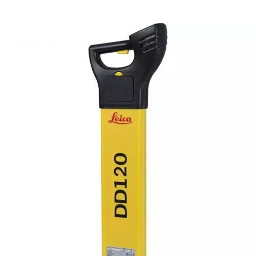
"name": "Leica DD120 Cable Loctoer ",
"description": "Easy to use, intuitive avoidance tool\nThe new Leica DD120 locator reduces the complexity normally associated with scanning for buried utilities. For construction professionals who need to know what is beneath their sites, the DD120 cable locator is a simple, intuitive locator designed to detect and avoid buried utilities. The DD120’s automated pinpointing process improves the detection of utilities, reduces utility damage and increases workforce safety.\nAutomatic pinpointing\nPower, Radio, Auto modes\nTransmitter, 33kHz, 8kHz\nDepth detection up to 3 meters (10 feet)\nGood-to-Go™ Health Check and Start up test\nIP54 rating - protection from dust and water\n1 year Warranty\n\nHandheld multi-frequency underground service locatorThe Leica DD100 Series cable locators feature advanced automatic controls making the DD100 Series easy-to-use, requiring minimal user experience. Avoiding underground cables and pipes is a major concern on construction sites. Therefore, detecting the position of buried cables and pipes before excavation work can help prevent operator injury, asset damage and any subsequent costs. Use the DD120 or DD130 cable locators in conjunction with a DA220 or DA230 signal transmitter or range of accessories to achieve improved accuracy and application scope.\nUnmatched ease of useWith Automatic Pinpointing there is no need for you to manually adjust the sensitivity of your Digicat cable locator ensuring you’re using the optimum sensitivity for the environment you are detecting the underground utilities in. Reducing the likelihood of human error and enabling easier and more efficient cable and pipe locating. Ultimately saving you time and money.\n\nUnderground Exploration with Leica DD120User-Centric Design: Effortless operation with an in-built self-test for accuracy assurance.Dynamic Alert System: Hazard Zone alert for shallow services within 30cm ensures enhanced safety.Versatile Modes: Detect in Auto, Power, Radio, and Transmitter modes for comprehensive utility detection.\n\n",
"price": 0.0,
"discountamount": 0.0,
"currencycode": "INR",
"priority": 1000000,
"isfreeshipmentavailable": false,
"shipmentduration": 7,
"_keywords": null,
"isarchived": false,
"isavailable": true,
"applicationid": null,
"productindex": 232,
"imageuri": "https://productimages.withfloats.com/actual/6538b35d9144637b5496fab1.jpg",
"tileimageuri": "https://productimages.withfloats.com/tile/6538b35d9144637b5496fab1.jpg",
"images": null,
"totalqueries": 0,
"gpid": null,
"groupproductid": null,
"createdon": "2023-10-25T06:18:57.85Z",
"updatedon": "2023-10-25T06:18:57.85Z",
"buyonlinelink": null,
"producturl": "http://WWW.SURVEYEQUIPMENT.IN//leica-dd120-cable-loctoer-/232",
"availableunits": -1.0,
"iscodavailable": false,
"isprepaidonlineavailable": false,
"maxcodorders": 0,
"maxprepaidonlineorders": 0,
"uniquepaymenturl": null,
"brandname": "Leica",
"category": "Pipe and Cable locators",
"tags": null,
"variants": false,
"keyspecification": null,
"otherspecifications": null,
"pickupaddressreferenceid": "",
"paymenttype": "None",
"producttype": "products",
"hsncode": null,
"gstslab": 0.001,
"isnotforsale": false
},
{
"_id": "60e1a313e49d1200012fbdc3",
"fptag": "SBENTERPRISESTRADINGPUNE",
"merchantname": null,
"customwidgets": null,
"externalsourceid": null,
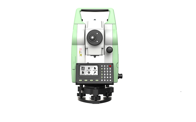
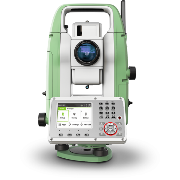
"name": "Leica TS01 Manual Total Stations ",
"description": "Leica TS01: The entry to Leica Geosystems' Total Stations\nLeica TS01 empowers you to carry out measurement tasks with ease and simplicity.\n\nThe Leica TS01 total station empowers you to carry out measurement tasks with ease and simplicity. The TS01 is an entry-level manual total station, created to help you master surveying, layout and mapping projects. It will prove itself in the field and immediately become a valuable member of your team.\n\nBuying a Leica TS01 is a smart decision as it represents a business-smart entry into Leica Geosystems world. You and your surveying crew members will be ready for new projects in no time.\n\nEnjoy the benefits of a 500 m non-prism range and 3,000 m prism range, always combined with accuracy and measurement speed, which increases your productivity. With built-in sensors like an electronic dual axis compensator, a laser plummet, onboard field software and short keys for quick menu access you'll have a fast instrument setup and fast measurements.\n\nWith the Leica TS01 total station you get your all-in-on package as it comes with Leica Geosystems accessories, such as a long-operating battery, a charger and a tribrach tested to reliably fulfil the requirements – when every detail counts.\n\n\nFirst class after sales service and support\n\nLeica Geosystems's highly qualified after-sales service and support network will help you managing any issue to continue work quickly.\nBe it maintenance work, in any of our local service workshops, or getting a question answered from local support, both are part of Leica Geosystems's active customer care.\n\n\nStart-up into business easily\n\n\n\nLeica Geosystems' TS01 will get your trusted partner in managing survey, layout and mapping projects with ease and simplicity.\nPowerful built-in sensors, as well as intuitive field software, empower you to complete tasks without any delay.\n",
"price": 0.0,
"discountamount": 0.0,
"currencycode": "INR",
"priority": 1000000,
"isfreeshipmentavailable": false,
"shipmentduration": 7,
"_keywords": null,
"isarchived": false,
"isavailable": true,
"applicationid": null,
"productindex": 200,
"imageuri": "https://productimages.withfloats.com/actual/60e1a315eef7850001dd7f3e.png",
"tileimageuri": "https://productimages.withfloats.com/tile/60e1a315eef7850001dd7f3e.png",
"images": null,
"totalqueries": 0,
"gpid": null,
"groupproductid": null,
"createdon": "2021-07-04T12:01:23.298Z",
"updatedon": "2021-07-04T12:01:23.298Z",
"buyonlinelink": null,
"producturl": "http://WWW.SURVEYEQUIPMENT.IN//leica-ts01-manual-total-stations-/200",
"availableunits": -1.0,
"iscodavailable": false,
"isprepaidonlineavailable": false,
"maxcodorders": 0,
"maxprepaidonlineorders": 0,
"uniquepaymenturl": null,
"brandname": "Leica Geosystems",
"category": "Leica Total Station in India ",
"tags": [
"Leica Total Station in India",
"TOTALSTATIONS",
"Robotic Total Station",
"leicatotalstationsindia",
"robotictotalstationpune",
"robotictotalstations",
"leicatotalstationsindia",
"leicatotalstationoune",
"leicageosystems",
"Geographical Survey",
"GNSS/GPS Survey Equipment - Surveying Equipment fr"
],
"variants": false,
"keyspecification": null,
"otherspecifications": null,
"pickupaddressreferenceid": "",
"paymenttype": "None",
"producttype": "products",
"hsncode": null,
"gstslab": 0.001,
"isnotforsale": false
},
{
"_id": "5daaf779f9dc390001952ef9",
"fptag": "SBENTERPRISESTRADINGPUNE",
"merchantname": null,
"customwidgets": null,
"externalsourceid": null,
"name": "Leica FlexLine TS07 Manual Total Station",
"description": "Leica FlexLine TS07 Manual Total Station\nThe Leica FlexLine TS07 high-quality, manual total station is based on a proven product concept that has been revolutionising the world of measurement and survey for nearly 200 years. The Leica TS07 is equipped with a comprehensive application-based software package - Leica FlexField software - that enables most survey and stakeout tasks to be carried out easily and efficiently. The new FlexLine TS07 works reliably and delivers accurate results even in the harshest environments.\n\nWork faster: measure more points per day due to faster measurement and stakeout procedures (endless drives, trigger key, drives on both sides, pinpoint EDM and more), supported by our comprehensive and user-friendly Leica FlexField software.\nUse it trouble-free: increase productivity and minimise downtime by relying on instruments that simply work and come with a global service and support network.\nChoose products that are built to last: FlexLine operates with the same high level of quality even after years of use under harsh conditions (like mud, dust, blowing rain, extreme heat and cold).\nControl your investment: reliability, speed and accuracy ensure a lower investment over the product lifetime and a higher resell value.\nSave time with AutoHeight: measure, read and set the instrument height automatically with this revolutionary feature in the FlexLine TS07 (optional). Errors are minimised and the setup process onsite is faster.",
"price": 0.0,
"discountamount": 0.0,
"currencycode": "INR",
"priority": 1000000,
"isfreeshipmentavailable": false,
"shipmentduration": 7,
"_keywords": null,
"isarchived": false,
"isavailable": true,
"applicationid": null,
"productindex": 156,
"imageuri": "https://productimages.withfloats.com/actual/5daaf77b836b6b0001c86cb4.png",
"tileimageuri": "https://productimages.withfloats.com/tile/5daaf77b836b6b0001c86cb4.png",
"images": null,
"totalqueries": 0,
"gpid": null,
"groupproductid": null,
"createdon": "2019-10-19T11:46:01.098Z",
"updatedon": "2019-10-19T11:46:01.098Z",
"buyonlinelink": null,
"producturl": "http://WWW.SURVEYEQUIPMENT.IN//leica-flexline-ts07-manual-total-station/156",
"availableunits": -1.0,
"iscodavailable": false,
"isprepaidonlineavailable": false,
"maxcodorders": 0,
"maxprepaidonlineorders": 0,
"uniquepaymenturl": null,
"brandname": "Leica Geosystems ",
"category": "",
"tags": null,
"variants": false,
"keyspecification": null,
"otherspecifications": null,
"pickupaddressreferenceid": "",
"paymenttype": "None",
"producttype": "products",
"hsncode": null,
"gstslab": 0.0,
"isnotforsale": false
},
{
"_id": "5b7ffb95147e16051e773f27",
"fptag": "SBENTERPRISESTRADINGPUNE",
"merchantname": null,
"customwidgets": null,
"externalsourceid": null,
"name": "IDS GeoRadar - Stream C",
"description": "IDS GeoRadar - Stream C\nThe compact array solution for accurate 3D utility mapping.\nHigh quality, High productivity and Simple to Use compact radar system for real time underground surveys.\n\nStream C is the compact array solution for real-time 3D mapping of underground utilities and features. Thanks to increased level of accuracy provided by a massive antenna array, Stream C is able to automatically detect pipes and cables.\n\nDaily use of Stream C is aided by ergonomic features including electronic ride height adjustment, options to tow manually or with a small vehicle and a motor assisted drive wheel.\n\nSTREAM C BENEFITS\n\nHigh Productivity: surveys only need to be performed in one direction to ensure optimal detection for both longitudinal and transversal pipes.\nNo advanced training needed: the system automatically detects and locates the position of pipes in real time and displays them on screen.\nReduced user fatigue: thanks to electronic ride height adjustment and a motor assisted drive wheel.\nFacilitates large surveys: the system can be towed manually or with a small vehicle, increasing the acquisition speed (up to 6 km/h).\n\nSTREAM C FEATURES\n\nMassive array of 34 antennas in two polarizations: this enables an accurate 3D reconstruction of the underground utility network to be created in a single scan.\nAutomatic Pipe Detection (APD): real-time automatic detection of buried pipes and cables\nCompact size: Stream C’s small dimensions enable it to survey areas inaccessible to larger array systems while maintaining the same accuracy.\nRobust construction: built to the highest standards and with hardwearing materials so that it can be used in harsh, demanding environments.\n3D radar tomography: real-time tomography on a GPS or total station assisted cartographic background. • Professional subsurface survey: pipes, cables and buried objects can be automatically transferred to CAD and GIS formats allowing a complete subsurface GIS based digital map to be quickly produced.\n\nBenefits of Stream EM include:\n\nImproved management of underground utility design, relocation and coordination;\nCost and time reductions: No need to block traffic or perform surveys at night;\nIncrease in accuracy with a detection accuracy of as little as 5 cm;\nIncrease productivity and have the ability to detect every buried target;\nHighly modular structure allows it to be reconfigured to map sidewalks and difficult to access areas\n\nReal time software for advanced viewing \nStream EM is supplied with the OneVsion and GRED HD 3D CAD software suites.",
"price": 0.0,
"discountamount": 0.0,
"currencycode": "INR",
"priority": 1000000,
"isfreeshipmentavailable": false,
"shipmentduration": 7,
"_keywords": [
"detection accuracy",
"accurate 3D utility",
"real time underground",
"massive antenna array",
"underground utilities",
"compact array solution",
"small dimensions enable",
"complete subsurface GIS",
"Use compact radar system",
"survey areas inaccessible",
"underground utility design",
"accurate 3D reconstruction",
"underground utility network",
"GRED HD 3D CAD software suites",
"Professional subsurface survey"
],
"isarchived": false,
"isavailable": true,
"applicationid": null,
"productindex": 111,
"imageuri": "",
"tileimageuri": "",
"images": null,
"totalqueries": 0,
"gpid": null,
"groupproductid": null,
"createdon": "2018-08-24T12:35:33.806Z",
"updatedon": "2018-08-24T12:35:33.806Z",
"buyonlinelink": null,
"producturl": "http://WWW.SURVEYEQUIPMENT.IN//ids-georadar-stream-c/111",
"availableunits": -1.0,
"iscodavailable": true,
"isprepaidonlineavailable": false,
"maxcodorders": 0,
"maxprepaidonlineorders": 0,
"uniquepaymenturl": null,
"brandname": null,
"category": null,
"tags": null,
"variants": false,
"keyspecification": null,
"otherspecifications": null,
"pickupaddressreferenceid": "5d08ebb3edf0e25c3b8da5d0",
"paymenttype": "AssuredPurchase",
"producttype": "products",
"hsncode": null,
"gstslab": 0.0,
"isnotforsale": false
},
{
"_id": "5b6b3a9dd682be0552aefccb",
"fptag": "SBENTERPRISESTRADINGPUNE",
"merchantname": null,
"customwidgets": null,
"externalsourceid": null,
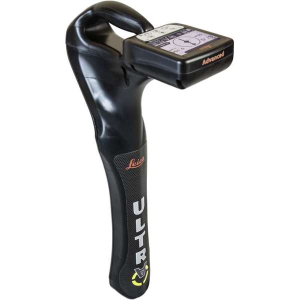
"name": "Leica ULTRA Utility Tracing System",
"description": "Leica ULTRA Utility Tracing System\nBest precision locating in faster, more confident work\n\nSave time and increase confidence in your results with the Leica ULTRA, our most advanced precision utility tracing instrument.\n\nThe complexity of underground utility networks is continually increasing, and obtaining precise information on the location of buried utilities has never been more important. The protection of buried assets during excavation work demands accurate mapping and surveying of existing utilities. \n\nIntegrating intelligent signal processing with unique flexible operating modes, Leica ULTRA traces buried utility lines accurately for safe underground excavations and utility surveys. Outstanding performance with operational ease and flexibility.\n\nLARGE CLEAR DISPLAY\nLarge backlit high visibility LCD screen\nClear display provides clear, improved and confident location and utility tracing\nCUSTOM FREQUENCIES\nConfigure for site specific applications\nUser configurable modes from 50 Hz to 200 kHz\nChoose from 100 pre-selected frequencies or customise your own frequencies\nCOMPASS\nShows the user the direction of the utility they are locating / tracing\nBLUETOOTH®\nEnable wireless communications with software running on a laptop, survey field PC or other GPS enabled device\nINCREASED TRANSMITTER POWER OUTPUT\nChoose between 5W and 12W transmitter power outputs for superior tracing performance\nBUILT FOR THE MOST DEMANDING ENVIRONMENTS\nIP65 protection\nFulfils toughest standards - shock resistant, protected against water and dust ingress\nSELECTABLE ANTENNA CONFIGURATION\nConfigure antenna to best optimise for your job site\nSelect between more range, sharper response, noise cancelling or easier sweeping\nDIRECTION ENABLED\nIdentifying your target utility amongst multiple parallel utilities\nApply a special direction enabled signal from the transmitter, the receiver will display an arrow on the compass heading to guide you along the designated utility path\nUnlock the power\nConfigure the Leica ULTRA for site specific applications. Custom build your receiver and transmitter.\n\nChoose from over 100 preselected frequencies, or customise your own frequency for highly specialised applications.\n\nAutomatically capture the instruments location data to ensure adherence to best practice. The data logging feature allows the user to record external GPS coordinates and download with the datafile as a KML or CSV format. Upload into GIS systems or Google Maps to confirm where, when and how the work was performed.\n",
"price": 0.0,
"discountamount": 0.0,
"currencycode": "INR",
"priority": 1000000,
"isfreeshipmentavailable": false,
"shipmentduration": 7,
"_keywords": [
"target utility",
"utility surveys",
"precision utility",
"Leica ULTRA traces",
"designated utility",
"12W transmitter power",
"wireless communications",
"instruments location data",
"site specific applications",
"100 preselected frequencies",
"underground utility networks",
"safe underground excavations",
"intelligent signal processing",
"unique flexible operating modes",
"Leica ULTRA Utility Tracing System"
],
"isarchived": false,
"isavailable": true,
"applicationid": null,
"productindex": 90,
"imageuri": "https://productimages.withfloats.com/actual/5b45ea4dd3d93d01c4f1c9f9.jpg",
"tileimageuri": "https://productimages.withfloats.com/tile/5b45ea4dd3d93d01c4f1c9f9.jpg",
"images": null,
"totalqueries": 0,
"gpid": null,
"groupproductid": null,
"createdon": "2018-07-11T11:30:28.043Z",
"updatedon": "2018-08-08T18:46:53.973Z",
"buyonlinelink": null,
"producturl": "http://WWW.SURVEYEQUIPMENT.IN//leica-ultra-utility-tracing-system/90",
"availableunits": -1.0,
"iscodavailable": true,
"isprepaidonlineavailable": false,
"maxcodorders": 0,
"maxprepaidonlineorders": 0,
"uniquepaymenturl": null,
"brandname": null,
"category": null,
"tags": null,
"variants": false,
"keyspecification": null,
"otherspecifications": null,
"pickupaddressreferenceid": "5d08ebb3edf0e25c3b8da5d0",
"paymenttype": "AssuredPurchase",
"producttype": "products",
"hsncode": null,
"gstslab": 0.0,
"isnotforsale": false
},
{
"_id": "5b6b3a9ed682be0552aefd6c",
"fptag": "SBENTERPRISESTRADINGPUNE",
"merchantname": null,
"customwidgets": null,
"externalsourceid": null,
"name": "Leica ULTRA Locator – Standard",
"description": "Leica ULTRA Locator – Standard\nThe ULTRA System has unique flexible operating modes to help you easily decide the right mode for your locating application and site conditions.\n\nMultimode operation – 50-200Khz\nDaylight visible LCD screen\nPrecision locating, for utility tracing\nThe complexity of underground utility networks are continually increasing. So obtaining precise information on the location of buried utilities has never been more important. The protection of buried assets during excavation work demands accurate mapping and surveying of existing utilities.\n\nThe Leica ULTRA provides our most advanced precision utility tracing system. Intelligent signal processing has been integrated with unique flexible operating modes, to help save you time and increased confidence in your results. Selectable antenna and customised frequencies optimises your instrument for site specific applications, supported by our AIM system which monitors signal interference levels, recommending which mode to use for the best results.\n\nAmbient Interference Measurement (AIM) \nWhen working in congested environments, external interferences can affect the effectiveness of utility tracing. To guard against interference, the Leica ULTRA incorporates advanced Ambient Interference Measurement (AIM), which analyses the surrounding area for noise and recommends the best frequencies for accurate utility tracing.\n\nOffset measuring \nThere will always be an occasion when the utility runs close to, or underneath an obstruction. With Offset Measuring, the Leica ULTRA can locate the target line if not directly accessible from above. The function uses the available data to estimate the horizontal and vertical (depth) distance.\n\nTransmitter to receiver link \nAdvanced communication link between the Leica ULTRA receiver and transmitter, enables you to control the transmitter directly from the receiver. Work smarter and at greater distances to help achieve best practice whilst reducing time spent walking to the transmitter.",
"price": 0.0,
"discountamount": 0.0,
"currencycode": "INR",
"priority": 1000000,
"isfreeshipmentavailable": false,
"shipmentduration": 7,
"_keywords": [
"communication link",
"Leica ULTRA Locator",
"precise information",
"Leica ULTRA receiver",
"congested environments",
"external interferences",
"advanced precision utility",
"site specific applications",
"underground utility networks",
"Intelligent signal processing",
"unique flexible operating modes",
"monitors signal interference levels",
"advanced Ambient Interference Measurement"
],
"isarchived": false,
"isavailable": true,
"applicationid": null,
"productindex": 95,
"imageuri": "https://productimages.withfloats.com/actual/5b45e9a9d3d93d01c4f1c26c.jpg",
"tileimageuri": "https://productimages.withfloats.com/tile/5b45e9a9d3d93d01c4f1c26c.jpg",
"images": null,
"totalqueries": 0,
"gpid": null,
"groupproductid": null,
"createdon": "2018-07-11T11:27:45.603Z",
"updatedon": "2018-08-08T18:46:54.165Z",
"buyonlinelink": null,
"producturl": "http://WWW.SURVEYEQUIPMENT.IN//leica-ultra-locator-standard/95",
"availableunits": -1.0,
"iscodavailable": true,
"isprepaidonlineavailable": false,
"maxcodorders": 0,
"maxprepaidonlineorders": 0,
"uniquepaymenturl": null,
"brandname": null,
"category": "cable pipe detector equipments",
"tags": [
"cable pipe detector equipments",
"Cable Avoidance Tools",
"cable",
"cable route tracing to Datalogging locators",
"ndustry standard for cable locating equipments.",
"Pipe and Cable locators",
"underground cable & pipe locating equipments"
],
"variants": false,
"keyspecification": null,
"otherspecifications": null,
"pickupaddressreferenceid": "5d08ebb3edf0e25c3b8da5d0",
"paymenttype": "AssuredPurchase",
"producttype": "products",
"hsncode": null,
"gstslab": 0.0,
"isnotforsale": false
},
{
"_id": "5b6b3a9ad682be0552aef760",
"fptag": "SBENTERPRISESTRADINGPUNE",
"merchantname": null,
"customwidgets": null,
"externalsourceid": null,
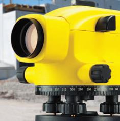
"name": "Leica Jogger Series",
"description": "Leica Jogger Series - Automatic Levels - Fit for Work\nOur most economical Automatic Levels designed specifically for general construction applications. The Leica Jogger Series is the ideal partner for all your daily levelling tasks.\n\nFit for Work - Great features and great performance:\nChoice of magnification: 20x/24x/28x or 32x \nAutomatic, air-damped compensator\nSmooth, double-sided endless fine drive for easy and precise targeting\nHorizontal circle with 360° division\nFit for Work - Quality and Endurance:\nWater resistant (IP54) for instrument use under harsh environmental conditions\n2 year warranty and access to the worldwide Leica Geosystems network of service and support centre\nFit for Work - Great Jogger package:\nTripod and staff are important parts of any levelling equipment. Get better results with approved original Leica Geosystems tripods and staffs. Ask for the original Leica Jogger package.\n\nApplications\nLevelling footing\nConcrete pours\nElevation control\nGrade checking\nExcavations\nDrainage pipes\nWalkway construction\nProfiling\nArea levelling\n",
"price": 0.0,
"discountamount": 0.0,
"currencycode": "INR",
"priority": 1000000,
"isfreeshipmentavailable": false,
"shipmentduration": 7,
"_keywords": [
"instrument use",
"important parts",
"daily levelling",
"great performance",
"endless fine drive",
"Leica Jogger Series",
"harsh environmental",
"levelling equipment",
"Great Jogger package",
"original Leica Jogger",
"Leica Geosystems network",
"economical Automatic Levels",
"original Leica Geosystems tripods",
"general construction applications"
],
"isarchived": false,
"isavailable": true,
"applicationid": null,
"productindex": 17,
"imageuri": "https://productimages.withfloats.com/actual/5aeed2b085c6af0ab87ee399.jpg",
"tileimageuri": "https://productimages.withfloats.com/tile/5aeed2b085c6af0ab87ee399.jpg",
"images": null,
"totalqueries": 0,
"gpid": null,
"groupproductid": null,
"createdon": "2018-05-06T10:02:24.011Z",
"updatedon": "2018-08-08T18:46:50.04Z",
"buyonlinelink": null,
"producturl": "http://WWW.SURVEYEQUIPMENT.IN//leica-jogger-series/17",
"availableunits": -1.0,
"iscodavailable": true,
"isprepaidonlineavailable": false,
"maxcodorders": 0,
"maxprepaidonlineorders": 0,
"uniquepaymenturl": null,
"brandname": null,
"category": null,
"tags": null,
"variants": false,
"keyspecification": null,
"otherspecifications": null,
"pickupaddressreferenceid": "5d08ebb3edf0e25c3b8da5d0",
"paymenttype": "AssuredPurchase",
"producttype": "products",
"hsncode": null,
"gstslab": 0.0,
"isnotforsale": false
}
],
"hasmoreitems": false,
"isapirequest": false,
"totalresults": 27,
"query": null,
"floatingpoint": null
}