Preview

This is your website preview.

Currently it only shows your basic business info. Start adding relevant business details such as description, images and products or services to gain your customers attention by using Boost 360 android app / iOS App / web portal.

SBENTERPRISESTRADINGPUNE 5abfbf1e7c88bb04a4d0fcc7 Products https://www.surveyequipment.in
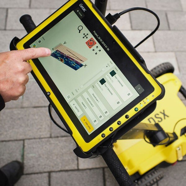
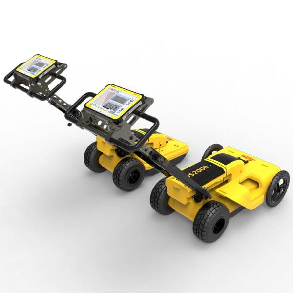
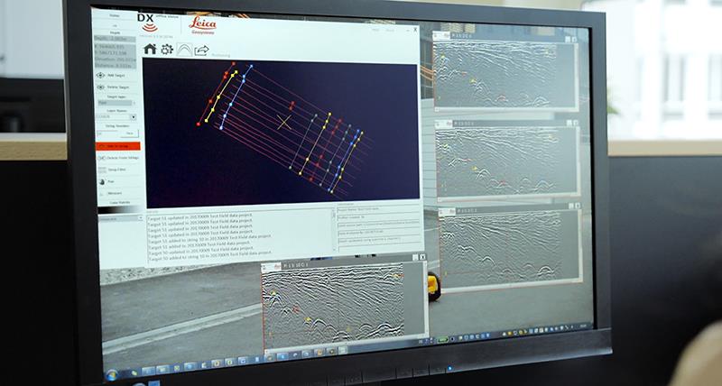
{ "products": [ { "_id": "5b6b3a9bd682be0552aef931", "fptag": "SBENTERPRISESTRADINGPUNE", "merchantname": null, "customwidgets": null, "externalsourceid": null, "name": "IBIS-FS Plus", "description": "IBIS-FS Plus\nRemote static and dynamic monitoring with accelerometer to mitigate large external vibrations.\n\nAn advanced microwave interferometry based system for remote static and dynamic monitoring, IBIS-FS Plus inferometric radar is used on bridges and other structures including buildings, historical monuments and towers. An accelerometer version of IBIS-FS, this radar mitigates the effect of large external vibration sources on results.\n\nIn static, the IBIS-FS Plus is ideal for:\n\nStructure load testing;\nStructure displacement and collapse hazards;\nCultural heritage preservation.\nIn dynamic, the IBIS-FS Plus is best used for:\n\nStructure resonance frequency measurements;\nStructural modal shape analysis.\nIn either state, the IBIS-FS Plus features:\n\nRemote sensing: Real-time remote sensing at up to 1 km with no need for equipment to be installed on the monitored structure.\nAccurate measurements: Measures displacements of as little as 0.01mm @ 0.5km range. No standard instrument can achieve such accuracy.\nGround vibration removal: Built-in accelerometer to cancel the self-induced vibrations transmitted to the radar from the ground.\nSampling: Structural vibration sampling up to 200 Hz.\nAlways operational: Operates day and night and in all weather conditions.\nBenefits of the IBIS-FS Plus include:\n\nAccurate measurements even when the system is installed in places with large ground vibrations;\nIncrease structural health monitoring efficiency through the use of a non-invasive vibration monitoring technique;\nAccurate and remote real-time monitoring of structural vibration and natural frequencies;\nReduces the time required for static or dynamic bridge structural testing to just a few minutes", "price": 0.0, "discountamount": 0.0, "currencycode": "INR", "priority": 1000000, "isfreeshipmentavailable": false, "shipmentduration": 7, "_keywords": [ "radar mitigates", "vibration removal", "dynamic monitoring", "standard instrument", "natural frequencies", "Structural vibration", "historical monuments", "accelerometer version", "Plus inferometric radar", "large ground vibrations", "vibration monitoring technique", "large external vibration sources", "resonance frequency measurements", "dynamic bridge structural testing", "structural health monitoring efficiency" ], "isarchived": false, "isavailable": true, "applicationid": null, "productindex": 41, "imageuri": "https://productimages.withfloats.com/actual/5aefe578449b020bf493df68.jpg", "tileimageuri": "https://productimages.withfloats.com/tile/5aefe578449b020bf493df68.jpg", "images": null, "totalqueries": 0, "gpid": null, "groupproductid": null, "createdon": "2018-05-07T05:34:49.166Z", "updatedon": "2018-08-08T18:46:51.305Z", "buyonlinelink": null, "producturl": "http://WWW.SURVEYEQUIPMENT.IN/products/ibis-fs-plus/41", "availableunits": -1.0, "iscodavailable": true, "isprepaidonlineavailable": false, "maxcodorders": 0, "maxprepaidonlineorders": 0, "uniquepaymenturl": null, "brandname": null, "category": null, "tags": null, "variants": false, "keyspecification": null, "otherspecifications": null, "pickupaddressreferenceid": "5d08ebb3edf0e25c3b8da5d0", "paymenttype": "AssuredPurchase", "producttype": "products", "hsncode": null, "gstslab": 0.0, "isnotforsale": false }, { "_id": "63b69b3e3fe46f0001fcd675", "fptag": "SBENTERPRISESTRADINGPUNE", "merchantname": null, "customwidgets": null, "externalsourceid": null, "name": "Bosch D-TECT 200 C Professional Wall Scanner", "description": "Bosch Professional Wall Scanner D-tect 200 C (detection of (non-) live cables, metal, plastic pipes, wooden studs and cavities, USB-C™ Cable, 4x AA batteries, Protective bag) , Blue\nWALLSCANNER D-TECT 200 C PROFESSIONAL\n\nBOSCH RADAR TECHNOLOGY: The detector uses advanced radar technology to detect all common objects: live/non-live cables, water-filled/empty plastic pipes, magnetic/non-magnetic metal and wooden studs\nEASY DOCUMENTATION: The screenshot feature supports quick and easy documentation of the detection results, which can be downloaded via USB-C and and Micro SD card.\nINTUITIVE USER INTERFACE: For precision, higher safety, and clear illustration of detected objects. Four different view settings offer flexibility to get the best results for each situation.\nAPPLICATIONS: The D-tect 200 C is ideal to search for objects before drilling and monitor construction progresses. It also features a leakage detection function to locate leaks inside walls.\nITEMS INCLUDED: Wall Scanner D-tect 200 C, AA1 adapter, 4x AA batteries, USB-C cable, hand strap and protective bag.\n\nAdvantages\nThe wall scanner for exceptional results: top performance and easy documentation\nBosch Radar Technology and modern user interface for precision, higher safety, and clear illustration of detected objects\nMultiple views flexibly offer best results in various situations\nScreenshot feature supports quick and easy documentation; screenshots are downloadable via USB-C™ and SD card slot\nThe D-tect 200 C Professional detects all common objects and illustrates them clearly, while making documentation easy. Equipped with Bosch Radar Technology and an improved user interface, it stands for safer and more precise construction work. Multiple views allow for conveniently choosing the best option for different applications, such as Spot View, that makes detection in hard-to-reach locations especially easy. To provide solid evidence, the wallscanner´s innovative screenshot feature enables quick documentation.\n\nThe D-tect 200 C Professional supports both indoor and outdoor jobs, prevents damage during drilling, and measures concrete coverage.\n\nThe walls canner detects objects in depths up to 20 cm and indicates the object´s depth.\n\n ", "price": 0.0, "discountamount": 0.0, "currencycode": "INR", "priority": 1000000, "isfreeshipmentavailable": false, "shipmentduration": 7, "_keywords": [ "detection results", "easy documentation", "documentation easy", "exceptional results", "monitor construction", "modern user interface", "Bosch Radar Technology", "different applications", "precise construction work", "200 C Professional detects", "leakage detection function", "Four different view settings", "innovative screenshot feature", "200 C Professional Wall Scanner", "Bosch Professional Wall Scanner" ], "isarchived": false, "isavailable": true, "applicationid": null, "productindex": 225, "imageuri": "https://productimages.withfloats.com/actual/63b69b3ffdd99e000124b434.jpg", "tileimageuri": "https://productimages.withfloats.com/tile/63b69b3ffdd99e000124b434.jpg", "images": null, "totalqueries": 0, "gpid": null, "groupproductid": null, "createdon": "2023-01-05T09:41:18.153Z", "updatedon": "2023-01-05T09:41:18.153Z", "buyonlinelink": null, "producturl": "http://WWW.SURVEYEQUIPMENT.IN/products/bosch-d-tect-200-c-professional-wall-scanner/225", "availableunits": -1.0, "iscodavailable": false, "isprepaidonlineavailable": false, "maxcodorders": 0, "maxprepaidonlineorders": 0, "uniquepaymenturl": null, "brandname": "BOSCH", "category": "laserscannerpune", "tags": null, "variants": false, "keyspecification": null, "otherspecifications": null, "pickupaddressreferenceid": "", "paymenttype": "None", "producttype": "products", "hsncode": null, "gstslab": 0.0, "isnotforsale": false }, { "_id": "5da061c96fcd40000173875d", "fptag": "SBENTERPRISESTRADINGPUNE", "merchantname": null, "customwidgets": null, "externalsourceid": null, "name": "DSX Utility Detections Solutions ", "description": "Leica DSX Utility Detection Solution\nA clearer view of underground utilities\nFor utility repair and maintenance, civil engineering and surveying companies, the Leica DSX utility detection solution, consisting of portable hardware with intuitive software allows to easily locate, visualise and map utilities. Unlike any other ground-penetrating radar (GPR) system, the Leica DSX maximises productivity with cutting-edge software that automates data analysis and creates a 3D utility map on the field.\n\nEasy to use\n\nEnsure smooth and accurate underground utility detection without expert knowledge\nComplete utility detection and mapping in just a few steps through the intuitive user interface\nScan anywhere and at any time, even in narrow areas and under severe conditions\nReliable Detection Results\n\nDetect all types of underground utilities in high resolution to assure reliable avoidance zones\nVerify detected utilities with support of smart algorithm\nImport of POI's and utility records to help you make better decisions\nInstant 2D/3D Utility Map\n\nSave your time on site by mapping underground utilities in just minutes\nExport utilities in CAD or BIM-read formats for further usage\nCreate professional reports, customised to your and your customers' needs\nIntegrated Solution\n\nOffer a complete workflow from acquire to excavate\nLocate underground utilities with survey-grade accuracy\nGenerate utility maps, compatible with all coordinate reference systems", "price": 0.0, "discountamount": 0.0, "currencycode": "INR", "priority": 1000000, "isfreeshipmentavailable": false, "shipmentduration": 7, "_keywords": null, "isarchived": false, "isavailable": true, "applicationid": null, "productindex": 155, "imageuri": "https://productimages.withfloats.com/actual/5da061ca48f8810001023a3d.jpg", "tileimageuri": "https://productimages.withfloats.com/tile/5da061ca48f8810001023a3d.jpg", "images": null, "totalqueries": 0, "gpid": null, "groupproductid": null, "createdon": "2019-10-11T11:04:41.923Z", "updatedon": "2019-10-11T11:04:41.923Z", "buyonlinelink": null, "producturl": "http://WWW.SURVEYEQUIPMENT.IN//dsx-utility-detections-solutions-/155", "availableunits": -1.0, "iscodavailable": false, "isprepaidonlineavailable": false, "maxcodorders": 0, "maxprepaidonlineorders": 0, "uniquepaymenturl": null, "brandname": "Leica DSX Utility Detection Solution", "category": "", "tags": null, "variants": false, "keyspecification": null, "otherspecifications": null, "pickupaddressreferenceid": "", "paymenttype": "None", "producttype": "products", "hsncode": null, "gstslab": 0.0, "isnotforsale": false }, { "_id": "5bcdaac7e3f0b00001d2a048", "fptag": "SBENTERPRISESTRADINGPUNE", "merchantname": null, "customwidgets": null, "externalsourceid": null, "name": "RIS One & RIS Plus", "description": "RIS One & RIS Plus\nCompact and lightweight ground penetrating radar\n\nRIS ONE and RIS PLUS are the most compact and lightweight antennas available on the market. Gain increased acquisition speed through a high stacking factor as well as improved penetration depth with these single or multi-channel radar control unit.\n\nThe system is supported by antennas operating in 25 MHz to 2.6 GHz frequency range. Custom solutions are available with the IDS GeoRadar control unit, able to power up multiple antennas connected in chain. The antennas feature:\n\nExcellent data quality\nHighest flexibility in multi-channel chain connection\nHigh stacking thereby improving penetration depth\nWireless link to keep track of the survey path and the location of buried objects;\nRIS ONE and RIS PLUS are the ideal solutions for:\n\nUnderground tunnel inspection and condition assessment;\nBedrock and lithological profiling;\nFracture characterisation;\nGround water profiling;\nFoundation and pile measurements;\nBorehole investigations.\nBenefits of the RIS ONE and RIS PLUS include:\n\nLargest antenna gamma in the ground penetrating radar market: A comprehensive set of antennas from 25 MHz to 3.0 GHz, including multi-frequency, borehole and horn antennas ensuring that the right equipment is available for the right application.\nMore than eight hours of autonomous use: IDS GeoRadar’s radar control unit has the lowest power consumption in the ground penetrating radar market.\nFlexible: The multi-channel DAD control unit can drive any IDS Georadar antenna and up to eight antennas in chain connection simultaneously enabling the use of custom configurations.\n\n\n", "price": 0.0, "discountamount": 0.0, "currencycode": "INR", "priority": 1000000, "isfreeshipmentavailable": false, "shipmentduration": 7, "_keywords": null, "isarchived": false, "isavailable": true, "applicationid": null, "productindex": 118, "imageuri": "https://productimages.withfloats.com/actual/5bcdaac884ac000001a78fc7.jpg", "tileimageuri": "https://productimages.withfloats.com/tile/5bcdaac884ac000001a78fc7.jpg", "images": null, "totalqueries": 0, "gpid": null, "groupproductid": null, "createdon": "2018-10-22T10:47:35.934Z", "updatedon": "2018-10-22T10:47:35.934Z", "buyonlinelink": null, "producturl": "http://WWW.SURVEYEQUIPMENT.IN/products/ris-one-ris-plus/118", "availableunits": -1.0, "iscodavailable": true, "isprepaidonlineavailable": false, "maxcodorders": 0, "maxprepaidonlineorders": 0, "uniquepaymenturl": null, "brandname": null, "category": null, "tags": null, "variants": false, "keyspecification": null, "otherspecifications": null, "pickupaddressreferenceid": "5d08ebb3edf0e25c3b8da5d0", "paymenttype": "AssuredPurchase", "producttype": "products", "hsncode": null, "gstslab": 0.0, "isnotforsale": false }, { "_id": "5b7ffb95147e16051e773f27", "fptag": "SBENTERPRISESTRADINGPUNE", "merchantname": null, "customwidgets": null, "externalsourceid": null, "name": "IDS GeoRadar - Stream C", "description": "IDS GeoRadar - Stream C\nThe compact array solution for accurate 3D utility mapping.\nHigh quality, High productivity and Simple to Use compact radar system for real time underground surveys.\n\nStream C is the compact array solution for real-time 3D mapping of underground utilities and features. Thanks to increased level of accuracy provided by a massive antenna array, Stream C is able to automatically detect pipes and cables.\n\nDaily use of Stream C is aided by ergonomic features including electronic ride height adjustment, options to tow manually or with a small vehicle and a motor assisted drive wheel.\n\nSTREAM C BENEFITS\n\nHigh Productivity: surveys only need to be performed in one direction to ensure optimal detection for both longitudinal and transversal pipes.\nNo advanced training needed: the system automatically detects and locates the position of pipes in real time and displays them on screen.\nReduced user fatigue: thanks to electronic ride height adjustment and a motor assisted drive wheel.\nFacilitates large surveys: the system can be towed manually or with a small vehicle, increasing the acquisition speed (up to 6 km/h).\n\nSTREAM C FEATURES\n\nMassive array of 34 antennas in two polarizations: this enables an accurate 3D reconstruction of the underground utility network to be created in a single scan.\nAutomatic Pipe Detection (APD): real-time automatic detection of buried pipes and cables\nCompact size: Stream C’s small dimensions enable it to survey areas inaccessible to larger array systems while maintaining the same accuracy.\nRobust construction: built to the highest standards and with hardwearing materials so that it can be used in harsh, demanding environments.\n3D radar tomography: real-time tomography on a GPS or total station assisted cartographic background. • Professional subsurface survey: pipes, cables and buried objects can be automatically transferred to CAD and GIS formats allowing a complete subsurface GIS based digital map to be quickly produced.\n\nBenefits of Stream EM include:\n\nImproved management of underground utility design, relocation and coordination;\nCost and time reductions: No need to block traffic or perform surveys at night;\nIncrease in accuracy with a detection accuracy of as little as 5 cm;\nIncrease productivity and have the ability to detect every buried target;\nHighly modular structure allows it to be reconfigured to map sidewalks and difficult to access areas\n\nReal time software for advanced viewing \nStream EM is supplied with the OneVsion and GRED HD 3D CAD software suites.", "price": 0.0, "discountamount": 0.0, "currencycode": "INR", "priority": 1000000, "isfreeshipmentavailable": false, "shipmentduration": 7, "_keywords": [ "detection accuracy", "accurate 3D utility", "real time underground", "massive antenna array", "underground utilities", "compact array solution", "small dimensions enable", "complete subsurface GIS", "Use compact radar system", "survey areas inaccessible", "underground utility design", "accurate 3D reconstruction", "underground utility network", "GRED HD 3D CAD software suites", "Professional subsurface survey" ], "isarchived": false, "isavailable": true, "applicationid": null, "productindex": 111, "imageuri": "", "tileimageuri": "", "images": null, "totalqueries": 0, "gpid": null, "groupproductid": null, "createdon": "2018-08-24T12:35:33.806Z", "updatedon": "2018-08-24T12:35:33.806Z", "buyonlinelink": null, "producturl": "http://WWW.SURVEYEQUIPMENT.IN/products/ids-georadar-stream-c/111", "availableunits": -1.0, "iscodavailable": true, "isprepaidonlineavailable": false, "maxcodorders": 0, "maxprepaidonlineorders": 0, "uniquepaymenturl": null, "brandname": null, "category": null, "tags": null, "variants": false, "keyspecification": null, "otherspecifications": null, "pickupaddressreferenceid": "5d08ebb3edf0e25c3b8da5d0", "paymenttype": "AssuredPurchase", "producttype": "products", "hsncode": null, "gstslab": 0.0, "isnotforsale": false }, { "_id": "5b6b3a9ed682be0552aefd47", "fptag": "SBENTERPRISESTRADINGPUNE", "merchantname": null, "customwidgets": null, "externalsourceid": null, "name": "Leica DS2000 Utility Detection Radar", "description": "Leica DS2000 Utility Detection Radar\nUncovering safer, faster, more\n\nThere’s a lot going on underground that you need to know about before you ever start to dig. The Leica DS2000 Utility Detection Radar finds all potential threats, including non-conductive pipes and fibre optics, increasing safety by lowering the risk of accidently hitting underground assets.\n\nIncrease safety, speed up work and lower asset management costs with the ability to prevent hazardous outages and collect more information. The DS2000 betters your business by making it safer, faster and more efficient.\n\nKey benefits\nIncrease safety when the DS2000 identifies all potential threats\nGet to assets and recover quicker from outages when you know exactly where underground utility assets are located\nDual-frequency antenna to detect deep and shallow targets simultaneously\nEasily collect and understand data with the DS2000’s simple and intuitive software and data storage\nSimple data storage and export to continue working on the post-processing at the office\nEffortlessly maneuver around the most challenging sites with the DS2000’s advanced ergonomics\nExpert knowledge of Leica Geosystems with more than 270 service centres worldwide\nPROTECT by Leica Geosystems - the strongest warranty in the market\n\nDetection and underground mapping solution\nCombined with the powerful and rugged Leica CT2000 field tablet, the GG04 or the GPS60 smart antenna, and the DIGICAT intelligent cable locators and DIGITEX transmitters, the DS2000 is part of the complete Leica Geosystems detection and underground mapping solution that will enhance your business by making it faster and more efficient. With DX Office Vision post processing software, convert radar data to CAD file in an uncomplicated way.\n\nStart today\nContact your Leica Geosystems distribution partner for more information on the Leica DS2000 and other detection solutions.", "price": 0.0, "discountamount": 0.0, "currencycode": "INR", "priority": 1000000, "isfreeshipmentavailable": false, "shipmentduration": 7, "_keywords": [ "DS2000 betters", "convert radar data", "intuitive software", "GPS60 smart antenna", "detection solutions", "DIGITEX transmitters", "asset management costs", "Leica CT2000 field tablet", "underground utility assets", "DIGICAT intelligent cable locators", "complete Leica Geosystems detection", "Leica DS2000 Utility Detection Radar", "Leica Geosystems distribution partner", "DX Office Vision post processing software" ], "isarchived": false, "isavailable": true, "applicationid": null, "productindex": 94, "imageuri": "https://productimages.withfloats.com/actual/5b45a66fd4575c0f14706fc4.jpg", "tileimageuri": "https://productimages.withfloats.com/tile/5b45a66fd4575c0f14706fc4.jpg", "images": null, "totalqueries": 0, "gpid": null, "groupproductid": null, "createdon": "2018-07-11T06:40:39.103Z", "updatedon": "2018-08-08T18:46:54.113Z", "buyonlinelink": null, "producturl": "http://WWW.SURVEYEQUIPMENT.IN/products/leica-ds2000-utility-detection-radar/94", "availableunits": -1.0, "iscodavailable": true, "isprepaidonlineavailable": false, "maxcodorders": 0, "maxprepaidonlineorders": 0, "uniquepaymenturl": null, "brandname": null, "category": "GPR Ground Penetrating Radar", "tags": [ "GPR Ground Penetrating Radar", "| GPR Ground Penetrating Radar Survey Equipment Di" ], "variants": false, "keyspecification": null, "otherspecifications": null, "pickupaddressreferenceid": "5d08ebb3edf0e25c3b8da5d0", "paymenttype": "AssuredPurchase", "producttype": "products", "hsncode": null, "gstslab": 0.0, "isnotforsale": false }, { "_id": "5b6b3a9ed682be0552aefd91", "fptag": "SBENTERPRISESTRADINGPUNE", "merchantname": null, "customwidgets": null, "externalsourceid": null, "name": "DX Office Vision", "description": "DX Office Vision\nUtility post processing software\n\n\nDX Office Vision is Leica Geosystems’ Utility Post Processing Software that allows DS2000 users to map digitally the detected underground utilities in a simple way by converting GPR data into CAD drawings.\n\nKey benefits:\nCreate CAD drawings of the detected utilities in an uncomplicated way in minimum time and with less training.\nView collected data of the detected utilities in a simple way - compare data files side by side or from top to bottom to locate consistent features.\nObtain CAD drawings in 3D with object attributes in different layers – filter, select, identify and make annotations of consistent targets and anomalies.\nReduce processing time with no intermediate converting, third party software or patch required.\nVisualise radar data from your DS2000 with an intuitive interface.\nMerge your DX Office Vision Data with other Leica detection products like DS2000, Digicat and Ultra.\n \n\nTake over data processing into CAD drawings with confidence and simplicity\nFor utility surveyors looking to map digitally the detected underground utilities, DX Office Vision is the post processing software with the fastest conversion speed and most intuitive interface to convert GPR data into CAD drawings for every user. DX Office Vision was developed by utility mapping contractors who are every day on the field, and understand the need of delivering 3D CAD drawings in an efficient way.\n\nDX Office Vision features:\nAutomatic data import\nAutomatic pre-set filtering\nReal-world depth calibration\n3D CAD export\nTarget addition, Target connectivity, Depth filtering\nDX Office Vision X-Section:\nAdditional to DX Office Vision,\n\nVelocity Depth Calibration\n3D CAD view (fully navigable)\nTime Slice Function\n\n", "price": 0.0, "discountamount": 0.0, "currencycode": "INR", "priority": 1000000, "isfreeshipmentavailable": false, "shipmentduration": 7, "_keywords": [ "3D CAD drawings", "data processing", "convert GPR data", "intuitive interface", "third party software", "DX Office Vision Data", "underground utilities", "Office Vision features", "compare data files side", "Leica detection products", "utility mapping contractors", "Utility Post Processing Software" ], "isarchived": false, "isavailable": true, "applicationid": null, "productindex": 96, "imageuri": "https://productimages.withfloats.com/actual/5b459f01d4575c0f14705198.jpg", "tileimageuri": "https://productimages.withfloats.com/tile/5b459f01d4575c0f14705198.jpg", "images": null, "totalqueries": 0, "gpid": null, "groupproductid": null, "createdon": "2018-07-11T06:08:57.374Z", "updatedon": "2018-08-08T18:46:54.222Z", "buyonlinelink": null, "producturl": "http://WWW.SURVEYEQUIPMENT.IN/products/dx-office-vision/96", "availableunits": -1.0, "iscodavailable": true, "isprepaidonlineavailable": false, "maxcodorders": 0, "maxprepaidonlineorders": 0, "uniquepaymenturl": null, "brandname": null, "category": "Utility post processing software", "tags": [ "Utility post processing software", "Detection and underground mapping solution", "GPR" ], "variants": false, "keyspecification": null, "otherspecifications": null, "pickupaddressreferenceid": "5d08ebb3edf0e25c3b8da5d0", "paymenttype": "AssuredPurchase", "producttype": "products", "hsncode": null, "gstslab": 0.0, "isnotforsale": false }, { "_id": "5b6b3a9bd682be0552aef908", "fptag": "SBENTERPRISESTRADINGPUNE", "merchantname": null, "customwidgets": null, "externalsourceid": null, "name": "IBIS-FS", "description": "IBIS-FS\nRemote monitoring for structural movements\n\nA microwave interferometry based system for remote static and dynamic monitoring, IBIS-FS interferometric radar is used on bridges and other structures including buildings, historical monuments and towers.\n\nIn static, the IBIS-FS is ideal for:\n\nStructure load testing;\nStructure displacement and collapse hazards;\nCultural heritage preservation.\nIn dynamic, the IBIS-FS is best used for:\n\nStructure resonance frequency measurements;\nStructural modal shape analysis.\nIn either state, the IBIS-FS features:\n\nRemote sensing: Real-time remote sensing at up to 1 km with no need for equipment to be installed on the monitored structure.\nAccurate measurements: Measures displacements of as little as 0.01mm @ 0.5km range. No standard instrument can achieve such accuracy.\nGround vibration removal: Built-in accelerometer to cancel the self-induced vibrations transmitted to the radar from the ground (IBIS-FS Plus).\nSampling: Structural vibration sampling up to 200 Hz.\nAlways operational: Operates day and night and in all weather conditions.\nBenefits of the IBIS-FS include:\n\nIncreased structural health monitoring efficiency through the use of a non-invasive vibration monitoring technique;\nAccurate and remote monitoring of a bridge or structure;\nReduces the time necessary for static or dynamic bridge structural testing to just a few minutes;\nReal-time data on structural vibration and natural frequencies;", "price": 0.0, "discountamount": 0.0, "currencycode": "INR", "priority": 1000000, "isfreeshipmentavailable": false, "shipmentduration": 7, "_keywords": [ "remote static", "time necessary", "collapse hazards", "remote monitoring", "vibration removal", "dynamic monitoring", "standard instrument", "natural frequencies", "structural vibration", "historical monuments", "interferometric radar", "vibration monitoring technique", "resonance frequency measurements", "dynamic bridge structural testing", "structural health monitoring efficiency" ], "isarchived": false, "isavailable": true, "applicationid": null, "productindex": 39, "imageuri": "https://productimages.withfloats.com/actual/5aefe528449b020bf493defb.jpg", "tileimageuri": "https://productimages.withfloats.com/tile/5aefe528449b020bf493defb.jpg", "images": null, "totalqueries": 0, "gpid": null, "groupproductid": null, "createdon": "2018-05-07T05:33:29.028Z", "updatedon": "2018-08-08T18:46:51.203Z", "buyonlinelink": null, "producturl": "http://WWW.SURVEYEQUIPMENT.IN//ibis-fs/39", "availableunits": -1.0, "iscodavailable": true, "isprepaidonlineavailable": false, "maxcodorders": 0, "maxprepaidonlineorders": 0, "uniquepaymenturl": null, "brandname": null, "category": null, "tags": null, "variants": false, "keyspecification": null, "otherspecifications": null, "pickupaddressreferenceid": "5d08ebb3edf0e25c3b8da5d0", "paymenttype": "AssuredPurchase", "producttype": "products", "hsncode": null, "gstslab": 0.0, "isnotforsale": false }, { "_id": "5b6b3a9bd682be0552aef91d", "fptag": "SBENTERPRISESTRADINGPUNE", "merchantname": null, "customwidgets": null, "externalsourceid": null, "name": "RIS One & RIS Plus", "description": "RIS One & RIS Plus\n\nCompact and lightweight ground penetrating radar\n\nRIS ONE and RIS PLUS are the most compact and lightweight antennas available on the market. Gain increased acquisition speed through a high stacking factor as well as improved penetration depth with these single or multi-channel radar control unit.\n\nThe system is supported by antennas operating in 25 MHz to 2.6 GHz frequency range. Custom solutions are available with the IDS GeoRadar control unit, able to power up multiple antennas connected in chain. The antennas feature:\n\nExcellent data quality\nHighest flexibility in multi-channel chain connection\nHigh stacking thereby improving penetration depth\nWireless link to keep track of the survey path and the location of buried objects;\nRIS ONE and RIS PLUS are the ideal solutions for:\n\nUnderground tunnel inspection and condition assessment;\nBedrock and lithological profiling;\nFracture characterisation;\nGround water profiling;\nFoundation and pile measurements;\nBorehole investigations.\nBenefits of the RIS ONE and RIS PLUS include:\n\nLargest antenna gamma in the ground penetrating radar market: A comprehensive set of antennas from 25 MHz to 3.0 GHz, including multi-frequency, borehole and horn antennas ensuring that the right equipment is available for the right application.\nMore than eight hours of autonomous use: IDS GeoRadar’s radar control unit has the lowest power consumption in the ground penetrating radar market.\nFlexible: The multi-channel DAD control unit can drive any IDS Georadar antenna and up to eight antennas in chain connection simultaneously enabling the use of custom configurations.", "price": 0.0, "discountamount": 0.0, "currencycode": "INR", "priority": 1000000, "isfreeshipmentavailable": false, "shipmentduration": 7, "_keywords": [ "eight antennas", "DAD control unit", "antennas feature", "chain connection", "multiple antennas", "penetration depth", "antennas available", "GHz frequency range", "IDS Georadar antenna", "high stacking factor", "condition assessment", "custom configurations", "lithological profiling", "IDS GeoRadar control unit" ], "isarchived": false, "isavailable": true, "applicationid": null, "productindex": 40, "imageuri": "https://productimages.withfloats.com/actual/5aefe4dc85c6af01dc0af42f.jpg", "tileimageuri": "https://productimages.withfloats.com/tile/5aefe4dc85c6af01dc0af42f.jpg", "images": null, "totalqueries": 0, "gpid": null, "groupproductid": null, "createdon": "2018-05-07T05:32:12.749Z", "updatedon": "2018-08-08T18:46:51.263Z", "buyonlinelink": null, "producturl": "http://WWW.SURVEYEQUIPMENT.IN//ris-one-ris-plus/40", "availableunits": -1.0, "iscodavailable": true, "isprepaidonlineavailable": false, "maxcodorders": 0, "maxprepaidonlineorders": 0, "uniquepaymenturl": null, "brandname": null, "category": null, "tags": null, "variants": false, "keyspecification": null, "otherspecifications": null, "pickupaddressreferenceid": "5d08ebb3edf0e25c3b8da5d0", "paymenttype": "AssuredPurchase", "producttype": "products", "hsncode": null, "gstslab": 0.0, "isnotforsale": false } ], "hasmoreitems": false, "isapirequest": false, "totalresults": 27, "query": null, "floatingpoint": null }

Still searching for
radar mitigates?

Still searching for
radar mitigates?

Chat with us