Currently it only shows your basic business info. Start adding relevant business details such as description, images and products or services to gain your customers attention by using Boost 360
android app
/
iOS App/ web portal.
{
"products": [
{
"_id": "60e1a313e49d1200012fbdc3",
"fptag": "SBENTERPRISESTRADINGPUNE",
"merchantname": null,
"customwidgets": null,
"externalsourceid": null,
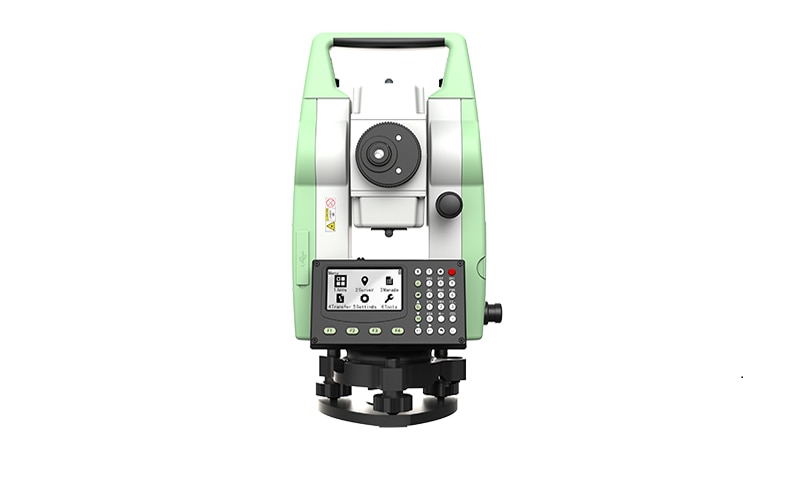
"name": "Leica TS01 Manual Total Stations ",
"description": "Leica TS01: The entry to Leica Geosystems' Total Stations\nLeica TS01 empowers you to carry out measurement tasks with ease and simplicity.\n\nThe Leica TS01 total station empowers you to carry out measurement tasks with ease and simplicity. The TS01 is an entry-level manual total station, created to help you master surveying, layout and mapping projects. It will prove itself in the field and immediately become a valuable member of your team.\n\nBuying a Leica TS01 is a smart decision as it represents a business-smart entry into Leica Geosystems world. You and your surveying crew members will be ready for new projects in no time.\n\nEnjoy the benefits of a 500 m non-prism range and 3,000 m prism range, always combined with accuracy and measurement speed, which increases your productivity. With built-in sensors like an electronic dual axis compensator, a laser plummet, onboard field software and short keys for quick menu access you'll have a fast instrument setup and fast measurements.\n\nWith the Leica TS01 total station you get your all-in-on package as it comes with Leica Geosystems accessories, such as a long-operating battery, a charger and a tribrach tested to reliably fulfil the requirements – when every detail counts.\n\n\nFirst class after sales service and support\n\nLeica Geosystems's highly qualified after-sales service and support network will help you managing any issue to continue work quickly.\nBe it maintenance work, in any of our local service workshops, or getting a question answered from local support, both are part of Leica Geosystems's active customer care.\n\n\nStart-up into business easily\n\n\n\nLeica Geosystems' TS01 will get your trusted partner in managing survey, layout and mapping projects with ease and simplicity.\nPowerful built-in sensors, as well as intuitive field software, empower you to complete tasks without any delay.\n",
"price": 0.0,
"discountamount": 0.0,
"currencycode": "INR",
"priority": 1000000,
"isfreeshipmentavailable": false,
"shipmentduration": 7,
"_keywords": null,
"isarchived": false,
"isavailable": true,
"applicationid": null,
"productindex": 200,
"imageuri": "https://productimages.withfloats.com/actual/60e1a315eef7850001dd7f3e.png",
"tileimageuri": "https://productimages.withfloats.com/tile/60e1a315eef7850001dd7f3e.png",
"images": null,
"totalqueries": 0,
"gpid": null,
"groupproductid": null,
"createdon": "2021-07-04T12:01:23.298Z",
"updatedon": "2021-07-04T12:01:23.298Z",
"buyonlinelink": null,
"producturl": "http://WWW.SURVEYEQUIPMENT.IN/products/leica-ts01-manual-total-stations-/200",
"availableunits": -1.0,
"iscodavailable": false,
"isprepaidonlineavailable": false,
"maxcodorders": 0,
"maxprepaidonlineorders": 0,
"uniquepaymenturl": null,
"brandname": "Leica Geosystems",
"category": "Leica Total Station in India ",
"tags": [
"Leica Total Station in India",
"TOTALSTATIONS",
"Robotic Total Station",
"leicatotalstationsindia",
"robotictotalstationpune",
"robotictotalstations",
"leicatotalstationsindia",
"leicatotalstationoune",
"leicageosystems",
"Geographical Survey",
"GNSS/GPS Survey Equipment - Surveying Equipment fr"
],
"variants": false,
"keyspecification": null,
"otherspecifications": null,
"pickupaddressreferenceid": "",
"paymenttype": "None",
"producttype": "products",
"hsncode": null,
"gstslab": 0.001,
"isnotforsale": false
},
{
"_id": "5e204a5d390cad0001e6d72b",
"fptag": "SBENTERPRISESTRADINGPUNE",
"merchantname": null,
"customwidgets": null,
"externalsourceid": null,
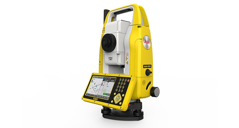
"name": " iCON iCB70 Reflectorless Total Station",
"description": "Leica iCON iCB70 Manual Construction Total Station\nThe Leica iCON iCB70 manual construction total station makes you layout more points per day on your construction project with either prism or reflectorless measurements. Featuring mobile data capability, the iCB70 lets you transfer construction data between the office and the instrument directly, keeping your project progress and plans constantly up to date, assuring that you do not miss any changes in design. Facilitating the move from conventional analogue layout methods to modern digital workflows, the iCB70 helps you to achieve the productivity and accuracies demanded by the building construction industry.\n\nThe iCON iCB70 allows users to:\n\nKeep tight project tolerances by measuring to a prism\nLayout points and lines quickly and accurately, even on complex structures\nPerform verticality checks on formwork and structures\nComplete fast and accurate as-built measurements\nReport volume calculations directly on site\nWork with digital design data including fully rendered models in IFC format\nTransfer construction data directly to and from the instrument\n\n\nEquipped with the construction-tailored and easy-to-use software platform iCON build, the Leica iCON iCB70 manual construction total station guarantees efficient layout and as-built tasks. Forget about paper plans, tapes, plumb-bobs and chalk-line that cause error-prone layout jobs on your construction site. Leica Geosystems’ new manual construction total stations support you in your no-tapes and no-strings approach to construction layout.\n\nThe iCON iCB70 features:\n\niCON build with ‘build plus’ on-board software\n5 inch colour touch screen and full numeric keyboard\nFineFocus telescope to simply aim to a defined target\n1’’, 2’’ and 5’’ angular accuracy\nPrism and reflectorless measurements\nBluetooth and WLAN\nMobile data (GSM / GPRS / UMTS / LTE) as an option\nIP66 rating",
"price": 0.0,
"discountamount": 0.0,
"currencycode": "INR",
"priority": 1000000,
"isfreeshipmentavailable": false,
"shipmentduration": 7,
"_keywords": null,
"isarchived": false,
"isavailable": true,
"applicationid": null,
"productindex": 162,
"imageuri": "https://productimages.withfloats.com/actual/5e204a5f61b40d000185be1d.jpg",
"tileimageuri": "https://productimages.withfloats.com/tile/5e204a5f61b40d000185be1d.jpg",
"images": null,
"totalqueries": 0,
"gpid": null,
"groupproductid": null,
"createdon": "2020-01-16T11:34:53.026Z",
"updatedon": "2020-01-16T11:34:53.026Z",
"buyonlinelink": null,
"producturl": "http://WWW.SURVEYEQUIPMENT.IN//-icon-icb70-reflectorless-total-station/162",
"availableunits": -1.0,
"iscodavailable": false,
"isprepaidonlineavailable": false,
"maxcodorders": 0,
"maxprepaidonlineorders": 0,
"uniquepaymenturl": null,
"brandname": "Leica",
"category": "",
"tags": [
"Leica Total Station in India",
"TOTALSTATIONS",
"robotictotalstationpune",
"Robotic Total Station"
],
"variants": false,
"keyspecification": null,
"otherspecifications": null,
"pickupaddressreferenceid": "",
"paymenttype": "None",
"producttype": "products",
"hsncode": null,
"gstslab": 0.0,
"isnotforsale": false
},
{
"_id": "5c528f7519bf0400016c2058",
"fptag": "SBENTERPRISESTRADINGPUNE",
"merchantname": null,
"customwidgets": null,
"externalsourceid": null,
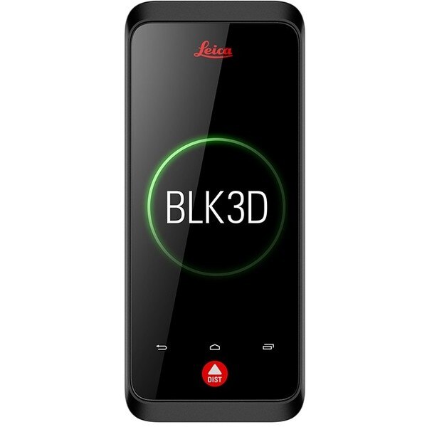
"name": "Leica BLK3D",
"description": "Leica BLK3D\nReal-time, professional grade, in-picture 3D measurement\nThe Leica BLK3D is a real-time, in-picture 3D measurement solution. By combining measurement sensors, software, and on-device edge data processing capabilities, the Leica BLK3D makes in-picture measurements with professional-grade accuracy in real-time possible. Every image captured is a complete and precise 3D measurement record.\n\nIts edge computing capabilities eliminate the need for network connections and cloud services, ensuring professionals can make faster decisions within their daily workflows – whether measuring inaccessible locations, creating floor plans, estimating building installations, documenting construction site progress or creating measurable, as-built documentation.\n\nTake a picture. Measure anything.\nThe BLK3D captures images and places precise measurements at your fingertips. Share images and measurements in multiple formats.\n\nThe art of photogrammetry. Simplified.\nUn-matched combination of a calibrated stereo-camera, advanced algorithms and real-time edge computing fused with leading Electronic Distance Measurement (EDM) technology.\n\nAccess projects. Anywhere, anytime.\nMeasure in your image – on the handheld imager, on the desktop, on-site or in the office.\n\nWorking with digital floorplans.\nCreate floorplans and import existing ones. Add measurable images. Document construction progress with multiple images over time.\n\nNew dimensions for 2D pictures.\nThe BLK3D creates images that contain precise three-dimensional measurements.\n\nProgressive project documentation for AEC.\nCapture critical moments throughout the life of a building.\n\nObject detection and snapping.\nAuto-Snapping uses computer vision technologies to select the right points for your measurements.\n\nStore. Organize. Share.\nStore your measurable images on the device and on desktop. Organize your projects by tagging measurable images with searchable keywords for easy recall and share them in multiple formats.\n\n",
"price": 0.0,
"discountamount": 0.0,
"currencycode": "INR",
"priority": 1000000,
"isfreeshipmentavailable": false,
"shipmentduration": 0,
"_keywords": null,
"isarchived": false,
"isavailable": false,
"applicationid": null,
"productindex": 139,
"imageuri": "https://productimages.withfloats.com/actual/5c5293511e8d150001c19faa.jpg",
"tileimageuri": "https://productimages.withfloats.com/tile/5c5293511e8d150001c19faa.jpg",
"images": null,
"totalqueries": 0,
"gpid": null,
"groupproductid": null,
"createdon": "2019-01-31T06:02:29.05Z",
"updatedon": "2019-01-31T06:18:55.492Z",
"buyonlinelink": null,
"producturl": "http://WWW.SURVEYEQUIPMENT.IN//leica-blk3d/139",
"availableunits": -1.0,
"iscodavailable": true,
"isprepaidonlineavailable": false,
"maxcodorders": 0,
"maxprepaidonlineorders": 0,
"uniquepaymenturl": null,
"brandname": null,
"category": "leicageosystems",
"tags": [
"leicageosystems",
"BLK3D",
"leicadisto",
"BLK360",
"laserdistancemeter",
"leicascanner"
],
"variants": false,
"keyspecification": null,
"otherspecifications": null,
"pickupaddressreferenceid": "5d08ebb3edf0e25c3b8da5d0",
"paymenttype": "AssuredPurchase",
"producttype": "products",
"hsncode": null,
"gstslab": 0.0,
"isnotforsale": false
},
{
"_id": "5bcda7bf2757570001e2fc40",
"fptag": "SBENTERPRISESTRADINGPUNE",
"merchantname": null,
"customwidgets": null,
"externalsourceid": null,
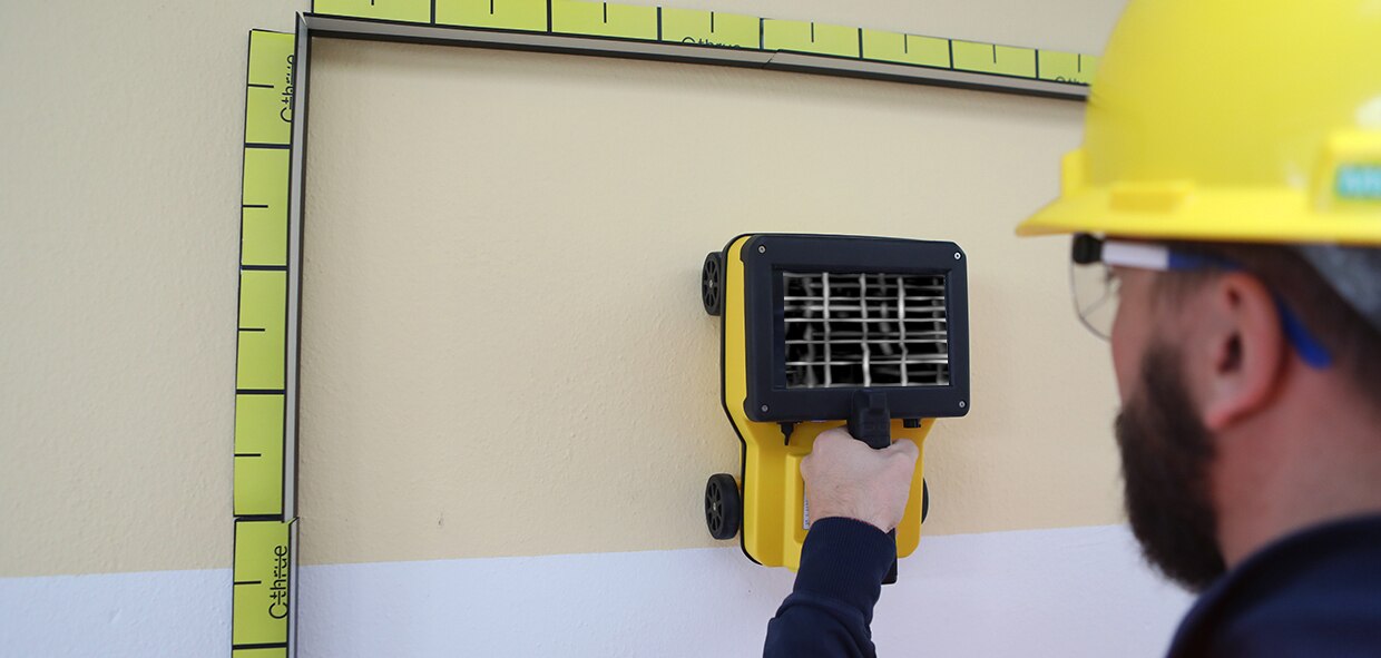
"name": "C-thrue",
"description": "C-thrue\nSee thru concrete structures and reveal true data that lead to optimal decision-making\n\nCONCRETE SCANNING\nPinpoint hidden objects in cured concrete—without expensive specialists.\n\nScanning, analyzing, and interpreting what's beneath concrete has never been faster or easier. The C-thrue, now equipped with an additional sensor are the industry's easiest-to-use tools for self-performing concrete inspections.\n\nC-thrue is an all-in-one Ground Penetrating Radar (GPR) for accurate scanning and real time analysis of concrete structures. Construction and service companies as well as civil and structural engineers can now improve the way they locate rebars, voids, post-tension cables, cavities, conduits, and any other objects buried in the structure before cutting or drilling into the concrete.\n\nC-thrue is an easy-to-use and robust solution to see through concrete structures and reveal true data that lead to optimal decision-making. The solution is suited for all construction sites and operations including building renovation, overpasses, monuments, bridges and tunnels surveys, as well as for detailed analysis of the original engineering project and comparison with the as-built structure.\n\nToday, C-thrue offers more flexibility with no limitations for your analysis requirements, thanks to a compact and light telescopic pole and an external controller that can be easily transported on site in challenging locations or conditions (e.g. under a deck, along vertical walls, etc...). \nThe C-thrue external controller allows easier and faster data interpretation thanks to real-time data processing and representation of results in Augmented Reality for more efficient decision-making.\n\nFeatures and Benefits:\n\nClearer and faster surveys \nDetection of both first and second levels of rebars thanks to the system’s double polarisation.\nSafe drill in the surveyed structure\nRebar/void automatic insight capabilities that improve safety before cutting or drilling into the concrete.\n\nFully-visible, multi-touch display \nData displayed on the screen are never obscured by the handle or the user’s hand.\n\nSimplified data interpretation\nOptimal decision-making supported by visualisation of acquired data in 3D models.\n\nIncreased data accuracy\nEliminate manual, error-prone paper grids with an automatic positioning and navigation system.\n\nAdvanced data visualisation\nAugmented reality for 3D data visualisation and sharing across operators – in real time or intervals after acquisition.\n\nAutomated data acquisition and analysis\nAutomatic detection of the first layer of rebars and result exportation.\n\nFlexibility everywhere\nLightweight, compact, drop resistant and transportable system for every user operations and construction sites.",
"price": 0.0,
"discountamount": 0.0,
"currencycode": "INR",
"priority": 1000000,
"isfreeshipmentavailable": false,
"shipmentduration": 7,
"_keywords": null,
"isarchived": false,
"isavailable": true,
"applicationid": null,
"productindex": 117,
"imageuri": "https://productimages.withfloats.com/actual/5bcda7c0e34dfa000137913c.jpg",
"tileimageuri": "https://productimages.withfloats.com/tile/5bcda7c0e34dfa000137913c.jpg",
"images": null,
"totalqueries": 0,
"gpid": null,
"groupproductid": null,
"createdon": "2018-10-22T10:34:39.836Z",
"updatedon": "2018-11-22T05:55:37.191Z",
"buyonlinelink": null,
"producturl": "http://WWW.SURVEYEQUIPMENT.IN//c-thrue/117",
"availableunits": -1.0,
"iscodavailable": true,
"isprepaidonlineavailable": false,
"maxcodorders": 0,
"maxprepaidonlineorders": 0,
"uniquepaymenturl": null,
"brandname": null,
"category": "gpr",
"tags": [
"gpr",
"ground peantritng radar",
"concretescanner"
],
"variants": false,
"keyspecification": null,
"otherspecifications": null,
"pickupaddressreferenceid": "5d08ebb3edf0e25c3b8da5d0",
"paymenttype": "AssuredPurchase",
"producttype": "products",
"hsncode": null,
"gstslab": 0.0,
"isnotforsale": false
},
{
"_id": "5b91054f2626a60521ac8372",
"fptag": "SBENTERPRISESTRADINGPUNE",
"merchantname": null,
"customwidgets": null,
"externalsourceid": null,
"name": "Leica Zeno Mobile",
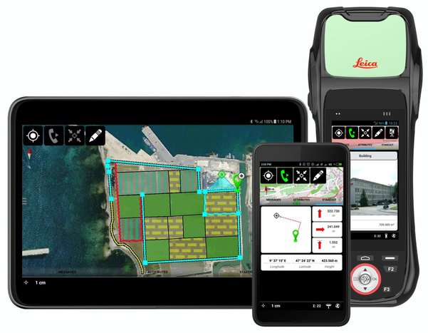
"description": "Leica Zeno Mobile\nIntuitive data capture\n\nLeica Zeno Mobile is an Android™ app available on the Leica Zeno 20 and selected Android smartphones and tablets.\n\n Supports Leica Zeno 20, selected\nsmartphones and tablets with Android\nv5.0 or higher\n Connect to Leica Zeno GNSS devices to\nutilise high accuracy data collection\n Simple and intuitive user interface\nand workflows with minimum training\nrequired\n Different versions of Zeno Mobile\navailable depending on your needs \n\nInteraction with Zeno Mobile is simple and\nintuitive, providing advanced functionality\nwithout the need for extensive training.\n Import and export data to\ncloud service\n Multi-touch support for easy\nmap orientation\n Use OpenStreetMap or your own\nbackground maps instantly via WMS\n Supports wide range of GIS and CAD\ndata formats\n\nZeno Mobile saves you time in the field by\nenabling you to capture more data quicker.\n Data collection projects can be setup\non the fly without the need for other\nsoftware\n Capture inaccessible points using\nGAMtec (Zeno 20 only)\n Capture multiple features at the same\ntime using the multi-collect function\n Connect to cable detection devices\n Stakeout tool for precision location\n Easily import and export data with\nLeica Zeno Office",
"price": 0.0,
"discountamount": 0.0,
"currencycode": "INR",
"priority": 1000000,
"isfreeshipmentavailable": false,
"shipmentduration": 7,
"_keywords": null,
"isarchived": false,
"isavailable": true,
"applicationid": null,
"productindex": 112,
"imageuri": "https://productimages.withfloats.com/actual/5b91054f8b91ff054a4ed0cc.jpg",
"tileimageuri": "https://productimages.withfloats.com/tile/5b91054f8b91ff054a4ed0cc.jpg",
"images": null,
"totalqueries": 0,
"gpid": null,
"groupproductid": null,
"createdon": "2018-09-06T10:45:35.843Z",
"updatedon": "2018-09-06T10:45:35.843Z",
"buyonlinelink": null,
"producturl": "http://WWW.SURVEYEQUIPMENT.IN//leica-zeno-mobile/112",
"availableunits": -1.0,
"iscodavailable": true,
"isprepaidonlineavailable": false,
"maxcodorders": 0,
"maxprepaidonlineorders": 0,
"uniquepaymenturl": null,
"brandname": null,
"category": "DGPS",
"tags": [
"DGPS",
"TOTALSTATIONS",
"GPS"
],
"variants": false,
"keyspecification": null,
"otherspecifications": null,
"pickupaddressreferenceid": "5d08ebb3edf0e25c3b8da5d0",
"paymenttype": "AssuredPurchase",
"producttype": "products",
"hsncode": null,
"gstslab": 0.0,
"isnotforsale": false
},
{
"_id": "5b6b3a9ed682be0552aefde4",
"fptag": "SBENTERPRISESTRADINGPUNE",
"merchantname": null,
"customwidgets": null,
"externalsourceid": null,
"name": "Leica iCON Robot 50",
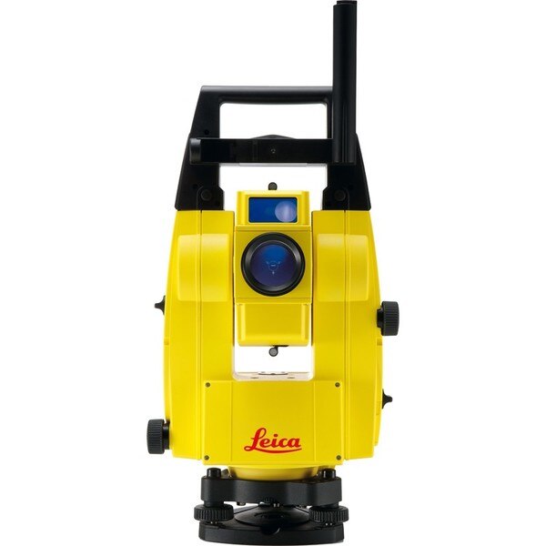
"description": "Leica iCON Robot 50\nThe Leica iCON Robot 50 total station is operable using the field controller (iCON CC50) at the point of positioning using the prism pole, therefore there is no need for an operator at the instrument itself. This technology is extremely efficient and a highly accurate way of working.\n\nThe iCON robot 50 achieves the most precise reflector less measurements in its class. It features a simple one-button keyboard and patented PowerSearch option in order to find the prism quickly. Take advantage of applications through the custom-built software – iCONstruct. It also communicates using Bluetooth (up to 350m), WLAN (150m) and RS232 for different requirements, simply change the instrument handle to upgrade.\n\nWith very tight tolerances the Leica iCON Robot 50 is able to precisely control Graders, Dozers and Pavers automatically as well as set out or survey conventionally with one person. With the use of the most precise and accurate laser pointers the Leica Robot 50 is also able to layout points on ceilings or walls.\n\nFeatures\nExtremely precise reflectorless measurements\nSimple keyboard for easy use\nExcellent tracking\nRobust data communication\nGuide light\nand-over control from the rover\nWide range of apps with bespoke iCONstruct software\nIntegrates with all Leica iCON sensors\n\nLeica iCON robot 50 is designed specifically for ease of use within the construction industry, simply level the instrument and go.\n\nSave time and increase your productivity by doing layout work and as-built checks yourself. With iCON robot 50 you don’t need an operator at the instrument. The robotic total station can be operated from the field controller at the prism pole, at the point you need positioning.\n\nThe iCON robot 50 also delivers with:\n\nMost accurate reflectorless measurements in its class\nOne-button keyboard for simple operation\nFaster prism search by PowerSearch (patented technology)\nSuperior tracking performance ensures minimum machine downtime in machine control operation\nFlexible data communication: WLAN (150m range) or Long-range Bluetooth® (350m). Simply upgrade your communication by swapping the instrument handle\nEasy hand-over control from rover to machine control and vice versa\n \nOne-person robotic \nWith industry leading tracking performance and the patented PowerSearch technology, iCON robot 50 allows you to finish jobs faster maintaining highest accuracy.\n\nInterior overhead with laser pointer \nUsing one of the world’s most accurate laser pointers, remotely lay-out points on walls for drill patterns or on ceilings for air conditioning or other such projects.\n\nMachine control \nWork to the tightest tolerances under any site conditions. Carry out fine grading and paving with highest precision, speeding up your work with construction machinery.\n\nLimitless applications \nWith the iCONstruct software, you can use iCON robot 50 for a wide range of measuring and positioning tasks on site, such as:\n\nLayout\nStake-out\nGrade checking\nVolumes\nAs-built checks\nMachine control\n\n",
"price": 0.0,
"discountamount": 0.0,
"currencycode": "INR",
"priority": 1000000,
"isfreeshipmentavailable": false,
"shipmentduration": 7,
"_keywords": [
"Leica Robot 50",
"use iCON robot 50",
"iCONstruct software",
"iCON robot 50 allows",
"precise reflectorless",
"robotic total station",
"construction industry",
"iCON robot 50 achieves",
"PowerSearch technology",
"accurate laser pointers",
"Leica iCON Robot 50 total station",
"accurate reflectorless measurements",
"performance ensures minimum machine downtime"
],
"isarchived": false,
"isavailable": true,
"applicationid": null,
"productindex": 99,
"imageuri": "https://productimages.withfloats.com/actual/5b486c5af599f80511fd9ca6.jpg",
"tileimageuri": "https://productimages.withfloats.com/tile/5b486c5af599f80511fd9ca6.jpg",
"images": null,
"totalqueries": 0,
"gpid": null,
"groupproductid": null,
"createdon": "2018-07-13T09:09:46.162Z",
"updatedon": "2018-08-08T18:46:54.36Z",
"buyonlinelink": null,
"producturl": "http://WWW.SURVEYEQUIPMENT.IN//leica-icon-robot-50/99",
"availableunits": -1.0,
"iscodavailable": true,
"isprepaidonlineavailable": false,
"maxcodorders": 0,
"maxprepaidonlineorders": 0,
"uniquepaymenturl": null,
"brandname": null,
"category": "leicatotalstations",
"tags": [
"leicatotalstations",
"leicatotalstationsindia",
"robotictotalstations",
"leicatotalstationpune",
"leicaicon"
],
"variants": false,
"keyspecification": null,
"otherspecifications": null,
"pickupaddressreferenceid": "5d08ebb3edf0e25c3b8da5d0",
"paymenttype": "AssuredPurchase",
"producttype": "products",
"hsncode": null,
"gstslab": 0.0,
"isnotforsale": false
},
{
"_id": "5b6b3a9dd682be0552aefcbd",
"fptag": "SBENTERPRISESTRADINGPUNE",
"merchantname": null,
"customwidgets": null,
"externalsourceid": null,
"name": "Leica DX Manager Mapping",
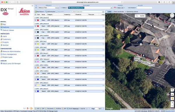
"description": "Leica DX Manager Mapping\nOne central dashboard for all the Leica Geosystems Detection solutions\n\nLeica DX Manager is the only enterprise grade utility mapping solution on the market. A unique cloud-powered solution that delivers unparalleled performance. Manage projects, tasks and spatial data from one central dashboard for all the Leica Geosystems Detection solutions.\n\nUpdate drawings, raw data, location pictures, data layers and mobile forms remotely and in a period of real time operate at an enterprise level rather than having to manually update individual users one at a time. With the Leica DX Manager, you have all dashboards, status updates and project management tools in one platform. Now, project managers can track field operations in real time and make critical decisions with a broader understanding of the current situation.\n\nKey benefits\n\nSimplified processes\nImprovement of data quality and accuracy\nConsistent data collection methods\nIntegration of DS2000, cable locators and asset mapping data\nWorkflows to maintain data integrity\nManage the whole workflow\n\nShare data to all devices and users within your organisation.\n\nAnalyse maps result\nVisualise on online maps\nFilter on users, within date ranges or any attributes\nExport to standard GIS and CAD formats\nShare data to your clients\nAn easy-to-use online portal allows management of all aspects of documenting utility location tasks. The user can switch between street view, satellite imagery and cartographic street maps. Field acquired survey data becomes instantly available and can be accessed by users anytime and anywhere.\n\nUtility detection integration\n\nLeica DX Manager integrates the entire Leica Geosystems Detection portfolio into a simple survey workflow, empowering the user to apply locator depth measurements to GNSS measurements. The result is a seamless fusion of both worlds – with all locator related data reviewable either in Leica DX Manager or any export format.\n\nLocate the utility\nMeasure the depth\nAll location data is sent directly to the Leica DX Field application on the GNSS device\nIt triggers the GNSS measurement on the mapping device\nAll data is integrated into the features metadata\nMaximum user experience and productivity\n\nLeica DX Field mobile app is designed for productivity and maximum user experience and built for enforcing data quality and accuracy. \n\nEasy mapping / surveying of assets\nSmart mobile forms\nImmediate visualisation on map\nMetadata collection\nAutomatic sync with Cloud\nFull offline capabilities\nMake sure your measured data always matches your quality expectations (up to centimetres with RTK) as Leica DX Manager notifications steadily monitor the system parameters. All quality parameters are stored as metadata. Next to the utility mapping aspect, it delivers work orders, time tracking and document management.",
"price": 0.0,
"discountamount": 0.0,
"currencycode": "INR",
"priority": 1000000,
"isfreeshipmentavailable": false,
"shipmentduration": 7,
"_keywords": [
"data quality",
"location data",
"data collection",
"data reviewable",
"survey data becomes",
"DX Field mobile app",
"Leica DX Manager Mapping",
"cartographic street maps",
"Leica DX Field application",
"update individual users one",
"Leica DX Manager notifications",
"apply locator depth measurements",
"enterprise grade utility mapping solution",
"entire Leica Geosystems Detection portfolio"
],
"isarchived": false,
"isavailable": true,
"applicationid": null,
"productindex": 89,
"imageuri": "https://productimages.withfloats.com/actual/5b459fa2f3579911b41e9cda.jpg",
"tileimageuri": "https://productimages.withfloats.com/tile/5b459fa2f3579911b41e9cda.jpg",
"images": null,
"totalqueries": 0,
"gpid": null,
"groupproductid": null,
"createdon": "2018-07-11T06:11:47.283Z",
"updatedon": "2018-08-08T18:46:53.959Z",
"buyonlinelink": null,
"producturl": "http://WWW.SURVEYEQUIPMENT.IN//leica-dx-manager-mapping/89",
"availableunits": -1.0,
"iscodavailable": true,
"isprepaidonlineavailable": false,
"maxcodorders": 0,
"maxprepaidonlineorders": 0,
"uniquepaymenturl": null,
"brandname": null,
"category": "GPR",
"tags": [
"GPR",
"Detection and underground mapping solution",
"Leica DX Manager Mapping"
],
"variants": false,
"keyspecification": null,
"otherspecifications": null,
"pickupaddressreferenceid": "5d08ebb3edf0e25c3b8da5d0",
"paymenttype": "AssuredPurchase",
"producttype": "products",
"hsncode": null,
"gstslab": 0.0,
"isnotforsale": false
},
{
"_id": "5b6b3a9dd682be0552aefc69",
"fptag": "SBENTERPRISESTRADINGPUNE",
"merchantname": null,
"customwidgets": null,
"externalsourceid": null,
"name": "Leica Disto D110 Laser Distance Meter",
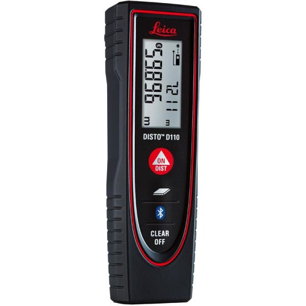
"description": "Leica Disto D110 Laser Distance Meter\nThe New Leica Disto D110 is the smallest Disto with Bluetooth Smart on the market. Create floor plans and sketches very easily by connecting the new Leica D110 with the DISTO Sketch app on a Smartphone or tablet device.\n\nBenefits of the Leica Disto D110:\nNew ergonomic design for easy use\nIncreased functionality with integrated Bluetooth Smart technology and Leica Disto Sketch app\nPerfect for fast indoor distance and area measurements\nPocket clip to help with carrying\nProven Leica quality and precision\nThis is the first laser Disto with Bluetooth technology that’s small and fits in a pocket.\n\nEffortless measurements can be taken whether it’s for a quick material estimation or a home improvement project, the Disto Sketch App provides potential to create floor plans, sketches and document measurements with pictures using a tablet or smartphone.\n\nMeasure precise distances with ±1.5mm accuracy\nMeasure up to 60m distances without moving\nIdeal for the jobsite – Protected against splash water and dust\nDocument results with the Disto Sketch App for faster, easier and safer work. The App is available for free download from Google Play and the App Store for Android and iOS devices.\n\nThe lightest and smallest Disto in the range, its ergonomic design means that it fits in your hand perfectly and is very comfortable to use. The simple to understand button allow intuitive and quick operation. Measuring has never been easier. The removable pocket clip is a valued accessory, simply clip the device to the pocket of your shirt or trousers for convenient use.\n\nTechnical Data\nMeasuring Accuracy: ±1.5mm\nRange: 60m\nMeasuring units: m, ft, in\nIncludes: Power Range Technology, Illuminated Display, Free App\nBatteries: 2x AAA\nProtection Class: IP54 (splash water and dust)\nDimensions: 120x37x23mm\nWeight: 92g\nIncludes:\nLeica DISTO D110 Laser Distance Meter\nPocket Clip\nHolster\n2x AAA Batteries.\n",
"price": 0.0,
"discountamount": 0.0,
"currencycode": "INR",
"priority": 1000000,
"isfreeshipmentavailable": false,
"shipmentduration": 7,
"_keywords": [
"new Leica D110",
"Disto Sketch App",
"first laser Disto",
"Leica Disto Sketch",
"create floor plans",
"New Leica Disto D110",
"Bluetooth technology",
"fast indoor distance",
"removable pocket clip",
"document measurements",
"Power Range Technology",
"home improvement project",
"quick material estimation",
"Bluetooth Smart technology",
"Leica Disto D110 Laser Distance Meter"
],
"isarchived": false,
"isavailable": true,
"applicationid": null,
"productindex": 86,
"imageuri": "https://productimages.withfloats.com/actual/5b3f41a0d3d93d03a4b91a60.jpg",
"tileimageuri": "https://productimages.withfloats.com/tile/5b3f41a0d3d93d03a4b91a60.jpg",
"images": null,
"totalqueries": 0,
"gpid": null,
"groupproductid": null,
"createdon": "2018-07-06T10:17:10.03Z",
"updatedon": "2018-08-08T18:46:53.841Z",
"buyonlinelink": null,
"producturl": "http://WWW.SURVEYEQUIPMENT.IN//leica-disto-d110-laser-distance-meter/86",
"availableunits": -1.0,
"iscodavailable": true,
"isprepaidonlineavailable": false,
"maxcodorders": 0,
"maxprepaidonlineorders": 0,
"uniquepaymenturl": null,
"brandname": null,
"category": "leicadisto",
"tags": [
"leicadisto",
"laserdistancemeter",
"leicageosystems"
],
"variants": false,
"keyspecification": null,
"otherspecifications": null,
"pickupaddressreferenceid": "5d08ebb3edf0e25c3b8da5d0",
"paymenttype": "AssuredPurchase",
"producttype": "products",
"hsncode": null,
"gstslab": 0.0,
"isnotforsale": false
},
{
"_id": "5b6b3a9ed682be0552aefcef",
"fptag": "SBENTERPRISESTRADINGPUNE",
"merchantname": null,
"customwidgets": null,
"externalsourceid": null,
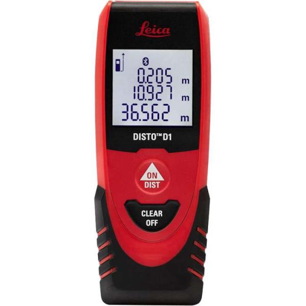
"name": "Leica Disto D1 Laser Distance Meter",
"description": "Leica Disto D1 Laser Distance Meter\nOld fashioned measuring tape versus laser precision? There’s no comparison.\n\nLeica Disto D1\nThe Leica Disto D1 measures distances and heights of up to 40m like a pro and there’s no need of a ladder, a slack steel tape or a tired companion. You’ll get 2 mm accuracy with just one press of a button. It’ll save you time and reduce errors. Difficult or unsafe measuring situations are now in the past. The Leica Disto D1 provides professionals as well as DIY users with a fast, reliable and easy-to-use laser measuring tool. One measurement is enough and the result can be effortlessly read off the clear display.\n\nJust turn on the Bluetooth™ Smart enabled Leica D1 and it can connect with the Disto Sketch app. Create photos or sketches and dimension them with the results, which are transmitted directly to your tablet or smart phone. Plans are automatically completed with circumferences and areas. Disto Sketch integrates measurements into job-site sketches or project images to speed up workflows and finished jobs faster. Error-free information of projects is sent instantly back to the site or office.\n\nEnjoy the convenience of modern simplicity with renowned Leica precision and quality. Compact and lightweight, the D1 is never out of reach.\n\nFeatured with\nBluetooth® Smart for data transfer to smart phones and tablets\nFree App Leica DISTO™ sketch\n40meter range\nXRange Power Technology\nClear, illuminated display\nIP54 splash water and dust protected",
"price": 5607.0,
"discountamount": 0.0,
"currencycode": "INR",
"priority": 1000000,
"isfreeshipmentavailable": false,
"shipmentduration": 7,
"_keywords": [
"Leica D1",
"App Leica",
"2 mm accuracy",
"Create photos",
"circumferences",
"project images",
"Leica precision",
"laser precision",
"One measurement",
"tired companion",
"Disto Sketch app",
"slack steel tape",
"modern simplicity",
"Leica Disto D1 Laser Distance Meter"
],
"isarchived": false,
"isavailable": true,
"applicationid": null,
"productindex": 91,
"imageuri": "https://productimages.withfloats.com/actual/5b3f3770d4575c0f401f7cf2.jpg",
"tileimageuri": "https://productimages.withfloats.com/tile/5b3f3770d4575c0f401f7cf2.jpg",
"images": null,
"totalqueries": 0,
"gpid": null,
"groupproductid": null,
"createdon": "2018-07-06T09:33:30.021Z",
"updatedon": "2018-08-08T18:46:54.01Z",
"buyonlinelink": null,
"producturl": "http://WWW.SURVEYEQUIPMENT.IN//leica-disto-d1-laser-distance-meter/91",
"availableunits": -1.0,
"iscodavailable": true,
"isprepaidonlineavailable": false,
"maxcodorders": 0,
"maxprepaidonlineorders": 0,
"uniquepaymenturl": null,
"brandname": null,
"category": "leasedistancemeter",
"tags": [
"leasedistancemeter",
"leicadistopune",
"leicadisto",
"Leica Disto D1 Laser Distance Meter"
],
"variants": false,
"keyspecification": null,
"otherspecifications": null,
"pickupaddressreferenceid": "5d08ebb3edf0e25c3b8da5d0",
"paymenttype": "AssuredPurchase",
"producttype": "products",
"hsncode": null,
"gstslab": 0.0,
"isnotforsale": false
}
],
"hasmoreitems": false,
"isapirequest": false,
"totalresults": 27,
"query": null,
"floatingpoint": null
}