Currently it only shows your basic business info. Start adding relevant business details such as description, images and products or services to gain your customers attention by using Boost 360
android app
/
iOS App/ web portal.
{
"products": [
{
"_id": "5c839daa0eac470001975d08",
"fptag": "SBENTERPRISESTRADINGPUNE",
"merchantname": null,
"customwidgets": null,
"externalsourceid": null,
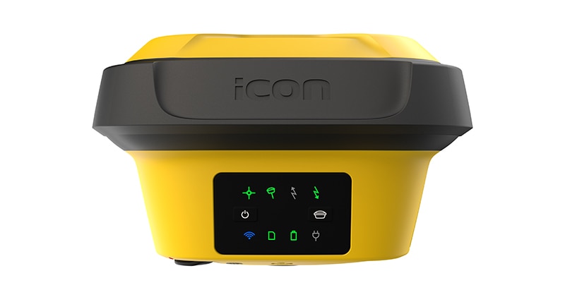
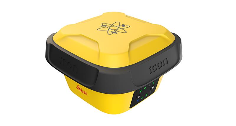
"name": "Leica iCON gps 70 Series",
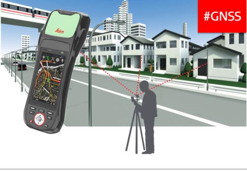
"description": "Leica iCON gps 70 Series\nPermanent tilt compensation and resistance to magnetic interferences – Leica iCON gps 70 T\n\n\nLeica iCON gps 70 Series – Ultimate performance for your construction site\nUltimate GNSS Rover and field solution for maximum efficiency. Speed up – anytime, anywhere. Leica Geosystems introduces the most efficient construction GNSS rovers, the Leica iCON gps 70 Series. Combining the latest GNSS technology and inertial measurement unit (IMU), the Leica iCON gps 70 T is equipped with permanent tilt compensation and as well resistant to any magnetic interferences. Being calibration-free, the iCON gps 70 T is ready when you are – anytime, anywhere. The iCON gps 70 T releases the limitations of working with the pole in vertical positions and increases the productivity compared to conventional methods. Furthermore, the efficiency on a construction site is enhanced by collecting as-built field data and staking out designs faster, while increasing accuracy and reducing errors. Without time-consuming procedures, users measure where it was not possible before with improved quality control. The seamless integration of the Leica iCON gps 70 Series into the Leica iCON field software leads to simple workflows which require less training and avoid costly downtime.\n\n\nDGPS Surveying Instruments\nDGPS Surveying Instruments - Positioning System Retailer from Mumbai\n\nDGPS Surveying Instruments - Positioning System Retailer from Pune\n\nDGPS Surveying Instruments - Positioning System Retailer from India\n\nDGPS Surveying Instruments - Positioning System Retailer from Maharashtra\n\nGPS Survey Equipment\n\nDifferential GPS India\n\nDifferential Global Positioning System (DGPS) from Mumbai\n\nDifferential Global Positioning System (DGPS) from Pune\n\nDifferential Global Positioning System (DGPS) from India\n\nDifferential Global Positioning System (DGPS) from Maharashtra\n\nGNSS/GPS Survey Equipment - Surveying Equipment from Mumbai\n\nGNSS/GPS Survey Equipment - Surveying Equipment from Pune\n\nGNSS/GPS Survey Equipment - Surveying Equipment from India\n\nGNSS/GPS Survey Equipment - Surveying Equipment from Maharashtra\n\nConstruction Surveying Equipment, Surveying Instruments in India\n\n \n\n",
"price": 0.0,
"discountamount": 0.0,
"currencycode": "INR",
"priority": 1000000,
"isfreeshipmentavailable": false,
"shipmentduration": 7,
"_keywords": [
"Survey Equipment",
"Leica iCON gps 70 T",
"Surveying Equipment",
"Surveying Instruments",
"iCON gps 70 T releases",
"Leica iCON gps 70 Series",
"Global Positioning System",
"Leica iCON field software",
"inertial measurement unit",
"Positioning System Retailer",
"permanent tilt compensation",
"efficient construction GNSS rovers"
],
"isarchived": false,
"isavailable": true,
"applicationid": null,
"productindex": 141,
"imageuri": "https://productimages.withfloats.com/actual/5c839dabdc44740001742988.jpg",
"tileimageuri": "https://productimages.withfloats.com/tile/5c839dabdc44740001742988.jpg",
"images": null,
"totalqueries": 0,
"gpid": null,
"groupproductid": null,
"createdon": "2019-03-09T11:04:10.316Z",
"updatedon": "2019-03-09T11:04:10.316Z",
"buyonlinelink": null,
"producturl": "http://WWW.SURVEYEQUIPMENT.IN/products/leica-icon-gps-70-series/141",
"availableunits": -1.0,
"iscodavailable": true,
"isprepaidonlineavailable": false,
"maxcodorders": 0,
"maxprepaidonlineorders": 0,
"uniquepaymenturl": null,
"brandname": null,
"category": "DGPS Surveying Instruments",
"tags": [
"DGPS Surveying Instruments",
"Differential GPS India",
"DGPS Surveying Instruments - Positioning System Re",
"GNSS/GPS Survey Equipment - Surveying Equipment fr"
],
"variants": false,
"keyspecification": null,
"otherspecifications": null,
"pickupaddressreferenceid": "5d08ebb3edf0e25c3b8da5d0",
"paymenttype": "AssuredPurchase",
"producttype": "products",
"hsncode": null,
"gstslab": 0.0,
"isnotforsale": false
},
{
"_id": "5c528f7519bf0400016c2058",
"fptag": "SBENTERPRISESTRADINGPUNE",
"merchantname": null,
"customwidgets": null,
"externalsourceid": null,
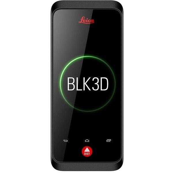
"name": "Leica BLK3D",
"description": "Leica BLK3D\nReal-time, professional grade, in-picture 3D measurement\nThe Leica BLK3D is a real-time, in-picture 3D measurement solution. By combining measurement sensors, software, and on-device edge data processing capabilities, the Leica BLK3D makes in-picture measurements with professional-grade accuracy in real-time possible. Every image captured is a complete and precise 3D measurement record.\n\nIts edge computing capabilities eliminate the need for network connections and cloud services, ensuring professionals can make faster decisions within their daily workflows – whether measuring inaccessible locations, creating floor plans, estimating building installations, documenting construction site progress or creating measurable, as-built documentation.\n\nTake a picture. Measure anything.\nThe BLK3D captures images and places precise measurements at your fingertips. Share images and measurements in multiple formats.\n\nThe art of photogrammetry. Simplified.\nUn-matched combination of a calibrated stereo-camera, advanced algorithms and real-time edge computing fused with leading Electronic Distance Measurement (EDM) technology.\n\nAccess projects. Anywhere, anytime.\nMeasure in your image – on the handheld imager, on the desktop, on-site or in the office.\n\nWorking with digital floorplans.\nCreate floorplans and import existing ones. Add measurable images. Document construction progress with multiple images over time.\n\nNew dimensions for 2D pictures.\nThe BLK3D creates images that contain precise three-dimensional measurements.\n\nProgressive project documentation for AEC.\nCapture critical moments throughout the life of a building.\n\nObject detection and snapping.\nAuto-Snapping uses computer vision technologies to select the right points for your measurements.\n\nStore. Organize. Share.\nStore your measurable images on the device and on desktop. Organize your projects by tagging measurable images with searchable keywords for easy recall and share them in multiple formats.\n\n",
"price": 0.0,
"discountamount": 0.0,
"currencycode": "INR",
"priority": 1000000,
"isfreeshipmentavailable": false,
"shipmentduration": 0,
"_keywords": null,
"isarchived": false,
"isavailable": false,
"applicationid": null,
"productindex": 139,
"imageuri": "https://productimages.withfloats.com/actual/5c5293511e8d150001c19faa.jpg",
"tileimageuri": "https://productimages.withfloats.com/tile/5c5293511e8d150001c19faa.jpg",
"images": null,
"totalqueries": 0,
"gpid": null,
"groupproductid": null,
"createdon": "2019-01-31T06:02:29.05Z",
"updatedon": "2019-01-31T06:18:55.492Z",
"buyonlinelink": null,
"producturl": "http://WWW.SURVEYEQUIPMENT.IN/products/leica-blk3d/139",
"availableunits": -1.0,
"iscodavailable": true,
"isprepaidonlineavailable": false,
"maxcodorders": 0,
"maxprepaidonlineorders": 0,
"uniquepaymenturl": null,
"brandname": null,
"category": "leicageosystems",
"tags": [
"leicageosystems",
"BLK3D",
"leicadisto",
"BLK360",
"laserdistancemeter",
"leicascanner"
],
"variants": false,
"keyspecification": null,
"otherspecifications": null,
"pickupaddressreferenceid": "5d08ebb3edf0e25c3b8da5d0",
"paymenttype": "AssuredPurchase",
"producttype": "products",
"hsncode": null,
"gstslab": 0.0,
"isnotforsale": false
},
{
"_id": "5b6b3a9cd682be0552aefa7b",
"fptag": "SBENTERPRISESTRADINGPUNE",
"merchantname": null,
"customwidgets": null,
"externalsourceid": null,
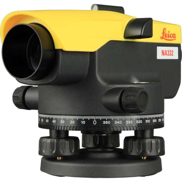
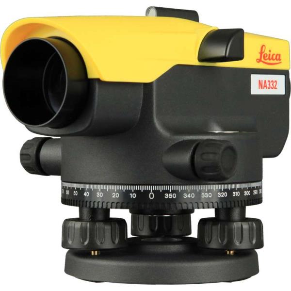
"name": "Leica NA332 Automatic Level",
"description": "Leica NA332 Automatic Level\nAutomatic levels for daily levelling tasks.\nUnique. Accurate. Simple.\n\nProfessionals face many obstructions on site. Whatever the levelling challenge, Leica NA300 Series levels overcome. Rely on the known expertise of Leica Geosystems for the best quality and performance. On your terms, on your site, Leica Geosystems and the Leica NA300 Series are your trusted partners for accurate measurements every time.\n\nUNIQUE\nWhether you´re facing basic demands or you need more support, the unique design of the Leica NA300 Series of automatic (optical) levels can meet you wherever you are in the building and construction field. With a better protected shape, these rugged levels offer increased ergonomic handling while ensuring you receive the highest quality results at the best price value.\n\nACCURATE\nLeica NA300 Series levels have been engineered for daily levelling tasks. Whatever the need, these levels measure with the highest precision and accuracy. These automatic (optical) levels provide the highest in both while being ergonomic in their handling and rugged for daily use in the harshest conditions.\n\nSIMPLE\nA perfectly designed mirror makes it extremely easy to adjust the horizontal level with the highest possible accuracy and confidence. The Leica NA300 Series levels - along with all our automatic (optical) levels - are made for everyday use for any site.\n\nKey Benefits:\nQuick and easy measurements\nUnique design and highest quality of results for levelling needs\nManufactured for the most rugged sites and the harshest conditions\nUnbeaten service offering\nPrice Includes:\nNA332 automatic Level\nCarrying Case\nUser Manual",
"price": 0.0,
"discountamount": 0.0,
"currencycode": "INR",
"priority": 1000000,
"isfreeshipmentavailable": false,
"shipmentduration": 7,
"_keywords": [
"rugged levels",
"quality results",
"Leica Geosystems",
"possible accuracy",
"many obstructions",
"ergonomic handling",
"construction field",
"levelling challenge",
"accurate measurements",
"daily levelling tasks",
"Leica NA300 Series levels",
"Leica NA332 Automatic Level"
],
"isarchived": false,
"isavailable": true,
"applicationid": null,
"productindex": 60,
"imageuri": "https://productimages.withfloats.com/actual/5afbefb2b636c40afc5d2cfc.jpg",
"tileimageuri": "https://productimages.withfloats.com/tile/5afbefb2b636c40afc5d2cfc.jpg",
"images": null,
"totalqueries": 0,
"gpid": null,
"groupproductid": null,
"createdon": "2018-05-16T08:45:40.793Z",
"updatedon": "2018-08-08T18:46:52.107Z",
"buyonlinelink": null,
"producturl": "http://WWW.SURVEYEQUIPMENT.IN/products/leica-na332-automatic-level/60",
"availableunits": -1.0,
"iscodavailable": true,
"isprepaidonlineavailable": false,
"maxcodorders": 0,
"maxprepaidonlineorders": 0,
"uniquepaymenturl": null,
"brandname": null,
"category": null,
"tags": null,
"variants": false,
"keyspecification": null,
"otherspecifications": null,
"pickupaddressreferenceid": "5d08ebb3edf0e25c3b8da5d0",
"paymenttype": "AssuredPurchase",
"producttype": "products",
"hsncode": null,
"gstslab": 0.0,
"isnotforsale": false
},
{
"_id": "5b6b3a9cd682be0552aefa56",
"fptag": "SBENTERPRISESTRADINGPUNE",
"merchantname": null,
"customwidgets": null,
"externalsourceid": null,
"name": "Leica NA324 Automatic Level",
"description": "Leica NA324 Automatic Level\nAutomatic levels for daily levelling tasks.\nUnique. Accurate. Simple.\n\nProfessionals face many obstructions on site. Whatever the levelling challenge, Leica NA300 Series levels overcome. Rely on the known expertise of Leica Geosystems for the best quality and perfor-mance. On your terms, on your site, Leica Geosystems and the Leica NA300 Series are your trusted partners for accurate measurements every time.\n\nUNIQUE\nWhether you´re facing basic demands or you need more support, the unique design of the Leica NA300 Series of automatic (optical) levels can meet you wherever you are in the building and construction field. With a better protected shape, these rugged levels offer increased ergonomic handling while ensuring you receive the highest quality results at the best price value.\n\nACCURATE\nLeica NA300 Series levels have been engineered for daily levelling tasks. Whatever the need, these levels measure with the highest precision and accuracy. These automatic (optical) levels provide the highest in both while being ergonomic in their handling and rugged for daily use in the harshest conditions.\n\nSIMPLE\nA perfectly designed mirror makes it extremely easy to adjust the horizontal level with the highest possible accuracy and confidence. The Leica NA300 Series levels - along with all our automatic (optical) levels - are made for everyday use for any site.\n\nKey Benefits:\nQuick and easy measurements\nUnique design and highest quality of results for levelling needs\nManufactured for the most rugged sites and the harshest conditions\nUnbeaten service offering\nPrice Includes:\nNA324 automatic Level\nCarrying Case\nUser Manual",
"price": 0.0,
"discountamount": 0.0,
"currencycode": "INR",
"priority": 1000000,
"isfreeshipmentavailable": false,
"shipmentduration": 7,
"_keywords": [
"rugged levels",
"quality results",
"Leica Geosystems",
"possible accuracy",
"many obstructions",
"ergonomic handling",
"construction field",
"levelling challenge",
"accurate measurements",
"daily levelling tasks",
"Leica NA300 Series levels",
"Leica NA324 Automatic Level"
],
"isarchived": false,
"isavailable": true,
"applicationid": null,
"productindex": 58,
"imageuri": "https://productimages.withfloats.com/actual/5afbed36e03a4c0b54daa60f.jpg",
"tileimageuri": "https://productimages.withfloats.com/tile/5afbed36e03a4c0b54daa60f.jpg",
"images": null,
"totalqueries": 0,
"gpid": null,
"groupproductid": null,
"createdon": "2018-05-16T08:35:05.169Z",
"updatedon": "2018-08-08T18:46:52.035Z",
"buyonlinelink": null,
"producturl": "http://WWW.SURVEYEQUIPMENT.IN//leica-na324-automatic-level/58",
"availableunits": -1.0,
"iscodavailable": true,
"isprepaidonlineavailable": false,
"maxcodorders": 0,
"maxprepaidonlineorders": 0,
"uniquepaymenturl": null,
"brandname": null,
"category": null,
"tags": null,
"variants": false,
"keyspecification": null,
"otherspecifications": null,
"pickupaddressreferenceid": "5d08ebb3edf0e25c3b8da5d0",
"paymenttype": "AssuredPurchase",
"producttype": "products",
"hsncode": null,
"gstslab": 0.0,
"isnotforsale": false
},
{
"_id": "5b6b3a9cd682be0552aefa68",
"fptag": "SBENTERPRISESTRADINGPUNE",
"merchantname": null,
"customwidgets": null,
"externalsourceid": null,
"name": "Leica NA320 Automatic Level",
"description": "Leica NA320 Automatic Level\nAutomatic levels for daily levelling tasks.\nUnique. Accurate. Simple.\n\nProfessionals face many obstructions on site. Whatever the levelling challenge, Leica NA300 Series levels overcome. Rely on the known expertise of Leica Geosystems for the best quality and performance. On your terms, on your site, Leica Geosystems and the Leica NA300 Series are your trusted partners for accurate measurements every time.\n\nUNIQUE\nWhether you´re facing basic demands or you need more support, the unique design of the Leica NA300 Series of automatic (optical) levels can meet you wherever you are in the building and construction field. With a better protected shape, these rugged levels offer increased ergonomic handling while ensuring you receive the highest quality results at the best price value.\n\nACCURATE\nLeica NA300 Series levels have been engineered for daily levelling tasks. Whatever the need, these levels measure with the highest precision and accuracy. These automatic (optical) levels provide the highest in both while being ergonomic in their handling and rugged for daily use in the harshest conditions.\n\nSIMPLE\nA perfectly designed mirror makes it extremely easy to adjust the horizontal level with the highest possible accuracy and confidence. The Leica NA300 Series levels - along with all our automatic (optical) levels - are made for everyday use for any site.\n\nKey Benefits:\nQuick and easy measurements\nUnique design and highest quality of results for levelling needs\nManufactured for the most rugged sites and the harshest conditions\nUnbeaten service offering\nPrice Includes:\nNA320 automatic Level\nCarrying Case\nUser Manual",
"price": 0.0,
"discountamount": 0.0,
"currencycode": "INR",
"priority": 1000000,
"isfreeshipmentavailable": false,
"shipmentduration": 7,
"_keywords": [
"rugged levels",
"quality results",
"Leica Geosystems",
"horizontal level",
"possible accuracy",
"many obstructions",
"ergonomic handling",
"construction field",
"levelling challenge",
"accurate measurements",
"daily levelling tasks",
"Leica NA300 Series levels",
"Leica NA320 Automatic Level"
],
"isarchived": false,
"isavailable": true,
"applicationid": null,
"productindex": 59,
"imageuri": "https://productimages.withfloats.com/actual/5afbec53b636c40afc5d2ac2.jpg",
"tileimageuri": "https://productimages.withfloats.com/tile/5afbec53b636c40afc5d2ac2.jpg",
"images": null,
"totalqueries": 0,
"gpid": null,
"groupproductid": null,
"createdon": "2018-05-16T08:31:18.021Z",
"updatedon": "2018-08-08T18:46:52.069Z",
"buyonlinelink": null,
"producturl": "http://WWW.SURVEYEQUIPMENT.IN/products/leica-na320-automatic-level/59",
"availableunits": -1.0,
"iscodavailable": true,
"isprepaidonlineavailable": false,
"maxcodorders": 0,
"maxprepaidonlineorders": 0,
"uniquepaymenturl": null,
"brandname": null,
"category": null,
"tags": null,
"variants": false,
"keyspecification": null,
"otherspecifications": null,
"pickupaddressreferenceid": "5d08ebb3edf0e25c3b8da5d0",
"paymenttype": "AssuredPurchase",
"producttype": "products",
"hsncode": null,
"gstslab": 0.0,
"isnotforsale": false
},
{
"_id": "5b6b3a9bd682be0552aef96c",
"fptag": "SBENTERPRISESTRADINGPUNE",
"merchantname": null,
"customwidgets": null,
"externalsourceid": null,
"name": "Leica iCON gps 70",
"description": "Leica iCON gps 70 Series\nPermanent tilt compensation and resistance to magnetic interferences – Leica iCON gps 70 T\n\nLeica iCON gps 70 Series – Ultimate performance for your construction site\nUltimate GNSS Rover and field solution for maximum efficiency. Speed up – anytime, anywhere. Leica Geosystems introduces the most efficient construction GNSS rovers, the Leica iCON gps 70 Series. Combining the latest GNSS technology and inertial measurement unit (IMU), the Leica iCON gps 70 T is equipped with permanent tilt compensation and as well resistant to any magnetic interferences. Being calibration-free, the iCON gps 70 T is ready when you are – anytime, anywhere. The iCON gps 70 T releases the limitations of working with the pole in vertical positions and increases the productivity compared to conventional methods. Furthermore, the efficiency on a construction site is enhanced by collecting as-built field data and staking out designs faster, while increasing accuracy and reducing errors. Without time-consuming procedures, users measure where it was not possible before with improved quality control. The seamless integration of the Leica iCON gps 70 Series into the Leica iCON field software leads to simple workflows which require less training and avoid costly downtime.\n\nTilt – Traceability – Trust\n\nWith the Leica iCON gps 70 T there is no need to hold the pole vertical and level the bubble when measuring. Reliable traceability by storing tilt values with each measurement improves the quality control of any measured point. The permanent tilt compensation extends the measurement possibilities on any construction site and improves quality and accuracy of the collected data.\n\niCON field solution – unmatched simplicity\n\nLeica iCON field offers a smart and customised positioning solution for all construction sites. Construction-tailored, intelligent software applications, workflows and an innovative software design result in improved performance. Seamlessly integrating into all iCON sensors and Leica ConX, Leica Geosystems provides all the tools to increase the efficiency of your field operations. The iCON gps 70 Series follows this concept and perfectly complements the existing iCON field solution.",
"price": 0.0,
"discountamount": 0.0,
"currencycode": "INR",
"priority": 1000000,
"isfreeshipmentavailable": false,
"shipmentduration": 7,
"_keywords": [
"Leica Geosystems",
"iCON field offers",
"Leica iCON gps 70 T",
"iCON field solution",
"iCON gps 70 T releases",
"Leica iCON gps 70 Series",
"Leica iCON field software",
"inertial measurement unit",
"measurement possibilities",
"permanent tilt compensation",
"innovative software design result",
"intelligent software applications",
"efficient construction GNSS rovers"
],
"isarchived": false,
"isavailable": true,
"applicationid": null,
"productindex": 44,
"imageuri": "https://productimages.withfloats.com/actual/5af4387e85c6af0e4085d331.jpg",
"tileimageuri": "https://productimages.withfloats.com/tile/5af4387e85c6af0e4085d331.jpg",
"images": null,
"totalqueries": 0,
"gpid": null,
"groupproductid": null,
"createdon": "2018-05-10T12:18:12.482Z",
"updatedon": "2018-08-08T18:46:51.438Z",
"buyonlinelink": null,
"producturl": "http://WWW.SURVEYEQUIPMENT.IN/products/leica-icon-gps-70/44",
"availableunits": -1.0,
"iscodavailable": true,
"isprepaidonlineavailable": false,
"maxcodorders": 0,
"maxprepaidonlineorders": 0,
"uniquepaymenturl": null,
"brandname": null,
"category": null,
"tags": null,
"variants": false,
"keyspecification": null,
"otherspecifications": null,
"pickupaddressreferenceid": "5d08ebb3edf0e25c3b8da5d0",
"paymenttype": "AssuredPurchase",
"producttype": "products",
"hsncode": null,
"gstslab": 0.0,
"isnotforsale": false
},
{
"_id": "5b6b3a99d682be0552aef73f",
"fptag": "SBENTERPRISESTRADINGPUNE",
"merchantname": null,
"customwidgets": null,
"externalsourceid": null,
"name": "Leica NA 720 Automatic Level",
"description": "he Leica NA720, The automatic level for all construction site applications with 20x telescopic magnification.\nNothing stops the robust Leica NA720 level. A short drop onto the ground, a fall into water, vibration from heavy machinery – with a Leica NA720 level you just carry on working. No time-consuming checking or readjustment required. And, the \"best in class\" Leica optics enable you to always work as precisely as possible, even in twilight. What does this add up to? Reduced work downtime, thus translate into higher productivity, resulting in reliability and accuracy at an extremely reasonable price. Leica NA720 Level - The automatic level for all applications on the construction site. 20x telescopic magnification.",
"price": 0.0,
"discountamount": 0.0,
"currencycode": "INR",
"priority": 1000000,
"isfreeshipmentavailable": false,
"shipmentduration": 7,
"_keywords": [
"readjustment",
"heavy machinery",
"reasonable price",
"Leica optics enable",
"Reduced work downtime",
"robust Leica NA720 level",
"Leica NA 720 Automatic Level",
"20x telescopic magnification",
"construction site applications"
],
"isarchived": false,
"isavailable": true,
"applicationid": null,
"productindex": 15,
"imageuri": "https://productimages.withfloats.com/actual/5aeed3f3449b020e58d96967.jpg",
"tileimageuri": "https://productimages.withfloats.com/tile/5aeed3f3449b020e58d96967.jpg",
"images": null,
"totalqueries": 0,
"gpid": null,
"groupproductid": null,
"createdon": "2018-05-06T10:07:49.466Z",
"updatedon": "2018-08-08T18:46:49.969Z",
"buyonlinelink": null,
"producturl": "http://WWW.SURVEYEQUIPMENT.IN/products/leica-na-720-automatic-level/15",
"availableunits": -1.0,
"iscodavailable": true,
"isprepaidonlineavailable": false,
"maxcodorders": 0,
"maxprepaidonlineorders": 0,
"uniquepaymenturl": null,
"brandname": null,
"category": null,
"tags": null,
"variants": false,
"keyspecification": null,
"otherspecifications": null,
"pickupaddressreferenceid": "5d08ebb3edf0e25c3b8da5d0",
"paymenttype": "AssuredPurchase",
"producttype": "products",
"hsncode": null,
"gstslab": 0.0,
"isnotforsale": false
},
{
"_id": "5b6b3a99d682be0552aef6ed",
"fptag": "SBENTERPRISESTRADINGPUNE",
"merchantname": null,
"customwidgets": null,
"externalsourceid": null,
"name": "Leica Zeno GG04 plus Smart Antenna",
"description": "Leica Zeno GG04 plus Smart Antenna for high accuracy everywhere\nUse your own device and get high accuracy everywhere\n\nCollecting high-accuracy geospatial data on your smartphone or tablet has never been easier.\n\nPair with all existing Leica Zeno handhelds and a wide range of Android, Apple or Windows® smart devices, to bring cutting-edge GNSS technology and industry-leading 555 channel tracking power to your hands.\n\nThe rugged, flexible and easy-to-use smart antenna utilises RTK technology and can now apply Precise Point Positioning (PPP). This makes high-accuracy data collection possible in real-time even in the most demanding of locations without the need for a mobile data connection.\n\nWith its compact, lightweight design and IP68 durability, you can work longer in all conditions - the world of high accuracy mapping comes to life at your fingertips.\n\nSmart device independence\n\nUse your existing smartphone or tablet\nAvailable for Android, Apple and Windows®\nBluetooth® connection ensures cable free operation\nEnhanced tracking performance\n\n555 channels support an increased number of satellites\nState-of-the-art GNSS technology\nReady for future GNSS developments\nPrecise point positioning (PPP)\n\nAchieve high accuracy data collection without a mobile data connection\nAvailable anywhere in the world, anytime\nRemoves reliance on post processing\nExtensive software support\n\nUse with your favourite data collection apps and software\nNo development efforts required\nProvides NMEA messages output on different Bluetooth® ports to allow reviewing and storing of GNSS metadata information\nBuilt to last\n\nIP68 protection ensures water and dustproofing\nContinuous performance in all environments\nAll day battery life\nLeica Geosystems compatible software\n\nZeno Mobile\nZeno Field, Zeno Connect\nZeno Office\nMobileMatriX",
"price": 0.0,
"discountamount": 0.0,
"currencycode": "INR",
"priority": 1000000,
"isfreeshipmentavailable": false,
"shipmentduration": 7,
"_keywords": [
"Leica Zeno GG04",
"GNSS technology",
"geospatial data",
"channels support",
"lightweight design",
"development efforts",
"Leica Zeno handhelds",
"NMEA messages output",
"high accuracy mapping",
"Geosystems compatible",
"data collection possible",
"Precise Point Positioning",
"high accuracy data collection",
"favourite data collection apps",
"smart antenna utilises RTK technology"
],
"isarchived": false,
"isavailable": true,
"applicationid": null,
"productindex": 11,
"imageuri": "https://productimages.withfloats.com/actual/5ae6f1a2b303650b7cd1693f.jpg",
"tileimageuri": "https://productimages.withfloats.com/tile/5ae6f1a2b303650b7cd1693f.jpg",
"images": null,
"totalqueries": 0,
"gpid": null,
"groupproductid": null,
"createdon": "2018-04-30T10:36:19.854Z",
"updatedon": "2018-08-08T18:46:49.78Z",
"buyonlinelink": null,
"producturl": "http://WWW.SURVEYEQUIPMENT.IN//leica-zeno-gg04-plus-smart-antenna/11",
"availableunits": -1.0,
"iscodavailable": true,
"isprepaidonlineavailable": false,
"maxcodorders": 0,
"maxprepaidonlineorders": 0,
"uniquepaymenturl": null,
"brandname": null,
"category": null,
"tags": null,
"variants": false,
"keyspecification": null,
"otherspecifications": null,
"pickupaddressreferenceid": "5d08ebb3edf0e25c3b8da5d0",
"paymenttype": "AssuredPurchase",
"producttype": "products",
"hsncode": null,
"gstslab": 0.0,
"isnotforsale": false
},
{
"_id": "5b6b3a99d682be0552aef672",
"fptag": "SBENTERPRISESTRADINGPUNE",
"merchantname": null,
"customwidgets": null,
"externalsourceid": null,
"name": "Leica Zeno 20 GIS Collector",
"description": "Leica Zeno 20 GIS Collector\nSimple, accurate and rugged asset management\n\n\nThe Leica Zeno 20 simplifies daily data capture for GIS field personnel. Leverage the strength of cutting-edge technology in one remarkably compact device.\n\nSo simplistic it will become your indispensable tool.\nSo accurate you will always be sure.\nSo productive it will change your workday.\nMade rugged to withstand the elements of any work site, the Leica Zeno comes with a durable IP67 dust and waterproof rating. Work from anywhere when you download the Android app that streams RTK-corrected GNSS positons.\n\nSolve daily GIS challenges with new technologies\nThe No. 1 challenge facing GIS field personnel is GNSS-denied environments. Collecting reliable and accurate positioning data is near impossible in these areas. This struggle is eliminated with new innovative technologies by Leica Geosystems inside the Leica Zeno 20 GIS collector:\n\nApogeetec\nEven in closed or covered areas, such as dense forests, an internal antenna enables collecting accurate position data. With maximum performance, collect more, collect simpler.\nGamtec\nBe more productive, increase safety and save time when the Leica Zeno 20 GIS collector is combined with the Leica DISTO S910 laser distance metre. End the struggle to access hard-to-reach and dangerous points when you simply aim and instantly collect from anywhere, anytime.\nMore accuracy, greater time savings, increased productivity – achieve all this with the Leica Zeno 20 GIS collector’s better satellite acquisition with stronger signals and contactless offset measuring . This GIS solution is truly comprehensive and second to none.\n\nLeica Geosystems, Esri improve GIS with ZenoCollector\nThe leader in measurement technology has joined with the leader in GIS technology to bring you an all-new integrated solution in mobile data capturing. The rugged Leica Zeno 20 combines with the powerful Collector for ArcGISto create the ZenoCollector. With Collector for ArcGIS as its main user interface and bundled with an ArcGIS Online organisational subscription for one year, the ZenoCollector:\n\nSaves time automatically synching field changes to enterprise information\nIncreases productivity opening access to all for the latest data from the field\nImproves accuracy with professional-grade GNSS coordination\n ",
"price": 0.0,
"discountamount": 0.0,
"currencycode": "INR",
"priority": 1000000,
"isfreeshipmentavailable": false,
"shipmentduration": 7,
"_keywords": [
"GIS solution",
"GIS technology",
"Leica Geosystems",
"GIS field personnel",
"Leica Zeno 20 combines",
"accurate position data",
"measurement technology",
"one remarkably compact",
"internal antenna enables",
"accurate positioning data",
"Leica Zeno 20 GIS Collector",
"new innovative technologies",
"Leica DISTO S910 laser distance metre",
"ArcGIS Online organisational subscription",
"Leica Zeno 20 simplifies daily data capture"
],
"isarchived": false,
"isavailable": true,
"applicationid": null,
"productindex": 5,
"imageuri": "https://productimages.withfloats.com/actual/5ae6ee849c08ba0c2c2af762.jpg",
"tileimageuri": "https://productimages.withfloats.com/tile/5ae6ee849c08ba0c2c2af762.jpg",
"images": null,
"totalqueries": 0,
"gpid": null,
"groupproductid": null,
"createdon": "2018-04-30T10:22:58.832Z",
"updatedon": "2018-08-08T18:46:49.527Z",
"buyonlinelink": null,
"producturl": "http://WWW.SURVEYEQUIPMENT.IN/products/leica-zeno-20-gis-collector/5",
"availableunits": -1.0,
"iscodavailable": true,
"isprepaidonlineavailable": false,
"maxcodorders": 0,
"maxprepaidonlineorders": 0,
"uniquepaymenturl": null,
"brandname": null,
"category": null,
"tags": null,
"variants": false,
"keyspecification": null,
"otherspecifications": null,
"pickupaddressreferenceid": "5d08ebb3edf0e25c3b8da5d0",
"paymenttype": "AssuredPurchase",
"producttype": "products",
"hsncode": null,
"gstslab": 0.0,
"isnotforsale": false
}
],
"hasmoreitems": false,
"isapirequest": false,
"totalresults": 27,
"query": null,
"floatingpoint": null
}