Preview

This is your website preview.

Currently it only shows your basic business info. Start adding relevant business details such as description, images and products or services to gain your customers attention by using Boost 360 android app / iOS App / web portal.

SBENTERPRISESTRADINGPUNE 5abfbf1e7c88bb04a4d0fcc7 Products https://www.surveyequipment.in
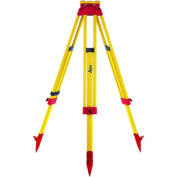
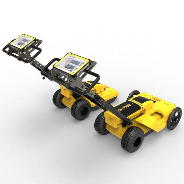
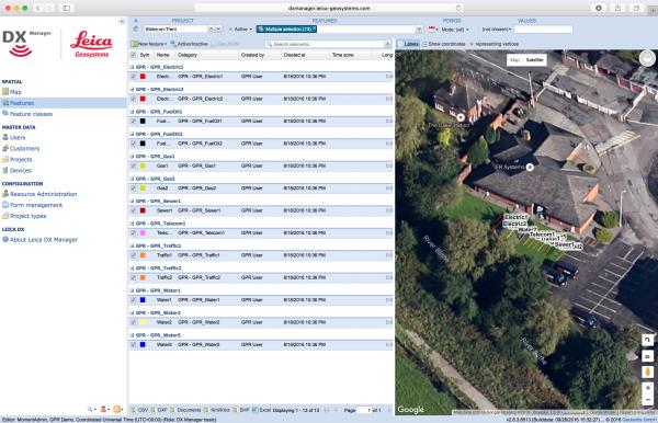
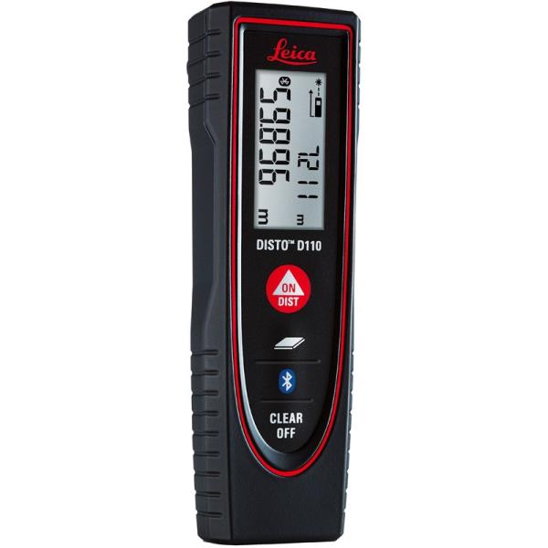
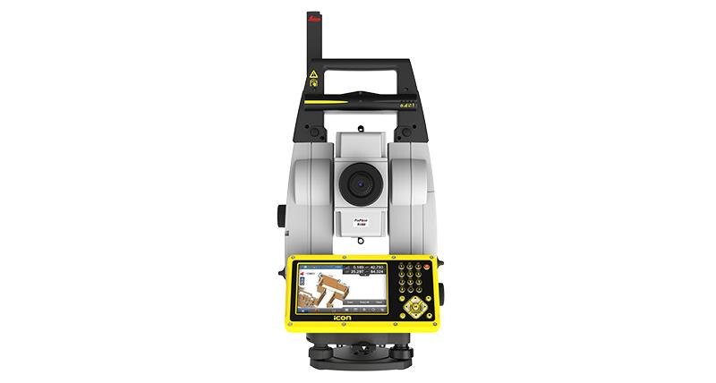
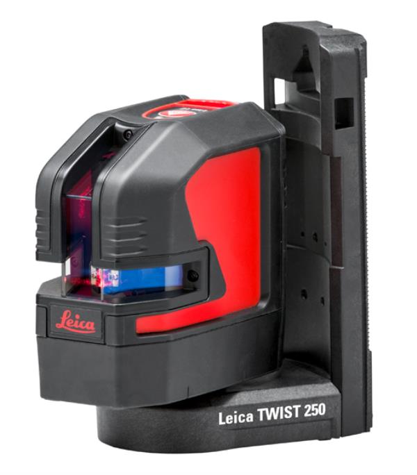
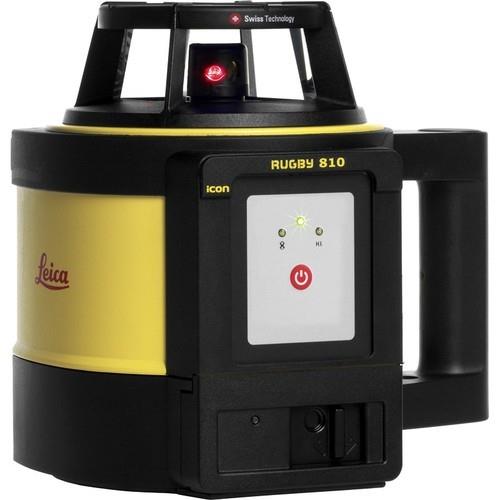
{ "products": [ { "_id": "60c1c9c3db1b200001edc164", "fptag": "SBENTERPRISESTRADINGPUNE", "merchantname": null, "customwidgets": null, "externalsourceid": null, "name": "Leica GST05 Wooden Tripod ", "description": "Leica GST05 Wooden Tripod\nThe Leica GST05 is a light duty tripod with carrying straps, side clamp screws and water-tight plastic wrap for complete protection. Suitable for TPS instruments with angular measurement accuracy above 5”, reflectors and GNSS antennas.\nThese tripods are well regarded by the market for being extremely stable and long lasting. Being highly rigid and with good vibration characteristics, these tripods are recommended by Leica Geosystems to be used with TPS and GNSS for surveying and engineering applications.\nHeight StabilityThe ISO standard defines that the position of thetripod head may not vertically shift by more than0,05 mm when subject to double the maximum instrument weight. Therefore the heavy duty GST120-9, GST101 and Trimax require testing with 30kg. TheGST05, GST05L and GST103 are defined for light dutyand were tested with 10kg. \nQuality criteria – describes the relevant testparameters\nTest results – summarizes and evaluates test results\nUser recommendations\nGST05, Wooden Tripod Light duty tripod with water-tight plastic wrap for complete protection. Suitable for TPS-Instruments with angular measurement accuracy above 5”, reflectors and GNSS antennas. Packaged length 107cm (3.51ft), extendible to 176cm (5.77ft), weight 5.6kg (12.3lb).\n", "price": 15950.0, "discountamount": 0.0, "currencycode": "INR", "priority": 1000000, "isfreeshipmentavailable": false, "shipmentduration": 7, "_keywords": null, "isarchived": false, "isavailable": true, "applicationid": null, "productindex": 197, "imageuri": "https://productimages.withfloats.com/actual/60c1c9c3a3f86100014910c2.jpg", "tileimageuri": "https://productimages.withfloats.com/tile/60c1c9c3a3f86100014910c2.jpg", "images": null, "totalqueries": 0, "gpid": null, "groupproductid": null, "createdon": "2021-06-10T08:13:55.065Z", "updatedon": "2021-06-10T08:13:55.065Z", "buyonlinelink": null, "producturl": "http://WWW.SURVEYEQUIPMENT.IN/products/leica-gst05-wooden-tripod-/197", "availableunits": -1.0, "iscodavailable": false, "isprepaidonlineavailable": false, "maxcodorders": 0, "maxprepaidonlineorders": 0, "uniquepaymenturl": null, "brandname": "Leica Geosystems ", "category": "Tripod", "tags": [ "Tripod", "DGPS Surveying Instruments", "DGPS Surveying Instruments - Positioning System Re", "GNSS/GPS Survey Equipment - Surveying Equipment fr", "Leica Total Station in India", "TOTALSTATIONS", "Robotic Total Station", "leicatotalstationsindia" ], "variants": false, "keyspecification": null, "otherspecifications": null, "pickupaddressreferenceid": "", "paymenttype": "None", "producttype": "products", "hsncode": null, "gstslab": 0.001, "isnotforsale": false }, { "_id": "5bcdaac7e3f0b00001d2a048", "fptag": "SBENTERPRISESTRADINGPUNE", "merchantname": null, "customwidgets": null, "externalsourceid": null, "name": "RIS One & RIS Plus", "description": "RIS One & RIS Plus\nCompact and lightweight ground penetrating radar\n\nRIS ONE and RIS PLUS are the most compact and lightweight antennas available on the market. Gain increased acquisition speed through a high stacking factor as well as improved penetration depth with these single or multi-channel radar control unit.\n\nThe system is supported by antennas operating in 25 MHz to 2.6 GHz frequency range. Custom solutions are available with the IDS GeoRadar control unit, able to power up multiple antennas connected in chain. The antennas feature:\n\nExcellent data quality\nHighest flexibility in multi-channel chain connection\nHigh stacking thereby improving penetration depth\nWireless link to keep track of the survey path and the location of buried objects;\nRIS ONE and RIS PLUS are the ideal solutions for:\n\nUnderground tunnel inspection and condition assessment;\nBedrock and lithological profiling;\nFracture characterisation;\nGround water profiling;\nFoundation and pile measurements;\nBorehole investigations.\nBenefits of the RIS ONE and RIS PLUS include:\n\nLargest antenna gamma in the ground penetrating radar market: A comprehensive set of antennas from 25 MHz to 3.0 GHz, including multi-frequency, borehole and horn antennas ensuring that the right equipment is available for the right application.\nMore than eight hours of autonomous use: IDS GeoRadar’s radar control unit has the lowest power consumption in the ground penetrating radar market.\nFlexible: The multi-channel DAD control unit can drive any IDS Georadar antenna and up to eight antennas in chain connection simultaneously enabling the use of custom configurations.\n\n\n", "price": 0.0, "discountamount": 0.0, "currencycode": "INR", "priority": 1000000, "isfreeshipmentavailable": false, "shipmentduration": 7, "_keywords": null, "isarchived": false, "isavailable": true, "applicationid": null, "productindex": 118, "imageuri": "https://productimages.withfloats.com/actual/5bcdaac884ac000001a78fc7.jpg", "tileimageuri": "https://productimages.withfloats.com/tile/5bcdaac884ac000001a78fc7.jpg", "images": null, "totalqueries": 0, "gpid": null, "groupproductid": null, "createdon": "2018-10-22T10:47:35.934Z", "updatedon": "2018-10-22T10:47:35.934Z", "buyonlinelink": null, "producturl": "http://WWW.SURVEYEQUIPMENT.IN//ris-one-ris-plus/118", "availableunits": -1.0, "iscodavailable": true, "isprepaidonlineavailable": false, "maxcodorders": 0, "maxprepaidonlineorders": 0, "uniquepaymenturl": null, "brandname": null, "category": null, "tags": null, "variants": false, "keyspecification": null, "otherspecifications": null, "pickupaddressreferenceid": "5d08ebb3edf0e25c3b8da5d0", "paymenttype": "AssuredPurchase", "producttype": "products", "hsncode": null, "gstslab": 0.0, "isnotforsale": false }, { "_id": "5b6b3a9ed682be0552aefd47", "fptag": "SBENTERPRISESTRADINGPUNE", "merchantname": null, "customwidgets": null, "externalsourceid": null, "name": "Leica DS2000 Utility Detection Radar", "description": "Leica DS2000 Utility Detection Radar\nUncovering safer, faster, more\n\nThere’s a lot going on underground that you need to know about before you ever start to dig. The Leica DS2000 Utility Detection Radar finds all potential threats, including non-conductive pipes and fibre optics, increasing safety by lowering the risk of accidently hitting underground assets.\n\nIncrease safety, speed up work and lower asset management costs with the ability to prevent hazardous outages and collect more information. The DS2000 betters your business by making it safer, faster and more efficient.\n\nKey benefits\nIncrease safety when the DS2000 identifies all potential threats\nGet to assets and recover quicker from outages when you know exactly where underground utility assets are located\nDual-frequency antenna to detect deep and shallow targets simultaneously\nEasily collect and understand data with the DS2000’s simple and intuitive software and data storage\nSimple data storage and export to continue working on the post-processing at the office\nEffortlessly maneuver around the most challenging sites with the DS2000’s advanced ergonomics\nExpert knowledge of Leica Geosystems with more than 270 service centres worldwide\nPROTECT by Leica Geosystems - the strongest warranty in the market\n\nDetection and underground mapping solution\nCombined with the powerful and rugged Leica CT2000 field tablet, the GG04 or the GPS60 smart antenna, and the DIGICAT intelligent cable locators and DIGITEX transmitters, the DS2000 is part of the complete Leica Geosystems detection and underground mapping solution that will enhance your business by making it faster and more efficient. With DX Office Vision post processing software, convert radar data to CAD file in an uncomplicated way.\n\nStart today\nContact your Leica Geosystems distribution partner for more information on the Leica DS2000 and other detection solutions.", "price": 0.0, "discountamount": 0.0, "currencycode": "INR", "priority": 1000000, "isfreeshipmentavailable": false, "shipmentduration": 7, "_keywords": [ "DS2000 betters", "convert radar data", "intuitive software", "GPS60 smart antenna", "detection solutions", "DIGITEX transmitters", "asset management costs", "Leica CT2000 field tablet", "underground utility assets", "DIGICAT intelligent cable locators", "complete Leica Geosystems detection", "Leica DS2000 Utility Detection Radar", "Leica Geosystems distribution partner", "DX Office Vision post processing software" ], "isarchived": false, "isavailable": true, "applicationid": null, "productindex": 94, "imageuri": "https://productimages.withfloats.com/actual/5b45a66fd4575c0f14706fc4.jpg", "tileimageuri": "https://productimages.withfloats.com/tile/5b45a66fd4575c0f14706fc4.jpg", "images": null, "totalqueries": 0, "gpid": null, "groupproductid": null, "createdon": "2018-07-11T06:40:39.103Z", "updatedon": "2018-08-08T18:46:54.113Z", "buyonlinelink": null, "producturl": "http://WWW.SURVEYEQUIPMENT.IN//leica-ds2000-utility-detection-radar/94", "availableunits": -1.0, "iscodavailable": true, "isprepaidonlineavailable": false, "maxcodorders": 0, "maxprepaidonlineorders": 0, "uniquepaymenturl": null, "brandname": null, "category": "GPR Ground Penetrating Radar", "tags": [ "GPR Ground Penetrating Radar", "| GPR Ground Penetrating Radar Survey Equipment Di" ], "variants": false, "keyspecification": null, "otherspecifications": null, "pickupaddressreferenceid": "5d08ebb3edf0e25c3b8da5d0", "paymenttype": "AssuredPurchase", "producttype": "products", "hsncode": null, "gstslab": 0.0, "isnotforsale": false }, { "_id": "5b6b3a9dd682be0552aefcbd", "fptag": "SBENTERPRISESTRADINGPUNE", "merchantname": null, "customwidgets": null, "externalsourceid": null, "name": "Leica DX Manager Mapping", "description": "Leica DX Manager Mapping\nOne central dashboard for all the Leica Geosystems Detection solutions\n\nLeica DX Manager is the only enterprise grade utility mapping solution on the market. A unique cloud-powered solution that delivers unparalleled performance. Manage projects, tasks and spatial data from one central dashboard for all the Leica Geosystems Detection solutions.\n\nUpdate drawings, raw data, location pictures, data layers and mobile forms remotely and in a period of real time operate at an enterprise level rather than having to manually update individual users one at a time. With the Leica DX Manager, you have all dashboards, status updates and project management tools in one platform. Now, project managers can track field operations in real time and make critical decisions with a broader understanding of the current situation.\n\nKey benefits\n\nSimplified processes\nImprovement of data quality and accuracy\nConsistent data collection methods\nIntegration of DS2000, cable locators and asset mapping data\nWorkflows to maintain data integrity\nManage the whole workflow\n\nShare data to all devices and users within your organisation.\n\nAnalyse maps result\nVisualise on online maps\nFilter on users, within date ranges or any attributes\nExport to standard GIS and CAD formats\nShare data to your clients\nAn easy-to-use online portal allows management of all aspects of documenting utility location tasks. The user can switch between street view, satellite imagery and cartographic street maps. Field acquired survey data becomes instantly available and can be accessed by users anytime and anywhere.\n\nUtility detection integration\n\nLeica DX Manager integrates the entire Leica Geosystems Detection portfolio into a simple survey workflow, empowering the user to apply locator depth measurements to GNSS measurements. The result is a seamless fusion of both worlds – with all locator related data reviewable either in Leica DX Manager or any export format.\n\nLocate the utility\nMeasure the depth\nAll location data is sent directly to the Leica DX Field application on the GNSS device\nIt triggers the GNSS measurement on the mapping device\nAll data is integrated into the features metadata\nMaximum user experience and productivity\n\nLeica DX Field mobile app is designed for productivity and maximum user experience and built for enforcing data quality and accuracy. \n\nEasy mapping / surveying of assets\nSmart mobile forms\nImmediate visualisation on map\nMetadata collection\nAutomatic sync with Cloud\nFull offline capabilities\nMake sure your measured data always matches your quality expectations (up to centimetres with RTK) as Leica DX Manager notifications steadily monitor the system parameters. All quality parameters are stored as metadata. Next to the utility mapping aspect, it delivers work orders, time tracking and document management.", "price": 0.0, "discountamount": 0.0, "currencycode": "INR", "priority": 1000000, "isfreeshipmentavailable": false, "shipmentduration": 7, "_keywords": [ "data quality", "location data", "data collection", "data reviewable", "survey data becomes", "DX Field mobile app", "Leica DX Manager Mapping", "cartographic street maps", "Leica DX Field application", "update individual users one", "Leica DX Manager notifications", "apply locator depth measurements", "enterprise grade utility mapping solution", "entire Leica Geosystems Detection portfolio" ], "isarchived": false, "isavailable": true, "applicationid": null, "productindex": 89, "imageuri": "https://productimages.withfloats.com/actual/5b459fa2f3579911b41e9cda.jpg", "tileimageuri": "https://productimages.withfloats.com/tile/5b459fa2f3579911b41e9cda.jpg", "images": null, "totalqueries": 0, "gpid": null, "groupproductid": null, "createdon": "2018-07-11T06:11:47.283Z", "updatedon": "2018-08-08T18:46:53.959Z", "buyonlinelink": null, "producturl": "http://WWW.SURVEYEQUIPMENT.IN//leica-dx-manager-mapping/89", "availableunits": -1.0, "iscodavailable": true, "isprepaidonlineavailable": false, "maxcodorders": 0, "maxprepaidonlineorders": 0, "uniquepaymenturl": null, "brandname": null, "category": "GPR", "tags": [ "GPR", "Detection and underground mapping solution", "Leica DX Manager Mapping" ], "variants": false, "keyspecification": null, "otherspecifications": null, "pickupaddressreferenceid": "5d08ebb3edf0e25c3b8da5d0", "paymenttype": "AssuredPurchase", "producttype": "products", "hsncode": null, "gstslab": 0.0, "isnotforsale": false }, { "_id": "5b6b3a9dd682be0552aefc69", "fptag": "SBENTERPRISESTRADINGPUNE", "merchantname": null, "customwidgets": null, "externalsourceid": null, "name": "Leica Disto D110 Laser Distance Meter", "description": "Leica Disto D110 Laser Distance Meter\nThe New Leica Disto D110 is the smallest Disto with Bluetooth Smart on the market. Create floor plans and sketches very easily by connecting the new Leica D110 with the DISTO Sketch app on a Smartphone or tablet device.\n\nBenefits of the Leica Disto D110:\nNew ergonomic design for easy use\nIncreased functionality with integrated Bluetooth Smart technology and Leica Disto Sketch app\nPerfect for fast indoor distance and area measurements\nPocket clip to help with carrying\nProven Leica quality and precision\nThis is the first laser Disto with Bluetooth technology that’s small and fits in a pocket.\n\nEffortless measurements can be taken whether it’s for a quick material estimation or a home improvement project, the Disto Sketch App provides potential to create floor plans, sketches and document measurements with pictures using a tablet or smartphone.\n\nMeasure precise distances with ±1.5mm accuracy\nMeasure up to 60m distances without moving\nIdeal for the jobsite – Protected against splash water and dust\nDocument results with the Disto Sketch App for faster, easier and safer work. The App is available for free download from Google Play and the App Store for Android and iOS devices.\n\nThe lightest and smallest Disto in the range, its ergonomic design means that it fits in your hand perfectly and is very comfortable to use. The simple to understand button allow intuitive and quick operation. Measuring has never been easier. The removable pocket clip is a valued accessory, simply clip the device to the pocket of your shirt or trousers for convenient use.\n\nTechnical Data\nMeasuring Accuracy: ±1.5mm\nRange: 60m\nMeasuring units: m, ft, in\nIncludes: Power Range Technology, Illuminated Display, Free App\nBatteries: 2x AAA\nProtection Class: IP54 (splash water and dust)\nDimensions: 120x37x23mm\nWeight: 92g\nIncludes:\nLeica DISTO D110 Laser Distance Meter\nPocket Clip\nHolster\n2x AAA Batteries.\n", "price": 0.0, "discountamount": 0.0, "currencycode": "INR", "priority": 1000000, "isfreeshipmentavailable": false, "shipmentduration": 7, "_keywords": [ "new Leica D110", "Disto Sketch App", "first laser Disto", "Leica Disto Sketch", "create floor plans", "New Leica Disto D110", "Bluetooth technology", "fast indoor distance", "removable pocket clip", "document measurements", "Power Range Technology", "home improvement project", "quick material estimation", "Bluetooth Smart technology", "Leica Disto D110 Laser Distance Meter" ], "isarchived": false, "isavailable": true, "applicationid": null, "productindex": 86, "imageuri": "https://productimages.withfloats.com/actual/5b3f41a0d3d93d03a4b91a60.jpg", "tileimageuri": "https://productimages.withfloats.com/tile/5b3f41a0d3d93d03a4b91a60.jpg", "images": null, "totalqueries": 0, "gpid": null, "groupproductid": null, "createdon": "2018-07-06T10:17:10.03Z", "updatedon": "2018-08-08T18:46:53.841Z", "buyonlinelink": null, "producturl": "http://WWW.SURVEYEQUIPMENT.IN//leica-disto-d110-laser-distance-meter/86", "availableunits": -1.0, "iscodavailable": true, "isprepaidonlineavailable": false, "maxcodorders": 0, "maxprepaidonlineorders": 0, "uniquepaymenturl": null, "brandname": null, "category": "leicadisto", "tags": [ "leicadisto", "laserdistancemeter", "leicageosystems" ], "variants": false, "keyspecification": null, "otherspecifications": null, "pickupaddressreferenceid": "5d08ebb3edf0e25c3b8da5d0", "paymenttype": "AssuredPurchase", "producttype": "products", "hsncode": null, "gstslab": 0.0, "isnotforsale": false }, { "_id": "5b6b3a9dd682be0552aefc2a", "fptag": "SBENTERPRISESTRADINGPUNE", "merchantname": null, "customwidgets": null, "externalsourceid": null, "name": "Leica iCON iCR80 Robotic Total Station", "description": "Leica iCON iCR80 Robotic Total Station\nAchieve more layout points all day every day\n\nThe Leica iCON iCR80 construction total station keeps its ‘eye’ on only one thing: the user’s target. Layout more points per day thanks to ATRplus, the most robust automated-aiming, lock and re-lock technology in the market. iCR80 is especially useful in congested sites with many distractions, such as reflections, machines and people moving around. Challenging and changing site conditions should not be an obstacle.\n\nThe iCON iCR80 allows users to:\n\nLayout lines for footings or chalk line for formwork on foundation\nLayout points on blinding layer, such as pipe insert or cut-outs before pouring concrete\nLayout true design objects based on federated and enriched models\nMEP layout of wall penetrations for pipes, hanger locations for HVAC and duct work, inserts and slits for sheet metal work\nControl a wide variety of construction machines, such as curb and gutter or milling machines, asphalt or concrete pavers, and graders or dozers\nThe iCON iCR80 guarantees layout efficiency with the most reliable, simple and automatic set up procedure, industry-leading prism lock, and flexible handling of fully rendered 3D design models in the field. This sophisticated, one-person total station offers an ‘all-in-one’ solution for every purpose – especially the difficult ones, allowing you to speed up your workflow.\n\nThe iCON iCR80 total station is fully compatible with:\n\nLeica iCON CC80 tablet with an enhanced version of the tailored iCON build construction field software\nLeica Infinity office software and Leica ConX for online sharing of data between the office and the site\nThe iCON iCR80 features:\n\nFaster prism search by patented technology, PowerSearch\nStable data communication with long-range Bluetooth® (up to 400m)\nEasy hand-over control from pole to machine and vice versa\nATRplus technology, maximising the total station’s ability to remain locked on your target for highest point-to-point layout speed\n“Tune out targets” feature to ignore other distractions in the field\nFastest re-lock in case of interrupted line of sight\n\nLowest total cost of ownership\n\nLeica Geosystems construction total stations have a high value, giving you the lowest total cost of ownership. Its resilient hardware allows for longevity and reliability, giving you many years of rough usage in the most demanding environments. Its level of quality ensures your data remains accurate, lowers downtime and keeps your productivity high in all environments and conditions. Invest in the smarter total station solution and reap massive long-term rewards.\n\nNever loose lock\n\nThe iCR80 comes with automated aiming ATRplus, which intelligently and automatically detects environmental conditions, such as light, dust, rain and other site conditions. The new ATRplus, lock and re-lock technology speeds aiming and following of targets and delivers accurate measurements independent of user aiming or site conditions. Even when used on busy construction sites, the down time resulting from loss of lock is minimal, speeding up significantly your layout task.\n\n\n", "price": 0.0, "discountamount": 0.0, "currencycode": "INR", "priority": 1000000, "isfreeshipmentavailable": false, "shipmentduration": 7, "_keywords": [ "iCON CC80 tablet", "iCON iCR80 features", "construction machines", "data remains accurate", "busy construction sites", "iCON iCR80 total station", "environmental conditions", "Infinity office software", "iCON build construction field", "smarter total station solution", "Leica iCON iCR80 Robotic Total Station", "Geosystems construction total stations", "iCON iCR80 guarantees layout efficiency", "delivers accurate measurements independent", "Leica iCON iCR80 construction total station" ], "isarchived": false, "isavailable": true, "applicationid": null, "productindex": 83, "imageuri": "https://productimages.withfloats.com/actual/5b2df1bcdfeea305b4fb1db1.jpg", "tileimageuri": "https://productimages.withfloats.com/tile/5b2df1bcdfeea305b4fb1db1.jpg", "images": null, "totalqueries": 0, "gpid": null, "groupproductid": null, "createdon": "2018-06-23T07:07:40.566Z", "updatedon": "2018-08-08T18:46:53.535Z", "buyonlinelink": null, "producturl": "http://WWW.SURVEYEQUIPMENT.IN//leica-icon-icr80-robotic-total-station/83", "availableunits": -1.0, "iscodavailable": true, "isprepaidonlineavailable": false, "maxcodorders": 0, "maxprepaidonlineorders": 0, "uniquepaymenturl": null, "brandname": null, "category": "leicatotalstations", "tags": [ "leicatotalstations", "sokkiatotalstation", "Robotic Total Station" ], "variants": false, "keyspecification": null, "otherspecifications": null, "pickupaddressreferenceid": "5d08ebb3edf0e25c3b8da5d0", "paymenttype": "AssuredPurchase", "producttype": "products", "hsncode": null, "gstslab": 0.0, "isnotforsale": false }, { "_id": "5b6b3a9dd682be0552aefba4", "fptag": "SBENTERPRISESTRADINGPUNE", "merchantname": null, "customwidgets": null, "externalsourceid": null, "name": "Leica LINO L2 Lithium - line laser", "description": "Leica LINO L2 Lithium - line laser\nThe perfect alignment tool, now rechargeable, with new extended fan angle\n\nThe self levelling Leica LINO L2 Lithium cross line laser level projects very bright lines accurate to the millimetre while you have your hands free to get on with your work.\n\nOutstanding Laser Visibility\nThe high-precision optics of the Leica Lino L2 ensure outstanding laser line visibility up to 25 meters (depending on lighting conditions). Its exceptionally long horizontal and vertical laser lines are projected to floors, walls and ceilings at more than 180°.\n\nAdditional information\nThe self levelling Leica LINO L2 Lithium cross line laser level projects very bright lines accurate to the millimetre while you have your hands free to get on with your work. The Leica Lino L2 was awarded the Red Dot innovation award for design, functionality and voted top by electricians, plumbers, kitchen fitters as the easiest, brightest, quickest self leveling laser on the market. The Leica Lino L2 Lithium is covered by a Leica 3 Year Warranty.\n\nThe self levelling Leica LINO L2 Lithium automatically and quickly levels its self offering accurate vertical and horizontal lines accurately set at 90°. Whether horizontal, vertical or crossed - the red lines are perfectly visible everywhere on the wall. Simply perfect all along the line!", "price": 0.0, "discountamount": 0.0, "currencycode": "INR", "priority": 1000000, "isfreeshipmentavailable": false, "shipmentduration": 7, "_keywords": [ "red lines", "hands free", "Leica 3 Year", "electricians", "functionality", "Simply perfect", "horizontal lines", "accurate vertical", "Whether horizontal", "vertical laser lines", "bright lines accurate", "perfect alignment tool", "Red Dot innovation award", "outstanding laser line visibility", "Leica LINO L2 Lithium cross line laser level projects" ], "isarchived": false, "isavailable": true, "applicationid": null, "productindex": 76, "imageuri": "https://productimages.withfloats.com/actual/5b1f7b7fab52d6071c0f47fd.jpg", "tileimageuri": "https://productimages.withfloats.com/tile/5b1f7b7fab52d6071c0f47fd.jpg", "images": null, "totalqueries": 0, "gpid": null, "groupproductid": null, "createdon": "2018-06-12T07:51:27.882Z", "updatedon": "2018-08-08T18:46:53.039Z", "buyonlinelink": null, "producturl": "http://WWW.SURVEYEQUIPMENT.IN//leica-lino-l2-lithium-line-laser/76", "availableunits": -1.0, "iscodavailable": true, "isprepaidonlineavailable": false, "maxcodorders": 0, "maxprepaidonlineorders": 0, "uniquepaymenturl": null, "brandname": null, "category": "CROSSLINELESER", "tags": [ "CROSSLINELESER", "LEICALASERLEVEL", "LASERLEVELMACHINE" ], "variants": false, "keyspecification": null, "otherspecifications": null, "pickupaddressreferenceid": "5d08ebb3edf0e25c3b8da5d0", "paymenttype": "AssuredPurchase", "producttype": "products", "hsncode": null, "gstslab": 0.0, "isnotforsale": false }, { "_id": "5b6b3a9dd682be0552aefbdd", "fptag": "SBENTERPRISESTRADINGPUNE", "merchantname": null, "customwidgets": null, "externalsourceid": null, "name": "Leica LINO L2 Alk - line laser", "description": "Leica LINO L2 Alk - line laser\nSpeedy and exact projection of horizontal & vertical lines. With new extended fan angle\n\nThere's no need to draw lines on the walls! The Lino L2 projects sharp, very bright lines accurate to the millimetre, speedily & easily while you have your hands free to get on with the job.\n\nOutstanding Laser Visibility\nThe high-precision optics of the Leica Lino L2 ensure outstanding laser line visibility up to 25 meters (depending on lighting conditions). Its exceptionally long horizontal and vertical laser lines are projected to floors, walls and ceilings at more than 180°.\n\nAdditional information\nThe self levelling Leica LINO L2 Alk cross line laser level projects very bright lines accurate to the millimetre while you have your hands free to get on with your work. The Leica Lino L2 was awarded the Red Dot innovation award for design, functionality and voted top by electricians, plumbers, kitchen fitters as the easiest, brightest, quickest self leveling laser on the market. The Leica Lino L2 ALK is covered by a Leica 3 Year Warranty.\n\nThe self levelling Leica LINO L2 Alk automatically and quickly levels its self offering accurate vertical and horizontal lines accurately set at 90°. Whether horizontal, vertical or crossed - the red lines are perfectly visible everywhere on the wall. Simply perfect all along the line!\n\nSpecifications\nRange\tup to 25 m depending on lighting conditions\nRange with laser receiver\tup to 80 m depending on lighting conditions\nLevelling accuracy\t± 0.2 mm / m\nSelf-levelling range\t± 4 °\nSelf-levelling time\t< 3 s\nNumber of laser lines\t2\nBeam direction\tvertical, horizontal\nLaser line width at 5m\t< 2 mm\nLaser type\t635 nm / class 2 (red)\nBattery type\tLi-Ion rechargeable (or AA 3 x 1.5 V)\nOperating time\tup to 44 h (Li-Ion) depending on laser mode\nTemperature range storage\t-25 to 70°C (-13 to 158°F)\nTemperature range operation\t-10 to 50°C (14 to 122°F)\nProtection class\tIP 54\nDimensions\t110 x 60 x 100 mm\nWeight with batteries\t530 g\nTripod thread Lino\t1/4\"\nTripod thread adapter\t1/4\" + 5/8\"\nArt. No.\t864413 (L2 starter kit 848435)\nEAN / UPC\t7640110697528 (L2 starter kit 7640110697511)", "price": 0.0, "discountamount": 0.0, "currencycode": "INR", "priority": 1000000, "isfreeshipmentavailable": false, "shipmentduration": 7, "_keywords": [ "L2 starter", "draw lines", "Leica 3 Year", "vertical lines", "horizontal lines", "accurate vertical", "Whether horizontal", "vertical laser lines", "bright lines accurate", "Lino L2 projects sharp", "Red Dot innovation award", "outstanding laser line visibility", "Leica LINO L2 Alk cross line laser level projects" ], "isarchived": false, "isavailable": true, "applicationid": null, "productindex": 79, "imageuri": "https://productimages.withfloats.com/actual/5b1f789f0c1c510a64fff171.jpg", "tileimageuri": "https://productimages.withfloats.com/tile/5b1f789f0c1c510a64fff171.jpg", "images": null, "totalqueries": 0, "gpid": null, "groupproductid": null, "createdon": "2018-06-12T07:39:10.15Z", "updatedon": "2018-08-08T18:46:53.254Z", "buyonlinelink": null, "producturl": "http://WWW.SURVEYEQUIPMENT.IN//leica-lino-l2-alk-line-laser/79", "availableunits": -1.0, "iscodavailable": true, "isprepaidonlineavailable": false, "maxcodorders": 0, "maxprepaidonlineorders": 0, "uniquepaymenturl": null, "brandname": null, "category": "laser level machine", "tags": [ "laser level machine" ], "variants": false, "keyspecification": null, "otherspecifications": null, "pickupaddressreferenceid": "5d08ebb3edf0e25c3b8da5d0", "paymenttype": "AssuredPurchase", "producttype": "products", "hsncode": null, "gstslab": 0.0, "isnotforsale": false }, { "_id": "5b6b3a9bd682be0552aef958", "fptag": "SBENTERPRISESTRADINGPUNE", "merchantname": null, "customwidgets": null, "externalsourceid": null, "name": "Leica agricultural land levelling", "description": "Leica Rugby 810 Rotating Laser\nHighly robust horizontal one-button laser\n\nDesigned for concrete contractors who want to achieve the highest application performance and who value the best quality, the self-levelling Leica Rugby 810 horizontal laser offers the ultimate levelling solution, completed by the unique power concept, unbeatable ruggedness and the highest accuracy.\n\n\n\n\n\nSimplicity without compromise on performance\nExtremely easy-to-use, one button Leica Rugby 810 laser level saves time and money by reducing preparation time and eliminating costly errors in levelling applications. Simple operation does not compromise on outstanding performance up to 1100 metres, highest measuring accuracy and reliability under any weather conditions. Simple in operation, Rugby 810 construction laser ensures that your concrete works and formwork levelling applications are always exact, easy and reliable.\n\n\nNo laser downtime\nTake advantage of the unique and versatile power concept offered for the Rugby 810 rotating laser. The new generation of smart, Li-Ion battery technology enables contractors to work even longer hours and charge faster, lowering their operating costs. Assuring high flexibility, the Li-Ion battery can be charged on-the-go with the car charger (optional) or from any battery using the 12V connector (opt.); and if needed, exchanged anytime to alkaline battery packs. Setting the standard in environmental-friendly energy management, Rugby 810 rotary laser can also be charged with the optional solar panel by attaching it to the carrying case.\n\nIndustry leading ruggedness and service offering\nWork effectively 365 days a year with the Rugby 810, the most rugged and robust rotating laser level in the market. Proven by its IP 68 protection standard and the military grade certification, Rugby 810 provides the most reliable application performance. Demonstrating high confidence in laser's quality, Leica Geosystems safeguards customers investment with: \nPROTECT by Leica Geosystems service offering\nLifetime Manufacturer's Warranty\n5 years No Cost* period\n2 year Knockdown Warranty", "price": 0.0, "discountamount": 0.0, "currencycode": "INR", "priority": 1000000, "isfreeshipmentavailable": false, "shipmentduration": 7, "_keywords": [ "Rugby 810 rotary laser", "outstanding performance", "Leica Rugby 810 Rotating", "Leica Geosystems service", "IP 68 protection standard", "Assuring high flexibility", "ultimate levelling solution", "Rugby 810 construction laser", "military grade certification", "Demonstrating high confidence", "reliable application performance", "Leica agricultural land levelling", "Leica Rugby 810 horizontal laser offers", "one button Leica Rugby 810 laser level saves time" ], "isarchived": false, "isavailable": true, "applicationid": null, "productindex": 43, "imageuri": "https://productimages.withfloats.com/actual/5af2cd5a85c6af0a1070b40a.jpg", "tileimageuri": "https://productimages.withfloats.com/tile/5af2cd5a85c6af0a1070b40a.jpg", "images": null, "totalqueries": 0, "gpid": null, "groupproductid": null, "createdon": "2018-05-09T10:28:42.37Z", "updatedon": "2018-08-08T18:46:51.398Z", "buyonlinelink": null, "producturl": "http://WWW.SURVEYEQUIPMENT.IN//leica-agricultural-land-levelling/43", "availableunits": -1.0, "iscodavailable": true, "isprepaidonlineavailable": false, "maxcodorders": 0, "maxprepaidonlineorders": 0, "uniquepaymenturl": null, "brandname": null, "category": null, "tags": null, "variants": false, "keyspecification": null, "otherspecifications": null, "pickupaddressreferenceid": "5d08ebb3edf0e25c3b8da5d0", "paymenttype": "AssuredPurchase", "producttype": "products", "hsncode": null, "gstslab": 0.0, "isnotforsale": false } ], "hasmoreitems": false, "isapirequest": false, "totalresults": 27, "query": null, "floatingpoint": null }

Still searching for
market?

Still searching for
market?

Chat with us