Currently it only shows your basic business info. Start adding relevant business details such as description, images and products or services to gain your customers attention by using Boost 360
android app
/
iOS App/ web portal.
{
"products": [
{
"_id": "65cf1a9a6f500018087d604e",
"fptag": "SBENTERPRISESTRADINGPUNE",
"merchantname": null,
"customwidgets": null,
"externalsourceid": null,
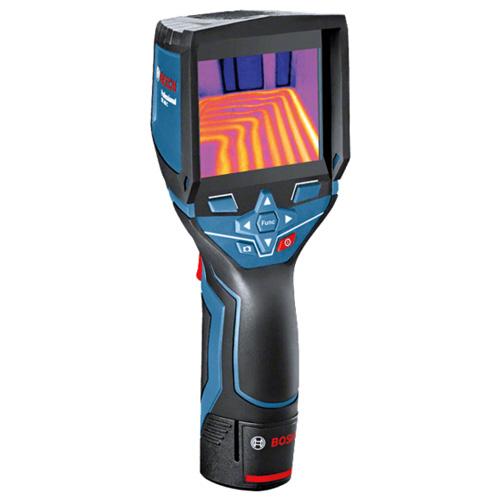
"name": "Bosch GTC 400 C Professional thermal camera",
"description": "The Bosch GTC 400 C Professional thermal camera is designed to provide high-quality thermal imaging for various applications. Here are some key features and benefits:\nHigh-Quality Thermal Images: The thermal camera boasts a 160 x 120 pixel sensor, resulting in 19,200 measuring points. This high resolution allows for detailed and accurate thermal imaging, making it easier to visualize temperature differences in the working environment.\nTemperature Range and Accuracy: The GTC 400 C has a broad temperature range, allowing it to measure temperatures between -10°C and +400°C. The device provides an accuracy of ±3°C, ensuring reliable and precise temperature readings in various conditions.\nData Storage and Reference: With the ability to save up to 500 visual and thermal images, the device enables users to document measurements for later reference. This feature is valuable for creating records, analyzing trends, and maintaining a history of thermal conditions.\nEasy Data Transfer and Analysis: The Measuring Master app facilitates quick data exchange and documentation of measurements. Additionally, the PC software allows users to edit thermal images and create detailed reports. This feature enhances the overall usability of the thermal camera in professional settings.\nUser-Friendly Interface: The thermal camera is designed with ease of use in mind. The interface is user-friendly, and important functions can be accessed with just one click. The picture-in-picture function is a useful feature that aids in locating measurements efficiently.\nVersatility: The wide working temperature range and high image quality make the GTC 400 C suitable for a variety of applications, from industrial and construction settings to maintenance and troubleshooting tasks.\nApplication Support: The device is supported by the Measuring Master app, providing additional functionality and connectivity options for seamless integration into various workflows.\nOverall, the Bosch GTC 400 C Professional thermal camera appears to be a versatile and reliable tool for professionals who require accurate thermal imaging in their work.\n\nThe Bosch GTC 400 C Professional thermal camera is well-suited for a wide range of applications, including but not limited to:\nElectrical Applications:\nQuickly and effectively check cable connections for anomalies or overheating.Inspect cabinets and electrical components to identify potential issues.Detect abnormal temperature patterns that may indicate electrical problems.HVAC (Heating, Ventilation, and Air Conditioning):\nCheck underfloor heating systems to ensure even heat distribution.Locate leaks in HVAC systems by identifying temperature variations.Inspect radiators for proper functioning and identify any blockages or malfunctions.Window Installation:\nSearch for faulty insulation in windows and doors.Identify thermal bridges that can contribute to energy inefficiency.Detect leaks and water penetration around windows and doors.Automotive:\nScan heating and cooling systems to identify temperature irregularities.Inspect fuse boxes for overheating or electrical issues.Check coolant pipes and radiators for leaks or blockages.Inspect catalytic converters for proper functioning.In each of these applications, the thermal camera's ability to visualize temperature differences provides a valuable tool for preventive maintenance, troubleshooting, and quality control. It allows professionals to identify potential problems before they lead to more significant issues, improving overall efficiency and safety in various industries. The device's wide temperature range, high image quality, and user-friendly interface make it a versatile tool for professionals in electrical, HVAC, construction, automotive, and related fields.",
"price": 72000.0,
"discountamount": 0.0,
"currencycode": "INR",
"priority": 1000000,
"isfreeshipmentavailable": false,
"shipmentduration": 7,
"_keywords": [
"ease",
"mind",
"10°C",
"±3°C",
"Scan",
"users",
"doors",
"leaks",
"safety",
"device",
"trends",
"+400°C",
"Search",
"variety",
"records",
"history",
"windows",
"cabinets",
"Analysis",
"benefits",
"Accuracy",
"anomalies",
"blockages",
"one click",
"500 visual",
"wide range",
"industrial",
"fuse boxes",
"Automotive",
"Versatility",
"overheating",
"Ventilation",
"PC software",
"temperatures",
"key features",
"malfunctions",
"measurements",
"Data Storage",
"HVAC systems",
"reliable tool",
"coolant pipes",
"valuable tool",
"The GTC 400 C",
"professionals",
"documentation",
"versatile tool",
"related fields",
"useful feature",
"later reference",
"thermal bridges",
"high resolution",
"quality control",
"cooling systems",
"potential issues",
"Air Conditioning",
"picture function",
"detailed reports",
"Inspect radiators",
"water penetration",
"electrical issues",
"overall usability",
"heat distribution",
"various workflows",
"faulty insulation",
"cable connections",
"various industries",
"overall efficiency",
"proper functioning",
"thermal conditions",
"significant issues",
"various conditions",
"potential problems",
"Easy Data Transfer",
"high image quality",
"quick data exchange",
"working environment",
"Application Support",
"important functions",
"energy inefficiency",
"Window Installation",
"electrical problems",
"various applications",
"seamless integration",
"connectivity options",
"catalytic converters",
"construction settings",
"troubleshooting tasks",
"professional settings",
"electrical components",
"preventive maintenance",
"wide temperature range",
"temperature variations",
"160 x 120 pixel sensor",
"temperature differences",
"19,200 measuring points",
"Electrical Applications",
"broad temperature range",
"User-Friendly Interface",
"The Measuring Master app",
"additional functionality",
"accurate thermal imaging",
"temperature irregularities",
"underfloor heating systems",
"High-Quality Thermal Images",
"precise temperature readings",
"high-quality thermal imaging",
"abnormal temperature patterns",
"wide working temperature range",
"The Bosch GTC 400 C Professional thermal camera"
],
"isarchived": false,
"isavailable": true,
"applicationid": null,
"productindex": 235,
"imageuri": "https://productimages.withfloats.com/actual/65cf1a9e1f63cf9c49f7de00.jpg",
"tileimageuri": "https://productimages.withfloats.com/tile/65cf1a9e1f63cf9c49f7de00.jpg",
"images": null,
"totalqueries": 0,
"gpid": null,
"groupproductid": null,
"createdon": "2024-02-16T08:19:38.327Z",
"updatedon": "2024-02-16T08:19:38.327Z",
"buyonlinelink": null,
"producturl": "http://WWW.SURVEYEQUIPMENT.IN/products/bosch-gtc-400-c-professional-thermal-camera/235",
"availableunits": -1.0,
"iscodavailable": false,
"isprepaidonlineavailable": false,
"maxcodorders": 0,
"maxprepaidonlineorders": 0,
"uniquepaymenturl": null,
"brandname": "BOSCH ",
"category": "ThermalCamera",
"tags": null,
"variants": false,
"keyspecification": null,
"otherspecifications": null,
"pickupaddressreferenceid": "",
"paymenttype": "None",
"producttype": "products",
"hsncode": null,
"gstslab": 0.0,
"isnotforsale": false
},
{
"_id": "60e1a313e49d1200012fbdc3",
"fptag": "SBENTERPRISESTRADINGPUNE",
"merchantname": null,
"customwidgets": null,
"externalsourceid": null,
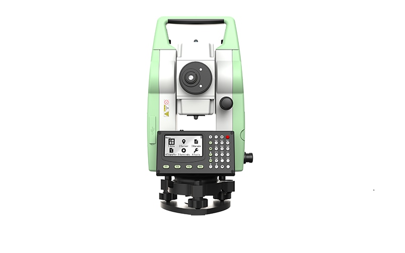
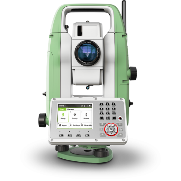
"name": "Leica TS01 Manual Total Stations ",
"description": "Leica TS01: The entry to Leica Geosystems' Total Stations\nLeica TS01 empowers you to carry out measurement tasks with ease and simplicity.\n\nThe Leica TS01 total station empowers you to carry out measurement tasks with ease and simplicity. The TS01 is an entry-level manual total station, created to help you master surveying, layout and mapping projects. It will prove itself in the field and immediately become a valuable member of your team.\n\nBuying a Leica TS01 is a smart decision as it represents a business-smart entry into Leica Geosystems world. You and your surveying crew members will be ready for new projects in no time.\n\nEnjoy the benefits of a 500 m non-prism range and 3,000 m prism range, always combined with accuracy and measurement speed, which increases your productivity. With built-in sensors like an electronic dual axis compensator, a laser plummet, onboard field software and short keys for quick menu access you'll have a fast instrument setup and fast measurements.\n\nWith the Leica TS01 total station you get your all-in-on package as it comes with Leica Geosystems accessories, such as a long-operating battery, a charger and a tribrach tested to reliably fulfil the requirements – when every detail counts.\n\n\nFirst class after sales service and support\n\nLeica Geosystems's highly qualified after-sales service and support network will help you managing any issue to continue work quickly.\nBe it maintenance work, in any of our local service workshops, or getting a question answered from local support, both are part of Leica Geosystems's active customer care.\n\n\nStart-up into business easily\n\n\n\nLeica Geosystems' TS01 will get your trusted partner in managing survey, layout and mapping projects with ease and simplicity.\nPowerful built-in sensors, as well as intuitive field software, empower you to complete tasks without any delay.\n",
"price": 0.0,
"discountamount": 0.0,
"currencycode": "INR",
"priority": 1000000,
"isfreeshipmentavailable": false,
"shipmentduration": 7,
"_keywords": null,
"isarchived": false,
"isavailable": true,
"applicationid": null,
"productindex": 200,
"imageuri": "https://productimages.withfloats.com/actual/60e1a315eef7850001dd7f3e.png",
"tileimageuri": "https://productimages.withfloats.com/tile/60e1a315eef7850001dd7f3e.png",
"images": null,
"totalqueries": 0,
"gpid": null,
"groupproductid": null,
"createdon": "2021-07-04T12:01:23.298Z",
"updatedon": "2021-07-04T12:01:23.298Z",
"buyonlinelink": null,
"producturl": "http://WWW.SURVEYEQUIPMENT.IN//leica-ts01-manual-total-stations-/200",
"availableunits": -1.0,
"iscodavailable": false,
"isprepaidonlineavailable": false,
"maxcodorders": 0,
"maxprepaidonlineorders": 0,
"uniquepaymenturl": null,
"brandname": "Leica Geosystems",
"category": "Leica Total Station in India ",
"tags": [
"Leica Total Station in India",
"TOTALSTATIONS",
"Robotic Total Station",
"leicatotalstationsindia",
"robotictotalstationpune",
"robotictotalstations",
"leicatotalstationsindia",
"leicatotalstationoune",
"leicageosystems",
"Geographical Survey",
"GNSS/GPS Survey Equipment - Surveying Equipment fr"
],
"variants": false,
"keyspecification": null,
"otherspecifications": null,
"pickupaddressreferenceid": "",
"paymenttype": "None",
"producttype": "products",
"hsncode": null,
"gstslab": 0.0,
"isnotforsale": false
},
{
"_id": "5e96c40249c9ab000155998b",
"fptag": "SBENTERPRISESTRADINGPUNE",
"merchantname": null,
"customwidgets": null,
"externalsourceid": null,
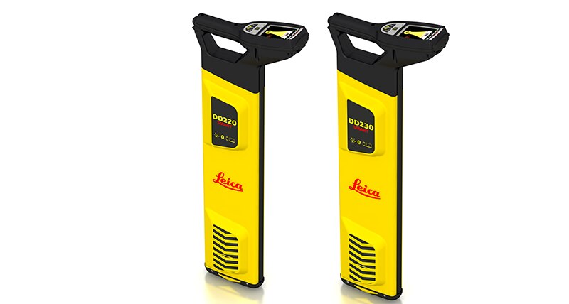
"name": "Leica DD220 Smart Cable & Pipe Locator",
"description": "Leica DD220 Smart Utility LocatorProtect your assets and your workersThe new Leica DD220 is an easy to use, intuitive locator simplifying the detection of buried utilities and increasing user confidence .\n\n\nWith automated pinpointing technology and a clear visible display, the DD220 discovers buried utilities with confidence, even in densely packed areas. On-board video support, usage alerts and diagnostics, combine to improve product use and, protect operators and utilities.\n\n\n\nSMART Technology; GPS, Bluetooth®, 8GB internal memory\nPower, Radio, Auto modes\nTransmitter modes, 131kHz, 33kHz, 8kHz or Auto (automatic detection of the transmitter signal)\nDepth detection up to 7 meters (23 feet)\nGood-to-Go™ Health Check and Start up test\nOn-board video user guides\nIP66 rating - protection from dust and water\nWeb Calibration Verification\n3 year Warranty\nLeica DD SMART utility locator solution\n\n\nFor professionals looking to streamline utility locating operations, the Leica DD SMART utility locators create a single source solution. DX Shield software provides a space for utility analysis and a convenient connection between SMART locators to increase productivity and save time.\n\nDX Shield software allows you to gain a better understanding of task performance and site complexities with easy-to-use reports that provide a fast and convenient overview of product use, reducing utility strikes and saving direct repair costs and project downtime.",
"price": 0.0,
"discountamount": 0.0,
"currencycode": "INR",
"priority": 1000000,
"isfreeshipmentavailable": false,
"shipmentduration": 7,
"_keywords": null,
"isarchived": false,
"isavailable": true,
"applicationid": null,
"productindex": 169,
"imageuri": "https://productimages.withfloats.com/actual/5e96c4065379a400011ee9f4.png",
"tileimageuri": "https://productimages.withfloats.com/tile/5e96c4065379a400011ee9f4.png",
"images": null,
"totalqueries": 0,
"gpid": null,
"groupproductid": null,
"createdon": "2020-04-15T08:21:22.911Z",
"updatedon": "2020-04-15T08:21:22.911Z",
"buyonlinelink": null,
"producturl": "http://WWW.SURVEYEQUIPMENT.IN/products/leica-dd220-smart-cable-pipe-locator/169",
"availableunits": -1.0,
"iscodavailable": false,
"isprepaidonlineavailable": false,
"maxcodorders": 0,
"maxprepaidonlineorders": 0,
"uniquepaymenturl": null,
"brandname": "Leica",
"category": "",
"tags": null,
"variants": false,
"keyspecification": null,
"otherspecifications": null,
"pickupaddressreferenceid": "",
"paymenttype": "None",
"producttype": "products",
"hsncode": null,
"gstslab": 0.0,
"isnotforsale": false
},
{
"_id": "5e204a5d390cad0001e6d72b",
"fptag": "SBENTERPRISESTRADINGPUNE",
"merchantname": null,
"customwidgets": null,
"externalsourceid": null,
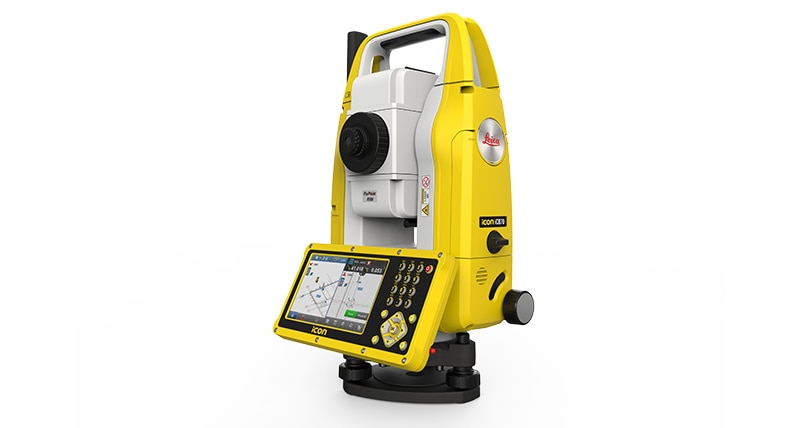
"name": " iCON iCB70 Reflectorless Total Station",
"description": "Leica iCON iCB70 Manual Construction Total Station\nThe Leica iCON iCB70 manual construction total station makes you layout more points per day on your construction project with either prism or reflectorless measurements. Featuring mobile data capability, the iCB70 lets you transfer construction data between the office and the instrument directly, keeping your project progress and plans constantly up to date, assuring that you do not miss any changes in design. Facilitating the move from conventional analogue layout methods to modern digital workflows, the iCB70 helps you to achieve the productivity and accuracies demanded by the building construction industry.\n\nThe iCON iCB70 allows users to:\n\nKeep tight project tolerances by measuring to a prism\nLayout points and lines quickly and accurately, even on complex structures\nPerform verticality checks on formwork and structures\nComplete fast and accurate as-built measurements\nReport volume calculations directly on site\nWork with digital design data including fully rendered models in IFC format\nTransfer construction data directly to and from the instrument\n\n\nEquipped with the construction-tailored and easy-to-use software platform iCON build, the Leica iCON iCB70 manual construction total station guarantees efficient layout and as-built tasks. Forget about paper plans, tapes, plumb-bobs and chalk-line that cause error-prone layout jobs on your construction site. Leica Geosystems’ new manual construction total stations support you in your no-tapes and no-strings approach to construction layout.\n\nThe iCON iCB70 features:\n\niCON build with ‘build plus’ on-board software\n5 inch colour touch screen and full numeric keyboard\nFineFocus telescope to simply aim to a defined target\n1’’, 2’’ and 5’’ angular accuracy\nPrism and reflectorless measurements\nBluetooth and WLAN\nMobile data (GSM / GPRS / UMTS / LTE) as an option\nIP66 rating",
"price": 0.0,
"discountamount": 0.0,
"currencycode": "INR",
"priority": 1000000,
"isfreeshipmentavailable": false,
"shipmentduration": 7,
"_keywords": null,
"isarchived": false,
"isavailable": true,
"applicationid": null,
"productindex": 162,
"imageuri": "https://productimages.withfloats.com/actual/5e204a5f61b40d000185be1d.jpg",
"tileimageuri": "https://productimages.withfloats.com/tile/5e204a5f61b40d000185be1d.jpg",
"images": null,
"totalqueries": 0,
"gpid": null,
"groupproductid": null,
"createdon": "2020-01-16T11:34:53.026Z",
"updatedon": "2020-01-16T11:34:53.026Z",
"buyonlinelink": null,
"producturl": "http://WWW.SURVEYEQUIPMENT.IN/products/-icon-icb70-reflectorless-total-station/162",
"availableunits": -1.0,
"iscodavailable": false,
"isprepaidonlineavailable": false,
"maxcodorders": 0,
"maxprepaidonlineorders": 0,
"uniquepaymenturl": null,
"brandname": "Leica",
"category": "",
"tags": [
"Leica Total Station in India",
"TOTALSTATIONS",
"robotictotalstationpune",
"Robotic Total Station"
],
"variants": false,
"keyspecification": null,
"otherspecifications": null,
"pickupaddressreferenceid": "",
"paymenttype": "None",
"producttype": "products",
"hsncode": null,
"gstslab": 0.0,
"isnotforsale": false
},
{
"_id": "5daaf779f9dc390001952ef9",
"fptag": "SBENTERPRISESTRADINGPUNE",
"merchantname": null,
"customwidgets": null,
"externalsourceid": null,
"name": "Leica FlexLine TS07 Manual Total Station",
"description": "Leica FlexLine TS07 Manual Total Station\nThe Leica FlexLine TS07 high-quality, manual total station is based on a proven product concept that has been revolutionising the world of measurement and survey for nearly 200 years. The Leica TS07 is equipped with a comprehensive application-based software package - Leica FlexField software - that enables most survey and stakeout tasks to be carried out easily and efficiently. The new FlexLine TS07 works reliably and delivers accurate results even in the harshest environments.\n\nWork faster: measure more points per day due to faster measurement and stakeout procedures (endless drives, trigger key, drives on both sides, pinpoint EDM and more), supported by our comprehensive and user-friendly Leica FlexField software.\nUse it trouble-free: increase productivity and minimise downtime by relying on instruments that simply work and come with a global service and support network.\nChoose products that are built to last: FlexLine operates with the same high level of quality even after years of use under harsh conditions (like mud, dust, blowing rain, extreme heat and cold).\nControl your investment: reliability, speed and accuracy ensure a lower investment over the product lifetime and a higher resell value.\nSave time with AutoHeight: measure, read and set the instrument height automatically with this revolutionary feature in the FlexLine TS07 (optional). Errors are minimised and the setup process onsite is faster.",
"price": 0.0,
"discountamount": 0.0,
"currencycode": "INR",
"priority": 1000000,
"isfreeshipmentavailable": false,
"shipmentduration": 7,
"_keywords": null,
"isarchived": false,
"isavailable": true,
"applicationid": null,
"productindex": 156,
"imageuri": "https://productimages.withfloats.com/actual/5daaf77b836b6b0001c86cb4.png",
"tileimageuri": "https://productimages.withfloats.com/tile/5daaf77b836b6b0001c86cb4.png",
"images": null,
"totalqueries": 0,
"gpid": null,
"groupproductid": null,
"createdon": "2019-10-19T11:46:01.098Z",
"updatedon": "2019-10-19T11:46:01.098Z",
"buyonlinelink": null,
"producturl": "http://WWW.SURVEYEQUIPMENT.IN//leica-flexline-ts07-manual-total-station/156",
"availableunits": -1.0,
"iscodavailable": false,
"isprepaidonlineavailable": false,
"maxcodorders": 0,
"maxprepaidonlineorders": 0,
"uniquepaymenturl": null,
"brandname": "Leica Geosystems ",
"category": "",
"tags": null,
"variants": false,
"keyspecification": null,
"otherspecifications": null,
"pickupaddressreferenceid": "",
"paymenttype": "None",
"producttype": "products",
"hsncode": null,
"gstslab": 0.0,
"isnotforsale": false
},
{
"_id": "5da061c96fcd40000173875d",
"fptag": "SBENTERPRISESTRADINGPUNE",
"merchantname": null,
"customwidgets": null,
"externalsourceid": null,
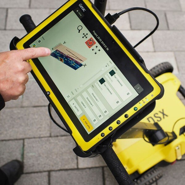
"name": "DSX Utility Detections Solutions ",
"description": "Leica DSX Utility Detection Solution\nA clearer view of underground utilities\nFor utility repair and maintenance, civil engineering and surveying companies, the Leica DSX utility detection solution, consisting of portable hardware with intuitive software allows to easily locate, visualise and map utilities. Unlike any other ground-penetrating radar (GPR) system, the Leica DSX maximises productivity with cutting-edge software that automates data analysis and creates a 3D utility map on the field.\n\nEasy to use\n\nEnsure smooth and accurate underground utility detection without expert knowledge\nComplete utility detection and mapping in just a few steps through the intuitive user interface\nScan anywhere and at any time, even in narrow areas and under severe conditions\nReliable Detection Results\n\nDetect all types of underground utilities in high resolution to assure reliable avoidance zones\nVerify detected utilities with support of smart algorithm\nImport of POI's and utility records to help you make better decisions\nInstant 2D/3D Utility Map\n\nSave your time on site by mapping underground utilities in just minutes\nExport utilities in CAD or BIM-read formats for further usage\nCreate professional reports, customised to your and your customers' needs\nIntegrated Solution\n\nOffer a complete workflow from acquire to excavate\nLocate underground utilities with survey-grade accuracy\nGenerate utility maps, compatible with all coordinate reference systems",
"price": 0.0,
"discountamount": 0.0,
"currencycode": "INR",
"priority": 1000000,
"isfreeshipmentavailable": false,
"shipmentduration": 7,
"_keywords": null,
"isarchived": false,
"isavailable": true,
"applicationid": null,
"productindex": 155,
"imageuri": "https://productimages.withfloats.com/actual/5da061ca48f8810001023a3d.jpg",
"tileimageuri": "https://productimages.withfloats.com/tile/5da061ca48f8810001023a3d.jpg",
"images": null,
"totalqueries": 0,
"gpid": null,
"groupproductid": null,
"createdon": "2019-10-11T11:04:41.923Z",
"updatedon": "2019-10-11T11:04:41.923Z",
"buyonlinelink": null,
"producturl": "http://WWW.SURVEYEQUIPMENT.IN//dsx-utility-detections-solutions-/155",
"availableunits": -1.0,
"iscodavailable": false,
"isprepaidonlineavailable": false,
"maxcodorders": 0,
"maxprepaidonlineorders": 0,
"uniquepaymenturl": null,
"brandname": "Leica DSX Utility Detection Solution",
"category": "",
"tags": null,
"variants": false,
"keyspecification": null,
"otherspecifications": null,
"pickupaddressreferenceid": "",
"paymenttype": "None",
"producttype": "products",
"hsncode": null,
"gstslab": 0.0,
"isnotforsale": false
},
{
"_id": "5c839daa0eac470001975d08",
"fptag": "SBENTERPRISESTRADINGPUNE",
"merchantname": null,
"customwidgets": null,
"externalsourceid": null,
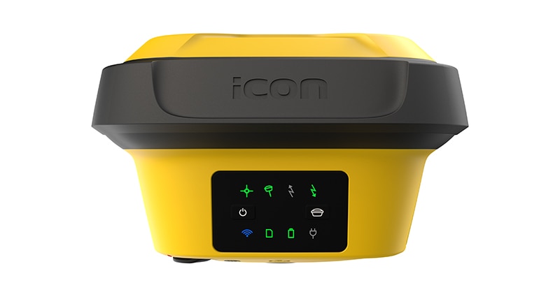
"name": "Leica iCON gps 70 Series",
"description": "Leica iCON gps 70 Series\nPermanent tilt compensation and resistance to magnetic interferences – Leica iCON gps 70 T\n\n\nLeica iCON gps 70 Series – Ultimate performance for your construction site\nUltimate GNSS Rover and field solution for maximum efficiency. Speed up – anytime, anywhere. Leica Geosystems introduces the most efficient construction GNSS rovers, the Leica iCON gps 70 Series. Combining the latest GNSS technology and inertial measurement unit (IMU), the Leica iCON gps 70 T is equipped with permanent tilt compensation and as well resistant to any magnetic interferences. Being calibration-free, the iCON gps 70 T is ready when you are – anytime, anywhere. The iCON gps 70 T releases the limitations of working with the pole in vertical positions and increases the productivity compared to conventional methods. Furthermore, the efficiency on a construction site is enhanced by collecting as-built field data and staking out designs faster, while increasing accuracy and reducing errors. Without time-consuming procedures, users measure where it was not possible before with improved quality control. The seamless integration of the Leica iCON gps 70 Series into the Leica iCON field software leads to simple workflows which require less training and avoid costly downtime.\n\n\nDGPS Surveying Instruments\nDGPS Surveying Instruments - Positioning System Retailer from Mumbai\n\nDGPS Surveying Instruments - Positioning System Retailer from Pune\n\nDGPS Surveying Instruments - Positioning System Retailer from India\n\nDGPS Surveying Instruments - Positioning System Retailer from Maharashtra\n\nGPS Survey Equipment\n\nDifferential GPS India\n\nDifferential Global Positioning System (DGPS) from Mumbai\n\nDifferential Global Positioning System (DGPS) from Pune\n\nDifferential Global Positioning System (DGPS) from India\n\nDifferential Global Positioning System (DGPS) from Maharashtra\n\nGNSS/GPS Survey Equipment - Surveying Equipment from Mumbai\n\nGNSS/GPS Survey Equipment - Surveying Equipment from Pune\n\nGNSS/GPS Survey Equipment - Surveying Equipment from India\n\nGNSS/GPS Survey Equipment - Surveying Equipment from Maharashtra\n\nConstruction Surveying Equipment, Surveying Instruments in India\n\n \n\n",
"price": 0.0,
"discountamount": 0.0,
"currencycode": "INR",
"priority": 1000000,
"isfreeshipmentavailable": false,
"shipmentduration": 7,
"_keywords": [
"Survey Equipment",
"Leica iCON gps 70 T",
"Surveying Equipment",
"Surveying Instruments",
"iCON gps 70 T releases",
"Leica iCON gps 70 Series",
"Global Positioning System",
"Leica iCON field software",
"inertial measurement unit",
"Positioning System Retailer",
"permanent tilt compensation",
"efficient construction GNSS rovers"
],
"isarchived": false,
"isavailable": true,
"applicationid": null,
"productindex": 141,
"imageuri": "https://productimages.withfloats.com/actual/5c839dabdc44740001742988.jpg",
"tileimageuri": "https://productimages.withfloats.com/tile/5c839dabdc44740001742988.jpg",
"images": null,
"totalqueries": 0,
"gpid": null,
"groupproductid": null,
"createdon": "2019-03-09T11:04:10.316Z",
"updatedon": "2019-03-09T11:04:10.316Z",
"buyonlinelink": null,
"producturl": "http://WWW.SURVEYEQUIPMENT.IN//leica-icon-gps-70-series/141",
"availableunits": -1.0,
"iscodavailable": true,
"isprepaidonlineavailable": false,
"maxcodorders": 0,
"maxprepaidonlineorders": 0,
"uniquepaymenturl": null,
"brandname": null,
"category": "DGPS Surveying Instruments",
"tags": [
"DGPS Surveying Instruments",
"Differential GPS India",
"DGPS Surveying Instruments - Positioning System Re",
"GNSS/GPS Survey Equipment - Surveying Equipment fr"
],
"variants": false,
"keyspecification": null,
"otherspecifications": null,
"pickupaddressreferenceid": "5d08ebb3edf0e25c3b8da5d0",
"paymenttype": "AssuredPurchase",
"producttype": "products",
"hsncode": null,
"gstslab": 0.0,
"isnotforsale": false
},
{
"_id": "5c528f7519bf0400016c2058",
"fptag": "SBENTERPRISESTRADINGPUNE",
"merchantname": null,
"customwidgets": null,
"externalsourceid": null,
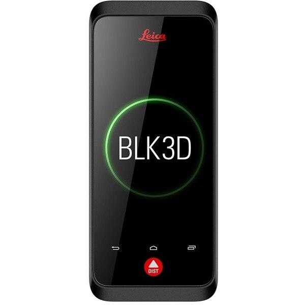
"name": "Leica BLK3D",
"description": "Leica BLK3D\nReal-time, professional grade, in-picture 3D measurement\nThe Leica BLK3D is a real-time, in-picture 3D measurement solution. By combining measurement sensors, software, and on-device edge data processing capabilities, the Leica BLK3D makes in-picture measurements with professional-grade accuracy in real-time possible. Every image captured is a complete and precise 3D measurement record.\n\nIts edge computing capabilities eliminate the need for network connections and cloud services, ensuring professionals can make faster decisions within their daily workflows – whether measuring inaccessible locations, creating floor plans, estimating building installations, documenting construction site progress or creating measurable, as-built documentation.\n\nTake a picture. Measure anything.\nThe BLK3D captures images and places precise measurements at your fingertips. Share images and measurements in multiple formats.\n\nThe art of photogrammetry. Simplified.\nUn-matched combination of a calibrated stereo-camera, advanced algorithms and real-time edge computing fused with leading Electronic Distance Measurement (EDM) technology.\n\nAccess projects. Anywhere, anytime.\nMeasure in your image – on the handheld imager, on the desktop, on-site or in the office.\n\nWorking with digital floorplans.\nCreate floorplans and import existing ones. Add measurable images. Document construction progress with multiple images over time.\n\nNew dimensions for 2D pictures.\nThe BLK3D creates images that contain precise three-dimensional measurements.\n\nProgressive project documentation for AEC.\nCapture critical moments throughout the life of a building.\n\nObject detection and snapping.\nAuto-Snapping uses computer vision technologies to select the right points for your measurements.\n\nStore. Organize. Share.\nStore your measurable images on the device and on desktop. Organize your projects by tagging measurable images with searchable keywords for easy recall and share them in multiple formats.\n\n",
"price": 0.0,
"discountamount": 0.0,
"currencycode": "INR",
"priority": 1000000,
"isfreeshipmentavailable": false,
"shipmentduration": 0,
"_keywords": null,
"isarchived": false,
"isavailable": false,
"applicationid": null,
"productindex": 139,
"imageuri": "https://productimages.withfloats.com/actual/5c5293511e8d150001c19faa.jpg",
"tileimageuri": "https://productimages.withfloats.com/tile/5c5293511e8d150001c19faa.jpg",
"images": null,
"totalqueries": 0,
"gpid": null,
"groupproductid": null,
"createdon": "2019-01-31T06:02:29.05Z",
"updatedon": "2019-01-31T06:18:55.492Z",
"buyonlinelink": null,
"producturl": "http://WWW.SURVEYEQUIPMENT.IN//leica-blk3d/139",
"availableunits": -1.0,
"iscodavailable": true,
"isprepaidonlineavailable": false,
"maxcodorders": 0,
"maxprepaidonlineorders": 0,
"uniquepaymenturl": null,
"brandname": null,
"category": "leicageosystems",
"tags": [
"leicageosystems",
"BLK3D",
"leicadisto",
"BLK360",
"laserdistancemeter",
"leicascanner"
],
"variants": false,
"keyspecification": null,
"otherspecifications": null,
"pickupaddressreferenceid": "5d08ebb3edf0e25c3b8da5d0",
"paymenttype": "AssuredPurchase",
"producttype": "products",
"hsncode": null,
"gstslab": 0.0,
"isnotforsale": false
},
{
"_id": "5c18b8e4ead682000197c724",
"fptag": "SBENTERPRISESTRADINGPUNE",
"merchantname": null,
"customwidgets": null,
"externalsourceid": null,
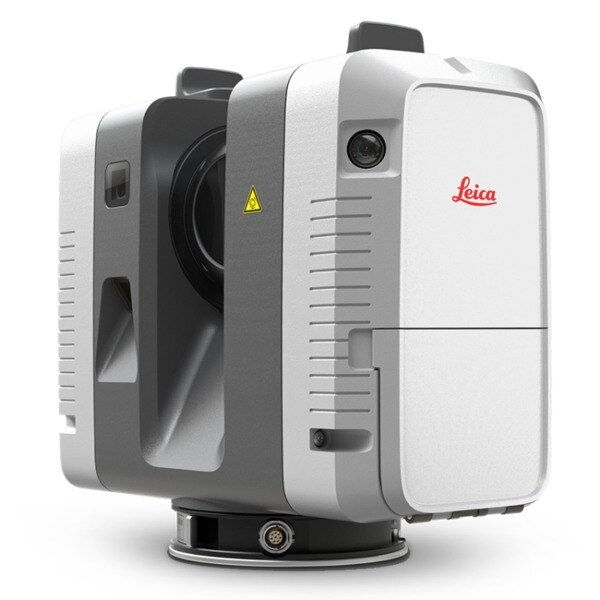
"name": "Leica RTC360 Laser Scanner",
"description": "Leica RTC360 Laser Scanner\nFast, agile and precise 3D reality capture solution\nFast\nFAST\nThe Leica RTC360 laser scanner makes 3D reality capture faster than ever before. With a measuring rate of up to 2 million points per second and advanced HDR imaging system, the creation of colored 3D point clouds can be completed in under 2 minutes. Plus, automated targetless field registration (based on VIS technology) and the seamless, automated transfer of data from site to office reduce time spent in the field and further maximize productivity.\n\nAgile\nAgile\nSmall and lightweight, the Leica RTC360 scanner’s portable design and collapsible tripod mean it’s compact enough to fit into most backpacks, ready to be taken anywhere. Once on-site, easy-to-use one-button operation makes for fast, hassle-free scanning.\n\nPrecise\nPrecise\nLow noise data allows for better images, resulting in crisp, high-quality scans that are rich in detail and ready for use in a range of applications. Combined with Cyclone FIELD 360 software for automated registration in the field, the Leica RTC360 scanner offers outstanding precision that can be checked on-site.\n\nLeica RTC360 Product Specifications\n3D Laser Scanner\tHigh-speed 3D laser scanner with integrated HDR spherical imaging system and Visual Inertial System (VIS) for real time registration\nData acquisition\t< 2 min for complete full dome scan and spherical HDR image at 6mm @ 10m resolution\nReal time registration\tAutomatic point cloud alignment based on real time tracking of scanner movement between setups based on Visual Inertial System (VIS) by video-enhanced inertial measurement unit\nDouble scan\tAutomatic removal of moving objects\nDistance measurement\tHigh-speed, high dynamic time of flight enhanced by Waveform Digitizing (WFD) technology\nLaser Class\t1 (in accordance with IEC 60825-1:2014), 1550nm (invisible)\nField of view\t360° (horizontal) / 300° (vertical)\nRange\tMin. 0.5 - up to 130 m\nSpeed\tUp to 2‘000‘000 pts / sec\nResolution\t3 user selectable settings (3/6/12mm @ 10m)\nAccuracy\tAngular accuracy 18”\nRange accuracy 1.0 mm + 10 ppm \n3D point accuracy \n1.9 mm @ 10 m \n2.9 mm @ 20 m \n5.3 mm @ 40 m\nRange noise\t0.4 mm @ 10 m, 0.5 mm @ 20 m\nCamera\t36 MP 3-camera system captures \n432 MPx raw data for calibrated \n360° x 300° spherical image\nSpeed\t1 minute for full spherical HDR image at any light condition\nHDR\tAutomatic, 5 brackets\nVisual Inertial System\tVideo enhanced inertial measuring system to track movement of the scanner position relative to the previous setup in real time\nTilt\tIMU based, Accuracy: 3‘ for any tilt\nAdditional sensors\tAltimeter, Compass, GNSS\nOn scanner\tTouch-screen control with finger touch, full color WVGA graphic display 480 x 800 pixels\nMobile devices\tLeica Cyclone FIELD 360 app for iPad or Android tablets including:\n- Remote control of scan functions\n- 2D & 3D data viewing\n- Tagging\n- Automatic alignment of scans\nWireless\tIntegrated wireless LAN (802.11 b/g/n)\nData storage\tLeica MS256, 256GB exchangeable USB 3.0 flash drive\nHousing\tAluminium frame and sidecovers\nDimensions\t120mm x 240mm x 230mm / 4.7‘‘ x 9.4‘‘ x 9.1\nWeight\t5.35 kg / 11.7 lbs, nominal (w/o batteries)\nMounting mechanism\tQuick mounting on 5/8“ stub on lightweight tripod / optional tribrach adapter / survey tribrach adapter available\nInternal battery\t2 x Leica GEB361 internal, rechargeable Li-Ion batteries.\nDuration: Typically up to 4 hours\nWeight: 340 g per battery\nExternal\tLeica GEV282 AC adapter\nOperating temperature\t5° to +40° C\nStorage temperature\t40° to +70° C\nDust/Humidity\tSolid particle/liquid ingress protection IP54",
"price": 0.0,
"discountamount": 0.0,
"currencycode": "INR",
"priority": 1000000,
"isfreeshipmentavailable": false,
"shipmentduration": 7,
"_keywords": null,
"isarchived": false,
"isavailable": true,
"applicationid": null,
"productindex": 132,
"imageuri": "https://productimages.withfloats.com/actual/5c18b8e5c4c56a0001280ffa.jpg",
"tileimageuri": "https://productimages.withfloats.com/tile/5c18b8e5c4c56a0001280ffa.jpg",
"images": null,
"totalqueries": 0,
"gpid": null,
"groupproductid": null,
"createdon": "2018-12-18T09:07:48.277Z",
"updatedon": "2019-02-16T09:46:13.795Z",
"buyonlinelink": null,
"producturl": "http://WWW.SURVEYEQUIPMENT.IN/products/leica-rtc360-laser-scanner/132",
"availableunits": -1.0,
"iscodavailable": true,
"isprepaidonlineavailable": false,
"maxcodorders": 0,
"maxprepaidonlineorders": 0,
"uniquepaymenturl": null,
"brandname": null,
"category": "blk360laserscanner",
"tags": [
"blk360laserscanner",
"3dlaserscanner",
"laserscanner",
"rtc36laserscanner"
],
"variants": false,
"keyspecification": null,
"otherspecifications": null,
"pickupaddressreferenceid": "5d08ebb3edf0e25c3b8da5d0",
"paymenttype": "AssuredPurchase",
"producttype": "products",
"hsncode": null,
"gstslab": 0.0,
"isnotforsale": false
}
],
"hasmoreitems": false,
"isapirequest": false,
"totalresults": 27,
"query": null,
"floatingpoint": null
}