Preview

This is your website preview.

Currently it only shows your basic business info. Start adding relevant business details such as description, images and products or services to gain your customers attention by using Boost 360 android app / iOS App / web portal.

SBENTERPRISESTRADINGPUNE 5abfbf1e7c88bb04a4d0fcc7 Products https://www.surveyequipment.in
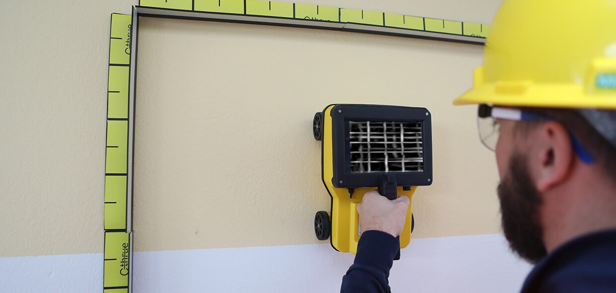
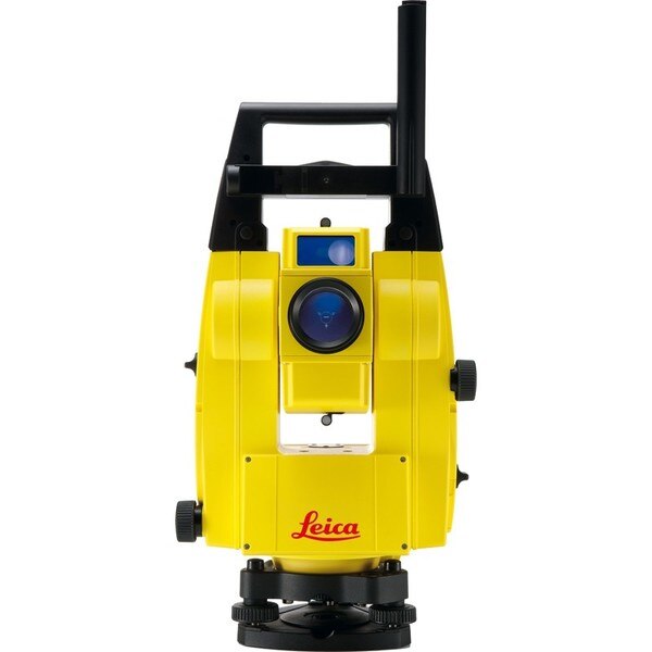
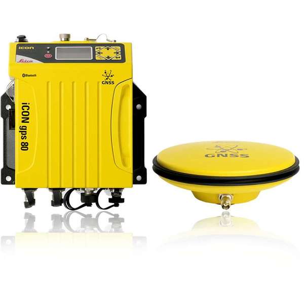
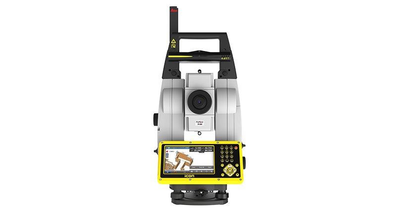
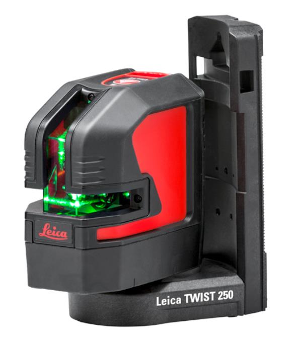
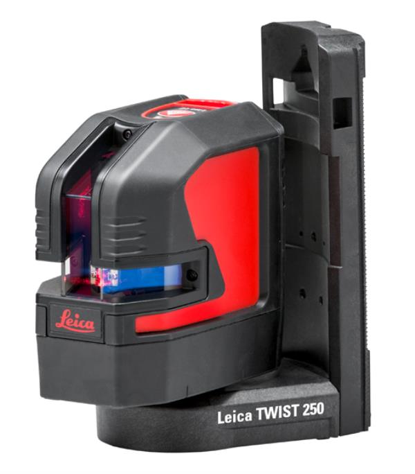
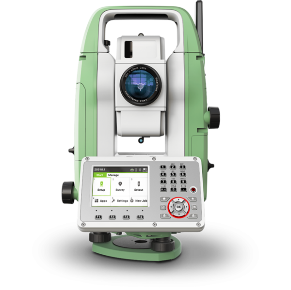
{ "products": [ { "_id": "5daaf779f9dc390001952ef9", "fptag": "SBENTERPRISESTRADINGPUNE", "merchantname": null, "customwidgets": null, "externalsourceid": null, "name": "Leica FlexLine TS07 Manual Total Station", "description": "Leica FlexLine TS07 Manual Total Station\nThe Leica FlexLine TS07 high-quality, manual total station is based on a proven product concept that has been revolutionising the world of measurement and survey for nearly 200 years. The Leica TS07 is equipped with a comprehensive application-based software package - Leica FlexField software - that enables most survey and stakeout tasks to be carried out easily and efficiently. The new FlexLine TS07 works reliably and delivers accurate results even in the harshest environments.\n\nWork faster: measure more points per day due to faster measurement and stakeout procedures (endless drives, trigger key, drives on both sides, pinpoint EDM and more), supported by our comprehensive and user-friendly Leica FlexField software.\nUse it trouble-free: increase productivity and minimise downtime by relying on instruments that simply work and come with a global service and support network.\nChoose products that are built to last: FlexLine operates with the same high level of quality even after years of use under harsh conditions (like mud, dust, blowing rain, extreme heat and cold).\nControl your investment: reliability, speed and accuracy ensure a lower investment over the product lifetime and a higher resell value.\nSave time with AutoHeight: measure, read and set the instrument height automatically with this revolutionary feature in the FlexLine TS07 (optional). Errors are minimised and the setup process onsite is faster.", "price": 0.0, "discountamount": 0.0, "currencycode": "INR", "priority": 1000000, "isfreeshipmentavailable": false, "shipmentduration": 7, "_keywords": null, "isarchived": false, "isavailable": true, "applicationid": null, "productindex": 156, "imageuri": "https://productimages.withfloats.com/actual/5daaf77b836b6b0001c86cb4.png", "tileimageuri": "https://productimages.withfloats.com/tile/5daaf77b836b6b0001c86cb4.png", "images": null, "totalqueries": 0, "gpid": null, "groupproductid": null, "createdon": "2019-10-19T11:46:01.098Z", "updatedon": "2019-10-19T11:46:01.098Z", "buyonlinelink": null, "producturl": "http://WWW.SURVEYEQUIPMENT.IN/products/leica-flexline-ts07-manual-total-station/156", "availableunits": -1.0, "iscodavailable": false, "isprepaidonlineavailable": false, "maxcodorders": 0, "maxprepaidonlineorders": 0, "uniquepaymenturl": null, "brandname": "Leica Geosystems ", "category": "", "tags": null, "variants": false, "keyspecification": null, "otherspecifications": null, "pickupaddressreferenceid": "", "paymenttype": "None", "producttype": "products", "hsncode": null, "gstslab": 0.0, "isnotforsale": false }, { "_id": "5bcda7bf2757570001e2fc40", "fptag": "SBENTERPRISESTRADINGPUNE", "merchantname": null, "customwidgets": null, "externalsourceid": null, "name": "C-thrue", "description": "C-thrue\nSee thru concrete structures and reveal true data that lead to optimal decision-making\n\nCONCRETE SCANNING\nPinpoint hidden objects in cured concrete—without expensive specialists.\n\nScanning, analyzing, and interpreting what's beneath concrete has never been faster or easier. The C-thrue, now equipped with an additional sensor are the industry's easiest-to-use tools for self-performing concrete inspections.\n\nC-thrue is an all-in-one Ground Penetrating Radar (GPR) for accurate scanning and real time analysis of concrete structures. Construction and service companies as well as civil and structural engineers can now improve the way they locate rebars, voids, post-tension cables, cavities, conduits, and any other objects buried in the structure before cutting or drilling into the concrete.\n\nC-thrue is an easy-to-use and robust solution to see through concrete structures and reveal true data that lead to optimal decision-making. The solution is suited for all construction sites and operations including building renovation, overpasses, monuments, bridges and tunnels surveys, as well as for detailed analysis of the original engineering project and comparison with the as-built structure.\n\nToday, C-thrue offers more flexibility with no limitations for your analysis requirements, thanks to a compact and light telescopic pole and an external controller that can be easily transported on site in challenging locations or conditions (e.g. under a deck, along vertical walls, etc...). \nThe C-thrue external controller allows easier and faster data interpretation thanks to real-time data processing and representation of results in Augmented Reality for more efficient decision-making.\n\nFeatures and Benefits:\n\nClearer and faster surveys \nDetection of both first and second levels of rebars thanks to the system’s double polarisation.\nSafe drill in the surveyed structure\nRebar/void automatic insight capabilities that improve safety before cutting or drilling into the concrete.\n\nFully-visible, multi-touch display \nData displayed on the screen are never obscured by the handle or the user’s hand.\n\nSimplified data interpretation\nOptimal decision-making supported by visualisation of acquired data in 3D models.\n\nIncreased data accuracy\nEliminate manual, error-prone paper grids with an automatic positioning and navigation system.\n\nAdvanced data visualisation\nAugmented reality for 3D data visualisation and sharing across operators – in real time or intervals after acquisition.\n\nAutomated data acquisition and analysis\nAutomatic detection of the first layer of rebars and result exportation.\n\nFlexibility everywhere\nLightweight, compact, drop resistant and transportable system for every user operations and construction sites.", "price": 0.0, "discountamount": 0.0, "currencycode": "INR", "priority": 1000000, "isfreeshipmentavailable": false, "shipmentduration": 7, "_keywords": null, "isarchived": false, "isavailable": true, "applicationid": null, "productindex": 117, "imageuri": "https://productimages.withfloats.com/actual/5bcda7c0e34dfa000137913c.jpg", "tileimageuri": "https://productimages.withfloats.com/tile/5bcda7c0e34dfa000137913c.jpg", "images": null, "totalqueries": 0, "gpid": null, "groupproductid": null, "createdon": "2018-10-22T10:34:39.836Z", "updatedon": "2018-11-22T05:55:37.191Z", "buyonlinelink": null, "producturl": "http://WWW.SURVEYEQUIPMENT.IN/products/c-thrue/117", "availableunits": -1.0, "iscodavailable": true, "isprepaidonlineavailable": false, "maxcodorders": 0, "maxprepaidonlineorders": 0, "uniquepaymenturl": null, "brandname": null, "category": "gpr", "tags": [ "gpr", "ground peantritng radar", "concretescanner" ], "variants": false, "keyspecification": null, "otherspecifications": null, "pickupaddressreferenceid": "5d08ebb3edf0e25c3b8da5d0", "paymenttype": "AssuredPurchase", "producttype": "products", "hsncode": null, "gstslab": 0.0, "isnotforsale": false }, { "_id": "5b7ffb95147e16051e773f27", "fptag": "SBENTERPRISESTRADINGPUNE", "merchantname": null, "customwidgets": null, "externalsourceid": null, "name": "IDS GeoRadar - Stream C", "description": "IDS GeoRadar - Stream C\nThe compact array solution for accurate 3D utility mapping.\nHigh quality, High productivity and Simple to Use compact radar system for real time underground surveys.\n\nStream C is the compact array solution for real-time 3D mapping of underground utilities and features. Thanks to increased level of accuracy provided by a massive antenna array, Stream C is able to automatically detect pipes and cables.\n\nDaily use of Stream C is aided by ergonomic features including electronic ride height adjustment, options to tow manually or with a small vehicle and a motor assisted drive wheel.\n\nSTREAM C BENEFITS\n\nHigh Productivity: surveys only need to be performed in one direction to ensure optimal detection for both longitudinal and transversal pipes.\nNo advanced training needed: the system automatically detects and locates the position of pipes in real time and displays them on screen.\nReduced user fatigue: thanks to electronic ride height adjustment and a motor assisted drive wheel.\nFacilitates large surveys: the system can be towed manually or with a small vehicle, increasing the acquisition speed (up to 6 km/h).\n\nSTREAM C FEATURES\n\nMassive array of 34 antennas in two polarizations: this enables an accurate 3D reconstruction of the underground utility network to be created in a single scan.\nAutomatic Pipe Detection (APD): real-time automatic detection of buried pipes and cables\nCompact size: Stream C’s small dimensions enable it to survey areas inaccessible to larger array systems while maintaining the same accuracy.\nRobust construction: built to the highest standards and with hardwearing materials so that it can be used in harsh, demanding environments.\n3D radar tomography: real-time tomography on a GPS or total station assisted cartographic background. • Professional subsurface survey: pipes, cables and buried objects can be automatically transferred to CAD and GIS formats allowing a complete subsurface GIS based digital map to be quickly produced.\n\nBenefits of Stream EM include:\n\nImproved management of underground utility design, relocation and coordination;\nCost and time reductions: No need to block traffic or perform surveys at night;\nIncrease in accuracy with a detection accuracy of as little as 5 cm;\nIncrease productivity and have the ability to detect every buried target;\nHighly modular structure allows it to be reconfigured to map sidewalks and difficult to access areas\n\nReal time software for advanced viewing \nStream EM is supplied with the OneVsion and GRED HD 3D CAD software suites.", "price": 0.0, "discountamount": 0.0, "currencycode": "INR", "priority": 1000000, "isfreeshipmentavailable": false, "shipmentduration": 7, "_keywords": [ "detection accuracy", "accurate 3D utility", "real time underground", "massive antenna array", "underground utilities", "compact array solution", "small dimensions enable", "complete subsurface GIS", "Use compact radar system", "survey areas inaccessible", "underground utility design", "accurate 3D reconstruction", "underground utility network", "GRED HD 3D CAD software suites", "Professional subsurface survey" ], "isarchived": false, "isavailable": true, "applicationid": null, "productindex": 111, "imageuri": "", "tileimageuri": "", "images": null, "totalqueries": 0, "gpid": null, "groupproductid": null, "createdon": "2018-08-24T12:35:33.806Z", "updatedon": "2018-08-24T12:35:33.806Z", "buyonlinelink": null, "producturl": "http://WWW.SURVEYEQUIPMENT.IN/products/ids-georadar-stream-c/111", "availableunits": -1.0, "iscodavailable": true, "isprepaidonlineavailable": false, "maxcodorders": 0, "maxprepaidonlineorders": 0, "uniquepaymenturl": null, "brandname": null, "category": null, "tags": null, "variants": false, "keyspecification": null, "otherspecifications": null, "pickupaddressreferenceid": "5d08ebb3edf0e25c3b8da5d0", "paymenttype": "AssuredPurchase", "producttype": "products", "hsncode": null, "gstslab": 0.0, "isnotforsale": false }, { "_id": "5b72a7c70bec88055cad7a33", "fptag": "SBENTERPRISESTRADINGPUNE", "merchantname": null, "customwidgets": null, "externalsourceid": null, "name": "Leica Lino L2-1 Cross Line Laser", "description": "Leica Lino L2-1 Cross Line Laser\nExact and quick projection of horizontal and vertical lines\nThe Leica Lino L2-1 is a self-levelling cross-line laser. It is a reliable precision laser for any kind of tasks like levelling, transfering and setting out right angles. It supports you on job side with two crossing vertical and horizontal lines.\n\n\n\nLeica Lino L2 Cross line laser\n\nStarter package includes:\n\nLeica Lino L2-1\nTwist 250\nPouch\n3 x AA batteries\nTarget Plate\nQuickstart Guide.\n \n\nLeica Lino L2 Cross line laser\n\nProfessional package includes:\n\nLeica Lino L2\nTwist 250\nCase\nLi-Ion Battery\nCharger\nAlkaline Battery Tray\nTarget Plate\nQuickstart Guide.\n\n\nOutstanding Laser Visibility\nThe high-precision optics of the Leica Lino L2 ensure outstanding laser line visibility up to 25 meters, depending on lighting conditions. Its exceptionally long horizontal and vertical laser lines are projected to floors, walls and ceilings at more than 180 degrees.\n\nSelf-Levelling\nThe Leica Lino L2 automatically adjusts its positioning if it is slightly out of level up to ± 4°. Outside this limit a visual alert is activated to prevent errors.\n\nSmart Adapters\nSmart adapters allow for quick and precise positioning. You can set up rotatable adapters over edges and profiles, or easily attach them to iron pipes, tracks and bars.\n\nAlways powered\nTriple Power Concept\nThe Leica Lino P5’s triple power concept ensures an uninterrupted workflow. You can power your laser by using rechargeable Li-Ion batteries for up to 44 hours on one charge. Alternatively, you can use Alkaline batteries or simply its charger.\n\nRugged Design\n\nThe Leica Lino L2 is dust and spray water protected to IP 54 standards. This makes it a rugged instrument suitable for all your jobs.", "price": 0.0, "discountamount": 0.0, "currencycode": "INR", "priority": 1000000, "isfreeshipmentavailable": false, "shipmentduration": 7, "_keywords": [ "horizontal", "Leica Lino L2", "IP 54 standards", "Cross Line Laser", "quick projection", "Lino L2 Cross line", "rotatable adapters", "Alkaline batteries", "precise positioning", "vertical laser lines", "reliable precision laser", "rugged instrument suitable", "triple power concept ensures", "outstanding laser line visibility" ], "isarchived": false, "isavailable": true, "applicationid": null, "productindex": 110, "imageuri": "", "tileimageuri": "", "images": null, "totalqueries": 0, "gpid": null, "groupproductid": null, "createdon": "2018-08-14T09:58:31.183Z", "updatedon": "2018-08-14T09:58:31.183Z", "buyonlinelink": null, "producturl": "http://WWW.SURVEYEQUIPMENT.IN/products/leica-lino-l2-1-cross-line-laser/110", "availableunits": -1.0, "iscodavailable": true, "isprepaidonlineavailable": false, "maxcodorders": 0, "maxprepaidonlineorders": 0, "uniquepaymenturl": null, "brandname": null, "category": null, "tags": null, "variants": false, "keyspecification": null, "otherspecifications": null, "pickupaddressreferenceid": "5d08ebb3edf0e25c3b8da5d0", "paymenttype": "AssuredPurchase", "producttype": "products", "hsncode": null, "gstslab": 0.0, "isnotforsale": false }, { "_id": "5b6b3a9ed682be0552aefde4", "fptag": "SBENTERPRISESTRADINGPUNE", "merchantname": null, "customwidgets": null, "externalsourceid": null, "name": "Leica iCON Robot 50", "description": "Leica iCON Robot 50\nThe Leica iCON Robot 50 total station is operable using the field controller (iCON CC50) at the point of positioning using the prism pole, therefore there is no need for an operator at the instrument itself. This technology is extremely efficient and a highly accurate way of working.\n\nThe iCON robot 50 achieves the most precise reflector less measurements in its class. It features a simple one-button keyboard and patented PowerSearch option in order to find the prism quickly. Take advantage of applications through the custom-built software – iCONstruct. It also communicates using Bluetooth (up to 350m), WLAN (150m) and RS232 for different requirements, simply change the instrument handle to upgrade.\n\nWith very tight tolerances the Leica iCON Robot 50 is able to precisely control Graders, Dozers and Pavers automatically as well as set out or survey conventionally with one person. With the use of the most precise and accurate laser pointers the Leica Robot 50 is also able to layout points on ceilings or walls.\n\nFeatures\nExtremely precise reflectorless measurements\nSimple keyboard for easy use\nExcellent tracking\nRobust data communication\nGuide light\nand-over control from the rover\nWide range of apps with bespoke iCONstruct software\nIntegrates with all Leica iCON sensors\n\nLeica iCON robot 50 is designed specifically for ease of use within the construction industry, simply level the instrument and go.\n\nSave time and increase your productivity by doing layout work and as-built checks yourself. With iCON robot 50 you don’t need an operator at the instrument. The robotic total station can be operated from the field controller at the prism pole, at the point you need positioning.\n\nThe iCON robot 50 also delivers with:\n\nMost accurate reflectorless measurements in its class\nOne-button keyboard for simple operation\nFaster prism search by PowerSearch (patented technology)\nSuperior tracking performance ensures minimum machine downtime in machine control operation\nFlexible data communication: WLAN (150m range) or Long-range Bluetooth® (350m). Simply upgrade your communication by swapping the instrument handle\nEasy hand-over control from rover to machine control and vice versa\n \nOne-person robotic \nWith industry leading tracking performance and the patented PowerSearch technology, iCON robot 50 allows you to finish jobs faster maintaining highest accuracy.\n\nInterior overhead with laser pointer \nUsing one of the world’s most accurate laser pointers, remotely lay-out points on walls for drill patterns or on ceilings for air conditioning or other such projects.\n\nMachine control \nWork to the tightest tolerances under any site conditions. Carry out fine grading and paving with highest precision, speeding up your work with construction machinery.\n\nLimitless applications \nWith the iCONstruct software, you can use iCON robot 50 for a wide range of measuring and positioning tasks on site, such as:\n\nLayout\nStake-out\nGrade checking\nVolumes\nAs-built checks\nMachine control\n\n", "price": 0.0, "discountamount": 0.0, "currencycode": "INR", "priority": 1000000, "isfreeshipmentavailable": false, "shipmentduration": 7, "_keywords": [ "Leica Robot 50", "use iCON robot 50", "iCONstruct software", "iCON robot 50 allows", "precise reflectorless", "robotic total station", "construction industry", "iCON robot 50 achieves", "PowerSearch technology", "accurate laser pointers", "Leica iCON Robot 50 total station", "accurate reflectorless measurements", "performance ensures minimum machine downtime" ], "isarchived": false, "isavailable": true, "applicationid": null, "productindex": 99, "imageuri": "https://productimages.withfloats.com/actual/5b486c5af599f80511fd9ca6.jpg", "tileimageuri": "https://productimages.withfloats.com/tile/5b486c5af599f80511fd9ca6.jpg", "images": null, "totalqueries": 0, "gpid": null, "groupproductid": null, "createdon": "2018-07-13T09:09:46.162Z", "updatedon": "2018-08-08T18:46:54.36Z", "buyonlinelink": null, "producturl": "http://WWW.SURVEYEQUIPMENT.IN/products/leica-icon-robot-50/99", "availableunits": -1.0, "iscodavailable": true, "isprepaidonlineavailable": false, "maxcodorders": 0, "maxprepaidonlineorders": 0, "uniquepaymenturl": null, "brandname": null, "category": "leicatotalstations", "tags": [ "leicatotalstations", "leicatotalstationsindia", "robotictotalstations", "leicatotalstationpune", "leicaicon" ], "variants": false, "keyspecification": null, "otherspecifications": null, "pickupaddressreferenceid": "5d08ebb3edf0e25c3b8da5d0", "paymenttype": "AssuredPurchase", "producttype": "products", "hsncode": null, "gstslab": 0.0, "isnotforsale": false }, { "_id": "5b6b3a9ed682be0552aefdd6", "fptag": "SBENTERPRISESTRADINGPUNE", "merchantname": null, "customwidgets": null, "externalsourceid": null, "name": "Leica iCON gps 80", "description": "Leica iCON gps 80\nThe Leica iCON gps 80 GNSS machine receiver takes machine control to the next level.\nThe iCG80 GNSS receiver in combination with CGA 60 GNSS antenna increases the performance of your iCON machine control solution, allowing you to work more productively than ever before.\n\nIncrease dozer, excavator, drilling, excavator, wheel loader, grader and paver machine uptime. Enjoy the benefits from reliable, fast 3D positioning and productive operation via a high performance machine control system.\n\nKey benefits at a glance\nSensor integration with the machine system increases automatic handling, ease of use and work speed\nIncreased productivity and performance with all system elements fitting together\nCAN bus protocol specifically designed and created for GNSS machine control, providing reliable communication and increased uptime\nBuilt in modem and removable radios for flexible communication\nxRTK provides machine guidance and increases productivity in demanding environments\nLeica iCON telematics allows remote access to the machine computer fast data transfer and support\n\nUltimate performance for machine applications\nThe iCON GPS 80 GNSS machine receiver raises the performance of the machine control system to ensures maximum uptime and enabling applications to be done more quickly without compromising on quality.\n\n", "price": 0.0, "discountamount": 0.0, "currencycode": "INR", "priority": 1000000, "isfreeshipmentavailable": false, "shipmentduration": 7, "_keywords": [ "machine guidance", "machine computer", "iCG80 GNSS receiver", "GNSS machine control", "paver machine uptime", "machine control system", "increases productivity", "reliable communication", "iCON machine control solution", "CGA 60 GNSS antenna increases", "high performance machine control", "machine system increases automatic", "Leica iCON gps 80 GNSS machine receiver" ], "isarchived": false, "isavailable": true, "applicationid": null, "productindex": 98, "imageuri": "https://productimages.withfloats.com/actual/5b486344f599f80511fd98b1.jpg", "tileimageuri": "https://productimages.withfloats.com/tile/5b486344f599f80511fd98b1.jpg", "images": null, "totalqueries": 0, "gpid": null, "groupproductid": null, "createdon": "2018-07-13T08:31:00.378Z", "updatedon": "2018-08-08T18:46:54.336Z", "buyonlinelink": null, "producturl": "http://WWW.SURVEYEQUIPMENT.IN/products/leica-icon-gps-80/98", "availableunits": -1.0, "iscodavailable": true, "isprepaidonlineavailable": false, "maxcodorders": 0, "maxprepaidonlineorders": 0, "uniquepaymenturl": null, "brandname": null, "category": "Topographical Survey", "tags": [ "Topographical Survey", "Transmission Line Survey", "Survey Equipments", "Geographical Survey", "Road Survey" ], "variants": false, "keyspecification": null, "otherspecifications": null, "pickupaddressreferenceid": "5d08ebb3edf0e25c3b8da5d0", "paymenttype": "AssuredPurchase", "producttype": "products", "hsncode": null, "gstslab": 0.0, "isnotforsale": false }, { "_id": "5b6b3a9dd682be0552aefc2a", "fptag": "SBENTERPRISESTRADINGPUNE", "merchantname": null, "customwidgets": null, "externalsourceid": null, "name": "Leica iCON iCR80 Robotic Total Station", "description": "Leica iCON iCR80 Robotic Total Station\nAchieve more layout points all day every day\n\nThe Leica iCON iCR80 construction total station keeps its ‘eye’ on only one thing: the user’s target. Layout more points per day thanks to ATRplus, the most robust automated-aiming, lock and re-lock technology in the market. iCR80 is especially useful in congested sites with many distractions, such as reflections, machines and people moving around. Challenging and changing site conditions should not be an obstacle.\n\nThe iCON iCR80 allows users to:\n\nLayout lines for footings or chalk line for formwork on foundation\nLayout points on blinding layer, such as pipe insert or cut-outs before pouring concrete\nLayout true design objects based on federated and enriched models\nMEP layout of wall penetrations for pipes, hanger locations for HVAC and duct work, inserts and slits for sheet metal work\nControl a wide variety of construction machines, such as curb and gutter or milling machines, asphalt or concrete pavers, and graders or dozers\nThe iCON iCR80 guarantees layout efficiency with the most reliable, simple and automatic set up procedure, industry-leading prism lock, and flexible handling of fully rendered 3D design models in the field. This sophisticated, one-person total station offers an ‘all-in-one’ solution for every purpose – especially the difficult ones, allowing you to speed up your workflow.\n\nThe iCON iCR80 total station is fully compatible with:\n\nLeica iCON CC80 tablet with an enhanced version of the tailored iCON build construction field software\nLeica Infinity office software and Leica ConX for online sharing of data between the office and the site\nThe iCON iCR80 features:\n\nFaster prism search by patented technology, PowerSearch\nStable data communication with long-range Bluetooth® (up to 400m)\nEasy hand-over control from pole to machine and vice versa\nATRplus technology, maximising the total station’s ability to remain locked on your target for highest point-to-point layout speed\n“Tune out targets” feature to ignore other distractions in the field\nFastest re-lock in case of interrupted line of sight\n\nLowest total cost of ownership\n\nLeica Geosystems construction total stations have a high value, giving you the lowest total cost of ownership. Its resilient hardware allows for longevity and reliability, giving you many years of rough usage in the most demanding environments. Its level of quality ensures your data remains accurate, lowers downtime and keeps your productivity high in all environments and conditions. Invest in the smarter total station solution and reap massive long-term rewards.\n\nNever loose lock\n\nThe iCR80 comes with automated aiming ATRplus, which intelligently and automatically detects environmental conditions, such as light, dust, rain and other site conditions. The new ATRplus, lock and re-lock technology speeds aiming and following of targets and delivers accurate measurements independent of user aiming or site conditions. Even when used on busy construction sites, the down time resulting from loss of lock is minimal, speeding up significantly your layout task.\n\n\n", "price": 0.0, "discountamount": 0.0, "currencycode": "INR", "priority": 1000000, "isfreeshipmentavailable": false, "shipmentduration": 7, "_keywords": [ "iCON CC80 tablet", "iCON iCR80 features", "construction machines", "data remains accurate", "busy construction sites", "iCON iCR80 total station", "environmental conditions", "Infinity office software", "iCON build construction field", "smarter total station solution", "Leica iCON iCR80 Robotic Total Station", "Geosystems construction total stations", "iCON iCR80 guarantees layout efficiency", "delivers accurate measurements independent", "Leica iCON iCR80 construction total station" ], "isarchived": false, "isavailable": true, "applicationid": null, "productindex": 83, "imageuri": "https://productimages.withfloats.com/actual/5b2df1bcdfeea305b4fb1db1.jpg", "tileimageuri": "https://productimages.withfloats.com/tile/5b2df1bcdfeea305b4fb1db1.jpg", "images": null, "totalqueries": 0, "gpid": null, "groupproductid": null, "createdon": "2018-06-23T07:07:40.566Z", "updatedon": "2018-08-08T18:46:53.535Z", "buyonlinelink": null, "producturl": "http://WWW.SURVEYEQUIPMENT.IN/products/leica-icon-icr80-robotic-total-station/83", "availableunits": -1.0, "iscodavailable": true, "isprepaidonlineavailable": false, "maxcodorders": 0, "maxprepaidonlineorders": 0, "uniquepaymenturl": null, "brandname": null, "category": "leicatotalstations", "tags": [ "leicatotalstations", "sokkiatotalstation", "Robotic Total Station" ], "variants": false, "keyspecification": null, "otherspecifications": null, "pickupaddressreferenceid": "5d08ebb3edf0e25c3b8da5d0", "paymenttype": "AssuredPurchase", "producttype": "products", "hsncode": null, "gstslab": 0.0, "isnotforsale": false }, { "_id": "5b6b3a9dd682be0552aefbcb", "fptag": "SBENTERPRISESTRADINGPUNE", "merchantname": null, "customwidgets": null, "externalsourceid": null, "name": "Leica LINO L2G Lithium - Green Line Laser", "description": "Leica LINO L2G Lithium - Green Line Laser\nVisibility on a new level!\n\nLeica’s latest green laser technology brings laser line visibility and clarity to the highest level. Green reference lines are easily seen in difficult lighting conditions and over long distances.\n\nThe Leica Lino L2G Lithium cross-line laser projects highly visible lines at the correct angles to one another. Its new laser uses the latest green laser technology which makes lines even more visible and clear. As a result, this laser will make it easier for you to see your reference lines, even in extreme lighting conditions or over long distances.\n\nAdditional information\nThe Lino L2G Lithium is a self-levelling laser. It automatically corrects its positioning when out of level up to ± 4°. The laser beams flash if the tilt is outside this range to prevent errors.\n\nThe L2G Lithium is dust and spray water protected to IP 54 standards and comes in a hard case allowing you to store all accessories safely.\n\n", "price": 0.0, "discountamount": 0.0, "currencycode": "INR", "priority": 1000000, "isfreeshipmentavailable": false, "shipmentduration": 7, "_keywords": [ "new laser", "new level", "laser beams", "visible lines", "laser projects", "IP 54 standards", "Green Line Laser", "laser line visibility", "Green reference lines", "Leica LINO L2G Lithium", "green laser technology", "difficult lighting conditions" ], "isarchived": false, "isavailable": true, "applicationid": null, "productindex": 78, "imageuri": "https://productimages.withfloats.com/actual/5b1f812fab52d6071c0f54fe.jpg", "tileimageuri": "https://productimages.withfloats.com/tile/5b1f812fab52d6071c0f54fe.jpg", "images": null, "totalqueries": 0, "gpid": null, "groupproductid": null, "createdon": "2018-06-12T08:15:44.511Z", "updatedon": "2018-08-08T18:46:53.173Z", "buyonlinelink": null, "producturl": "http://WWW.SURVEYEQUIPMENT.IN/products/leica-lino-l2g-lithium-green-line-laser/78", "availableunits": -1.0, "iscodavailable": true, "isprepaidonlineavailable": false, "maxcodorders": 0, "maxprepaidonlineorders": 0, "uniquepaymenturl": null, "brandname": null, "category": null, "tags": null, "variants": false, "keyspecification": null, "otherspecifications": null, "pickupaddressreferenceid": "5d08ebb3edf0e25c3b8da5d0", "paymenttype": "AssuredPurchase", "producttype": "products", "hsncode": null, "gstslab": 0.0, "isnotforsale": false }, { "_id": "5b6b3a9dd682be0552aefba4", "fptag": "SBENTERPRISESTRADINGPUNE", "merchantname": null, "customwidgets": null, "externalsourceid": null, "name": "Leica LINO L2 Lithium - line laser", "description": "Leica LINO L2 Lithium - line laser\nThe perfect alignment tool, now rechargeable, with new extended fan angle\n\nThe self levelling Leica LINO L2 Lithium cross line laser level projects very bright lines accurate to the millimetre while you have your hands free to get on with your work.\n\nOutstanding Laser Visibility\nThe high-precision optics of the Leica Lino L2 ensure outstanding laser line visibility up to 25 meters (depending on lighting conditions). Its exceptionally long horizontal and vertical laser lines are projected to floors, walls and ceilings at more than 180°.\n\nAdditional information\nThe self levelling Leica LINO L2 Lithium cross line laser level projects very bright lines accurate to the millimetre while you have your hands free to get on with your work. The Leica Lino L2 was awarded the Red Dot innovation award for design, functionality and voted top by electricians, plumbers, kitchen fitters as the easiest, brightest, quickest self leveling laser on the market. The Leica Lino L2 Lithium is covered by a Leica 3 Year Warranty.\n\nThe self levelling Leica LINO L2 Lithium automatically and quickly levels its self offering accurate vertical and horizontal lines accurately set at 90°. Whether horizontal, vertical or crossed - the red lines are perfectly visible everywhere on the wall. Simply perfect all along the line!", "price": 0.0, "discountamount": 0.0, "currencycode": "INR", "priority": 1000000, "isfreeshipmentavailable": false, "shipmentduration": 7, "_keywords": [ "red lines", "hands free", "Leica 3 Year", "electricians", "functionality", "Simply perfect", "horizontal lines", "accurate vertical", "Whether horizontal", "vertical laser lines", "bright lines accurate", "perfect alignment tool", "Red Dot innovation award", "outstanding laser line visibility", "Leica LINO L2 Lithium cross line laser level projects" ], "isarchived": false, "isavailable": true, "applicationid": null, "productindex": 76, "imageuri": "https://productimages.withfloats.com/actual/5b1f7b7fab52d6071c0f47fd.jpg", "tileimageuri": "https://productimages.withfloats.com/tile/5b1f7b7fab52d6071c0f47fd.jpg", "images": null, "totalqueries": 0, "gpid": null, "groupproductid": null, "createdon": "2018-06-12T07:51:27.882Z", "updatedon": "2018-08-08T18:46:53.039Z", "buyonlinelink": null, "producturl": "http://WWW.SURVEYEQUIPMENT.IN/products/leica-lino-l2-lithium-line-laser/76", "availableunits": -1.0, "iscodavailable": true, "isprepaidonlineavailable": false, "maxcodorders": 0, "maxprepaidonlineorders": 0, "uniquepaymenturl": null, "brandname": null, "category": "CROSSLINELESER", "tags": [ "CROSSLINELESER", "LEICALASERLEVEL", "LASERLEVELMACHINE" ], "variants": false, "keyspecification": null, "otherspecifications": null, "pickupaddressreferenceid": "5d08ebb3edf0e25c3b8da5d0", "paymenttype": "AssuredPurchase", "producttype": "products", "hsncode": null, "gstslab": 0.0, "isnotforsale": false } ], "hasmoreitems": false, "isapirequest": false, "totalresults": 27, "query": null, "floatingpoint": null }

Still searching for
leica na720 automatic level?

Still searching for
leica na720 automatic level?

Chat with us