Currently it only shows your basic business info. Start adding relevant business details such as description, images and products or services to gain your customers attention by using Boost 360
android app
/
iOS App/ web portal.
{
"products": [
{
"_id": "65cf1a9a6f500018087d604e",
"fptag": "SBENTERPRISESTRADINGPUNE",
"merchantname": null,
"customwidgets": null,
"externalsourceid": null,
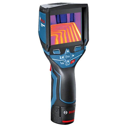
"name": "Bosch GTC 400 C Professional thermal camera",
"description": "The Bosch GTC 400 C Professional thermal camera is designed to provide high-quality thermal imaging for various applications. Here are some key features and benefits:\nHigh-Quality Thermal Images: The thermal camera boasts a 160 x 120 pixel sensor, resulting in 19,200 measuring points. This high resolution allows for detailed and accurate thermal imaging, making it easier to visualize temperature differences in the working environment.\nTemperature Range and Accuracy: The GTC 400 C has a broad temperature range, allowing it to measure temperatures between -10°C and +400°C. The device provides an accuracy of ±3°C, ensuring reliable and precise temperature readings in various conditions.\nData Storage and Reference: With the ability to save up to 500 visual and thermal images, the device enables users to document measurements for later reference. This feature is valuable for creating records, analyzing trends, and maintaining a history of thermal conditions.\nEasy Data Transfer and Analysis: The Measuring Master app facilitates quick data exchange and documentation of measurements. Additionally, the PC software allows users to edit thermal images and create detailed reports. This feature enhances the overall usability of the thermal camera in professional settings.\nUser-Friendly Interface: The thermal camera is designed with ease of use in mind. The interface is user-friendly, and important functions can be accessed with just one click. The picture-in-picture function is a useful feature that aids in locating measurements efficiently.\nVersatility: The wide working temperature range and high image quality make the GTC 400 C suitable for a variety of applications, from industrial and construction settings to maintenance and troubleshooting tasks.\nApplication Support: The device is supported by the Measuring Master app, providing additional functionality and connectivity options for seamless integration into various workflows.\nOverall, the Bosch GTC 400 C Professional thermal camera appears to be a versatile and reliable tool for professionals who require accurate thermal imaging in their work.\n\nThe Bosch GTC 400 C Professional thermal camera is well-suited for a wide range of applications, including but not limited to:\nElectrical Applications:\nQuickly and effectively check cable connections for anomalies or overheating.Inspect cabinets and electrical components to identify potential issues.Detect abnormal temperature patterns that may indicate electrical problems.HVAC (Heating, Ventilation, and Air Conditioning):\nCheck underfloor heating systems to ensure even heat distribution.Locate leaks in HVAC systems by identifying temperature variations.Inspect radiators for proper functioning and identify any blockages or malfunctions.Window Installation:\nSearch for faulty insulation in windows and doors.Identify thermal bridges that can contribute to energy inefficiency.Detect leaks and water penetration around windows and doors.Automotive:\nScan heating and cooling systems to identify temperature irregularities.Inspect fuse boxes for overheating or electrical issues.Check coolant pipes and radiators for leaks or blockages.Inspect catalytic converters for proper functioning.In each of these applications, the thermal camera's ability to visualize temperature differences provides a valuable tool for preventive maintenance, troubleshooting, and quality control. It allows professionals to identify potential problems before they lead to more significant issues, improving overall efficiency and safety in various industries. The device's wide temperature range, high image quality, and user-friendly interface make it a versatile tool for professionals in electrical, HVAC, construction, automotive, and related fields.",
"price": 72000.0,
"discountamount": 0.0,
"currencycode": "INR",
"priority": 1000000,
"isfreeshipmentavailable": false,
"shipmentduration": 7,
"_keywords": [
"ease",
"mind",
"10°C",
"±3°C",
"Scan",
"users",
"doors",
"leaks",
"safety",
"device",
"trends",
"+400°C",
"Search",
"variety",
"records",
"history",
"windows",
"cabinets",
"Analysis",
"benefits",
"Accuracy",
"anomalies",
"blockages",
"one click",
"500 visual",
"wide range",
"industrial",
"fuse boxes",
"Automotive",
"Versatility",
"overheating",
"Ventilation",
"PC software",
"temperatures",
"key features",
"malfunctions",
"measurements",
"Data Storage",
"HVAC systems",
"reliable tool",
"coolant pipes",
"valuable tool",
"The GTC 400 C",
"professionals",
"documentation",
"versatile tool",
"related fields",
"useful feature",
"later reference",
"thermal bridges",
"high resolution",
"quality control",
"cooling systems",
"potential issues",
"Air Conditioning",
"picture function",
"detailed reports",
"Inspect radiators",
"water penetration",
"electrical issues",
"overall usability",
"heat distribution",
"various workflows",
"faulty insulation",
"cable connections",
"various industries",
"overall efficiency",
"proper functioning",
"thermal conditions",
"significant issues",
"various conditions",
"potential problems",
"Easy Data Transfer",
"high image quality",
"quick data exchange",
"working environment",
"Application Support",
"important functions",
"energy inefficiency",
"Window Installation",
"electrical problems",
"various applications",
"seamless integration",
"connectivity options",
"catalytic converters",
"construction settings",
"troubleshooting tasks",
"professional settings",
"electrical components",
"preventive maintenance",
"wide temperature range",
"temperature variations",
"160 x 120 pixel sensor",
"temperature differences",
"19,200 measuring points",
"Electrical Applications",
"broad temperature range",
"User-Friendly Interface",
"The Measuring Master app",
"additional functionality",
"accurate thermal imaging",
"temperature irregularities",
"underfloor heating systems",
"High-Quality Thermal Images",
"precise temperature readings",
"high-quality thermal imaging",
"abnormal temperature patterns",
"wide working temperature range",
"The Bosch GTC 400 C Professional thermal camera"
],
"isarchived": false,
"isavailable": true,
"applicationid": null,
"productindex": 235,
"imageuri": "https://productimages.withfloats.com/actual/65cf1a9e1f63cf9c49f7de00.jpg",
"tileimageuri": "https://productimages.withfloats.com/tile/65cf1a9e1f63cf9c49f7de00.jpg",
"images": null,
"totalqueries": 0,
"gpid": null,
"groupproductid": null,
"createdon": "2024-02-16T08:19:38.327Z",
"updatedon": "2024-02-16T08:19:38.327Z",
"buyonlinelink": null,
"producturl": "http://WWW.SURVEYEQUIPMENT.IN/products/bosch-gtc-400-c-professional-thermal-camera/235",
"availableunits": -1.0,
"iscodavailable": false,
"isprepaidonlineavailable": false,
"maxcodorders": 0,
"maxprepaidonlineorders": 0,
"uniquepaymenturl": null,
"brandname": "BOSCH ",
"category": "ThermalCamera",
"tags": null,
"variants": false,
"keyspecification": null,
"otherspecifications": null,
"pickupaddressreferenceid": "",
"paymenttype": "None",
"producttype": "products",
"hsncode": null,
"gstslab": 0.0,
"isnotforsale": false
},
{
"_id": "5d4e66ac5c6ebf0001143d5b",
"fptag": "SBENTERPRISESTRADINGPUNE",
"merchantname": null,
"customwidgets": null,
"externalsourceid": null,
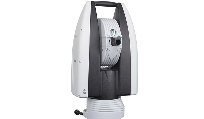
"name": "Leica Absolute Tracker AT960",
"description": "Leica Absolute Tracker AT960\nLaser Tracker Systems\nHigh-accuracy probing, scanning and reflector measurement for large-volume industrial applications\n\n\n\nHigh-performance 6DoF laser tracker technology in an ultra-portable and easy-to-use form factor.\n\n\n\nThe Leica Absolute Tracker AT960 is a robust, all-in-one laser tracker that fits in a single flight case. Offering high-speed dynamic measurement as standard, it is a complete solution for six degrees of freedom (6DoF) probing, scanning and automated inspection as well as reflector measurement.\n\n\nA new generation of portable CMM system based on proven technology, the AT960 brings together the 6DoF functionality introduced with the Leica Absolute Tracker AT901 and the portability and usability delivered by the compact Leica Absolute Tracker AT403. The result is a highly-sophisticated yet easy-to-use large-volume measurement solution weighing less than 14 kilograms.\n\nThe AT960 laser tracker can be transported easily, unpacked quickly and powered up in minutes to deliver high-performance measurement almost anywhere. Dynamic features and flexible functionality give users absolute speed, accuracy and portability.\n\nFeaturing wireless communication and a battery operation option, the integrated-technology design of the AT960 makes lengthy setup a thing of the past. The Leica Absolute Interferometer (AIFM) enables accurate high-speed measurement to a moving target while the innovative PowerLock function ensures an interrupted beam is instantly re-established without user intervention, reducing operator workload and training requirements. Intuitive touch-screen controls minimise the potential for user error, saving time, effort and money. Check and compensation architecture means basic adjustments can be made in the field, while robust design guarantees on-specification operations with minimal calibration and servicing\n\nWhen combined with the Real-Time Feature Pack and Leica T-Mac, the AT960 evolves into a laser tracker solution that meets the deterministic measurement data-delivery requirements of high-end automated installations. Built on the industry-proven EtherCAT protocol, it enables the delivery of 6DoF measurement data with accurate timestamps at an output rate of up to 1000 Hertz. Known as 7DoF measurement data, this enables real-time machine control within even highly-dynamic robotic setups.\n\nWith a measurement volume of up to 160 metres in diameter, the AT960 is compatible with Leica T-Probe, Leica T-Mac, Leica T-Scan 5 and Leica Absolute Scanner technology. This flexibility allows it to cater to a wide variety of inspection applications – from quality lab to in-line; from in the factory to in the field – ensuring users have the right tool for any measurement challenge.\n\n",
"price": 0.0,
"discountamount": 0.0,
"currencycode": "INR",
"priority": 1000000,
"isfreeshipmentavailable": false,
"shipmentduration": 7,
"_keywords": null,
"isarchived": false,
"isavailable": true,
"applicationid": null,
"productindex": 150,
"imageuri": "https://productimages.withfloats.com/actual/5d4e66adb409c900010d17d6.jpg",
"tileimageuri": "https://productimages.withfloats.com/tile/5d4e66adb409c900010d17d6.jpg",
"images": null,
"totalqueries": 0,
"gpid": null,
"groupproductid": null,
"createdon": "2019-08-10T06:39:40.851Z",
"updatedon": "2019-08-10T06:39:40.851Z",
"buyonlinelink": null,
"producturl": "http://WWW.SURVEYEQUIPMENT.IN/products/leica-absolute-tracker-at960/150",
"availableunits": -1.0,
"iscodavailable": false,
"isprepaidonlineavailable": false,
"maxcodorders": 0,
"maxprepaidonlineorders": 0,
"uniquepaymenturl": null,
"brandname": "Leica ",
"category": "",
"tags": [
"laser tracker"
],
"variants": false,
"keyspecification": null,
"otherspecifications": null,
"pickupaddressreferenceid": "",
"paymenttype": "None",
"producttype": "products",
"hsncode": null,
"gstslab": 0.0,
"isnotforsale": false
},
{
"_id": "5c18b8e4ead682000197c724",
"fptag": "SBENTERPRISESTRADINGPUNE",
"merchantname": null,
"customwidgets": null,
"externalsourceid": null,
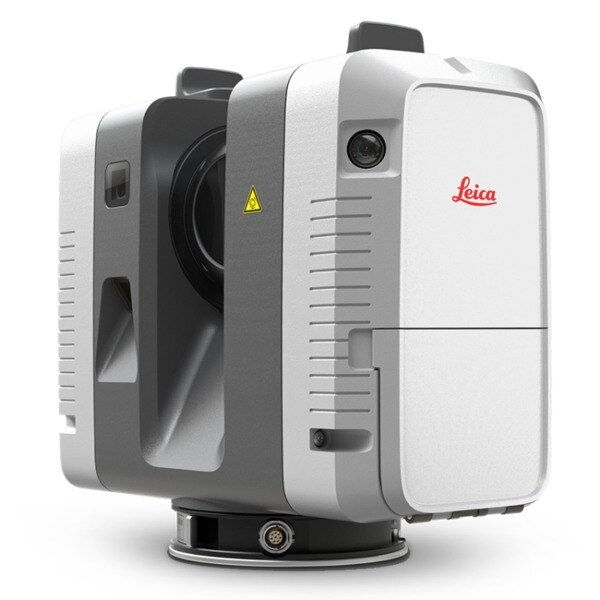
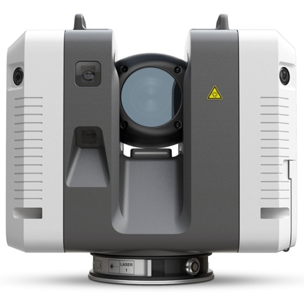
"name": "Leica RTC360 Laser Scanner",
"description": "Leica RTC360 Laser Scanner\nFast, agile and precise 3D reality capture solution\nFast\nFAST\nThe Leica RTC360 laser scanner makes 3D reality capture faster than ever before. With a measuring rate of up to 2 million points per second and advanced HDR imaging system, the creation of colored 3D point clouds can be completed in under 2 minutes. Plus, automated targetless field registration (based on VIS technology) and the seamless, automated transfer of data from site to office reduce time spent in the field and further maximize productivity.\n\nAgile\nAgile\nSmall and lightweight, the Leica RTC360 scanner’s portable design and collapsible tripod mean it’s compact enough to fit into most backpacks, ready to be taken anywhere. Once on-site, easy-to-use one-button operation makes for fast, hassle-free scanning.\n\nPrecise\nPrecise\nLow noise data allows for better images, resulting in crisp, high-quality scans that are rich in detail and ready for use in a range of applications. Combined with Cyclone FIELD 360 software for automated registration in the field, the Leica RTC360 scanner offers outstanding precision that can be checked on-site.\n\nLeica RTC360 Product Specifications\n3D Laser Scanner\tHigh-speed 3D laser scanner with integrated HDR spherical imaging system and Visual Inertial System (VIS) for real time registration\nData acquisition\t< 2 min for complete full dome scan and spherical HDR image at 6mm @ 10m resolution\nReal time registration\tAutomatic point cloud alignment based on real time tracking of scanner movement between setups based on Visual Inertial System (VIS) by video-enhanced inertial measurement unit\nDouble scan\tAutomatic removal of moving objects\nDistance measurement\tHigh-speed, high dynamic time of flight enhanced by Waveform Digitizing (WFD) technology\nLaser Class\t1 (in accordance with IEC 60825-1:2014), 1550nm (invisible)\nField of view\t360° (horizontal) / 300° (vertical)\nRange\tMin. 0.5 - up to 130 m\nSpeed\tUp to 2‘000‘000 pts / sec\nResolution\t3 user selectable settings (3/6/12mm @ 10m)\nAccuracy\tAngular accuracy 18”\nRange accuracy 1.0 mm + 10 ppm \n3D point accuracy \n1.9 mm @ 10 m \n2.9 mm @ 20 m \n5.3 mm @ 40 m\nRange noise\t0.4 mm @ 10 m, 0.5 mm @ 20 m\nCamera\t36 MP 3-camera system captures \n432 MPx raw data for calibrated \n360° x 300° spherical image\nSpeed\t1 minute for full spherical HDR image at any light condition\nHDR\tAutomatic, 5 brackets\nVisual Inertial System\tVideo enhanced inertial measuring system to track movement of the scanner position relative to the previous setup in real time\nTilt\tIMU based, Accuracy: 3‘ for any tilt\nAdditional sensors\tAltimeter, Compass, GNSS\nOn scanner\tTouch-screen control with finger touch, full color WVGA graphic display 480 x 800 pixels\nMobile devices\tLeica Cyclone FIELD 360 app for iPad or Android tablets including:\n- Remote control of scan functions\n- 2D & 3D data viewing\n- Tagging\n- Automatic alignment of scans\nWireless\tIntegrated wireless LAN (802.11 b/g/n)\nData storage\tLeica MS256, 256GB exchangeable USB 3.0 flash drive\nHousing\tAluminium frame and sidecovers\nDimensions\t120mm x 240mm x 230mm / 4.7‘‘ x 9.4‘‘ x 9.1\nWeight\t5.35 kg / 11.7 lbs, nominal (w/o batteries)\nMounting mechanism\tQuick mounting on 5/8“ stub on lightweight tripod / optional tribrach adapter / survey tribrach adapter available\nInternal battery\t2 x Leica GEB361 internal, rechargeable Li-Ion batteries.\nDuration: Typically up to 4 hours\nWeight: 340 g per battery\nExternal\tLeica GEV282 AC adapter\nOperating temperature\t5° to +40° C\nStorage temperature\t40° to +70° C\nDust/Humidity\tSolid particle/liquid ingress protection IP54",
"price": 0.0,
"discountamount": 0.0,
"currencycode": "INR",
"priority": 1000000,
"isfreeshipmentavailable": false,
"shipmentduration": 7,
"_keywords": null,
"isarchived": false,
"isavailable": true,
"applicationid": null,
"productindex": 132,
"imageuri": "https://productimages.withfloats.com/actual/5c18b8e5c4c56a0001280ffa.jpg",
"tileimageuri": "https://productimages.withfloats.com/tile/5c18b8e5c4c56a0001280ffa.jpg",
"images": null,
"totalqueries": 0,
"gpid": null,
"groupproductid": null,
"createdon": "2018-12-18T09:07:48.277Z",
"updatedon": "2019-02-16T09:46:13.795Z",
"buyonlinelink": null,
"producturl": "http://WWW.SURVEYEQUIPMENT.IN//leica-rtc360-laser-scanner/132",
"availableunits": -1.0,
"iscodavailable": true,
"isprepaidonlineavailable": false,
"maxcodorders": 0,
"maxprepaidonlineorders": 0,
"uniquepaymenturl": null,
"brandname": null,
"category": "blk360laserscanner",
"tags": [
"blk360laserscanner",
"3dlaserscanner",
"laserscanner",
"rtc36laserscanner"
],
"variants": false,
"keyspecification": null,
"otherspecifications": null,
"pickupaddressreferenceid": "5d08ebb3edf0e25c3b8da5d0",
"paymenttype": "AssuredPurchase",
"producttype": "products",
"hsncode": null,
"gstslab": 0.0,
"isnotforsale": false
},
{
"_id": "5b6b3a9ed682be0552aefe0d",
"fptag": "SBENTERPRISESTRADINGPUNE",
"merchantname": null,
"customwidgets": null,
"externalsourceid": null,
"name": "Leica RTC360 Laser Scanner",
"description": "Leica RTC360 Laser Scanner\nFast, agile and precise 3D reality capture solution\nFast\nFAST\nThe Leica RTC360 laser scanner makes 3D reality capture faster than ever before. With a measuring rate of up to 2 million points per second and advanced HDR imaging system, the creation of colored 3D point clouds can be completed in under 2 minutes. Plus, automated targetless field registration (based on VIS technology) and the seamless, automated transfer of data from site to office reduce time spent in the field and further maximize productivity.\n\nAgile\nAgile\nSmall and lightweight, the Leica RTC360 scanner’s portable design and collapsible tripod mean it’s compact enough to fit into most backpacks, ready to be taken anywhere. Once on-site, easy-to-use one-button operation makes for fast, hassle-free scanning.\n\nPrecise\nPrecise\nLow noise data allows for better images, resulting in crisp, high-quality scans that are rich in detail and ready for use in a range of applications. Combined with Cyclone FIELD 360 software for automated registration in the field, the Leica RTC360 scanner offers outstanding precision that can be checked on-site.\n\n",
"price": 0.0,
"discountamount": 0.0,
"currencycode": "INR",
"priority": 1000000,
"isfreeshipmentavailable": false,
"shipmentduration": 7,
"_keywords": [
"applications",
"VIS technology",
"compact enough",
"3D point clouds",
"portable design",
"2 million points",
"automated transfer",
"automated registration",
"collapsible tripod mean",
"Leica RTC360 laser scanner",
"precise 3D reality capture",
"Cyclone FIELD 360 software",
"automated targetless field registration",
"Leica RTC360 scanner offers outstanding precision"
],
"isarchived": false,
"isavailable": true,
"applicationid": null,
"productindex": 102,
"imageuri": "https://productimages.withfloats.com/actual/5b59b39f1d9ccd05176d6df2.jpg",
"tileimageuri": "https://productimages.withfloats.com/tile/5b59b39f1d9ccd05176d6df2.jpg",
"images": null,
"totalqueries": 0,
"gpid": null,
"groupproductid": null,
"createdon": "2018-07-26T11:42:23.676Z",
"updatedon": "2018-08-08T18:46:54.418Z",
"buyonlinelink": null,
"producturl": "http://WWW.SURVEYEQUIPMENT.IN//leica-rtc360-laser-scanner/102",
"availableunits": -1.0,
"iscodavailable": true,
"isprepaidonlineavailable": false,
"maxcodorders": 0,
"maxprepaidonlineorders": 0,
"uniquepaymenturl": null,
"brandname": null,
"category": "laserscannerpune",
"tags": [
"laserscannerpune",
"laserscannerindia",
"laserscanner",
"laserscannermumbai"
],
"variants": false,
"keyspecification": null,
"otherspecifications": null,
"pickupaddressreferenceid": "5d08ebb3edf0e25c3b8da5d0",
"paymenttype": "AssuredPurchase",
"producttype": "products",
"hsncode": null,
"gstslab": 0.0,
"isnotforsale": false
},
{
"_id": "5b6b3a9ed682be0552aefde4",
"fptag": "SBENTERPRISESTRADINGPUNE",
"merchantname": null,
"customwidgets": null,
"externalsourceid": null,
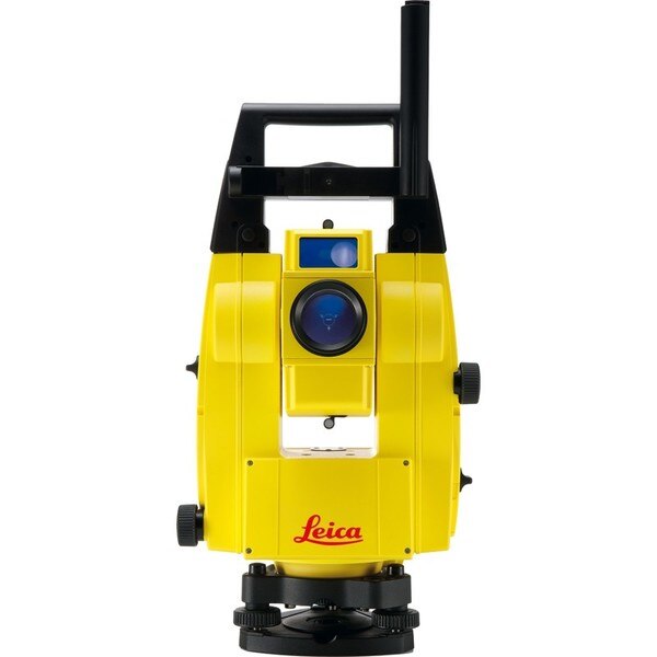
"name": "Leica iCON Robot 50",
"description": "Leica iCON Robot 50\nThe Leica iCON Robot 50 total station is operable using the field controller (iCON CC50) at the point of positioning using the prism pole, therefore there is no need for an operator at the instrument itself. This technology is extremely efficient and a highly accurate way of working.\n\nThe iCON robot 50 achieves the most precise reflector less measurements in its class. It features a simple one-button keyboard and patented PowerSearch option in order to find the prism quickly. Take advantage of applications through the custom-built software – iCONstruct. It also communicates using Bluetooth (up to 350m), WLAN (150m) and RS232 for different requirements, simply change the instrument handle to upgrade.\n\nWith very tight tolerances the Leica iCON Robot 50 is able to precisely control Graders, Dozers and Pavers automatically as well as set out or survey conventionally with one person. With the use of the most precise and accurate laser pointers the Leica Robot 50 is also able to layout points on ceilings or walls.\n\nFeatures\nExtremely precise reflectorless measurements\nSimple keyboard for easy use\nExcellent tracking\nRobust data communication\nGuide light\nand-over control from the rover\nWide range of apps with bespoke iCONstruct software\nIntegrates with all Leica iCON sensors\n\nLeica iCON robot 50 is designed specifically for ease of use within the construction industry, simply level the instrument and go.\n\nSave time and increase your productivity by doing layout work and as-built checks yourself. With iCON robot 50 you don’t need an operator at the instrument. The robotic total station can be operated from the field controller at the prism pole, at the point you need positioning.\n\nThe iCON robot 50 also delivers with:\n\nMost accurate reflectorless measurements in its class\nOne-button keyboard for simple operation\nFaster prism search by PowerSearch (patented technology)\nSuperior tracking performance ensures minimum machine downtime in machine control operation\nFlexible data communication: WLAN (150m range) or Long-range Bluetooth® (350m). Simply upgrade your communication by swapping the instrument handle\nEasy hand-over control from rover to machine control and vice versa\n \nOne-person robotic \nWith industry leading tracking performance and the patented PowerSearch technology, iCON robot 50 allows you to finish jobs faster maintaining highest accuracy.\n\nInterior overhead with laser pointer \nUsing one of the world’s most accurate laser pointers, remotely lay-out points on walls for drill patterns or on ceilings for air conditioning or other such projects.\n\nMachine control \nWork to the tightest tolerances under any site conditions. Carry out fine grading and paving with highest precision, speeding up your work with construction machinery.\n\nLimitless applications \nWith the iCONstruct software, you can use iCON robot 50 for a wide range of measuring and positioning tasks on site, such as:\n\nLayout\nStake-out\nGrade checking\nVolumes\nAs-built checks\nMachine control\n\n",
"price": 0.0,
"discountamount": 0.0,
"currencycode": "INR",
"priority": 1000000,
"isfreeshipmentavailable": false,
"shipmentduration": 7,
"_keywords": [
"Leica Robot 50",
"use iCON robot 50",
"iCONstruct software",
"iCON robot 50 allows",
"precise reflectorless",
"robotic total station",
"construction industry",
"iCON robot 50 achieves",
"PowerSearch technology",
"accurate laser pointers",
"Leica iCON Robot 50 total station",
"accurate reflectorless measurements",
"performance ensures minimum machine downtime"
],
"isarchived": false,
"isavailable": true,
"applicationid": null,
"productindex": 99,
"imageuri": "https://productimages.withfloats.com/actual/5b486c5af599f80511fd9ca6.jpg",
"tileimageuri": "https://productimages.withfloats.com/tile/5b486c5af599f80511fd9ca6.jpg",
"images": null,
"totalqueries": 0,
"gpid": null,
"groupproductid": null,
"createdon": "2018-07-13T09:09:46.162Z",
"updatedon": "2018-08-08T18:46:54.36Z",
"buyonlinelink": null,
"producturl": "http://WWW.SURVEYEQUIPMENT.IN//leica-icon-robot-50/99",
"availableunits": -1.0,
"iscodavailable": true,
"isprepaidonlineavailable": false,
"maxcodorders": 0,
"maxprepaidonlineorders": 0,
"uniquepaymenturl": null,
"brandname": null,
"category": "leicatotalstations",
"tags": [
"leicatotalstations",
"leicatotalstationsindia",
"robotictotalstations",
"leicatotalstationpune",
"leicaicon"
],
"variants": false,
"keyspecification": null,
"otherspecifications": null,
"pickupaddressreferenceid": "5d08ebb3edf0e25c3b8da5d0",
"paymenttype": "AssuredPurchase",
"producttype": "products",
"hsncode": null,
"gstslab": 0.0,
"isnotforsale": false
},
{
"_id": "5b6b3a9dd682be0552aefccb",
"fptag": "SBENTERPRISESTRADINGPUNE",
"merchantname": null,
"customwidgets": null,
"externalsourceid": null,
"name": "Leica ULTRA Utility Tracing System",
"description": "Leica ULTRA Utility Tracing System\nBest precision locating in faster, more confident work\n\nSave time and increase confidence in your results with the Leica ULTRA, our most advanced precision utility tracing instrument.\n\nThe complexity of underground utility networks is continually increasing, and obtaining precise information on the location of buried utilities has never been more important. The protection of buried assets during excavation work demands accurate mapping and surveying of existing utilities. \n\nIntegrating intelligent signal processing with unique flexible operating modes, Leica ULTRA traces buried utility lines accurately for safe underground excavations and utility surveys. Outstanding performance with operational ease and flexibility.\n\nLARGE CLEAR DISPLAY\nLarge backlit high visibility LCD screen\nClear display provides clear, improved and confident location and utility tracing\nCUSTOM FREQUENCIES\nConfigure for site specific applications\nUser configurable modes from 50 Hz to 200 kHz\nChoose from 100 pre-selected frequencies or customise your own frequencies\nCOMPASS\nShows the user the direction of the utility they are locating / tracing\nBLUETOOTH®\nEnable wireless communications with software running on a laptop, survey field PC or other GPS enabled device\nINCREASED TRANSMITTER POWER OUTPUT\nChoose between 5W and 12W transmitter power outputs for superior tracing performance\nBUILT FOR THE MOST DEMANDING ENVIRONMENTS\nIP65 protection\nFulfils toughest standards - shock resistant, protected against water and dust ingress\nSELECTABLE ANTENNA CONFIGURATION\nConfigure antenna to best optimise for your job site\nSelect between more range, sharper response, noise cancelling or easier sweeping\nDIRECTION ENABLED\nIdentifying your target utility amongst multiple parallel utilities\nApply a special direction enabled signal from the transmitter, the receiver will display an arrow on the compass heading to guide you along the designated utility path\nUnlock the power\nConfigure the Leica ULTRA for site specific applications. Custom build your receiver and transmitter.\n\nChoose from over 100 preselected frequencies, or customise your own frequency for highly specialised applications.\n\nAutomatically capture the instruments location data to ensure adherence to best practice. The data logging feature allows the user to record external GPS coordinates and download with the datafile as a KML or CSV format. Upload into GIS systems or Google Maps to confirm where, when and how the work was performed.\n",
"price": 0.0,
"discountamount": 0.0,
"currencycode": "INR",
"priority": 1000000,
"isfreeshipmentavailable": false,
"shipmentduration": 7,
"_keywords": [
"target utility",
"utility surveys",
"precision utility",
"Leica ULTRA traces",
"designated utility",
"12W transmitter power",
"wireless communications",
"instruments location data",
"site specific applications",
"100 preselected frequencies",
"underground utility networks",
"safe underground excavations",
"intelligent signal processing",
"unique flexible operating modes",
"Leica ULTRA Utility Tracing System"
],
"isarchived": false,
"isavailable": true,
"applicationid": null,
"productindex": 90,
"imageuri": "https://productimages.withfloats.com/actual/5b45ea4dd3d93d01c4f1c9f9.jpg",
"tileimageuri": "https://productimages.withfloats.com/tile/5b45ea4dd3d93d01c4f1c9f9.jpg",
"images": null,
"totalqueries": 0,
"gpid": null,
"groupproductid": null,
"createdon": "2018-07-11T11:30:28.043Z",
"updatedon": "2018-08-08T18:46:53.973Z",
"buyonlinelink": null,
"producturl": "http://WWW.SURVEYEQUIPMENT.IN//leica-ultra-utility-tracing-system/90",
"availableunits": -1.0,
"iscodavailable": true,
"isprepaidonlineavailable": false,
"maxcodorders": 0,
"maxprepaidonlineorders": 0,
"uniquepaymenturl": null,
"brandname": null,
"category": null,
"tags": null,
"variants": false,
"keyspecification": null,
"otherspecifications": null,
"pickupaddressreferenceid": "5d08ebb3edf0e25c3b8da5d0",
"paymenttype": "AssuredPurchase",
"producttype": "products",
"hsncode": null,
"gstslab": 0.0,
"isnotforsale": false
},
{
"_id": "5b6b3a9dd682be0552aefcbd",
"fptag": "SBENTERPRISESTRADINGPUNE",
"merchantname": null,
"customwidgets": null,
"externalsourceid": null,
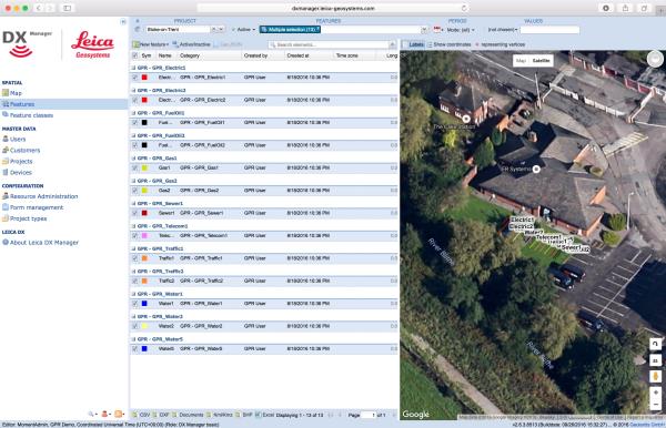
"name": "Leica DX Manager Mapping",
"description": "Leica DX Manager Mapping\nOne central dashboard for all the Leica Geosystems Detection solutions\n\nLeica DX Manager is the only enterprise grade utility mapping solution on the market. A unique cloud-powered solution that delivers unparalleled performance. Manage projects, tasks and spatial data from one central dashboard for all the Leica Geosystems Detection solutions.\n\nUpdate drawings, raw data, location pictures, data layers and mobile forms remotely and in a period of real time operate at an enterprise level rather than having to manually update individual users one at a time. With the Leica DX Manager, you have all dashboards, status updates and project management tools in one platform. Now, project managers can track field operations in real time and make critical decisions with a broader understanding of the current situation.\n\nKey benefits\n\nSimplified processes\nImprovement of data quality and accuracy\nConsistent data collection methods\nIntegration of DS2000, cable locators and asset mapping data\nWorkflows to maintain data integrity\nManage the whole workflow\n\nShare data to all devices and users within your organisation.\n\nAnalyse maps result\nVisualise on online maps\nFilter on users, within date ranges or any attributes\nExport to standard GIS and CAD formats\nShare data to your clients\nAn easy-to-use online portal allows management of all aspects of documenting utility location tasks. The user can switch between street view, satellite imagery and cartographic street maps. Field acquired survey data becomes instantly available and can be accessed by users anytime and anywhere.\n\nUtility detection integration\n\nLeica DX Manager integrates the entire Leica Geosystems Detection portfolio into a simple survey workflow, empowering the user to apply locator depth measurements to GNSS measurements. The result is a seamless fusion of both worlds – with all locator related data reviewable either in Leica DX Manager or any export format.\n\nLocate the utility\nMeasure the depth\nAll location data is sent directly to the Leica DX Field application on the GNSS device\nIt triggers the GNSS measurement on the mapping device\nAll data is integrated into the features metadata\nMaximum user experience and productivity\n\nLeica DX Field mobile app is designed for productivity and maximum user experience and built for enforcing data quality and accuracy. \n\nEasy mapping / surveying of assets\nSmart mobile forms\nImmediate visualisation on map\nMetadata collection\nAutomatic sync with Cloud\nFull offline capabilities\nMake sure your measured data always matches your quality expectations (up to centimetres with RTK) as Leica DX Manager notifications steadily monitor the system parameters. All quality parameters are stored as metadata. Next to the utility mapping aspect, it delivers work orders, time tracking and document management.",
"price": 0.0,
"discountamount": 0.0,
"currencycode": "INR",
"priority": 1000000,
"isfreeshipmentavailable": false,
"shipmentduration": 7,
"_keywords": [
"data quality",
"location data",
"data collection",
"data reviewable",
"survey data becomes",
"DX Field mobile app",
"Leica DX Manager Mapping",
"cartographic street maps",
"Leica DX Field application",
"update individual users one",
"Leica DX Manager notifications",
"apply locator depth measurements",
"enterprise grade utility mapping solution",
"entire Leica Geosystems Detection portfolio"
],
"isarchived": false,
"isavailable": true,
"applicationid": null,
"productindex": 89,
"imageuri": "https://productimages.withfloats.com/actual/5b459fa2f3579911b41e9cda.jpg",
"tileimageuri": "https://productimages.withfloats.com/tile/5b459fa2f3579911b41e9cda.jpg",
"images": null,
"totalqueries": 0,
"gpid": null,
"groupproductid": null,
"createdon": "2018-07-11T06:11:47.283Z",
"updatedon": "2018-08-08T18:46:53.959Z",
"buyonlinelink": null,
"producturl": "http://WWW.SURVEYEQUIPMENT.IN/products/leica-dx-manager-mapping/89",
"availableunits": -1.0,
"iscodavailable": true,
"isprepaidonlineavailable": false,
"maxcodorders": 0,
"maxprepaidonlineorders": 0,
"uniquepaymenturl": null,
"brandname": null,
"category": "GPR",
"tags": [
"GPR",
"Detection and underground mapping solution",
"Leica DX Manager Mapping"
],
"variants": false,
"keyspecification": null,
"otherspecifications": null,
"pickupaddressreferenceid": "5d08ebb3edf0e25c3b8da5d0",
"paymenttype": "AssuredPurchase",
"producttype": "products",
"hsncode": null,
"gstslab": 0.0,
"isnotforsale": false
},
{
"_id": "5b6b3a9cd682be0552aefb67",
"fptag": "SBENTERPRISESTRADINGPUNE",
"merchantname": null,
"customwidgets": null,
"externalsourceid": null,
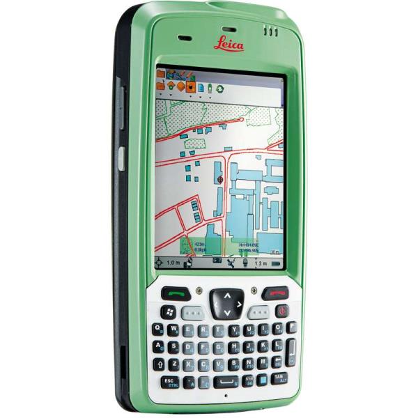
"name": "Leica Zeno 5 GPS Handheld",
"description": "Leica Zeno 5 GPS Handheld\nUncompromising performance and functionality\nThe extremely functional, powerful and ergonomic Leica Zeno 5 brings quality and performance to the industry. The most rugged and powerful GPS handheld from Leica, it includes complete phone functionality and a very fast processor. Without compromising performance it fully integrates in to the Zeno GIS range.\n\nIncludes 3.2 Megapixel camera and lithium ion battery\nHighly sensitive GPS receiver with 2-5m positional accuracy.\nErgonomics and excellent viewing \nEquipped with a VGA transflective colour touchscreen, the Zeno 5 can be controlled by either to provided stylus or finger. The 3.7” display is readable in sunlight and includes a backlit feature for dark conditions.\n\nRugged, lightweight and protected to IP54 standards, it also fits on one hand.\nIncludes embedded Windows® Handheld 6.5 Operating System for intuitive and easy control\nModern technology for field work support\nThe Zeno 5 is the most up to date GPS handheld and features wireless communication technology, accelerometer, digital compass, gyroscope, light sensors, and GPS providing supported mapping applications which link directly to the office\n\nBluetooth, WI-FI, GSM/CDMA/UMTS for high speed comms.\nAutomatic rotational screen to view maps quickly or docs in landscape mode.",
"price": 0.0,
"discountamount": 0.0,
"currencycode": "INR",
"priority": 1000000,
"isfreeshipmentavailable": false,
"shipmentduration": 7,
"_keywords": [
"landscape mode",
"digital compass",
"backlit feature",
"Operating System",
"Megapixel camera",
"date GPS handheld",
"rotational screen",
"mapping applications",
"powerful GPS handheld",
"sensitive GPS receiver",
"Leica Zeno 5 GPS Handheld",
"complete phone functionality",
"VGA transflective colour touchscreen",
"ergonomic Leica Zeno 5 brings quality",
"features wireless communication technology"
],
"isarchived": false,
"isavailable": true,
"applicationid": null,
"productindex": 73,
"imageuri": "https://productimages.withfloats.com/actual/5b1b9fb83b9b61043c76e8a8.jpg",
"tileimageuri": "https://productimages.withfloats.com/tile/5b1b9fb83b9b61043c76e8a8.jpg",
"images": null,
"totalqueries": 0,
"gpid": null,
"groupproductid": null,
"createdon": "2018-06-09T09:36:56.141Z",
"updatedon": "2018-08-08T18:46:52.833Z",
"buyonlinelink": null,
"producturl": "http://WWW.SURVEYEQUIPMENT.IN/products/leica-zeno-5-gps-handheld/73",
"availableunits": -1.0,
"iscodavailable": true,
"isprepaidonlineavailable": false,
"maxcodorders": 0,
"maxprepaidonlineorders": 0,
"uniquepaymenturl": null,
"brandname": null,
"category": "handheldgps",
"tags": [
"handheldgps",
"leicagps",
"gps",
"gnss",
"leicagnss"
],
"variants": false,
"keyspecification": null,
"otherspecifications": null,
"pickupaddressreferenceid": "5d08ebb3edf0e25c3b8da5d0",
"paymenttype": "AssuredPurchase",
"producttype": "products",
"hsncode": null,
"gstslab": 0.0,
"isnotforsale": false
},
{
"_id": "5b6b3a9cd682be0552aefac6",
"fptag": "SBENTERPRISESTRADINGPUNE",
"merchantname": null,
"customwidgets": null,
"externalsourceid": null,
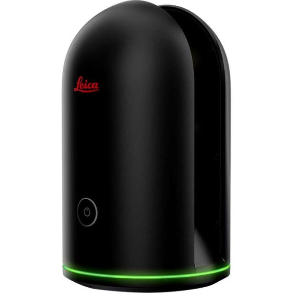
"name": "Leica BLK360 Imaging Laser Scanner",
"description": "Leica BLK360 Imaging Laser Scanner\n\nThe smallest and lightest imaging laser scanner available\nThe Leica BLK360 captures the world around you with full-colour panoramic images overlaid on a high-accuracy point cloud. Simple to use with just the single push of one button, the BLK360 is the smallest and lightest of its kind. Anyone who can operate an iPad can now capture the world around them with high resolution 3D panoramic images.\n\nUsing the ReCap Pro mobile app, the BLK360 streams image and point cloud data to iPad. The app filters and registers scan data in real time. After capture, ReCap Pro enables point cloud data transfer to a number of CAD, BIM, VR and AR applications. The integration of BLK360 and Autodesk software dramatically streamlines the reality capture process thereby opening this technology to non-surveying individuals.\n\nPackage includes:\n\nLeica BLK360 Imaging Laser Scanner\nGEB212 Lithium-Ion Battery for the BLK360\nGKL311 Battery Charger\nAC/DC adaptor\nBLK360 Tripod\nBLK360 Mission bag\n\nBLK360 Imaging Laser Scanner\n\nAllows you to scan in high, standard and fast resolutions\nWeighs 1kg / Size 165 mm tall x 100 mm diameter \nLess than 3 minutes for full-dome scan (in standard resolution) and 150 MP spherical image generation\n360,000 laser scan pts/sec\nReCap Pro Software\n\nGain complete access to ReCap Pro for desktop, web and mobile*\nControl all aspects of the reality capture process remotely on ReCap for iPad\nAutomatically register and visualise scan data in the field\nMark up, tag and collaborate on scans while on the job site\nReduce rework requests and share reality data remotely\nSeamless data transfer into Autodesk design software\nWith the combination of the BLK360 and Autodesk ReCap Pro, benefit from:\n\nSpeed\nOn-the-fly image and point cloud processing in the field.\n\nPortability\nFlexibility to scan wherever, whenever with the small lightweight scanner that fits into a messenger bag.\n\nEase of Use\nPush-button scanning that automatically stitches and registers in the mobile version of ReCap Pro.\n\nCloud Connectivity\nBetter collaboration and virtualisation with cloud sync.\n\nSimplified Data Collection\nTwo-in-one 360º image documentation and laser scan data.\n\nInteroperability\nReality capture data connectivity with Autodesk’s design solutions.\n\n",
"price": 0.0,
"discountamount": 0.0,
"currencycode": "INR",
"priority": 1000000,
"isfreeshipmentavailable": false,
"shipmentduration": 7,
"_keywords": [
"Autodesk ReCap Pro",
"share reality data",
"registers scan data",
"visualise scan data",
"image documentation",
"ReCap Pro mobile app",
"150 MP spherical image",
"reality capture process",
"point cloud data transfer",
"capture data connectivity",
"small lightweight scanner",
"high resolution 3D panoramic",
"Leica BLK360 Imaging Laser Scanner"
],
"isarchived": false,
"isavailable": true,
"applicationid": null,
"productindex": 64,
"imageuri": "https://productimages.withfloats.com/actual/5b028d086061cb0e609ff97b.jpg",
"tileimageuri": "https://productimages.withfloats.com/tile/5b028d086061cb0e609ff97b.jpg",
"images": null,
"totalqueries": 0,
"gpid": null,
"groupproductid": null,
"createdon": "2018-05-21T09:10:26.841Z",
"updatedon": "2018-08-08T18:46:52.294Z",
"buyonlinelink": null,
"producturl": "http://WWW.SURVEYEQUIPMENT.IN//leica-blk360-imaging-laser-scanner/64",
"availableunits": -1.0,
"iscodavailable": true,
"isprepaidonlineavailable": false,
"maxcodorders": 0,
"maxprepaidonlineorders": 0,
"uniquepaymenturl": null,
"brandname": null,
"category": null,
"tags": null,
"variants": false,
"keyspecification": null,
"otherspecifications": null,
"pickupaddressreferenceid": "5d08ebb3edf0e25c3b8da5d0",
"paymenttype": "AssuredPurchase",
"producttype": "products",
"hsncode": null,
"gstslab": 0.0,
"isnotforsale": false
}
],
"hasmoreitems": false,
"isapirequest": false,
"totalresults": 27,
"query": null,
"floatingpoint": null
}