Preview

This is your website preview.

Currently it only shows your basic business info. Start adding relevant business details such as description, images and products or services to gain your customers attention by using Boost 360 android app / iOS App / web portal.

SBENTERPRISESTRADINGPUNE 5abfbf1e7c88bb04a4d0fcc7 Products https://www.surveyequipment.in
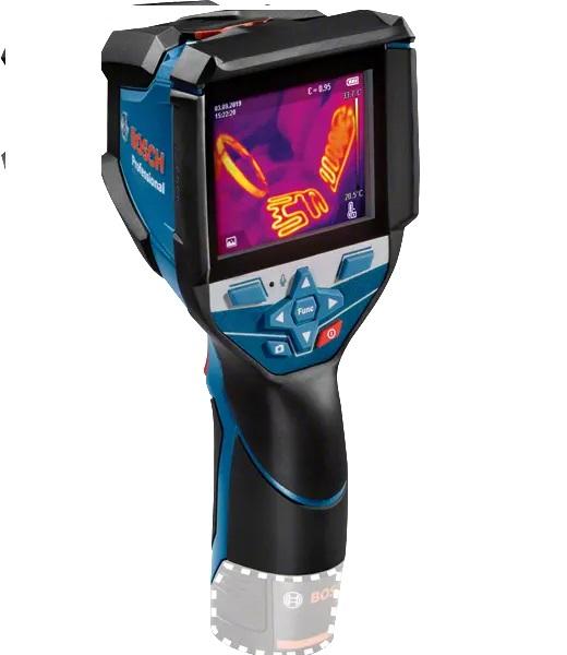
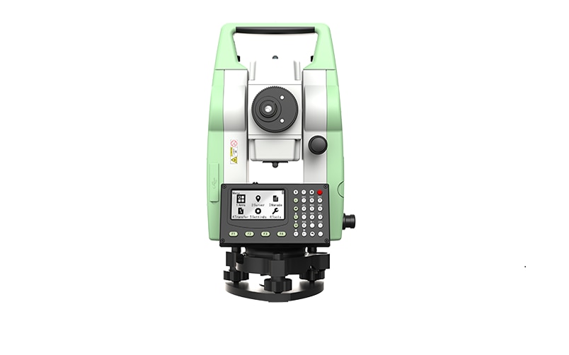
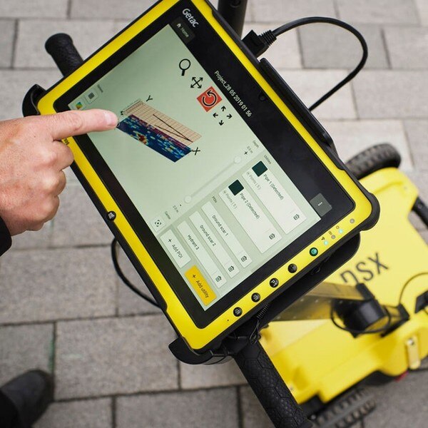
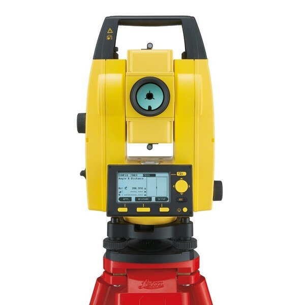
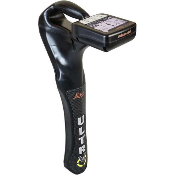
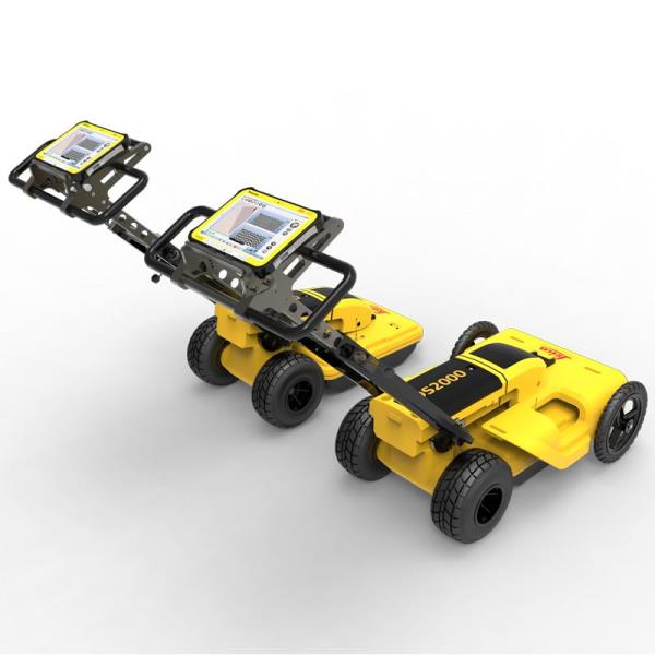
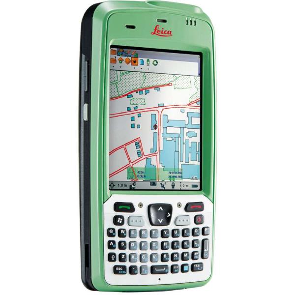
{ "products": [ { "_id": "5b6b3a9cd682be0552aefb67", "fptag": "SBENTERPRISESTRADINGPUNE", "merchantname": null, "customwidgets": null, "externalsourceid": null, "name": "Leica Zeno 5 GPS Handheld", "description": "Leica Zeno 5 GPS Handheld\nUncompromising performance and functionality\nThe extremely functional, powerful and ergonomic Leica Zeno 5 brings quality and performance to the industry. The most rugged and powerful GPS handheld from Leica, it includes complete phone functionality and a very fast processor. Without compromising performance it fully integrates in to the Zeno GIS range.\n\nIncludes 3.2 Megapixel camera and lithium ion battery\nHighly sensitive GPS receiver with 2-5m positional accuracy.\nErgonomics and excellent viewing \nEquipped with a VGA transflective colour touchscreen, the Zeno 5 can be controlled by either to provided stylus or finger. The 3.7” display is readable in sunlight and includes a backlit feature for dark conditions.\n\nRugged, lightweight and protected to IP54 standards, it also fits on one hand.\nIncludes embedded Windows® Handheld 6.5 Operating System for intuitive and easy control\nModern technology for field work support\nThe Zeno 5 is the most up to date GPS handheld and features wireless communication technology, accelerometer, digital compass, gyroscope, light sensors, and GPS providing supported mapping applications which link directly to the office\n\nBluetooth, WI-FI, GSM/CDMA/UMTS for high speed comms.\nAutomatic rotational screen to view maps quickly or docs in landscape mode.", "price": 0.0, "discountamount": 0.0, "currencycode": "INR", "priority": 1000000, "isfreeshipmentavailable": false, "shipmentduration": 7, "_keywords": [ "landscape mode", "digital compass", "backlit feature", "Operating System", "Megapixel camera", "date GPS handheld", "rotational screen", "mapping applications", "powerful GPS handheld", "sensitive GPS receiver", "Leica Zeno 5 GPS Handheld", "complete phone functionality", "VGA transflective colour touchscreen", "ergonomic Leica Zeno 5 brings quality", "features wireless communication technology" ], "isarchived": false, "isavailable": true, "applicationid": null, "productindex": 73, "imageuri": "https://productimages.withfloats.com/actual/5b1b9fb83b9b61043c76e8a8.jpg", "tileimageuri": "https://productimages.withfloats.com/tile/5b1b9fb83b9b61043c76e8a8.jpg", "images": null, "totalqueries": 0, "gpid": null, "groupproductid": null, "createdon": "2018-06-09T09:36:56.141Z", "updatedon": "2018-08-08T18:46:52.833Z", "buyonlinelink": null, "producturl": "http://WWW.SURVEYEQUIPMENT.IN/products/leica-zeno-5-gps-handheld/73", "availableunits": -1.0, "iscodavailable": true, "isprepaidonlineavailable": false, "maxcodorders": 0, "maxprepaidonlineorders": 0, "uniquepaymenturl": null, "brandname": null, "category": "handheldgps", "tags": [ "handheldgps", "leicagps", "gps", "gnss", "leicagnss" ], "variants": false, "keyspecification": null, "otherspecifications": null, "pickupaddressreferenceid": "5d08ebb3edf0e25c3b8da5d0", "paymenttype": "AssuredPurchase", "producttype": "products", "hsncode": null, "gstslab": 0.0, "isnotforsale": false }, { "_id": "64a0157d2c079200014a7597", "fptag": "SBENTERPRISESTRADINGPUNE", "merchantname": null, "customwidgets": null, "externalsourceid": null, "name": "Bosch GTC 600 C Professional Thermo Camera", "description": "GTC 600 C PROFESSIONALTHERMO CAMERA\nDetailed visualisation of temperature differences with smart documentationHigh thermal resolution and wide measuring range for maximum applicationsVoice note and Bosch Thermal App enable easy documentation of thermal imagesIntuitive user interface and seamlessly integrated features deliver successful results in minimum clicks\nThe GTC 600 C PROFESSIONAL is a high-performance cordless hedge trimmer designed for professional use. With its powerful motor and advanced features, this hedge trimmer delivers exceptional cutting performance and precision.\nFeaturing a 60 cm dual-action laser-cut blade, the GTC 600 C PROFESSIONAL ensures clean and precise cuts, allowing you to trim hedges, shrubs, and bushes with ease. The dual-action design reduces vibration and enhances cutting efficiency, making your trimming tasks quicker and more efficient.\nOne of the standout features of the GTC 600 C PROFESSIONAL is its cordless design. Powered by a high-capacity lithium-ion battery, this hedge trimmer provides you with the freedom to move around without the hassle of cords or cables. The battery technology ensures consistent power delivery and extended runtime, allowing you to tackle large trimming jobs without interruptions.\nEquipped with Bosch's Syneon Chip technology, the GTC 600 C PROFESSIONAL optimizes power output and battery efficiency for maximum performance. This intelligent chip regulates energy usage based on the cutting conditions, ensuring you get the most out of your battery charge.\nThe GTC 600 C PROFESSIONAL is ergonomically designed for comfort and ease of use. It features a soft-grip handle and a balanced weight distribution, reducing fatigue during extended periods of operation. The trimmer also includes a transparent hand guard for improved visibility and protection while working.\nThis hedge trimmer incorporates safety features to provide a secure operating experience. It includes a two-handed safety switch to prevent accidental startup and a blade tip protector to protect against damage during storage or transport.\nWhether you are a professional landscaper or a homeowner with extensive trimming needs, the GTC 600 C PROFESSIONAL is a reliable and powerful tool that delivers excellent results. Its cutting-edge features, cordless convenience, and robust construction make it the ideal choice for tackling even the toughest hedge trimming tasks.", "price": 0.0, "discountamount": 0.0, "currencycode": "INR", "priority": 1000000, "isfreeshipmentavailable": false, "shipmentduration": 7, "_keywords": [ "ease", "jobs", "clean", "cords", "hedges", "damage", "shrubs", "bushes", "hassle", "cables", "storage", "fatigue", "freedom", "comfort", "reliable", "vibration", "operation", "transport", "homeowner", "precision", "visibility", "protection", "power output", "ideal choice", "energy usage", "precise cuts", "interruptions", "powerful tool", "large trimming", "powerful motor", "minimum clicks", "battery charge", "cordless design", "safety features", "extended periods", "soft-grip handle", "extended runtime", "intelligent chip", "professional use", "excellent results", "advanced features", "standout features", "Bosch Thermal App", "accidental startup", "easy documentation", "battery efficiency", "cutting conditions", "cutting efficiency", "battery technology", "dual-action design", "successful results", "robust construction", "maximum performance", "blade tip protector", "cordless convenience", "wide measuring range", "cutting-edge features", "Detailed visualisation", "transparent hand guard", "Syneon Chip technology", "temperature differences", "professional landscaper", "two-handed safety switch", "extensive trimming needs", "consistent power delivery", "The GTC 600 C PROFESSIONAL", "secure operating experience", "balanced weight distribution", "toughest hedge trimming tasks", "maximum applicationsVoice note", "exceptional cutting performance", "high-capacity lithium-ion battery", "60 cm dual-action laser-cut blade", "GTC 600 C PROFESSIONALTHERMO CAMERA", "thermal imagesIntuitive user interface", "high-performance cordless hedge trimmer", "smart documentationHigh thermal resolution", "Bosch GTC 600 C Professional Thermo Camera" ], "isarchived": false, "isavailable": true, "applicationid": null, "productindex": 228, "imageuri": "https://productimages.withfloats.com/actual/64a01581186e9d0001f6688d.jpg", "tileimageuri": "https://productimages.withfloats.com/tile/64a01581186e9d0001f6688d.jpg", "images": null, "totalqueries": 0, "gpid": null, "groupproductid": null, "createdon": "2023-07-01T12:01:01.931Z", "updatedon": "2023-07-01T12:01:01.931Z", "buyonlinelink": null, "producturl": "http://WWW.SURVEYEQUIPMENT.IN//bosch-gtc-600-c-professional-thermo-camera/228", "availableunits": -1.0, "iscodavailable": false, "isprepaidonlineavailable": false, "maxcodorders": 0, "maxprepaidonlineorders": 0, "uniquepaymenturl": null, "brandname": "BOSCH", "category": "thermalamera", "tags": null, "variants": false, "keyspecification": null, "otherspecifications": null, "pickupaddressreferenceid": "", "paymenttype": "None", "producttype": "products", "hsncode": null, "gstslab": 0.0, "isnotforsale": false }, { "_id": "60e1a313e49d1200012fbdc3", "fptag": "SBENTERPRISESTRADINGPUNE", "merchantname": null, "customwidgets": null, "externalsourceid": null, "name": "Leica TS01 Manual Total Stations ", "description": "Leica TS01: The entry to Leica Geosystems' Total Stations\nLeica TS01 empowers you to carry out measurement tasks with ease and simplicity.\n\nThe Leica TS01 total station empowers you to carry out measurement tasks with ease and simplicity. The TS01 is an entry-level manual total station, created to help you master surveying, layout and mapping projects. It will prove itself in the field and immediately become a valuable member of your team.\n\nBuying a Leica TS01 is a smart decision as it represents a business-smart entry into Leica Geosystems world. You and your surveying crew members will be ready for new projects in no time.\n\nEnjoy the benefits of a 500 m non-prism range and 3,000 m prism range, always combined with accuracy and measurement speed, which increases your productivity. With built-in sensors like an electronic dual axis compensator, a laser plummet, onboard field software and short keys for quick menu access you'll have a fast instrument setup and fast measurements.\n\nWith the Leica TS01 total station you get your all-in-on package as it comes with Leica Geosystems accessories, such as a long-operating battery, a charger and a tribrach tested to reliably fulfil the requirements – when every detail counts.\n\n\nFirst class after sales service and support\n\nLeica Geosystems's highly qualified after-sales service and support network will help you managing any issue to continue work quickly.\nBe it maintenance work, in any of our local service workshops, or getting a question answered from local support, both are part of Leica Geosystems's active customer care.\n\n\nStart-up into business easily\n\n\n\nLeica Geosystems' TS01 will get your trusted partner in managing survey, layout and mapping projects with ease and simplicity.\nPowerful built-in sensors, as well as intuitive field software, empower you to complete tasks without any delay.\n", "price": 0.0, "discountamount": 0.0, "currencycode": "INR", "priority": 1000000, "isfreeshipmentavailable": false, "shipmentduration": 7, "_keywords": null, "isarchived": false, "isavailable": true, "applicationid": null, "productindex": 200, "imageuri": "https://productimages.withfloats.com/actual/60e1a315eef7850001dd7f3e.png", "tileimageuri": "https://productimages.withfloats.com/tile/60e1a315eef7850001dd7f3e.png", "images": null, "totalqueries": 0, "gpid": null, "groupproductid": null, "createdon": "2021-07-04T12:01:23.298Z", "updatedon": "2021-07-04T12:01:23.298Z", "buyonlinelink": null, "producturl": "http://WWW.SURVEYEQUIPMENT.IN//leica-ts01-manual-total-stations-/200", "availableunits": -1.0, "iscodavailable": false, "isprepaidonlineavailable": false, "maxcodorders": 0, "maxprepaidonlineorders": 0, "uniquepaymenturl": null, "brandname": "Leica Geosystems", "category": "Leica Total Station in India ", "tags": [ "Leica Total Station in India", "TOTALSTATIONS", "Robotic Total Station", "leicatotalstationsindia", "robotictotalstationpune", "robotictotalstations", "leicatotalstationsindia", "leicatotalstationoune", "leicageosystems", "Geographical Survey", "GNSS/GPS Survey Equipment - Surveying Equipment fr" ], "variants": false, "keyspecification": null, "otherspecifications": null, "pickupaddressreferenceid": "", "paymenttype": "None", "producttype": "products", "hsncode": null, "gstslab": 0.0, "isnotforsale": false }, { "_id": "5da061c96fcd40000173875d", "fptag": "SBENTERPRISESTRADINGPUNE", "merchantname": null, "customwidgets": null, "externalsourceid": null, "name": "DSX Utility Detections Solutions ", "description": "Leica DSX Utility Detection Solution\nA clearer view of underground utilities\nFor utility repair and maintenance, civil engineering and surveying companies, the Leica DSX utility detection solution, consisting of portable hardware with intuitive software allows to easily locate, visualise and map utilities. Unlike any other ground-penetrating radar (GPR) system, the Leica DSX maximises productivity with cutting-edge software that automates data analysis and creates a 3D utility map on the field.\n\nEasy to use\n\nEnsure smooth and accurate underground utility detection without expert knowledge\nComplete utility detection and mapping in just a few steps through the intuitive user interface\nScan anywhere and at any time, even in narrow areas and under severe conditions\nReliable Detection Results\n\nDetect all types of underground utilities in high resolution to assure reliable avoidance zones\nVerify detected utilities with support of smart algorithm\nImport of POI's and utility records to help you make better decisions\nInstant 2D/3D Utility Map\n\nSave your time on site by mapping underground utilities in just minutes\nExport utilities in CAD or BIM-read formats for further usage\nCreate professional reports, customised to your and your customers' needs\nIntegrated Solution\n\nOffer a complete workflow from acquire to excavate\nLocate underground utilities with survey-grade accuracy\nGenerate utility maps, compatible with all coordinate reference systems", "price": 0.0, "discountamount": 0.0, "currencycode": "INR", "priority": 1000000, "isfreeshipmentavailable": false, "shipmentduration": 7, "_keywords": null, "isarchived": false, "isavailable": true, "applicationid": null, "productindex": 155, "imageuri": "https://productimages.withfloats.com/actual/5da061ca48f8810001023a3d.jpg", "tileimageuri": "https://productimages.withfloats.com/tile/5da061ca48f8810001023a3d.jpg", "images": null, "totalqueries": 0, "gpid": null, "groupproductid": null, "createdon": "2019-10-11T11:04:41.923Z", "updatedon": "2019-10-11T11:04:41.923Z", "buyonlinelink": null, "producturl": "http://WWW.SURVEYEQUIPMENT.IN//dsx-utility-detections-solutions-/155", "availableunits": -1.0, "iscodavailable": false, "isprepaidonlineavailable": false, "maxcodorders": 0, "maxprepaidonlineorders": 0, "uniquepaymenturl": null, "brandname": "Leica DSX Utility Detection Solution", "category": "", "tags": null, "variants": false, "keyspecification": null, "otherspecifications": null, "pickupaddressreferenceid": "", "paymenttype": "None", "producttype": "products", "hsncode": null, "gstslab": 0.0, "isnotforsale": false }, { "_id": "5b7ffb95147e16051e773f27", "fptag": "SBENTERPRISESTRADINGPUNE", "merchantname": null, "customwidgets": null, "externalsourceid": null, "name": "IDS GeoRadar - Stream C", "description": "IDS GeoRadar - Stream C\nThe compact array solution for accurate 3D utility mapping.\nHigh quality, High productivity and Simple to Use compact radar system for real time underground surveys.\n\nStream C is the compact array solution for real-time 3D mapping of underground utilities and features. Thanks to increased level of accuracy provided by a massive antenna array, Stream C is able to automatically detect pipes and cables.\n\nDaily use of Stream C is aided by ergonomic features including electronic ride height adjustment, options to tow manually or with a small vehicle and a motor assisted drive wheel.\n\nSTREAM C BENEFITS\n\nHigh Productivity: surveys only need to be performed in one direction to ensure optimal detection for both longitudinal and transversal pipes.\nNo advanced training needed: the system automatically detects and locates the position of pipes in real time and displays them on screen.\nReduced user fatigue: thanks to electronic ride height adjustment and a motor assisted drive wheel.\nFacilitates large surveys: the system can be towed manually or with a small vehicle, increasing the acquisition speed (up to 6 km/h).\n\nSTREAM C FEATURES\n\nMassive array of 34 antennas in two polarizations: this enables an accurate 3D reconstruction of the underground utility network to be created in a single scan.\nAutomatic Pipe Detection (APD): real-time automatic detection of buried pipes and cables\nCompact size: Stream C’s small dimensions enable it to survey areas inaccessible to larger array systems while maintaining the same accuracy.\nRobust construction: built to the highest standards and with hardwearing materials so that it can be used in harsh, demanding environments.\n3D radar tomography: real-time tomography on a GPS or total station assisted cartographic background. • Professional subsurface survey: pipes, cables and buried objects can be automatically transferred to CAD and GIS formats allowing a complete subsurface GIS based digital map to be quickly produced.\n\nBenefits of Stream EM include:\n\nImproved management of underground utility design, relocation and coordination;\nCost and time reductions: No need to block traffic or perform surveys at night;\nIncrease in accuracy with a detection accuracy of as little as 5 cm;\nIncrease productivity and have the ability to detect every buried target;\nHighly modular structure allows it to be reconfigured to map sidewalks and difficult to access areas\n\nReal time software for advanced viewing \nStream EM is supplied with the OneVsion and GRED HD 3D CAD software suites.", "price": 0.0, "discountamount": 0.0, "currencycode": "INR", "priority": 1000000, "isfreeshipmentavailable": false, "shipmentduration": 7, "_keywords": [ "detection accuracy", "accurate 3D utility", "real time underground", "massive antenna array", "underground utilities", "compact array solution", "small dimensions enable", "complete subsurface GIS", "Use compact radar system", "survey areas inaccessible", "underground utility design", "accurate 3D reconstruction", "underground utility network", "GRED HD 3D CAD software suites", "Professional subsurface survey" ], "isarchived": false, "isavailable": true, "applicationid": null, "productindex": 111, "imageuri": "", "tileimageuri": "", "images": null, "totalqueries": 0, "gpid": null, "groupproductid": null, "createdon": "2018-08-24T12:35:33.806Z", "updatedon": "2018-08-24T12:35:33.806Z", "buyonlinelink": null, "producturl": "http://WWW.SURVEYEQUIPMENT.IN//ids-georadar-stream-c/111", "availableunits": -1.0, "iscodavailable": true, "isprepaidonlineavailable": false, "maxcodorders": 0, "maxprepaidonlineorders": 0, "uniquepaymenturl": null, "brandname": null, "category": null, "tags": null, "variants": false, "keyspecification": null, "otherspecifications": null, "pickupaddressreferenceid": "5d08ebb3edf0e25c3b8da5d0", "paymenttype": "AssuredPurchase", "producttype": "products", "hsncode": null, "gstslab": 0.0, "isnotforsale": false }, { "_id": "5b6b3a9ed682be0552aefe44", "fptag": "SBENTERPRISESTRADINGPUNE", "merchantname": null, "customwidgets": null, "externalsourceid": null, "name": "Leica Builder 200 Total Station Set", "description": "Leica Builder 200 Total Station Set\n\nThe Leica Builder 200 Total Station a reflectorless total station which includes all features of the Leica Builder 100 Theodolite, as well as added features such as laser distance measuring and tracking mode, making traditional layout work more efficient. For easy and quick setup it uses a laser plummet and for accurate plumbing a dual axis compensator. Other features include audible notices, graphical aids for levelling, endless drives and pit stop alert. It also comes with an environmental IP55 rating and pin code system for theft protection.\n\nIt is ideal for all types of operators such as landscapers, builders, carpenters and architects. Easily align excavations and structures along line values which have been transferred directly from plans. Volumes can also be calculated such as cut/fill, mass haul and formation cutting, saving time and avoiding guess work. Setting out profile boards is done precisely and there is no need for strings, tapes or plumbing. Determine parallel walls, drainage grades and clearances immediately.\n\nWith Leica Laser Distance Measurement Technology measuring in to edges and corners is made simple and accurate with superb signal strength. The laser can measure up to 80m or 260ft with increased efficiency.\n\nThe Leica Builder 200 Total Station uses a very clear and easy to read graphic user interface and is supports 3 languages at any one time, which is unique to the class. It also comes with an array of PowerSite software which is easy to learn and use and features professional programs specially created for every job.\n\nFor further requirements and functionality such as Extended RedDot range, Volumes Calculation, Direct DXF download and other features please view the Leica Builder 300, Leica Builder 400 or Leica Builder 500 Total Stations.\n\nInstrument options\nBUILDER 209 SET Total Station\nBUILDER 206 SET Total Station\nPackage includes\nLeica Builder 200 Total Station\nSerial RS232 interface\nLaser plummet\n1 keyboard\nTribrach\nLi-Ion battery\nCharger\nFlat prism\nReflector pole\nUser manual\nCarry case", "price": 0.0, "discountamount": 0.0, "currencycode": "INR", "priority": 1000000, "isfreeshipmentavailable": false, "shipmentduration": 7, "_keywords": [ "206 SET Total", "209 SET Total", "Leica Builder 300", "Leica Builder 400", "superb signal strength", "Leica Builder 500 Total", "traditional layout work", "Determine parallel walls", "environmental IP55 rating", "read graphic user interface", "reflectorless total station", "Leica Builder 100 Theodolite", "features professional programs", "Leica Builder 200 Total Station Set", "Leica Laser Distance Measurement Technology" ], "isarchived": false, "isavailable": true, "applicationid": null, "productindex": 107, "imageuri": "https://productimages.withfloats.com/actual/5b5c3cf29594e8050e8ef27e.jpg", "tileimageuri": "https://productimages.withfloats.com/tile/5b5c3cf29594e8050e8ef27e.jpg", "images": null, "totalqueries": 0, "gpid": null, "groupproductid": null, "createdon": "2018-07-28T09:52:50.345Z", "updatedon": "2018-08-08T18:46:54.507Z", "buyonlinelink": null, "producturl": "http://WWW.SURVEYEQUIPMENT.IN//leica-builder-200-total-station-set/107", "availableunits": -1.0, "iscodavailable": true, "isprepaidonlineavailable": false, "maxcodorders": 0, "maxprepaidonlineorders": 0, "uniquepaymenturl": null, "brandname": null, "category": "leicatotalstationsindia", "tags": [ "leicatotalstationsindia", "leicatotalstations", "leicatotalstationoune" ], "variants": false, "keyspecification": null, "otherspecifications": null, "pickupaddressreferenceid": "5d08ebb3edf0e25c3b8da5d0", "paymenttype": "AssuredPurchase", "producttype": "products", "hsncode": null, "gstslab": 0.0, "isnotforsale": false }, { "_id": "5b6b3a9dd682be0552aefccb", "fptag": "SBENTERPRISESTRADINGPUNE", "merchantname": null, "customwidgets": null, "externalsourceid": null, "name": "Leica ULTRA Utility Tracing System", "description": "Leica ULTRA Utility Tracing System\nBest precision locating in faster, more confident work\n\nSave time and increase confidence in your results with the Leica ULTRA, our most advanced precision utility tracing instrument.\n\nThe complexity of underground utility networks is continually increasing, and obtaining precise information on the location of buried utilities has never been more important. The protection of buried assets during excavation work demands accurate mapping and surveying of existing utilities. \n\nIntegrating intelligent signal processing with unique flexible operating modes, Leica ULTRA traces buried utility lines accurately for safe underground excavations and utility surveys. Outstanding performance with operational ease and flexibility.\n\nLARGE CLEAR DISPLAY\nLarge backlit high visibility LCD screen\nClear display provides clear, improved and confident location and utility tracing\nCUSTOM FREQUENCIES\nConfigure for site specific applications\nUser configurable modes from 50 Hz to 200 kHz\nChoose from 100 pre-selected frequencies or customise your own frequencies\nCOMPASS\nShows the user the direction of the utility they are locating / tracing\nBLUETOOTH®\nEnable wireless communications with software running on a laptop, survey field PC or other GPS enabled device\nINCREASED TRANSMITTER POWER OUTPUT\nChoose between 5W and 12W transmitter power outputs for superior tracing performance\nBUILT FOR THE MOST DEMANDING ENVIRONMENTS\nIP65 protection\nFulfils toughest standards - shock resistant, protected against water and dust ingress\nSELECTABLE ANTENNA CONFIGURATION\nConfigure antenna to best optimise for your job site\nSelect between more range, sharper response, noise cancelling or easier sweeping\nDIRECTION ENABLED\nIdentifying your target utility amongst multiple parallel utilities\nApply a special direction enabled signal from the transmitter, the receiver will display an arrow on the compass heading to guide you along the designated utility path\nUnlock the power\nConfigure the Leica ULTRA for site specific applications. Custom build your receiver and transmitter.\n\nChoose from over 100 preselected frequencies, or customise your own frequency for highly specialised applications.\n\nAutomatically capture the instruments location data to ensure adherence to best practice. The data logging feature allows the user to record external GPS coordinates and download with the datafile as a KML or CSV format. Upload into GIS systems or Google Maps to confirm where, when and how the work was performed.\n", "price": 0.0, "discountamount": 0.0, "currencycode": "INR", "priority": 1000000, "isfreeshipmentavailable": false, "shipmentduration": 7, "_keywords": [ "target utility", "utility surveys", "precision utility", "Leica ULTRA traces", "designated utility", "12W transmitter power", "wireless communications", "instruments location data", "site specific applications", "100 preselected frequencies", "underground utility networks", "safe underground excavations", "intelligent signal processing", "unique flexible operating modes", "Leica ULTRA Utility Tracing System" ], "isarchived": false, "isavailable": true, "applicationid": null, "productindex": 90, "imageuri": "https://productimages.withfloats.com/actual/5b45ea4dd3d93d01c4f1c9f9.jpg", "tileimageuri": "https://productimages.withfloats.com/tile/5b45ea4dd3d93d01c4f1c9f9.jpg", "images": null, "totalqueries": 0, "gpid": null, "groupproductid": null, "createdon": "2018-07-11T11:30:28.043Z", "updatedon": "2018-08-08T18:46:53.973Z", "buyonlinelink": null, "producturl": "http://WWW.SURVEYEQUIPMENT.IN//leica-ultra-utility-tracing-system/90", "availableunits": -1.0, "iscodavailable": true, "isprepaidonlineavailable": false, "maxcodorders": 0, "maxprepaidonlineorders": 0, "uniquepaymenturl": null, "brandname": null, "category": null, "tags": null, "variants": false, "keyspecification": null, "otherspecifications": null, "pickupaddressreferenceid": "5d08ebb3edf0e25c3b8da5d0", "paymenttype": "AssuredPurchase", "producttype": "products", "hsncode": null, "gstslab": 0.0, "isnotforsale": false }, { "_id": "5b6b3a9ed682be0552aefd6c", "fptag": "SBENTERPRISESTRADINGPUNE", "merchantname": null, "customwidgets": null, "externalsourceid": null, "name": "Leica ULTRA Locator – Standard", "description": "Leica ULTRA Locator – Standard\nThe ULTRA System has unique flexible operating modes to help you easily decide the right mode for your locating application and site conditions.\n\nMultimode operation – 50-200Khz\nDaylight visible LCD screen\nPrecision locating, for utility tracing\nThe complexity of underground utility networks are continually increasing. So obtaining precise information on the location of buried utilities has never been more important. The protection of buried assets during excavation work demands accurate mapping and surveying of existing utilities.\n\nThe Leica ULTRA provides our most advanced precision utility tracing system. Intelligent signal processing has been integrated with unique flexible operating modes, to help save you time and increased confidence in your results. Selectable antenna and customised frequencies optimises your instrument for site specific applications, supported by our AIM system which monitors signal interference levels, recommending which mode to use for the best results.\n\nAmbient Interference Measurement (AIM) \nWhen working in congested environments, external interferences can affect the effectiveness of utility tracing. To guard against interference, the Leica ULTRA incorporates advanced Ambient Interference Measurement (AIM), which analyses the surrounding area for noise and recommends the best frequencies for accurate utility tracing.\n\nOffset measuring \nThere will always be an occasion when the utility runs close to, or underneath an obstruction. With Offset Measuring, the Leica ULTRA can locate the target line if not directly accessible from above. The function uses the available data to estimate the horizontal and vertical (depth) distance.\n\nTransmitter to receiver link \nAdvanced communication link between the Leica ULTRA receiver and transmitter, enables you to control the transmitter directly from the receiver. Work smarter and at greater distances to help achieve best practice whilst reducing time spent walking to the transmitter.", "price": 0.0, "discountamount": 0.0, "currencycode": "INR", "priority": 1000000, "isfreeshipmentavailable": false, "shipmentduration": 7, "_keywords": [ "communication link", "Leica ULTRA Locator", "precise information", "Leica ULTRA receiver", "congested environments", "external interferences", "advanced precision utility", "site specific applications", "underground utility networks", "Intelligent signal processing", "unique flexible operating modes", "monitors signal interference levels", "advanced Ambient Interference Measurement" ], "isarchived": false, "isavailable": true, "applicationid": null, "productindex": 95, "imageuri": "https://productimages.withfloats.com/actual/5b45e9a9d3d93d01c4f1c26c.jpg", "tileimageuri": "https://productimages.withfloats.com/tile/5b45e9a9d3d93d01c4f1c26c.jpg", "images": null, "totalqueries": 0, "gpid": null, "groupproductid": null, "createdon": "2018-07-11T11:27:45.603Z", "updatedon": "2018-08-08T18:46:54.165Z", "buyonlinelink": null, "producturl": "http://WWW.SURVEYEQUIPMENT.IN/products/leica-ultra-locator-standard/95", "availableunits": -1.0, "iscodavailable": true, "isprepaidonlineavailable": false, "maxcodorders": 0, "maxprepaidonlineorders": 0, "uniquepaymenturl": null, "brandname": null, "category": "cable pipe detector equipments", "tags": [ "cable pipe detector equipments", "Cable Avoidance Tools", "cable", "cable route tracing to Datalogging locators", "ndustry standard for cable locating equipments.", "Pipe and Cable locators", "underground cable & pipe locating equipments" ], "variants": false, "keyspecification": null, "otherspecifications": null, "pickupaddressreferenceid": "5d08ebb3edf0e25c3b8da5d0", "paymenttype": "AssuredPurchase", "producttype": "products", "hsncode": null, "gstslab": 0.0, "isnotforsale": false }, { "_id": "5b6b3a9ed682be0552aefd47", "fptag": "SBENTERPRISESTRADINGPUNE", "merchantname": null, "customwidgets": null, "externalsourceid": null, "name": "Leica DS2000 Utility Detection Radar", "description": "Leica DS2000 Utility Detection Radar\nUncovering safer, faster, more\n\nThere’s a lot going on underground that you need to know about before you ever start to dig. The Leica DS2000 Utility Detection Radar finds all potential threats, including non-conductive pipes and fibre optics, increasing safety by lowering the risk of accidently hitting underground assets.\n\nIncrease safety, speed up work and lower asset management costs with the ability to prevent hazardous outages and collect more information. The DS2000 betters your business by making it safer, faster and more efficient.\n\nKey benefits\nIncrease safety when the DS2000 identifies all potential threats\nGet to assets and recover quicker from outages when you know exactly where underground utility assets are located\nDual-frequency antenna to detect deep and shallow targets simultaneously\nEasily collect and understand data with the DS2000’s simple and intuitive software and data storage\nSimple data storage and export to continue working on the post-processing at the office\nEffortlessly maneuver around the most challenging sites with the DS2000’s advanced ergonomics\nExpert knowledge of Leica Geosystems with more than 270 service centres worldwide\nPROTECT by Leica Geosystems - the strongest warranty in the market\n\nDetection and underground mapping solution\nCombined with the powerful and rugged Leica CT2000 field tablet, the GG04 or the GPS60 smart antenna, and the DIGICAT intelligent cable locators and DIGITEX transmitters, the DS2000 is part of the complete Leica Geosystems detection and underground mapping solution that will enhance your business by making it faster and more efficient. With DX Office Vision post processing software, convert radar data to CAD file in an uncomplicated way.\n\nStart today\nContact your Leica Geosystems distribution partner for more information on the Leica DS2000 and other detection solutions.", "price": 0.0, "discountamount": 0.0, "currencycode": "INR", "priority": 1000000, "isfreeshipmentavailable": false, "shipmentduration": 7, "_keywords": [ "DS2000 betters", "convert radar data", "intuitive software", "GPS60 smart antenna", "detection solutions", "DIGITEX transmitters", "asset management costs", "Leica CT2000 field tablet", "underground utility assets", "DIGICAT intelligent cable locators", "complete Leica Geosystems detection", "Leica DS2000 Utility Detection Radar", "Leica Geosystems distribution partner", "DX Office Vision post processing software" ], "isarchived": false, "isavailable": true, "applicationid": null, "productindex": 94, "imageuri": "https://productimages.withfloats.com/actual/5b45a66fd4575c0f14706fc4.jpg", "tileimageuri": "https://productimages.withfloats.com/tile/5b45a66fd4575c0f14706fc4.jpg", "images": null, "totalqueries": 0, "gpid": null, "groupproductid": null, "createdon": "2018-07-11T06:40:39.103Z", "updatedon": "2018-08-08T18:46:54.113Z", "buyonlinelink": null, "producturl": "http://WWW.SURVEYEQUIPMENT.IN//leica-ds2000-utility-detection-radar/94", "availableunits": -1.0, "iscodavailable": true, "isprepaidonlineavailable": false, "maxcodorders": 0, "maxprepaidonlineorders": 0, "uniquepaymenturl": null, "brandname": null, "category": "GPR Ground Penetrating Radar", "tags": [ "GPR Ground Penetrating Radar", "| GPR Ground Penetrating Radar Survey Equipment Di" ], "variants": false, "keyspecification": null, "otherspecifications": null, "pickupaddressreferenceid": "5d08ebb3edf0e25c3b8da5d0", "paymenttype": "AssuredPurchase", "producttype": "products", "hsncode": null, "gstslab": 0.0, "isnotforsale": false } ], "hasmoreitems": false, "isapirequest": false, "totalresults": 27, "query": null, "floatingpoint": null }

Still searching for
land mapping?

Still searching for
land mapping?

Chat with us