Currently it only shows your basic business info. Start adding relevant business details such as description, images and products or services to gain your customers attention by using Boost 360
android app
/
iOS App/ web portal.
{
"products": [
{
"_id": "5b6b3a9dd682be0552aefccb",
"fptag": "SBENTERPRISESTRADINGPUNE",
"merchantname": null,
"customwidgets": null,
"externalsourceid": null,
"name": "Leica ULTRA Utility Tracing System",
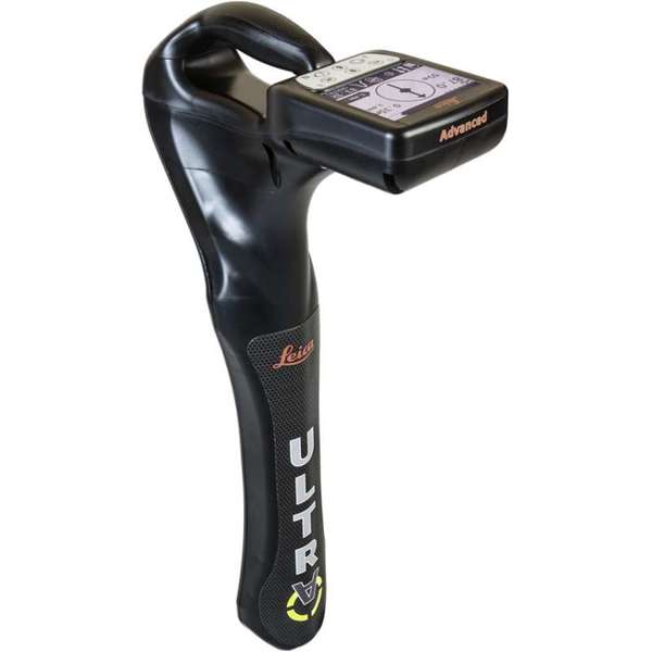
"description": "Leica ULTRA Utility Tracing System\nBest precision locating in faster, more confident work\n\nSave time and increase confidence in your results with the Leica ULTRA, our most advanced precision utility tracing instrument.\n\nThe complexity of underground utility networks is continually increasing, and obtaining precise information on the location of buried utilities has never been more important. The protection of buried assets during excavation work demands accurate mapping and surveying of existing utilities. \n\nIntegrating intelligent signal processing with unique flexible operating modes, Leica ULTRA traces buried utility lines accurately for safe underground excavations and utility surveys. Outstanding performance with operational ease and flexibility.\n\nLARGE CLEAR DISPLAY\nLarge backlit high visibility LCD screen\nClear display provides clear, improved and confident location and utility tracing\nCUSTOM FREQUENCIES\nConfigure for site specific applications\nUser configurable modes from 50 Hz to 200 kHz\nChoose from 100 pre-selected frequencies or customise your own frequencies\nCOMPASS\nShows the user the direction of the utility they are locating / tracing\nBLUETOOTH®\nEnable wireless communications with software running on a laptop, survey field PC or other GPS enabled device\nINCREASED TRANSMITTER POWER OUTPUT\nChoose between 5W and 12W transmitter power outputs for superior tracing performance\nBUILT FOR THE MOST DEMANDING ENVIRONMENTS\nIP65 protection\nFulfils toughest standards - shock resistant, protected against water and dust ingress\nSELECTABLE ANTENNA CONFIGURATION\nConfigure antenna to best optimise for your job site\nSelect between more range, sharper response, noise cancelling or easier sweeping\nDIRECTION ENABLED\nIdentifying your target utility amongst multiple parallel utilities\nApply a special direction enabled signal from the transmitter, the receiver will display an arrow on the compass heading to guide you along the designated utility path\nUnlock the power\nConfigure the Leica ULTRA for site specific applications. Custom build your receiver and transmitter.\n\nChoose from over 100 preselected frequencies, or customise your own frequency for highly specialised applications.\n\nAutomatically capture the instruments location data to ensure adherence to best practice. The data logging feature allows the user to record external GPS coordinates and download with the datafile as a KML or CSV format. Upload into GIS systems or Google Maps to confirm where, when and how the work was performed.\n",
"price": 0.0,
"discountamount": 0.0,
"currencycode": "INR",
"priority": 1000000,
"isfreeshipmentavailable": false,
"shipmentduration": 7,
"_keywords": [
"target utility",
"utility surveys",
"precision utility",
"Leica ULTRA traces",
"designated utility",
"12W transmitter power",
"wireless communications",
"instruments location data",
"site specific applications",
"100 preselected frequencies",
"underground utility networks",
"safe underground excavations",
"intelligent signal processing",
"unique flexible operating modes",
"Leica ULTRA Utility Tracing System"
],
"isarchived": false,
"isavailable": true,
"applicationid": null,
"productindex": 90,
"imageuri": "https://productimages.withfloats.com/actual/5b45ea4dd3d93d01c4f1c9f9.jpg",
"tileimageuri": "https://productimages.withfloats.com/tile/5b45ea4dd3d93d01c4f1c9f9.jpg",
"images": null,
"totalqueries": 0,
"gpid": null,
"groupproductid": null,
"createdon": "2018-07-11T11:30:28.043Z",
"updatedon": "2018-08-08T18:46:53.973Z",
"buyonlinelink": null,
"producturl": "http://WWW.SURVEYEQUIPMENT.IN//leica-ultra-utility-tracing-system/90",
"availableunits": -1.0,
"iscodavailable": true,
"isprepaidonlineavailable": false,
"maxcodorders": 0,
"maxprepaidonlineorders": 0,
"uniquepaymenturl": null,
"brandname": null,
"category": null,
"tags": null,
"variants": false,
"keyspecification": null,
"otherspecifications": null,
"pickupaddressreferenceid": "5d08ebb3edf0e25c3b8da5d0",
"paymenttype": "AssuredPurchase",
"producttype": "products",
"hsncode": null,
"gstslab": 0.0,
"isnotforsale": false
},
{
"_id": "5b6b3a9dd682be0552aefc94",
"fptag": "SBENTERPRISESTRADINGPUNE",
"merchantname": null,
"customwidgets": null,
"externalsourceid": null,
"name": "Leica LOGiCAT VU Management & Monitoring System",
"description": "Leica LOGiCAT VU Management & Monitoring System\nAnalyse data to reduce utility strikes\n\nBy deploying Leica Digicat cable locators, utility strike rates have reduced dramatically. Now, with the introduction of Leica LOGiCAT VU software, cable locators can be managed and monitored centrally.\nData analysis helps fleet managers to improve cable locator usage and effectiveness during the excavation, increases attention to site safety initiative and enhances product familiarisation training and operator behaviour.\n\nWhat is Leica LOGiCAT VU?\nLeica LOGiCAT VU is a management and monitoring system for analysing data from cable locators.\nCable locators are used to identifying the location of buried utilities; the data enables instruments to record GPS coordinates alongside logged instrument data.\nLeica LOGiCAT VU helps plant, fleet and site managers to evaluate and analyse the data from one or more cable locators.\nThe system gives fleet managers a “view” of how the survey was conducted and if it has been undertaken to best practice. The locator positions can be mapped and presented through Google maps, highlighting the path of the survey.\n\nKey benefits\n\nGreater insight if best practice has been followed\nUsing just the cable locator on its own you could miss 45 up to 50% of dormant utilities which hold the potential of fatal injury. The Fleet Manager can evaluate the Leica LOGiCAT VU data and see how and if the Operator has thoroughly undertaken a site investigate, in all modes and with correct accessories, ensuring adherence to best practice.\n\nData visualisation on satellite images to support interpretation\nGPS enables cable locator to record their coordinates alongside usage data. Leica LOGiCAT VU displays field data overlaid on digital map and images, showing where the operator has undertaken the survey to support post-survey evaluation.Clarity for post utility strike evaluation. \n\nClarity for post utility strike evaluation\nIn the event of a utility strike, the incident report can be produced simply and provide a comprehensive and clear view of instruments usage leading up to the incident. Within the report, colours indicate the survey quality, Red/Poor and Green/Good.\n\nData export to GIS and BIM System\nThe instruments data can be exported to a third party GIS and BIM software enhancing knowledge about subsurface utilities for future excavation activities. ",
"price": 0.0,
"discountamount": 0.0,
"currencycode": "INR",
"priority": 1000000,
"isfreeshipmentavailable": false,
"shipmentduration": 7,
"_keywords": [
"instruments data",
"cable locator usage",
"alongside usage data",
"utility strike rates",
"subsurface utilities",
"Leica LOGiCAT VU data",
"enables cable locator",
"site safety initiative",
"data enables instruments",
"Leica LOGiCAT VU software",
"Leica LOGiCAT VU Management",
"post utility strike evaluation",
"deploying Leica Digicat cable locators",
"enhances product familiarisation training"
],
"isarchived": false,
"isavailable": true,
"applicationid": null,
"productindex": 88,
"imageuri": "https://productimages.withfloats.com/actual/5b45a062d3d93d01c4f0ed4e.jpg",
"tileimageuri": "https://productimages.withfloats.com/tile/5b45a062d3d93d01c4f0ed4e.jpg",
"images": null,
"totalqueries": 0,
"gpid": null,
"groupproductid": null,
"createdon": "2018-07-11T06:15:05.058Z",
"updatedon": "2018-08-08T18:46:53.924Z",
"buyonlinelink": null,
"producturl": "http://WWW.SURVEYEQUIPMENT.IN/products/leica-logicat-vu-management-monitoring-system/88",
"availableunits": -1.0,
"iscodavailable": true,
"isprepaidonlineavailable": false,
"maxcodorders": 0,
"maxprepaidonlineorders": 0,
"uniquepaymenturl": null,
"brandname": null,
"category": null,
"tags": null,
"variants": false,
"keyspecification": null,
"otherspecifications": null,
"pickupaddressreferenceid": "5d08ebb3edf0e25c3b8da5d0",
"paymenttype": "AssuredPurchase",
"producttype": "products",
"hsncode": null,
"gstslab": 0.0,
"isnotforsale": false
},
{
"_id": "5c528f7519bf0400016c2058",
"fptag": "SBENTERPRISESTRADINGPUNE",
"merchantname": null,
"customwidgets": null,
"externalsourceid": null,
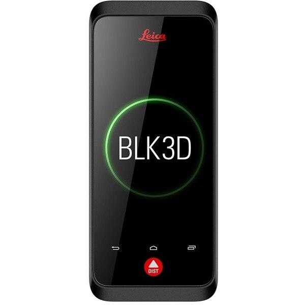
"name": "Leica BLK3D",
"description": "Leica BLK3D\nReal-time, professional grade, in-picture 3D measurement\nThe Leica BLK3D is a real-time, in-picture 3D measurement solution. By combining measurement sensors, software, and on-device edge data processing capabilities, the Leica BLK3D makes in-picture measurements with professional-grade accuracy in real-time possible. Every image captured is a complete and precise 3D measurement record.\n\nIts edge computing capabilities eliminate the need for network connections and cloud services, ensuring professionals can make faster decisions within their daily workflows – whether measuring inaccessible locations, creating floor plans, estimating building installations, documenting construction site progress or creating measurable, as-built documentation.\n\nTake a picture. Measure anything.\nThe BLK3D captures images and places precise measurements at your fingertips. Share images and measurements in multiple formats.\n\nThe art of photogrammetry. Simplified.\nUn-matched combination of a calibrated stereo-camera, advanced algorithms and real-time edge computing fused with leading Electronic Distance Measurement (EDM) technology.\n\nAccess projects. Anywhere, anytime.\nMeasure in your image – on the handheld imager, on the desktop, on-site or in the office.\n\nWorking with digital floorplans.\nCreate floorplans and import existing ones. Add measurable images. Document construction progress with multiple images over time.\n\nNew dimensions for 2D pictures.\nThe BLK3D creates images that contain precise three-dimensional measurements.\n\nProgressive project documentation for AEC.\nCapture critical moments throughout the life of a building.\n\nObject detection and snapping.\nAuto-Snapping uses computer vision technologies to select the right points for your measurements.\n\nStore. Organize. Share.\nStore your measurable images on the device and on desktop. Organize your projects by tagging measurable images with searchable keywords for easy recall and share them in multiple formats.\n\n",
"price": 0.0,
"discountamount": 0.0,
"currencycode": "INR",
"priority": 1000000,
"isfreeshipmentavailable": false,
"shipmentduration": 0,
"_keywords": null,
"isarchived": false,
"isavailable": false,
"applicationid": null,
"productindex": 139,
"imageuri": "https://productimages.withfloats.com/actual/5c5293511e8d150001c19faa.jpg",
"tileimageuri": "https://productimages.withfloats.com/tile/5c5293511e8d150001c19faa.jpg",
"images": null,
"totalqueries": 0,
"gpid": null,
"groupproductid": null,
"createdon": "2019-01-31T06:02:29.05Z",
"updatedon": "2019-01-31T06:18:55.492Z",
"buyonlinelink": null,
"producturl": "http://WWW.SURVEYEQUIPMENT.IN//leica-blk3d/139",
"availableunits": -1.0,
"iscodavailable": true,
"isprepaidonlineavailable": false,
"maxcodorders": 0,
"maxprepaidonlineorders": 0,
"uniquepaymenturl": null,
"brandname": null,
"category": "leicageosystems",
"tags": [
"leicageosystems",
"BLK3D",
"leicadisto",
"BLK360",
"laserdistancemeter",
"leicascanner"
],
"variants": false,
"keyspecification": null,
"otherspecifications": null,
"pickupaddressreferenceid": "5d08ebb3edf0e25c3b8da5d0",
"paymenttype": "AssuredPurchase",
"producttype": "products",
"hsncode": null,
"gstslab": 0.0,
"isnotforsale": false
},
{
"_id": "5bcdaac7e3f0b00001d2a048",
"fptag": "SBENTERPRISESTRADINGPUNE",
"merchantname": null,
"customwidgets": null,
"externalsourceid": null,
"name": "RIS One & RIS Plus",
"description": "RIS One & RIS Plus\nCompact and lightweight ground penetrating radar\n\nRIS ONE and RIS PLUS are the most compact and lightweight antennas available on the market. Gain increased acquisition speed through a high stacking factor as well as improved penetration depth with these single or multi-channel radar control unit.\n\nThe system is supported by antennas operating in 25 MHz to 2.6 GHz frequency range. Custom solutions are available with the IDS GeoRadar control unit, able to power up multiple antennas connected in chain. The antennas feature:\n\nExcellent data quality\nHighest flexibility in multi-channel chain connection\nHigh stacking thereby improving penetration depth\nWireless link to keep track of the survey path and the location of buried objects;\nRIS ONE and RIS PLUS are the ideal solutions for:\n\nUnderground tunnel inspection and condition assessment;\nBedrock and lithological profiling;\nFracture characterisation;\nGround water profiling;\nFoundation and pile measurements;\nBorehole investigations.\nBenefits of the RIS ONE and RIS PLUS include:\n\nLargest antenna gamma in the ground penetrating radar market: A comprehensive set of antennas from 25 MHz to 3.0 GHz, including multi-frequency, borehole and horn antennas ensuring that the right equipment is available for the right application.\nMore than eight hours of autonomous use: IDS GeoRadar’s radar control unit has the lowest power consumption in the ground penetrating radar market.\nFlexible: The multi-channel DAD control unit can drive any IDS Georadar antenna and up to eight antennas in chain connection simultaneously enabling the use of custom configurations.\n\n\n",
"price": 0.0,
"discountamount": 0.0,
"currencycode": "INR",
"priority": 1000000,
"isfreeshipmentavailable": false,
"shipmentduration": 7,
"_keywords": null,
"isarchived": false,
"isavailable": true,
"applicationid": null,
"productindex": 118,
"imageuri": "https://productimages.withfloats.com/actual/5bcdaac884ac000001a78fc7.jpg",
"tileimageuri": "https://productimages.withfloats.com/tile/5bcdaac884ac000001a78fc7.jpg",
"images": null,
"totalqueries": 0,
"gpid": null,
"groupproductid": null,
"createdon": "2018-10-22T10:47:35.934Z",
"updatedon": "2018-10-22T10:47:35.934Z",
"buyonlinelink": null,
"producturl": "http://WWW.SURVEYEQUIPMENT.IN//ris-one-ris-plus/118",
"availableunits": -1.0,
"iscodavailable": true,
"isprepaidonlineavailable": false,
"maxcodorders": 0,
"maxprepaidonlineorders": 0,
"uniquepaymenturl": null,
"brandname": null,
"category": null,
"tags": null,
"variants": false,
"keyspecification": null,
"otherspecifications": null,
"pickupaddressreferenceid": "5d08ebb3edf0e25c3b8da5d0",
"paymenttype": "AssuredPurchase",
"producttype": "products",
"hsncode": null,
"gstslab": 0.0,
"isnotforsale": false
},
{
"_id": "5bcda7bf2757570001e2fc40",
"fptag": "SBENTERPRISESTRADINGPUNE",
"merchantname": null,
"customwidgets": null,
"externalsourceid": null,
"name": "C-thrue",
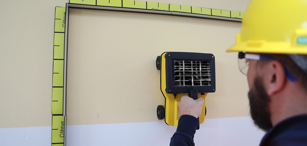
"description": "C-thrue\nSee thru concrete structures and reveal true data that lead to optimal decision-making\n\nCONCRETE SCANNING\nPinpoint hidden objects in cured concrete—without expensive specialists.\n\nScanning, analyzing, and interpreting what's beneath concrete has never been faster or easier. The C-thrue, now equipped with an additional sensor are the industry's easiest-to-use tools for self-performing concrete inspections.\n\nC-thrue is an all-in-one Ground Penetrating Radar (GPR) for accurate scanning and real time analysis of concrete structures. Construction and service companies as well as civil and structural engineers can now improve the way they locate rebars, voids, post-tension cables, cavities, conduits, and any other objects buried in the structure before cutting or drilling into the concrete.\n\nC-thrue is an easy-to-use and robust solution to see through concrete structures and reveal true data that lead to optimal decision-making. The solution is suited for all construction sites and operations including building renovation, overpasses, monuments, bridges and tunnels surveys, as well as for detailed analysis of the original engineering project and comparison with the as-built structure.\n\nToday, C-thrue offers more flexibility with no limitations for your analysis requirements, thanks to a compact and light telescopic pole and an external controller that can be easily transported on site in challenging locations or conditions (e.g. under a deck, along vertical walls, etc...). \nThe C-thrue external controller allows easier and faster data interpretation thanks to real-time data processing and representation of results in Augmented Reality for more efficient decision-making.\n\nFeatures and Benefits:\n\nClearer and faster surveys \nDetection of both first and second levels of rebars thanks to the system’s double polarisation.\nSafe drill in the surveyed structure\nRebar/void automatic insight capabilities that improve safety before cutting or drilling into the concrete.\n\nFully-visible, multi-touch display \nData displayed on the screen are never obscured by the handle or the user’s hand.\n\nSimplified data interpretation\nOptimal decision-making supported by visualisation of acquired data in 3D models.\n\nIncreased data accuracy\nEliminate manual, error-prone paper grids with an automatic positioning and navigation system.\n\nAdvanced data visualisation\nAugmented reality for 3D data visualisation and sharing across operators – in real time or intervals after acquisition.\n\nAutomated data acquisition and analysis\nAutomatic detection of the first layer of rebars and result exportation.\n\nFlexibility everywhere\nLightweight, compact, drop resistant and transportable system for every user operations and construction sites.",
"price": 0.0,
"discountamount": 0.0,
"currencycode": "INR",
"priority": 1000000,
"isfreeshipmentavailable": false,
"shipmentduration": 7,
"_keywords": null,
"isarchived": false,
"isavailable": true,
"applicationid": null,
"productindex": 117,
"imageuri": "https://productimages.withfloats.com/actual/5bcda7c0e34dfa000137913c.jpg",
"tileimageuri": "https://productimages.withfloats.com/tile/5bcda7c0e34dfa000137913c.jpg",
"images": null,
"totalqueries": 0,
"gpid": null,
"groupproductid": null,
"createdon": "2018-10-22T10:34:39.836Z",
"updatedon": "2018-11-22T05:55:37.191Z",
"buyonlinelink": null,
"producturl": "http://WWW.SURVEYEQUIPMENT.IN//c-thrue/117",
"availableunits": -1.0,
"iscodavailable": true,
"isprepaidonlineavailable": false,
"maxcodorders": 0,
"maxprepaidonlineorders": 0,
"uniquepaymenturl": null,
"brandname": null,
"category": "gpr",
"tags": [
"gpr",
"ground peantritng radar",
"concretescanner"
],
"variants": false,
"keyspecification": null,
"otherspecifications": null,
"pickupaddressreferenceid": "5d08ebb3edf0e25c3b8da5d0",
"paymenttype": "AssuredPurchase",
"producttype": "products",
"hsncode": null,
"gstslab": 0.0,
"isnotforsale": false
},
{
"_id": "5b91054f2626a60521ac8372",
"fptag": "SBENTERPRISESTRADINGPUNE",
"merchantname": null,
"customwidgets": null,
"externalsourceid": null,
"name": "Leica Zeno Mobile",
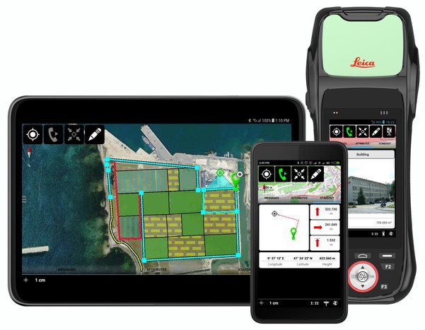
"description": "Leica Zeno Mobile\nIntuitive data capture\n\nLeica Zeno Mobile is an Android™ app available on the Leica Zeno 20 and selected Android smartphones and tablets.\n\n Supports Leica Zeno 20, selected\nsmartphones and tablets with Android\nv5.0 or higher\n Connect to Leica Zeno GNSS devices to\nutilise high accuracy data collection\n Simple and intuitive user interface\nand workflows with minimum training\nrequired\n Different versions of Zeno Mobile\navailable depending on your needs \n\nInteraction with Zeno Mobile is simple and\nintuitive, providing advanced functionality\nwithout the need for extensive training.\n Import and export data to\ncloud service\n Multi-touch support for easy\nmap orientation\n Use OpenStreetMap or your own\nbackground maps instantly via WMS\n Supports wide range of GIS and CAD\ndata formats\n\nZeno Mobile saves you time in the field by\nenabling you to capture more data quicker.\n Data collection projects can be setup\non the fly without the need for other\nsoftware\n Capture inaccessible points using\nGAMtec (Zeno 20 only)\n Capture multiple features at the same\ntime using the multi-collect function\n Connect to cable detection devices\n Stakeout tool for precision location\n Easily import and export data with\nLeica Zeno Office",
"price": 0.0,
"discountamount": 0.0,
"currencycode": "INR",
"priority": 1000000,
"isfreeshipmentavailable": false,
"shipmentduration": 7,
"_keywords": null,
"isarchived": false,
"isavailable": true,
"applicationid": null,
"productindex": 112,
"imageuri": "https://productimages.withfloats.com/actual/5b91054f8b91ff054a4ed0cc.jpg",
"tileimageuri": "https://productimages.withfloats.com/tile/5b91054f8b91ff054a4ed0cc.jpg",
"images": null,
"totalqueries": 0,
"gpid": null,
"groupproductid": null,
"createdon": "2018-09-06T10:45:35.843Z",
"updatedon": "2018-09-06T10:45:35.843Z",
"buyonlinelink": null,
"producturl": "http://WWW.SURVEYEQUIPMENT.IN/products/leica-zeno-mobile/112",
"availableunits": -1.0,
"iscodavailable": true,
"isprepaidonlineavailable": false,
"maxcodorders": 0,
"maxprepaidonlineorders": 0,
"uniquepaymenturl": null,
"brandname": null,
"category": "DGPS",
"tags": [
"DGPS",
"TOTALSTATIONS",
"GPS"
],
"variants": false,
"keyspecification": null,
"otherspecifications": null,
"pickupaddressreferenceid": "5d08ebb3edf0e25c3b8da5d0",
"paymenttype": "AssuredPurchase",
"producttype": "products",
"hsncode": null,
"gstslab": 0.0,
"isnotforsale": false
},
{
"_id": "5b6b3a9ed682be0552aefe5c",
"fptag": "SBENTERPRISESTRADINGPUNE",
"merchantname": null,
"customwidgets": null,
"externalsourceid": null,
"name": "Leica iCON iCR70 Robotic Total Station",
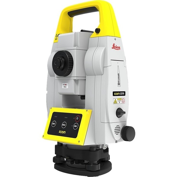
"description": "The Leica iCON iCR70 facilitates the move from traditional analogue measurement methods to modern digital layout techniques.\n\nThe Leica iCON iCR70 facilitates the move from traditional analogue measurement methods to modern digital layout techniques. Which are a necessity within modern BIM processes and achieves high productivity and accuracies demanded by the building construction industry. \nThe iCR70 can be used by the existing construction workforce with minimal training and does not disrupt existing construction processes.\n\nLayout lines for footings or chalk line for formwork on foundations\nLayout points on binding layer such as pipe insert of cut-outs before pouring concrete\nMEP layout of hanger locations for HVAC and duct work, inserts and slits for sheet metal work\nFully automatic layout routines of points on floor or ceiling lines for pipe wall penetrations\nPrepare and execute construction tasks faster, simpler and more accurately. This robot, tailored to your construction needs, is designed for one-person operation, giving you approximately an eighty per cent increase of productivity over other conventional layout practices. The iCON iCR70 is your best partner for construction layout, helping you to simplify your work on site, be on time and under budget. With a bullet-proof set-up routine, you can be confident that you have the right set up. It guarantees layout efficiency with flexible handling of fully rendered 3D design models in the field.\n\n4-button keypad for simple operation\nFast prism search by patented technology SpeedSearch\nStable data communication with long-range Bluetooth (up tp 400m)\nAligned to modern BIM processes, fully-rendered 3D design models can be easily shared via COnx from the design office to the field crews\nGo Digital \nSwap the traditional measuring methods for new modern technology that is easy-to-use. The iCON iCR70 allows you to move from traditional analogue layout methods, such as tapes, plumb bobs and strings to modern digital layout methods. Using the new construction total station from Leica you can now turn complex designs into reality with ease.\n\nAutonomy\nRich intelligent design data can be handed over form the office to field crews as fully rendered 3D models. The layout objects App. allows you to lay out straight from 3D models be selecting an object, like a column or pipe, simply by tapping on it in the controller. This gives field crews full flexibility selecting their work packages by objects with simple yet powerful filter mechanisms making this ideal for MEP/HVAC construction layout.\n\nAutomated Set Up\nThe Setup Pilot app allows you to remain confident with the most reliable, simple and automated setup routine which requires no user interaction. With it a successful set-up completion is visually communicated, indicating layout can immediately begin at the push of a button.",
"price": 0.0,
"discountamount": 0.0,
"currencycode": "INR",
"priority": 1000000,
"isfreeshipmentavailable": false,
"shipmentduration": 7,
"_keywords": [
"construction layout",
"new modern technology",
"construction workforce",
"automatic layout routines",
"execute construction tasks",
"guarantees layout efficiency",
"field crews full flexibility",
"modern digital layout methods",
"conventional layout practices",
"new construction total station",
"building construction industry",
"modern digital layout techniques",
"traditional analogue layout methods",
"Leica iCON iCR70 Robotic Total Station",
"traditional analogue measurement methods"
],
"isarchived": false,
"isavailable": true,
"applicationid": null,
"productindex": 108,
"imageuri": "https://productimages.withfloats.com/actual/5b6550f8ca14c4050adf1f4e.jpg",
"tileimageuri": "https://productimages.withfloats.com/tile/5b6550f8ca14c4050adf1f4e.jpg",
"images": null,
"totalqueries": 0,
"gpid": null,
"groupproductid": null,
"createdon": "2018-08-04T07:08:40.837Z",
"updatedon": "2018-08-08T18:46:54.54Z",
"buyonlinelink": null,
"producturl": "http://WWW.SURVEYEQUIPMENT.IN//leica-icon-icr70-robotic-total-station/108",
"availableunits": -1.0,
"iscodavailable": true,
"isprepaidonlineavailable": false,
"maxcodorders": 0,
"maxprepaidonlineorders": 0,
"uniquepaymenturl": null,
"brandname": null,
"category": "robotictotalstationpune",
"tags": [
"robotictotalstationpune",
"robotictotalstations"
],
"variants": false,
"keyspecification": null,
"otherspecifications": null,
"pickupaddressreferenceid": "5d08ebb3edf0e25c3b8da5d0",
"paymenttype": "AssuredPurchase",
"producttype": "products",
"hsncode": null,
"gstslab": 0.0,
"isnotforsale": false
},
{
"_id": "5b6b3a9ed682be0552aefdfe",
"fptag": "SBENTERPRISESTRADINGPUNE",
"merchantname": null,
"customwidgets": null,
"externalsourceid": null,
"name": "Leica Disto S910 - Pro Kit",
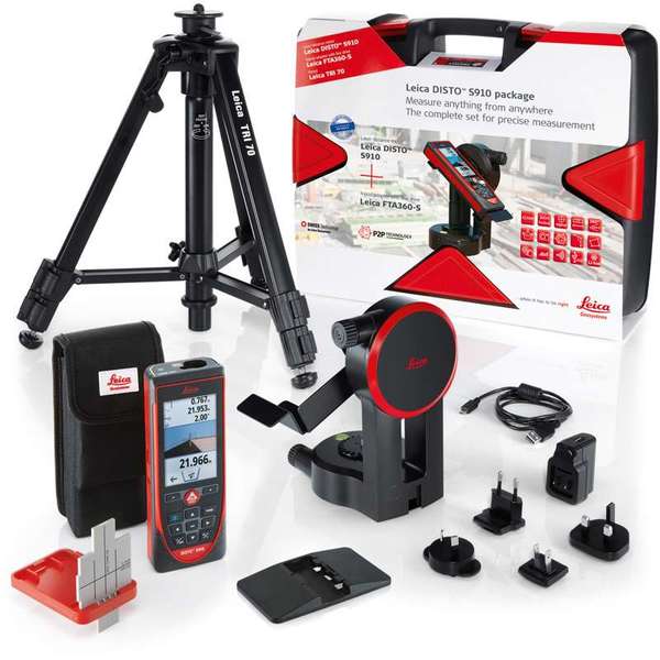
"description": "Leica Disto S910 - Pro Kit\nSpecial package promotion Leica DISTO™ S910 with tripod, adapter, target plate and carry case.\nMeasure quickly and accurate distances between two points from a single location with the Leica DISTO™ S910 laser distance meter. Generate effortlessly as-built documentation, determine rooftop dimensions and integrate information into CAD or BIM software for even 3D conceptions. This improved workflows saves valued time and money. All of this at distances of up to 300 meters.\n\nPro Kit includes\nLeica DISTO™ S910 laser distance meter\nSmart Base Extension\nHolster\nHand loop\nUSB charger incl. 4 plugs\nLeica FTA360-S tripod adapter\nLeica TRI 70 tripod\nLeica GZM3 target plate\nCarrying case\nFeatures include:\nSmart Base for P2P Technology\nPointfinder with 4x zoom for effortless targeting\nX-Range Power Technology for maximum measurement functioning\n360° tilt sensor\nDXF data capture\nData transfer in real-time with WLAN\nBluetooth® Smart\nFree Leica DISTO™ sketch App\nMeasure with P2P Technology\nThe incorporated Smart Base allows distances to be measured between any two points, inclinations and angles at the same time from a single location. You will never have to reach for remote areas again, allowing even the most complicated measurement job to be carried out accurately, quickly, and safely.\n\nAttain measurement data in CAD format\nThe Leica DISTO™ S910 laser measurer can save measured points to a DXF file as a wall layout, floor plan or 3D point coordinates which can be transferred to a PC via USB. Save money, reduce workflow and prevent mistakes. Everything is completely digital.\n\nTransfer point data in real-time\nEasily move measurement data promptly on site over the Wireless LAN interface to a transportable computer for additional processing in your favoured software. Produce documentation or assess lay-outs in real-time and communicate measurement points as you need with or without pictures.\n\nX-Range Power Technology\nThe state-of-the-art X-Range Power Technology included with the Leica DISTO™ S910 represents the future of measuring technology. It successfully measures distances of up to 300 meters and guarantees the optimum measuring functioning even to badly reflecting objects.\n\n \n\n£1,510.80\tinc VAT\n£1,259.00\texcl VAT\nQty: \n1\n Add to Basket\nIncludes FREE Next Day Delivery\nOrder by phone: 01480 404888\nCall our experienced sales team to order or discuss any products.\nCredit Card Logos\n\nSend to a Colleague\n\nDelivery and Returns\n\nLeica\n",
"price": 0.0,
"discountamount": 0.0,
"currencycode": "INR",
"priority": 1000000,
"isfreeshipmentavailable": false,
"shipmentduration": 7,
"_keywords": [
"Leica Disto S910",
"measurement data",
"Power Technology",
"accurate distances",
"S910 laser measurer",
"maximum measurement",
"3D point coordinates",
"Produce documentation",
"additional processing",
"transportable computer",
"Wireless LAN interface",
"package promotion Leica",
"S910 laser distance meter",
"determine rooftop dimensions",
"communicate measurement points"
],
"isarchived": false,
"isavailable": true,
"applicationid": null,
"productindex": 101,
"imageuri": "https://productimages.withfloats.com/actual/5b52e68d2b1777063123668e.jpg",
"tileimageuri": "https://productimages.withfloats.com/tile/5b52e68d2b1777063123668e.jpg",
"images": null,
"totalqueries": 0,
"gpid": null,
"groupproductid": null,
"createdon": "2018-07-21T07:53:48.529Z",
"updatedon": "2018-08-08T18:46:54.394Z",
"buyonlinelink": null,
"producturl": "http://WWW.SURVEYEQUIPMENT.IN//leica-disto-s910-pro-kit/101",
"availableunits": -1.0,
"iscodavailable": true,
"isprepaidonlineavailable": false,
"maxcodorders": 0,
"maxprepaidonlineorders": 0,
"uniquepaymenturl": null,
"brandname": null,
"category": "laserdistancemeter",
"tags": [
"laserdistancemeter",
"leicadisto",
"leicas910"
],
"variants": false,
"keyspecification": null,
"otherspecifications": null,
"pickupaddressreferenceid": "5d08ebb3edf0e25c3b8da5d0",
"paymenttype": "AssuredPurchase",
"producttype": "products",
"hsncode": null,
"gstslab": 0.0,
"isnotforsale": false
},
{
"_id": "5b6b3a9ed682be0552aefd6c",
"fptag": "SBENTERPRISESTRADINGPUNE",
"merchantname": null,
"customwidgets": null,
"externalsourceid": null,
"name": "Leica ULTRA Locator – Standard",
"description": "Leica ULTRA Locator – Standard\nThe ULTRA System has unique flexible operating modes to help you easily decide the right mode for your locating application and site conditions.\n\nMultimode operation – 50-200Khz\nDaylight visible LCD screen\nPrecision locating, for utility tracing\nThe complexity of underground utility networks are continually increasing. So obtaining precise information on the location of buried utilities has never been more important. The protection of buried assets during excavation work demands accurate mapping and surveying of existing utilities.\n\nThe Leica ULTRA provides our most advanced precision utility tracing system. Intelligent signal processing has been integrated with unique flexible operating modes, to help save you time and increased confidence in your results. Selectable antenna and customised frequencies optimises your instrument for site specific applications, supported by our AIM system which monitors signal interference levels, recommending which mode to use for the best results.\n\nAmbient Interference Measurement (AIM) \nWhen working in congested environments, external interferences can affect the effectiveness of utility tracing. To guard against interference, the Leica ULTRA incorporates advanced Ambient Interference Measurement (AIM), which analyses the surrounding area for noise and recommends the best frequencies for accurate utility tracing.\n\nOffset measuring \nThere will always be an occasion when the utility runs close to, or underneath an obstruction. With Offset Measuring, the Leica ULTRA can locate the target line if not directly accessible from above. The function uses the available data to estimate the horizontal and vertical (depth) distance.\n\nTransmitter to receiver link \nAdvanced communication link between the Leica ULTRA receiver and transmitter, enables you to control the transmitter directly from the receiver. Work smarter and at greater distances to help achieve best practice whilst reducing time spent walking to the transmitter.",
"price": 0.0,
"discountamount": 0.0,
"currencycode": "INR",
"priority": 1000000,
"isfreeshipmentavailable": false,
"shipmentduration": 7,
"_keywords": [
"communication link",
"Leica ULTRA Locator",
"precise information",
"Leica ULTRA receiver",
"congested environments",
"external interferences",
"advanced precision utility",
"site specific applications",
"underground utility networks",
"Intelligent signal processing",
"unique flexible operating modes",
"monitors signal interference levels",
"advanced Ambient Interference Measurement"
],
"isarchived": false,
"isavailable": true,
"applicationid": null,
"productindex": 95,
"imageuri": "https://productimages.withfloats.com/actual/5b45e9a9d3d93d01c4f1c26c.jpg",
"tileimageuri": "https://productimages.withfloats.com/tile/5b45e9a9d3d93d01c4f1c26c.jpg",
"images": null,
"totalqueries": 0,
"gpid": null,
"groupproductid": null,
"createdon": "2018-07-11T11:27:45.603Z",
"updatedon": "2018-08-08T18:46:54.165Z",
"buyonlinelink": null,
"producturl": "http://WWW.SURVEYEQUIPMENT.IN//leica-ultra-locator-standard/95",
"availableunits": -1.0,
"iscodavailable": true,
"isprepaidonlineavailable": false,
"maxcodorders": 0,
"maxprepaidonlineorders": 0,
"uniquepaymenturl": null,
"brandname": null,
"category": "cable pipe detector equipments",
"tags": [
"cable pipe detector equipments",
"Cable Avoidance Tools",
"cable",
"cable route tracing to Datalogging locators",
"ndustry standard for cable locating equipments.",
"Pipe and Cable locators",
"underground cable & pipe locating equipments"
],
"variants": false,
"keyspecification": null,
"otherspecifications": null,
"pickupaddressreferenceid": "5d08ebb3edf0e25c3b8da5d0",
"paymenttype": "AssuredPurchase",
"producttype": "products",
"hsncode": null,
"gstslab": 0.0,
"isnotforsale": false
}
],
"hasmoreitems": false,
"isapirequest": false,
"totalresults": 27,
"query": null,
"floatingpoint": null
}