Currently it only shows your basic business info. Start adding relevant business details such as description, images and products or services to gain your customers attention by using Boost 360
android app
/
iOS App/ web portal.
{
"products": [
{
"_id": "5c839daa0eac470001975d08",
"fptag": "SBENTERPRISESTRADINGPUNE",
"merchantname": null,
"customwidgets": null,
"externalsourceid": null,
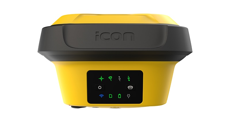
"name": "Leica iCON gps 70 Series",
"description": "Leica iCON gps 70 Series\nPermanent tilt compensation and resistance to magnetic interferences – Leica iCON gps 70 T\n\n\nLeica iCON gps 70 Series – Ultimate performance for your construction site\nUltimate GNSS Rover and field solution for maximum efficiency. Speed up – anytime, anywhere. Leica Geosystems introduces the most efficient construction GNSS rovers, the Leica iCON gps 70 Series. Combining the latest GNSS technology and inertial measurement unit (IMU), the Leica iCON gps 70 T is equipped with permanent tilt compensation and as well resistant to any magnetic interferences. Being calibration-free, the iCON gps 70 T is ready when you are – anytime, anywhere. The iCON gps 70 T releases the limitations of working with the pole in vertical positions and increases the productivity compared to conventional methods. Furthermore, the efficiency on a construction site is enhanced by collecting as-built field data and staking out designs faster, while increasing accuracy and reducing errors. Without time-consuming procedures, users measure where it was not possible before with improved quality control. The seamless integration of the Leica iCON gps 70 Series into the Leica iCON field software leads to simple workflows which require less training and avoid costly downtime.\n\n\nDGPS Surveying Instruments\nDGPS Surveying Instruments - Positioning System Retailer from Mumbai\n\nDGPS Surveying Instruments - Positioning System Retailer from Pune\n\nDGPS Surveying Instruments - Positioning System Retailer from India\n\nDGPS Surveying Instruments - Positioning System Retailer from Maharashtra\n\nGPS Survey Equipment\n\nDifferential GPS India\n\nDifferential Global Positioning System (DGPS) from Mumbai\n\nDifferential Global Positioning System (DGPS) from Pune\n\nDifferential Global Positioning System (DGPS) from India\n\nDifferential Global Positioning System (DGPS) from Maharashtra\n\nGNSS/GPS Survey Equipment - Surveying Equipment from Mumbai\n\nGNSS/GPS Survey Equipment - Surveying Equipment from Pune\n\nGNSS/GPS Survey Equipment - Surveying Equipment from India\n\nGNSS/GPS Survey Equipment - Surveying Equipment from Maharashtra\n\nConstruction Surveying Equipment, Surveying Instruments in India\n\n \n\n",
"price": 0.0,
"discountamount": 0.0,
"currencycode": "INR",
"priority": 1000000,
"isfreeshipmentavailable": false,
"shipmentduration": 7,
"_keywords": [
"Survey Equipment",
"Leica iCON gps 70 T",
"Surveying Equipment",
"Surveying Instruments",
"iCON gps 70 T releases",
"Leica iCON gps 70 Series",
"Global Positioning System",
"Leica iCON field software",
"inertial measurement unit",
"Positioning System Retailer",
"permanent tilt compensation",
"efficient construction GNSS rovers"
],
"isarchived": false,
"isavailable": true,
"applicationid": null,
"productindex": 141,
"imageuri": "https://productimages.withfloats.com/actual/5c839dabdc44740001742988.jpg",
"tileimageuri": "https://productimages.withfloats.com/tile/5c839dabdc44740001742988.jpg",
"images": null,
"totalqueries": 0,
"gpid": null,
"groupproductid": null,
"createdon": "2019-03-09T11:04:10.316Z",
"updatedon": "2019-03-09T11:04:10.316Z",
"buyonlinelink": null,
"producturl": "http://WWW.SURVEYEQUIPMENT.IN//leica-icon-gps-70-series/141",
"availableunits": -1.0,
"iscodavailable": true,
"isprepaidonlineavailable": false,
"maxcodorders": 0,
"maxprepaidonlineorders": 0,
"uniquepaymenturl": null,
"brandname": null,
"category": "DGPS Surveying Instruments",
"tags": [
"DGPS Surveying Instruments",
"Differential GPS India",
"DGPS Surveying Instruments - Positioning System Re",
"GNSS/GPS Survey Equipment - Surveying Equipment fr"
],
"variants": false,
"keyspecification": null,
"otherspecifications": null,
"pickupaddressreferenceid": "5d08ebb3edf0e25c3b8da5d0",
"paymenttype": "AssuredPurchase",
"producttype": "products",
"hsncode": null,
"gstslab": 0.0,
"isnotforsale": false
},
{
"_id": "5c18b8e4ead682000197c724",
"fptag": "SBENTERPRISESTRADINGPUNE",
"merchantname": null,
"customwidgets": null,
"externalsourceid": null,
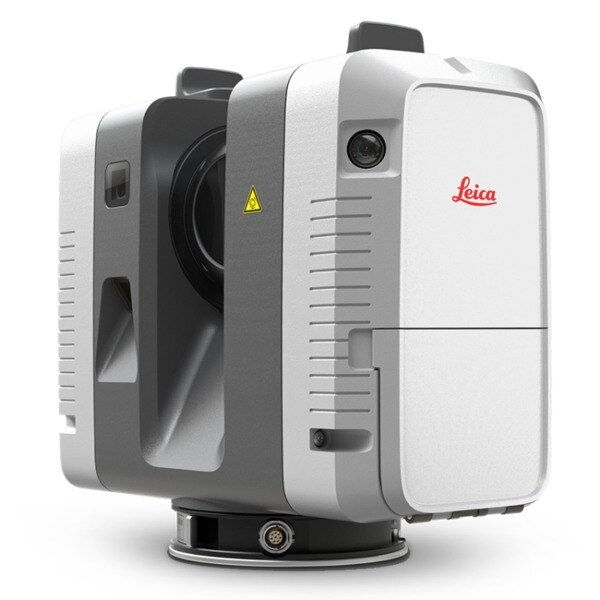
"name": "Leica RTC360 Laser Scanner",
"description": "Leica RTC360 Laser Scanner\nFast, agile and precise 3D reality capture solution\nFast\nFAST\nThe Leica RTC360 laser scanner makes 3D reality capture faster than ever before. With a measuring rate of up to 2 million points per second and advanced HDR imaging system, the creation of colored 3D point clouds can be completed in under 2 minutes. Plus, automated targetless field registration (based on VIS technology) and the seamless, automated transfer of data from site to office reduce time spent in the field and further maximize productivity.\n\nAgile\nAgile\nSmall and lightweight, the Leica RTC360 scanner’s portable design and collapsible tripod mean it’s compact enough to fit into most backpacks, ready to be taken anywhere. Once on-site, easy-to-use one-button operation makes for fast, hassle-free scanning.\n\nPrecise\nPrecise\nLow noise data allows for better images, resulting in crisp, high-quality scans that are rich in detail and ready for use in a range of applications. Combined with Cyclone FIELD 360 software for automated registration in the field, the Leica RTC360 scanner offers outstanding precision that can be checked on-site.\n\nLeica RTC360 Product Specifications\n3D Laser Scanner\tHigh-speed 3D laser scanner with integrated HDR spherical imaging system and Visual Inertial System (VIS) for real time registration\nData acquisition\t< 2 min for complete full dome scan and spherical HDR image at 6mm @ 10m resolution\nReal time registration\tAutomatic point cloud alignment based on real time tracking of scanner movement between setups based on Visual Inertial System (VIS) by video-enhanced inertial measurement unit\nDouble scan\tAutomatic removal of moving objects\nDistance measurement\tHigh-speed, high dynamic time of flight enhanced by Waveform Digitizing (WFD) technology\nLaser Class\t1 (in accordance with IEC 60825-1:2014), 1550nm (invisible)\nField of view\t360° (horizontal) / 300° (vertical)\nRange\tMin. 0.5 - up to 130 m\nSpeed\tUp to 2‘000‘000 pts / sec\nResolution\t3 user selectable settings (3/6/12mm @ 10m)\nAccuracy\tAngular accuracy 18”\nRange accuracy 1.0 mm + 10 ppm \n3D point accuracy \n1.9 mm @ 10 m \n2.9 mm @ 20 m \n5.3 mm @ 40 m\nRange noise\t0.4 mm @ 10 m, 0.5 mm @ 20 m\nCamera\t36 MP 3-camera system captures \n432 MPx raw data for calibrated \n360° x 300° spherical image\nSpeed\t1 minute for full spherical HDR image at any light condition\nHDR\tAutomatic, 5 brackets\nVisual Inertial System\tVideo enhanced inertial measuring system to track movement of the scanner position relative to the previous setup in real time\nTilt\tIMU based, Accuracy: 3‘ for any tilt\nAdditional sensors\tAltimeter, Compass, GNSS\nOn scanner\tTouch-screen control with finger touch, full color WVGA graphic display 480 x 800 pixels\nMobile devices\tLeica Cyclone FIELD 360 app for iPad or Android tablets including:\n- Remote control of scan functions\n- 2D & 3D data viewing\n- Tagging\n- Automatic alignment of scans\nWireless\tIntegrated wireless LAN (802.11 b/g/n)\nData storage\tLeica MS256, 256GB exchangeable USB 3.0 flash drive\nHousing\tAluminium frame and sidecovers\nDimensions\t120mm x 240mm x 230mm / 4.7‘‘ x 9.4‘‘ x 9.1\nWeight\t5.35 kg / 11.7 lbs, nominal (w/o batteries)\nMounting mechanism\tQuick mounting on 5/8“ stub on lightweight tripod / optional tribrach adapter / survey tribrach adapter available\nInternal battery\t2 x Leica GEB361 internal, rechargeable Li-Ion batteries.\nDuration: Typically up to 4 hours\nWeight: 340 g per battery\nExternal\tLeica GEV282 AC adapter\nOperating temperature\t5° to +40° C\nStorage temperature\t40° to +70° C\nDust/Humidity\tSolid particle/liquid ingress protection IP54",
"price": 0.0,
"discountamount": 0.0,
"currencycode": "INR",
"priority": 1000000,
"isfreeshipmentavailable": false,
"shipmentduration": 7,
"_keywords": null,
"isarchived": false,
"isavailable": true,
"applicationid": null,
"productindex": 132,
"imageuri": "https://productimages.withfloats.com/actual/5c18b8e5c4c56a0001280ffa.jpg",
"tileimageuri": "https://productimages.withfloats.com/tile/5c18b8e5c4c56a0001280ffa.jpg",
"images": null,
"totalqueries": 0,
"gpid": null,
"groupproductid": null,
"createdon": "2018-12-18T09:07:48.277Z",
"updatedon": "2019-02-16T09:46:13.795Z",
"buyonlinelink": null,
"producturl": "http://WWW.SURVEYEQUIPMENT.IN/products/leica-rtc360-laser-scanner/132",
"availableunits": -1.0,
"iscodavailable": true,
"isprepaidonlineavailable": false,
"maxcodorders": 0,
"maxprepaidonlineorders": 0,
"uniquepaymenturl": null,
"brandname": null,
"category": "blk360laserscanner",
"tags": [
"blk360laserscanner",
"3dlaserscanner",
"laserscanner",
"rtc36laserscanner"
],
"variants": false,
"keyspecification": null,
"otherspecifications": null,
"pickupaddressreferenceid": "5d08ebb3edf0e25c3b8da5d0",
"paymenttype": "AssuredPurchase",
"producttype": "products",
"hsncode": null,
"gstslab": 0.0,
"isnotforsale": false
},
{
"_id": "5b6b3a9bd682be0552aef96c",
"fptag": "SBENTERPRISESTRADINGPUNE",
"merchantname": null,
"customwidgets": null,
"externalsourceid": null,
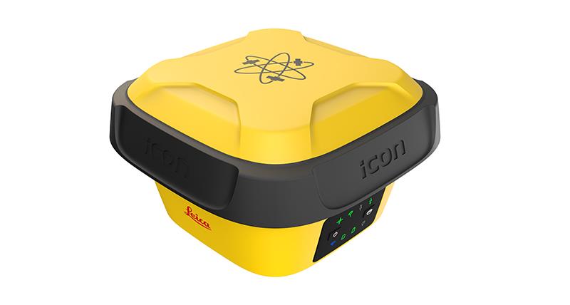
"name": "Leica iCON gps 70",
"description": "Leica iCON gps 70 Series\nPermanent tilt compensation and resistance to magnetic interferences – Leica iCON gps 70 T\n\nLeica iCON gps 70 Series – Ultimate performance for your construction site\nUltimate GNSS Rover and field solution for maximum efficiency. Speed up – anytime, anywhere. Leica Geosystems introduces the most efficient construction GNSS rovers, the Leica iCON gps 70 Series. Combining the latest GNSS technology and inertial measurement unit (IMU), the Leica iCON gps 70 T is equipped with permanent tilt compensation and as well resistant to any magnetic interferences. Being calibration-free, the iCON gps 70 T is ready when you are – anytime, anywhere. The iCON gps 70 T releases the limitations of working with the pole in vertical positions and increases the productivity compared to conventional methods. Furthermore, the efficiency on a construction site is enhanced by collecting as-built field data and staking out designs faster, while increasing accuracy and reducing errors. Without time-consuming procedures, users measure where it was not possible before with improved quality control. The seamless integration of the Leica iCON gps 70 Series into the Leica iCON field software leads to simple workflows which require less training and avoid costly downtime.\n\nTilt – Traceability – Trust\n\nWith the Leica iCON gps 70 T there is no need to hold the pole vertical and level the bubble when measuring. Reliable traceability by storing tilt values with each measurement improves the quality control of any measured point. The permanent tilt compensation extends the measurement possibilities on any construction site and improves quality and accuracy of the collected data.\n\niCON field solution – unmatched simplicity\n\nLeica iCON field offers a smart and customised positioning solution for all construction sites. Construction-tailored, intelligent software applications, workflows and an innovative software design result in improved performance. Seamlessly integrating into all iCON sensors and Leica ConX, Leica Geosystems provides all the tools to increase the efficiency of your field operations. The iCON gps 70 Series follows this concept and perfectly complements the existing iCON field solution.",
"price": 0.0,
"discountamount": 0.0,
"currencycode": "INR",
"priority": 1000000,
"isfreeshipmentavailable": false,
"shipmentduration": 7,
"_keywords": [
"Leica Geosystems",
"iCON field offers",
"Leica iCON gps 70 T",
"iCON field solution",
"iCON gps 70 T releases",
"Leica iCON gps 70 Series",
"Leica iCON field software",
"inertial measurement unit",
"measurement possibilities",
"permanent tilt compensation",
"innovative software design result",
"intelligent software applications",
"efficient construction GNSS rovers"
],
"isarchived": false,
"isavailable": true,
"applicationid": null,
"productindex": 44,
"imageuri": "https://productimages.withfloats.com/actual/5af4387e85c6af0e4085d331.jpg",
"tileimageuri": "https://productimages.withfloats.com/tile/5af4387e85c6af0e4085d331.jpg",
"images": null,
"totalqueries": 0,
"gpid": null,
"groupproductid": null,
"createdon": "2018-05-10T12:18:12.482Z",
"updatedon": "2018-08-08T18:46:51.438Z",
"buyonlinelink": null,
"producturl": "http://WWW.SURVEYEQUIPMENT.IN/products/leica-icon-gps-70/44",
"availableunits": -1.0,
"iscodavailable": true,
"isprepaidonlineavailable": false,
"maxcodorders": 0,
"maxprepaidonlineorders": 0,
"uniquepaymenturl": null,
"brandname": null,
"category": null,
"tags": null,
"variants": false,
"keyspecification": null,
"otherspecifications": null,
"pickupaddressreferenceid": "5d08ebb3edf0e25c3b8da5d0",
"paymenttype": "AssuredPurchase",
"producttype": "products",
"hsncode": null,
"gstslab": 0.0,
"isnotforsale": false
},
{
"_id": "637e462719b75d0001675857",
"fptag": "SBENTERPRISESTRADINGPUNE",
"merchantname": null,
"customwidgets": null,
"externalsourceid": null,
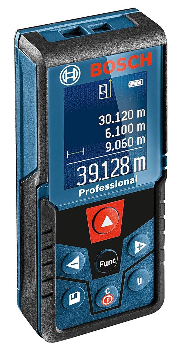
"name": "Bosch GLM 400 Laser Distance Measurer (40M Range)",
"description": "Bosch GLM 400 Professional Digital Laser Measure\nMeasurement range 0.05 – 40.00 mLaser diode 635 nm, < 1 mWUnits of measurement m/cm/ft/inch/ft-inchWeight, approx. 0.1 kg\nSKU 0 601 072 RK0 | EAN 3165140997119\n- Dedicated conversion button for immediate unit change at one press- User-friendly human machine interface (HMI) for quick selection of measuring functions- Colour display technology for easy interpretation of essential information and measurements\nGLM 400 PROFESSIONALLASER MEASURE\nConversion at one pressDedicated conversion button for immediate unit change at one pressUser-friendly human machine interface (HMI) for quick selection of measuring functionsColour display technology for easy interpretation of essential information and measurements",
"price": 0.0,
"discountamount": 0.0,
"currencycode": "INR",
"priority": 1000000,
"isfreeshipmentavailable": false,
"shipmentduration": 7,
"_keywords": [
"measurements",
"0 601 072 RK0",
"quick selection",
"conversion button",
"easy interpretation",
"mLaser diode 635 nm",
"immediate unit change",
"400 PROFESSIONALLASER",
"essential information",
"human machine interface",
"functionsColour display technology",
"Bosch GLM 400 Laser Distance Measurer",
"Bosch GLM 400 Professional Digital Laser"
],
"isarchived": false,
"isavailable": true,
"applicationid": null,
"productindex": 223,
"imageuri": "https://productimages.withfloats.com/actual/637e462843afb00001e44a62.jpg",
"tileimageuri": "https://productimages.withfloats.com/tile/637e462843afb00001e44a62.jpg",
"images": null,
"totalqueries": 0,
"gpid": null,
"groupproductid": null,
"createdon": "2022-11-23T16:11:19.852Z",
"updatedon": "2022-11-23T16:11:19.852Z",
"buyonlinelink": null,
"producturl": "http://WWW.SURVEYEQUIPMENT.IN/products/bosch-glm-400-laser-distance-measurer-40m-range-/223",
"availableunits": -1.0,
"iscodavailable": false,
"isprepaidonlineavailable": false,
"maxcodorders": 0,
"maxprepaidonlineorders": 0,
"uniquepaymenturl": null,
"brandname": "Leica",
"category": "laserdistancemeter",
"tags": null,
"variants": false,
"keyspecification": null,
"otherspecifications": null,
"pickupaddressreferenceid": "",
"paymenttype": "None",
"producttype": "products",
"hsncode": null,
"gstslab": 0.0,
"isnotforsale": false
},
{
"_id": "5bcdaac7e3f0b00001d2a048",
"fptag": "SBENTERPRISESTRADINGPUNE",
"merchantname": null,
"customwidgets": null,
"externalsourceid": null,
"name": "RIS One & RIS Plus",
"description": "RIS One & RIS Plus\nCompact and lightweight ground penetrating radar\n\nRIS ONE and RIS PLUS are the most compact and lightweight antennas available on the market. Gain increased acquisition speed through a high stacking factor as well as improved penetration depth with these single or multi-channel radar control unit.\n\nThe system is supported by antennas operating in 25 MHz to 2.6 GHz frequency range. Custom solutions are available with the IDS GeoRadar control unit, able to power up multiple antennas connected in chain. The antennas feature:\n\nExcellent data quality\nHighest flexibility in multi-channel chain connection\nHigh stacking thereby improving penetration depth\nWireless link to keep track of the survey path and the location of buried objects;\nRIS ONE and RIS PLUS are the ideal solutions for:\n\nUnderground tunnel inspection and condition assessment;\nBedrock and lithological profiling;\nFracture characterisation;\nGround water profiling;\nFoundation and pile measurements;\nBorehole investigations.\nBenefits of the RIS ONE and RIS PLUS include:\n\nLargest antenna gamma in the ground penetrating radar market: A comprehensive set of antennas from 25 MHz to 3.0 GHz, including multi-frequency, borehole and horn antennas ensuring that the right equipment is available for the right application.\nMore than eight hours of autonomous use: IDS GeoRadar’s radar control unit has the lowest power consumption in the ground penetrating radar market.\nFlexible: The multi-channel DAD control unit can drive any IDS Georadar antenna and up to eight antennas in chain connection simultaneously enabling the use of custom configurations.\n\n\n",
"price": 0.0,
"discountamount": 0.0,
"currencycode": "INR",
"priority": 1000000,
"isfreeshipmentavailable": false,
"shipmentduration": 7,
"_keywords": null,
"isarchived": false,
"isavailable": true,
"applicationid": null,
"productindex": 118,
"imageuri": "https://productimages.withfloats.com/actual/5bcdaac884ac000001a78fc7.jpg",
"tileimageuri": "https://productimages.withfloats.com/tile/5bcdaac884ac000001a78fc7.jpg",
"images": null,
"totalqueries": 0,
"gpid": null,
"groupproductid": null,
"createdon": "2018-10-22T10:47:35.934Z",
"updatedon": "2018-10-22T10:47:35.934Z",
"buyonlinelink": null,
"producturl": "http://WWW.SURVEYEQUIPMENT.IN//ris-one-ris-plus/118",
"availableunits": -1.0,
"iscodavailable": true,
"isprepaidonlineavailable": false,
"maxcodorders": 0,
"maxprepaidonlineorders": 0,
"uniquepaymenturl": null,
"brandname": null,
"category": null,
"tags": null,
"variants": false,
"keyspecification": null,
"otherspecifications": null,
"pickupaddressreferenceid": "5d08ebb3edf0e25c3b8da5d0",
"paymenttype": "AssuredPurchase",
"producttype": "products",
"hsncode": null,
"gstslab": 0.0,
"isnotforsale": false
},
{
"_id": "5b6b3a9dd682be0552aefc69",
"fptag": "SBENTERPRISESTRADINGPUNE",
"merchantname": null,
"customwidgets": null,
"externalsourceid": null,
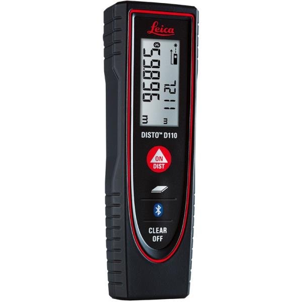
"name": "Leica Disto D110 Laser Distance Meter",
"description": "Leica Disto D110 Laser Distance Meter\nThe New Leica Disto D110 is the smallest Disto with Bluetooth Smart on the market. Create floor plans and sketches very easily by connecting the new Leica D110 with the DISTO Sketch app on a Smartphone or tablet device.\n\nBenefits of the Leica Disto D110:\nNew ergonomic design for easy use\nIncreased functionality with integrated Bluetooth Smart technology and Leica Disto Sketch app\nPerfect for fast indoor distance and area measurements\nPocket clip to help with carrying\nProven Leica quality and precision\nThis is the first laser Disto with Bluetooth technology that’s small and fits in a pocket.\n\nEffortless measurements can be taken whether it’s for a quick material estimation or a home improvement project, the Disto Sketch App provides potential to create floor plans, sketches and document measurements with pictures using a tablet or smartphone.\n\nMeasure precise distances with ±1.5mm accuracy\nMeasure up to 60m distances without moving\nIdeal for the jobsite – Protected against splash water and dust\nDocument results with the Disto Sketch App for faster, easier and safer work. The App is available for free download from Google Play and the App Store for Android and iOS devices.\n\nThe lightest and smallest Disto in the range, its ergonomic design means that it fits in your hand perfectly and is very comfortable to use. The simple to understand button allow intuitive and quick operation. Measuring has never been easier. The removable pocket clip is a valued accessory, simply clip the device to the pocket of your shirt or trousers for convenient use.\n\nTechnical Data\nMeasuring Accuracy: ±1.5mm\nRange: 60m\nMeasuring units: m, ft, in\nIncludes: Power Range Technology, Illuminated Display, Free App\nBatteries: 2x AAA\nProtection Class: IP54 (splash water and dust)\nDimensions: 120x37x23mm\nWeight: 92g\nIncludes:\nLeica DISTO D110 Laser Distance Meter\nPocket Clip\nHolster\n2x AAA Batteries.\n",
"price": 0.0,
"discountamount": 0.0,
"currencycode": "INR",
"priority": 1000000,
"isfreeshipmentavailable": false,
"shipmentduration": 7,
"_keywords": [
"new Leica D110",
"Disto Sketch App",
"first laser Disto",
"Leica Disto Sketch",
"create floor plans",
"New Leica Disto D110",
"Bluetooth technology",
"fast indoor distance",
"removable pocket clip",
"document measurements",
"Power Range Technology",
"home improvement project",
"quick material estimation",
"Bluetooth Smart technology",
"Leica Disto D110 Laser Distance Meter"
],
"isarchived": false,
"isavailable": true,
"applicationid": null,
"productindex": 86,
"imageuri": "https://productimages.withfloats.com/actual/5b3f41a0d3d93d03a4b91a60.jpg",
"tileimageuri": "https://productimages.withfloats.com/tile/5b3f41a0d3d93d03a4b91a60.jpg",
"images": null,
"totalqueries": 0,
"gpid": null,
"groupproductid": null,
"createdon": "2018-07-06T10:17:10.03Z",
"updatedon": "2018-08-08T18:46:53.841Z",
"buyonlinelink": null,
"producturl": "http://WWW.SURVEYEQUIPMENT.IN/products/leica-disto-d110-laser-distance-meter/86",
"availableunits": -1.0,
"iscodavailable": true,
"isprepaidonlineavailable": false,
"maxcodorders": 0,
"maxprepaidonlineorders": 0,
"uniquepaymenturl": null,
"brandname": null,
"category": "leicadisto",
"tags": [
"leicadisto",
"laserdistancemeter",
"leicageosystems"
],
"variants": false,
"keyspecification": null,
"otherspecifications": null,
"pickupaddressreferenceid": "5d08ebb3edf0e25c3b8da5d0",
"paymenttype": "AssuredPurchase",
"producttype": "products",
"hsncode": null,
"gstslab": 0.0,
"isnotforsale": false
},
{
"_id": "5b6b3a9dd682be0552aefc3f",
"fptag": "SBENTERPRISESTRADINGPUNE",
"merchantname": null,
"customwidgets": null,
"externalsourceid": null,
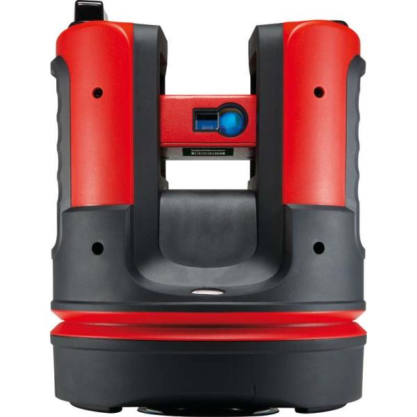
"name": "Leica Disto 3D Laser Distance Meter ",
"description": "Leica Disto 3D Laser Distance Meter \n\nThe high-precision Leica 3D Disto is used whenever the use of conventional measuring tools is only possible with a great deal of time and effort. With the various measurement functions you can record all spatial situations precisely and use the data afterwards in your customary software environment. With the realistic data you can produce the final parts directly. The time-consuming template and modification work during installation is no longer necessary. The fully digitalized workflow saves valuable time.\n\nLine and surface scans\nDigital measurement with immediate results\nCable-free operation\nDigital pointfinder\nGraphic 2D or 3D display\nMarking heights, plumb points and parallel lines\nImport of own data for simple staking out\nChanging the position with photo backup\nExport formats: DXF (2D, 3D and overview plan), JPG, CSV and TXT\nComes supplied with\nLeica 3D Disto\nLicense for 3D Disto Software for Windows®\nRemote control RM100\nPower supply for 3D Disto\n4 country specific powercords for worldwide use\nPower supply for control unit\n4 country specific adapter plugs for worldwide use\nUSB memory stick\nSelf-adhesive target points\nRuler (for measuring hidden points)\nLeica GZM3 target plate\n2x USB cable\nQuickstart",
"price": 0.0,
"discountamount": 0.0,
"currencycode": "INR",
"priority": 1000000,
"isfreeshipmentavailable": false,
"shipmentduration": 7,
"_keywords": [
"plumb points",
"Leica 3D Disto",
"realistic data",
"data afterwards",
"3D Disto Software",
"modification work",
"spatial situations",
"measuring hidden points",
"workflow saves valuable",
"country specific powercords",
"conventional measuring tools",
"various measurement functions",
"country specific adapter plugs",
"customary software environment",
"Leica Disto 3D Laser Distance Meter"
],
"isarchived": false,
"isavailable": true,
"applicationid": null,
"productindex": 84,
"imageuri": "https://productimages.withfloats.com/actual/5b3f2d14f3579908c0a05310.jpg",
"tileimageuri": "https://productimages.withfloats.com/tile/5b3f2d14f3579908c0a05310.jpg",
"images": null,
"totalqueries": 0,
"gpid": null,
"groupproductid": null,
"createdon": "2018-07-06T08:49:25.454Z",
"updatedon": "2018-08-08T18:46:53.666Z",
"buyonlinelink": null,
"producturl": "http://WWW.SURVEYEQUIPMENT.IN//leica-disto-3d-laser-distance-meter-/84",
"availableunits": -1.0,
"iscodavailable": true,
"isprepaidonlineavailable": false,
"maxcodorders": 0,
"maxprepaidonlineorders": 0,
"uniquepaymenturl": null,
"brandname": null,
"category": "leicatotalstations",
"tags": [
"leicatotalstations",
"leicadisto3dlaserdistancemeter",
"leicadisto"
],
"variants": false,
"keyspecification": null,
"otherspecifications": null,
"pickupaddressreferenceid": "5d08ebb3edf0e25c3b8da5d0",
"paymenttype": "AssuredPurchase",
"producttype": "products",
"hsncode": null,
"gstslab": 0.0,
"isnotforsale": false
},
{
"_id": "5b6b3a9bd682be0552aef91d",
"fptag": "SBENTERPRISESTRADINGPUNE",
"merchantname": null,
"customwidgets": null,
"externalsourceid": null,
"name": "RIS One & RIS Plus",
"description": "RIS One & RIS Plus\n\nCompact and lightweight ground penetrating radar\n\nRIS ONE and RIS PLUS are the most compact and lightweight antennas available on the market. Gain increased acquisition speed through a high stacking factor as well as improved penetration depth with these single or multi-channel radar control unit.\n\nThe system is supported by antennas operating in 25 MHz to 2.6 GHz frequency range. Custom solutions are available with the IDS GeoRadar control unit, able to power up multiple antennas connected in chain. The antennas feature:\n\nExcellent data quality\nHighest flexibility in multi-channel chain connection\nHigh stacking thereby improving penetration depth\nWireless link to keep track of the survey path and the location of buried objects;\nRIS ONE and RIS PLUS are the ideal solutions for:\n\nUnderground tunnel inspection and condition assessment;\nBedrock and lithological profiling;\nFracture characterisation;\nGround water profiling;\nFoundation and pile measurements;\nBorehole investigations.\nBenefits of the RIS ONE and RIS PLUS include:\n\nLargest antenna gamma in the ground penetrating radar market: A comprehensive set of antennas from 25 MHz to 3.0 GHz, including multi-frequency, borehole and horn antennas ensuring that the right equipment is available for the right application.\nMore than eight hours of autonomous use: IDS GeoRadar’s radar control unit has the lowest power consumption in the ground penetrating radar market.\nFlexible: The multi-channel DAD control unit can drive any IDS Georadar antenna and up to eight antennas in chain connection simultaneously enabling the use of custom configurations.",
"price": 0.0,
"discountamount": 0.0,
"currencycode": "INR",
"priority": 1000000,
"isfreeshipmentavailable": false,
"shipmentduration": 7,
"_keywords": [
"eight antennas",
"DAD control unit",
"antennas feature",
"chain connection",
"multiple antennas",
"penetration depth",
"antennas available",
"GHz frequency range",
"IDS Georadar antenna",
"high stacking factor",
"condition assessment",
"custom configurations",
"lithological profiling",
"IDS GeoRadar control unit"
],
"isarchived": false,
"isavailable": true,
"applicationid": null,
"productindex": 40,
"imageuri": "https://productimages.withfloats.com/actual/5aefe4dc85c6af01dc0af42f.jpg",
"tileimageuri": "https://productimages.withfloats.com/tile/5aefe4dc85c6af01dc0af42f.jpg",
"images": null,
"totalqueries": 0,
"gpid": null,
"groupproductid": null,
"createdon": "2018-05-07T05:32:12.749Z",
"updatedon": "2018-08-08T18:46:51.263Z",
"buyonlinelink": null,
"producturl": "http://WWW.SURVEYEQUIPMENT.IN/products/ris-one-ris-plus/40",
"availableunits": -1.0,
"iscodavailable": true,
"isprepaidonlineavailable": false,
"maxcodorders": 0,
"maxprepaidonlineorders": 0,
"uniquepaymenturl": null,
"brandname": null,
"category": null,
"tags": null,
"variants": false,
"keyspecification": null,
"otherspecifications": null,
"pickupaddressreferenceid": "5d08ebb3edf0e25c3b8da5d0",
"paymenttype": "AssuredPurchase",
"producttype": "products",
"hsncode": null,
"gstslab": 0.0,
"isnotforsale": false
},
{
"_id": "5b6b3a99d682be0552aef638",
"fptag": "SBENTERPRISESTRADINGPUNE",
"merchantname": null,
"customwidgets": null,
"externalsourceid": null,
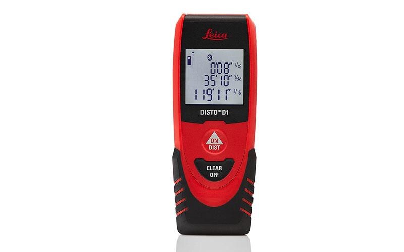
"name": "Leica DISTO D1",
"description": "Leica DISTO D1\nHandy, simple, precise, with Bluetooth!\n\nThe Leica DISTO D1 has been stripped down to just the basics. The DISTO D1 is perfect for quick and accurate interior measurements. It is small, very light and fits easily into your pocket. Whether you are measuring for carpentry, flooring, hanging pictures on a wall with its impressive range of 40m the DISTO D1 has it covered.\n\nExtended functionality and error-free measuring documentation\nPair the D1 with any smartphone or tablet to create digital floor plans on the go using the DISTO Sketch app.The new Leica DISTO D1 comes with Bluetooth® Smart data transfer that links to the Free Measuring App! You can transfer measuring results to smart phones or tablets to speed up your work flow.\n\nThe Bluetooth Smart technology allows you to easily document & exchange data wirelessly from the work site to office.\nThe DISTO D1 is capable of more than just measuring, data can be conveniently & accurately transferred via integrated Bluetooth. The free Leica DISTO Sketch App allows you to create floor plans or data tables on iPhone or iPad. Dimensions can be entered onto photographs with no effort.\n\nMeasure with laser precision\n\nAt the touch of a button the Leica DISTO D1 measures precisely and reliably even over longer distances. It is easy to operate and can hit targets which are not directly accessible.\n\n\nPerfect documentation\n\nWith just a few clicks, the Leica DISTO D1 can be connected with the DISTO sketch app. Create sketches or photos and dimension them with the measurement results, which are transferred directly to your smart phone or tablet. Plans are even automatically completed with areas and circumferences.\n\n\nKey Features of the Leica DISTO D1\nBluetooth® Smart for data transfer to smart phones and tablets\n40 m range\nXRange Power Technology\nClear, illuminated 3 line display\nIP 54 dust and splash water protected\n\n\nThe benefits of the Leica DISTO D1 laser measure:\nBenefits \t Popular with\nRange: 0.2 - 40m\t Surveyors\n±2.0 mm accuracy\t Architects\nMeasuring units: m, ft, in\t Building contractors\n3 line, illuminated display DIY enthusiasts\nBattery life 20hrs operation Kitchen Fitters\nIP54 water & dust protection \tPlumbers\nSimple & easy to use, handy compact size\t \nFree applications Leica DISTO sketch\t ",
"price": 0.0,
"discountamount": 0.0,
"currencycode": "INR",
"priority": 1000000,
"isfreeshipmentavailable": false,
"shipmentduration": 7,
"_keywords": [
"new Leica DISTO D1",
"create floor plans",
"Smart data transfer",
"measurement results",
"integrated Bluetooth",
"applications Leica DISTO",
"Bluetooth Smart technology",
"create digital floor plans",
"transfer measuring results",
"free Leica DISTO Sketch App",
"Leica DISTO D1 laser measure",
"life 20hrs operation Kitchen",
"accurate interior measurements"
],
"isarchived": false,
"isavailable": true,
"applicationid": null,
"productindex": 2,
"imageuri": "https://productimages.withfloats.com/actual/5ae46867b303650c7cafa855.jpg",
"tileimageuri": "https://productimages.withfloats.com/tile/5ae46867b303650c7cafa855.jpg",
"images": null,
"totalqueries": 0,
"gpid": null,
"groupproductid": null,
"createdon": "2018-04-28T12:26:15.394Z",
"updatedon": "2018-08-08T18:46:49.353Z",
"buyonlinelink": null,
"producturl": "http://WWW.SURVEYEQUIPMENT.IN/products/leica-disto-d1/2",
"availableunits": -1.0,
"iscodavailable": true,
"isprepaidonlineavailable": false,
"maxcodorders": 0,
"maxprepaidonlineorders": 0,
"uniquepaymenturl": null,
"brandname": null,
"category": null,
"tags": null,
"variants": false,
"keyspecification": null,
"otherspecifications": null,
"pickupaddressreferenceid": "5d08ebb3edf0e25c3b8da5d0",
"paymenttype": "AssuredPurchase",
"producttype": "products",
"hsncode": null,
"gstslab": 0.0,
"isnotforsale": false
}
],
"hasmoreitems": false,
"isapirequest": false,
"totalresults": 27,
"query": null,
"floatingpoint": null
}