Preview

This is your website preview.

Currently it only shows your basic business info. Start adding relevant business details such as description, images and products or services to gain your customers attention by using Boost 360 android app / iOS App / web portal.

SBENTERPRISESTRADINGPUNE 5abfbf1e7c88bb04a4d0fcc7 Products https://www.surveyequipment.in
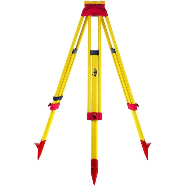
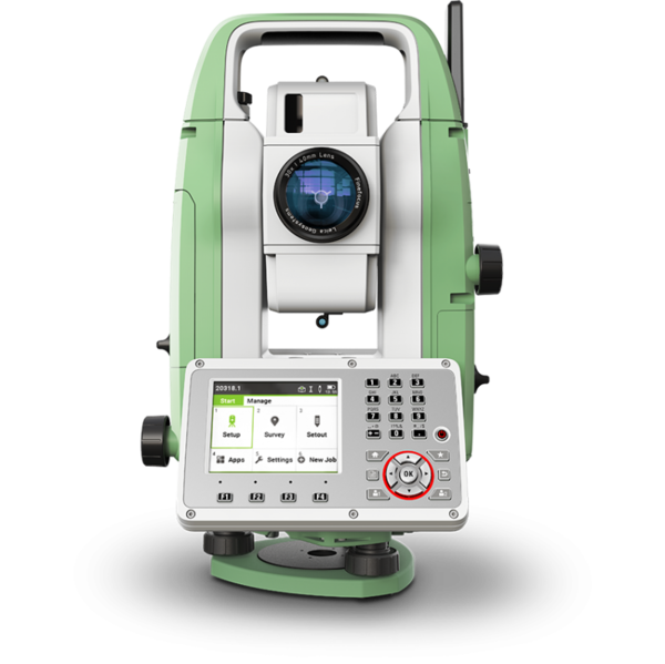
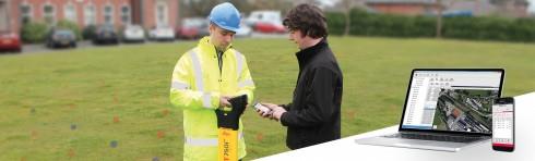
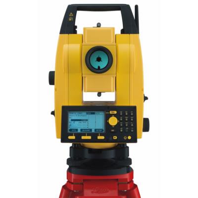
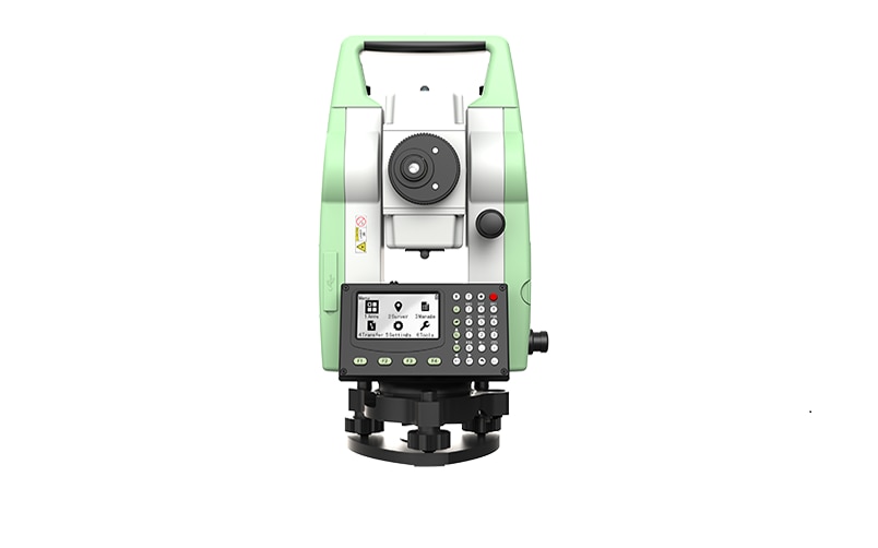
{ "products": [ { "_id": "60c1c9c3db1b200001edc164", "fptag": "SBENTERPRISESTRADINGPUNE", "merchantname": null, "customwidgets": null, "externalsourceid": null, "name": "Leica GST05 Wooden Tripod ", "description": "Leica GST05 Wooden Tripod\nThe Leica GST05 is a light duty tripod with carrying straps, side clamp screws and water-tight plastic wrap for complete protection. Suitable for TPS instruments with angular measurement accuracy above 5”, reflectors and GNSS antennas.\nThese tripods are well regarded by the market for being extremely stable and long lasting. Being highly rigid and with good vibration characteristics, these tripods are recommended by Leica Geosystems to be used with TPS and GNSS for surveying and engineering applications.\nHeight StabilityThe ISO standard defines that the position of thetripod head may not vertically shift by more than0,05 mm when subject to double the maximum instrument weight. Therefore the heavy duty GST120-9, GST101 and Trimax require testing with 30kg. TheGST05, GST05L and GST103 are defined for light dutyand were tested with 10kg. \nQuality criteria – describes the relevant testparameters\nTest results – summarizes and evaluates test results\nUser recommendations\nGST05, Wooden Tripod Light duty tripod with water-tight plastic wrap for complete protection. Suitable for TPS-Instruments with angular measurement accuracy above 5”, reflectors and GNSS antennas. Packaged length 107cm (3.51ft), extendible to 176cm (5.77ft), weight 5.6kg (12.3lb).\n", "price": 15950.0, "discountamount": 0.0, "currencycode": "INR", "priority": 1000000, "isfreeshipmentavailable": false, "shipmentduration": 7, "_keywords": null, "isarchived": false, "isavailable": true, "applicationid": null, "productindex": 197, "imageuri": "https://productimages.withfloats.com/actual/60c1c9c3a3f86100014910c2.jpg", "tileimageuri": "https://productimages.withfloats.com/tile/60c1c9c3a3f86100014910c2.jpg", "images": null, "totalqueries": 0, "gpid": null, "groupproductid": null, "createdon": "2021-06-10T08:13:55.065Z", "updatedon": "2021-06-10T08:13:55.065Z", "buyonlinelink": null, "producturl": "http://WWW.SURVEYEQUIPMENT.IN/products/leica-gst05-wooden-tripod-/197", "availableunits": -1.0, "iscodavailable": false, "isprepaidonlineavailable": false, "maxcodorders": 0, "maxprepaidonlineorders": 0, "uniquepaymenturl": null, "brandname": "Leica Geosystems ", "category": "Tripod", "tags": [ "Tripod", "DGPS Surveying Instruments", "DGPS Surveying Instruments - Positioning System Re", "GNSS/GPS Survey Equipment - Surveying Equipment fr", "Leica Total Station in India", "TOTALSTATIONS", "Robotic Total Station", "leicatotalstationsindia" ], "variants": false, "keyspecification": null, "otherspecifications": null, "pickupaddressreferenceid": "", "paymenttype": "None", "producttype": "products", "hsncode": null, "gstslab": 0.001, "isnotforsale": false }, { "_id": "5daaf779f9dc390001952ef9", "fptag": "SBENTERPRISESTRADINGPUNE", "merchantname": null, "customwidgets": null, "externalsourceid": null, "name": "Leica FlexLine TS07 Manual Total Station", "description": "Leica FlexLine TS07 Manual Total Station\nThe Leica FlexLine TS07 high-quality, manual total station is based on a proven product concept that has been revolutionising the world of measurement and survey for nearly 200 years. The Leica TS07 is equipped with a comprehensive application-based software package - Leica FlexField software - that enables most survey and stakeout tasks to be carried out easily and efficiently. The new FlexLine TS07 works reliably and delivers accurate results even in the harshest environments.\n\nWork faster: measure more points per day due to faster measurement and stakeout procedures (endless drives, trigger key, drives on both sides, pinpoint EDM and more), supported by our comprehensive and user-friendly Leica FlexField software.\nUse it trouble-free: increase productivity and minimise downtime by relying on instruments that simply work and come with a global service and support network.\nChoose products that are built to last: FlexLine operates with the same high level of quality even after years of use under harsh conditions (like mud, dust, blowing rain, extreme heat and cold).\nControl your investment: reliability, speed and accuracy ensure a lower investment over the product lifetime and a higher resell value.\nSave time with AutoHeight: measure, read and set the instrument height automatically with this revolutionary feature in the FlexLine TS07 (optional). Errors are minimised and the setup process onsite is faster.", "price": 0.0, "discountamount": 0.0, "currencycode": "INR", "priority": 1000000, "isfreeshipmentavailable": false, "shipmentduration": 7, "_keywords": null, "isarchived": false, "isavailable": true, "applicationid": null, "productindex": 156, "imageuri": "https://productimages.withfloats.com/actual/5daaf77b836b6b0001c86cb4.png", "tileimageuri": "https://productimages.withfloats.com/tile/5daaf77b836b6b0001c86cb4.png", "images": null, "totalqueries": 0, "gpid": null, "groupproductid": null, "createdon": "2019-10-19T11:46:01.098Z", "updatedon": "2019-10-19T11:46:01.098Z", "buyonlinelink": null, "producturl": "http://WWW.SURVEYEQUIPMENT.IN//leica-flexline-ts07-manual-total-station/156", "availableunits": -1.0, "iscodavailable": false, "isprepaidonlineavailable": false, "maxcodorders": 0, "maxprepaidonlineorders": 0, "uniquepaymenturl": null, "brandname": "Leica Geosystems ", "category": "", "tags": null, "variants": false, "keyspecification": null, "otherspecifications": null, "pickupaddressreferenceid": "", "paymenttype": "None", "producttype": "products", "hsncode": null, "gstslab": 0.0, "isnotforsale": false }, { "_id": "5bcdaac7e3f0b00001d2a048", "fptag": "SBENTERPRISESTRADINGPUNE", "merchantname": null, "customwidgets": null, "externalsourceid": null, "name": "RIS One & RIS Plus", "description": "RIS One & RIS Plus\nCompact and lightweight ground penetrating radar\n\nRIS ONE and RIS PLUS are the most compact and lightweight antennas available on the market. Gain increased acquisition speed through a high stacking factor as well as improved penetration depth with these single or multi-channel radar control unit.\n\nThe system is supported by antennas operating in 25 MHz to 2.6 GHz frequency range. Custom solutions are available with the IDS GeoRadar control unit, able to power up multiple antennas connected in chain. The antennas feature:\n\nExcellent data quality\nHighest flexibility in multi-channel chain connection\nHigh stacking thereby improving penetration depth\nWireless link to keep track of the survey path and the location of buried objects;\nRIS ONE and RIS PLUS are the ideal solutions for:\n\nUnderground tunnel inspection and condition assessment;\nBedrock and lithological profiling;\nFracture characterisation;\nGround water profiling;\nFoundation and pile measurements;\nBorehole investigations.\nBenefits of the RIS ONE and RIS PLUS include:\n\nLargest antenna gamma in the ground penetrating radar market: A comprehensive set of antennas from 25 MHz to 3.0 GHz, including multi-frequency, borehole and horn antennas ensuring that the right equipment is available for the right application.\nMore than eight hours of autonomous use: IDS GeoRadar’s radar control unit has the lowest power consumption in the ground penetrating radar market.\nFlexible: The multi-channel DAD control unit can drive any IDS Georadar antenna and up to eight antennas in chain connection simultaneously enabling the use of custom configurations.\n\n\n", "price": 0.0, "discountamount": 0.0, "currencycode": "INR", "priority": 1000000, "isfreeshipmentavailable": false, "shipmentduration": 7, "_keywords": null, "isarchived": false, "isavailable": true, "applicationid": null, "productindex": 118, "imageuri": "https://productimages.withfloats.com/actual/5bcdaac884ac000001a78fc7.jpg", "tileimageuri": "https://productimages.withfloats.com/tile/5bcdaac884ac000001a78fc7.jpg", "images": null, "totalqueries": 0, "gpid": null, "groupproductid": null, "createdon": "2018-10-22T10:47:35.934Z", "updatedon": "2018-10-22T10:47:35.934Z", "buyonlinelink": null, "producturl": "http://WWW.SURVEYEQUIPMENT.IN//ris-one-ris-plus/118", "availableunits": -1.0, "iscodavailable": true, "isprepaidonlineavailable": false, "maxcodorders": 0, "maxprepaidonlineorders": 0, "uniquepaymenturl": null, "brandname": null, "category": null, "tags": null, "variants": false, "keyspecification": null, "otherspecifications": null, "pickupaddressreferenceid": "5d08ebb3edf0e25c3b8da5d0", "paymenttype": "AssuredPurchase", "producttype": "products", "hsncode": null, "gstslab": 0.0, "isnotforsale": false }, { "_id": "5b6b3a9dd682be0552aefccb", "fptag": "SBENTERPRISESTRADINGPUNE", "merchantname": null, "customwidgets": null, "externalsourceid": null, "name": "Leica ULTRA Utility Tracing System", "description": "Leica ULTRA Utility Tracing System\nBest precision locating in faster, more confident work\n\nSave time and increase confidence in your results with the Leica ULTRA, our most advanced precision utility tracing instrument.\n\nThe complexity of underground utility networks is continually increasing, and obtaining precise information on the location of buried utilities has never been more important. The protection of buried assets during excavation work demands accurate mapping and surveying of existing utilities. \n\nIntegrating intelligent signal processing with unique flexible operating modes, Leica ULTRA traces buried utility lines accurately for safe underground excavations and utility surveys. Outstanding performance with operational ease and flexibility.\n\nLARGE CLEAR DISPLAY\nLarge backlit high visibility LCD screen\nClear display provides clear, improved and confident location and utility tracing\nCUSTOM FREQUENCIES\nConfigure for site specific applications\nUser configurable modes from 50 Hz to 200 kHz\nChoose from 100 pre-selected frequencies or customise your own frequencies\nCOMPASS\nShows the user the direction of the utility they are locating / tracing\nBLUETOOTH®\nEnable wireless communications with software running on a laptop, survey field PC or other GPS enabled device\nINCREASED TRANSMITTER POWER OUTPUT\nChoose between 5W and 12W transmitter power outputs for superior tracing performance\nBUILT FOR THE MOST DEMANDING ENVIRONMENTS\nIP65 protection\nFulfils toughest standards - shock resistant, protected against water and dust ingress\nSELECTABLE ANTENNA CONFIGURATION\nConfigure antenna to best optimise for your job site\nSelect between more range, sharper response, noise cancelling or easier sweeping\nDIRECTION ENABLED\nIdentifying your target utility amongst multiple parallel utilities\nApply a special direction enabled signal from the transmitter, the receiver will display an arrow on the compass heading to guide you along the designated utility path\nUnlock the power\nConfigure the Leica ULTRA for site specific applications. Custom build your receiver and transmitter.\n\nChoose from over 100 preselected frequencies, or customise your own frequency for highly specialised applications.\n\nAutomatically capture the instruments location data to ensure adherence to best practice. The data logging feature allows the user to record external GPS coordinates and download with the datafile as a KML or CSV format. Upload into GIS systems or Google Maps to confirm where, when and how the work was performed.\n", "price": 0.0, "discountamount": 0.0, "currencycode": "INR", "priority": 1000000, "isfreeshipmentavailable": false, "shipmentduration": 7, "_keywords": [ "target utility", "utility surveys", "precision utility", "Leica ULTRA traces", "designated utility", "12W transmitter power", "wireless communications", "instruments location data", "site specific applications", "100 preselected frequencies", "underground utility networks", "safe underground excavations", "intelligent signal processing", "unique flexible operating modes", "Leica ULTRA Utility Tracing System" ], "isarchived": false, "isavailable": true, "applicationid": null, "productindex": 90, "imageuri": "https://productimages.withfloats.com/actual/5b45ea4dd3d93d01c4f1c9f9.jpg", "tileimageuri": "https://productimages.withfloats.com/tile/5b45ea4dd3d93d01c4f1c9f9.jpg", "images": null, "totalqueries": 0, "gpid": null, "groupproductid": null, "createdon": "2018-07-11T11:30:28.043Z", "updatedon": "2018-08-08T18:46:53.973Z", "buyonlinelink": null, "producturl": "http://WWW.SURVEYEQUIPMENT.IN//leica-ultra-utility-tracing-system/90", "availableunits": -1.0, "iscodavailable": true, "isprepaidonlineavailable": false, "maxcodorders": 0, "maxprepaidonlineorders": 0, "uniquepaymenturl": null, "brandname": null, "category": null, "tags": null, "variants": false, "keyspecification": null, "otherspecifications": null, "pickupaddressreferenceid": "5d08ebb3edf0e25c3b8da5d0", "paymenttype": "AssuredPurchase", "producttype": "products", "hsncode": null, "gstslab": 0.0, "isnotforsale": false }, { "_id": "5b6b3a9dd682be0552aefc94", "fptag": "SBENTERPRISESTRADINGPUNE", "merchantname": null, "customwidgets": null, "externalsourceid": null, "name": "Leica LOGiCAT VU Management & Monitoring System", "description": "Leica LOGiCAT VU Management & Monitoring System\nAnalyse data to reduce utility strikes\n\nBy deploying Leica Digicat cable locators, utility strike rates have reduced dramatically. Now, with the introduction of Leica LOGiCAT VU software, cable locators can be managed and monitored centrally.\nData analysis helps fleet managers to improve cable locator usage and effectiveness during the excavation, increases attention to site safety initiative and enhances product familiarisation training and operator behaviour.\n\nWhat is Leica LOGiCAT VU?\nLeica LOGiCAT VU is a management and monitoring system for analysing data from cable locators.\nCable locators are used to identifying the location of buried utilities; the data enables instruments to record GPS coordinates alongside logged instrument data.\nLeica LOGiCAT VU helps plant, fleet and site managers to evaluate and analyse the data from one or more cable locators.\nThe system gives fleet managers a “view” of how the survey was conducted and if it has been undertaken to best practice. The locator positions can be mapped and presented through Google maps, highlighting the path of the survey.\n\nKey benefits\n\nGreater insight if best practice has been followed\nUsing just the cable locator on its own you could miss 45 up to 50% of dormant utilities which hold the potential of fatal injury. The Fleet Manager can evaluate the Leica LOGiCAT VU data and see how and if the Operator has thoroughly undertaken a site investigate, in all modes and with correct accessories, ensuring adherence to best practice.\n\nData visualisation on satellite images to support interpretation\nGPS enables cable locator to record their coordinates alongside usage data. Leica LOGiCAT VU displays field data overlaid on digital map and images, showing where the operator has undertaken the survey to support post-survey evaluation.Clarity for post utility strike evaluation. \n\nClarity for post utility strike evaluation\nIn the event of a utility strike, the incident report can be produced simply and provide a comprehensive and clear view of instruments usage leading up to the incident. Within the report, colours indicate the survey quality, Red/Poor and Green/Good.\n\nData export to GIS and BIM System\nThe instruments data can be exported to a third party GIS and BIM software enhancing knowledge about subsurface utilities for future excavation activities. ", "price": 0.0, "discountamount": 0.0, "currencycode": "INR", "priority": 1000000, "isfreeshipmentavailable": false, "shipmentduration": 7, "_keywords": [ "instruments data", "cable locator usage", "alongside usage data", "utility strike rates", "subsurface utilities", "Leica LOGiCAT VU data", "enables cable locator", "site safety initiative", "data enables instruments", "Leica LOGiCAT VU software", "Leica LOGiCAT VU Management", "post utility strike evaluation", "deploying Leica Digicat cable locators", "enhances product familiarisation training" ], "isarchived": false, "isavailable": true, "applicationid": null, "productindex": 88, "imageuri": "https://productimages.withfloats.com/actual/5b45a062d3d93d01c4f0ed4e.jpg", "tileimageuri": "https://productimages.withfloats.com/tile/5b45a062d3d93d01c4f0ed4e.jpg", "images": null, "totalqueries": 0, "gpid": null, "groupproductid": null, "createdon": "2018-07-11T06:15:05.058Z", "updatedon": "2018-08-08T18:46:53.924Z", "buyonlinelink": null, "producturl": "http://WWW.SURVEYEQUIPMENT.IN//leica-logicat-vu-management-monitoring-system/88", "availableunits": -1.0, "iscodavailable": true, "isprepaidonlineavailable": false, "maxcodorders": 0, "maxprepaidonlineorders": 0, "uniquepaymenturl": null, "brandname": null, "category": null, "tags": null, "variants": false, "keyspecification": null, "otherspecifications": null, "pickupaddressreferenceid": "5d08ebb3edf0e25c3b8da5d0", "paymenttype": "AssuredPurchase", "producttype": "products", "hsncode": null, "gstslab": 0.0, "isnotforsale": false }, { "_id": "5b6b3a9dd682be0552aefc15", "fptag": "SBENTERPRISESTRADINGPUNE", "merchantname": null, "customwidgets": null, "externalsourceid": null, "name": "Leica Builder 502", "description": "Leica Builder 502 – when a construction plan goes digital\n\nThe Leica Builder 502 total station is designed to meet the requirements of construction. High performance and ease to use built in Leica Powersite software makes it the ideal solution for every layout task. The user additionally benefits from the most advanced electronic distance measurement and pinpoint accuracy.Builder Programmes include - Setup, Height transfer, Layout as built, Angle & Distance,Tie & Distance, Area & Volumes, Measure & Descriptor, Parallel Lines, Hidden Point, COGO, Layout Line/ Arc/ Spiral, Stockpile Volumes.New features of the Leica PowerSite Software extend the users’ possibilities such as calculate volumes, layout of curved structures, measuring to hidden points and layout using intersection points or grid points. Graphical elements guide the user through the software and make all tasks visually understandable, starting from the first levelling of the instrument, to a computed block volume.\n\nLeica Builder 502 Total Station – turning construction sites digital. The Leica Builder 502 total station is an all-round instrument. Whether you require a total station that performs routine surveying tasks or a professional highly accurate instrument, the Leica Builder 502 has all the features to meet your demands.\n\nBenefits of The Builder 502 are:\nCall up plan data and record points eliminate read and write errors.\nData exchange via industrial grade USB stick simplifies data handling.\nA direct DXF download function.\nTracking mode.\nSetup anywhere function.\nOptional volumes calculation.\nLaser distance measurement up to 250m.\nLeica Builder 500 Options:\nThe Leica Builder 500 Series is available in three accuracy:\n\nBuilder 502 – 2″ Angle Measurement\nBuilder 503 – 3″ Angle Measurement\nBuilder 505 – 5″ Angle Measurement\nUnique Features of Leica Builder 502 Series Total Station\nMultilingual Function\nIf you have a crew that speak different languages then the Leica Builder 502 is the ideal total station for you. The Leica Builder is the only instrument in its class that comes with multiple languages on-board. Switching between languages is fast and easy with only one keystroke, improving convenience and efficiency. The Leica Builder 502 total station allows 3 languages to be displayed at the same time.\n\nDirect.dxf\nWith “Direct.dxf” functionality, data can be read directly from the instrument in dxf-format and read into AutoCAD® on a PC without any intermediate steps. Coordinates and point numbers can be stored in different layers.\n\nTheft protection\n\nA PIN-code system features on the Leica Builder 500 to prevent unauthorised persons from using the instrument. This increases your data security. Without correct code, the equipment cannot be operated, data erased and makes it less appealing to steal, which protects you from having damages, increases your safety and possibly lowers your insurance rates.\n\nLeica Builder 500 Delivery Package:\nCTB101 Black Tribrach (01 No.)\nGEB211 Battery (02 Nos.)\nGKL221 Charger (complete with car adapter cable) (01 No.)\nCPR111 Builder Prism (01 No.)\nGLS115 Mini Reflector Pole set with point (01 No.)\nGEV223 Data Cable TS to USB (01 No.)\nMS1, 1Gb USB Stick (01 No.)\nUser Manual (01 No.)\nCarry Case (01 No.)\n\n", "price": 0.0, "discountamount": 0.0, "currencycode": "INR", "priority": 1000000, "isfreeshipmentavailable": false, "shipmentduration": 0, "_keywords": [ "Builder Prism", "construction plan", "multiple languages", "ideal total station", "accurate instrument", "intersection points", "Leica Builder 500 Series", "Leica Powersite software", "speak different languages", "Builder 500 Delivery Package", "prevent unauthorised persons", "Leica Builder 502 Series Total", "Leica Builder 502 total station", "electronic distance measurement", "industrial grade USB stick simplifies data" ], "isarchived": false, "isavailable": false, "applicationid": null, "productindex": 82, "imageuri": "https://productimages.withfloats.com/actual/5b237d830c1c510f40d95d51.jpg", "tileimageuri": "https://productimages.withfloats.com/tile/5b237d830c1c510f40d95d51.jpg", "images": null, "totalqueries": 0, "gpid": null, "groupproductid": null, "createdon": "2018-06-15T08:42:40.75Z", "updatedon": "2018-08-08T18:46:53.464Z", "buyonlinelink": null, "producturl": "http://WWW.SURVEYEQUIPMENT.IN//leica-builder-502/82", "availableunits": -1.0, "iscodavailable": true, "isprepaidonlineavailable": false, "maxcodorders": 0, "maxprepaidonlineorders": 0, "uniquepaymenturl": null, "brandname": null, "category": null, "tags": null, "variants": false, "keyspecification": null, "otherspecifications": null, "pickupaddressreferenceid": "5d08ebb3edf0e25c3b8da5d0", "paymenttype": "AssuredPurchase", "producttype": "products", "hsncode": null, "gstslab": 0.0, "isnotforsale": false }, { "_id": "5b6b3a9bd682be0552aef91d", "fptag": "SBENTERPRISESTRADINGPUNE", "merchantname": null, "customwidgets": null, "externalsourceid": null, "name": "RIS One & RIS Plus", "description": "RIS One & RIS Plus\n\nCompact and lightweight ground penetrating radar\n\nRIS ONE and RIS PLUS are the most compact and lightweight antennas available on the market. Gain increased acquisition speed through a high stacking factor as well as improved penetration depth with these single or multi-channel radar control unit.\n\nThe system is supported by antennas operating in 25 MHz to 2.6 GHz frequency range. Custom solutions are available with the IDS GeoRadar control unit, able to power up multiple antennas connected in chain. The antennas feature:\n\nExcellent data quality\nHighest flexibility in multi-channel chain connection\nHigh stacking thereby improving penetration depth\nWireless link to keep track of the survey path and the location of buried objects;\nRIS ONE and RIS PLUS are the ideal solutions for:\n\nUnderground tunnel inspection and condition assessment;\nBedrock and lithological profiling;\nFracture characterisation;\nGround water profiling;\nFoundation and pile measurements;\nBorehole investigations.\nBenefits of the RIS ONE and RIS PLUS include:\n\nLargest antenna gamma in the ground penetrating radar market: A comprehensive set of antennas from 25 MHz to 3.0 GHz, including multi-frequency, borehole and horn antennas ensuring that the right equipment is available for the right application.\nMore than eight hours of autonomous use: IDS GeoRadar’s radar control unit has the lowest power consumption in the ground penetrating radar market.\nFlexible: The multi-channel DAD control unit can drive any IDS Georadar antenna and up to eight antennas in chain connection simultaneously enabling the use of custom configurations.", "price": 0.0, "discountamount": 0.0, "currencycode": "INR", "priority": 1000000, "isfreeshipmentavailable": false, "shipmentduration": 7, "_keywords": [ "eight antennas", "DAD control unit", "antennas feature", "chain connection", "multiple antennas", "penetration depth", "antennas available", "GHz frequency range", "IDS Georadar antenna", "high stacking factor", "condition assessment", "custom configurations", "lithological profiling", "IDS GeoRadar control unit" ], "isarchived": false, "isavailable": true, "applicationid": null, "productindex": 40, "imageuri": "https://productimages.withfloats.com/actual/5aefe4dc85c6af01dc0af42f.jpg", "tileimageuri": "https://productimages.withfloats.com/tile/5aefe4dc85c6af01dc0af42f.jpg", "images": null, "totalqueries": 0, "gpid": null, "groupproductid": null, "createdon": "2018-05-07T05:32:12.749Z", "updatedon": "2018-08-08T18:46:51.263Z", "buyonlinelink": null, "producturl": "http://WWW.SURVEYEQUIPMENT.IN//ris-one-ris-plus/40", "availableunits": -1.0, "iscodavailable": true, "isprepaidonlineavailable": false, "maxcodorders": 0, "maxprepaidonlineorders": 0, "uniquepaymenturl": null, "brandname": null, "category": null, "tags": null, "variants": false, "keyspecification": null, "otherspecifications": null, "pickupaddressreferenceid": "5d08ebb3edf0e25c3b8da5d0", "paymenttype": "AssuredPurchase", "producttype": "products", "hsncode": null, "gstslab": 0.0, "isnotforsale": false }, { "_id": "60e1a313e49d1200012fbdc3", "fptag": "SBENTERPRISESTRADINGPUNE", "merchantname": null, "customwidgets": null, "externalsourceid": null, "name": "Leica TS01 Manual Total Stations ", "description": "Leica TS01: The entry to Leica Geosystems' Total Stations\nLeica TS01 empowers you to carry out measurement tasks with ease and simplicity.\n\nThe Leica TS01 total station empowers you to carry out measurement tasks with ease and simplicity. The TS01 is an entry-level manual total station, created to help you master surveying, layout and mapping projects. It will prove itself in the field and immediately become a valuable member of your team.\n\nBuying a Leica TS01 is a smart decision as it represents a business-smart entry into Leica Geosystems world. You and your surveying crew members will be ready for new projects in no time.\n\nEnjoy the benefits of a 500 m non-prism range and 3,000 m prism range, always combined with accuracy and measurement speed, which increases your productivity. With built-in sensors like an electronic dual axis compensator, a laser plummet, onboard field software and short keys for quick menu access you'll have a fast instrument setup and fast measurements.\n\nWith the Leica TS01 total station you get your all-in-on package as it comes with Leica Geosystems accessories, such as a long-operating battery, a charger and a tribrach tested to reliably fulfil the requirements – when every detail counts.\n\n\nFirst class after sales service and support\n\nLeica Geosystems's highly qualified after-sales service and support network will help you managing any issue to continue work quickly.\nBe it maintenance work, in any of our local service workshops, or getting a question answered from local support, both are part of Leica Geosystems's active customer care.\n\n\nStart-up into business easily\n\n\n\nLeica Geosystems' TS01 will get your trusted partner in managing survey, layout and mapping projects with ease and simplicity.\nPowerful built-in sensors, as well as intuitive field software, empower you to complete tasks without any delay.\n", "price": 0.0, "discountamount": 0.0, "currencycode": "INR", "priority": 1000000, "isfreeshipmentavailable": false, "shipmentduration": 7, "_keywords": null, "isarchived": false, "isavailable": true, "applicationid": null, "productindex": 200, "imageuri": "https://productimages.withfloats.com/actual/60e1a315eef7850001dd7f3e.png", "tileimageuri": "https://productimages.withfloats.com/tile/60e1a315eef7850001dd7f3e.png", "images": null, "totalqueries": 0, "gpid": null, "groupproductid": null, "createdon": "2021-07-04T12:01:23.298Z", "updatedon": "2021-07-04T12:01:23.298Z", "buyonlinelink": null, "producturl": "http://WWW.SURVEYEQUIPMENT.IN//leica-ts01-manual-total-stations-/200", "availableunits": -1.0, "iscodavailable": false, "isprepaidonlineavailable": false, "maxcodorders": 0, "maxprepaidonlineorders": 0, "uniquepaymenturl": null, "brandname": "Leica Geosystems", "category": "Leica Total Station in India ", "tags": [ "Leica Total Station in India", "TOTALSTATIONS", "Robotic Total Station", "leicatotalstationsindia", "robotictotalstationpune", "robotictotalstations", "leicatotalstationsindia", "leicatotalstationoune", "leicageosystems", "Geographical Survey", "GNSS/GPS Survey Equipment - Surveying Equipment fr" ], "variants": false, "keyspecification": null, "otherspecifications": null, "pickupaddressreferenceid": "", "paymenttype": "None", "producttype": "products", "hsncode": null, "gstslab": 0.001, "isnotforsale": false }, { "_id": "60bdaaf6f6ad400001d5499f", "fptag": "SBENTERPRISESTRADINGPUNE", "merchantname": null, "customwidgets": null, "externalsourceid": null, "name": "ASV MolySulf Anti Spatter ASA 540", "description": "ASV ASA 540 is water based, silicone free, anti-stickseparation agent for preventing adherence of spatter towelding surfaces.\n\nFormulated with special synthetic release agents, it preventsburning of welding spatters on contact tips and work piecesthereby eliminating the need for chiseling, grinding orbrushing after welding.\n\nASV ASA 540 improves surface finish of equipment andsaves valuable time and labor. It does not contain anysilicones or ozone depleting chemicals and is paintablethereby enabling post-welding treatment as painting or anyother industrial metal treatment processes.\n\nASV ASA 540 outperforms aerosol based spatter releaseagents and besides economy adds to the safety of usage asit contains no flammable solvents or propellants especiallyin enclosed work areas.\n\nApplicationsFor prevention of spatter formation on: Nozzles Work pieces Torches Jigs\n\nBenefits Prevents burning of welding spatters on contact tips & work pieces Provides long lasting anti adherent effect Improves surface finish Extends nozzle life Silicone free\nAvailable Packaging5 liter, 30 liter\nShelf Life12 months from date of manufacture in sealed condition.\n\nWater Based AntiSpatter Liquid, Oil, Gel, Spray", "price": 0.0, "discountamount": 0.0, "currencycode": "INR", "priority": 1000000, "isfreeshipmentavailable": false, "shipmentduration": 7, "_keywords": null, "isarchived": false, "isavailable": true, "applicationid": null, "productindex": 195, "imageuri": "https://productimages.withfloats.com/actual/60bdaaf7562cbe0001335ad7.png", "tileimageuri": "https://productimages.withfloats.com/tile/60bdaaf7562cbe0001335ad7.png", "images": null, "totalqueries": 0, "gpid": null, "groupproductid": null, "createdon": "2021-06-07T05:13:26.417Z", "updatedon": "2021-06-07T05:13:26.417Z", "buyonlinelink": null, "producturl": "http://WWW.SURVEYEQUIPMENT.IN//asv-molysulf-anti-spatter-asa-540/195", "availableunits": -1.0, "iscodavailable": false, "isprepaidonlineavailable": false, "maxcodorders": 0, "maxprepaidonlineorders": 0, "uniquepaymenturl": null, "brandname": "ASV", "category": "AntiSpatter", "tags": [ "Anti Spatter Spray", "Paintable Welding Anti Spatter", "Calguard Anti-Spatter Spray" ], "variants": false, "keyspecification": null, "otherspecifications": null, "pickupaddressreferenceid": "", "paymenttype": "None", "producttype": "products", "hsncode": null, "gstslab": 0.001, "isnotforsale": false } ], "hasmoreitems": false, "isapirequest": false, "totalresults": 27, "query": null, "floatingpoint": null }

Still searching for
gnss survey equipment instruments?

Still searching for
gnss survey equipment instruments?

Chat with us