Preview

This is your website preview.

Currently it only shows your basic business info. Start adding relevant business details such as description, images and products or services to gain your customers attention by using Boost 360 android app / iOS App / web portal.

SBENTERPRISESTRADINGPUNE 5abfbf1e7c88bb04a4d0fcc7 Products https://www.surveyequipment.in
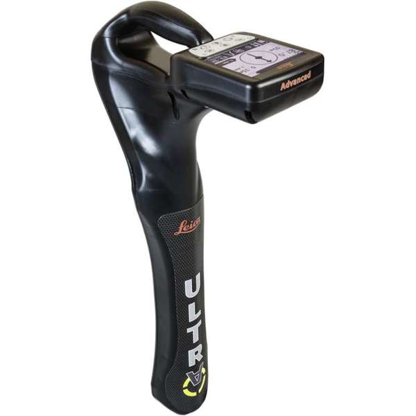
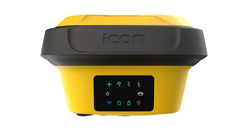
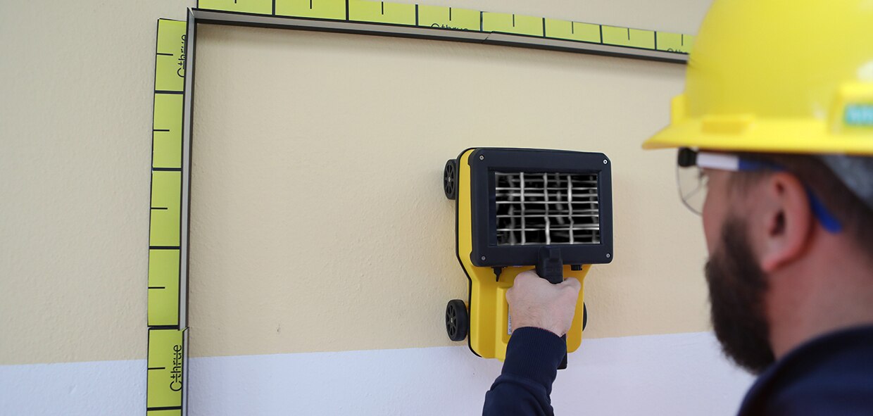
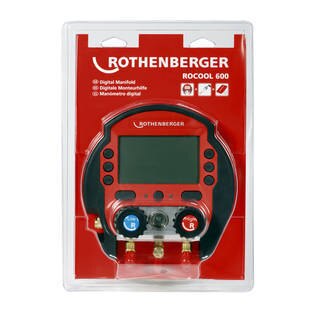
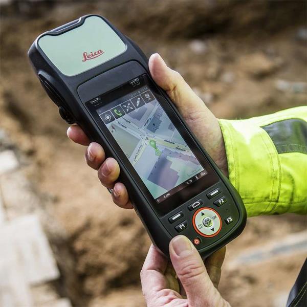
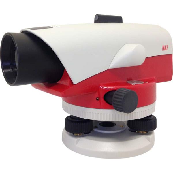
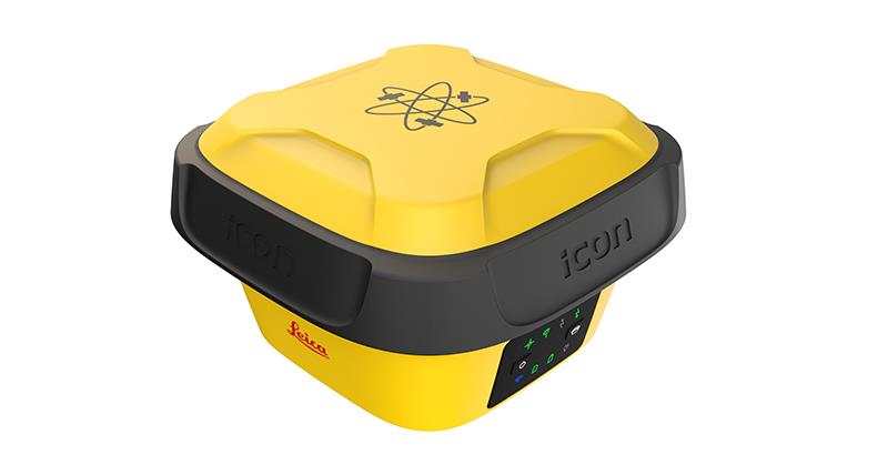
{ "products": [ { "_id": "5b6b3a9ed682be0552aefd6c", "fptag": "SBENTERPRISESTRADINGPUNE", "merchantname": null, "customwidgets": null, "externalsourceid": null, "name": "Leica ULTRA Locator – Standard", "description": "Leica ULTRA Locator – Standard\nThe ULTRA System has unique flexible operating modes to help you easily decide the right mode for your locating application and site conditions.\n\nMultimode operation – 50-200Khz\nDaylight visible LCD screen\nPrecision locating, for utility tracing\nThe complexity of underground utility networks are continually increasing. So obtaining precise information on the location of buried utilities has never been more important. The protection of buried assets during excavation work demands accurate mapping and surveying of existing utilities.\n\nThe Leica ULTRA provides our most advanced precision utility tracing system. Intelligent signal processing has been integrated with unique flexible operating modes, to help save you time and increased confidence in your results. Selectable antenna and customised frequencies optimises your instrument for site specific applications, supported by our AIM system which monitors signal interference levels, recommending which mode to use for the best results.\n\nAmbient Interference Measurement (AIM) \nWhen working in congested environments, external interferences can affect the effectiveness of utility tracing. To guard against interference, the Leica ULTRA incorporates advanced Ambient Interference Measurement (AIM), which analyses the surrounding area for noise and recommends the best frequencies for accurate utility tracing.\n\nOffset measuring \nThere will always be an occasion when the utility runs close to, or underneath an obstruction. With Offset Measuring, the Leica ULTRA can locate the target line if not directly accessible from above. The function uses the available data to estimate the horizontal and vertical (depth) distance.\n\nTransmitter to receiver link \nAdvanced communication link between the Leica ULTRA receiver and transmitter, enables you to control the transmitter directly from the receiver. Work smarter and at greater distances to help achieve best practice whilst reducing time spent walking to the transmitter.", "price": 0.0, "discountamount": 0.0, "currencycode": "INR", "priority": 1000000, "isfreeshipmentavailable": false, "shipmentduration": 7, "_keywords": [ "communication link", "Leica ULTRA Locator", "precise information", "Leica ULTRA receiver", "congested environments", "external interferences", "advanced precision utility", "site specific applications", "underground utility networks", "Intelligent signal processing", "unique flexible operating modes", "monitors signal interference levels", "advanced Ambient Interference Measurement" ], "isarchived": false, "isavailable": true, "applicationid": null, "productindex": 95, "imageuri": "https://productimages.withfloats.com/actual/5b45e9a9d3d93d01c4f1c26c.jpg", "tileimageuri": "https://productimages.withfloats.com/tile/5b45e9a9d3d93d01c4f1c26c.jpg", "images": null, "totalqueries": 0, "gpid": null, "groupproductid": null, "createdon": "2018-07-11T11:27:45.603Z", "updatedon": "2018-08-08T18:46:54.165Z", "buyonlinelink": null, "producturl": "http://WWW.SURVEYEQUIPMENT.IN/products/leica-ultra-locator-standard/95", "availableunits": -1.0, "iscodavailable": true, "isprepaidonlineavailable": false, "maxcodorders": 0, "maxprepaidonlineorders": 0, "uniquepaymenturl": null, "brandname": null, "category": "cable pipe detector equipments", "tags": [ "cable pipe detector equipments", "Cable Avoidance Tools", "cable", "cable route tracing to Datalogging locators", "ndustry standard for cable locating equipments.", "Pipe and Cable locators", "underground cable & pipe locating equipments" ], "variants": false, "keyspecification": null, "otherspecifications": null, "pickupaddressreferenceid": "5d08ebb3edf0e25c3b8da5d0", "paymenttype": "AssuredPurchase", "producttype": "products", "hsncode": null, "gstslab": 0.0, "isnotforsale": false }, { "_id": "6023a4673de1a60001bc5f20", "fptag": "SBENTERPRISESTRADINGPUNE", "merchantname": null, "customwidgets": null, "externalsourceid": null, "name": "Grease For Wire Ropes & Steel Cables", "description": "RL 1Grease For Wire Ropes & Steel CablesExtreme pressure semi fluid greaseContains MOS2 lubricating solidsProvides lubrication & corrosion protectionService rating from -25°C to +150°C\nHeavy duty, extreme pressure semi fluid grease with MoS2 solid lubricant\n\nProduct Description ASV RL1 is a highly adhesive, semi fluid extreme pressure grease for lubrication and corrosion protection of wire ropes and steel cables operating under adverse conditions of load, temperatures or environment. It penetrates rapidly through wire rope strands to leave a completely water resistant heavy duty lubricating film which provides both internal as well as external lubrication & corrosion protection. The solid lubricants prevent wearing and premature damage of internal strands and increase the life of the wire ropes. ASV RL1 forms a protective and lubricating waterproof film over the surface which does not emulsify even if submerged in water.\n\nApplications On wire ropes and steel cables in all cranes, ships, hoists, elevators especially exposed to marine environment or under adverse operating conditions.\n\nBenefits\n Protect against heavy loads, galling, and seizing\n Molybdenum disulfide solid lubricant & EP additives withstand high loads and pressures\n\n Reduces wear and friction\n Resists vibratory shocks\n Does not break down or melt or fling under prolonged use\n Effectively provides lubrication & corrosion protection even to the innermost strands ", "price": 0.0, "discountamount": 0.0, "currencycode": "INR", "priority": 1000000, "isfreeshipmentavailable": false, "shipmentduration": 7, "_keywords": null, "isarchived": false, "isavailable": true, "applicationid": null, "productindex": 188, "imageuri": "https://productimages.withfloats.com/actual/6023a4677d416c00019b47d2.png", "tileimageuri": "https://productimages.withfloats.com/tile/6023a4677d416c00019b47d2.png", "images": null, "totalqueries": 0, "gpid": null, "groupproductid": null, "createdon": "2021-02-10T09:16:23.158Z", "updatedon": "2021-02-10T09:16:23.158Z", "buyonlinelink": null, "producturl": "http://WWW.SURVEYEQUIPMENT.IN//grease-for-wire-ropes-steel-cables/188", "availableunits": -1.0, "iscodavailable": false, "isprepaidonlineavailable": false, "maxcodorders": 0, "maxprepaidonlineorders": 0, "uniquepaymenturl": null, "brandname": "ASV", "category": "Chemical", "tags": [ "grease", "industrialgrease" ], "variants": false, "keyspecification": null, "otherspecifications": null, "pickupaddressreferenceid": "", "paymenttype": "None", "producttype": "products", "hsncode": null, "gstslab": 0.001, "isnotforsale": false }, { "_id": "5c839daa0eac470001975d08", "fptag": "SBENTERPRISESTRADINGPUNE", "merchantname": null, "customwidgets": null, "externalsourceid": null, "name": "Leica iCON gps 70 Series", "description": "Leica iCON gps 70 Series\nPermanent tilt compensation and resistance to magnetic interferences – Leica iCON gps 70 T\n\n\nLeica iCON gps 70 Series – Ultimate performance for your construction site\nUltimate GNSS Rover and field solution for maximum efficiency. Speed up – anytime, anywhere. Leica Geosystems introduces the most efficient construction GNSS rovers, the Leica iCON gps 70 Series. Combining the latest GNSS technology and inertial measurement unit (IMU), the Leica iCON gps 70 T is equipped with permanent tilt compensation and as well resistant to any magnetic interferences. Being calibration-free, the iCON gps 70 T is ready when you are – anytime, anywhere. The iCON gps 70 T releases the limitations of working with the pole in vertical positions and increases the productivity compared to conventional methods. Furthermore, the efficiency on a construction site is enhanced by collecting as-built field data and staking out designs faster, while increasing accuracy and reducing errors. Without time-consuming procedures, users measure where it was not possible before with improved quality control. The seamless integration of the Leica iCON gps 70 Series into the Leica iCON field software leads to simple workflows which require less training and avoid costly downtime.\n\n\nDGPS Surveying Instruments\nDGPS Surveying Instruments - Positioning System Retailer from Mumbai\n\nDGPS Surveying Instruments - Positioning System Retailer from Pune\n\nDGPS Surveying Instruments - Positioning System Retailer from India\n\nDGPS Surveying Instruments - Positioning System Retailer from Maharashtra\n\nGPS Survey Equipment\n\nDifferential GPS India\n\nDifferential Global Positioning System (DGPS) from Mumbai\n\nDifferential Global Positioning System (DGPS) from Pune\n\nDifferential Global Positioning System (DGPS) from India\n\nDifferential Global Positioning System (DGPS) from Maharashtra\n\nGNSS/GPS Survey Equipment - Surveying Equipment from Mumbai\n\nGNSS/GPS Survey Equipment - Surveying Equipment from Pune\n\nGNSS/GPS Survey Equipment - Surveying Equipment from India\n\nGNSS/GPS Survey Equipment - Surveying Equipment from Maharashtra\n\nConstruction Surveying Equipment, Surveying Instruments in India‎\n\n \n\n", "price": 0.0, "discountamount": 0.0, "currencycode": "INR", "priority": 1000000, "isfreeshipmentavailable": false, "shipmentduration": 7, "_keywords": [ "Survey Equipment", "Leica iCON gps 70 T", "Surveying Equipment", "Surveying Instruments", "iCON gps 70 T releases", "Leica iCON gps 70 Series", "Global Positioning System", "Leica iCON field software", "inertial measurement unit", "Positioning System Retailer", "permanent tilt compensation", "efficient construction GNSS rovers" ], "isarchived": false, "isavailable": true, "applicationid": null, "productindex": 141, "imageuri": "https://productimages.withfloats.com/actual/5c839dabdc44740001742988.jpg", "tileimageuri": "https://productimages.withfloats.com/tile/5c839dabdc44740001742988.jpg", "images": null, "totalqueries": 0, "gpid": null, "groupproductid": null, "createdon": "2019-03-09T11:04:10.316Z", "updatedon": "2019-03-09T11:04:10.316Z", "buyonlinelink": null, "producturl": "http://WWW.SURVEYEQUIPMENT.IN//leica-icon-gps-70-series/141", "availableunits": -1.0, "iscodavailable": true, "isprepaidonlineavailable": false, "maxcodorders": 0, "maxprepaidonlineorders": 0, "uniquepaymenturl": null, "brandname": null, "category": "DGPS Surveying Instruments", "tags": [ "DGPS Surveying Instruments", "Differential GPS India", "DGPS Surveying Instruments - Positioning System Re", "GNSS/GPS Survey Equipment - Surveying Equipment fr" ], "variants": false, "keyspecification": null, "otherspecifications": null, "pickupaddressreferenceid": "5d08ebb3edf0e25c3b8da5d0", "paymenttype": "AssuredPurchase", "producttype": "products", "hsncode": null, "gstslab": 0.0, "isnotforsale": false }, { "_id": "5bcda7bf2757570001e2fc40", "fptag": "SBENTERPRISESTRADINGPUNE", "merchantname": null, "customwidgets": null, "externalsourceid": null, "name": "C-thrue", "description": "C-thrue\nSee thru concrete structures and reveal true data that lead to optimal decision-making\n\nCONCRETE SCANNING\nPinpoint hidden objects in cured concrete—without expensive specialists.\n\nScanning, analyzing, and interpreting what's beneath concrete has never been faster or easier. The C-thrue, now equipped with an additional sensor are the industry's easiest-to-use tools for self-performing concrete inspections.\n\nC-thrue is an all-in-one Ground Penetrating Radar (GPR) for accurate scanning and real time analysis of concrete structures. Construction and service companies as well as civil and structural engineers can now improve the way they locate rebars, voids, post-tension cables, cavities, conduits, and any other objects buried in the structure before cutting or drilling into the concrete.\n\nC-thrue is an easy-to-use and robust solution to see through concrete structures and reveal true data that lead to optimal decision-making. The solution is suited for all construction sites and operations including building renovation, overpasses, monuments, bridges and tunnels surveys, as well as for detailed analysis of the original engineering project and comparison with the as-built structure.\n\nToday, C-thrue offers more flexibility with no limitations for your analysis requirements, thanks to a compact and light telescopic pole and an external controller that can be easily transported on site in challenging locations or conditions (e.g. under a deck, along vertical walls, etc...). \nThe C-thrue external controller allows easier and faster data interpretation thanks to real-time data processing and representation of results in Augmented Reality for more efficient decision-making.\n\nFeatures and Benefits:\n\nClearer and faster surveys \nDetection of both first and second levels of rebars thanks to the system’s double polarisation.\nSafe drill in the surveyed structure\nRebar/void automatic insight capabilities that improve safety before cutting or drilling into the concrete.\n\nFully-visible, multi-touch display \nData displayed on the screen are never obscured by the handle or the user’s hand.\n\nSimplified data interpretation\nOptimal decision-making supported by visualisation of acquired data in 3D models.\n\nIncreased data accuracy\nEliminate manual, error-prone paper grids with an automatic positioning and navigation system.\n\nAdvanced data visualisation\nAugmented reality for 3D data visualisation and sharing across operators – in real time or intervals after acquisition.\n\nAutomated data acquisition and analysis\nAutomatic detection of the first layer of rebars and result exportation.\n\nFlexibility everywhere\nLightweight, compact, drop resistant and transportable system for every user operations and construction sites.", "price": 0.0, "discountamount": 0.0, "currencycode": "INR", "priority": 1000000, "isfreeshipmentavailable": false, "shipmentduration": 7, "_keywords": null, "isarchived": false, "isavailable": true, "applicationid": null, "productindex": 117, "imageuri": "https://productimages.withfloats.com/actual/5bcda7c0e34dfa000137913c.jpg", "tileimageuri": "https://productimages.withfloats.com/tile/5bcda7c0e34dfa000137913c.jpg", "images": null, "totalqueries": 0, "gpid": null, "groupproductid": null, "createdon": "2018-10-22T10:34:39.836Z", "updatedon": "2018-11-22T05:55:37.191Z", "buyonlinelink": null, "producturl": "http://WWW.SURVEYEQUIPMENT.IN//c-thrue/117", "availableunits": -1.0, "iscodavailable": true, "isprepaidonlineavailable": false, "maxcodorders": 0, "maxprepaidonlineorders": 0, "uniquepaymenturl": null, "brandname": null, "category": "gpr", "tags": [ "gpr", "ground peantritng radar", "concretescanner" ], "variants": false, "keyspecification": null, "otherspecifications": null, "pickupaddressreferenceid": "5d08ebb3edf0e25c3b8da5d0", "paymenttype": "AssuredPurchase", "producttype": "products", "hsncode": null, "gstslab": 0.0, "isnotforsale": false }, { "_id": "5ba5d0754386e20001336540", "fptag": "SBENTERPRISESTRADINGPUNE", "merchantname": null, "customwidgets": null, "externalsourceid": null, "name": "ROCOOL 600", "description": "ROCOOL 600\nFor commissioning, maintenance work and documentation of refrigeration systems of all kinds\n\nKey Features\nModular system: The basic device can be fitted with the optional Red Box incl. the Data Viewer software for reading out or recording data on a PC. Additionaly there is an optional external Pirani vacuum probe for precise vacuum readings\nMore than 70 refrigerants incl. R744 (sub-critical) are stored in the device. New refrigerants can be added later using the update function\nSimultaneous calculation of superheat and subcool\nThe documentation software Data Viewer generates an automatic report based on the data recorded. Ideal for handing out to the customer (client)\nAn external Pirani vacuum probe allows reading of the vacuum where the most precise measurement is possible: directly at the refrigeration system\n\nModular system: The basic device can be fitted with the optional Red Box incl. the Data Viewer software for reading out or recording data on a PC. Additionaly there is an optional external Pirani vacuum probe for precise vacuum readings\nMore than 70 refrigerants incl. R744 (sub-critical) are stored in the device. New refrigerants can be added later using the update function Simultaneous calculation of superheat and subcool The documentation software Data Viewer generates an automatic report based on the data recorded. Ideal for handing out to the customer (client) An external Pirani vacuum probe allows reading of the vacuum where the most precise measurement is possible: directly at the refrigeration system\n\nTechnical Data\nPressure display:bar, psi, Kpa, Mpa -\nPrecision (at 22°C):± 0,5 % fs -\nBattery capacity:550 mAh\nConnection:4x 1/4 \nSAE -Max. recording time (in the device):im Gerät,12 h\nMax. recording time (in the device):mit Red Box, 96 h\nTemperature display:°C, °F -Vacuum display:\nMicron, mbar, mmHg, Pa, mTorr -\nPower source:Batterie -\nBattery:9 V\nScreen size (Zoll):4 1/3 Inch\nScreen size (Zoll):11 cm", "price": 0.0, "discountamount": 0.0, "currencycode": "INR", "priority": 1000000, "isfreeshipmentavailable": true, "shipmentduration": 7, "_keywords": null, "isarchived": false, "isavailable": true, "applicationid": null, "productindex": 114, "imageuri": "https://productimages.withfloats.com/actual/5ba5d0758a57d200013b81d0.jpg", "tileimageuri": "https://productimages.withfloats.com/tile/5ba5d0758a57d200013b81d0.jpg", "images": null, "totalqueries": 0, "gpid": null, "groupproductid": null, "createdon": "2018-09-22T05:17:41.047Z", "updatedon": "2018-09-22T05:17:41.047Z", "buyonlinelink": null, "producturl": "http://WWW.SURVEYEQUIPMENT.IN//rocool-600/114", "availableunits": -1.0, "iscodavailable": true, "isprepaidonlineavailable": false, "maxcodorders": 0, "maxprepaidonlineorders": 0, "uniquepaymenturl": null, "brandname": null, "category": "Digital Manifold", "tags": [ "Digital Manifold" ], "variants": false, "keyspecification": null, "otherspecifications": null, "pickupaddressreferenceid": "5d08ebb3edf0e25c3b8da5d0", "paymenttype": "AssuredPurchase", "producttype": "products", "hsncode": null, "gstslab": 0.0, "isnotforsale": false }, { "_id": "5b6b3a9dd682be0552aefccb", "fptag": "SBENTERPRISESTRADINGPUNE", "merchantname": null, "customwidgets": null, "externalsourceid": null, "name": "Leica ULTRA Utility Tracing System", "description": "Leica ULTRA Utility Tracing System\nBest precision locating in faster, more confident work\n\nSave time and increase confidence in your results with the Leica ULTRA, our most advanced precision utility tracing instrument.\n\nThe complexity of underground utility networks is continually increasing, and obtaining precise information on the location of buried utilities has never been more important. The protection of buried assets during excavation work demands accurate mapping and surveying of existing utilities. \n\nIntegrating intelligent signal processing with unique flexible operating modes, Leica ULTRA traces buried utility lines accurately for safe underground excavations and utility surveys. Outstanding performance with operational ease and flexibility.\n\nLARGE CLEAR DISPLAY\nLarge backlit high visibility LCD screen\nClear display provides clear, improved and confident location and utility tracing\nCUSTOM FREQUENCIES\nConfigure for site specific applications\nUser configurable modes from 50 Hz to 200 kHz\nChoose from 100 pre-selected frequencies or customise your own frequencies\nCOMPASS\nShows the user the direction of the utility they are locating / tracing\nBLUETOOTH®\nEnable wireless communications with software running on a laptop, survey field PC or other GPS enabled device\nINCREASED TRANSMITTER POWER OUTPUT\nChoose between 5W and 12W transmitter power outputs for superior tracing performance\nBUILT FOR THE MOST DEMANDING ENVIRONMENTS\nIP65 protection\nFulfils toughest standards - shock resistant, protected against water and dust ingress\nSELECTABLE ANTENNA CONFIGURATION\nConfigure antenna to best optimise for your job site\nSelect between more range, sharper response, noise cancelling or easier sweeping\nDIRECTION ENABLED\nIdentifying your target utility amongst multiple parallel utilities\nApply a special direction enabled signal from the transmitter, the receiver will display an arrow on the compass heading to guide you along the designated utility path\nUnlock the power\nConfigure the Leica ULTRA for site specific applications. Custom build your receiver and transmitter.\n\nChoose from over 100 preselected frequencies, or customise your own frequency for highly specialised applications.\n\nAutomatically capture the instruments location data to ensure adherence to best practice. The data logging feature allows the user to record external GPS coordinates and download with the datafile as a KML or CSV format. Upload into GIS systems or Google Maps to confirm where, when and how the work was performed.\n", "price": 0.0, "discountamount": 0.0, "currencycode": "INR", "priority": 1000000, "isfreeshipmentavailable": false, "shipmentduration": 7, "_keywords": [ "target utility", "utility surveys", "precision utility", "Leica ULTRA traces", "designated utility", "12W transmitter power", "wireless communications", "instruments location data", "site specific applications", "100 preselected frequencies", "underground utility networks", "safe underground excavations", "intelligent signal processing", "unique flexible operating modes", "Leica ULTRA Utility Tracing System" ], "isarchived": false, "isavailable": true, "applicationid": null, "productindex": 90, "imageuri": "https://productimages.withfloats.com/actual/5b45ea4dd3d93d01c4f1c9f9.jpg", "tileimageuri": "https://productimages.withfloats.com/tile/5b45ea4dd3d93d01c4f1c9f9.jpg", "images": null, "totalqueries": 0, "gpid": null, "groupproductid": null, "createdon": "2018-07-11T11:30:28.043Z", "updatedon": "2018-08-08T18:46:53.973Z", "buyonlinelink": null, "producturl": "http://WWW.SURVEYEQUIPMENT.IN//leica-ultra-utility-tracing-system/90", "availableunits": -1.0, "iscodavailable": true, "isprepaidonlineavailable": false, "maxcodorders": 0, "maxprepaidonlineorders": 0, "uniquepaymenturl": null, "brandname": null, "category": null, "tags": null, "variants": false, "keyspecification": null, "otherspecifications": null, "pickupaddressreferenceid": "5d08ebb3edf0e25c3b8da5d0", "paymenttype": "AssuredPurchase", "producttype": "products", "hsncode": null, "gstslab": 0.0, "isnotforsale": false }, { "_id": "5b6b3a9cd682be0552aefb49", "fptag": "SBENTERPRISESTRADINGPUNE", "merchantname": null, "customwidgets": null, "externalsourceid": null, "name": "Leica Z-Rover Package", "description": "Leica ZRover – Faster, more accurate asset management\nSwitch from manual tools to digital processes to improve the accuracy and efficiency of collecting asset management information.\n\nThe construction industry is transforming to adopt digital ways of working. Traditional ways are often manual, time consuming and subject to human error.\n\nSwitching to digital asset management, by using the Leica ZRover solution, enables users to digitally locate, record and measure assets on a construction site with the highest accuracy, saving time and reducing errors.\n\nThe complete Z-Rover package includes\n\nLeica Zeno 20 Android UMTS Professional\nZeno Mobile (Android) 'Prof' on Zeno 20\n1 yr Zeno 20 / Zeno Mobile Basic CCP\nLeica AS10, Triple Frequency GNSS Antenna\nLeica GLS30, GNSS telescopic pole,carbon-fibre\nLeica AZ204 Zeno 20 Pole Mount\nLeica GEV238, 1.2m external antenna cable\nLeica AZ212 Hard Container for Zeno 20\nLeica GHT63 Pole clamp for attaching GHT\nAdopt digital working practices to improve efficiency, reporting, communication, record keeping and health and safety.", "price": 0.0, "discountamount": 0.0, "currencycode": "INR", "priority": 1000000, "isfreeshipmentavailable": false, "shipmentduration": 0, "_keywords": [ "yr Zeno 20", "GHT63 Pole clamp", "Zeno Mobile Basic", "digital processes", "construction site", "AZ204 Zeno 20 Pole", "adopt digital ways", "Zeno 20 Android UMTS", "GNSS telescopic pole", "AZ212 Hard Container", "Leica ZRover solution", "Triple Frequency GNSS", "construction industry", "digital asset management", "digital working practices" ], "isarchived": false, "isavailable": false, "applicationid": null, "productindex": 71, "imageuri": "https://productimages.withfloats.com/actual/5b1ba01d3b9b61043c76e8f2.jpg", "tileimageuri": "https://productimages.withfloats.com/tile/5b1ba01d3b9b61043c76e8f2.jpg", "images": null, "totalqueries": 0, "gpid": null, "groupproductid": null, "createdon": "2018-06-09T09:33:44.339Z", "updatedon": "2018-08-08T18:46:52.725Z", "buyonlinelink": null, "producturl": "http://WWW.SURVEYEQUIPMENT.IN//leica-z-rover-package/71", "availableunits": -1.0, "iscodavailable": true, "isprepaidonlineavailable": false, "maxcodorders": 0, "maxprepaidonlineorders": 0, "uniquepaymenturl": null, "brandname": null, "category": "gnssservicepune", "tags": [ "gnssservicepune", "DGPSssuplier GNSS Leica Geosystems", "gnss receiver", "GNSS", "leicageosystemspune", "GPS", "totalstions" ], "variants": false, "keyspecification": null, "otherspecifications": null, "pickupaddressreferenceid": "5d08ebb3edf0e25c3b8da5d0", "paymenttype": "AssuredPurchase", "producttype": "products", "hsncode": null, "gstslab": 0.0, "isnotforsale": false }, { "_id": "5b6b3a9cd682be0552aefa8d", "fptag": "SBENTERPRISESTRADINGPUNE", "merchantname": null, "customwidgets": null, "externalsourceid": null, "name": "Leica NA720 Automatic Level", "description": "Leica NA720 Automatic Level\nThe Leica NA720 automatic level is extremely popular within the construction industry being known for its increased robustness and precision when working in tough environments.\n\nOnsite hazards such as falling to ground from a low height, exposure to water and vibrations caused by heavy machinery are no problem for the robust Leica NA720. With no need to re-adjust this level carries on working and measuring precisely, day in and day out.\n\nThe horizontal circle and circular bubble are easily read, both being positioned next to the telescope and the external sight allowing for easy targeting. The upright image is clearly shown and the double sided endless drives provide fast targeting. The NA720 comes with one of the finest optics allowing for short measuring distances, measuring in adverse light conditions and accurate aiming.\n\nThe increased tough and robust features of the NA720 include waterproof and protection against dust. The tight seals and gas filled telescope give protection against hazards should the instrument be dropped in to water.\n\nLeica NA720 features include:\n20x magnification\nUpright telescope image\nGas filled telescope\n30mm objective diameter\n50cm short focus distance\n360 degree / 400 gon selectable angle measurement\n10’ / 2 mm circular bubble\nEndless Horizontal Drive\n2.5mm double run accuracy\n± 15’ working range\nWater resistant\n–20 to +50 °C operating temperature\n1.6kg total weight\n19cm x 12cm x 12cm\nIncludes:\nLeica NA720 Automatic Level\nCarry Case\nUser Manual", "price": 0.0, "discountamount": 0.0, "currencycode": "INR", "priority": 1000000, "isfreeshipmentavailable": false, "shipmentduration": 7, "_keywords": [ "NA720 features", "circular bubble", "increased tough", "robust features", "heavy machinery", "horizontal circle", "robust Leica NA720", "increased robustness", "construction industry", "adverse light conditions", "400 gon selectable angle", "telescope give protection", "short measuring distances", "Leica NA720 Automatic Level", "double sided endless drives" ], "isarchived": false, "isavailable": true, "applicationid": null, "productindex": 61, "imageuri": "https://productimages.withfloats.com/actual/5affe7168c010009bcaf4e75.jpg", "tileimageuri": "https://productimages.withfloats.com/tile/5affe7168c010009bcaf4e75.jpg", "images": null, "totalqueries": 0, "gpid": null, "groupproductid": null, "createdon": "2018-05-19T08:57:59.282Z", "updatedon": "2018-08-08T18:46:52.141Z", "buyonlinelink": null, "producturl": "http://WWW.SURVEYEQUIPMENT.IN//leica-na720-automatic-level/61", "availableunits": -1.0, "iscodavailable": true, "isprepaidonlineavailable": false, "maxcodorders": 0, "maxprepaidonlineorders": 0, "uniquepaymenturl": null, "brandname": null, "category": null, "tags": null, "variants": false, "keyspecification": null, "otherspecifications": null, "pickupaddressreferenceid": "5d08ebb3edf0e25c3b8da5d0", "paymenttype": "AssuredPurchase", "producttype": "products", "hsncode": null, "gstslab": 0.0, "isnotforsale": false }, { "_id": "5b6b3a9bd682be0552aef96c", "fptag": "SBENTERPRISESTRADINGPUNE", "merchantname": null, "customwidgets": null, "externalsourceid": null, "name": "Leica iCON gps 70", "description": "Leica iCON gps 70 Series\nPermanent tilt compensation and resistance to magnetic interferences – Leica iCON gps 70 T\n\nLeica iCON gps 70 Series – Ultimate performance for your construction site\nUltimate GNSS Rover and field solution for maximum efficiency. Speed up – anytime, anywhere. Leica Geosystems introduces the most efficient construction GNSS rovers, the Leica iCON gps 70 Series. Combining the latest GNSS technology and inertial measurement unit (IMU), the Leica iCON gps 70 T is equipped with permanent tilt compensation and as well resistant to any magnetic interferences. Being calibration-free, the iCON gps 70 T is ready when you are – anytime, anywhere. The iCON gps 70 T releases the limitations of working with the pole in vertical positions and increases the productivity compared to conventional methods. Furthermore, the efficiency on a construction site is enhanced by collecting as-built field data and staking out designs faster, while increasing accuracy and reducing errors. Without time-consuming procedures, users measure where it was not possible before with improved quality control. The seamless integration of the Leica iCON gps 70 Series into the Leica iCON field software leads to simple workflows which require less training and avoid costly downtime.\n\nTilt – Traceability – Trust\n\nWith the Leica iCON gps 70 T there is no need to hold the pole vertical and level the bubble when measuring. Reliable traceability by storing tilt values with each measurement improves the quality control of any measured point. The permanent tilt compensation extends the measurement possibilities on any construction site and improves quality and accuracy of the collected data.\n\niCON field solution – unmatched simplicity\n\nLeica iCON field offers a smart and customised positioning solution for all construction sites. Construction-tailored, intelligent software applications, workflows and an innovative software design result in improved performance. Seamlessly integrating into all iCON sensors and Leica ConX, Leica Geosystems provides all the tools to increase the efficiency of your field operations. The iCON gps 70 Series follows this concept and perfectly complements the existing iCON field solution.", "price": 0.0, "discountamount": 0.0, "currencycode": "INR", "priority": 1000000, "isfreeshipmentavailable": false, "shipmentduration": 7, "_keywords": [ "Leica Geosystems", "iCON field offers", "Leica iCON gps 70 T", "iCON field solution", "iCON gps 70 T releases", "Leica iCON gps 70 Series", "Leica iCON field software", "inertial measurement unit", "measurement possibilities", "permanent tilt compensation", "innovative software design result", "intelligent software applications", "efficient construction GNSS rovers" ], "isarchived": false, "isavailable": true, "applicationid": null, "productindex": 44, "imageuri": "https://productimages.withfloats.com/actual/5af4387e85c6af0e4085d331.jpg", "tileimageuri": "https://productimages.withfloats.com/tile/5af4387e85c6af0e4085d331.jpg", "images": null, "totalqueries": 0, "gpid": null, "groupproductid": null, "createdon": "2018-05-10T12:18:12.482Z", "updatedon": "2018-08-08T18:46:51.438Z", "buyonlinelink": null, "producturl": "http://WWW.SURVEYEQUIPMENT.IN//leica-icon-gps-70/44", "availableunits": -1.0, "iscodavailable": true, "isprepaidonlineavailable": false, "maxcodorders": 0, "maxprepaidonlineorders": 0, "uniquepaymenturl": null, "brandname": null, "category": null, "tags": null, "variants": false, "keyspecification": null, "otherspecifications": null, "pickupaddressreferenceid": "5d08ebb3edf0e25c3b8da5d0", "paymenttype": "AssuredPurchase", "producttype": "products", "hsncode": null, "gstslab": 0.0, "isnotforsale": false } ], "hasmoreitems": false, "isapirequest": false, "totalresults": 27, "query": null, "floatingpoint": null }

Still searching for
external interferences?

Still searching for
external interferences?

Chat with us