Preview

This is your website preview.

Currently it only shows your basic business info. Start adding relevant business details such as description, images and products or services to gain your customers attention by using Boost 360 android app / iOS App / web portal.

SBENTERPRISESTRADINGPUNE 5abfbf1e7c88bb04a4d0fcc7 Products https://www.surveyequipment.in
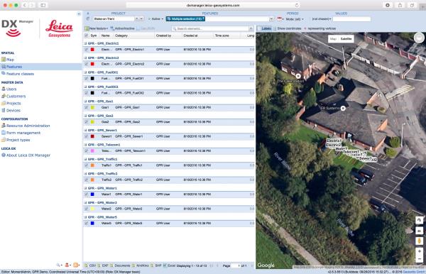
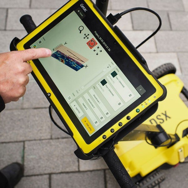
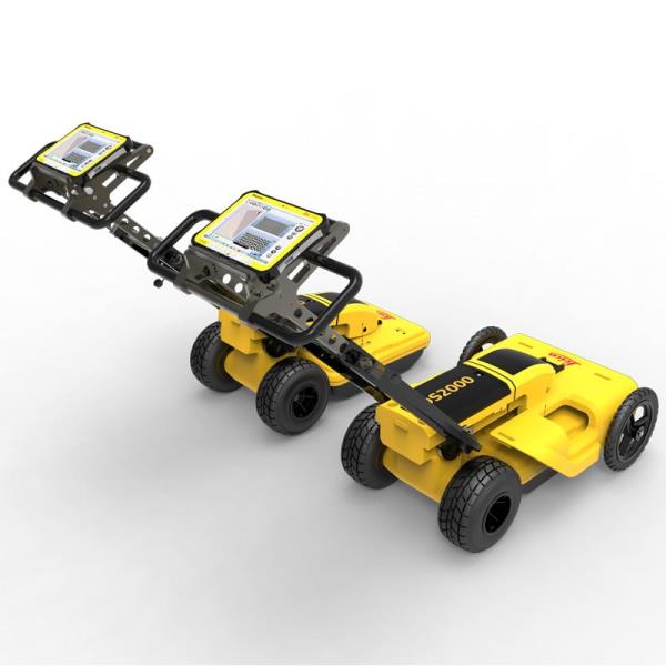
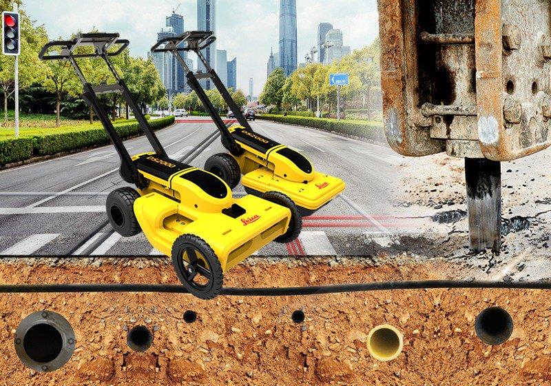
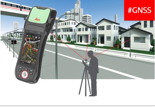
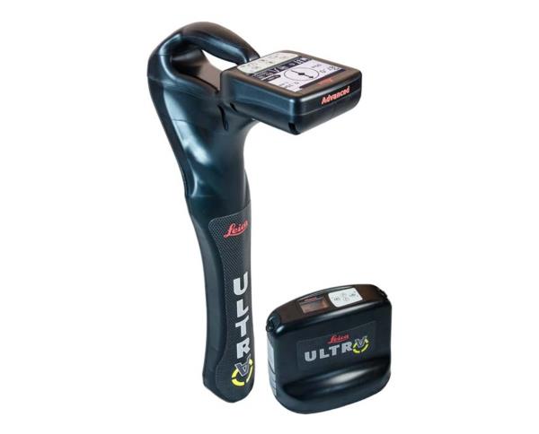
{ "products": [ { "_id": "5b6b3a9dd682be0552aefcbd", "fptag": "SBENTERPRISESTRADINGPUNE", "merchantname": null, "customwidgets": null, "externalsourceid": null, "name": "Leica DX Manager Mapping", "description": "Leica DX Manager Mapping\nOne central dashboard for all the Leica Geosystems Detection solutions\n\nLeica DX Manager is the only enterprise grade utility mapping solution on the market. A unique cloud-powered solution that delivers unparalleled performance. Manage projects, tasks and spatial data from one central dashboard for all the Leica Geosystems Detection solutions.\n\nUpdate drawings, raw data, location pictures, data layers and mobile forms remotely and in a period of real time operate at an enterprise level rather than having to manually update individual users one at a time. With the Leica DX Manager, you have all dashboards, status updates and project management tools in one platform. Now, project managers can track field operations in real time and make critical decisions with a broader understanding of the current situation.\n\nKey benefits\n\nSimplified processes\nImprovement of data quality and accuracy\nConsistent data collection methods\nIntegration of DS2000, cable locators and asset mapping data\nWorkflows to maintain data integrity\nManage the whole workflow\n\nShare data to all devices and users within your organisation.\n\nAnalyse maps result\nVisualise on online maps\nFilter on users, within date ranges or any attributes\nExport to standard GIS and CAD formats\nShare data to your clients\nAn easy-to-use online portal allows management of all aspects of documenting utility location tasks. The user can switch between street view, satellite imagery and cartographic street maps. Field acquired survey data becomes instantly available and can be accessed by users anytime and anywhere.\n\nUtility detection integration\n\nLeica DX Manager integrates the entire Leica Geosystems Detection portfolio into a simple survey workflow, empowering the user to apply locator depth measurements to GNSS measurements. The result is a seamless fusion of both worlds – with all locator related data reviewable either in Leica DX Manager or any export format.\n\nLocate the utility\nMeasure the depth\nAll location data is sent directly to the Leica DX Field application on the GNSS device\nIt triggers the GNSS measurement on the mapping device\nAll data is integrated into the features metadata\nMaximum user experience and productivity\n\nLeica DX Field mobile app is designed for productivity and maximum user experience and built for enforcing data quality and accuracy. \n\nEasy mapping / surveying of assets\nSmart mobile forms\nImmediate visualisation on map\nMetadata collection\nAutomatic sync with Cloud\nFull offline capabilities\nMake sure your measured data always matches your quality expectations (up to centimetres with RTK) as Leica DX Manager notifications steadily monitor the system parameters. All quality parameters are stored as metadata. Next to the utility mapping aspect, it delivers work orders, time tracking and document management.", "price": 0.0, "discountamount": 0.0, "currencycode": "INR", "priority": 1000000, "isfreeshipmentavailable": false, "shipmentduration": 7, "_keywords": [ "data quality", "location data", "data collection", "data reviewable", "survey data becomes", "DX Field mobile app", "Leica DX Manager Mapping", "cartographic street maps", "Leica DX Field application", "update individual users one", "Leica DX Manager notifications", "apply locator depth measurements", "enterprise grade utility mapping solution", "entire Leica Geosystems Detection portfolio" ], "isarchived": false, "isavailable": true, "applicationid": null, "productindex": 89, "imageuri": "https://productimages.withfloats.com/actual/5b459fa2f3579911b41e9cda.jpg", "tileimageuri": "https://productimages.withfloats.com/tile/5b459fa2f3579911b41e9cda.jpg", "images": null, "totalqueries": 0, "gpid": null, "groupproductid": null, "createdon": "2018-07-11T06:11:47.283Z", "updatedon": "2018-08-08T18:46:53.959Z", "buyonlinelink": null, "producturl": "http://WWW.SURVEYEQUIPMENT.IN/products/leica-dx-manager-mapping/89", "availableunits": -1.0, "iscodavailable": true, "isprepaidonlineavailable": false, "maxcodorders": 0, "maxprepaidonlineorders": 0, "uniquepaymenturl": null, "brandname": null, "category": "GPR", "tags": [ "GPR", "Detection and underground mapping solution", "Leica DX Manager Mapping" ], "variants": false, "keyspecification": null, "otherspecifications": null, "pickupaddressreferenceid": "5d08ebb3edf0e25c3b8da5d0", "paymenttype": "AssuredPurchase", "producttype": "products", "hsncode": null, "gstslab": 0.0, "isnotforsale": false }, { "_id": "5da061c96fcd40000173875d", "fptag": "SBENTERPRISESTRADINGPUNE", "merchantname": null, "customwidgets": null, "externalsourceid": null, "name": "DSX Utility Detections Solutions ", "description": "Leica DSX Utility Detection Solution\nA clearer view of underground utilities\nFor utility repair and maintenance, civil engineering and surveying companies, the Leica DSX utility detection solution, consisting of portable hardware with intuitive software allows to easily locate, visualise and map utilities. Unlike any other ground-penetrating radar (GPR) system, the Leica DSX maximises productivity with cutting-edge software that automates data analysis and creates a 3D utility map on the field.\n\nEasy to use\n\nEnsure smooth and accurate underground utility detection without expert knowledge\nComplete utility detection and mapping in just a few steps through the intuitive user interface\nScan anywhere and at any time, even in narrow areas and under severe conditions\nReliable Detection Results\n\nDetect all types of underground utilities in high resolution to assure reliable avoidance zones\nVerify detected utilities with support of smart algorithm\nImport of POI's and utility records to help you make better decisions\nInstant 2D/3D Utility Map\n\nSave your time on site by mapping underground utilities in just minutes\nExport utilities in CAD or BIM-read formats for further usage\nCreate professional reports, customised to your and your customers' needs\nIntegrated Solution\n\nOffer a complete workflow from acquire to excavate\nLocate underground utilities with survey-grade accuracy\nGenerate utility maps, compatible with all coordinate reference systems", "price": 0.0, "discountamount": 0.0, "currencycode": "INR", "priority": 1000000, "isfreeshipmentavailable": false, "shipmentduration": 7, "_keywords": null, "isarchived": false, "isavailable": true, "applicationid": null, "productindex": 155, "imageuri": "https://productimages.withfloats.com/actual/5da061ca48f8810001023a3d.jpg", "tileimageuri": "https://productimages.withfloats.com/tile/5da061ca48f8810001023a3d.jpg", "images": null, "totalqueries": 0, "gpid": null, "groupproductid": null, "createdon": "2019-10-11T11:04:41.923Z", "updatedon": "2019-10-11T11:04:41.923Z", "buyonlinelink": null, "producturl": "http://WWW.SURVEYEQUIPMENT.IN//dsx-utility-detections-solutions-/155", "availableunits": -1.0, "iscodavailable": false, "isprepaidonlineavailable": false, "maxcodorders": 0, "maxprepaidonlineorders": 0, "uniquepaymenturl": null, "brandname": "Leica DSX Utility Detection Solution", "category": "", "tags": null, "variants": false, "keyspecification": null, "otherspecifications": null, "pickupaddressreferenceid": "", "paymenttype": "None", "producttype": "products", "hsncode": null, "gstslab": 0.0, "isnotforsale": false }, { "_id": "5b7ffb95147e16051e773f27", "fptag": "SBENTERPRISESTRADINGPUNE", "merchantname": null, "customwidgets": null, "externalsourceid": null, "name": "IDS GeoRadar - Stream C", "description": "IDS GeoRadar - Stream C\nThe compact array solution for accurate 3D utility mapping.\nHigh quality, High productivity and Simple to Use compact radar system for real time underground surveys.\n\nStream C is the compact array solution for real-time 3D mapping of underground utilities and features. Thanks to increased level of accuracy provided by a massive antenna array, Stream C is able to automatically detect pipes and cables.\n\nDaily use of Stream C is aided by ergonomic features including electronic ride height adjustment, options to tow manually or with a small vehicle and a motor assisted drive wheel.\n\nSTREAM C BENEFITS\n\nHigh Productivity: surveys only need to be performed in one direction to ensure optimal detection for both longitudinal and transversal pipes.\nNo advanced training needed: the system automatically detects and locates the position of pipes in real time and displays them on screen.\nReduced user fatigue: thanks to electronic ride height adjustment and a motor assisted drive wheel.\nFacilitates large surveys: the system can be towed manually or with a small vehicle, increasing the acquisition speed (up to 6 km/h).\n\nSTREAM C FEATURES\n\nMassive array of 34 antennas in two polarizations: this enables an accurate 3D reconstruction of the underground utility network to be created in a single scan.\nAutomatic Pipe Detection (APD): real-time automatic detection of buried pipes and cables\nCompact size: Stream C’s small dimensions enable it to survey areas inaccessible to larger array systems while maintaining the same accuracy.\nRobust construction: built to the highest standards and with hardwearing materials so that it can be used in harsh, demanding environments.\n3D radar tomography: real-time tomography on a GPS or total station assisted cartographic background. • Professional subsurface survey: pipes, cables and buried objects can be automatically transferred to CAD and GIS formats allowing a complete subsurface GIS based digital map to be quickly produced.\n\nBenefits of Stream EM include:\n\nImproved management of underground utility design, relocation and coordination;\nCost and time reductions: No need to block traffic or perform surveys at night;\nIncrease in accuracy with a detection accuracy of as little as 5 cm;\nIncrease productivity and have the ability to detect every buried target;\nHighly modular structure allows it to be reconfigured to map sidewalks and difficult to access areas\n\nReal time software for advanced viewing \nStream EM is supplied with the OneVsion and GRED HD 3D CAD software suites.", "price": 0.0, "discountamount": 0.0, "currencycode": "INR", "priority": 1000000, "isfreeshipmentavailable": false, "shipmentduration": 7, "_keywords": [ "detection accuracy", "accurate 3D utility", "real time underground", "massive antenna array", "underground utilities", "compact array solution", "small dimensions enable", "complete subsurface GIS", "Use compact radar system", "survey areas inaccessible", "underground utility design", "accurate 3D reconstruction", "underground utility network", "GRED HD 3D CAD software suites", "Professional subsurface survey" ], "isarchived": false, "isavailable": true, "applicationid": null, "productindex": 111, "imageuri": "", "tileimageuri": "", "images": null, "totalqueries": 0, "gpid": null, "groupproductid": null, "createdon": "2018-08-24T12:35:33.806Z", "updatedon": "2018-08-24T12:35:33.806Z", "buyonlinelink": null, "producturl": "http://WWW.SURVEYEQUIPMENT.IN//ids-georadar-stream-c/111", "availableunits": -1.0, "iscodavailable": true, "isprepaidonlineavailable": false, "maxcodorders": 0, "maxprepaidonlineorders": 0, "uniquepaymenturl": null, "brandname": null, "category": null, "tags": null, "variants": false, "keyspecification": null, "otherspecifications": null, "pickupaddressreferenceid": "5d08ebb3edf0e25c3b8da5d0", "paymenttype": "AssuredPurchase", "producttype": "products", "hsncode": null, "gstslab": 0.0, "isnotforsale": false }, { "_id": "5b6b3a9ed682be0552aefd47", "fptag": "SBENTERPRISESTRADINGPUNE", "merchantname": null, "customwidgets": null, "externalsourceid": null, "name": "Leica DS2000 Utility Detection Radar", "description": "Leica DS2000 Utility Detection Radar\nUncovering safer, faster, more\n\nThere’s a lot going on underground that you need to know about before you ever start to dig. The Leica DS2000 Utility Detection Radar finds all potential threats, including non-conductive pipes and fibre optics, increasing safety by lowering the risk of accidently hitting underground assets.\n\nIncrease safety, speed up work and lower asset management costs with the ability to prevent hazardous outages and collect more information. The DS2000 betters your business by making it safer, faster and more efficient.\n\nKey benefits\nIncrease safety when the DS2000 identifies all potential threats\nGet to assets and recover quicker from outages when you know exactly where underground utility assets are located\nDual-frequency antenna to detect deep and shallow targets simultaneously\nEasily collect and understand data with the DS2000’s simple and intuitive software and data storage\nSimple data storage and export to continue working on the post-processing at the office\nEffortlessly maneuver around the most challenging sites with the DS2000’s advanced ergonomics\nExpert knowledge of Leica Geosystems with more than 270 service centres worldwide\nPROTECT by Leica Geosystems - the strongest warranty in the market\n\nDetection and underground mapping solution\nCombined with the powerful and rugged Leica CT2000 field tablet, the GG04 or the GPS60 smart antenna, and the DIGICAT intelligent cable locators and DIGITEX transmitters, the DS2000 is part of the complete Leica Geosystems detection and underground mapping solution that will enhance your business by making it faster and more efficient. With DX Office Vision post processing software, convert radar data to CAD file in an uncomplicated way.\n\nStart today\nContact your Leica Geosystems distribution partner for more information on the Leica DS2000 and other detection solutions.", "price": 0.0, "discountamount": 0.0, "currencycode": "INR", "priority": 1000000, "isfreeshipmentavailable": false, "shipmentduration": 7, "_keywords": [ "DS2000 betters", "convert radar data", "intuitive software", "GPS60 smart antenna", "detection solutions", "DIGITEX transmitters", "asset management costs", "Leica CT2000 field tablet", "underground utility assets", "DIGICAT intelligent cable locators", "complete Leica Geosystems detection", "Leica DS2000 Utility Detection Radar", "Leica Geosystems distribution partner", "DX Office Vision post processing software" ], "isarchived": false, "isavailable": true, "applicationid": null, "productindex": 94, "imageuri": "https://productimages.withfloats.com/actual/5b45a66fd4575c0f14706fc4.jpg", "tileimageuri": "https://productimages.withfloats.com/tile/5b45a66fd4575c0f14706fc4.jpg", "images": null, "totalqueries": 0, "gpid": null, "groupproductid": null, "createdon": "2018-07-11T06:40:39.103Z", "updatedon": "2018-08-08T18:46:54.113Z", "buyonlinelink": null, "producturl": "http://WWW.SURVEYEQUIPMENT.IN//leica-ds2000-utility-detection-radar/94", "availableunits": -1.0, "iscodavailable": true, "isprepaidonlineavailable": false, "maxcodorders": 0, "maxprepaidonlineorders": 0, "uniquepaymenturl": null, "brandname": null, "category": "GPR Ground Penetrating Radar", "tags": [ "GPR Ground Penetrating Radar", "| GPR Ground Penetrating Radar Survey Equipment Di" ], "variants": false, "keyspecification": null, "otherspecifications": null, "pickupaddressreferenceid": "5d08ebb3edf0e25c3b8da5d0", "paymenttype": "AssuredPurchase", "producttype": "products", "hsncode": null, "gstslab": 0.0, "isnotforsale": false }, { "_id": "5b6b3a99d682be0552aef6d9", "fptag": "SBENTERPRISESTRADINGPUNE", "merchantname": null, "customwidgets": null, "externalsourceid": null, "name": "Leica DS2000 Utility Detection Radar", "description": "Leica DS2000 Utility Detection Radar\nUncovering safer, faster, more\n\nThere’s a lot going on underground that you need to know about before you ever start to dig. The Leica DS2000 Utility Detection Radar finds all potential threats, including non-conductive pipes and fibre optics, increasing safety by lowering the risk of accidently hitting underground assets.\n\nIncrease safety, speed up work and lower asset management costs with the ability to prevent hazardous outages and collect more information. The DS2000 betters your business by making it safer, faster and more efficient.\n\nKey benefits\nIncrease safety when the DS2000 identifies all potential threats\nGet to assets and recover quicker from outages when you know exactly where underground utility assets are located\nDual-frequency antenna to detect deep and shallow targets simultaneously\nEasily collect and understand data with the DS2000’s simple and intuitive software and data storage\nSimple data storage and export to continue working on the post-processing at the office\nEffortlessly maneuver around the most challenging sites with the DS2000’s advanced ergonomics\nExpert knowledge of Leica Geosystems with more than 270 service centres worldwide\nPROTECT by Leica Geosystems - the strongest warranty in the market\n\nDetection and underground mapping solution\nCombined with the powerful and rugged Leica CT2000 field tablet, the GG04 or the GPS60 smart antenna, and the DIGICAT intelligent cable locators and DIGITEX transmitters, the DS2000 is part of the complete Leica Geosystems detection and underground mapping solution that will enhance your business by making it faster and more efficient. With DX Office Vision post processing software, convert radar data to CAD file in an uncomplicated way.\n\n", "price": 0.0, "discountamount": 0.0, "currencycode": "INR", "priority": 1000000, "isfreeshipmentavailable": false, "shipmentduration": 7, "_keywords": [ "DS2000 betters", "potential threats", "convert radar data", "intuitive software", "GPS60 smart antenna", "270 service centres", "DIGITEX transmitters", "asset management costs", "Leica CT2000 field tablet", "underground utility assets", "DIGICAT intelligent cable locators", "complete Leica Geosystems detection", "Leica DS2000 Utility Detection Radar", "DX Office Vision post processing software" ], "isarchived": false, "isavailable": true, "applicationid": null, "productindex": 10, "imageuri": "https://productimages.withfloats.com/actual/5ae6f0c89c08ba0c2c2afa3e.jpg", "tileimageuri": "https://productimages.withfloats.com/tile/5ae6f0c89c08ba0c2c2afa3e.jpg", "images": null, "totalqueries": 0, "gpid": null, "groupproductid": null, "createdon": "2018-04-30T10:32:43.449Z", "updatedon": "2018-08-08T18:46:49.746Z", "buyonlinelink": null, "producturl": "http://WWW.SURVEYEQUIPMENT.IN//leica-ds2000-utility-detection-radar/10", "availableunits": -1.0, "iscodavailable": true, "isprepaidonlineavailable": false, "maxcodorders": 0, "maxprepaidonlineorders": 0, "uniquepaymenturl": null, "brandname": null, "category": null, "tags": null, "variants": false, "keyspecification": null, "otherspecifications": null, "pickupaddressreferenceid": "5d08ebb3edf0e25c3b8da5d0", "paymenttype": "AssuredPurchase", "producttype": "products", "hsncode": null, "gstslab": 0.0, "isnotforsale": false }, { "_id": "5b6b3a99d682be0552aef672", "fptag": "SBENTERPRISESTRADINGPUNE", "merchantname": null, "customwidgets": null, "externalsourceid": null, "name": "Leica Zeno 20 GIS Collector", "description": "Leica Zeno 20 GIS Collector\nSimple, accurate and rugged asset management\n\n\nThe Leica Zeno 20 simplifies daily data capture for GIS field personnel. Leverage the strength of cutting-edge technology in one remarkably compact device.\n\nSo simplistic it will become your indispensable tool.\nSo accurate you will always be sure.\nSo productive it will change your workday.\nMade rugged to withstand the elements of any work site, the Leica Zeno comes with a durable IP67 dust and waterproof rating. Work from anywhere when you download the Android app that streams RTK-corrected GNSS positons.\n\nSolve daily GIS challenges with new technologies\nThe No. 1 challenge facing GIS field personnel is GNSS-denied environments. Collecting reliable and accurate positioning data is near impossible in these areas. This struggle is eliminated with new innovative technologies by Leica Geosystems inside the Leica Zeno 20 GIS collector:\n\nApogeetec\nEven in closed or covered areas, such as dense forests, an internal antenna enables collecting accurate position data. With maximum performance, collect more, collect simpler.\nGamtec\nBe more productive, increase safety and save time when the Leica Zeno 20 GIS collector is combined with the Leica DISTO S910 laser distance metre. End the struggle to access hard-to-reach and dangerous points when you simply aim and instantly collect from anywhere, anytime.\nMore accuracy, greater time savings, increased productivity – achieve all this with the Leica Zeno 20 GIS collector’s better satellite acquisition with stronger signals and contactless offset measuring . This GIS solution is truly comprehensive and second to none.\n\nLeica Geosystems, Esri improve GIS with ZenoCollector\nThe leader in measurement technology has joined with the leader in GIS technology to bring you an all-new integrated solution in mobile data capturing. The rugged Leica Zeno 20 combines with the powerful Collector for ArcGISto create the ZenoCollector. With Collector for ArcGIS as its main user interface and bundled with an ArcGIS Online organisational subscription for one year, the ZenoCollector:\n\nSaves time automatically synching field changes to enterprise information\nIncreases productivity opening access to all for the latest data from the field\nImproves accuracy with professional-grade GNSS coordination\n ", "price": 0.0, "discountamount": 0.0, "currencycode": "INR", "priority": 1000000, "isfreeshipmentavailable": false, "shipmentduration": 7, "_keywords": [ "GIS solution", "GIS technology", "Leica Geosystems", "GIS field personnel", "Leica Zeno 20 combines", "accurate position data", "measurement technology", "one remarkably compact", "internal antenna enables", "accurate positioning data", "Leica Zeno 20 GIS Collector", "new innovative technologies", "Leica DISTO S910 laser distance metre", "ArcGIS Online organisational subscription", "Leica Zeno 20 simplifies daily data capture" ], "isarchived": false, "isavailable": true, "applicationid": null, "productindex": 5, "imageuri": "https://productimages.withfloats.com/actual/5ae6ee849c08ba0c2c2af762.jpg", "tileimageuri": "https://productimages.withfloats.com/tile/5ae6ee849c08ba0c2c2af762.jpg", "images": null, "totalqueries": 0, "gpid": null, "groupproductid": null, "createdon": "2018-04-30T10:22:58.832Z", "updatedon": "2018-08-08T18:46:49.527Z", "buyonlinelink": null, "producturl": "http://WWW.SURVEYEQUIPMENT.IN//leica-zeno-20-gis-collector/5", "availableunits": -1.0, "iscodavailable": true, "isprepaidonlineavailable": false, "maxcodorders": 0, "maxprepaidonlineorders": 0, "uniquepaymenturl": null, "brandname": null, "category": null, "tags": null, "variants": false, "keyspecification": null, "otherspecifications": null, "pickupaddressreferenceid": "5d08ebb3edf0e25c3b8da5d0", "paymenttype": "AssuredPurchase", "producttype": "products", "hsncode": null, "gstslab": 0.0, "isnotforsale": false }, { "_id": "5b6b3a99d682be0552aef69b", "fptag": "SBENTERPRISESTRADINGPUNE", "merchantname": null, "customwidgets": null, "externalsourceid": null, "name": "Leica ULTRA Utility Tracing System", "description": "Leica ULTRA Utility Tracing System\nBest precision locating in faster, more confident work\n\nSave time and increase confidence in your results with the Leica ULTRA, our most advanced precision utility tracing instrument.\n\nThe complexity of underground utility networks is continually increasing, and obtaining precise information on the location of buried utilities has never been more important. The protection of buried assets during excavation work demands accurate mapping and surveying of existing utilities. \n\nIntegrating intelligent signal processing with unique flexible operating modes, Leica ULTRA traces buried utility lines accurately for safe underground excavations and utility surveys. Outstanding performance with operational ease and flexibility.\n\nOptimised specifically for utility tracing \nConfiguration for challenging environments\nOptimise the instrument to overcome the most challenging and complex site conditions. The Leica ULTRA locator can be configured for different project environments and has more than 100 programmable operating frequencies available. Programme modes can adapt the antennas to deliver improved accuracy and repeatability.\nBest frequencies in congested environment\nWhen working in congested environments, the Leica ULTRA incorporates Ambient Interference Measurement (AIM), which digitally analyses the surrounding area for noise and recommends the best frequencies for accurate utility tracing.\nTrace utilities through any obstruction\nThere will always be an occasion when the utility runs close to or underneath an obstruction. With Offset Measuring, the Leica ULTRA locates the target line if not directly accessible from above. The function uses the available data to estimate the horizontal and vertical (depth) distance.\nTransmitter to receiver link\nControl the transmitter directly from the receiver with the cutting-edge communication link between the Leica ULTRA receiver and the transmitter. No more walking from the tracing line to the transmitter, simply adjust the settings automatically.\nClear operational display\nClear graphical LCD screen, with auto-pinpointing directional arrows. Ensure confident and fast tracing in all operating conditions, day or night, with the large backlit display.\nGNSS & GIS integration\nTrue one man, single-step data capture solution for buried utility mapping or surveying applications. Leica ULTRA integrates with GNSS or GIS data capture devices.", "price": 0.0, "discountamount": 0.0, "currencycode": "INR", "priority": 1000000, "isfreeshipmentavailable": false, "shipmentduration": 7, "_keywords": [ "precision utility", "Leica ULTRA traces", "Leica ULTRA locator", "Leica ULTRA receiver", "data capture solution", "complex site conditions", "GIS data capture devices", "underground utility networks", "safe underground excavations", "intelligent signal processing", "different project environments", "unique flexible operating modes", "Ambient Interference Measurement", "Leica ULTRA Utility Tracing System", "100 programmable operating frequencies available" ], "isarchived": false, "isavailable": true, "applicationid": null, "productindex": 7, "imageuri": "https://productimages.withfloats.com/actual/5ae6ed7fb303650b7cd15c39.jpg", "tileimageuri": "https://productimages.withfloats.com/tile/5ae6ed7fb303650b7cd15c39.jpg", "images": null, "totalqueries": 0, "gpid": null, "groupproductid": null, "createdon": "2018-04-30T10:18:41.519Z", "updatedon": "2018-08-08T18:46:49.621Z", "buyonlinelink": null, "producturl": "http://WWW.SURVEYEQUIPMENT.IN//leica-ultra-utility-tracing-system/7", "availableunits": -1.0, "iscodavailable": true, "isprepaidonlineavailable": false, "maxcodorders": 0, "maxprepaidonlineorders": 0, "uniquepaymenturl": null, "brandname": null, "category": null, "tags": null, "variants": false, "keyspecification": null, "otherspecifications": null, "pickupaddressreferenceid": "5d08ebb3edf0e25c3b8da5d0", "paymenttype": "AssuredPurchase", "producttype": "products", "hsncode": null, "gstslab": 0.0, "isnotforsale": false }, { "_id": "65c5dc636523861ec4890fc9", "fptag": "SBENTERPRISESTRADINGPUNE", "merchantname": null, "customwidgets": null, "externalsourceid": null, "name": "GIM 120 PROFESSIONALDIGITAL INCLINOMETER", "description": "GIM 120 PROFESSIONALDIGITAL INCLINOMETER\nLonger for maximum precisionMeasures precise tilts in degrees, percent or millimetres/metresDirection arrows and audible signals at 0° and 90° for easy alignmentMeasured values automatically turn on the display when working overhead\n��️ Bosch GIM 120 PROFESSIONAL - Elevate Precision to Perfection! ��\nUpgrade your toolkit with the Bosch GIM 120 PROFESSIONAL, your go-to solution for unparalleled precision in measurements. ��\n✨ Key Features:\nPinpoint Accuracy: Achieve flawless results with the GIM 120's advanced measurement technology.Compact Design: Take precision on the go - the sleek, portable design ensures convenience on any job site.Durability: Built to withstand the rigors of professional use, the GIM 120 is your reliable companion for the long haul.�� Why Choose Bosch?Trusted by professionals worldwide, Bosch is synonymous with quality and innovation. The GIM 120 PROFESSIONAL continues this legacy, offering cutting-edge technology in a compact, durable package.\n�� Take Your Craft to New Heights!Whether you're a carpenter, electrician, or DIY enthusiast, the Bosch GIM 120 PROFESSIONAL is a game-changer. Elevate your precision game and achieve unparalleled results in every project.", "price": 0.0, "discountamount": 0.0, "currencycode": "INR", "priority": 1000000, "isfreeshipmentavailable": false, "shipmentduration": 7, "_keywords": [ "✨", "0°", "go", "job", "site", "Craft", "legacy", "quality", "degrees", "project", "percent", "display", "toolkit", "solution", "carpenter", "long haul", "innovation", "Durability", "Perfection", "convenience", "electrician", "New Heights", "millimetres", "measurements", "game-changer", "Key Features", "precise tilts", "professionals", "precision game", "DIY enthusiast", "Compact Design", "audible signals", "flawless results", "professional use", "Elevate Precision", "Pinpoint Accuracy", "reliable companion", "unparalleled results", "metresDirection arrows", "sleek, portable design", "unparalleled precision", "cutting-edge technology", "The GIM 120 PROFESSIONAL", "compact, durable package", "maximum precisionMeasures", "Bosch GIM 120 PROFESSIONAL", "easy alignmentMeasured values", "advanced measurement technology", "GIM 120 PROFESSIONALDIGITAL INCLINOMETER" ], "isarchived": false, "isavailable": true, "applicationid": null, "productindex": 234, "imageuri": "https://productimages.withfloats.com/actual/65c5dc65f71fb2d544cd4eaf.jpg", "tileimageuri": "https://productimages.withfloats.com/tile/65c5dc65f71fb2d544cd4eaf.jpg", "images": null, "totalqueries": 0, "gpid": null, "groupproductid": null, "createdon": "2024-02-09T08:03:47.25Z", "updatedon": "2024-02-09T08:03:47.25Z", "buyonlinelink": null, "producturl": "http://WWW.SURVEYEQUIPMENT.IN//gim-120-professionaldigital-inclinometer/234", "availableunits": -1.0, "iscodavailable": false, "isprepaidonlineavailable": false, "maxcodorders": 0, "maxprepaidonlineorders": 0, "uniquepaymenturl": null, "brandname": "BOSCH ", "category": "CROSSLINELESER", "tags": null, "variants": false, "keyspecification": null, "otherspecifications": null, "pickupaddressreferenceid": "", "paymenttype": "None", "producttype": "products", "hsncode": null, "gstslab": 0.001, "isnotforsale": false }, { "_id": "64a7e35514085700019c75c7", "fptag": "SBENTERPRISESTRADINGPUNE", "merchantname": null, "customwidgets": null, "externalsourceid": null, "name": "AIPL ABRO Masking Tape 6123 and 3123 Premium Grade", "description": "AIPL ABRO Masking Tape – 6123 & 3123-Premium GradeIdeal for carpenters and painters, ABRO masking tape is a high performance tape.\nUsed in a variety of applications like painting, carpentry, manufacturing and so, ABRO tape uses are vast.\nABRO multipurpose tape is thick because of which it give a tear free & residue free result.\nThis helps the contractors, painters and carpenters to save cost and also give results that add to their reputation and finishing.\nEngineered for performance, this tape is designed to have the perfect balance between paper and adhesive.\nKnown widely for quality, our Tape has high thickness and so is highly solvent and paint resistant.\nThis makes it ideal for masking tape for painting walls, doors, windows, furniture and so on.\nAvailable in various thickness, abro tape is ideal for projects of multiple scales and magnitude.\nAvailable across a price range, our solutions can not only easily fit into budgets but also give them the justification they need.\nAIPL ABRO Masking Tape is a premium-quality adhesive tape designed for a wide range of applications. Whether you're a professional painter, a DIY enthusiast, or need to secure and protect surfaces, this masking tape is your go-to solution. With its superior quality and reliable performance, it ensures clean lines, easy application, and residue-free removal.\nKey Features:\nPrecision Masking: Achieve clean, sharp paint lines and professional results every time. The AIPL ABRO Masking Tape provides precise masking for painting projects, allowing you to create crisp edges and protect adjacent surfaces from paint splatters.Strong Adhesion: The tape features excellent adhesion to various surfaces, including walls, wood, metal, glass, and plastic. It securely holds in place, preventing paint bleed-through and ensuring clean lines.Residue-Free Removal: Once your project is complete, you can easily remove the masking tape without leaving behind any sticky residue or damaging the underlying surface. Enjoy hassle-free cleanup and professional-looking finishes.Versatile Application: This masking tape is suitable for a wide range of tasks, such as painting, crafting, labeling, packaging, and more. It offers reliable performance in both indoor and outdoor settings.Easy to Use: The tape is designed for effortless application. Simply unroll and press it onto the desired surface. It adheres smoothly and stays in place during your project, making your task efficient and convenient.High-Quality Construction: AIPL ABRO Masking Tape is made from premium-grade materials, ensuring durability and long-lasting performance. It can withstand varying temperatures and environmental conditions.From professional painting projects to everyday household tasks, AIPL ABRO Masking Tape is your trusted companion. Its precision masking, strong adhesion, residue-free removal, and versatility make it an essential tool in any toolkit. Experience the convenience and reliability of AIPL ABRO Masking Tape for your next project.", "price": 0.0, "discountamount": 0.0, "currencycode": "INR", "priority": 1000000, "isfreeshipmentavailable": false, "shipmentduration": 7, "_keywords": [ "wood", "cost", "paper", "doors", "metal", "walls", "glass", "place", "Enjoy", "indoor", "plastic", "variety", "budgets", "windows", "toolkit", "painters", "crafting", "labeling", "carpentry", "magnitude", "tear free", "finishing", "ABRO tape", "solutions", "packaging", "furniture", "wide range", "durability", "carpenters", "reputation", "reliability", "crisp edges", "price range", "contractors", "clean lines", "versatility", "convenience", "Key Features", "applications", "next project", "justification", "manufacturing", "essential tool", "DIY enthusiast", "sticky residue", "high thickness", "Strong Adhesion", "multiple scales", "perfect balance", "paint splatters", "precise masking", "easy application", "various surfaces", "superior quality", "outdoor settings", "trusted companion", "adjacent surfaces", "Precision Masking", "various thickness", "excellent adhesion", "underlying surface", "3123 Premium Grade", "residue free result", "varying temperatures", "professional results", "residue-free removal", "reliable performance", "professional painter", "high performance tape", "Versatile Application", "ABRO multipurpose tape", "effortless application", "3123-Premium GradeIdeal", "premium-grade materials", "everyday household tasks", "long-lasting performance", "clean, sharp paint lines", "environmental conditions", "High-Quality Construction", "The AIPL ABRO Masking Tape", "professional-looking finishes", "premium-quality adhesive tape", "professional painting projects" ], "isarchived": false, "isavailable": true, "applicationid": null, "productindex": 230, "imageuri": "https://productimages.withfloats.com/actual/64a7e35bbc54c10001c63bf2.jpeg", "tileimageuri": "https://productimages.withfloats.com/tile/64a7e35bbc54c10001c63bf2.jpeg", "images": null, "totalqueries": 0, "gpid": null, "groupproductid": null, "createdon": "2023-07-07T10:05:09.784Z", "updatedon": "2023-07-07T10:05:09.784Z", "buyonlinelink": null, "producturl": "http://WWW.SURVEYEQUIPMENT.IN//aipl-abro-masking-tape-6123-and-3123-premium-grade/230", "availableunits": -1.0, "iscodavailable": false, "isprepaidonlineavailable": false, "maxcodorders": 0, "maxprepaidonlineorders": 0, "uniquepaymenturl": null, "brandname": "AIPL ABRO", "category": "Maskingtape", "tags": null, "variants": false, "keyspecification": null, "otherspecifications": null, "pickupaddressreferenceid": "", "paymenttype": "None", "producttype": "products", "hsncode": null, "gstslab": 0.001, "isnotforsale": false } ], "hasmoreitems": false, "isapirequest": false, "totalresults": 27, "query": null, "floatingpoint": null }

Still searching for
enterprise grade utility mapping solution?

Still searching for
enterprise grade utility mapping solution?

Chat with us