Preview

This is your website preview.

Currently it only shows your basic business info. Start adding relevant business details such as description, images and products or services to gain your customers attention by using Boost 360 android app / iOS App / web portal.

SBENTERPRISESTRADINGPUNE 5abfbf1e7c88bb04a4d0fcc7 Products https://www.surveyequipment.in
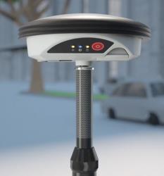
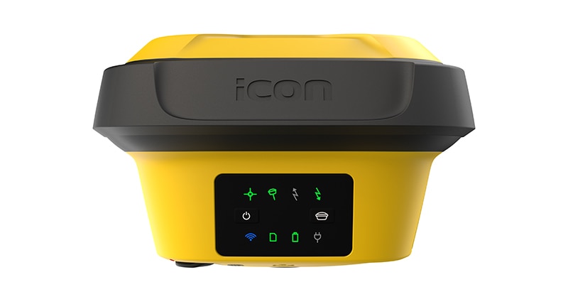
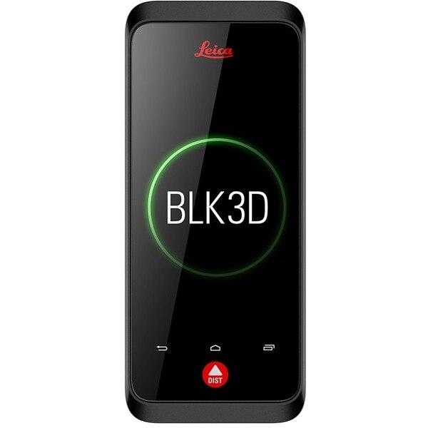
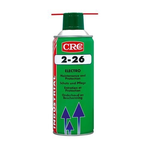
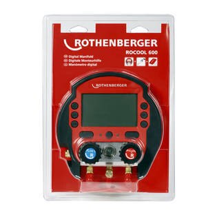
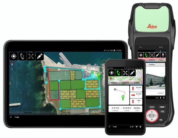
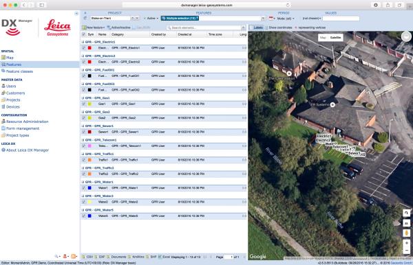
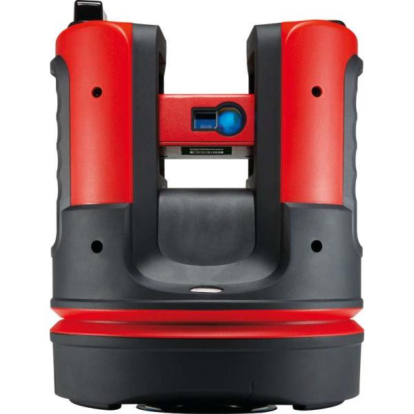
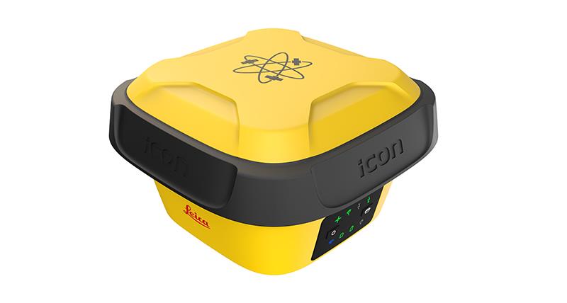
{ "products": [ { "_id": "5b6b3a99d682be0552aef6ed", "fptag": "SBENTERPRISESTRADINGPUNE", "merchantname": null, "customwidgets": null, "externalsourceid": null, "name": "Leica Zeno GG04 plus Smart Antenna", "description": "Leica Zeno GG04 plus Smart Antenna for high accuracy everywhere\nUse your own device and get high accuracy everywhere\n\nCollecting high-accuracy geospatial data on your smartphone or tablet has never been easier.\n\nPair with all existing Leica Zeno handhelds and a wide range of Android, Apple or Windows® smart devices, to bring cutting-edge GNSS technology and industry-leading 555 channel tracking power to your hands.\n\nThe rugged, flexible and easy-to-use smart antenna utilises RTK technology and can now apply Precise Point Positioning (PPP). This makes high-accuracy data collection possible in real-time even in the most demanding of locations without the need for a mobile data connection.\n\nWith its compact, lightweight design and IP68 durability, you can work longer in all conditions - the world of high accuracy mapping comes to life at your fingertips.\n\nSmart device independence\n\nUse your existing smartphone or tablet\nAvailable for Android, Apple and Windows®\nBluetooth® connection ensures cable free operation\nEnhanced tracking performance\n\n555 channels support an increased number of satellites\nState-of-the-art GNSS technology\nReady for future GNSS developments\nPrecise point positioning (PPP)\n\nAchieve high accuracy data collection without a mobile data connection\nAvailable anywhere in the world, anytime\nRemoves reliance on post processing\nExtensive software support\n\nUse with your favourite data collection apps and software\nNo development efforts required\nProvides NMEA messages output on different Bluetooth® ports to allow reviewing and storing of GNSS metadata information\nBuilt to last\n\nIP68 protection ensures water and dustproofing\nContinuous performance in all environments\nAll day battery life\nLeica Geosystems compatible software\n\nZeno Mobile\nZeno Field, Zeno Connect\nZeno Office\nMobileMatriX", "price": 0.0, "discountamount": 0.0, "currencycode": "INR", "priority": 1000000, "isfreeshipmentavailable": false, "shipmentduration": 7, "_keywords": [ "Leica Zeno GG04", "GNSS technology", "geospatial data", "channels support", "lightweight design", "development efforts", "Leica Zeno handhelds", "NMEA messages output", "high accuracy mapping", "Geosystems compatible", "data collection possible", "Precise Point Positioning", "high accuracy data collection", "favourite data collection apps", "smart antenna utilises RTK technology" ], "isarchived": false, "isavailable": true, "applicationid": null, "productindex": 11, "imageuri": "https://productimages.withfloats.com/actual/5ae6f1a2b303650b7cd1693f.jpg", "tileimageuri": "https://productimages.withfloats.com/tile/5ae6f1a2b303650b7cd1693f.jpg", "images": null, "totalqueries": 0, "gpid": null, "groupproductid": null, "createdon": "2018-04-30T10:36:19.854Z", "updatedon": "2018-08-08T18:46:49.78Z", "buyonlinelink": null, "producturl": "http://WWW.SURVEYEQUIPMENT.IN/products/leica-zeno-gg04-plus-smart-antenna/11", "availableunits": -1.0, "iscodavailable": true, "isprepaidonlineavailable": false, "maxcodorders": 0, "maxprepaidonlineorders": 0, "uniquepaymenturl": null, "brandname": null, "category": null, "tags": null, "variants": false, "keyspecification": null, "otherspecifications": null, "pickupaddressreferenceid": "5d08ebb3edf0e25c3b8da5d0", "paymenttype": "AssuredPurchase", "producttype": "products", "hsncode": null, "gstslab": 0.0, "isnotforsale": false }, { "_id": "5c839daa0eac470001975d08", "fptag": "SBENTERPRISESTRADINGPUNE", "merchantname": null, "customwidgets": null, "externalsourceid": null, "name": "Leica iCON gps 70 Series", "description": "Leica iCON gps 70 Series\nPermanent tilt compensation and resistance to magnetic interferences – Leica iCON gps 70 T\n\n\nLeica iCON gps 70 Series – Ultimate performance for your construction site\nUltimate GNSS Rover and field solution for maximum efficiency. Speed up – anytime, anywhere. Leica Geosystems introduces the most efficient construction GNSS rovers, the Leica iCON gps 70 Series. Combining the latest GNSS technology and inertial measurement unit (IMU), the Leica iCON gps 70 T is equipped with permanent tilt compensation and as well resistant to any magnetic interferences. Being calibration-free, the iCON gps 70 T is ready when you are – anytime, anywhere. The iCON gps 70 T releases the limitations of working with the pole in vertical positions and increases the productivity compared to conventional methods. Furthermore, the efficiency on a construction site is enhanced by collecting as-built field data and staking out designs faster, while increasing accuracy and reducing errors. Without time-consuming procedures, users measure where it was not possible before with improved quality control. The seamless integration of the Leica iCON gps 70 Series into the Leica iCON field software leads to simple workflows which require less training and avoid costly downtime.\n\n\nDGPS Surveying Instruments\nDGPS Surveying Instruments - Positioning System Retailer from Mumbai\n\nDGPS Surveying Instruments - Positioning System Retailer from Pune\n\nDGPS Surveying Instruments - Positioning System Retailer from India\n\nDGPS Surveying Instruments - Positioning System Retailer from Maharashtra\n\nGPS Survey Equipment\n\nDifferential GPS India\n\nDifferential Global Positioning System (DGPS) from Mumbai\n\nDifferential Global Positioning System (DGPS) from Pune\n\nDifferential Global Positioning System (DGPS) from India\n\nDifferential Global Positioning System (DGPS) from Maharashtra\n\nGNSS/GPS Survey Equipment - Surveying Equipment from Mumbai\n\nGNSS/GPS Survey Equipment - Surveying Equipment from Pune\n\nGNSS/GPS Survey Equipment - Surveying Equipment from India\n\nGNSS/GPS Survey Equipment - Surveying Equipment from Maharashtra\n\nConstruction Surveying Equipment, Surveying Instruments in India‎\n\n \n\n", "price": 0.0, "discountamount": 0.0, "currencycode": "INR", "priority": 1000000, "isfreeshipmentavailable": false, "shipmentduration": 7, "_keywords": [ "Survey Equipment", "Leica iCON gps 70 T", "Surveying Equipment", "Surveying Instruments", "iCON gps 70 T releases", "Leica iCON gps 70 Series", "Global Positioning System", "Leica iCON field software", "inertial measurement unit", "Positioning System Retailer", "permanent tilt compensation", "efficient construction GNSS rovers" ], "isarchived": false, "isavailable": true, "applicationid": null, "productindex": 141, "imageuri": "https://productimages.withfloats.com/actual/5c839dabdc44740001742988.jpg", "tileimageuri": "https://productimages.withfloats.com/tile/5c839dabdc44740001742988.jpg", "images": null, "totalqueries": 0, "gpid": null, "groupproductid": null, "createdon": "2019-03-09T11:04:10.316Z", "updatedon": "2019-03-09T11:04:10.316Z", "buyonlinelink": null, "producturl": "http://WWW.SURVEYEQUIPMENT.IN//leica-icon-gps-70-series/141", "availableunits": -1.0, "iscodavailable": true, "isprepaidonlineavailable": false, "maxcodorders": 0, "maxprepaidonlineorders": 0, "uniquepaymenturl": null, "brandname": null, "category": "DGPS Surveying Instruments", "tags": [ "DGPS Surveying Instruments", "Differential GPS India", "DGPS Surveying Instruments - Positioning System Re", "GNSS/GPS Survey Equipment - Surveying Equipment fr" ], "variants": false, "keyspecification": null, "otherspecifications": null, "pickupaddressreferenceid": "5d08ebb3edf0e25c3b8da5d0", "paymenttype": "AssuredPurchase", "producttype": "products", "hsncode": null, "gstslab": 0.0, "isnotforsale": false }, { "_id": "5c528f7519bf0400016c2058", "fptag": "SBENTERPRISESTRADINGPUNE", "merchantname": null, "customwidgets": null, "externalsourceid": null, "name": "Leica BLK3D", "description": "Leica BLK3D\nReal-time, professional grade, in-picture 3D measurement\nThe Leica BLK3D is a real-time, in-picture 3D measurement solution. By combining measurement sensors, software, and on-device edge data processing capabilities, the Leica BLK3D makes in-picture measurements with professional-grade accuracy in real-time possible. Every image captured is a complete and precise 3D measurement record.\n\nIts edge computing capabilities eliminate the need for network connections and cloud services, ensuring professionals can make faster decisions within their daily workflows – whether measuring inaccessible locations, creating floor plans, estimating building installations, documenting construction site progress or creating measurable, as-built documentation.\n\nTake a picture. Measure anything.\nThe BLK3D captures images and places precise measurements at your fingertips. Share images and measurements in multiple formats.\n\nThe art of photogrammetry. Simplified.\nUn-matched combination of a calibrated stereo-camera, advanced algorithms and real-time edge computing fused with leading Electronic Distance Measurement (EDM) technology.\n\nAccess projects. Anywhere, anytime.\nMeasure in your image – on the handheld imager, on the desktop, on-site or in the office.\n\nWorking with digital floorplans.\nCreate floorplans and import existing ones. Add measurable images. Document construction progress with multiple images over time.\n\nNew dimensions for 2D pictures.\nThe BLK3D creates images that contain precise three-dimensional measurements.\n\nProgressive project documentation for AEC.\nCapture critical moments throughout the life of a building.\n\nObject detection and snapping.\nAuto-Snapping uses computer vision technologies to select the right points for your measurements.\n\nStore. Organize. Share.\nStore your measurable images on the device and on desktop. Organize your projects by tagging measurable images with searchable keywords for easy recall and share them in multiple formats.\n\n", "price": 0.0, "discountamount": 0.0, "currencycode": "INR", "priority": 1000000, "isfreeshipmentavailable": false, "shipmentduration": 0, "_keywords": null, "isarchived": false, "isavailable": false, "applicationid": null, "productindex": 139, "imageuri": "https://productimages.withfloats.com/actual/5c5293511e8d150001c19faa.jpg", "tileimageuri": "https://productimages.withfloats.com/tile/5c5293511e8d150001c19faa.jpg", "images": null, "totalqueries": 0, "gpid": null, "groupproductid": null, "createdon": "2019-01-31T06:02:29.05Z", "updatedon": "2019-01-31T06:18:55.492Z", "buyonlinelink": null, "producturl": "http://WWW.SURVEYEQUIPMENT.IN//leica-blk3d/139", "availableunits": -1.0, "iscodavailable": true, "isprepaidonlineavailable": false, "maxcodorders": 0, "maxprepaidonlineorders": 0, "uniquepaymenturl": null, "brandname": null, "category": "leicageosystems", "tags": [ "leicageosystems", "BLK3D", "leicadisto", "BLK360", "laserdistancemeter", "leicascanner" ], "variants": false, "keyspecification": null, "otherspecifications": null, "pickupaddressreferenceid": "5d08ebb3edf0e25c3b8da5d0", "paymenttype": "AssuredPurchase", "producttype": "products", "hsncode": null, "gstslab": 0.0, "isnotforsale": false }, { "_id": "5bced1e73ceede0001be1f11", "fptag": "SBENTERPRISESTRADINGPUNE", "merchantname": null, "customwidgets": null, "externalsourceid": null, "name": "CRC 2-26 ELECTRICAL CONTACT CLEANER", "description": "CRC 2-26 ELECTRICAL CONTACT CLEANER\n\nGENERAL DESCRIPTION\n\nMulti-purpose maintenance for electrical equipment\n\nCRC 2-26 is a multi-purpose lubricant preventing electrical and electronic malfunction caused by water penetration, humidity, condensation or corrosion.The stable, low surface tension, high capillary action formula provides great penetrating and spreading power.\nFEATURES\nCleans, lubricates, protects, penetrates, and loosens corrosion\nPrevents corrosion by displacing moisture\nRestores resistance values by reducing current leakage\nProvides precision lubrication by its thin, high dielectric strength, lubricating film\nHelps restore water-damaged electrical equipment\nFrees rusted or seized parts by penetrating under dirt and scale into the finest pores and cracks\nCan be used on all metals and alloys\nWill not harm modern plastics, painted surfaces, coatings and rubbers\nConvenient 360° (upside-down) spray valve for aerosols\nNon-flammable CO2 propellant, giving an active product content of 97%\nSpecifications :\nNSN 6850-00-874-5847\nUSDA CLASS H2\nAPPLICATIONS\n\nHelps to protect, lubricate and restore\nElectrical connectors\nRelays\nCircuit breakers\nTransformers\nSwitch gears\nMotors\nGenerators\nControls\nInstruments\nCommunication assemblies\nElectronics\nAlarm systems\nStarters.\nDIRECTIONS\nSpray light even coat to protect surfaces and to seal out moisture.\nApply liberally to loosen rusted/seized parts; full penetration may require several hours.\nTo displace water, spray wet surfaces until run-off is clear and moisture free. When possible, dip water damaged equipment in CRC 2-26; agitate while submerged; remove and allow to drain. A detailed “CRC water damage restoration” procedure is available upon request.\nTo be removed by CRC Lectra Clean II, hydrocarbon solvents or alkaline degreasing before surface treatment.\nFor application of CRC 2-26 in dipping baths, customers should take care to stir from time to time (to distribute small amounts of deposits) and to prevent excessive evaporation of solvent.When stable emulsions have been formed, the bath should be emptied and cleaned, and the product replaced.\nDo not use on energised equipment; allow solvent to evaporate before energising.This evaporation may take up to 4 hours, depending on surface condition and environment. Use only in well ventilated area.\nA safety data sheet (MSDS) according EU93/112 is available for all CRC products.\nTYPICAL(*) PRODUCT DATA (without propellant)\nAppearance : light amber, clear\nSpecific gravity (@ 20°C) : 0.83\nDistillation range of solvents : 180-250°C\nFreezing point : < -50°C\nFlash point (closed cup) : 75°C\nDynamic viscosity (@ 20°C) : 4 mPa.s\nUltimate film thickness : 2.10-6m (2um), (@ 20°C, after a 24 hr spread)\nMaximum expected coverage : 60 to 100 m2/l, (@ 20°C, after a 24 hr spread)\nSolvent dissipation : 2-4 hrs, (@ 20°C, thin film)\nHeat resistance : 120°C (150°C short time)\nWater displacement (IP 178/61, method B) : pass\nFilm properties (after evaporation of solvent)\nSpecific gravity (@ 20°C) : 0.89\nFalex true load failure : 8900N\n(ASTM D 3233, Proc.A)\nSalt spray resistance (**) : 55 hrs.\n\n\nCRC 2-26 , Electro Cleaner , 500ml Aerosol\n \n\nCRC 2-26 18/8 Steel Power Spray 500 ml\n\n\n\n", "price": 0.0, "discountamount": 0.0, "currencycode": "INR", "priority": 1000000, "isfreeshipmentavailable": false, "shipmentduration": 7, "_keywords": null, "isarchived": false, "isavailable": true, "applicationid": null, "productindex": 120, "imageuri": "https://productimages.withfloats.com/actual/5bced1ead3fdc60001aba2a7.jpg", "tileimageuri": "https://productimages.withfloats.com/tile/5bced1ead3fdc60001aba2a7.jpg", "images": null, "totalqueries": 0, "gpid": null, "groupproductid": null, "createdon": "2018-10-23T07:46:47.341Z", "updatedon": "2020-04-01T05:19:37.111Z", "buyonlinelink": null, "producturl": "http://WWW.SURVEYEQUIPMENT.IN//crc-2-26-electrical-contact-cleaner/120", "availableunits": -1.0, "iscodavailable": false, "isprepaidonlineavailable": true, "maxcodorders": 0, "maxprepaidonlineorders": 500, "uniquepaymenturl": null, "brandname": "", "category": "Contact Cleaners", "tags": [ "Contact Cleaners", "Electrical Contact Cleaner", "Electronic Component Cleaner", "CRCSPRAY", "crc 2-26" ], "variants": false, "keyspecification": null, "otherspecifications": null, "pickupaddressreferenceid": "5d08ebb3edf0e25c3b8da5d0", "paymenttype": "AssuredPurchase", "producttype": "products", "hsncode": null, "gstslab": 0.0, "isnotforsale": false }, { "_id": "5ba5d0754386e20001336540", "fptag": "SBENTERPRISESTRADINGPUNE", "merchantname": null, "customwidgets": null, "externalsourceid": null, "name": "ROCOOL 600", "description": "ROCOOL 600\nFor commissioning, maintenance work and documentation of refrigeration systems of all kinds\n\nKey Features\nModular system: The basic device can be fitted with the optional Red Box incl. the Data Viewer software for reading out or recording data on a PC. Additionaly there is an optional external Pirani vacuum probe for precise vacuum readings\nMore than 70 refrigerants incl. R744 (sub-critical) are stored in the device. New refrigerants can be added later using the update function\nSimultaneous calculation of superheat and subcool\nThe documentation software Data Viewer generates an automatic report based on the data recorded. Ideal for handing out to the customer (client)\nAn external Pirani vacuum probe allows reading of the vacuum where the most precise measurement is possible: directly at the refrigeration system\n\nModular system: The basic device can be fitted with the optional Red Box incl. the Data Viewer software for reading out or recording data on a PC. Additionaly there is an optional external Pirani vacuum probe for precise vacuum readings\nMore than 70 refrigerants incl. R744 (sub-critical) are stored in the device. New refrigerants can be added later using the update function Simultaneous calculation of superheat and subcool The documentation software Data Viewer generates an automatic report based on the data recorded. Ideal for handing out to the customer (client) An external Pirani vacuum probe allows reading of the vacuum where the most precise measurement is possible: directly at the refrigeration system\n\nTechnical Data\nPressure display:bar, psi, Kpa, Mpa -\nPrecision (at 22°C):± 0,5 % fs -\nBattery capacity:550 mAh\nConnection:4x 1/4 \nSAE -Max. recording time (in the device):im Gerät,12 h\nMax. recording time (in the device):mit Red Box, 96 h\nTemperature display:°C, °F -Vacuum display:\nMicron, mbar, mmHg, Pa, mTorr -\nPower source:Batterie -\nBattery:9 V\nScreen size (Zoll):4 1/3 Inch\nScreen size (Zoll):11 cm", "price": 0.0, "discountamount": 0.0, "currencycode": "INR", "priority": 1000000, "isfreeshipmentavailable": true, "shipmentduration": 7, "_keywords": null, "isarchived": false, "isavailable": true, "applicationid": null, "productindex": 114, "imageuri": "https://productimages.withfloats.com/actual/5ba5d0758a57d200013b81d0.jpg", "tileimageuri": "https://productimages.withfloats.com/tile/5ba5d0758a57d200013b81d0.jpg", "images": null, "totalqueries": 0, "gpid": null, "groupproductid": null, "createdon": "2018-09-22T05:17:41.047Z", "updatedon": "2018-09-22T05:17:41.047Z", "buyonlinelink": null, "producturl": "http://WWW.SURVEYEQUIPMENT.IN//rocool-600/114", "availableunits": -1.0, "iscodavailable": true, "isprepaidonlineavailable": false, "maxcodorders": 0, "maxprepaidonlineorders": 0, "uniquepaymenturl": null, "brandname": null, "category": "Digital Manifold", "tags": [ "Digital Manifold" ], "variants": false, "keyspecification": null, "otherspecifications": null, "pickupaddressreferenceid": "5d08ebb3edf0e25c3b8da5d0", "paymenttype": "AssuredPurchase", "producttype": "products", "hsncode": null, "gstslab": 0.0, "isnotforsale": false }, { "_id": "5b91054f2626a60521ac8372", "fptag": "SBENTERPRISESTRADINGPUNE", "merchantname": null, "customwidgets": null, "externalsourceid": null, "name": "Leica Zeno Mobile", "description": "Leica Zeno Mobile\nIntuitive data capture\n\nLeica Zeno Mobile is an Android™ app available on the Leica Zeno 20 and selected Android smartphones and tablets.\n\nƒ Supports Leica Zeno 20, selected\nsmartphones and tablets with Android\nv5.0 or higher\nƒ Connect to Leica Zeno GNSS devices to\nutilise high accuracy data collection\nƒ Simple and intuitive user interface\nand workflows with minimum training\nrequired\nƒ Different versions of Zeno Mobile\navailable depending on your needs \n\nInteraction with Zeno Mobile is simple and\nintuitive, providing advanced functionality\nwithout the need for extensive training.\nƒ Import and export data to\ncloud service\nƒ Multi-touch support for easy\nmap orientation\nƒ Use OpenStreetMap or your own\nbackground maps instantly via WMS\nƒ Supports wide range of GIS and CAD\ndata formats\n\nZeno Mobile saves you time in the field by\nenabling you to capture more data quicker.\nƒ Data collection projects can be setup\non the fly without the need for other\nsoftware\nƒ Capture inaccessible points using\nGAMtec (Zeno 20 only)\nƒ Capture multiple features at the same\ntime using the multi-collect function\nƒ Connect to cable detection devices\nƒ Stakeout tool for precision location\nƒ Easily import and export data with\nLeica Zeno Office", "price": 0.0, "discountamount": 0.0, "currencycode": "INR", "priority": 1000000, "isfreeshipmentavailable": false, "shipmentduration": 7, "_keywords": null, "isarchived": false, "isavailable": true, "applicationid": null, "productindex": 112, "imageuri": "https://productimages.withfloats.com/actual/5b91054f8b91ff054a4ed0cc.jpg", "tileimageuri": "https://productimages.withfloats.com/tile/5b91054f8b91ff054a4ed0cc.jpg", "images": null, "totalqueries": 0, "gpid": null, "groupproductid": null, "createdon": "2018-09-06T10:45:35.843Z", "updatedon": "2018-09-06T10:45:35.843Z", "buyonlinelink": null, "producturl": "http://WWW.SURVEYEQUIPMENT.IN//leica-zeno-mobile/112", "availableunits": -1.0, "iscodavailable": true, "isprepaidonlineavailable": false, "maxcodorders": 0, "maxprepaidonlineorders": 0, "uniquepaymenturl": null, "brandname": null, "category": "DGPS", "tags": [ "DGPS", "TOTALSTATIONS", "GPS" ], "variants": false, "keyspecification": null, "otherspecifications": null, "pickupaddressreferenceid": "5d08ebb3edf0e25c3b8da5d0", "paymenttype": "AssuredPurchase", "producttype": "products", "hsncode": null, "gstslab": 0.0, "isnotforsale": false }, { "_id": "5b6b3a9dd682be0552aefcbd", "fptag": "SBENTERPRISESTRADINGPUNE", "merchantname": null, "customwidgets": null, "externalsourceid": null, "name": "Leica DX Manager Mapping", "description": "Leica DX Manager Mapping\nOne central dashboard for all the Leica Geosystems Detection solutions\n\nLeica DX Manager is the only enterprise grade utility mapping solution on the market. A unique cloud-powered solution that delivers unparalleled performance. Manage projects, tasks and spatial data from one central dashboard for all the Leica Geosystems Detection solutions.\n\nUpdate drawings, raw data, location pictures, data layers and mobile forms remotely and in a period of real time operate at an enterprise level rather than having to manually update individual users one at a time. With the Leica DX Manager, you have all dashboards, status updates and project management tools in one platform. Now, project managers can track field operations in real time and make critical decisions with a broader understanding of the current situation.\n\nKey benefits\n\nSimplified processes\nImprovement of data quality and accuracy\nConsistent data collection methods\nIntegration of DS2000, cable locators and asset mapping data\nWorkflows to maintain data integrity\nManage the whole workflow\n\nShare data to all devices and users within your organisation.\n\nAnalyse maps result\nVisualise on online maps\nFilter on users, within date ranges or any attributes\nExport to standard GIS and CAD formats\nShare data to your clients\nAn easy-to-use online portal allows management of all aspects of documenting utility location tasks. The user can switch between street view, satellite imagery and cartographic street maps. Field acquired survey data becomes instantly available and can be accessed by users anytime and anywhere.\n\nUtility detection integration\n\nLeica DX Manager integrates the entire Leica Geosystems Detection portfolio into a simple survey workflow, empowering the user to apply locator depth measurements to GNSS measurements. The result is a seamless fusion of both worlds – with all locator related data reviewable either in Leica DX Manager or any export format.\n\nLocate the utility\nMeasure the depth\nAll location data is sent directly to the Leica DX Field application on the GNSS device\nIt triggers the GNSS measurement on the mapping device\nAll data is integrated into the features metadata\nMaximum user experience and productivity\n\nLeica DX Field mobile app is designed for productivity and maximum user experience and built for enforcing data quality and accuracy. \n\nEasy mapping / surveying of assets\nSmart mobile forms\nImmediate visualisation on map\nMetadata collection\nAutomatic sync with Cloud\nFull offline capabilities\nMake sure your measured data always matches your quality expectations (up to centimetres with RTK) as Leica DX Manager notifications steadily monitor the system parameters. All quality parameters are stored as metadata. Next to the utility mapping aspect, it delivers work orders, time tracking and document management.", "price": 0.0, "discountamount": 0.0, "currencycode": "INR", "priority": 1000000, "isfreeshipmentavailable": false, "shipmentduration": 7, "_keywords": [ "data quality", "location data", "data collection", "data reviewable", "survey data becomes", "DX Field mobile app", "Leica DX Manager Mapping", "cartographic street maps", "Leica DX Field application", "update individual users one", "Leica DX Manager notifications", "apply locator depth measurements", "enterprise grade utility mapping solution", "entire Leica Geosystems Detection portfolio" ], "isarchived": false, "isavailable": true, "applicationid": null, "productindex": 89, "imageuri": "https://productimages.withfloats.com/actual/5b459fa2f3579911b41e9cda.jpg", "tileimageuri": "https://productimages.withfloats.com/tile/5b459fa2f3579911b41e9cda.jpg", "images": null, "totalqueries": 0, "gpid": null, "groupproductid": null, "createdon": "2018-07-11T06:11:47.283Z", "updatedon": "2018-08-08T18:46:53.959Z", "buyonlinelink": null, "producturl": "http://WWW.SURVEYEQUIPMENT.IN//leica-dx-manager-mapping/89", "availableunits": -1.0, "iscodavailable": true, "isprepaidonlineavailable": false, "maxcodorders": 0, "maxprepaidonlineorders": 0, "uniquepaymenturl": null, "brandname": null, "category": "GPR", "tags": [ "GPR", "Detection and underground mapping solution", "Leica DX Manager Mapping" ], "variants": false, "keyspecification": null, "otherspecifications": null, "pickupaddressreferenceid": "5d08ebb3edf0e25c3b8da5d0", "paymenttype": "AssuredPurchase", "producttype": "products", "hsncode": null, "gstslab": 0.0, "isnotforsale": false }, { "_id": "5b6b3a9dd682be0552aefc3f", "fptag": "SBENTERPRISESTRADINGPUNE", "merchantname": null, "customwidgets": null, "externalsourceid": null, "name": "Leica Disto 3D Laser Distance Meter ", "description": "Leica Disto 3D Laser Distance Meter \n\nThe high-precision Leica 3D Disto is used whenever the use of conventional measuring tools is only possible with a great deal of time and effort. With the various measurement functions you can record all spatial situations precisely and use the data afterwards in your customary software environment. With the realistic data you can produce the final parts directly. The time-consuming template and modification work during installation is no longer necessary. The fully digitalized workflow saves valuable time.\n\nLine and surface scans\nDigital measurement with immediate results\nCable-free operation\nDigital pointfinder\nGraphic 2D or 3D display\nMarking heights, plumb points and parallel lines\nImport of own data for simple staking out\nChanging the position with photo backup\nExport formats: DXF (2D, 3D and overview plan), JPG, CSV and TXT\nComes supplied with\nLeica 3D Disto\nLicense for 3D Disto Software for Windows®\nRemote control RM100\nPower supply for 3D Disto\n4 country specific powercords for worldwide use\nPower supply for control unit\n4 country specific adapter plugs for worldwide use\nUSB memory stick\nSelf-adhesive target points\nRuler (for measuring hidden points)\nLeica GZM3 target plate\n2x USB cable\nQuickstart", "price": 0.0, "discountamount": 0.0, "currencycode": "INR", "priority": 1000000, "isfreeshipmentavailable": false, "shipmentduration": 7, "_keywords": [ "plumb points", "Leica 3D Disto", "realistic data", "data afterwards", "3D Disto Software", "modification work", "spatial situations", "measuring hidden points", "workflow saves valuable", "country specific powercords", "conventional measuring tools", "various measurement functions", "country specific adapter plugs", "customary software environment", "Leica Disto 3D Laser Distance Meter" ], "isarchived": false, "isavailable": true, "applicationid": null, "productindex": 84, "imageuri": "https://productimages.withfloats.com/actual/5b3f2d14f3579908c0a05310.jpg", "tileimageuri": "https://productimages.withfloats.com/tile/5b3f2d14f3579908c0a05310.jpg", "images": null, "totalqueries": 0, "gpid": null, "groupproductid": null, "createdon": "2018-07-06T08:49:25.454Z", "updatedon": "2018-08-08T18:46:53.666Z", "buyonlinelink": null, "producturl": "http://WWW.SURVEYEQUIPMENT.IN//leica-disto-3d-laser-distance-meter-/84", "availableunits": -1.0, "iscodavailable": true, "isprepaidonlineavailable": false, "maxcodorders": 0, "maxprepaidonlineorders": 0, "uniquepaymenturl": null, "brandname": null, "category": "leicatotalstations", "tags": [ "leicatotalstations", "leicadisto3dlaserdistancemeter", "leicadisto" ], "variants": false, "keyspecification": null, "otherspecifications": null, "pickupaddressreferenceid": "5d08ebb3edf0e25c3b8da5d0", "paymenttype": "AssuredPurchase", "producttype": "products", "hsncode": null, "gstslab": 0.0, "isnotforsale": false }, { "_id": "5b6b3a9bd682be0552aef96c", "fptag": "SBENTERPRISESTRADINGPUNE", "merchantname": null, "customwidgets": null, "externalsourceid": null, "name": "Leica iCON gps 70", "description": "Leica iCON gps 70 Series\nPermanent tilt compensation and resistance to magnetic interferences – Leica iCON gps 70 T\n\nLeica iCON gps 70 Series – Ultimate performance for your construction site\nUltimate GNSS Rover and field solution for maximum efficiency. Speed up – anytime, anywhere. Leica Geosystems introduces the most efficient construction GNSS rovers, the Leica iCON gps 70 Series. Combining the latest GNSS technology and inertial measurement unit (IMU), the Leica iCON gps 70 T is equipped with permanent tilt compensation and as well resistant to any magnetic interferences. Being calibration-free, the iCON gps 70 T is ready when you are – anytime, anywhere. The iCON gps 70 T releases the limitations of working with the pole in vertical positions and increases the productivity compared to conventional methods. Furthermore, the efficiency on a construction site is enhanced by collecting as-built field data and staking out designs faster, while increasing accuracy and reducing errors. Without time-consuming procedures, users measure where it was not possible before with improved quality control. The seamless integration of the Leica iCON gps 70 Series into the Leica iCON field software leads to simple workflows which require less training and avoid costly downtime.\n\nTilt – Traceability – Trust\n\nWith the Leica iCON gps 70 T there is no need to hold the pole vertical and level the bubble when measuring. Reliable traceability by storing tilt values with each measurement improves the quality control of any measured point. The permanent tilt compensation extends the measurement possibilities on any construction site and improves quality and accuracy of the collected data.\n\niCON field solution – unmatched simplicity\n\nLeica iCON field offers a smart and customised positioning solution for all construction sites. Construction-tailored, intelligent software applications, workflows and an innovative software design result in improved performance. Seamlessly integrating into all iCON sensors and Leica ConX, Leica Geosystems provides all the tools to increase the efficiency of your field operations. The iCON gps 70 Series follows this concept and perfectly complements the existing iCON field solution.", "price": 0.0, "discountamount": 0.0, "currencycode": "INR", "priority": 1000000, "isfreeshipmentavailable": false, "shipmentduration": 7, "_keywords": [ "Leica Geosystems", "iCON field offers", "Leica iCON gps 70 T", "iCON field solution", "iCON gps 70 T releases", "Leica iCON gps 70 Series", "Leica iCON field software", "inertial measurement unit", "measurement possibilities", "permanent tilt compensation", "innovative software design result", "intelligent software applications", "efficient construction GNSS rovers" ], "isarchived": false, "isavailable": true, "applicationid": null, "productindex": 44, "imageuri": "https://productimages.withfloats.com/actual/5af4387e85c6af0e4085d331.jpg", "tileimageuri": "https://productimages.withfloats.com/tile/5af4387e85c6af0e4085d331.jpg", "images": null, "totalqueries": 0, "gpid": null, "groupproductid": null, "createdon": "2018-05-10T12:18:12.482Z", "updatedon": "2018-08-08T18:46:51.438Z", "buyonlinelink": null, "producturl": "http://WWW.SURVEYEQUIPMENT.IN//leica-icon-gps-70/44", "availableunits": -1.0, "iscodavailable": true, "isprepaidonlineavailable": false, "maxcodorders": 0, "maxprepaidonlineorders": 0, "uniquepaymenturl": null, "brandname": null, "category": null, "tags": null, "variants": false, "keyspecification": null, "otherspecifications": null, "pickupaddressreferenceid": "5d08ebb3edf0e25c3b8da5d0", "paymenttype": "AssuredPurchase", "producttype": "products", "hsncode": null, "gstslab": 0.0, "isnotforsale": false } ], "hasmoreitems": false, "isapirequest": false, "totalresults": 27, "query": null, "floatingpoint": null }

Still searching for
data collection possible?

Still searching for
data collection possible?

Chat with us