Currently it only shows your basic business info. Start adding relevant business details such as description, images and products or services to gain your customers attention by using Boost 360
android app
/
iOS App/ web portal.
{
"products": [
{
"_id": "62aaf9819592b5000167ad96",
"fptag": "SBENTERPRISESTRADINGPUNE",
"merchantname": null,
"customwidgets": null,
"externalsourceid": null,
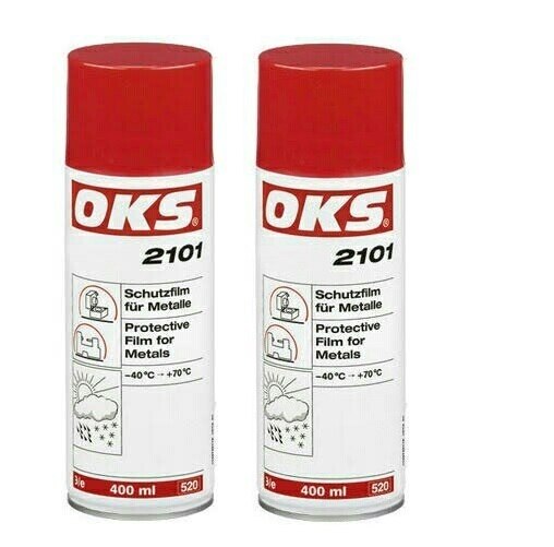
"name": "OKS 500ml Anti-Corrosion Wax Coating Spray Protective Film for Metals, 2101",
"description": "OKS 2101 – Protective Film for Metals, SprayDry and clean protective film fast to handling on a wax basis for metals that can be removed easily and protects against corrosion reliably up to two years.\nAreas of applicationPreservation of bare metal surfaces of all kinds, which are stored for longer periods and are subject to effects of weathering (tropics, ocean, industrial atmosphere)Ideal on-call and storage protection for spare parts with possibility of direction installation\nAdvantages and benefitsHighly effective due to good film-forming propertiesOutstanding corrosion and oxidation protectionNo degreasing prior to commissioning required, as compatible with all lubricantsWaterproof and resistant to weatheringSuitable for all climate zonesNo surface discolouration\nTechnical specificationsOperating temperature: -40 °C → +70 °CSalt spray test: 1,000 h with 50 µm layer thicknessLayer thickness: approx. 10 µm for one-time application\n\nApplications\nFor optimum effect, clean the surfaces. Best way is to clean mechanically first and then with OKS 2610/OKS 2611 universal cleaner. The surfaces must be bright metal and dry. Stir OKS 2100 thoroughly before use. Apply in an evenly thin film to the prepared surfaces, preferably by spraying or dipping, in individual cases also by brush. Shake OKS 2101 well and spray on evenly. Avoid local excesses. Drying times as specified in the following technical data.",
"price": 0.0,
"discountamount": 0.0,
"currencycode": "INR",
"priority": 1000000,
"isfreeshipmentavailable": false,
"shipmentduration": 7,
"_keywords": [
"use",
"10 µ",
"40 °",
"call",
"brush",
"Areas",
"kinds",
"ocean",
"Metals",
"effects",
"1,000 h",
"tropics",
"SprayDry",
"Best way",
"wax basis",
"thin film",
"two years",
"weathering",
"Advantages",
"spare parts",
"possibility",
"bright metal",
"Drying times",
"benefitsHighly",
"local excesses",
"optimum effect",
"longer periods",
"climate zonesNo",
"individual cases",
"storage protection",
"bare metal surfaces",
"lubricantsWaterproof",
"industrial atmosphere",
"+70 °CSalt spray test",
"clean protective film",
"surface discolouration",
"oxidation protectionNo",
"direction installation",
"applicationPreservation",
"following technical data",
"one-time application Applications",
"OKS 2610/OKS 2611 universal cleaner",
"50 µm layer thicknessLayer thickness",
"Technical specificationsOperating temperature",
"good film-forming propertiesOutstanding corrosion",
"OKS 500ml Anti-Corrosion Wax Coating Spray Protective Film"
],
"isarchived": false,
"isavailable": true,
"applicationid": null,
"productindex": 220,
"imageuri": "https://productimages.withfloats.com/actual/62aaf981b2387900016594dc.jpg",
"tileimageuri": "https://productimages.withfloats.com/tile/62aaf981b2387900016594dc.jpg",
"images": null,
"totalqueries": 0,
"gpid": null,
"groupproductid": null,
"createdon": "2022-06-16T09:36:01.513Z",
"updatedon": "2022-06-16T09:36:01.513Z",
"buyonlinelink": null,
"producturl": "http://WWW.SURVEYEQUIPMENT.IN/products/oks-500ml-anti-corrosion-wax-coating-spray-protective-film-for-metals-2101/220",
"availableunits": -1.0,
"iscodavailable": false,
"isprepaidonlineavailable": false,
"maxcodorders": 0,
"maxprepaidonlineorders": 0,
"uniquepaymenturl": null,
"brandname": "OKS",
"category": "CRCSPRAY",
"tags": null,
"variants": false,
"keyspecification": null,
"otherspecifications": null,
"pickupaddressreferenceid": "",
"paymenttype": "None",
"producttype": "products",
"hsncode": null,
"gstslab": 0.0,
"isnotforsale": false
},
{
"_id": "5bced1e73ceede0001be1f11",
"fptag": "SBENTERPRISESTRADINGPUNE",
"merchantname": null,
"customwidgets": null,
"externalsourceid": null,
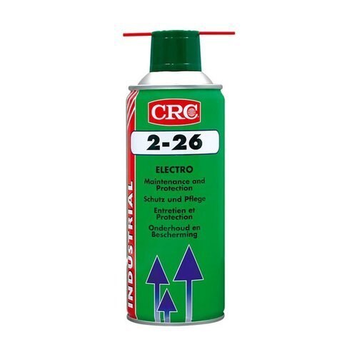
"name": "CRC 2-26 ELECTRICAL CONTACT CLEANER",
"description": "CRC 2-26 ELECTRICAL CONTACT CLEANER\n\nGENERAL DESCRIPTION\n\nMulti-purpose maintenance for electrical equipment\n\nCRC 2-26 is a multi-purpose lubricant preventing electrical and electronic malfunction caused by water penetration, humidity, condensation or corrosion.The stable, low surface tension, high capillary action formula provides great penetrating and spreading power.\nFEATURES\nCleans, lubricates, protects, penetrates, and loosens corrosion\nPrevents corrosion by displacing moisture\nRestores resistance values by reducing current leakage\nProvides precision lubrication by its thin, high dielectric strength, lubricating film\nHelps restore water-damaged electrical equipment\nFrees rusted or seized parts by penetrating under dirt and scale into the finest pores and cracks\nCan be used on all metals and alloys\nWill not harm modern plastics, painted surfaces, coatings and rubbers\nConvenient 360° (upside-down) spray valve for aerosols\nNon-flammable CO2 propellant, giving an active product content of 97%\nSpecifications :\nNSN 6850-00-874-5847\nUSDA CLASS H2\nAPPLICATIONS\n\nHelps to protect, lubricate and restore\nElectrical connectors\nRelays\nCircuit breakers\nTransformers\nSwitch gears\nMotors\nGenerators\nControls\nInstruments\nCommunication assemblies\nElectronics\nAlarm systems\nStarters.\nDIRECTIONS\nSpray light even coat to protect surfaces and to seal out moisture.\nApply liberally to loosen rusted/seized parts; full penetration may require several hours.\nTo displace water, spray wet surfaces until run-off is clear and moisture free. When possible, dip water damaged equipment in CRC 2-26; agitate while submerged; remove and allow to drain. A detailed “CRC water damage restoration” procedure is available upon request.\nTo be removed by CRC Lectra Clean II, hydrocarbon solvents or alkaline degreasing before surface treatment.\nFor application of CRC 2-26 in dipping baths, customers should take care to stir from time to time (to distribute small amounts of deposits) and to prevent excessive evaporation of solvent.When stable emulsions have been formed, the bath should be emptied and cleaned, and the product replaced.\nDo not use on energised equipment; allow solvent to evaporate before energising.This evaporation may take up to 4 hours, depending on surface condition and environment. Use only in well ventilated area.\nA safety data sheet (MSDS) according EU93/112 is available for all CRC products.\nTYPICAL(*) PRODUCT DATA (without propellant)\nAppearance : light amber, clear\nSpecific gravity (@ 20°C) : 0.83\nDistillation range of solvents : 180-250°C\nFreezing point : < -50°C\nFlash point (closed cup) : 75°C\nDynamic viscosity (@ 20°C) : 4 mPa.s\nUltimate film thickness : 2.10-6m (2um), (@ 20°C, after a 24 hr spread)\nMaximum expected coverage : 60 to 100 m2/l, (@ 20°C, after a 24 hr spread)\nSolvent dissipation : 2-4 hrs, (@ 20°C, thin film)\nHeat resistance : 120°C (150°C short time)\nWater displacement (IP 178/61, method B) : pass\nFilm properties (after evaporation of solvent)\nSpecific gravity (@ 20°C) : 0.89\nFalex true load failure : 8900N\n(ASTM D 3233, Proc.A)\nSalt spray resistance (**) : 55 hrs.\n\n\nCRC 2-26 , Electro Cleaner , 500ml Aerosol\n \n\nCRC 2-26 18/8 Steel Power Spray 500 ml\n\n\n\n",
"price": 0.0,
"discountamount": 0.0,
"currencycode": "INR",
"priority": 1000000,
"isfreeshipmentavailable": false,
"shipmentduration": 7,
"_keywords": null,
"isarchived": false,
"isavailable": true,
"applicationid": null,
"productindex": 120,
"imageuri": "https://productimages.withfloats.com/actual/5bced1ead3fdc60001aba2a7.jpg",
"tileimageuri": "https://productimages.withfloats.com/tile/5bced1ead3fdc60001aba2a7.jpg",
"images": null,
"totalqueries": 0,
"gpid": null,
"groupproductid": null,
"createdon": "2018-10-23T07:46:47.341Z",
"updatedon": "2020-04-01T05:19:37.111Z",
"buyonlinelink": null,
"producturl": "http://WWW.SURVEYEQUIPMENT.IN/products/crc-2-26-electrical-contact-cleaner/120",
"availableunits": -1.0,
"iscodavailable": false,
"isprepaidonlineavailable": true,
"maxcodorders": 0,
"maxprepaidonlineorders": 500,
"uniquepaymenturl": null,
"brandname": "",
"category": "Contact Cleaners",
"tags": [
"Contact Cleaners",
"Electrical Contact Cleaner",
"Electronic Component Cleaner",
"CRCSPRAY",
"crc 2-26"
],
"variants": false,
"keyspecification": null,
"otherspecifications": null,
"pickupaddressreferenceid": "5d08ebb3edf0e25c3b8da5d0",
"paymenttype": "AssuredPurchase",
"producttype": "products",
"hsncode": null,
"gstslab": 0.0,
"isnotforsale": false
},
{
"_id": "5bcdaac7e3f0b00001d2a048",
"fptag": "SBENTERPRISESTRADINGPUNE",
"merchantname": null,
"customwidgets": null,
"externalsourceid": null,
"name": "RIS One & RIS Plus",
"description": "RIS One & RIS Plus\nCompact and lightweight ground penetrating radar\n\nRIS ONE and RIS PLUS are the most compact and lightweight antennas available on the market. Gain increased acquisition speed through a high stacking factor as well as improved penetration depth with these single or multi-channel radar control unit.\n\nThe system is supported by antennas operating in 25 MHz to 2.6 GHz frequency range. Custom solutions are available with the IDS GeoRadar control unit, able to power up multiple antennas connected in chain. The antennas feature:\n\nExcellent data quality\nHighest flexibility in multi-channel chain connection\nHigh stacking thereby improving penetration depth\nWireless link to keep track of the survey path and the location of buried objects;\nRIS ONE and RIS PLUS are the ideal solutions for:\n\nUnderground tunnel inspection and condition assessment;\nBedrock and lithological profiling;\nFracture characterisation;\nGround water profiling;\nFoundation and pile measurements;\nBorehole investigations.\nBenefits of the RIS ONE and RIS PLUS include:\n\nLargest antenna gamma in the ground penetrating radar market: A comprehensive set of antennas from 25 MHz to 3.0 GHz, including multi-frequency, borehole and horn antennas ensuring that the right equipment is available for the right application.\nMore than eight hours of autonomous use: IDS GeoRadar’s radar control unit has the lowest power consumption in the ground penetrating radar market.\nFlexible: The multi-channel DAD control unit can drive any IDS Georadar antenna and up to eight antennas in chain connection simultaneously enabling the use of custom configurations.\n\n\n",
"price": 0.0,
"discountamount": 0.0,
"currencycode": "INR",
"priority": 1000000,
"isfreeshipmentavailable": false,
"shipmentduration": 7,
"_keywords": null,
"isarchived": false,
"isavailable": true,
"applicationid": null,
"productindex": 118,
"imageuri": "https://productimages.withfloats.com/actual/5bcdaac884ac000001a78fc7.jpg",
"tileimageuri": "https://productimages.withfloats.com/tile/5bcdaac884ac000001a78fc7.jpg",
"images": null,
"totalqueries": 0,
"gpid": null,
"groupproductid": null,
"createdon": "2018-10-22T10:47:35.934Z",
"updatedon": "2018-10-22T10:47:35.934Z",
"buyonlinelink": null,
"producturl": "http://WWW.SURVEYEQUIPMENT.IN/products/ris-one-ris-plus/118",
"availableunits": -1.0,
"iscodavailable": true,
"isprepaidonlineavailable": false,
"maxcodorders": 0,
"maxprepaidonlineorders": 0,
"uniquepaymenturl": null,
"brandname": null,
"category": null,
"tags": null,
"variants": false,
"keyspecification": null,
"otherspecifications": null,
"pickupaddressreferenceid": "5d08ebb3edf0e25c3b8da5d0",
"paymenttype": "AssuredPurchase",
"producttype": "products",
"hsncode": null,
"gstslab": 0.0,
"isnotforsale": false
},
{
"_id": "5b6b3a9ed682be0552aefe5c",
"fptag": "SBENTERPRISESTRADINGPUNE",
"merchantname": null,
"customwidgets": null,
"externalsourceid": null,
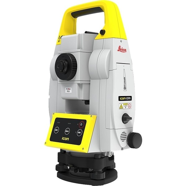
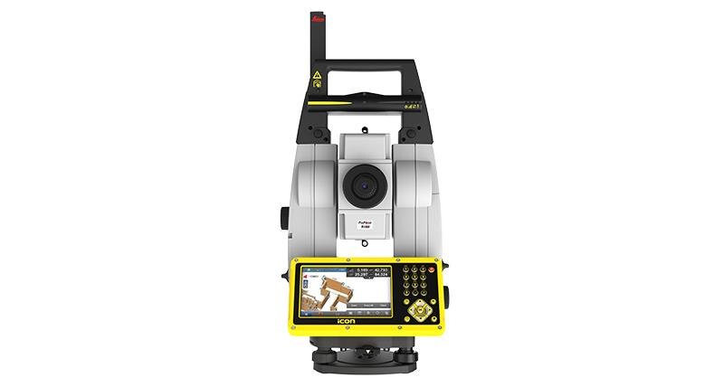
"name": "Leica iCON iCR70 Robotic Total Station",
"description": "The Leica iCON iCR70 facilitates the move from traditional analogue measurement methods to modern digital layout techniques.\n\nThe Leica iCON iCR70 facilitates the move from traditional analogue measurement methods to modern digital layout techniques. Which are a necessity within modern BIM processes and achieves high productivity and accuracies demanded by the building construction industry. \nThe iCR70 can be used by the existing construction workforce with minimal training and does not disrupt existing construction processes.\n\nLayout lines for footings or chalk line for formwork on foundations\nLayout points on binding layer such as pipe insert of cut-outs before pouring concrete\nMEP layout of hanger locations for HVAC and duct work, inserts and slits for sheet metal work\nFully automatic layout routines of points on floor or ceiling lines for pipe wall penetrations\nPrepare and execute construction tasks faster, simpler and more accurately. This robot, tailored to your construction needs, is designed for one-person operation, giving you approximately an eighty per cent increase of productivity over other conventional layout practices. The iCON iCR70 is your best partner for construction layout, helping you to simplify your work on site, be on time and under budget. With a bullet-proof set-up routine, you can be confident that you have the right set up. It guarantees layout efficiency with flexible handling of fully rendered 3D design models in the field.\n\n4-button keypad for simple operation\nFast prism search by patented technology SpeedSearch\nStable data communication with long-range Bluetooth (up tp 400m)\nAligned to modern BIM processes, fully-rendered 3D design models can be easily shared via COnx from the design office to the field crews\nGo Digital \nSwap the traditional measuring methods for new modern technology that is easy-to-use. The iCON iCR70 allows you to move from traditional analogue layout methods, such as tapes, plumb bobs and strings to modern digital layout methods. Using the new construction total station from Leica you can now turn complex designs into reality with ease.\n\nAutonomy\nRich intelligent design data can be handed over form the office to field crews as fully rendered 3D models. The layout objects App. allows you to lay out straight from 3D models be selecting an object, like a column or pipe, simply by tapping on it in the controller. This gives field crews full flexibility selecting their work packages by objects with simple yet powerful filter mechanisms making this ideal for MEP/HVAC construction layout.\n\nAutomated Set Up\nThe Setup Pilot app allows you to remain confident with the most reliable, simple and automated setup routine which requires no user interaction. With it a successful set-up completion is visually communicated, indicating layout can immediately begin at the push of a button.",
"price": 0.0,
"discountamount": 0.0,
"currencycode": "INR",
"priority": 1000000,
"isfreeshipmentavailable": false,
"shipmentduration": 7,
"_keywords": [
"construction layout",
"new modern technology",
"construction workforce",
"automatic layout routines",
"execute construction tasks",
"guarantees layout efficiency",
"field crews full flexibility",
"modern digital layout methods",
"conventional layout practices",
"new construction total station",
"building construction industry",
"modern digital layout techniques",
"traditional analogue layout methods",
"Leica iCON iCR70 Robotic Total Station",
"traditional analogue measurement methods"
],
"isarchived": false,
"isavailable": true,
"applicationid": null,
"productindex": 108,
"imageuri": "https://productimages.withfloats.com/actual/5b6550f8ca14c4050adf1f4e.jpg",
"tileimageuri": "https://productimages.withfloats.com/tile/5b6550f8ca14c4050adf1f4e.jpg",
"images": null,
"totalqueries": 0,
"gpid": null,
"groupproductid": null,
"createdon": "2018-08-04T07:08:40.837Z",
"updatedon": "2018-08-08T18:46:54.54Z",
"buyonlinelink": null,
"producturl": "http://WWW.SURVEYEQUIPMENT.IN/products/leica-icon-icr70-robotic-total-station/108",
"availableunits": -1.0,
"iscodavailable": true,
"isprepaidonlineavailable": false,
"maxcodorders": 0,
"maxprepaidonlineorders": 0,
"uniquepaymenturl": null,
"brandname": null,
"category": "robotictotalstationpune",
"tags": [
"robotictotalstationpune",
"robotictotalstations"
],
"variants": false,
"keyspecification": null,
"otherspecifications": null,
"pickupaddressreferenceid": "5d08ebb3edf0e25c3b8da5d0",
"paymenttype": "AssuredPurchase",
"producttype": "products",
"hsncode": null,
"gstslab": 0.0,
"isnotforsale": false
},
{
"_id": "5b6b3a9dd682be0552aefc94",
"fptag": "SBENTERPRISESTRADINGPUNE",
"merchantname": null,
"customwidgets": null,
"externalsourceid": null,
"name": "Leica LOGiCAT VU Management & Monitoring System",
"description": "Leica LOGiCAT VU Management & Monitoring System\nAnalyse data to reduce utility strikes\n\nBy deploying Leica Digicat cable locators, utility strike rates have reduced dramatically. Now, with the introduction of Leica LOGiCAT VU software, cable locators can be managed and monitored centrally.\nData analysis helps fleet managers to improve cable locator usage and effectiveness during the excavation, increases attention to site safety initiative and enhances product familiarisation training and operator behaviour.\n\nWhat is Leica LOGiCAT VU?\nLeica LOGiCAT VU is a management and monitoring system for analysing data from cable locators.\nCable locators are used to identifying the location of buried utilities; the data enables instruments to record GPS coordinates alongside logged instrument data.\nLeica LOGiCAT VU helps plant, fleet and site managers to evaluate and analyse the data from one or more cable locators.\nThe system gives fleet managers a “view” of how the survey was conducted and if it has been undertaken to best practice. The locator positions can be mapped and presented through Google maps, highlighting the path of the survey.\n\nKey benefits\n\nGreater insight if best practice has been followed\nUsing just the cable locator on its own you could miss 45 up to 50% of dormant utilities which hold the potential of fatal injury. The Fleet Manager can evaluate the Leica LOGiCAT VU data and see how and if the Operator has thoroughly undertaken a site investigate, in all modes and with correct accessories, ensuring adherence to best practice.\n\nData visualisation on satellite images to support interpretation\nGPS enables cable locator to record their coordinates alongside usage data. Leica LOGiCAT VU displays field data overlaid on digital map and images, showing where the operator has undertaken the survey to support post-survey evaluation.Clarity for post utility strike evaluation. \n\nClarity for post utility strike evaluation\nIn the event of a utility strike, the incident report can be produced simply and provide a comprehensive and clear view of instruments usage leading up to the incident. Within the report, colours indicate the survey quality, Red/Poor and Green/Good.\n\nData export to GIS and BIM System\nThe instruments data can be exported to a third party GIS and BIM software enhancing knowledge about subsurface utilities for future excavation activities. ",
"price": 0.0,
"discountamount": 0.0,
"currencycode": "INR",
"priority": 1000000,
"isfreeshipmentavailable": false,
"shipmentduration": 7,
"_keywords": [
"instruments data",
"cable locator usage",
"alongside usage data",
"utility strike rates",
"subsurface utilities",
"Leica LOGiCAT VU data",
"enables cable locator",
"site safety initiative",
"data enables instruments",
"Leica LOGiCAT VU software",
"Leica LOGiCAT VU Management",
"post utility strike evaluation",
"deploying Leica Digicat cable locators",
"enhances product familiarisation training"
],
"isarchived": false,
"isavailable": true,
"applicationid": null,
"productindex": 88,
"imageuri": "https://productimages.withfloats.com/actual/5b45a062d3d93d01c4f0ed4e.jpg",
"tileimageuri": "https://productimages.withfloats.com/tile/5b45a062d3d93d01c4f0ed4e.jpg",
"images": null,
"totalqueries": 0,
"gpid": null,
"groupproductid": null,
"createdon": "2018-07-11T06:15:05.058Z",
"updatedon": "2018-08-08T18:46:53.924Z",
"buyonlinelink": null,
"producturl": "http://WWW.SURVEYEQUIPMENT.IN//leica-logicat-vu-management-monitoring-system/88",
"availableunits": -1.0,
"iscodavailable": true,
"isprepaidonlineavailable": false,
"maxcodorders": 0,
"maxprepaidonlineorders": 0,
"uniquepaymenturl": null,
"brandname": null,
"category": null,
"tags": null,
"variants": false,
"keyspecification": null,
"otherspecifications": null,
"pickupaddressreferenceid": "5d08ebb3edf0e25c3b8da5d0",
"paymenttype": "AssuredPurchase",
"producttype": "products",
"hsncode": null,
"gstslab": 0.0,
"isnotforsale": false
},
{
"_id": "5b6b3a9dd682be0552aefcbd",
"fptag": "SBENTERPRISESTRADINGPUNE",
"merchantname": null,
"customwidgets": null,
"externalsourceid": null,
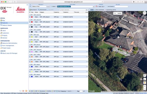
"name": "Leica DX Manager Mapping",
"description": "Leica DX Manager Mapping\nOne central dashboard for all the Leica Geosystems Detection solutions\n\nLeica DX Manager is the only enterprise grade utility mapping solution on the market. A unique cloud-powered solution that delivers unparalleled performance. Manage projects, tasks and spatial data from one central dashboard for all the Leica Geosystems Detection solutions.\n\nUpdate drawings, raw data, location pictures, data layers and mobile forms remotely and in a period of real time operate at an enterprise level rather than having to manually update individual users one at a time. With the Leica DX Manager, you have all dashboards, status updates and project management tools in one platform. Now, project managers can track field operations in real time and make critical decisions with a broader understanding of the current situation.\n\nKey benefits\n\nSimplified processes\nImprovement of data quality and accuracy\nConsistent data collection methods\nIntegration of DS2000, cable locators and asset mapping data\nWorkflows to maintain data integrity\nManage the whole workflow\n\nShare data to all devices and users within your organisation.\n\nAnalyse maps result\nVisualise on online maps\nFilter on users, within date ranges or any attributes\nExport to standard GIS and CAD formats\nShare data to your clients\nAn easy-to-use online portal allows management of all aspects of documenting utility location tasks. The user can switch between street view, satellite imagery and cartographic street maps. Field acquired survey data becomes instantly available and can be accessed by users anytime and anywhere.\n\nUtility detection integration\n\nLeica DX Manager integrates the entire Leica Geosystems Detection portfolio into a simple survey workflow, empowering the user to apply locator depth measurements to GNSS measurements. The result is a seamless fusion of both worlds – with all locator related data reviewable either in Leica DX Manager or any export format.\n\nLocate the utility\nMeasure the depth\nAll location data is sent directly to the Leica DX Field application on the GNSS device\nIt triggers the GNSS measurement on the mapping device\nAll data is integrated into the features metadata\nMaximum user experience and productivity\n\nLeica DX Field mobile app is designed for productivity and maximum user experience and built for enforcing data quality and accuracy. \n\nEasy mapping / surveying of assets\nSmart mobile forms\nImmediate visualisation on map\nMetadata collection\nAutomatic sync with Cloud\nFull offline capabilities\nMake sure your measured data always matches your quality expectations (up to centimetres with RTK) as Leica DX Manager notifications steadily monitor the system parameters. All quality parameters are stored as metadata. Next to the utility mapping aspect, it delivers work orders, time tracking and document management.",
"price": 0.0,
"discountamount": 0.0,
"currencycode": "INR",
"priority": 1000000,
"isfreeshipmentavailable": false,
"shipmentduration": 7,
"_keywords": [
"data quality",
"location data",
"data collection",
"data reviewable",
"survey data becomes",
"DX Field mobile app",
"Leica DX Manager Mapping",
"cartographic street maps",
"Leica DX Field application",
"update individual users one",
"Leica DX Manager notifications",
"apply locator depth measurements",
"enterprise grade utility mapping solution",
"entire Leica Geosystems Detection portfolio"
],
"isarchived": false,
"isavailable": true,
"applicationid": null,
"productindex": 89,
"imageuri": "https://productimages.withfloats.com/actual/5b459fa2f3579911b41e9cda.jpg",
"tileimageuri": "https://productimages.withfloats.com/tile/5b459fa2f3579911b41e9cda.jpg",
"images": null,
"totalqueries": 0,
"gpid": null,
"groupproductid": null,
"createdon": "2018-07-11T06:11:47.283Z",
"updatedon": "2018-08-08T18:46:53.959Z",
"buyonlinelink": null,
"producturl": "http://WWW.SURVEYEQUIPMENT.IN//leica-dx-manager-mapping/89",
"availableunits": -1.0,
"iscodavailable": true,
"isprepaidonlineavailable": false,
"maxcodorders": 0,
"maxprepaidonlineorders": 0,
"uniquepaymenturl": null,
"brandname": null,
"category": "GPR",
"tags": [
"GPR",
"Detection and underground mapping solution",
"Leica DX Manager Mapping"
],
"variants": false,
"keyspecification": null,
"otherspecifications": null,
"pickupaddressreferenceid": "5d08ebb3edf0e25c3b8da5d0",
"paymenttype": "AssuredPurchase",
"producttype": "products",
"hsncode": null,
"gstslab": 0.0,
"isnotforsale": false
},
{
"_id": "5b6b3a9dd682be0552aefc2a",
"fptag": "SBENTERPRISESTRADINGPUNE",
"merchantname": null,
"customwidgets": null,
"externalsourceid": null,
"name": "Leica iCON iCR80 Robotic Total Station",
"description": "Leica iCON iCR80 Robotic Total Station\nAchieve more layout points all day every day\n\nThe Leica iCON iCR80 construction total station keeps its ‘eye’ on only one thing: the user’s target. Layout more points per day thanks to ATRplus, the most robust automated-aiming, lock and re-lock technology in the market. iCR80 is especially useful in congested sites with many distractions, such as reflections, machines and people moving around. Challenging and changing site conditions should not be an obstacle.\n\nThe iCON iCR80 allows users to:\n\nLayout lines for footings or chalk line for formwork on foundation\nLayout points on blinding layer, such as pipe insert or cut-outs before pouring concrete\nLayout true design objects based on federated and enriched models\nMEP layout of wall penetrations for pipes, hanger locations for HVAC and duct work, inserts and slits for sheet metal work\nControl a wide variety of construction machines, such as curb and gutter or milling machines, asphalt or concrete pavers, and graders or dozers\nThe iCON iCR80 guarantees layout efficiency with the most reliable, simple and automatic set up procedure, industry-leading prism lock, and flexible handling of fully rendered 3D design models in the field. This sophisticated, one-person total station offers an ‘all-in-one’ solution for every purpose – especially the difficult ones, allowing you to speed up your workflow.\n\nThe iCON iCR80 total station is fully compatible with:\n\nLeica iCON CC80 tablet with an enhanced version of the tailored iCON build construction field software\nLeica Infinity office software and Leica ConX for online sharing of data between the office and the site\nThe iCON iCR80 features:\n\nFaster prism search by patented technology, PowerSearch\nStable data communication with long-range Bluetooth® (up to 400m)\nEasy hand-over control from pole to machine and vice versa\nATRplus technology, maximising the total station’s ability to remain locked on your target for highest point-to-point layout speed\n“Tune out targets” feature to ignore other distractions in the field\nFastest re-lock in case of interrupted line of sight\n\nLowest total cost of ownership\n\nLeica Geosystems construction total stations have a high value, giving you the lowest total cost of ownership. Its resilient hardware allows for longevity and reliability, giving you many years of rough usage in the most demanding environments. Its level of quality ensures your data remains accurate, lowers downtime and keeps your productivity high in all environments and conditions. Invest in the smarter total station solution and reap massive long-term rewards.\n\nNever loose lock\n\nThe iCR80 comes with automated aiming ATRplus, which intelligently and automatically detects environmental conditions, such as light, dust, rain and other site conditions. The new ATRplus, lock and re-lock technology speeds aiming and following of targets and delivers accurate measurements independent of user aiming or site conditions. Even when used on busy construction sites, the down time resulting from loss of lock is minimal, speeding up significantly your layout task.\n\n\n",
"price": 0.0,
"discountamount": 0.0,
"currencycode": "INR",
"priority": 1000000,
"isfreeshipmentavailable": false,
"shipmentduration": 7,
"_keywords": [
"iCON CC80 tablet",
"iCON iCR80 features",
"construction machines",
"data remains accurate",
"busy construction sites",
"iCON iCR80 total station",
"environmental conditions",
"Infinity office software",
"iCON build construction field",
"smarter total station solution",
"Leica iCON iCR80 Robotic Total Station",
"Geosystems construction total stations",
"iCON iCR80 guarantees layout efficiency",
"delivers accurate measurements independent",
"Leica iCON iCR80 construction total station"
],
"isarchived": false,
"isavailable": true,
"applicationid": null,
"productindex": 83,
"imageuri": "https://productimages.withfloats.com/actual/5b2df1bcdfeea305b4fb1db1.jpg",
"tileimageuri": "https://productimages.withfloats.com/tile/5b2df1bcdfeea305b4fb1db1.jpg",
"images": null,
"totalqueries": 0,
"gpid": null,
"groupproductid": null,
"createdon": "2018-06-23T07:07:40.566Z",
"updatedon": "2018-08-08T18:46:53.535Z",
"buyonlinelink": null,
"producturl": "http://WWW.SURVEYEQUIPMENT.IN/products/leica-icon-icr80-robotic-total-station/83",
"availableunits": -1.0,
"iscodavailable": true,
"isprepaidonlineavailable": false,
"maxcodorders": 0,
"maxprepaidonlineorders": 0,
"uniquepaymenturl": null,
"brandname": null,
"category": "leicatotalstations",
"tags": [
"leicatotalstations",
"sokkiatotalstation",
"Robotic Total Station"
],
"variants": false,
"keyspecification": null,
"otherspecifications": null,
"pickupaddressreferenceid": "5d08ebb3edf0e25c3b8da5d0",
"paymenttype": "AssuredPurchase",
"producttype": "products",
"hsncode": null,
"gstslab": 0.0,
"isnotforsale": false
},
{
"_id": "5b6b3a9bd682be0552aef91d",
"fptag": "SBENTERPRISESTRADINGPUNE",
"merchantname": null,
"customwidgets": null,
"externalsourceid": null,
"name": "RIS One & RIS Plus",
"description": "RIS One & RIS Plus\n\nCompact and lightweight ground penetrating radar\n\nRIS ONE and RIS PLUS are the most compact and lightweight antennas available on the market. Gain increased acquisition speed through a high stacking factor as well as improved penetration depth with these single or multi-channel radar control unit.\n\nThe system is supported by antennas operating in 25 MHz to 2.6 GHz frequency range. Custom solutions are available with the IDS GeoRadar control unit, able to power up multiple antennas connected in chain. The antennas feature:\n\nExcellent data quality\nHighest flexibility in multi-channel chain connection\nHigh stacking thereby improving penetration depth\nWireless link to keep track of the survey path and the location of buried objects;\nRIS ONE and RIS PLUS are the ideal solutions for:\n\nUnderground tunnel inspection and condition assessment;\nBedrock and lithological profiling;\nFracture characterisation;\nGround water profiling;\nFoundation and pile measurements;\nBorehole investigations.\nBenefits of the RIS ONE and RIS PLUS include:\n\nLargest antenna gamma in the ground penetrating radar market: A comprehensive set of antennas from 25 MHz to 3.0 GHz, including multi-frequency, borehole and horn antennas ensuring that the right equipment is available for the right application.\nMore than eight hours of autonomous use: IDS GeoRadar’s radar control unit has the lowest power consumption in the ground penetrating radar market.\nFlexible: The multi-channel DAD control unit can drive any IDS Georadar antenna and up to eight antennas in chain connection simultaneously enabling the use of custom configurations.",
"price": 0.0,
"discountamount": 0.0,
"currencycode": "INR",
"priority": 1000000,
"isfreeshipmentavailable": false,
"shipmentduration": 7,
"_keywords": [
"eight antennas",
"DAD control unit",
"antennas feature",
"chain connection",
"multiple antennas",
"penetration depth",
"antennas available",
"GHz frequency range",
"IDS Georadar antenna",
"high stacking factor",
"condition assessment",
"custom configurations",
"lithological profiling",
"IDS GeoRadar control unit"
],
"isarchived": false,
"isavailable": true,
"applicationid": null,
"productindex": 40,
"imageuri": "https://productimages.withfloats.com/actual/5aefe4dc85c6af01dc0af42f.jpg",
"tileimageuri": "https://productimages.withfloats.com/tile/5aefe4dc85c6af01dc0af42f.jpg",
"images": null,
"totalqueries": 0,
"gpid": null,
"groupproductid": null,
"createdon": "2018-05-07T05:32:12.749Z",
"updatedon": "2018-08-08T18:46:51.263Z",
"buyonlinelink": null,
"producturl": "http://WWW.SURVEYEQUIPMENT.IN/products/ris-one-ris-plus/40",
"availableunits": -1.0,
"iscodavailable": true,
"isprepaidonlineavailable": false,
"maxcodorders": 0,
"maxprepaidonlineorders": 0,
"uniquepaymenturl": null,
"brandname": null,
"category": null,
"tags": null,
"variants": false,
"keyspecification": null,
"otherspecifications": null,
"pickupaddressreferenceid": "5d08ebb3edf0e25c3b8da5d0",
"paymenttype": "AssuredPurchase",
"producttype": "products",
"hsncode": null,
"gstslab": 0.0,
"isnotforsale": false
},
{
"_id": "5b6b3a99d682be0552aef6ed",
"fptag": "SBENTERPRISESTRADINGPUNE",
"merchantname": null,
"customwidgets": null,
"externalsourceid": null,
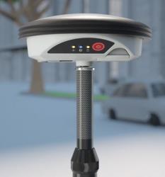
"name": "Leica Zeno GG04 plus Smart Antenna",
"description": "Leica Zeno GG04 plus Smart Antenna for high accuracy everywhere\nUse your own device and get high accuracy everywhere\n\nCollecting high-accuracy geospatial data on your smartphone or tablet has never been easier.\n\nPair with all existing Leica Zeno handhelds and a wide range of Android, Apple or Windows® smart devices, to bring cutting-edge GNSS technology and industry-leading 555 channel tracking power to your hands.\n\nThe rugged, flexible and easy-to-use smart antenna utilises RTK technology and can now apply Precise Point Positioning (PPP). This makes high-accuracy data collection possible in real-time even in the most demanding of locations without the need for a mobile data connection.\n\nWith its compact, lightweight design and IP68 durability, you can work longer in all conditions - the world of high accuracy mapping comes to life at your fingertips.\n\nSmart device independence\n\nUse your existing smartphone or tablet\nAvailable for Android, Apple and Windows®\nBluetooth® connection ensures cable free operation\nEnhanced tracking performance\n\n555 channels support an increased number of satellites\nState-of-the-art GNSS technology\nReady for future GNSS developments\nPrecise point positioning (PPP)\n\nAchieve high accuracy data collection without a mobile data connection\nAvailable anywhere in the world, anytime\nRemoves reliance on post processing\nExtensive software support\n\nUse with your favourite data collection apps and software\nNo development efforts required\nProvides NMEA messages output on different Bluetooth® ports to allow reviewing and storing of GNSS metadata information\nBuilt to last\n\nIP68 protection ensures water and dustproofing\nContinuous performance in all environments\nAll day battery life\nLeica Geosystems compatible software\n\nZeno Mobile\nZeno Field, Zeno Connect\nZeno Office\nMobileMatriX",
"price": 0.0,
"discountamount": 0.0,
"currencycode": "INR",
"priority": 1000000,
"isfreeshipmentavailable": false,
"shipmentduration": 7,
"_keywords": [
"Leica Zeno GG04",
"GNSS technology",
"geospatial data",
"channels support",
"lightweight design",
"development efforts",
"Leica Zeno handhelds",
"NMEA messages output",
"high accuracy mapping",
"Geosystems compatible",
"data collection possible",
"Precise Point Positioning",
"high accuracy data collection",
"favourite data collection apps",
"smart antenna utilises RTK technology"
],
"isarchived": false,
"isavailable": true,
"applicationid": null,
"productindex": 11,
"imageuri": "https://productimages.withfloats.com/actual/5ae6f1a2b303650b7cd1693f.jpg",
"tileimageuri": "https://productimages.withfloats.com/tile/5ae6f1a2b303650b7cd1693f.jpg",
"images": null,
"totalqueries": 0,
"gpid": null,
"groupproductid": null,
"createdon": "2018-04-30T10:36:19.854Z",
"updatedon": "2018-08-08T18:46:49.78Z",
"buyonlinelink": null,
"producturl": "http://WWW.SURVEYEQUIPMENT.IN//leica-zeno-gg04-plus-smart-antenna/11",
"availableunits": -1.0,
"iscodavailable": true,
"isprepaidonlineavailable": false,
"maxcodorders": 0,
"maxprepaidonlineorders": 0,
"uniquepaymenturl": null,
"brandname": null,
"category": null,
"tags": null,
"variants": false,
"keyspecification": null,
"otherspecifications": null,
"pickupaddressreferenceid": "5d08ebb3edf0e25c3b8da5d0",
"paymenttype": "AssuredPurchase",
"producttype": "products",
"hsncode": null,
"gstslab": 0.0,
"isnotforsale": false
}
],
"hasmoreitems": false,
"isapirequest": false,
"totalresults": 27,
"query": null,
"floatingpoint": null
}