Preview

This is your website preview.

Currently it only shows your basic business info. Start adding relevant business details such as description, images and products or services to gain your customers attention by using Boost 360 android app / iOS App / web portal.

SBENTERPRISESTRADINGPUNE 5abfbf1e7c88bb04a4d0fcc7 Products https://www.surveyequipment.in
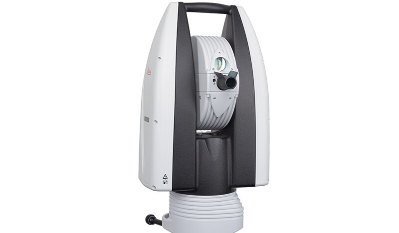
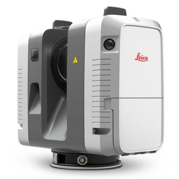
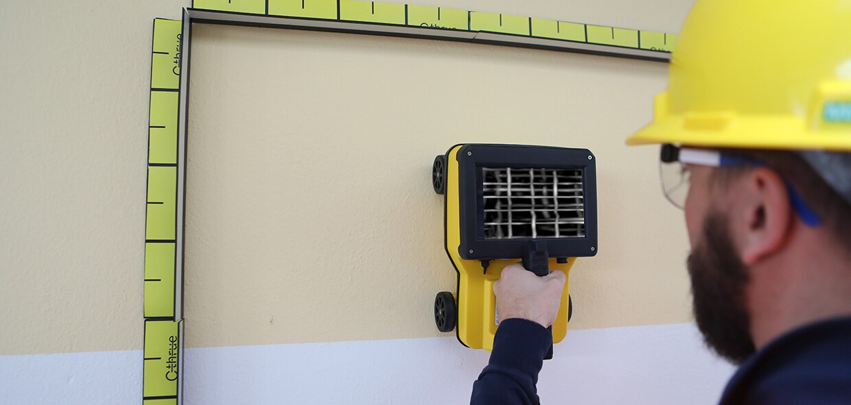
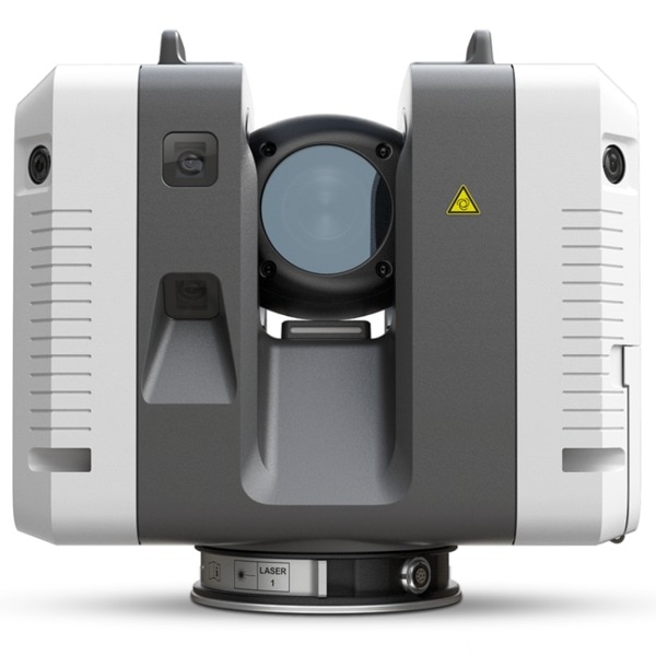
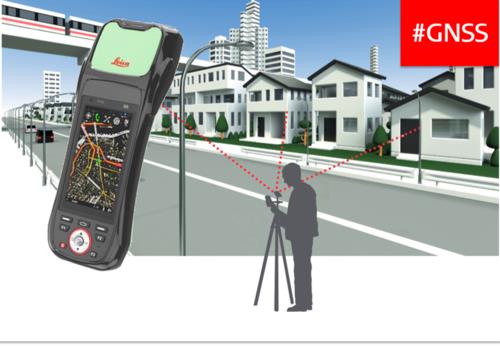
{ "products": [ { "_id": "5b7ffb95147e16051e773f27", "fptag": "SBENTERPRISESTRADINGPUNE", "merchantname": null, "customwidgets": null, "externalsourceid": null, "name": "IDS GeoRadar - Stream C", "description": "IDS GeoRadar - Stream C\nThe compact array solution for accurate 3D utility mapping.\nHigh quality, High productivity and Simple to Use compact radar system for real time underground surveys.\n\nStream C is the compact array solution for real-time 3D mapping of underground utilities and features. Thanks to increased level of accuracy provided by a massive antenna array, Stream C is able to automatically detect pipes and cables.\n\nDaily use of Stream C is aided by ergonomic features including electronic ride height adjustment, options to tow manually or with a small vehicle and a motor assisted drive wheel.\n\nSTREAM C BENEFITS\n\nHigh Productivity: surveys only need to be performed in one direction to ensure optimal detection for both longitudinal and transversal pipes.\nNo advanced training needed: the system automatically detects and locates the position of pipes in real time and displays them on screen.\nReduced user fatigue: thanks to electronic ride height adjustment and a motor assisted drive wheel.\nFacilitates large surveys: the system can be towed manually or with a small vehicle, increasing the acquisition speed (up to 6 km/h).\n\nSTREAM C FEATURES\n\nMassive array of 34 antennas in two polarizations: this enables an accurate 3D reconstruction of the underground utility network to be created in a single scan.\nAutomatic Pipe Detection (APD): real-time automatic detection of buried pipes and cables\nCompact size: Stream C’s small dimensions enable it to survey areas inaccessible to larger array systems while maintaining the same accuracy.\nRobust construction: built to the highest standards and with hardwearing materials so that it can be used in harsh, demanding environments.\n3D radar tomography: real-time tomography on a GPS or total station assisted cartographic background. • Professional subsurface survey: pipes, cables and buried objects can be automatically transferred to CAD and GIS formats allowing a complete subsurface GIS based digital map to be quickly produced.\n\nBenefits of Stream EM include:\n\nImproved management of underground utility design, relocation and coordination;\nCost and time reductions: No need to block traffic or perform surveys at night;\nIncrease in accuracy with a detection accuracy of as little as 5 cm;\nIncrease productivity and have the ability to detect every buried target;\nHighly modular structure allows it to be reconfigured to map sidewalks and difficult to access areas\n\nReal time software for advanced viewing \nStream EM is supplied with the OneVsion and GRED HD 3D CAD software suites.", "price": 0.0, "discountamount": 0.0, "currencycode": "INR", "priority": 1000000, "isfreeshipmentavailable": false, "shipmentduration": 7, "_keywords": [ "detection accuracy", "accurate 3D utility", "real time underground", "massive antenna array", "underground utilities", "compact array solution", "small dimensions enable", "complete subsurface GIS", "Use compact radar system", "survey areas inaccessible", "underground utility design", "accurate 3D reconstruction", "underground utility network", "GRED HD 3D CAD software suites", "Professional subsurface survey" ], "isarchived": false, "isavailable": true, "applicationid": null, "productindex": 111, "imageuri": "", "tileimageuri": "", "images": null, "totalqueries": 0, "gpid": null, "groupproductid": null, "createdon": "2018-08-24T12:35:33.806Z", "updatedon": "2018-08-24T12:35:33.806Z", "buyonlinelink": null, "producturl": "http://WWW.SURVEYEQUIPMENT.IN/products/ids-georadar-stream-c/111", "availableunits": -1.0, "iscodavailable": true, "isprepaidonlineavailable": false, "maxcodorders": 0, "maxprepaidonlineorders": 0, "uniquepaymenturl": null, "brandname": null, "category": null, "tags": null, "variants": false, "keyspecification": null, "otherspecifications": null, "pickupaddressreferenceid": "5d08ebb3edf0e25c3b8da5d0", "paymenttype": "AssuredPurchase", "producttype": "products", "hsncode": null, "gstslab": 0.0, "isnotforsale": false }, { "_id": "65c5dc636523861ec4890fc9", "fptag": "SBENTERPRISESTRADINGPUNE", "merchantname": null, "customwidgets": null, "externalsourceid": null, "name": "GIM 120 PROFESSIONALDIGITAL INCLINOMETER", "description": "GIM 120 PROFESSIONALDIGITAL INCLINOMETER\nLonger for maximum precisionMeasures precise tilts in degrees, percent or millimetres/metresDirection arrows and audible signals at 0° and 90° for easy alignmentMeasured values automatically turn on the display when working overhead\n��️ Bosch GIM 120 PROFESSIONAL - Elevate Precision to Perfection! ��\nUpgrade your toolkit with the Bosch GIM 120 PROFESSIONAL, your go-to solution for unparalleled precision in measurements. ��\n✨ Key Features:\nPinpoint Accuracy: Achieve flawless results with the GIM 120's advanced measurement technology.Compact Design: Take precision on the go - the sleek, portable design ensures convenience on any job site.Durability: Built to withstand the rigors of professional use, the GIM 120 is your reliable companion for the long haul.�� Why Choose Bosch?Trusted by professionals worldwide, Bosch is synonymous with quality and innovation. The GIM 120 PROFESSIONAL continues this legacy, offering cutting-edge technology in a compact, durable package.\n�� Take Your Craft to New Heights!Whether you're a carpenter, electrician, or DIY enthusiast, the Bosch GIM 120 PROFESSIONAL is a game-changer. Elevate your precision game and achieve unparalleled results in every project.", "price": 0.0, "discountamount": 0.0, "currencycode": "INR", "priority": 1000000, "isfreeshipmentavailable": false, "shipmentduration": 7, "_keywords": [ "✨", "0°", "go", "job", "site", "Craft", "legacy", "quality", "degrees", "project", "percent", "display", "toolkit", "solution", "carpenter", "long haul", "innovation", "Durability", "Perfection", "convenience", "electrician", "New Heights", "millimetres", "measurements", "game-changer", "Key Features", "precise tilts", "professionals", "precision game", "DIY enthusiast", "Compact Design", "audible signals", "flawless results", "professional use", "Elevate Precision", "Pinpoint Accuracy", "reliable companion", "unparalleled results", "metresDirection arrows", "sleek, portable design", "unparalleled precision", "cutting-edge technology", "The GIM 120 PROFESSIONAL", "compact, durable package", "maximum precisionMeasures", "Bosch GIM 120 PROFESSIONAL", "easy alignmentMeasured values", "advanced measurement technology", "GIM 120 PROFESSIONALDIGITAL INCLINOMETER" ], "isarchived": false, "isavailable": true, "applicationid": null, "productindex": 234, "imageuri": "https://productimages.withfloats.com/actual/65c5dc65f71fb2d544cd4eaf.jpg", "tileimageuri": "https://productimages.withfloats.com/tile/65c5dc65f71fb2d544cd4eaf.jpg", "images": null, "totalqueries": 0, "gpid": null, "groupproductid": null, "createdon": "2024-02-09T08:03:47.25Z", "updatedon": "2024-02-09T08:03:47.25Z", "buyonlinelink": null, "producturl": "http://WWW.SURVEYEQUIPMENT.IN/products/gim-120-professionaldigital-inclinometer/234", "availableunits": -1.0, "iscodavailable": false, "isprepaidonlineavailable": false, "maxcodorders": 0, "maxprepaidonlineorders": 0, "uniquepaymenturl": null, "brandname": "BOSCH ", "category": "CROSSLINELESER", "tags": null, "variants": false, "keyspecification": null, "otherspecifications": null, "pickupaddressreferenceid": "", "paymenttype": "None", "producttype": "products", "hsncode": null, "gstslab": 0.0, "isnotforsale": false }, { "_id": "5d4e66ac5c6ebf0001143d5b", "fptag": "SBENTERPRISESTRADINGPUNE", "merchantname": null, "customwidgets": null, "externalsourceid": null, "name": "Leica Absolute Tracker AT960", "description": "Leica Absolute Tracker AT960\nLaser Tracker Systems\nHigh-accuracy probing, scanning and reflector measurement for large-volume industrial applications\n\n\n\nHigh-performance 6DoF laser tracker technology in an ultra-portable and easy-to-use form factor.\n\n\n\nThe Leica Absolute Tracker AT960 is a robust, all-in-one laser tracker that fits in a single flight case. Offering high-speed dynamic measurement as standard, it is a complete solution for six degrees of freedom (6DoF) probing, scanning and automated inspection as well as reflector measurement.\n\n\nA new generation of portable CMM system based on proven technology, the AT960 brings together the 6DoF functionality introduced with the Leica Absolute Tracker AT901 and the portability and usability delivered by the compact Leica Absolute Tracker AT403. The result is a highly-sophisticated yet easy-to-use large-volume measurement solution weighing less than 14 kilograms.\n\nThe AT960 laser tracker can be transported easily, unpacked quickly and powered up in minutes to deliver high-performance measurement almost anywhere. Dynamic features and flexible functionality give users absolute speed, accuracy and portability.\n\nFeaturing wireless communication and a battery operation option, the integrated-technology design of the AT960 makes lengthy setup a thing of the past. The Leica Absolute Interferometer (AIFM) enables accurate high-speed measurement to a moving target while the innovative PowerLock function ensures an interrupted beam is instantly re-established without user intervention, reducing operator workload and training requirements. Intuitive touch-screen controls minimise the potential for user error, saving time, effort and money. Check and compensation architecture means basic adjustments can be made in the field, while robust design guarantees on-specification operations with minimal calibration and servicing\n\nWhen combined with the Real-Time Feature Pack and Leica T-Mac, the AT960 evolves into a laser tracker solution that meets the deterministic measurement data-delivery requirements of high-end automated installations. Built on the industry-proven EtherCAT protocol, it enables the delivery of 6DoF measurement data with accurate timestamps at an output rate of up to 1000 Hertz. Known as 7DoF measurement data, this enables real-time machine control within even highly-dynamic robotic setups.\n\nWith a measurement volume of up to 160 metres in diameter, the AT960 is compatible with Leica T-Probe, Leica T-Mac, Leica T-Scan 5 and Leica Absolute Scanner technology. This flexibility allows it to cater to a wide variety of inspection applications – from quality lab to in-line; from in the factory to in the field – ensuring users have the right tool for any measurement challenge.\n\n", "price": 0.0, "discountamount": 0.0, "currencycode": "INR", "priority": 1000000, "isfreeshipmentavailable": false, "shipmentduration": 7, "_keywords": null, "isarchived": false, "isavailable": true, "applicationid": null, "productindex": 150, "imageuri": "https://productimages.withfloats.com/actual/5d4e66adb409c900010d17d6.jpg", "tileimageuri": "https://productimages.withfloats.com/tile/5d4e66adb409c900010d17d6.jpg", "images": null, "totalqueries": 0, "gpid": null, "groupproductid": null, "createdon": "2019-08-10T06:39:40.851Z", "updatedon": "2019-08-10T06:39:40.851Z", "buyonlinelink": null, "producturl": "http://WWW.SURVEYEQUIPMENT.IN/products/leica-absolute-tracker-at960/150", "availableunits": -1.0, "iscodavailable": false, "isprepaidonlineavailable": false, "maxcodorders": 0, "maxprepaidonlineorders": 0, "uniquepaymenturl": null, "brandname": "Leica ", "category": "", "tags": [ "laser tracker" ], "variants": false, "keyspecification": null, "otherspecifications": null, "pickupaddressreferenceid": "", "paymenttype": "None", "producttype": "products", "hsncode": null, "gstslab": 0.0, "isnotforsale": false }, { "_id": "5c18b8e4ead682000197c724", "fptag": "SBENTERPRISESTRADINGPUNE", "merchantname": null, "customwidgets": null, "externalsourceid": null, "name": "Leica RTC360 Laser Scanner", "description": "Leica RTC360 Laser Scanner\nFast, agile and precise 3D reality capture solution\nFast\nFAST\nThe Leica RTC360 laser scanner makes 3D reality capture faster than ever before. With a measuring rate of up to 2 million points per second and advanced HDR imaging system, the creation of colored 3D point clouds can be completed in under 2 minutes. Plus, automated targetless field registration (based on VIS technology) and the seamless, automated transfer of data from site to office reduce time spent in the field and further maximize productivity.\n\nAgile\nAgile\nSmall and lightweight, the Leica RTC360 scanner’s portable design and collapsible tripod mean it’s compact enough to fit into most backpacks, ready to be taken anywhere. Once on-site, easy-to-use one-button operation makes for fast, hassle-free scanning.\n\nPrecise\nPrecise\nLow noise data allows for better images, resulting in crisp, high-quality scans that are rich in detail and ready for use in a range of applications. Combined with Cyclone FIELD 360 software for automated registration in the field, the Leica RTC360 scanner offers outstanding precision that can be checked on-site.\n\nLeica RTC360 Product Specifications\n3D Laser Scanner\tHigh-speed 3D laser scanner with integrated HDR spherical imaging system and Visual Inertial System (VIS) for real time registration\nData acquisition\t< 2 min for complete full dome scan and spherical HDR image at 6mm @ 10m resolution\nReal time registration\tAutomatic point cloud alignment based on real time tracking of scanner movement between setups based on Visual Inertial System (VIS) by video-enhanced inertial measurement unit\nDouble scan\tAutomatic removal of moving objects\nDistance measurement\tHigh-speed, high dynamic time of flight enhanced by Waveform Digitizing (WFD) technology\nLaser Class\t1 (in accordance with IEC 60825-1:2014), 1550nm (invisible)\nField of view\t360° (horizontal) / 300° (vertical)\nRange\tMin. 0.5 - up to 130 m\nSpeed\tUp to 2‘000‘000 pts / sec\nResolution\t3 user selectable settings (3/6/12mm @ 10m)\nAccuracy\tAngular accuracy 18”\nRange accuracy 1.0 mm + 10 ppm \n3D point accuracy \n1.9 mm @ 10 m \n2.9 mm @ 20 m \n5.3 mm @ 40 m\nRange noise\t0.4 mm @ 10 m, 0.5 mm @ 20 m\nCamera\t36 MP 3-camera system captures \n432 MPx raw data for calibrated \n360° x 300° spherical image\nSpeed\t1 minute for full spherical HDR image at any light condition\nHDR\tAutomatic, 5 brackets\nVisual Inertial System\tVideo enhanced inertial measuring system to track movement of the scanner position relative to the previous setup in real time\nTilt\tIMU based, Accuracy: 3‘ for any tilt\nAdditional sensors\tAltimeter, Compass, GNSS\nOn scanner\tTouch-screen control with finger touch, full color WVGA graphic display 480 x 800 pixels\nMobile devices\tLeica Cyclone FIELD 360 app for iPad or Android tablets including:\n- Remote control of scan functions\n- 2D & 3D data viewing\n- Tagging\n- Automatic alignment of scans\nWireless\tIntegrated wireless LAN (802.11 b/g/n)\nData storage\tLeica MS256, 256GB exchangeable USB 3.0 flash drive\nHousing\tAluminium frame and sidecovers\nDimensions\t120mm x 240mm x 230mm / 4.7‘‘ x 9.4‘‘ x 9.1\nWeight\t5.35 kg / 11.7 lbs, nominal (w/o batteries)\nMounting mechanism\tQuick mounting on 5/8“ stub on lightweight tripod / optional tribrach adapter / survey tribrach adapter available\nInternal battery\t2 x Leica GEB361 internal, rechargeable Li-Ion batteries.\nDuration: Typically up to 4 hours\nWeight: 340 g per battery\nExternal\tLeica GEV282 AC adapter\nOperating temperature\t5° to +40° C\nStorage temperature\t40° to +70° C\nDust/Humidity\tSolid particle/liquid ingress protection IP54", "price": 0.0, "discountamount": 0.0, "currencycode": "INR", "priority": 1000000, "isfreeshipmentavailable": false, "shipmentduration": 7, "_keywords": null, "isarchived": false, "isavailable": true, "applicationid": null, "productindex": 132, "imageuri": "https://productimages.withfloats.com/actual/5c18b8e5c4c56a0001280ffa.jpg", "tileimageuri": "https://productimages.withfloats.com/tile/5c18b8e5c4c56a0001280ffa.jpg", "images": null, "totalqueries": 0, "gpid": null, "groupproductid": null, "createdon": "2018-12-18T09:07:48.277Z", "updatedon": "2019-02-16T09:46:13.795Z", "buyonlinelink": null, "producturl": "http://WWW.SURVEYEQUIPMENT.IN/products/leica-rtc360-laser-scanner/132", "availableunits": -1.0, "iscodavailable": true, "isprepaidonlineavailable": false, "maxcodorders": 0, "maxprepaidonlineorders": 0, "uniquepaymenturl": null, "brandname": null, "category": "blk360laserscanner", "tags": [ "blk360laserscanner", "3dlaserscanner", "laserscanner", "rtc36laserscanner" ], "variants": false, "keyspecification": null, "otherspecifications": null, "pickupaddressreferenceid": "5d08ebb3edf0e25c3b8da5d0", "paymenttype": "AssuredPurchase", "producttype": "products", "hsncode": null, "gstslab": 0.0, "isnotforsale": false }, { "_id": "5bcdaac7e3f0b00001d2a048", "fptag": "SBENTERPRISESTRADINGPUNE", "merchantname": null, "customwidgets": null, "externalsourceid": null, "name": "RIS One & RIS Plus", "description": "RIS One & RIS Plus\nCompact and lightweight ground penetrating radar\n\nRIS ONE and RIS PLUS are the most compact and lightweight antennas available on the market. Gain increased acquisition speed through a high stacking factor as well as improved penetration depth with these single or multi-channel radar control unit.\n\nThe system is supported by antennas operating in 25 MHz to 2.6 GHz frequency range. Custom solutions are available with the IDS GeoRadar control unit, able to power up multiple antennas connected in chain. The antennas feature:\n\nExcellent data quality\nHighest flexibility in multi-channel chain connection\nHigh stacking thereby improving penetration depth\nWireless link to keep track of the survey path and the location of buried objects;\nRIS ONE and RIS PLUS are the ideal solutions for:\n\nUnderground tunnel inspection and condition assessment;\nBedrock and lithological profiling;\nFracture characterisation;\nGround water profiling;\nFoundation and pile measurements;\nBorehole investigations.\nBenefits of the RIS ONE and RIS PLUS include:\n\nLargest antenna gamma in the ground penetrating radar market: A comprehensive set of antennas from 25 MHz to 3.0 GHz, including multi-frequency, borehole and horn antennas ensuring that the right equipment is available for the right application.\nMore than eight hours of autonomous use: IDS GeoRadar’s radar control unit has the lowest power consumption in the ground penetrating radar market.\nFlexible: The multi-channel DAD control unit can drive any IDS Georadar antenna and up to eight antennas in chain connection simultaneously enabling the use of custom configurations.\n\n\n", "price": 0.0, "discountamount": 0.0, "currencycode": "INR", "priority": 1000000, "isfreeshipmentavailable": false, "shipmentduration": 7, "_keywords": null, "isarchived": false, "isavailable": true, "applicationid": null, "productindex": 118, "imageuri": "https://productimages.withfloats.com/actual/5bcdaac884ac000001a78fc7.jpg", "tileimageuri": "https://productimages.withfloats.com/tile/5bcdaac884ac000001a78fc7.jpg", "images": null, "totalqueries": 0, "gpid": null, "groupproductid": null, "createdon": "2018-10-22T10:47:35.934Z", "updatedon": "2018-10-22T10:47:35.934Z", "buyonlinelink": null, "producturl": "http://WWW.SURVEYEQUIPMENT.IN/products/ris-one-ris-plus/118", "availableunits": -1.0, "iscodavailable": true, "isprepaidonlineavailable": false, "maxcodorders": 0, "maxprepaidonlineorders": 0, "uniquepaymenturl": null, "brandname": null, "category": null, "tags": null, "variants": false, "keyspecification": null, "otherspecifications": null, "pickupaddressreferenceid": "5d08ebb3edf0e25c3b8da5d0", "paymenttype": "AssuredPurchase", "producttype": "products", "hsncode": null, "gstslab": 0.0, "isnotforsale": false }, { "_id": "5bcda7bf2757570001e2fc40", "fptag": "SBENTERPRISESTRADINGPUNE", "merchantname": null, "customwidgets": null, "externalsourceid": null, "name": "C-thrue", "description": "C-thrue\nSee thru concrete structures and reveal true data that lead to optimal decision-making\n\nCONCRETE SCANNING\nPinpoint hidden objects in cured concrete—without expensive specialists.\n\nScanning, analyzing, and interpreting what's beneath concrete has never been faster or easier. The C-thrue, now equipped with an additional sensor are the industry's easiest-to-use tools for self-performing concrete inspections.\n\nC-thrue is an all-in-one Ground Penetrating Radar (GPR) for accurate scanning and real time analysis of concrete structures. Construction and service companies as well as civil and structural engineers can now improve the way they locate rebars, voids, post-tension cables, cavities, conduits, and any other objects buried in the structure before cutting or drilling into the concrete.\n\nC-thrue is an easy-to-use and robust solution to see through concrete structures and reveal true data that lead to optimal decision-making. The solution is suited for all construction sites and operations including building renovation, overpasses, monuments, bridges and tunnels surveys, as well as for detailed analysis of the original engineering project and comparison with the as-built structure.\n\nToday, C-thrue offers more flexibility with no limitations for your analysis requirements, thanks to a compact and light telescopic pole and an external controller that can be easily transported on site in challenging locations or conditions (e.g. under a deck, along vertical walls, etc...). \nThe C-thrue external controller allows easier and faster data interpretation thanks to real-time data processing and representation of results in Augmented Reality for more efficient decision-making.\n\nFeatures and Benefits:\n\nClearer and faster surveys \nDetection of both first and second levels of rebars thanks to the system’s double polarisation.\nSafe drill in the surveyed structure\nRebar/void automatic insight capabilities that improve safety before cutting or drilling into the concrete.\n\nFully-visible, multi-touch display \nData displayed on the screen are never obscured by the handle or the user’s hand.\n\nSimplified data interpretation\nOptimal decision-making supported by visualisation of acquired data in 3D models.\n\nIncreased data accuracy\nEliminate manual, error-prone paper grids with an automatic positioning and navigation system.\n\nAdvanced data visualisation\nAugmented reality for 3D data visualisation and sharing across operators – in real time or intervals after acquisition.\n\nAutomated data acquisition and analysis\nAutomatic detection of the first layer of rebars and result exportation.\n\nFlexibility everywhere\nLightweight, compact, drop resistant and transportable system for every user operations and construction sites.", "price": 0.0, "discountamount": 0.0, "currencycode": "INR", "priority": 1000000, "isfreeshipmentavailable": false, "shipmentduration": 7, "_keywords": null, "isarchived": false, "isavailable": true, "applicationid": null, "productindex": 117, "imageuri": "https://productimages.withfloats.com/actual/5bcda7c0e34dfa000137913c.jpg", "tileimageuri": "https://productimages.withfloats.com/tile/5bcda7c0e34dfa000137913c.jpg", "images": null, "totalqueries": 0, "gpid": null, "groupproductid": null, "createdon": "2018-10-22T10:34:39.836Z", "updatedon": "2018-11-22T05:55:37.191Z", "buyonlinelink": null, "producturl": "http://WWW.SURVEYEQUIPMENT.IN/products/c-thrue/117", "availableunits": -1.0, "iscodavailable": true, "isprepaidonlineavailable": false, "maxcodorders": 0, "maxprepaidonlineorders": 0, "uniquepaymenturl": null, "brandname": null, "category": "gpr", "tags": [ "gpr", "ground peantritng radar", "concretescanner" ], "variants": false, "keyspecification": null, "otherspecifications": null, "pickupaddressreferenceid": "5d08ebb3edf0e25c3b8da5d0", "paymenttype": "AssuredPurchase", "producttype": "products", "hsncode": null, "gstslab": 0.0, "isnotforsale": false }, { "_id": "5b6b3a9ed682be0552aefe0d", "fptag": "SBENTERPRISESTRADINGPUNE", "merchantname": null, "customwidgets": null, "externalsourceid": null, "name": "Leica RTC360 Laser Scanner", "description": "Leica RTC360 Laser Scanner\nFast, agile and precise 3D reality capture solution\nFast\nFAST\nThe Leica RTC360 laser scanner makes 3D reality capture faster than ever before. With a measuring rate of up to 2 million points per second and advanced HDR imaging system, the creation of colored 3D point clouds can be completed in under 2 minutes. Plus, automated targetless field registration (based on VIS technology) and the seamless, automated transfer of data from site to office reduce time spent in the field and further maximize productivity.\n\nAgile\nAgile\nSmall and lightweight, the Leica RTC360 scanner’s portable design and collapsible tripod mean it’s compact enough to fit into most backpacks, ready to be taken anywhere. Once on-site, easy-to-use one-button operation makes for fast, hassle-free scanning.\n\nPrecise\nPrecise\nLow noise data allows for better images, resulting in crisp, high-quality scans that are rich in detail and ready for use in a range of applications. Combined with Cyclone FIELD 360 software for automated registration in the field, the Leica RTC360 scanner offers outstanding precision that can be checked on-site.\n\n", "price": 0.0, "discountamount": 0.0, "currencycode": "INR", "priority": 1000000, "isfreeshipmentavailable": false, "shipmentduration": 7, "_keywords": [ "applications", "VIS technology", "compact enough", "3D point clouds", "portable design", "2 million points", "automated transfer", "automated registration", "collapsible tripod mean", "Leica RTC360 laser scanner", "precise 3D reality capture", "Cyclone FIELD 360 software", "automated targetless field registration", "Leica RTC360 scanner offers outstanding precision" ], "isarchived": false, "isavailable": true, "applicationid": null, "productindex": 102, "imageuri": "https://productimages.withfloats.com/actual/5b59b39f1d9ccd05176d6df2.jpg", "tileimageuri": "https://productimages.withfloats.com/tile/5b59b39f1d9ccd05176d6df2.jpg", "images": null, "totalqueries": 0, "gpid": null, "groupproductid": null, "createdon": "2018-07-26T11:42:23.676Z", "updatedon": "2018-08-08T18:46:54.418Z", "buyonlinelink": null, "producturl": "http://WWW.SURVEYEQUIPMENT.IN/products/leica-rtc360-laser-scanner/102", "availableunits": -1.0, "iscodavailable": true, "isprepaidonlineavailable": false, "maxcodorders": 0, "maxprepaidonlineorders": 0, "uniquepaymenturl": null, "brandname": null, "category": "laserscannerpune", "tags": [ "laserscannerpune", "laserscannerindia", "laserscanner", "laserscannermumbai" ], "variants": false, "keyspecification": null, "otherspecifications": null, "pickupaddressreferenceid": "5d08ebb3edf0e25c3b8da5d0", "paymenttype": "AssuredPurchase", "producttype": "products", "hsncode": null, "gstslab": 0.0, "isnotforsale": false }, { "_id": "5b6b3a9bd682be0552aef91d", "fptag": "SBENTERPRISESTRADINGPUNE", "merchantname": null, "customwidgets": null, "externalsourceid": null, "name": "RIS One & RIS Plus", "description": "RIS One & RIS Plus\n\nCompact and lightweight ground penetrating radar\n\nRIS ONE and RIS PLUS are the most compact and lightweight antennas available on the market. Gain increased acquisition speed through a high stacking factor as well as improved penetration depth with these single or multi-channel radar control unit.\n\nThe system is supported by antennas operating in 25 MHz to 2.6 GHz frequency range. Custom solutions are available with the IDS GeoRadar control unit, able to power up multiple antennas connected in chain. The antennas feature:\n\nExcellent data quality\nHighest flexibility in multi-channel chain connection\nHigh stacking thereby improving penetration depth\nWireless link to keep track of the survey path and the location of buried objects;\nRIS ONE and RIS PLUS are the ideal solutions for:\n\nUnderground tunnel inspection and condition assessment;\nBedrock and lithological profiling;\nFracture characterisation;\nGround water profiling;\nFoundation and pile measurements;\nBorehole investigations.\nBenefits of the RIS ONE and RIS PLUS include:\n\nLargest antenna gamma in the ground penetrating radar market: A comprehensive set of antennas from 25 MHz to 3.0 GHz, including multi-frequency, borehole and horn antennas ensuring that the right equipment is available for the right application.\nMore than eight hours of autonomous use: IDS GeoRadar’s radar control unit has the lowest power consumption in the ground penetrating radar market.\nFlexible: The multi-channel DAD control unit can drive any IDS Georadar antenna and up to eight antennas in chain connection simultaneously enabling the use of custom configurations.", "price": 0.0, "discountamount": 0.0, "currencycode": "INR", "priority": 1000000, "isfreeshipmentavailable": false, "shipmentduration": 7, "_keywords": [ "eight antennas", "DAD control unit", "antennas feature", "chain connection", "multiple antennas", "penetration depth", "antennas available", "GHz frequency range", "IDS Georadar antenna", "high stacking factor", "condition assessment", "custom configurations", "lithological profiling", "IDS GeoRadar control unit" ], "isarchived": false, "isavailable": true, "applicationid": null, "productindex": 40, "imageuri": "https://productimages.withfloats.com/actual/5aefe4dc85c6af01dc0af42f.jpg", "tileimageuri": "https://productimages.withfloats.com/tile/5aefe4dc85c6af01dc0af42f.jpg", "images": null, "totalqueries": 0, "gpid": null, "groupproductid": null, "createdon": "2018-05-07T05:32:12.749Z", "updatedon": "2018-08-08T18:46:51.263Z", "buyonlinelink": null, "producturl": "http://WWW.SURVEYEQUIPMENT.IN/products/ris-one-ris-plus/40", "availableunits": -1.0, "iscodavailable": true, "isprepaidonlineavailable": false, "maxcodorders": 0, "maxprepaidonlineorders": 0, "uniquepaymenturl": null, "brandname": null, "category": null, "tags": null, "variants": false, "keyspecification": null, "otherspecifications": null, "pickupaddressreferenceid": "5d08ebb3edf0e25c3b8da5d0", "paymenttype": "AssuredPurchase", "producttype": "products", "hsncode": null, "gstslab": 0.0, "isnotforsale": false }, { "_id": "5b6b3a99d682be0552aef672", "fptag": "SBENTERPRISESTRADINGPUNE", "merchantname": null, "customwidgets": null, "externalsourceid": null, "name": "Leica Zeno 20 GIS Collector", "description": "Leica Zeno 20 GIS Collector\nSimple, accurate and rugged asset management\n\n\nThe Leica Zeno 20 simplifies daily data capture for GIS field personnel. Leverage the strength of cutting-edge technology in one remarkably compact device.\n\nSo simplistic it will become your indispensable tool.\nSo accurate you will always be sure.\nSo productive it will change your workday.\nMade rugged to withstand the elements of any work site, the Leica Zeno comes with a durable IP67 dust and waterproof rating. Work from anywhere when you download the Android app that streams RTK-corrected GNSS positons.\n\nSolve daily GIS challenges with new technologies\nThe No. 1 challenge facing GIS field personnel is GNSS-denied environments. Collecting reliable and accurate positioning data is near impossible in these areas. This struggle is eliminated with new innovative technologies by Leica Geosystems inside the Leica Zeno 20 GIS collector:\n\nApogeetec\nEven in closed or covered areas, such as dense forests, an internal antenna enables collecting accurate position data. With maximum performance, collect more, collect simpler.\nGamtec\nBe more productive, increase safety and save time when the Leica Zeno 20 GIS collector is combined with the Leica DISTO S910 laser distance metre. End the struggle to access hard-to-reach and dangerous points when you simply aim and instantly collect from anywhere, anytime.\nMore accuracy, greater time savings, increased productivity – achieve all this with the Leica Zeno 20 GIS collector’s better satellite acquisition with stronger signals and contactless offset measuring . This GIS solution is truly comprehensive and second to none.\n\nLeica Geosystems, Esri improve GIS with ZenoCollector\nThe leader in measurement technology has joined with the leader in GIS technology to bring you an all-new integrated solution in mobile data capturing. The rugged Leica Zeno 20 combines with the powerful Collector for ArcGISto create the ZenoCollector. With Collector for ArcGIS as its main user interface and bundled with an ArcGIS Online organisational subscription for one year, the ZenoCollector:\n\nSaves time automatically synching field changes to enterprise information\nIncreases productivity opening access to all for the latest data from the field\nImproves accuracy with professional-grade GNSS coordination\n ", "price": 0.0, "discountamount": 0.0, "currencycode": "INR", "priority": 1000000, "isfreeshipmentavailable": false, "shipmentduration": 7, "_keywords": [ "GIS solution", "GIS technology", "Leica Geosystems", "GIS field personnel", "Leica Zeno 20 combines", "accurate position data", "measurement technology", "one remarkably compact", "internal antenna enables", "accurate positioning data", "Leica Zeno 20 GIS Collector", "new innovative technologies", "Leica DISTO S910 laser distance metre", "ArcGIS Online organisational subscription", "Leica Zeno 20 simplifies daily data capture" ], "isarchived": false, "isavailable": true, "applicationid": null, "productindex": 5, "imageuri": "https://productimages.withfloats.com/actual/5ae6ee849c08ba0c2c2af762.jpg", "tileimageuri": "https://productimages.withfloats.com/tile/5ae6ee849c08ba0c2c2af762.jpg", "images": null, "totalqueries": 0, "gpid": null, "groupproductid": null, "createdon": "2018-04-30T10:22:58.832Z", "updatedon": "2018-08-08T18:46:49.527Z", "buyonlinelink": null, "producturl": "http://WWW.SURVEYEQUIPMENT.IN/products/leica-zeno-20-gis-collector/5", "availableunits": -1.0, "iscodavailable": true, "isprepaidonlineavailable": false, "maxcodorders": 0, "maxprepaidonlineorders": 0, "uniquepaymenturl": null, "brandname": null, "category": null, "tags": null, "variants": false, "keyspecification": null, "otherspecifications": null, "pickupaddressreferenceid": "5d08ebb3edf0e25c3b8da5d0", "paymenttype": "AssuredPurchase", "producttype": "products", "hsncode": null, "gstslab": 0.0, "isnotforsale": false } ], "hasmoreitems": false, "isapirequest": false, "totalresults": 27, "query": null, "floatingpoint": null }

Still searching for
compact array solution?

Still searching for
compact array solution?

Chat with us