Currently it only shows your basic business info. Start adding relevant business details such as description, images and products or services to gain your customers attention by using Boost 360
android app
/
iOS App/ web portal.
{
"products": [
{
"_id": "5e96c40249c9ab000155998b",
"fptag": "SBENTERPRISESTRADINGPUNE",
"merchantname": null,
"customwidgets": null,
"externalsourceid": null,
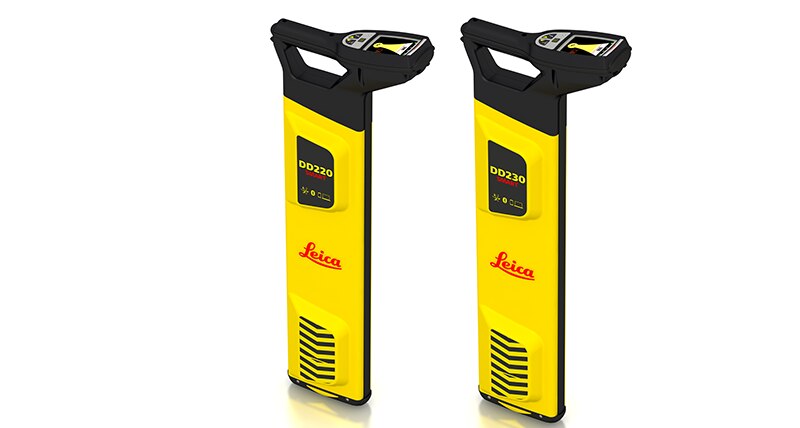
"name": "Leica DD220 Smart Cable & Pipe Locator",
"description": "Leica DD220 Smart Utility LocatorProtect your assets and your workersThe new Leica DD220 is an easy to use, intuitive locator simplifying the detection of buried utilities and increasing user confidence .\n\n\nWith automated pinpointing technology and a clear visible display, the DD220 discovers buried utilities with confidence, even in densely packed areas. On-board video support, usage alerts and diagnostics, combine to improve product use and, protect operators and utilities.\n\n\n\nSMART Technology; GPS, Bluetooth®, 8GB internal memory\nPower, Radio, Auto modes\nTransmitter modes, 131kHz, 33kHz, 8kHz or Auto (automatic detection of the transmitter signal)\nDepth detection up to 7 meters (23 feet)\nGood-to-Go™ Health Check and Start up test\nOn-board video user guides\nIP66 rating - protection from dust and water\nWeb Calibration Verification\n3 year Warranty\nLeica DD SMART utility locator solution\n\n\nFor professionals looking to streamline utility locating operations, the Leica DD SMART utility locators create a single source solution. DX Shield software provides a space for utility analysis and a convenient connection between SMART locators to increase productivity and save time.\n\nDX Shield software allows you to gain a better understanding of task performance and site complexities with easy-to-use reports that provide a fast and convenient overview of product use, reducing utility strikes and saving direct repair costs and project downtime.",
"price": 0.0,
"discountamount": 0.0,
"currencycode": "INR",
"priority": 1000000,
"isfreeshipmentavailable": false,
"shipmentduration": 7,
"_keywords": null,
"isarchived": false,
"isavailable": true,
"applicationid": null,
"productindex": 169,
"imageuri": "https://productimages.withfloats.com/actual/5e96c4065379a400011ee9f4.png",
"tileimageuri": "https://productimages.withfloats.com/tile/5e96c4065379a400011ee9f4.png",
"images": null,
"totalqueries": 0,
"gpid": null,
"groupproductid": null,
"createdon": "2020-04-15T08:21:22.911Z",
"updatedon": "2020-04-15T08:21:22.911Z",
"buyonlinelink": null,
"producturl": "http://WWW.SURVEYEQUIPMENT.IN/products/leica-dd220-smart-cable-pipe-locator/169",
"availableunits": -1.0,
"iscodavailable": false,
"isprepaidonlineavailable": false,
"maxcodorders": 0,
"maxprepaidonlineorders": 0,
"uniquepaymenturl": null,
"brandname": "Leica",
"category": "",
"tags": null,
"variants": false,
"keyspecification": null,
"otherspecifications": null,
"pickupaddressreferenceid": "",
"paymenttype": "None",
"producttype": "products",
"hsncode": null,
"gstslab": 0.0,
"isnotforsale": false
},
{
"_id": "5b6b3a9dd682be0552aefccb",
"fptag": "SBENTERPRISESTRADINGPUNE",
"merchantname": null,
"customwidgets": null,
"externalsourceid": null,
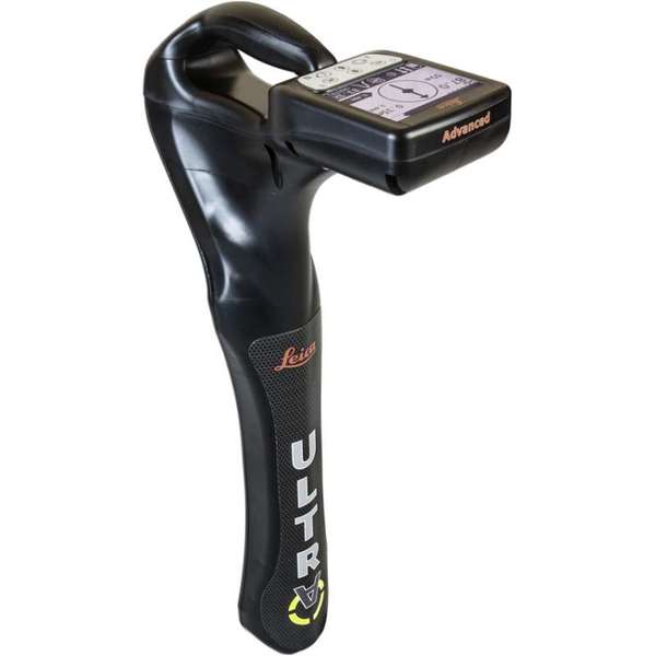
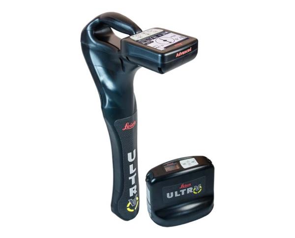
"name": "Leica ULTRA Utility Tracing System",
"description": "Leica ULTRA Utility Tracing System\nBest precision locating in faster, more confident work\n\nSave time and increase confidence in your results with the Leica ULTRA, our most advanced precision utility tracing instrument.\n\nThe complexity of underground utility networks is continually increasing, and obtaining precise information on the location of buried utilities has never been more important. The protection of buried assets during excavation work demands accurate mapping and surveying of existing utilities. \n\nIntegrating intelligent signal processing with unique flexible operating modes, Leica ULTRA traces buried utility lines accurately for safe underground excavations and utility surveys. Outstanding performance with operational ease and flexibility.\n\nLARGE CLEAR DISPLAY\nLarge backlit high visibility LCD screen\nClear display provides clear, improved and confident location and utility tracing\nCUSTOM FREQUENCIES\nConfigure for site specific applications\nUser configurable modes from 50 Hz to 200 kHz\nChoose from 100 pre-selected frequencies or customise your own frequencies\nCOMPASS\nShows the user the direction of the utility they are locating / tracing\nBLUETOOTH®\nEnable wireless communications with software running on a laptop, survey field PC or other GPS enabled device\nINCREASED TRANSMITTER POWER OUTPUT\nChoose between 5W and 12W transmitter power outputs for superior tracing performance\nBUILT FOR THE MOST DEMANDING ENVIRONMENTS\nIP65 protection\nFulfils toughest standards - shock resistant, protected against water and dust ingress\nSELECTABLE ANTENNA CONFIGURATION\nConfigure antenna to best optimise for your job site\nSelect between more range, sharper response, noise cancelling or easier sweeping\nDIRECTION ENABLED\nIdentifying your target utility amongst multiple parallel utilities\nApply a special direction enabled signal from the transmitter, the receiver will display an arrow on the compass heading to guide you along the designated utility path\nUnlock the power\nConfigure the Leica ULTRA for site specific applications. Custom build your receiver and transmitter.\n\nChoose from over 100 preselected frequencies, or customise your own frequency for highly specialised applications.\n\nAutomatically capture the instruments location data to ensure adherence to best practice. The data logging feature allows the user to record external GPS coordinates and download with the datafile as a KML or CSV format. Upload into GIS systems or Google Maps to confirm where, when and how the work was performed.\n",
"price": 0.0,
"discountamount": 0.0,
"currencycode": "INR",
"priority": 1000000,
"isfreeshipmentavailable": false,
"shipmentduration": 7,
"_keywords": [
"target utility",
"utility surveys",
"precision utility",
"Leica ULTRA traces",
"designated utility",
"12W transmitter power",
"wireless communications",
"instruments location data",
"site specific applications",
"100 preselected frequencies",
"underground utility networks",
"safe underground excavations",
"intelligent signal processing",
"unique flexible operating modes",
"Leica ULTRA Utility Tracing System"
],
"isarchived": false,
"isavailable": true,
"applicationid": null,
"productindex": 90,
"imageuri": "https://productimages.withfloats.com/actual/5b45ea4dd3d93d01c4f1c9f9.jpg",
"tileimageuri": "https://productimages.withfloats.com/tile/5b45ea4dd3d93d01c4f1c9f9.jpg",
"images": null,
"totalqueries": 0,
"gpid": null,
"groupproductid": null,
"createdon": "2018-07-11T11:30:28.043Z",
"updatedon": "2018-08-08T18:46:53.973Z",
"buyonlinelink": null,
"producturl": "http://WWW.SURVEYEQUIPMENT.IN/products/leica-ultra-utility-tracing-system/90",
"availableunits": -1.0,
"iscodavailable": true,
"isprepaidonlineavailable": false,
"maxcodorders": 0,
"maxprepaidonlineorders": 0,
"uniquepaymenturl": null,
"brandname": null,
"category": null,
"tags": null,
"variants": false,
"keyspecification": null,
"otherspecifications": null,
"pickupaddressreferenceid": "5d08ebb3edf0e25c3b8da5d0",
"paymenttype": "AssuredPurchase",
"producttype": "products",
"hsncode": null,
"gstslab": 0.0,
"isnotforsale": false
},
{
"_id": "5b6b3a9ed682be0552aefd6c",
"fptag": "SBENTERPRISESTRADINGPUNE",
"merchantname": null,
"customwidgets": null,
"externalsourceid": null,
"name": "Leica ULTRA Locator – Standard",
"description": "Leica ULTRA Locator – Standard\nThe ULTRA System has unique flexible operating modes to help you easily decide the right mode for your locating application and site conditions.\n\nMultimode operation – 50-200Khz\nDaylight visible LCD screen\nPrecision locating, for utility tracing\nThe complexity of underground utility networks are continually increasing. So obtaining precise information on the location of buried utilities has never been more important. The protection of buried assets during excavation work demands accurate mapping and surveying of existing utilities.\n\nThe Leica ULTRA provides our most advanced precision utility tracing system. Intelligent signal processing has been integrated with unique flexible operating modes, to help save you time and increased confidence in your results. Selectable antenna and customised frequencies optimises your instrument for site specific applications, supported by our AIM system which monitors signal interference levels, recommending which mode to use for the best results.\n\nAmbient Interference Measurement (AIM) \nWhen working in congested environments, external interferences can affect the effectiveness of utility tracing. To guard against interference, the Leica ULTRA incorporates advanced Ambient Interference Measurement (AIM), which analyses the surrounding area for noise and recommends the best frequencies for accurate utility tracing.\n\nOffset measuring \nThere will always be an occasion when the utility runs close to, or underneath an obstruction. With Offset Measuring, the Leica ULTRA can locate the target line if not directly accessible from above. The function uses the available data to estimate the horizontal and vertical (depth) distance.\n\nTransmitter to receiver link \nAdvanced communication link between the Leica ULTRA receiver and transmitter, enables you to control the transmitter directly from the receiver. Work smarter and at greater distances to help achieve best practice whilst reducing time spent walking to the transmitter.",
"price": 0.0,
"discountamount": 0.0,
"currencycode": "INR",
"priority": 1000000,
"isfreeshipmentavailable": false,
"shipmentduration": 7,
"_keywords": [
"communication link",
"Leica ULTRA Locator",
"precise information",
"Leica ULTRA receiver",
"congested environments",
"external interferences",
"advanced precision utility",
"site specific applications",
"underground utility networks",
"Intelligent signal processing",
"unique flexible operating modes",
"monitors signal interference levels",
"advanced Ambient Interference Measurement"
],
"isarchived": false,
"isavailable": true,
"applicationid": null,
"productindex": 95,
"imageuri": "https://productimages.withfloats.com/actual/5b45e9a9d3d93d01c4f1c26c.jpg",
"tileimageuri": "https://productimages.withfloats.com/tile/5b45e9a9d3d93d01c4f1c26c.jpg",
"images": null,
"totalqueries": 0,
"gpid": null,
"groupproductid": null,
"createdon": "2018-07-11T11:27:45.603Z",
"updatedon": "2018-08-08T18:46:54.165Z",
"buyonlinelink": null,
"producturl": "http://WWW.SURVEYEQUIPMENT.IN/products/leica-ultra-locator-standard/95",
"availableunits": -1.0,
"iscodavailable": true,
"isprepaidonlineavailable": false,
"maxcodorders": 0,
"maxprepaidonlineorders": 0,
"uniquepaymenturl": null,
"brandname": null,
"category": "cable pipe detector equipments",
"tags": [
"cable pipe detector equipments",
"Cable Avoidance Tools",
"cable",
"cable route tracing to Datalogging locators",
"ndustry standard for cable locating equipments.",
"Pipe and Cable locators",
"underground cable & pipe locating equipments"
],
"variants": false,
"keyspecification": null,
"otherspecifications": null,
"pickupaddressreferenceid": "5d08ebb3edf0e25c3b8da5d0",
"paymenttype": "AssuredPurchase",
"producttype": "products",
"hsncode": null,
"gstslab": 0.0,
"isnotforsale": false
},
{
"_id": "5b6b3a9ed682be0552aefd47",
"fptag": "SBENTERPRISESTRADINGPUNE",
"merchantname": null,
"customwidgets": null,
"externalsourceid": null,
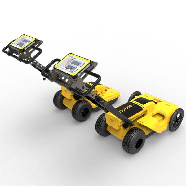
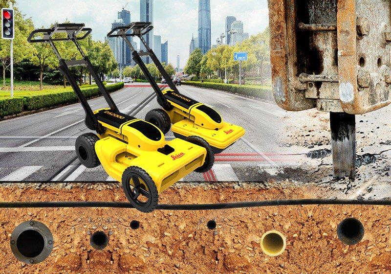
"name": "Leica DS2000 Utility Detection Radar",
"description": "Leica DS2000 Utility Detection Radar\nUncovering safer, faster, more\n\nThere’s a lot going on underground that you need to know about before you ever start to dig. The Leica DS2000 Utility Detection Radar finds all potential threats, including non-conductive pipes and fibre optics, increasing safety by lowering the risk of accidently hitting underground assets.\n\nIncrease safety, speed up work and lower asset management costs with the ability to prevent hazardous outages and collect more information. The DS2000 betters your business by making it safer, faster and more efficient.\n\nKey benefits\nIncrease safety when the DS2000 identifies all potential threats\nGet to assets and recover quicker from outages when you know exactly where underground utility assets are located\nDual-frequency antenna to detect deep and shallow targets simultaneously\nEasily collect and understand data with the DS2000’s simple and intuitive software and data storage\nSimple data storage and export to continue working on the post-processing at the office\nEffortlessly maneuver around the most challenging sites with the DS2000’s advanced ergonomics\nExpert knowledge of Leica Geosystems with more than 270 service centres worldwide\nPROTECT by Leica Geosystems - the strongest warranty in the market\n\nDetection and underground mapping solution\nCombined with the powerful and rugged Leica CT2000 field tablet, the GG04 or the GPS60 smart antenna, and the DIGICAT intelligent cable locators and DIGITEX transmitters, the DS2000 is part of the complete Leica Geosystems detection and underground mapping solution that will enhance your business by making it faster and more efficient. With DX Office Vision post processing software, convert radar data to CAD file in an uncomplicated way.\n\nStart today\nContact your Leica Geosystems distribution partner for more information on the Leica DS2000 and other detection solutions.",
"price": 0.0,
"discountamount": 0.0,
"currencycode": "INR",
"priority": 1000000,
"isfreeshipmentavailable": false,
"shipmentduration": 7,
"_keywords": [
"DS2000 betters",
"convert radar data",
"intuitive software",
"GPS60 smart antenna",
"detection solutions",
"DIGITEX transmitters",
"asset management costs",
"Leica CT2000 field tablet",
"underground utility assets",
"DIGICAT intelligent cable locators",
"complete Leica Geosystems detection",
"Leica DS2000 Utility Detection Radar",
"Leica Geosystems distribution partner",
"DX Office Vision post processing software"
],
"isarchived": false,
"isavailable": true,
"applicationid": null,
"productindex": 94,
"imageuri": "https://productimages.withfloats.com/actual/5b45a66fd4575c0f14706fc4.jpg",
"tileimageuri": "https://productimages.withfloats.com/tile/5b45a66fd4575c0f14706fc4.jpg",
"images": null,
"totalqueries": 0,
"gpid": null,
"groupproductid": null,
"createdon": "2018-07-11T06:40:39.103Z",
"updatedon": "2018-08-08T18:46:54.113Z",
"buyonlinelink": null,
"producturl": "http://WWW.SURVEYEQUIPMENT.IN/products/leica-ds2000-utility-detection-radar/94",
"availableunits": -1.0,
"iscodavailable": true,
"isprepaidonlineavailable": false,
"maxcodorders": 0,
"maxprepaidonlineorders": 0,
"uniquepaymenturl": null,
"brandname": null,
"category": "GPR Ground Penetrating Radar",
"tags": [
"GPR Ground Penetrating Radar",
"| GPR Ground Penetrating Radar Survey Equipment Di"
],
"variants": false,
"keyspecification": null,
"otherspecifications": null,
"pickupaddressreferenceid": "5d08ebb3edf0e25c3b8da5d0",
"paymenttype": "AssuredPurchase",
"producttype": "products",
"hsncode": null,
"gstslab": 0.0,
"isnotforsale": false
},
{
"_id": "5b6b3a9dd682be0552aefcbd",
"fptag": "SBENTERPRISESTRADINGPUNE",
"merchantname": null,
"customwidgets": null,
"externalsourceid": null,
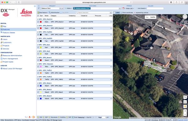
"name": "Leica DX Manager Mapping",
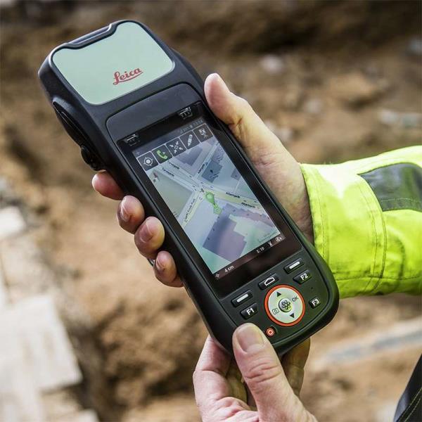
"description": "Leica DX Manager Mapping\nOne central dashboard for all the Leica Geosystems Detection solutions\n\nLeica DX Manager is the only enterprise grade utility mapping solution on the market. A unique cloud-powered solution that delivers unparalleled performance. Manage projects, tasks and spatial data from one central dashboard for all the Leica Geosystems Detection solutions.\n\nUpdate drawings, raw data, location pictures, data layers and mobile forms remotely and in a period of real time operate at an enterprise level rather than having to manually update individual users one at a time. With the Leica DX Manager, you have all dashboards, status updates and project management tools in one platform. Now, project managers can track field operations in real time and make critical decisions with a broader understanding of the current situation.\n\nKey benefits\n\nSimplified processes\nImprovement of data quality and accuracy\nConsistent data collection methods\nIntegration of DS2000, cable locators and asset mapping data\nWorkflows to maintain data integrity\nManage the whole workflow\n\nShare data to all devices and users within your organisation.\n\nAnalyse maps result\nVisualise on online maps\nFilter on users, within date ranges or any attributes\nExport to standard GIS and CAD formats\nShare data to your clients\nAn easy-to-use online portal allows management of all aspects of documenting utility location tasks. The user can switch between street view, satellite imagery and cartographic street maps. Field acquired survey data becomes instantly available and can be accessed by users anytime and anywhere.\n\nUtility detection integration\n\nLeica DX Manager integrates the entire Leica Geosystems Detection portfolio into a simple survey workflow, empowering the user to apply locator depth measurements to GNSS measurements. The result is a seamless fusion of both worlds – with all locator related data reviewable either in Leica DX Manager or any export format.\n\nLocate the utility\nMeasure the depth\nAll location data is sent directly to the Leica DX Field application on the GNSS device\nIt triggers the GNSS measurement on the mapping device\nAll data is integrated into the features metadata\nMaximum user experience and productivity\n\nLeica DX Field mobile app is designed for productivity and maximum user experience and built for enforcing data quality and accuracy. \n\nEasy mapping / surveying of assets\nSmart mobile forms\nImmediate visualisation on map\nMetadata collection\nAutomatic sync with Cloud\nFull offline capabilities\nMake sure your measured data always matches your quality expectations (up to centimetres with RTK) as Leica DX Manager notifications steadily monitor the system parameters. All quality parameters are stored as metadata. Next to the utility mapping aspect, it delivers work orders, time tracking and document management.",
"price": 0.0,
"discountamount": 0.0,
"currencycode": "INR",
"priority": 1000000,
"isfreeshipmentavailable": false,
"shipmentduration": 7,
"_keywords": [
"data quality",
"location data",
"data collection",
"data reviewable",
"survey data becomes",
"DX Field mobile app",
"Leica DX Manager Mapping",
"cartographic street maps",
"Leica DX Field application",
"update individual users one",
"Leica DX Manager notifications",
"apply locator depth measurements",
"enterprise grade utility mapping solution",
"entire Leica Geosystems Detection portfolio"
],
"isarchived": false,
"isavailable": true,
"applicationid": null,
"productindex": 89,
"imageuri": "https://productimages.withfloats.com/actual/5b459fa2f3579911b41e9cda.jpg",
"tileimageuri": "https://productimages.withfloats.com/tile/5b459fa2f3579911b41e9cda.jpg",
"images": null,
"totalqueries": 0,
"gpid": null,
"groupproductid": null,
"createdon": "2018-07-11T06:11:47.283Z",
"updatedon": "2018-08-08T18:46:53.959Z",
"buyonlinelink": null,
"producturl": "http://WWW.SURVEYEQUIPMENT.IN/products/leica-dx-manager-mapping/89",
"availableunits": -1.0,
"iscodavailable": true,
"isprepaidonlineavailable": false,
"maxcodorders": 0,
"maxprepaidonlineorders": 0,
"uniquepaymenturl": null,
"brandname": null,
"category": "GPR",
"tags": [
"GPR",
"Detection and underground mapping solution",
"Leica DX Manager Mapping"
],
"variants": false,
"keyspecification": null,
"otherspecifications": null,
"pickupaddressreferenceid": "5d08ebb3edf0e25c3b8da5d0",
"paymenttype": "AssuredPurchase",
"producttype": "products",
"hsncode": null,
"gstslab": 0.0,
"isnotforsale": false
},
{
"_id": "5b6b3a9dd682be0552aefc54",
"fptag": "SBENTERPRISESTRADINGPUNE",
"merchantname": null,
"customwidgets": null,
"externalsourceid": null,
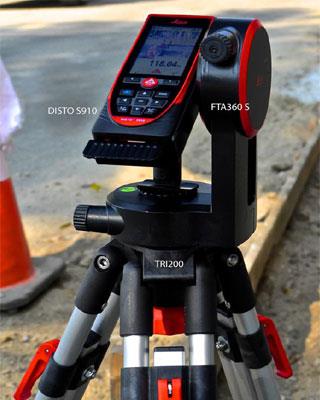
"name": "Leica Zeno 20 + DISTO S910: gamtec",
"description": "Leica Zeno 20 + DISTO S910: gamtec\nClosing GNSS gaps with point-to-point technology\n\nCombining the new Leica DISTO™ S910 with the Leica Zeno 20 changes how users collect asset information in GNSS-denied areas. With this signature gamtec technology, highly accurate distance and angular measurements from the DISTO™ S910 can be transferred on the fly to the Zeno 20, where data is imported in real time in your GIS – challenging GNSS areas are now problems of the past.\n\nA winning combination\nThe DISTO™ S910 can precisely measure directions and angles, and with the accurate positions delivered from the Zeno 20, you have a revolutionary instrument to capture inaccessible assets securely. Zeno Mobile running on the Zeno 20 allows you to effortlessly establish the connection and import the DISTO™ S910 measurements into your project - no post-editing is necessary.\n\nIn a simple and affordable way, remove the limitations of GNSS while increasing safety.\n\nOffset measuring \nSimply target the offset point and transfer necessary information via one click to the Zeno 20 where the offset point is generated in the user defined coordinate system.\n\nDifferent to compass-based solutions, the gamtec benefits from direction readings achieving much higher accuracies, which are further improved through stable tripod setup.\n\nSafely and accurately do offset measurements from one setup location while increasing productivity.\n\nRemoves the limitation of GNSS and close gaps in GNSS-denied areas in a simple and affordable way\nMaintain very high accuracy through mechanical angular reading, stable setup and highly accurate setup positioning\nIncrease safety - no need to cross a street to measure a point on the other side and no need to stand on a busy street to measure the gully",
"price": 0.0,
"discountamount": 0.0,
"currencycode": "INR",
"priority": 1000000,
"isfreeshipmentavailable": false,
"shipmentduration": 7,
"_keywords": [
"DISTO S910",
"S910 measurements",
"accurate distance",
"one setup location",
"measure directions",
"accurate positions",
"direction readings",
"offset measurements",
"angular measurements",
"Leica Zeno 20 changes",
"revolutionary instrument",
"mechanical angular reading",
"signature gamtec technology",
"capture inaccessible assets",
"transfer necessary information"
],
"isarchived": false,
"isavailable": true,
"applicationid": null,
"productindex": 85,
"imageuri": "https://productimages.withfloats.com/actual/5b3f3487d3d93d03a4b8fb73.jpg",
"tileimageuri": "https://productimages.withfloats.com/tile/5b3f3487d3d93d03a4b8fb73.jpg",
"images": null,
"totalqueries": 0,
"gpid": null,
"groupproductid": null,
"createdon": "2018-07-06T09:21:17.639Z",
"updatedon": "2018-08-08T18:46:53.791Z",
"buyonlinelink": null,
"producturl": "http://WWW.SURVEYEQUIPMENT.IN//leica-zeno-20-disto-s910-gamtec/85",
"availableunits": -1.0,
"iscodavailable": true,
"isprepaidonlineavailable": false,
"maxcodorders": 0,
"maxprepaidonlineorders": 0,
"uniquepaymenturl": null,
"brandname": null,
"category": "DGPS",
"tags": [
"DGPS",
"GNSS",
"GIS",
"laserdistancemeter"
],
"variants": false,
"keyspecification": null,
"otherspecifications": null,
"pickupaddressreferenceid": "5d08ebb3edf0e25c3b8da5d0",
"paymenttype": "AssuredPurchase",
"producttype": "products",
"hsncode": null,
"gstslab": 0.0,
"isnotforsale": false
},
{
"_id": "5b6b3a9cd682be0552aefb49",
"fptag": "SBENTERPRISESTRADINGPUNE",
"merchantname": null,
"customwidgets": null,
"externalsourceid": null,
"name": "Leica Z-Rover Package",
"description": "Leica ZRover – Faster, more accurate asset management\nSwitch from manual tools to digital processes to improve the accuracy and efficiency of collecting asset management information.\n\nThe construction industry is transforming to adopt digital ways of working. Traditional ways are often manual, time consuming and subject to human error.\n\nSwitching to digital asset management, by using the Leica ZRover solution, enables users to digitally locate, record and measure assets on a construction site with the highest accuracy, saving time and reducing errors.\n\nThe complete Z-Rover package includes\n\nLeica Zeno 20 Android UMTS Professional\nZeno Mobile (Android) 'Prof' on Zeno 20\n1 yr Zeno 20 / Zeno Mobile Basic CCP\nLeica AS10, Triple Frequency GNSS Antenna\nLeica GLS30, GNSS telescopic pole,carbon-fibre\nLeica AZ204 Zeno 20 Pole Mount\nLeica GEV238, 1.2m external antenna cable\nLeica AZ212 Hard Container for Zeno 20\nLeica GHT63 Pole clamp for attaching GHT\nAdopt digital working practices to improve efficiency, reporting, communication, record keeping and health and safety.",
"price": 0.0,
"discountamount": 0.0,
"currencycode": "INR",
"priority": 1000000,
"isfreeshipmentavailable": false,
"shipmentduration": 0,
"_keywords": [
"yr Zeno 20",
"GHT63 Pole clamp",
"Zeno Mobile Basic",
"digital processes",
"construction site",
"AZ204 Zeno 20 Pole",
"adopt digital ways",
"Zeno 20 Android UMTS",
"GNSS telescopic pole",
"AZ212 Hard Container",
"Leica ZRover solution",
"Triple Frequency GNSS",
"construction industry",
"digital asset management",
"digital working practices"
],
"isarchived": false,
"isavailable": false,
"applicationid": null,
"productindex": 71,
"imageuri": "https://productimages.withfloats.com/actual/5b1ba01d3b9b61043c76e8f2.jpg",
"tileimageuri": "https://productimages.withfloats.com/tile/5b1ba01d3b9b61043c76e8f2.jpg",
"images": null,
"totalqueries": 0,
"gpid": null,
"groupproductid": null,
"createdon": "2018-06-09T09:33:44.339Z",
"updatedon": "2018-08-08T18:46:52.725Z",
"buyonlinelink": null,
"producturl": "http://WWW.SURVEYEQUIPMENT.IN/products/leica-z-rover-package/71",
"availableunits": -1.0,
"iscodavailable": true,
"isprepaidonlineavailable": false,
"maxcodorders": 0,
"maxprepaidonlineorders": 0,
"uniquepaymenturl": null,
"brandname": null,
"category": "gnssservicepune",
"tags": [
"gnssservicepune",
"DGPSssuplier GNSS Leica Geosystems",
"gnss receiver",
"GNSS",
"leicageosystemspune",
"GPS",
"totalstions"
],
"variants": false,
"keyspecification": null,
"otherspecifications": null,
"pickupaddressreferenceid": "5d08ebb3edf0e25c3b8da5d0",
"paymenttype": "AssuredPurchase",
"producttype": "products",
"hsncode": null,
"gstslab": 0.0,
"isnotforsale": false
},
{
"_id": "5b6b3a99d682be0552aef6d9",
"fptag": "SBENTERPRISESTRADINGPUNE",
"merchantname": null,
"customwidgets": null,
"externalsourceid": null,
"name": "Leica DS2000 Utility Detection Radar",
"description": "Leica DS2000 Utility Detection Radar\nUncovering safer, faster, more\n\nThere’s a lot going on underground that you need to know about before you ever start to dig. The Leica DS2000 Utility Detection Radar finds all potential threats, including non-conductive pipes and fibre optics, increasing safety by lowering the risk of accidently hitting underground assets.\n\nIncrease safety, speed up work and lower asset management costs with the ability to prevent hazardous outages and collect more information. The DS2000 betters your business by making it safer, faster and more efficient.\n\nKey benefits\nIncrease safety when the DS2000 identifies all potential threats\nGet to assets and recover quicker from outages when you know exactly where underground utility assets are located\nDual-frequency antenna to detect deep and shallow targets simultaneously\nEasily collect and understand data with the DS2000’s simple and intuitive software and data storage\nSimple data storage and export to continue working on the post-processing at the office\nEffortlessly maneuver around the most challenging sites with the DS2000’s advanced ergonomics\nExpert knowledge of Leica Geosystems with more than 270 service centres worldwide\nPROTECT by Leica Geosystems - the strongest warranty in the market\n\nDetection and underground mapping solution\nCombined with the powerful and rugged Leica CT2000 field tablet, the GG04 or the GPS60 smart antenna, and the DIGICAT intelligent cable locators and DIGITEX transmitters, the DS2000 is part of the complete Leica Geosystems detection and underground mapping solution that will enhance your business by making it faster and more efficient. With DX Office Vision post processing software, convert radar data to CAD file in an uncomplicated way.\n\n",
"price": 0.0,
"discountamount": 0.0,
"currencycode": "INR",
"priority": 1000000,
"isfreeshipmentavailable": false,
"shipmentduration": 7,
"_keywords": [
"DS2000 betters",
"potential threats",
"convert radar data",
"intuitive software",
"GPS60 smart antenna",
"270 service centres",
"DIGITEX transmitters",
"asset management costs",
"Leica CT2000 field tablet",
"underground utility assets",
"DIGICAT intelligent cable locators",
"complete Leica Geosystems detection",
"Leica DS2000 Utility Detection Radar",
"DX Office Vision post processing software"
],
"isarchived": false,
"isavailable": true,
"applicationid": null,
"productindex": 10,
"imageuri": "https://productimages.withfloats.com/actual/5ae6f0c89c08ba0c2c2afa3e.jpg",
"tileimageuri": "https://productimages.withfloats.com/tile/5ae6f0c89c08ba0c2c2afa3e.jpg",
"images": null,
"totalqueries": 0,
"gpid": null,
"groupproductid": null,
"createdon": "2018-04-30T10:32:43.449Z",
"updatedon": "2018-08-08T18:46:49.746Z",
"buyonlinelink": null,
"producturl": "http://WWW.SURVEYEQUIPMENT.IN//leica-ds2000-utility-detection-radar/10",
"availableunits": -1.0,
"iscodavailable": true,
"isprepaidonlineavailable": false,
"maxcodorders": 0,
"maxprepaidonlineorders": 0,
"uniquepaymenturl": null,
"brandname": null,
"category": null,
"tags": null,
"variants": false,
"keyspecification": null,
"otherspecifications": null,
"pickupaddressreferenceid": "5d08ebb3edf0e25c3b8da5d0",
"paymenttype": "AssuredPurchase",
"producttype": "products",
"hsncode": null,
"gstslab": 0.0,
"isnotforsale": false
},
{
"_id": "5b6b3a99d682be0552aef69b",
"fptag": "SBENTERPRISESTRADINGPUNE",
"merchantname": null,
"customwidgets": null,
"externalsourceid": null,
"name": "Leica ULTRA Utility Tracing System",
"description": "Leica ULTRA Utility Tracing System\nBest precision locating in faster, more confident work\n\nSave time and increase confidence in your results with the Leica ULTRA, our most advanced precision utility tracing instrument.\n\nThe complexity of underground utility networks is continually increasing, and obtaining precise information on the location of buried utilities has never been more important. The protection of buried assets during excavation work demands accurate mapping and surveying of existing utilities. \n\nIntegrating intelligent signal processing with unique flexible operating modes, Leica ULTRA traces buried utility lines accurately for safe underground excavations and utility surveys. Outstanding performance with operational ease and flexibility.\n\nOptimised specifically for utility tracing \nConfiguration for challenging environments\nOptimise the instrument to overcome the most challenging and complex site conditions. The Leica ULTRA locator can be configured for different project environments and has more than 100 programmable operating frequencies available. Programme modes can adapt the antennas to deliver improved accuracy and repeatability.\nBest frequencies in congested environment\nWhen working in congested environments, the Leica ULTRA incorporates Ambient Interference Measurement (AIM), which digitally analyses the surrounding area for noise and recommends the best frequencies for accurate utility tracing.\nTrace utilities through any obstruction\nThere will always be an occasion when the utility runs close to or underneath an obstruction. With Offset Measuring, the Leica ULTRA locates the target line if not directly accessible from above. The function uses the available data to estimate the horizontal and vertical (depth) distance.\nTransmitter to receiver link\nControl the transmitter directly from the receiver with the cutting-edge communication link between the Leica ULTRA receiver and the transmitter. No more walking from the tracing line to the transmitter, simply adjust the settings automatically.\nClear operational display\nClear graphical LCD screen, with auto-pinpointing directional arrows. Ensure confident and fast tracing in all operating conditions, day or night, with the large backlit display.\nGNSS & GIS integration\nTrue one man, single-step data capture solution for buried utility mapping or surveying applications. Leica ULTRA integrates with GNSS or GIS data capture devices.",
"price": 0.0,
"discountamount": 0.0,
"currencycode": "INR",
"priority": 1000000,
"isfreeshipmentavailable": false,
"shipmentduration": 7,
"_keywords": [
"precision utility",
"Leica ULTRA traces",
"Leica ULTRA locator",
"Leica ULTRA receiver",
"data capture solution",
"complex site conditions",
"GIS data capture devices",
"underground utility networks",
"safe underground excavations",
"intelligent signal processing",
"different project environments",
"unique flexible operating modes",
"Ambient Interference Measurement",
"Leica ULTRA Utility Tracing System",
"100 programmable operating frequencies available"
],
"isarchived": false,
"isavailable": true,
"applicationid": null,
"productindex": 7,
"imageuri": "https://productimages.withfloats.com/actual/5ae6ed7fb303650b7cd15c39.jpg",
"tileimageuri": "https://productimages.withfloats.com/tile/5ae6ed7fb303650b7cd15c39.jpg",
"images": null,
"totalqueries": 0,
"gpid": null,
"groupproductid": null,
"createdon": "2018-04-30T10:18:41.519Z",
"updatedon": "2018-08-08T18:46:49.621Z",
"buyonlinelink": null,
"producturl": "http://WWW.SURVEYEQUIPMENT.IN/products/leica-ultra-utility-tracing-system/7",
"availableunits": -1.0,
"iscodavailable": true,
"isprepaidonlineavailable": false,
"maxcodorders": 0,
"maxprepaidonlineorders": 0,
"uniquepaymenturl": null,
"brandname": null,
"category": null,
"tags": null,
"variants": false,
"keyspecification": null,
"otherspecifications": null,
"pickupaddressreferenceid": "5d08ebb3edf0e25c3b8da5d0",
"paymenttype": "AssuredPurchase",
"producttype": "products",
"hsncode": null,
"gstslab": 0.0,
"isnotforsale": false
}
],
"hasmoreitems": false,
"isapirequest": false,
"totalresults": 27,
"query": null,
"floatingpoint": null
}