Currently it only shows your basic business info. Start adding relevant business details such as description, images and products or services to gain your customers attention by using Boost 360
android app
/
iOS App/ web portal.
{
"products": [
{
"_id": "5b6b3a9ed682be0552aefd47",
"fptag": "SBENTERPRISESTRADINGPUNE",
"merchantname": null,
"customwidgets": null,
"externalsourceid": null,
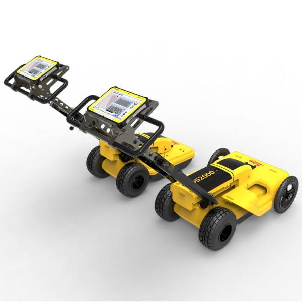
"name": "Leica DS2000 Utility Detection Radar",
"description": "Leica DS2000 Utility Detection Radar\nUncovering safer, faster, more\n\nThere’s a lot going on underground that you need to know about before you ever start to dig. The Leica DS2000 Utility Detection Radar finds all potential threats, including non-conductive pipes and fibre optics, increasing safety by lowering the risk of accidently hitting underground assets.\n\nIncrease safety, speed up work and lower asset management costs with the ability to prevent hazardous outages and collect more information. The DS2000 betters your business by making it safer, faster and more efficient.\n\nKey benefits\nIncrease safety when the DS2000 identifies all potential threats\nGet to assets and recover quicker from outages when you know exactly where underground utility assets are located\nDual-frequency antenna to detect deep and shallow targets simultaneously\nEasily collect and understand data with the DS2000’s simple and intuitive software and data storage\nSimple data storage and export to continue working on the post-processing at the office\nEffortlessly maneuver around the most challenging sites with the DS2000’s advanced ergonomics\nExpert knowledge of Leica Geosystems with more than 270 service centres worldwide\nPROTECT by Leica Geosystems - the strongest warranty in the market\n\nDetection and underground mapping solution\nCombined with the powerful and rugged Leica CT2000 field tablet, the GG04 or the GPS60 smart antenna, and the DIGICAT intelligent cable locators and DIGITEX transmitters, the DS2000 is part of the complete Leica Geosystems detection and underground mapping solution that will enhance your business by making it faster and more efficient. With DX Office Vision post processing software, convert radar data to CAD file in an uncomplicated way.\n\nStart today\nContact your Leica Geosystems distribution partner for more information on the Leica DS2000 and other detection solutions.",
"price": 0.0,
"discountamount": 0.0,
"currencycode": "INR",
"priority": 1000000,
"isfreeshipmentavailable": false,
"shipmentduration": 7,
"_keywords": [
"DS2000 betters",
"convert radar data",
"intuitive software",
"GPS60 smart antenna",
"detection solutions",
"DIGITEX transmitters",
"asset management costs",
"Leica CT2000 field tablet",
"underground utility assets",
"DIGICAT intelligent cable locators",
"complete Leica Geosystems detection",
"Leica DS2000 Utility Detection Radar",
"Leica Geosystems distribution partner",
"DX Office Vision post processing software"
],
"isarchived": false,
"isavailable": true,
"applicationid": null,
"productindex": 94,
"imageuri": "https://productimages.withfloats.com/actual/5b45a66fd4575c0f14706fc4.jpg",
"tileimageuri": "https://productimages.withfloats.com/tile/5b45a66fd4575c0f14706fc4.jpg",
"images": null,
"totalqueries": 0,
"gpid": null,
"groupproductid": null,
"createdon": "2018-07-11T06:40:39.103Z",
"updatedon": "2018-08-08T18:46:54.113Z",
"buyonlinelink": null,
"producturl": "http://WWW.SURVEYEQUIPMENT.IN/products/leica-ds2000-utility-detection-radar/94",
"availableunits": -1.0,
"iscodavailable": true,
"isprepaidonlineavailable": false,
"maxcodorders": 0,
"maxprepaidonlineorders": 0,
"uniquepaymenturl": null,
"brandname": null,
"category": "GPR Ground Penetrating Radar",
"tags": [
"GPR Ground Penetrating Radar",
"| GPR Ground Penetrating Radar Survey Equipment Di"
],
"variants": false,
"keyspecification": null,
"otherspecifications": null,
"pickupaddressreferenceid": "5d08ebb3edf0e25c3b8da5d0",
"paymenttype": "AssuredPurchase",
"producttype": "products",
"hsncode": null,
"gstslab": 0.0,
"isnotforsale": false
},
{
"_id": "5b6b3a9dd682be0552aefcbd",
"fptag": "SBENTERPRISESTRADINGPUNE",
"merchantname": null,
"customwidgets": null,
"externalsourceid": null,
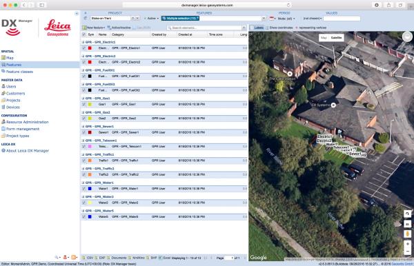
"name": "Leica DX Manager Mapping",
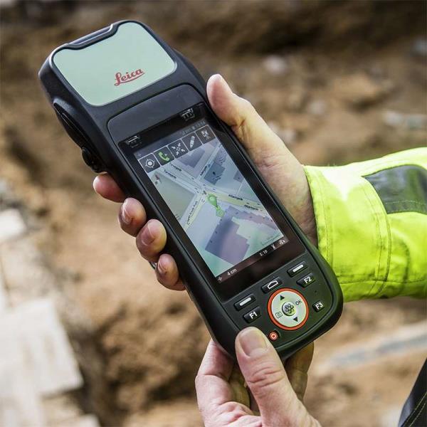
"description": "Leica DX Manager Mapping\nOne central dashboard for all the Leica Geosystems Detection solutions\n\nLeica DX Manager is the only enterprise grade utility mapping solution on the market. A unique cloud-powered solution that delivers unparalleled performance. Manage projects, tasks and spatial data from one central dashboard for all the Leica Geosystems Detection solutions.\n\nUpdate drawings, raw data, location pictures, data layers and mobile forms remotely and in a period of real time operate at an enterprise level rather than having to manually update individual users one at a time. With the Leica DX Manager, you have all dashboards, status updates and project management tools in one platform. Now, project managers can track field operations in real time and make critical decisions with a broader understanding of the current situation.\n\nKey benefits\n\nSimplified processes\nImprovement of data quality and accuracy\nConsistent data collection methods\nIntegration of DS2000, cable locators and asset mapping data\nWorkflows to maintain data integrity\nManage the whole workflow\n\nShare data to all devices and users within your organisation.\n\nAnalyse maps result\nVisualise on online maps\nFilter on users, within date ranges or any attributes\nExport to standard GIS and CAD formats\nShare data to your clients\nAn easy-to-use online portal allows management of all aspects of documenting utility location tasks. The user can switch between street view, satellite imagery and cartographic street maps. Field acquired survey data becomes instantly available and can be accessed by users anytime and anywhere.\n\nUtility detection integration\n\nLeica DX Manager integrates the entire Leica Geosystems Detection portfolio into a simple survey workflow, empowering the user to apply locator depth measurements to GNSS measurements. The result is a seamless fusion of both worlds – with all locator related data reviewable either in Leica DX Manager or any export format.\n\nLocate the utility\nMeasure the depth\nAll location data is sent directly to the Leica DX Field application on the GNSS device\nIt triggers the GNSS measurement on the mapping device\nAll data is integrated into the features metadata\nMaximum user experience and productivity\n\nLeica DX Field mobile app is designed for productivity and maximum user experience and built for enforcing data quality and accuracy. \n\nEasy mapping / surveying of assets\nSmart mobile forms\nImmediate visualisation on map\nMetadata collection\nAutomatic sync with Cloud\nFull offline capabilities\nMake sure your measured data always matches your quality expectations (up to centimetres with RTK) as Leica DX Manager notifications steadily monitor the system parameters. All quality parameters are stored as metadata. Next to the utility mapping aspect, it delivers work orders, time tracking and document management.",
"price": 0.0,
"discountamount": 0.0,
"currencycode": "INR",
"priority": 1000000,
"isfreeshipmentavailable": false,
"shipmentduration": 7,
"_keywords": [
"data quality",
"location data",
"data collection",
"data reviewable",
"survey data becomes",
"DX Field mobile app",
"Leica DX Manager Mapping",
"cartographic street maps",
"Leica DX Field application",
"update individual users one",
"Leica DX Manager notifications",
"apply locator depth measurements",
"enterprise grade utility mapping solution",
"entire Leica Geosystems Detection portfolio"
],
"isarchived": false,
"isavailable": true,
"applicationid": null,
"productindex": 89,
"imageuri": "https://productimages.withfloats.com/actual/5b459fa2f3579911b41e9cda.jpg",
"tileimageuri": "https://productimages.withfloats.com/tile/5b459fa2f3579911b41e9cda.jpg",
"images": null,
"totalqueries": 0,
"gpid": null,
"groupproductid": null,
"createdon": "2018-07-11T06:11:47.283Z",
"updatedon": "2018-08-08T18:46:53.959Z",
"buyonlinelink": null,
"producturl": "http://WWW.SURVEYEQUIPMENT.IN//leica-dx-manager-mapping/89",
"availableunits": -1.0,
"iscodavailable": true,
"isprepaidonlineavailable": false,
"maxcodorders": 0,
"maxprepaidonlineorders": 0,
"uniquepaymenturl": null,
"brandname": null,
"category": "GPR",
"tags": [
"GPR",
"Detection and underground mapping solution",
"Leica DX Manager Mapping"
],
"variants": false,
"keyspecification": null,
"otherspecifications": null,
"pickupaddressreferenceid": "5d08ebb3edf0e25c3b8da5d0",
"paymenttype": "AssuredPurchase",
"producttype": "products",
"hsncode": null,
"gstslab": 0.0,
"isnotforsale": false
},
{
"_id": "5b6b3a9cd682be0552aefb49",
"fptag": "SBENTERPRISESTRADINGPUNE",
"merchantname": null,
"customwidgets": null,
"externalsourceid": null,
"name": "Leica Z-Rover Package",
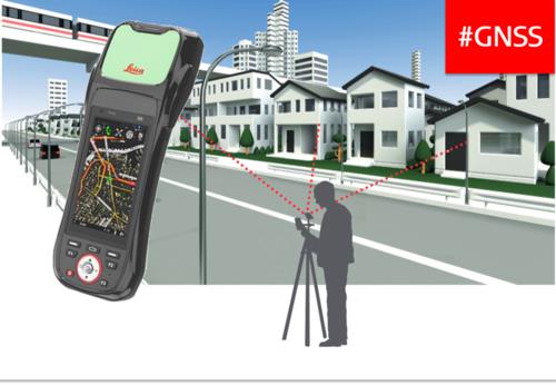
"description": "Leica ZRover – Faster, more accurate asset management\nSwitch from manual tools to digital processes to improve the accuracy and efficiency of collecting asset management information.\n\nThe construction industry is transforming to adopt digital ways of working. Traditional ways are often manual, time consuming and subject to human error.\n\nSwitching to digital asset management, by using the Leica ZRover solution, enables users to digitally locate, record and measure assets on a construction site with the highest accuracy, saving time and reducing errors.\n\nThe complete Z-Rover package includes\n\nLeica Zeno 20 Android UMTS Professional\nZeno Mobile (Android) 'Prof' on Zeno 20\n1 yr Zeno 20 / Zeno Mobile Basic CCP\nLeica AS10, Triple Frequency GNSS Antenna\nLeica GLS30, GNSS telescopic pole,carbon-fibre\nLeica AZ204 Zeno 20 Pole Mount\nLeica GEV238, 1.2m external antenna cable\nLeica AZ212 Hard Container for Zeno 20\nLeica GHT63 Pole clamp for attaching GHT\nAdopt digital working practices to improve efficiency, reporting, communication, record keeping and health and safety.",
"price": 0.0,
"discountamount": 0.0,
"currencycode": "INR",
"priority": 1000000,
"isfreeshipmentavailable": false,
"shipmentduration": 0,
"_keywords": [
"yr Zeno 20",
"GHT63 Pole clamp",
"Zeno Mobile Basic",
"digital processes",
"construction site",
"AZ204 Zeno 20 Pole",
"adopt digital ways",
"Zeno 20 Android UMTS",
"GNSS telescopic pole",
"AZ212 Hard Container",
"Leica ZRover solution",
"Triple Frequency GNSS",
"construction industry",
"digital asset management",
"digital working practices"
],
"isarchived": false,
"isavailable": false,
"applicationid": null,
"productindex": 71,
"imageuri": "https://productimages.withfloats.com/actual/5b1ba01d3b9b61043c76e8f2.jpg",
"tileimageuri": "https://productimages.withfloats.com/tile/5b1ba01d3b9b61043c76e8f2.jpg",
"images": null,
"totalqueries": 0,
"gpid": null,
"groupproductid": null,
"createdon": "2018-06-09T09:33:44.339Z",
"updatedon": "2018-08-08T18:46:52.725Z",
"buyonlinelink": null,
"producturl": "http://WWW.SURVEYEQUIPMENT.IN//leica-z-rover-package/71",
"availableunits": -1.0,
"iscodavailable": true,
"isprepaidonlineavailable": false,
"maxcodorders": 0,
"maxprepaidonlineorders": 0,
"uniquepaymenturl": null,
"brandname": null,
"category": "gnssservicepune",
"tags": [
"gnssservicepune",
"DGPSssuplier GNSS Leica Geosystems",
"gnss receiver",
"GNSS",
"leicageosystemspune",
"GPS",
"totalstions"
],
"variants": false,
"keyspecification": null,
"otherspecifications": null,
"pickupaddressreferenceid": "5d08ebb3edf0e25c3b8da5d0",
"paymenttype": "AssuredPurchase",
"producttype": "products",
"hsncode": null,
"gstslab": 0.0,
"isnotforsale": false
},
{
"_id": "5b6b3a99d682be0552aef6d9",
"fptag": "SBENTERPRISESTRADINGPUNE",
"merchantname": null,
"customwidgets": null,
"externalsourceid": null,
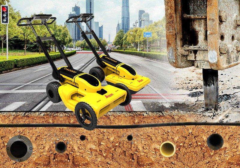
"name": "Leica DS2000 Utility Detection Radar",
"description": "Leica DS2000 Utility Detection Radar\nUncovering safer, faster, more\n\nThere’s a lot going on underground that you need to know about before you ever start to dig. The Leica DS2000 Utility Detection Radar finds all potential threats, including non-conductive pipes and fibre optics, increasing safety by lowering the risk of accidently hitting underground assets.\n\nIncrease safety, speed up work and lower asset management costs with the ability to prevent hazardous outages and collect more information. The DS2000 betters your business by making it safer, faster and more efficient.\n\nKey benefits\nIncrease safety when the DS2000 identifies all potential threats\nGet to assets and recover quicker from outages when you know exactly where underground utility assets are located\nDual-frequency antenna to detect deep and shallow targets simultaneously\nEasily collect and understand data with the DS2000’s simple and intuitive software and data storage\nSimple data storage and export to continue working on the post-processing at the office\nEffortlessly maneuver around the most challenging sites with the DS2000’s advanced ergonomics\nExpert knowledge of Leica Geosystems with more than 270 service centres worldwide\nPROTECT by Leica Geosystems - the strongest warranty in the market\n\nDetection and underground mapping solution\nCombined with the powerful and rugged Leica CT2000 field tablet, the GG04 or the GPS60 smart antenna, and the DIGICAT intelligent cable locators and DIGITEX transmitters, the DS2000 is part of the complete Leica Geosystems detection and underground mapping solution that will enhance your business by making it faster and more efficient. With DX Office Vision post processing software, convert radar data to CAD file in an uncomplicated way.\n\n",
"price": 0.0,
"discountamount": 0.0,
"currencycode": "INR",
"priority": 1000000,
"isfreeshipmentavailable": false,
"shipmentduration": 7,
"_keywords": [
"DS2000 betters",
"potential threats",
"convert radar data",
"intuitive software",
"GPS60 smart antenna",
"270 service centres",
"DIGITEX transmitters",
"asset management costs",
"Leica CT2000 field tablet",
"underground utility assets",
"DIGICAT intelligent cable locators",
"complete Leica Geosystems detection",
"Leica DS2000 Utility Detection Radar",
"DX Office Vision post processing software"
],
"isarchived": false,
"isavailable": true,
"applicationid": null,
"productindex": 10,
"imageuri": "https://productimages.withfloats.com/actual/5ae6f0c89c08ba0c2c2afa3e.jpg",
"tileimageuri": "https://productimages.withfloats.com/tile/5ae6f0c89c08ba0c2c2afa3e.jpg",
"images": null,
"totalqueries": 0,
"gpid": null,
"groupproductid": null,
"createdon": "2018-04-30T10:32:43.449Z",
"updatedon": "2018-08-08T18:46:49.746Z",
"buyonlinelink": null,
"producturl": "http://WWW.SURVEYEQUIPMENT.IN//leica-ds2000-utility-detection-radar/10",
"availableunits": -1.0,
"iscodavailable": true,
"isprepaidonlineavailable": false,
"maxcodorders": 0,
"maxprepaidonlineorders": 0,
"uniquepaymenturl": null,
"brandname": null,
"category": null,
"tags": null,
"variants": false,
"keyspecification": null,
"otherspecifications": null,
"pickupaddressreferenceid": "5d08ebb3edf0e25c3b8da5d0",
"paymenttype": "AssuredPurchase",
"producttype": "products",
"hsncode": null,
"gstslab": 0.0,
"isnotforsale": false
},
{
"_id": "5b6b3a99d682be0552aef672",
"fptag": "SBENTERPRISESTRADINGPUNE",
"merchantname": null,
"customwidgets": null,
"externalsourceid": null,
"name": "Leica Zeno 20 GIS Collector",
"description": "Leica Zeno 20 GIS Collector\nSimple, accurate and rugged asset management\n\n\nThe Leica Zeno 20 simplifies daily data capture for GIS field personnel. Leverage the strength of cutting-edge technology in one remarkably compact device.\n\nSo simplistic it will become your indispensable tool.\nSo accurate you will always be sure.\nSo productive it will change your workday.\nMade rugged to withstand the elements of any work site, the Leica Zeno comes with a durable IP67 dust and waterproof rating. Work from anywhere when you download the Android app that streams RTK-corrected GNSS positons.\n\nSolve daily GIS challenges with new technologies\nThe No. 1 challenge facing GIS field personnel is GNSS-denied environments. Collecting reliable and accurate positioning data is near impossible in these areas. This struggle is eliminated with new innovative technologies by Leica Geosystems inside the Leica Zeno 20 GIS collector:\n\nApogeetec\nEven in closed or covered areas, such as dense forests, an internal antenna enables collecting accurate position data. With maximum performance, collect more, collect simpler.\nGamtec\nBe more productive, increase safety and save time when the Leica Zeno 20 GIS collector is combined with the Leica DISTO S910 laser distance metre. End the struggle to access hard-to-reach and dangerous points when you simply aim and instantly collect from anywhere, anytime.\nMore accuracy, greater time savings, increased productivity – achieve all this with the Leica Zeno 20 GIS collector’s better satellite acquisition with stronger signals and contactless offset measuring . This GIS solution is truly comprehensive and second to none.\n\nLeica Geosystems, Esri improve GIS with ZenoCollector\nThe leader in measurement technology has joined with the leader in GIS technology to bring you an all-new integrated solution in mobile data capturing. The rugged Leica Zeno 20 combines with the powerful Collector for ArcGISto create the ZenoCollector. With Collector for ArcGIS as its main user interface and bundled with an ArcGIS Online organisational subscription for one year, the ZenoCollector:\n\nSaves time automatically synching field changes to enterprise information\nIncreases productivity opening access to all for the latest data from the field\nImproves accuracy with professional-grade GNSS coordination\n ",
"price": 0.0,
"discountamount": 0.0,
"currencycode": "INR",
"priority": 1000000,
"isfreeshipmentavailable": false,
"shipmentduration": 7,
"_keywords": [
"GIS solution",
"GIS technology",
"Leica Geosystems",
"GIS field personnel",
"Leica Zeno 20 combines",
"accurate position data",
"measurement technology",
"one remarkably compact",
"internal antenna enables",
"accurate positioning data",
"Leica Zeno 20 GIS Collector",
"new innovative technologies",
"Leica DISTO S910 laser distance metre",
"ArcGIS Online organisational subscription",
"Leica Zeno 20 simplifies daily data capture"
],
"isarchived": false,
"isavailable": true,
"applicationid": null,
"productindex": 5,
"imageuri": "https://productimages.withfloats.com/actual/5ae6ee849c08ba0c2c2af762.jpg",
"tileimageuri": "https://productimages.withfloats.com/tile/5ae6ee849c08ba0c2c2af762.jpg",
"images": null,
"totalqueries": 0,
"gpid": null,
"groupproductid": null,
"createdon": "2018-04-30T10:22:58.832Z",
"updatedon": "2018-08-08T18:46:49.527Z",
"buyonlinelink": null,
"producturl": "http://WWW.SURVEYEQUIPMENT.IN//leica-zeno-20-gis-collector/5",
"availableunits": -1.0,
"iscodavailable": true,
"isprepaidonlineavailable": false,
"maxcodorders": 0,
"maxprepaidonlineorders": 0,
"uniquepaymenturl": null,
"brandname": null,
"category": null,
"tags": null,
"variants": false,
"keyspecification": null,
"otherspecifications": null,
"pickupaddressreferenceid": "5d08ebb3edf0e25c3b8da5d0",
"paymenttype": "AssuredPurchase",
"producttype": "products",
"hsncode": null,
"gstslab": 0.0,
"isnotforsale": false
},
{
"_id": "6538b3519c14ab0f94083db9",
"fptag": "SBENTERPRISESTRADINGPUNE",
"merchantname": null,
"customwidgets": null,
"externalsourceid": null,
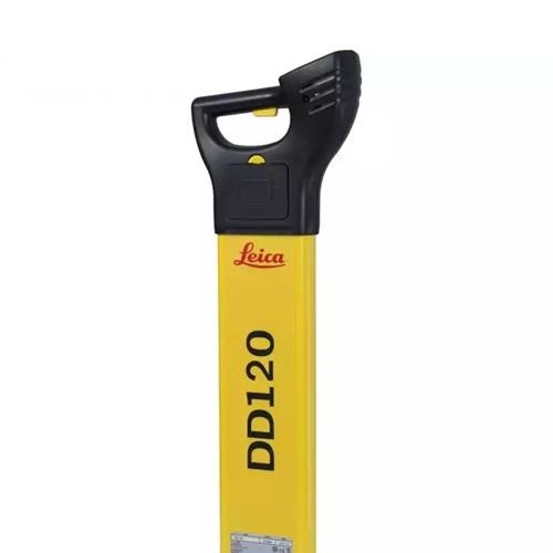
"name": "Leica DD120 Cable Loctoer ",
"description": "Easy to use, intuitive avoidance tool\nThe new Leica DD120 locator reduces the complexity normally associated with scanning for buried utilities. For construction professionals who need to know what is beneath their sites, the DD120 cable locator is a simple, intuitive locator designed to detect and avoid buried utilities. The DD120’s automated pinpointing process improves the detection of utilities, reduces utility damage and increases workforce safety.\nAutomatic pinpointing\nPower, Radio, Auto modes\nTransmitter, 33kHz, 8kHz\nDepth detection up to 3 meters (10 feet)\nGood-to-Go™ Health Check and Start up test\nIP54 rating - protection from dust and water\n1 year Warranty\n\nHandheld multi-frequency underground service locatorThe Leica DD100 Series cable locators feature advanced automatic controls making the DD100 Series easy-to-use, requiring minimal user experience. Avoiding underground cables and pipes is a major concern on construction sites. Therefore, detecting the position of buried cables and pipes before excavation work can help prevent operator injury, asset damage and any subsequent costs. Use the DD120 or DD130 cable locators in conjunction with a DA220 or DA230 signal transmitter or range of accessories to achieve improved accuracy and application scope.\nUnmatched ease of useWith Automatic Pinpointing there is no need for you to manually adjust the sensitivity of your Digicat cable locator ensuring you’re using the optimum sensitivity for the environment you are detecting the underground utilities in. Reducing the likelihood of human error and enabling easier and more efficient cable and pipe locating. Ultimately saving you time and money.\n\nUnderground Exploration with Leica DD120User-Centric Design: Effortless operation with an in-built self-test for accuracy assurance.Dynamic Alert System: Hazard Zone alert for shallow services within 30cm ensures enhanced safety.Versatile Modes: Detect in Auto, Power, Radio, and Transmitter modes for comprehensive utility detection.\n\n",
"price": 0.0,
"discountamount": 0.0,
"currencycode": "INR",
"priority": 1000000,
"isfreeshipmentavailable": false,
"shipmentduration": 7,
"_keywords": null,
"isarchived": false,
"isavailable": true,
"applicationid": null,
"productindex": 232,
"imageuri": "https://productimages.withfloats.com/actual/6538b35d9144637b5496fab1.jpg",
"tileimageuri": "https://productimages.withfloats.com/tile/6538b35d9144637b5496fab1.jpg",
"images": null,
"totalqueries": 0,
"gpid": null,
"groupproductid": null,
"createdon": "2023-10-25T06:18:57.85Z",
"updatedon": "2023-10-25T06:18:57.85Z",
"buyonlinelink": null,
"producturl": "http://WWW.SURVEYEQUIPMENT.IN//leica-dd120-cable-loctoer-/232",
"availableunits": -1.0,
"iscodavailable": false,
"isprepaidonlineavailable": false,
"maxcodorders": 0,
"maxprepaidonlineorders": 0,
"uniquepaymenturl": null,
"brandname": "Leica",
"category": "Pipe and Cable locators",
"tags": null,
"variants": false,
"keyspecification": null,
"otherspecifications": null,
"pickupaddressreferenceid": "",
"paymenttype": "None",
"producttype": "products",
"hsncode": null,
"gstslab": 0.001,
"isnotforsale": false
},
{
"_id": "5e96c40249c9ab000155998b",
"fptag": "SBENTERPRISESTRADINGPUNE",
"merchantname": null,
"customwidgets": null,
"externalsourceid": null,
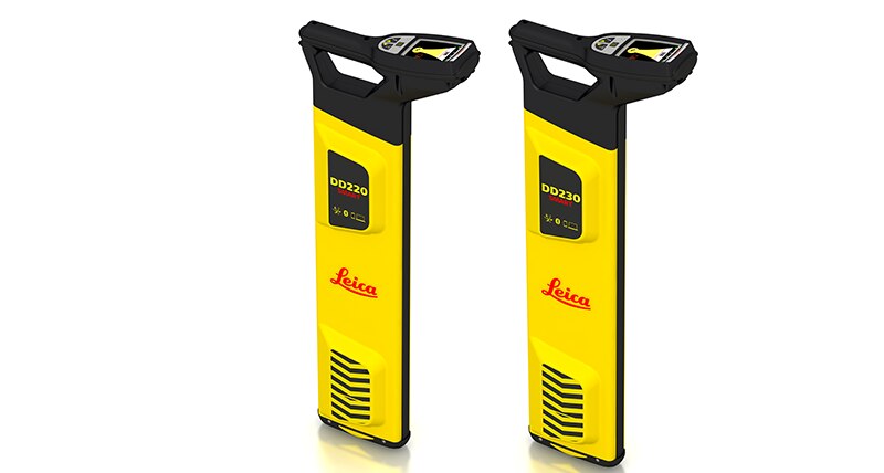
"name": "Leica DD220 Smart Cable & Pipe Locator",
"description": "Leica DD220 Smart Utility LocatorProtect your assets and your workersThe new Leica DD220 is an easy to use, intuitive locator simplifying the detection of buried utilities and increasing user confidence .\n\n\nWith automated pinpointing technology and a clear visible display, the DD220 discovers buried utilities with confidence, even in densely packed areas. On-board video support, usage alerts and diagnostics, combine to improve product use and, protect operators and utilities.\n\n\n\nSMART Technology; GPS, Bluetooth®, 8GB internal memory\nPower, Radio, Auto modes\nTransmitter modes, 131kHz, 33kHz, 8kHz or Auto (automatic detection of the transmitter signal)\nDepth detection up to 7 meters (23 feet)\nGood-to-Go™ Health Check and Start up test\nOn-board video user guides\nIP66 rating - protection from dust and water\nWeb Calibration Verification\n3 year Warranty\nLeica DD SMART utility locator solution\n\n\nFor professionals looking to streamline utility locating operations, the Leica DD SMART utility locators create a single source solution. DX Shield software provides a space for utility analysis and a convenient connection between SMART locators to increase productivity and save time.\n\nDX Shield software allows you to gain a better understanding of task performance and site complexities with easy-to-use reports that provide a fast and convenient overview of product use, reducing utility strikes and saving direct repair costs and project downtime.",
"price": 0.0,
"discountamount": 0.0,
"currencycode": "INR",
"priority": 1000000,
"isfreeshipmentavailable": false,
"shipmentduration": 7,
"_keywords": null,
"isarchived": false,
"isavailable": true,
"applicationid": null,
"productindex": 169,
"imageuri": "https://productimages.withfloats.com/actual/5e96c4065379a400011ee9f4.png",
"tileimageuri": "https://productimages.withfloats.com/tile/5e96c4065379a400011ee9f4.png",
"images": null,
"totalqueries": 0,
"gpid": null,
"groupproductid": null,
"createdon": "2020-04-15T08:21:22.911Z",
"updatedon": "2020-04-15T08:21:22.911Z",
"buyonlinelink": null,
"producturl": "http://WWW.SURVEYEQUIPMENT.IN//leica-dd220-smart-cable-pipe-locator/169",
"availableunits": -1.0,
"iscodavailable": false,
"isprepaidonlineavailable": false,
"maxcodorders": 0,
"maxprepaidonlineorders": 0,
"uniquepaymenturl": null,
"brandname": "Leica",
"category": "",
"tags": null,
"variants": false,
"keyspecification": null,
"otherspecifications": null,
"pickupaddressreferenceid": "",
"paymenttype": "None",
"producttype": "products",
"hsncode": null,
"gstslab": 0.0,
"isnotforsale": false
},
{
"_id": "5b7ffb95147e16051e773f27",
"fptag": "SBENTERPRISESTRADINGPUNE",
"merchantname": null,
"customwidgets": null,
"externalsourceid": null,
"name": "IDS GeoRadar - Stream C",
"description": "IDS GeoRadar - Stream C\nThe compact array solution for accurate 3D utility mapping.\nHigh quality, High productivity and Simple to Use compact radar system for real time underground surveys.\n\nStream C is the compact array solution for real-time 3D mapping of underground utilities and features. Thanks to increased level of accuracy provided by a massive antenna array, Stream C is able to automatically detect pipes and cables.\n\nDaily use of Stream C is aided by ergonomic features including electronic ride height adjustment, options to tow manually or with a small vehicle and a motor assisted drive wheel.\n\nSTREAM C BENEFITS\n\nHigh Productivity: surveys only need to be performed in one direction to ensure optimal detection for both longitudinal and transversal pipes.\nNo advanced training needed: the system automatically detects and locates the position of pipes in real time and displays them on screen.\nReduced user fatigue: thanks to electronic ride height adjustment and a motor assisted drive wheel.\nFacilitates large surveys: the system can be towed manually or with a small vehicle, increasing the acquisition speed (up to 6 km/h).\n\nSTREAM C FEATURES\n\nMassive array of 34 antennas in two polarizations: this enables an accurate 3D reconstruction of the underground utility network to be created in a single scan.\nAutomatic Pipe Detection (APD): real-time automatic detection of buried pipes and cables\nCompact size: Stream C’s small dimensions enable it to survey areas inaccessible to larger array systems while maintaining the same accuracy.\nRobust construction: built to the highest standards and with hardwearing materials so that it can be used in harsh, demanding environments.\n3D radar tomography: real-time tomography on a GPS or total station assisted cartographic background. • Professional subsurface survey: pipes, cables and buried objects can be automatically transferred to CAD and GIS formats allowing a complete subsurface GIS based digital map to be quickly produced.\n\nBenefits of Stream EM include:\n\nImproved management of underground utility design, relocation and coordination;\nCost and time reductions: No need to block traffic or perform surveys at night;\nIncrease in accuracy with a detection accuracy of as little as 5 cm;\nIncrease productivity and have the ability to detect every buried target;\nHighly modular structure allows it to be reconfigured to map sidewalks and difficult to access areas\n\nReal time software for advanced viewing \nStream EM is supplied with the OneVsion and GRED HD 3D CAD software suites.",
"price": 0.0,
"discountamount": 0.0,
"currencycode": "INR",
"priority": 1000000,
"isfreeshipmentavailable": false,
"shipmentduration": 7,
"_keywords": [
"detection accuracy",
"accurate 3D utility",
"real time underground",
"massive antenna array",
"underground utilities",
"compact array solution",
"small dimensions enable",
"complete subsurface GIS",
"Use compact radar system",
"survey areas inaccessible",
"underground utility design",
"accurate 3D reconstruction",
"underground utility network",
"GRED HD 3D CAD software suites",
"Professional subsurface survey"
],
"isarchived": false,
"isavailable": true,
"applicationid": null,
"productindex": 111,
"imageuri": "",
"tileimageuri": "",
"images": null,
"totalqueries": 0,
"gpid": null,
"groupproductid": null,
"createdon": "2018-08-24T12:35:33.806Z",
"updatedon": "2018-08-24T12:35:33.806Z",
"buyonlinelink": null,
"producturl": "http://WWW.SURVEYEQUIPMENT.IN//ids-georadar-stream-c/111",
"availableunits": -1.0,
"iscodavailable": true,
"isprepaidonlineavailable": false,
"maxcodorders": 0,
"maxprepaidonlineorders": 0,
"uniquepaymenturl": null,
"brandname": null,
"category": null,
"tags": null,
"variants": false,
"keyspecification": null,
"otherspecifications": null,
"pickupaddressreferenceid": "5d08ebb3edf0e25c3b8da5d0",
"paymenttype": "AssuredPurchase",
"producttype": "products",
"hsncode": null,
"gstslab": 0.0,
"isnotforsale": false
},
{
"_id": "5b6b3a9dd682be0552aefc7e",
"fptag": "SBENTERPRISESTRADINGPUNE",
"merchantname": null,
"customwidgets": null,
"externalsourceid": null,
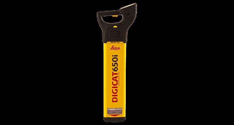
"name": "Leica Digicat 600i Series Cable Locators",
"description": "Leica Digicat 600i Series Cable Locators\nIntelligent data logging cable locators\n\nThe Leica Digicat 600i Series cable locators feature fully integrated data logging capabilities with Bluetooth delivering the Where and How.\n\nAvoiding underground cables is a major concern on construction sites and identifying the position of these buried utilities before excavation work can help prevent operator injury, asset damage risks or any subsequent costs. The Leica Digicat 600i Series cable locators record the cable locating activities, making it easier for you to identify training needs of operators and provides users with evidence of compliance to industry best practice.\n\nUnmatched ease-of-use\nWith Automatic Pinpointing there is no need for you to manually adjust the sensitivity of your Digicat cable locator ensuring you’re using the optimum sensitivity for the environment you are detecting the underground utilities in. Reducing the likelihood of human error and ultimately saving you time and money.\n\nBetter informed about your site environment\nThe Leica Digicat 600i Series cable locators record and store how and when your cable locator has been used. The data collected can then be easily transferred via Bluetooth® to your PC, Android mobile phone or tablet, using Leica’s LOGiCAT software. It provides you with visibility of locating activities enabling identification of training needs and providing traceability of locating activities following a near miss or utility strike.\n\nImproved accuracy and application scope\nTo achieve improved accuracy and application scope use the DIGICAT cable locators in conjunction with a Digitex 100t or 300t signal transmitter and/or the Digisystem accessories.\n\nEstimating the depth of the underground infrastructure improves cable locating accuracy and data range. To get a depth estimation you can use a Digicat 650i cable locator and a Digitex 100t or 300t signal transmitter.\n\nDigicat 650i cable locator – with depth - data logging, Bluetooth®, hazard zone alert, signal service indicator, built-in self-test and service due indicator.\n\nDigicat 600i cable locator – without depth - data logging, Bluetooth®, hazard zone alert, signal service indicator, built-in self-test and service due indicator.",
"price": 120478.0,
"discountamount": 0.0,
"currencycode": "INR",
"priority": 1000000,
"isfreeshipmentavailable": false,
"shipmentduration": 7,
"_keywords": [
"600i cable locator",
"optimum sensitivity",
"service due indicator",
"application scope use",
"underground utilities",
"Automatic Pinpointing",
"DIGICAT cable locators",
"cable locating accuracy",
"300t signal transmitter",
"signal service indicator",
"cable locating activities",
"Digicat 650i cable locator",
"underground infrastructure",
"Leica Digicat 600i Series cable locators record"
],
"isarchived": false,
"isavailable": true,
"applicationid": null,
"productindex": 87,
"imageuri": "https://productimages.withfloats.com/actual/5b45f174f357991204a4e9f7.jpg",
"tileimageuri": "https://productimages.withfloats.com/tile/5b45f174f357991204a4e9f7.jpg",
"images": null,
"totalqueries": 0,
"gpid": null,
"groupproductid": null,
"createdon": "2018-07-11T12:00:54.083Z",
"updatedon": "2018-08-08T18:46:53.885Z",
"buyonlinelink": null,
"producturl": "http://WWW.SURVEYEQUIPMENT.IN//leica-digicat-600i-series-cable-locators/87",
"availableunits": -1.0,
"iscodavailable": true,
"isprepaidonlineavailable": false,
"maxcodorders": 0,
"maxprepaidonlineorders": 0,
"uniquepaymenturl": null,
"brandname": null,
"category": "underground cable & pipe locating equipments",
"tags": [
"underground cable & pipe locating equipments",
"Cable Avoidance Tools",
"Pipe and Cable locators",
"Underground Pipe and Cable Locator in India"
],
"variants": false,
"keyspecification": null,
"otherspecifications": null,
"pickupaddressreferenceid": "5d08ebb3edf0e25c3b8da5d0",
"paymenttype": "AssuredPurchase",
"producttype": "products",
"hsncode": null,
"gstslab": 0.0,
"isnotforsale": false
}
],
"hasmoreitems": false,
"isapirequest": false,
"totalresults": 27,
"query": null,
"floatingpoint": null
}