Currently it only shows your basic business info. Start adding relevant business details such as description, images and products or services to gain your customers attention by using Boost 360
android app
/
iOS App/ web portal.
{
"products": [
{
"_id": "5b6b3a9bd682be0552aef931",
"fptag": "SBENTERPRISESTRADINGPUNE",
"merchantname": null,
"customwidgets": null,
"externalsourceid": null,
"name": "IBIS-FS Plus",
"description": "IBIS-FS Plus\nRemote static and dynamic monitoring with accelerometer to mitigate large external vibrations.\n\nAn advanced microwave interferometry based system for remote static and dynamic monitoring, IBIS-FS Plus inferometric radar is used on bridges and other structures including buildings, historical monuments and towers. An accelerometer version of IBIS-FS, this radar mitigates the effect of large external vibration sources on results.\n\nIn static, the IBIS-FS Plus is ideal for:\n\nStructure load testing;\nStructure displacement and collapse hazards;\nCultural heritage preservation.\nIn dynamic, the IBIS-FS Plus is best used for:\n\nStructure resonance frequency measurements;\nStructural modal shape analysis.\nIn either state, the IBIS-FS Plus features:\n\nRemote sensing: Real-time remote sensing at up to 1 km with no need for equipment to be installed on the monitored structure.\nAccurate measurements: Measures displacements of as little as 0.01mm @ 0.5km range. No standard instrument can achieve such accuracy.\nGround vibration removal: Built-in accelerometer to cancel the self-induced vibrations transmitted to the radar from the ground.\nSampling: Structural vibration sampling up to 200 Hz.\nAlways operational: Operates day and night and in all weather conditions.\nBenefits of the IBIS-FS Plus include:\n\nAccurate measurements even when the system is installed in places with large ground vibrations;\nIncrease structural health monitoring efficiency through the use of a non-invasive vibration monitoring technique;\nAccurate and remote real-time monitoring of structural vibration and natural frequencies;\nReduces the time required for static or dynamic bridge structural testing to just a few minutes",
"price": 0.0,
"discountamount": 0.0,
"currencycode": "INR",
"priority": 1000000,
"isfreeshipmentavailable": false,
"shipmentduration": 7,
"_keywords": [
"radar mitigates",
"vibration removal",
"dynamic monitoring",
"standard instrument",
"natural frequencies",
"Structural vibration",
"historical monuments",
"accelerometer version",
"Plus inferometric radar",
"large ground vibrations",
"vibration monitoring technique",
"large external vibration sources",
"resonance frequency measurements",
"dynamic bridge structural testing",
"structural health monitoring efficiency"
],
"isarchived": false,
"isavailable": true,
"applicationid": null,
"productindex": 41,
"imageuri": "https://productimages.withfloats.com/actual/5aefe578449b020bf493df68.jpg",
"tileimageuri": "https://productimages.withfloats.com/tile/5aefe578449b020bf493df68.jpg",
"images": null,
"totalqueries": 0,
"gpid": null,
"groupproductid": null,
"createdon": "2018-05-07T05:34:49.166Z",
"updatedon": "2018-08-08T18:46:51.305Z",
"buyonlinelink": null,
"producturl": "http://WWW.SURVEYEQUIPMENT.IN/products/ibis-fs-plus/41",
"availableunits": -1.0,
"iscodavailable": true,
"isprepaidonlineavailable": false,
"maxcodorders": 0,
"maxprepaidonlineorders": 0,
"uniquepaymenturl": null,
"brandname": null,
"category": null,
"tags": null,
"variants": false,
"keyspecification": null,
"otherspecifications": null,
"pickupaddressreferenceid": "5d08ebb3edf0e25c3b8da5d0",
"paymenttype": "AssuredPurchase",
"producttype": "products",
"hsncode": null,
"gstslab": 0.0,
"isnotforsale": false
},
{
"_id": "637e462719b75d0001675857",
"fptag": "SBENTERPRISESTRADINGPUNE",
"merchantname": null,
"customwidgets": null,
"externalsourceid": null,
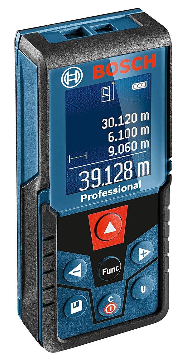
"name": "Bosch GLM 400 Laser Distance Measurer (40M Range)",
"description": "Bosch GLM 400 Professional Digital Laser Measure\nMeasurement range 0.05 – 40.00 mLaser diode 635 nm, < 1 mWUnits of measurement m/cm/ft/inch/ft-inchWeight, approx. 0.1 kg\nSKU 0 601 072 RK0 | EAN 3165140997119\n- Dedicated conversion button for immediate unit change at one press- User-friendly human machine interface (HMI) for quick selection of measuring functions- Colour display technology for easy interpretation of essential information and measurements\nGLM 400 PROFESSIONALLASER MEASURE\nConversion at one pressDedicated conversion button for immediate unit change at one pressUser-friendly human machine interface (HMI) for quick selection of measuring functionsColour display technology for easy interpretation of essential information and measurements",
"price": 0.0,
"discountamount": 0.0,
"currencycode": "INR",
"priority": 1000000,
"isfreeshipmentavailable": false,
"shipmentduration": 7,
"_keywords": [
"measurements",
"0 601 072 RK0",
"quick selection",
"conversion button",
"easy interpretation",
"mLaser diode 635 nm",
"immediate unit change",
"400 PROFESSIONALLASER",
"essential information",
"human machine interface",
"functionsColour display technology",
"Bosch GLM 400 Laser Distance Measurer",
"Bosch GLM 400 Professional Digital Laser"
],
"isarchived": false,
"isavailable": true,
"applicationid": null,
"productindex": 223,
"imageuri": "https://productimages.withfloats.com/actual/637e462843afb00001e44a62.jpg",
"tileimageuri": "https://productimages.withfloats.com/tile/637e462843afb00001e44a62.jpg",
"images": null,
"totalqueries": 0,
"gpid": null,
"groupproductid": null,
"createdon": "2022-11-23T16:11:19.852Z",
"updatedon": "2022-11-23T16:11:19.852Z",
"buyonlinelink": null,
"producturl": "http://WWW.SURVEYEQUIPMENT.IN/products/bosch-glm-400-laser-distance-measurer-40m-range-/223",
"availableunits": -1.0,
"iscodavailable": false,
"isprepaidonlineavailable": false,
"maxcodorders": 0,
"maxprepaidonlineorders": 0,
"uniquepaymenturl": null,
"brandname": "Leica",
"category": "laserdistancemeter",
"tags": null,
"variants": false,
"keyspecification": null,
"otherspecifications": null,
"pickupaddressreferenceid": "",
"paymenttype": "None",
"producttype": "products",
"hsncode": null,
"gstslab": 0.0,
"isnotforsale": false
},
{
"_id": "5b91054f2626a60521ac8372",
"fptag": "SBENTERPRISESTRADINGPUNE",
"merchantname": null,
"customwidgets": null,
"externalsourceid": null,
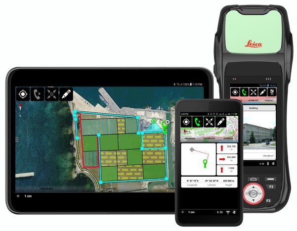
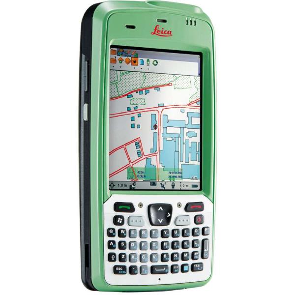
"name": "Leica Zeno Mobile",
"description": "Leica Zeno Mobile\nIntuitive data capture\n\nLeica Zeno Mobile is an Android™ app available on the Leica Zeno 20 and selected Android smartphones and tablets.\n\n Supports Leica Zeno 20, selected\nsmartphones and tablets with Android\nv5.0 or higher\n Connect to Leica Zeno GNSS devices to\nutilise high accuracy data collection\n Simple and intuitive user interface\nand workflows with minimum training\nrequired\n Different versions of Zeno Mobile\navailable depending on your needs \n\nInteraction with Zeno Mobile is simple and\nintuitive, providing advanced functionality\nwithout the need for extensive training.\n Import and export data to\ncloud service\n Multi-touch support for easy\nmap orientation\n Use OpenStreetMap or your own\nbackground maps instantly via WMS\n Supports wide range of GIS and CAD\ndata formats\n\nZeno Mobile saves you time in the field by\nenabling you to capture more data quicker.\n Data collection projects can be setup\non the fly without the need for other\nsoftware\n Capture inaccessible points using\nGAMtec (Zeno 20 only)\n Capture multiple features at the same\ntime using the multi-collect function\n Connect to cable detection devices\n Stakeout tool for precision location\n Easily import and export data with\nLeica Zeno Office",
"price": 0.0,
"discountamount": 0.0,
"currencycode": "INR",
"priority": 1000000,
"isfreeshipmentavailable": false,
"shipmentduration": 7,
"_keywords": null,
"isarchived": false,
"isavailable": true,
"applicationid": null,
"productindex": 112,
"imageuri": "https://productimages.withfloats.com/actual/5b91054f8b91ff054a4ed0cc.jpg",
"tileimageuri": "https://productimages.withfloats.com/tile/5b91054f8b91ff054a4ed0cc.jpg",
"images": null,
"totalqueries": 0,
"gpid": null,
"groupproductid": null,
"createdon": "2018-09-06T10:45:35.843Z",
"updatedon": "2018-09-06T10:45:35.843Z",
"buyonlinelink": null,
"producturl": "http://WWW.SURVEYEQUIPMENT.IN/products/leica-zeno-mobile/112",
"availableunits": -1.0,
"iscodavailable": true,
"isprepaidonlineavailable": false,
"maxcodorders": 0,
"maxprepaidonlineorders": 0,
"uniquepaymenturl": null,
"brandname": null,
"category": "DGPS",
"tags": [
"DGPS",
"TOTALSTATIONS",
"GPS"
],
"variants": false,
"keyspecification": null,
"otherspecifications": null,
"pickupaddressreferenceid": "5d08ebb3edf0e25c3b8da5d0",
"paymenttype": "AssuredPurchase",
"producttype": "products",
"hsncode": null,
"gstslab": 0.0,
"isnotforsale": false
},
{
"_id": "5b6b3a9ed682be0552aefd91",
"fptag": "SBENTERPRISESTRADINGPUNE",
"merchantname": null,
"customwidgets": null,
"externalsourceid": null,
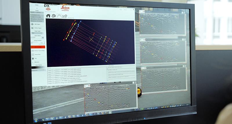
"name": "DX Office Vision",
"description": "DX Office Vision\nUtility post processing software\n\n\nDX Office Vision is Leica Geosystems’ Utility Post Processing Software that allows DS2000 users to map digitally the detected underground utilities in a simple way by converting GPR data into CAD drawings.\n\nKey benefits:\nCreate CAD drawings of the detected utilities in an uncomplicated way in minimum time and with less training.\nView collected data of the detected utilities in a simple way - compare data files side by side or from top to bottom to locate consistent features.\nObtain CAD drawings in 3D with object attributes in different layers – filter, select, identify and make annotations of consistent targets and anomalies.\nReduce processing time with no intermediate converting, third party software or patch required.\nVisualise radar data from your DS2000 with an intuitive interface.\nMerge your DX Office Vision Data with other Leica detection products like DS2000, Digicat and Ultra.\n \n\nTake over data processing into CAD drawings with confidence and simplicity\nFor utility surveyors looking to map digitally the detected underground utilities, DX Office Vision is the post processing software with the fastest conversion speed and most intuitive interface to convert GPR data into CAD drawings for every user. DX Office Vision was developed by utility mapping contractors who are every day on the field, and understand the need of delivering 3D CAD drawings in an efficient way.\n\nDX Office Vision features:\nAutomatic data import\nAutomatic pre-set filtering\nReal-world depth calibration\n3D CAD export\nTarget addition, Target connectivity, Depth filtering\nDX Office Vision X-Section:\nAdditional to DX Office Vision,\n\nVelocity Depth Calibration\n3D CAD view (fully navigable)\nTime Slice Function\n\n",
"price": 0.0,
"discountamount": 0.0,
"currencycode": "INR",
"priority": 1000000,
"isfreeshipmentavailable": false,
"shipmentduration": 7,
"_keywords": [
"3D CAD drawings",
"data processing",
"convert GPR data",
"intuitive interface",
"third party software",
"DX Office Vision Data",
"underground utilities",
"Office Vision features",
"compare data files side",
"Leica detection products",
"utility mapping contractors",
"Utility Post Processing Software"
],
"isarchived": false,
"isavailable": true,
"applicationid": null,
"productindex": 96,
"imageuri": "https://productimages.withfloats.com/actual/5b459f01d4575c0f14705198.jpg",
"tileimageuri": "https://productimages.withfloats.com/tile/5b459f01d4575c0f14705198.jpg",
"images": null,
"totalqueries": 0,
"gpid": null,
"groupproductid": null,
"createdon": "2018-07-11T06:08:57.374Z",
"updatedon": "2018-08-08T18:46:54.222Z",
"buyonlinelink": null,
"producturl": "http://WWW.SURVEYEQUIPMENT.IN//dx-office-vision/96",
"availableunits": -1.0,
"iscodavailable": true,
"isprepaidonlineavailable": false,
"maxcodorders": 0,
"maxprepaidonlineorders": 0,
"uniquepaymenturl": null,
"brandname": null,
"category": "Utility post processing software",
"tags": [
"Utility post processing software",
"Detection and underground mapping solution",
"GPR"
],
"variants": false,
"keyspecification": null,
"otherspecifications": null,
"pickupaddressreferenceid": "5d08ebb3edf0e25c3b8da5d0",
"paymenttype": "AssuredPurchase",
"producttype": "products",
"hsncode": null,
"gstslab": 0.0,
"isnotforsale": false
},
{
"_id": "5b6b3a9dd682be0552aefc2a",
"fptag": "SBENTERPRISESTRADINGPUNE",
"merchantname": null,
"customwidgets": null,
"externalsourceid": null,
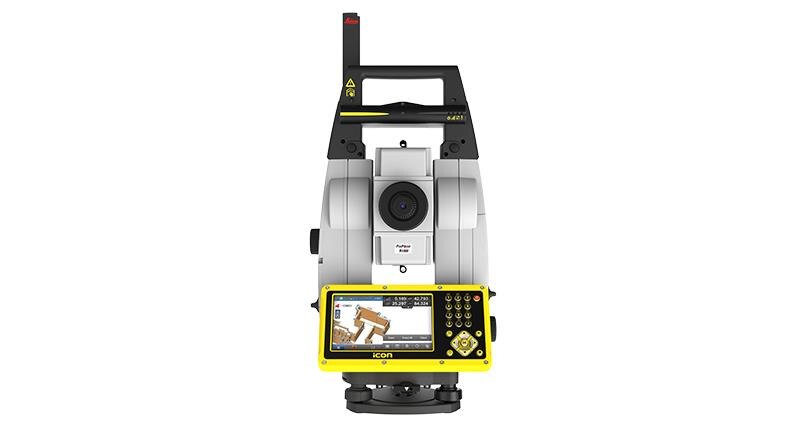
"name": "Leica iCON iCR80 Robotic Total Station",
"description": "Leica iCON iCR80 Robotic Total Station\nAchieve more layout points all day every day\n\nThe Leica iCON iCR80 construction total station keeps its ‘eye’ on only one thing: the user’s target. Layout more points per day thanks to ATRplus, the most robust automated-aiming, lock and re-lock technology in the market. iCR80 is especially useful in congested sites with many distractions, such as reflections, machines and people moving around. Challenging and changing site conditions should not be an obstacle.\n\nThe iCON iCR80 allows users to:\n\nLayout lines for footings or chalk line for formwork on foundation\nLayout points on blinding layer, such as pipe insert or cut-outs before pouring concrete\nLayout true design objects based on federated and enriched models\nMEP layout of wall penetrations for pipes, hanger locations for HVAC and duct work, inserts and slits for sheet metal work\nControl a wide variety of construction machines, such as curb and gutter or milling machines, asphalt or concrete pavers, and graders or dozers\nThe iCON iCR80 guarantees layout efficiency with the most reliable, simple and automatic set up procedure, industry-leading prism lock, and flexible handling of fully rendered 3D design models in the field. This sophisticated, one-person total station offers an ‘all-in-one’ solution for every purpose – especially the difficult ones, allowing you to speed up your workflow.\n\nThe iCON iCR80 total station is fully compatible with:\n\nLeica iCON CC80 tablet with an enhanced version of the tailored iCON build construction field software\nLeica Infinity office software and Leica ConX for online sharing of data between the office and the site\nThe iCON iCR80 features:\n\nFaster prism search by patented technology, PowerSearch\nStable data communication with long-range Bluetooth® (up to 400m)\nEasy hand-over control from pole to machine and vice versa\nATRplus technology, maximising the total station’s ability to remain locked on your target for highest point-to-point layout speed\n“Tune out targets” feature to ignore other distractions in the field\nFastest re-lock in case of interrupted line of sight\n\nLowest total cost of ownership\n\nLeica Geosystems construction total stations have a high value, giving you the lowest total cost of ownership. Its resilient hardware allows for longevity and reliability, giving you many years of rough usage in the most demanding environments. Its level of quality ensures your data remains accurate, lowers downtime and keeps your productivity high in all environments and conditions. Invest in the smarter total station solution and reap massive long-term rewards.\n\nNever loose lock\n\nThe iCR80 comes with automated aiming ATRplus, which intelligently and automatically detects environmental conditions, such as light, dust, rain and other site conditions. The new ATRplus, lock and re-lock technology speeds aiming and following of targets and delivers accurate measurements independent of user aiming or site conditions. Even when used on busy construction sites, the down time resulting from loss of lock is minimal, speeding up significantly your layout task.\n\n\n",
"price": 0.0,
"discountamount": 0.0,
"currencycode": "INR",
"priority": 1000000,
"isfreeshipmentavailable": false,
"shipmentduration": 7,
"_keywords": [
"iCON CC80 tablet",
"iCON iCR80 features",
"construction machines",
"data remains accurate",
"busy construction sites",
"iCON iCR80 total station",
"environmental conditions",
"Infinity office software",
"iCON build construction field",
"smarter total station solution",
"Leica iCON iCR80 Robotic Total Station",
"Geosystems construction total stations",
"iCON iCR80 guarantees layout efficiency",
"delivers accurate measurements independent",
"Leica iCON iCR80 construction total station"
],
"isarchived": false,
"isavailable": true,
"applicationid": null,
"productindex": 83,
"imageuri": "https://productimages.withfloats.com/actual/5b2df1bcdfeea305b4fb1db1.jpg",
"tileimageuri": "https://productimages.withfloats.com/tile/5b2df1bcdfeea305b4fb1db1.jpg",
"images": null,
"totalqueries": 0,
"gpid": null,
"groupproductid": null,
"createdon": "2018-06-23T07:07:40.566Z",
"updatedon": "2018-08-08T18:46:53.535Z",
"buyonlinelink": null,
"producturl": "http://WWW.SURVEYEQUIPMENT.IN/products/leica-icon-icr80-robotic-total-station/83",
"availableunits": -1.0,
"iscodavailable": true,
"isprepaidonlineavailable": false,
"maxcodorders": 0,
"maxprepaidonlineorders": 0,
"uniquepaymenturl": null,
"brandname": null,
"category": "leicatotalstations",
"tags": [
"leicatotalstations",
"sokkiatotalstation",
"Robotic Total Station"
],
"variants": false,
"keyspecification": null,
"otherspecifications": null,
"pickupaddressreferenceid": "5d08ebb3edf0e25c3b8da5d0",
"paymenttype": "AssuredPurchase",
"producttype": "products",
"hsncode": null,
"gstslab": 0.0,
"isnotforsale": false
},
{
"_id": "5b6b3a9cd682be0552aefb67",
"fptag": "SBENTERPRISESTRADINGPUNE",
"merchantname": null,
"customwidgets": null,
"externalsourceid": null,
"name": "Leica Zeno 5 GPS Handheld",
"description": "Leica Zeno 5 GPS Handheld\nUncompromising performance and functionality\nThe extremely functional, powerful and ergonomic Leica Zeno 5 brings quality and performance to the industry. The most rugged and powerful GPS handheld from Leica, it includes complete phone functionality and a very fast processor. Without compromising performance it fully integrates in to the Zeno GIS range.\n\nIncludes 3.2 Megapixel camera and lithium ion battery\nHighly sensitive GPS receiver with 2-5m positional accuracy.\nErgonomics and excellent viewing \nEquipped with a VGA transflective colour touchscreen, the Zeno 5 can be controlled by either to provided stylus or finger. The 3.7” display is readable in sunlight and includes a backlit feature for dark conditions.\n\nRugged, lightweight and protected to IP54 standards, it also fits on one hand.\nIncludes embedded Windows® Handheld 6.5 Operating System for intuitive and easy control\nModern technology for field work support\nThe Zeno 5 is the most up to date GPS handheld and features wireless communication technology, accelerometer, digital compass, gyroscope, light sensors, and GPS providing supported mapping applications which link directly to the office\n\nBluetooth, WI-FI, GSM/CDMA/UMTS for high speed comms.\nAutomatic rotational screen to view maps quickly or docs in landscape mode.",
"price": 0.0,
"discountamount": 0.0,
"currencycode": "INR",
"priority": 1000000,
"isfreeshipmentavailable": false,
"shipmentduration": 7,
"_keywords": [
"landscape mode",
"digital compass",
"backlit feature",
"Operating System",
"Megapixel camera",
"date GPS handheld",
"rotational screen",
"mapping applications",
"powerful GPS handheld",
"sensitive GPS receiver",
"Leica Zeno 5 GPS Handheld",
"complete phone functionality",
"VGA transflective colour touchscreen",
"ergonomic Leica Zeno 5 brings quality",
"features wireless communication technology"
],
"isarchived": false,
"isavailable": true,
"applicationid": null,
"productindex": 73,
"imageuri": "https://productimages.withfloats.com/actual/5b1b9fb83b9b61043c76e8a8.jpg",
"tileimageuri": "https://productimages.withfloats.com/tile/5b1b9fb83b9b61043c76e8a8.jpg",
"images": null,
"totalqueries": 0,
"gpid": null,
"groupproductid": null,
"createdon": "2018-06-09T09:36:56.141Z",
"updatedon": "2018-08-08T18:46:52.833Z",
"buyonlinelink": null,
"producturl": "http://WWW.SURVEYEQUIPMENT.IN//leica-zeno-5-gps-handheld/73",
"availableunits": -1.0,
"iscodavailable": true,
"isprepaidonlineavailable": false,
"maxcodorders": 0,
"maxprepaidonlineorders": 0,
"uniquepaymenturl": null,
"brandname": null,
"category": "handheldgps",
"tags": [
"handheldgps",
"leicagps",
"gps",
"gnss",
"leicagnss"
],
"variants": false,
"keyspecification": null,
"otherspecifications": null,
"pickupaddressreferenceid": "5d08ebb3edf0e25c3b8da5d0",
"paymenttype": "AssuredPurchase",
"producttype": "products",
"hsncode": null,
"gstslab": 0.0,
"isnotforsale": false
},
{
"_id": "5b6b3a9cd682be0552aefb16",
"fptag": "SBENTERPRISESTRADINGPUNE",
"merchantname": null,
"customwidgets": null,
"externalsourceid": null,
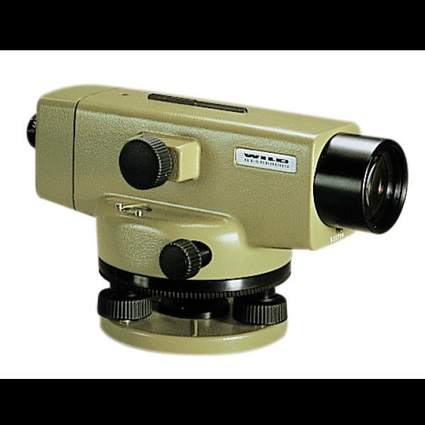
"name": "Leica NAK2 Automatic Level",
"description": "Leica NAK2 Automatic Level\nThe NAK2 automatic level is the flagship optical level product from Leica Geosystems. Designed by leading surveyors and developed by highly skilled engineers with a great deal of experience in knowing what an instrument must achieve in the field. Created for all types of surveying task. the NAK2 is economical and productive for routine levelling task on building sites, for geodetic control at all levels of accuracy, and in engineering projects.\n\nFeatures of the NAK2\n\nSuited for levelling of all orders and types of accuracy\nAccurate settlement and levelling determinations\nRoutine heighting for road, railway, pipeline, and tunnel construction\nControl measurements and setting-out work on site\nHigh accuracy area levelling\nK-version on flat terrain provides Tacheometric levelling by bringing together stadia and angular measurements with height readings\nBridge monitoring and deformation measurement\n \n\nThe NAK2 provides added angle measurement.\n\nThe model NAK2 has an internal glass circle which is read via a scale microscope and which can be set to any value by turning the rim around the base of the instrument. Tacheometric levelling is also available with the K-version on fl at terrain by combining stadia and angular measurements with height readings.\n\nGenerally, the NAK2 is able to set up on any Leica tripod. In most cases we recommend the heavy-duty Leica GST20 Wooden Tripod. For precise levelling the GST40 Wooden Tripod is suitable due to its extreme rigidity.\n\nThe durable and tough NAK2 can be used in varying weather conditions and very reliable when used in harsh working conditions such as the building site. The pendulum compensator is protected against shocks and the vibration damping mechanism is highly effective.\n\nSet up is quick and easy with the circular level only needing to be centred approximately and bring the compensator into its working range. The Pentaprism provides a positive bubble which is monitored down the eyepiece.\n\nThe high quality optics within the telescope provides bright, high contrast images which can be focussed on quickly.\n\nFor ease of use and the press of one button, the instantaneous check facility give complete confidence. Controls are well designed and arranged for added convenience and the endless horizontal drive enables rapid fine pointing.\n\nAccessories including the parallel-plate, laser eyepiece, increase the potential use of this impressive levelling instrument.",
"price": 0.0,
"discountamount": 0.0,
"currencycode": "INR",
"priority": 1000000,
"isfreeshipmentavailable": false,
"shipmentduration": 7,
"_keywords": [
"Leica Geosystems",
"GST40 Wooden Tripod",
"angular measurements",
"high contrast images",
"pendulum compensator",
"internal glass circle",
"routine levelling task",
"Tacheometric levelling",
"harsh working conditions",
"Leica GST20 Wooden Tripod",
"Leica NAK2 Automatic Level",
"instantaneous check facility",
"flagship optical level product",
"impressive levelling instrument",
"endless horizontal drive enables rapid fine"
],
"isarchived": false,
"isavailable": true,
"applicationid": null,
"productindex": 68,
"imageuri": "https://productimages.withfloats.com/actual/5b1a4e873b9b610fc8e459d0.jpg",
"tileimageuri": "https://productimages.withfloats.com/tile/5b1a4e873b9b610fc8e459d0.jpg",
"images": null,
"totalqueries": 0,
"gpid": null,
"groupproductid": null,
"createdon": "2018-06-08T09:38:15.903Z",
"updatedon": "2018-08-08T18:46:52.529Z",
"buyonlinelink": null,
"producturl": "http://WWW.SURVEYEQUIPMENT.IN/products/leica-nak2-automatic-level/68",
"availableunits": -1.0,
"iscodavailable": true,
"isprepaidonlineavailable": false,
"maxcodorders": 0,
"maxprepaidonlineorders": 0,
"uniquepaymenturl": null,
"brandname": null,
"category": null,
"tags": null,
"variants": false,
"keyspecification": null,
"otherspecifications": null,
"pickupaddressreferenceid": "5d08ebb3edf0e25c3b8da5d0",
"paymenttype": "AssuredPurchase",
"producttype": "products",
"hsncode": null,
"gstslab": 0.0,
"isnotforsale": false
},
{
"_id": "5b6b3a9cd682be0552aefb01",
"fptag": "SBENTERPRISESTRADINGPUNE",
"merchantname": null,
"customwidgets": null,
"externalsourceid": null,
"name": "Leica NA2 Automatic Level",
"description": "The NA2 automatic level is the flagship optical level product from Leica Geosystems. Designed by leading surveyors and developed by highly skilled engineers with a great deal of experience in knowing what an instrument must achieve in the field. Created for all types of surveying task, the NA2 is highly precise and efficient when doing routine levelling task on building sites, for geodetic control at all levels of accuracy, and in engineering projects. For additional precision it can be coupled with the optional GPM3 Parallel Plate Micrometer.\n\nFeatures of the NA2\n\nSuited for levelling of all orders and types of accuracy\nAccurate settlement and levelling determinations\nRoutine heighting for road, railway, pipeline, and tunnel construction\nControl measurements and setting-out work on site\nHigh accuracy area levelling\nK-version on flat terrain provides Tacheometric levelling by bringing together stadia and angular measurements with height readings\nBridge monitoring and deformation measurement\n \n\nGenerally, the NA2 is able to set up on any Leica tripod. In most cases we recommend the heavy-duty Leica GST20 Wooden Tripod. For precise levelling the GST40 Wooden Tripod is suitable due to its extreme rigidity.\nSet up is quick and easy with the circular level only needing to be centred approximately and bring the compensator into its working range. The Pentaprism provides a positive bubble which is monitored down the eyepiece.\n\nThe durable and tough NA2 can be used in varying weather conditions and very reliable when used in harsh working conditions such as the building site. The pendulum compensator is protected against shocks and the vibration damping mechanism is highly effective.\n\nFor ease of use and the press of one button, the instantaneous compensator check facility gives complete confidence. Controls are well designed and arranged for added convenience and the endless horizontal drive enables rapid fine pointing.\nThe high quality optics within the telescope provides bright, high contrast images which can be focussed on quickly. \nAccessories including the parallel-plate, laser eyepiece, increase the potential use of this impressive levelling instrument.\n\n\n",
"price": 0.0,
"discountamount": 0.0,
"currencycode": "INR",
"priority": 1000000,
"isfreeshipmentavailable": false,
"shipmentduration": 7,
"_keywords": [
"GST40 Wooden Tripod",
"pendulum compensator",
"angular measurements",
"high contrast images",
"engineering projects",
"additional precision",
"routine levelling task",
"Tacheometric levelling",
"harsh working conditions",
"Leica NA2 Automatic Level",
"Leica GST20 Wooden Tripod",
"optional GPM3 Parallel Plate",
"flagship optical level product",
"instantaneous compensator check facility",
"endless horizontal drive enables rapid fine"
],
"isarchived": false,
"isavailable": true,
"applicationid": null,
"productindex": 67,
"imageuri": "https://productimages.withfloats.com/actual/5b1a4e2c3b9b610fc8e459ad.jpg",
"tileimageuri": "https://productimages.withfloats.com/tile/5b1a4e2c3b9b610fc8e459ad.jpg",
"images": null,
"totalqueries": 0,
"gpid": null,
"groupproductid": null,
"createdon": "2018-06-08T09:36:45.562Z",
"updatedon": "2018-08-08T18:46:52.424Z",
"buyonlinelink": null,
"producturl": "http://WWW.SURVEYEQUIPMENT.IN//leica-na2-automatic-level/67",
"availableunits": -1.0,
"iscodavailable": true,
"isprepaidonlineavailable": false,
"maxcodorders": 0,
"maxprepaidonlineorders": 0,
"uniquepaymenturl": null,
"brandname": null,
"category": null,
"tags": null,
"variants": false,
"keyspecification": null,
"otherspecifications": null,
"pickupaddressreferenceid": "5d08ebb3edf0e25c3b8da5d0",
"paymenttype": "AssuredPurchase",
"producttype": "products",
"hsncode": null,
"gstslab": 0.0,
"isnotforsale": false
},
{
"_id": "5b6b3a9cd682be0552aefac6",
"fptag": "SBENTERPRISESTRADINGPUNE",
"merchantname": null,
"customwidgets": null,
"externalsourceid": null,
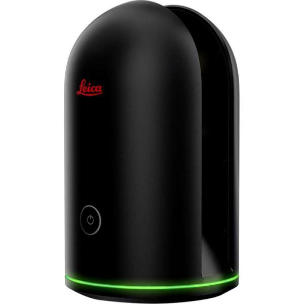
"name": "Leica BLK360 Imaging Laser Scanner",
"description": "Leica BLK360 Imaging Laser Scanner\n\nThe smallest and lightest imaging laser scanner available\nThe Leica BLK360 captures the world around you with full-colour panoramic images overlaid on a high-accuracy point cloud. Simple to use with just the single push of one button, the BLK360 is the smallest and lightest of its kind. Anyone who can operate an iPad can now capture the world around them with high resolution 3D panoramic images.\n\nUsing the ReCap Pro mobile app, the BLK360 streams image and point cloud data to iPad. The app filters and registers scan data in real time. After capture, ReCap Pro enables point cloud data transfer to a number of CAD, BIM, VR and AR applications. The integration of BLK360 and Autodesk software dramatically streamlines the reality capture process thereby opening this technology to non-surveying individuals.\n\nPackage includes:\n\nLeica BLK360 Imaging Laser Scanner\nGEB212 Lithium-Ion Battery for the BLK360\nGKL311 Battery Charger\nAC/DC adaptor\nBLK360 Tripod\nBLK360 Mission bag\n\nBLK360 Imaging Laser Scanner\n\nAllows you to scan in high, standard and fast resolutions\nWeighs 1kg / Size 165 mm tall x 100 mm diameter \nLess than 3 minutes for full-dome scan (in standard resolution) and 150 MP spherical image generation\n360,000 laser scan pts/sec\nReCap Pro Software\n\nGain complete access to ReCap Pro for desktop, web and mobile*\nControl all aspects of the reality capture process remotely on ReCap for iPad\nAutomatically register and visualise scan data in the field\nMark up, tag and collaborate on scans while on the job site\nReduce rework requests and share reality data remotely\nSeamless data transfer into Autodesk design software\nWith the combination of the BLK360 and Autodesk ReCap Pro, benefit from:\n\nSpeed\nOn-the-fly image and point cloud processing in the field.\n\nPortability\nFlexibility to scan wherever, whenever with the small lightweight scanner that fits into a messenger bag.\n\nEase of Use\nPush-button scanning that automatically stitches and registers in the mobile version of ReCap Pro.\n\nCloud Connectivity\nBetter collaboration and virtualisation with cloud sync.\n\nSimplified Data Collection\nTwo-in-one 360º image documentation and laser scan data.\n\nInteroperability\nReality capture data connectivity with Autodesk’s design solutions.\n\n",
"price": 0.0,
"discountamount": 0.0,
"currencycode": "INR",
"priority": 1000000,
"isfreeshipmentavailable": false,
"shipmentduration": 7,
"_keywords": [
"Autodesk ReCap Pro",
"share reality data",
"registers scan data",
"visualise scan data",
"image documentation",
"ReCap Pro mobile app",
"150 MP spherical image",
"reality capture process",
"point cloud data transfer",
"capture data connectivity",
"small lightweight scanner",
"high resolution 3D panoramic",
"Leica BLK360 Imaging Laser Scanner"
],
"isarchived": false,
"isavailable": true,
"applicationid": null,
"productindex": 64,
"imageuri": "https://productimages.withfloats.com/actual/5b028d086061cb0e609ff97b.jpg",
"tileimageuri": "https://productimages.withfloats.com/tile/5b028d086061cb0e609ff97b.jpg",
"images": null,
"totalqueries": 0,
"gpid": null,
"groupproductid": null,
"createdon": "2018-05-21T09:10:26.841Z",
"updatedon": "2018-08-08T18:46:52.294Z",
"buyonlinelink": null,
"producturl": "http://WWW.SURVEYEQUIPMENT.IN//leica-blk360-imaging-laser-scanner/64",
"availableunits": -1.0,
"iscodavailable": true,
"isprepaidonlineavailable": false,
"maxcodorders": 0,
"maxprepaidonlineorders": 0,
"uniquepaymenturl": null,
"brandname": null,
"category": null,
"tags": null,
"variants": false,
"keyspecification": null,
"otherspecifications": null,
"pickupaddressreferenceid": "5d08ebb3edf0e25c3b8da5d0",
"paymenttype": "AssuredPurchase",
"producttype": "products",
"hsncode": null,
"gstslab": 0.0,
"isnotforsale": false
}
],
"hasmoreitems": false,
"isapirequest": false,
"totalresults": 27,
"query": null,
"floatingpoint": null
}